Neo Apartments
Slough, Berkshire, SL1 1UG
£1,050 pcm
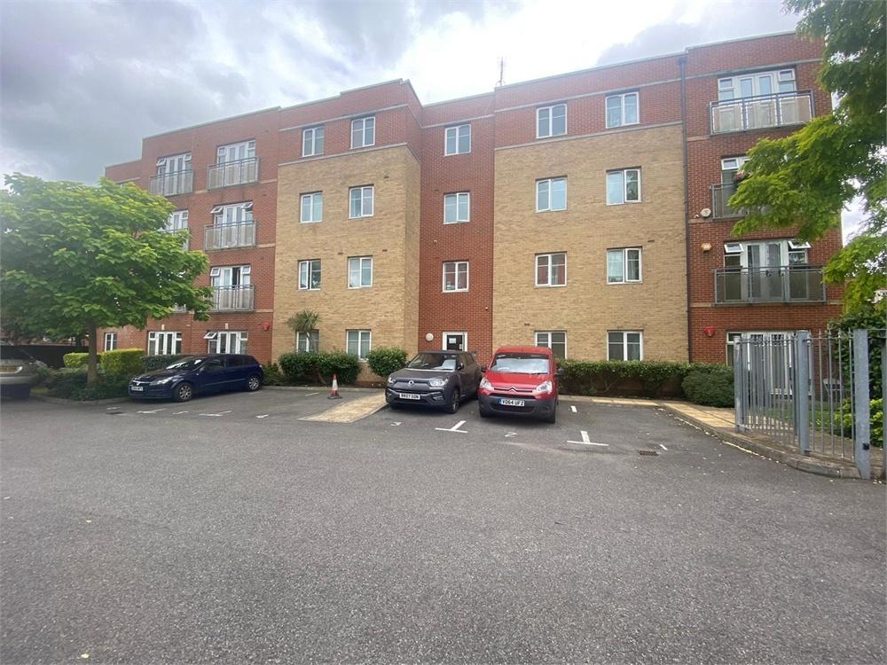
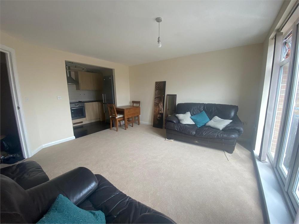
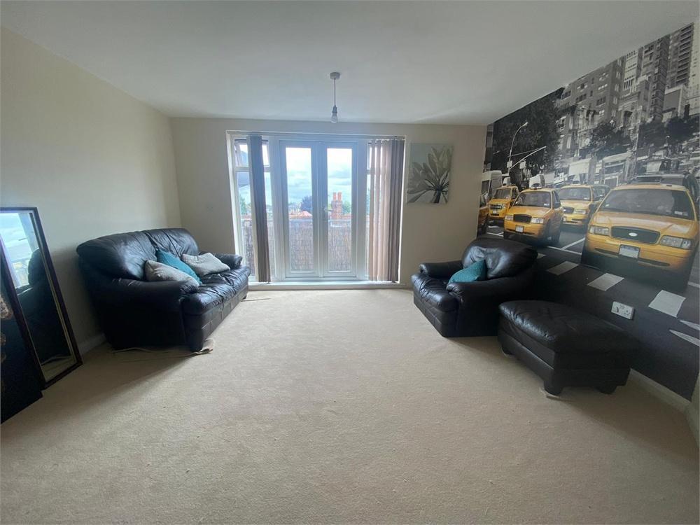
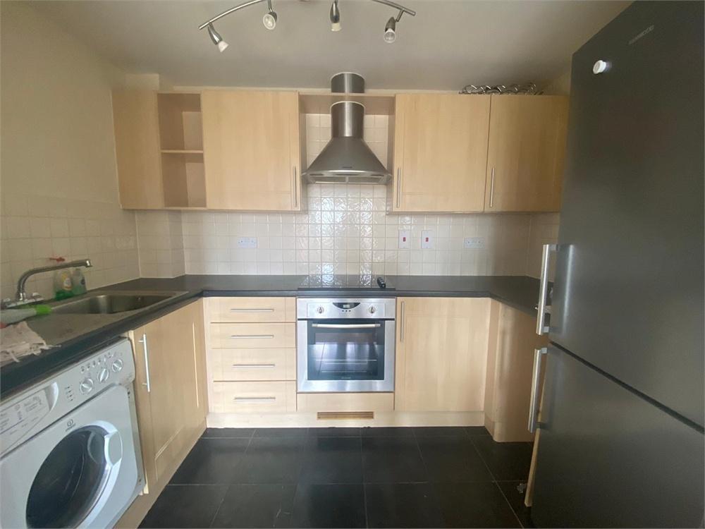
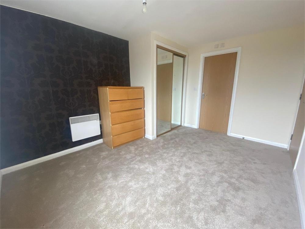
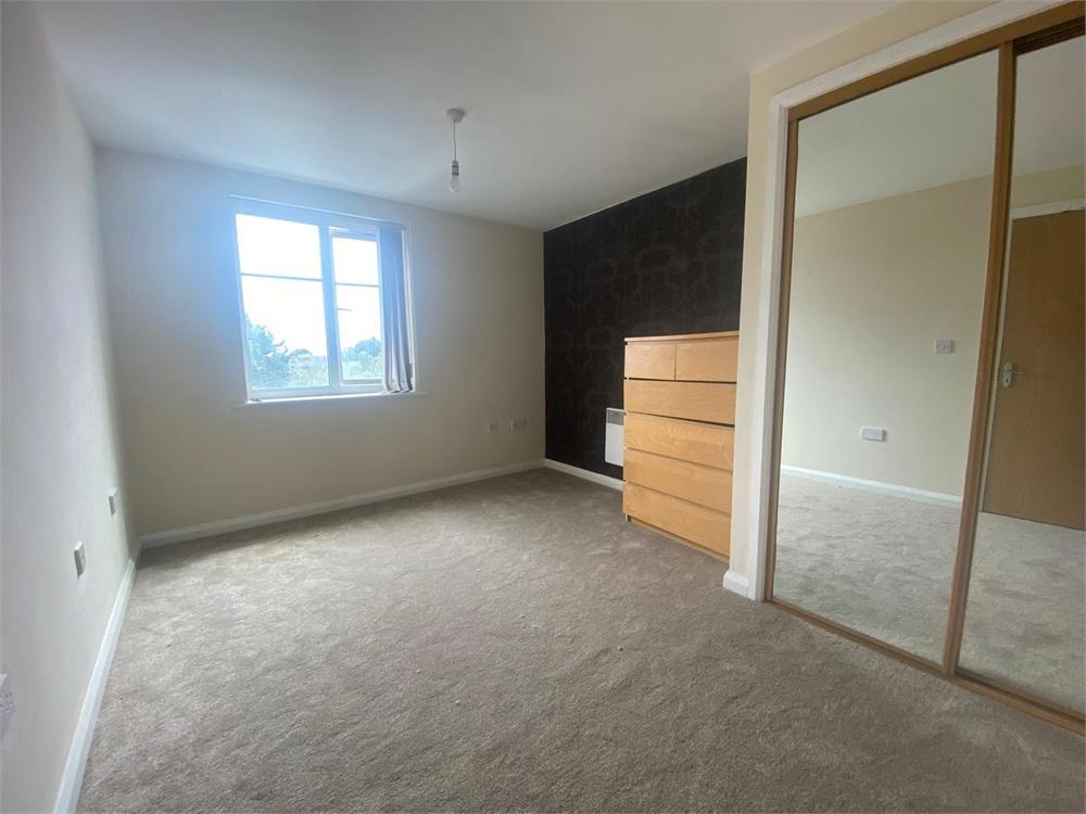
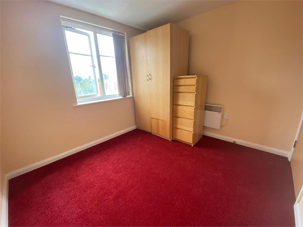
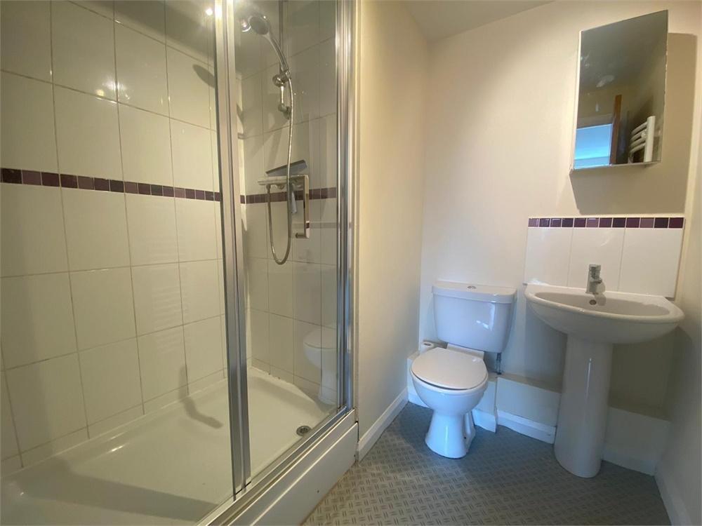
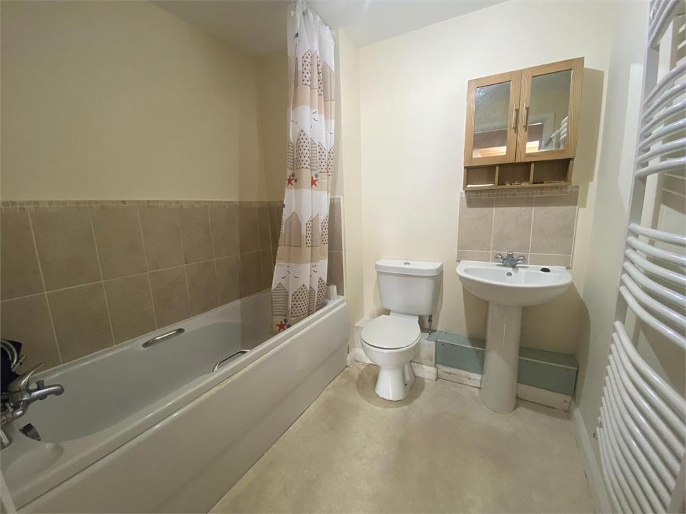
Photo 1 Photo 2 Photo 3 Photo 4 Photo 5 Photo 6 Photo 7 Photo 8 Photo 9
/ 9
Property details
Street crime
579 incidents within 1 mile (Apr 2026)
Key features
- Two Bedroom Third Floor Apartment
- Prime Location For Slough Train Station
- Open Plan Living
- Family Bathroom & En-suite
- EPC Rating - C
- Council Tax Band - C
- Available Immediately
- Part furnished
Additional details
- Parking
- Yes
Description
The property has been newly renovated with new carpets and a new modern décor throughout. Both bedrooms are of a good size and the master bedroom boasting an en-suite bathroom offering a shower, sink and W.C.
A family bathroom is located at the end of the hallway which offers a bath, shower attachment, sink and W.C. The hallway leads through to a well-spaced open plan lounge diner with glass French doors that open up to a private balcony to create a bright and airy atmosphere. Off of the lounge is a kitchen that has lots of cupboard space and the essential white goods.
Lastly the property comes with one allocated parking spaces.
Property ref: 121_2923_4917435
Listed by
Burnham
Oakwood Estates
Reference: 111901238
EPC ratings on this postcode
We don't have a matched EPC for this property yet. Below are efficiency scores and details for other addresses on this postcode.
| Address | Current | Potential | Floor area | Age band | Type |
|---|---|---|---|---|---|
| 1 Neo Apartments, 1-9, Wexham Road, SLOUGH | 72 | 81 | 63 m² | England and Wales: 2003-2006 | Flat |
| 10 Neo Apartments, 1-9, Wexham Road, SLOUGH | 78 | 85 | 74 m² | England and Wales: 1967-1975 | Flat |
| 12 Neo Apartments, 1-9, Wexham Road, SLOUGH | 80 | 86 | 60 m² | England and Wales: 1996-2002 | Flat |
| 14 Neo Apartments, 1-9, Wexham Road, SLOUGH | 78 | 84 | 61 m² | England and Wales: 2003-2006 | Flat |
| 15 NEO APARTMENTS, 1-9 WEXHAM ROAD, SLOUGH, SLOUGH | 78 | 84 | 63 m² | England and Wales: 2003-2006 | Flat |
| 16 Neo Apartments, 1-9, Wexham Road, SLOUGH | 84 | 88 | 62 m² | England and Wales: 2003-2006 | Flat |
| 17 Neo Apartments, 1-9, Wexham Road, SLOUGH | 83 | 83 | 64 m² | England and Wales: 2003-2006 | Flat |
| 2 NEO APARTMENTS, 1-9 WEXHAM ROAD, SLOUGH, SLOUGH | 56 | 76 | 50 m² | England and Wales: 1976-1982 | Flat |
| 20 NEO APARTMENTS, 1-9 WEXHAM ROAD, SLOUGH, SLOUGH | 69 | 78 | 71 m² | England and Wales: 2003-2006 | Flat |
| 21 Neo Apartments, 1-9, Wexham Road, SLOUGH | 69 | 79 | 89 m² | England and Wales: 2003-2006 | Flat |
| 22 Neo Apartments, 1-9, Wexham Road, SLOUGH | 73 | 81 | 64 m² | England and Wales: 2003-2006 | Flat |
| 23 Neo Apartments, 1-9, Wexham Road, SLOUGH | 74 | 82 | 74 m² | England and Wales: 2003-2006 | Flat |
| 24 Neo Apartments, 1-9, Wexham Road, SLOUGH | 73 | 82 | 63 m² | England and Wales: 2003-2006 | Flat |
| 24 Neo Apartments, 1-9, Wexham Road, SLOUGH | 76 | 82 | 61 m² | England and Wales: 2003-2006 | Flat |
| 24 Neo Apartments, 1-9, Wexham Road, SLOUGH | 75 | 82 | 61 m² | England and Wales: 2003-2006 | Flat |
Flood risk
Zone: 1
Risk: Low
Job (default Low)
EPC Graphs

EER
Rental Range
Estimated market rent for Slough. Low = conservative, Realistic = average, Optimistic = best case.
Based on Local Authority from postcode lookup → Slough.
LHA (30th percentile) floor for East Thames Valley: £1,197/mo (Apr 2025 – Mar 2026)
Location
Nearby
Nearest stations, universities and amenities (distance from property).
| Type | Name | Distance |
|---|---|---|
| Shop | Hair & Beauty salon | 0.0 miles |
| Shop | Nutri Point | 0.0 miles |
| Bus stop | Wexham Road | 0.1 miles |
| Bus stop | Sorting Office | 0.1 miles |
| Train station | Slough | 0.4 miles |
| Train station | Windsor and Eton Riverside | 1.7 miles |
| University | Royal Holloway University | 5.7 miles |
| University | Royal Holloway | 5.8 miles |
| Hospital | Hounslow Medical Centre | 9.3 miles |
Street-level crime
| Category | Count |
|---|---|
| Violence and sexual offences | 224 |
| Anti-social behaviour | 57 |
| Public order | 49 |
| Criminal damage and arson | 40 |
| Drugs | 37 |
| Shoplifting | 37 |
| Other theft | 35 |
| Vehicle crime | 32 |
| Burglary | 20 |
| Robbery | 13 |
| Other crime | 11 |
| Bicycle theft | 10 |
| Possession of weapons | 9 |
| Theft from the person | 5 |
| Total incidents | 579 |
Within 1 mile during Apr 2026. Source: data.police.uk (England & Wales).
Schools nearby
Nearest open schools with Ofsted ratings (England). Closed schools are not shown. Data from Get Information about Schools and Ofsted.
| Name | Type | Distance | Ofsted |
|---|---|---|---|
| St Mary's Church of England Primary School | Primary | 0.2 miles | Good — 24 Feb 2016 |
| Upton Court Grammar School | Secondary | 0.4 miles | Outstanding — 23 Jan 2023 |
| St Bernard's Preparatory School | Other | 0.4 miles | — (No rating) |
| Long Close School | Other | 0.4 miles | — (No rating) |
| St Bernard's Catholic Grammar School | Secondary | 0.5 miles | Outstanding — 14 Jan 2024 |
Rental Comparables
Residential lets from OpenRent and Rightmove for the area (same bedroom count). Use to validate rent estimates. Student lets are excluded.
| Title | Rent | Beds | Distance | As seen on |
|---|---|---|---|---|
| 2 Bed Penthouse, Verona, SL1 | £1,950/mo | 2 | 0.14 miles | OpenRent |
Average rent: £1,950/mo (1 listing)
Enter House Number
Enter the house number to help us retrieve more accurate pricing history and property data.
Please log in to submit or correct the house number for this listing.
Log in to continue