48 BIRKBECK ROAD
LONDON, LONDON, GREATER LONDON W3 6BQ
£2,200 pcm
Property details
Floor area
49 m²
Council tax band
A
Deprivation
Decile 2 (5,515 of 33,755)
Street crime
728 incidents within 1 mile (Apr 2026)
Key features
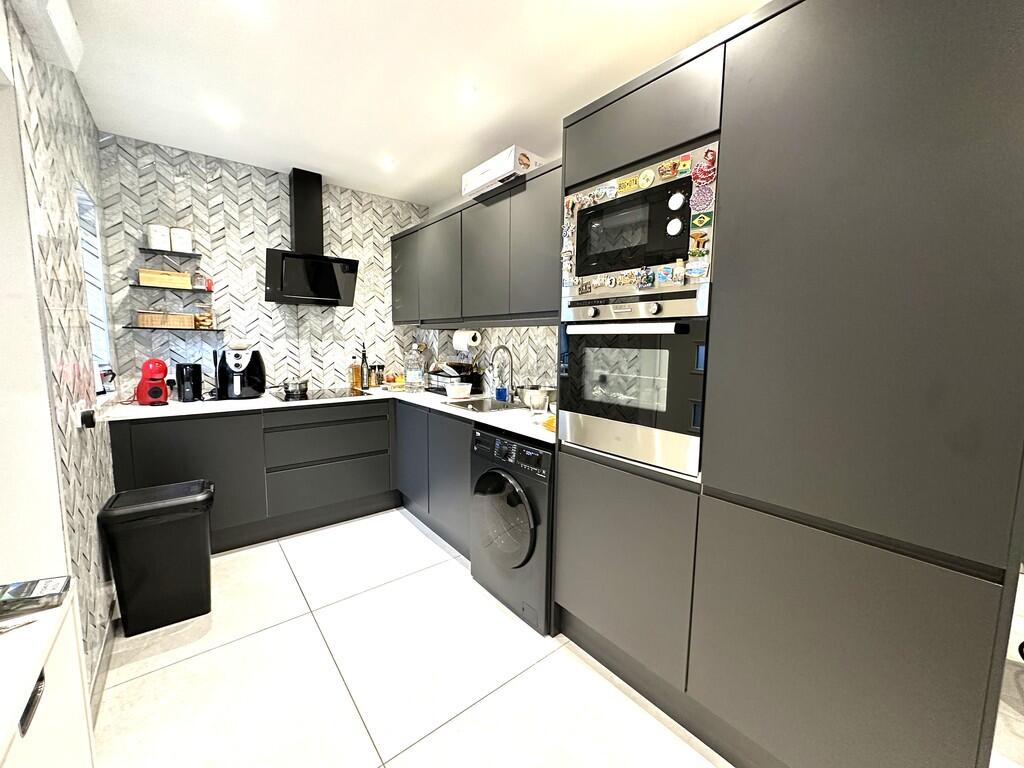
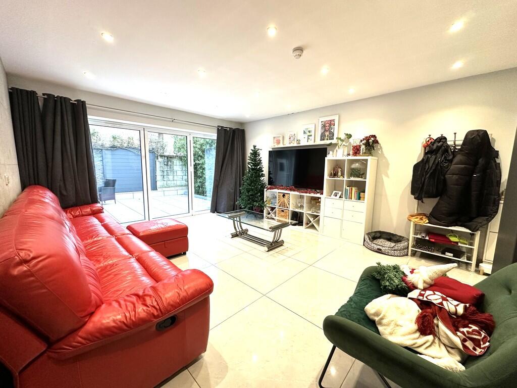
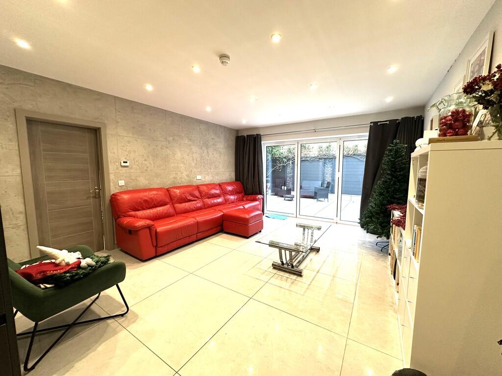
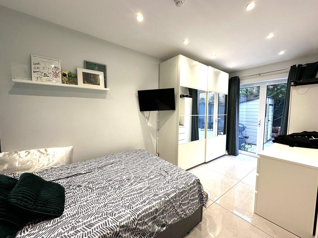
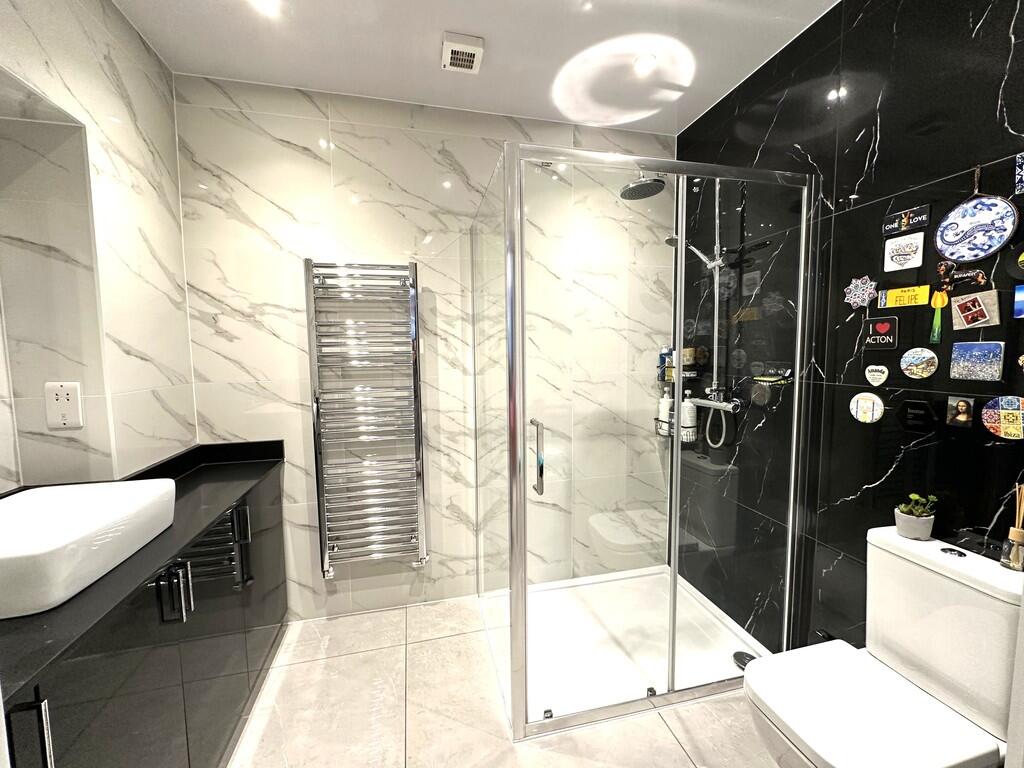
- 1 bedroom
- 1 bathroom
- 1 reception
- All utility bills included
- Underfloor heating
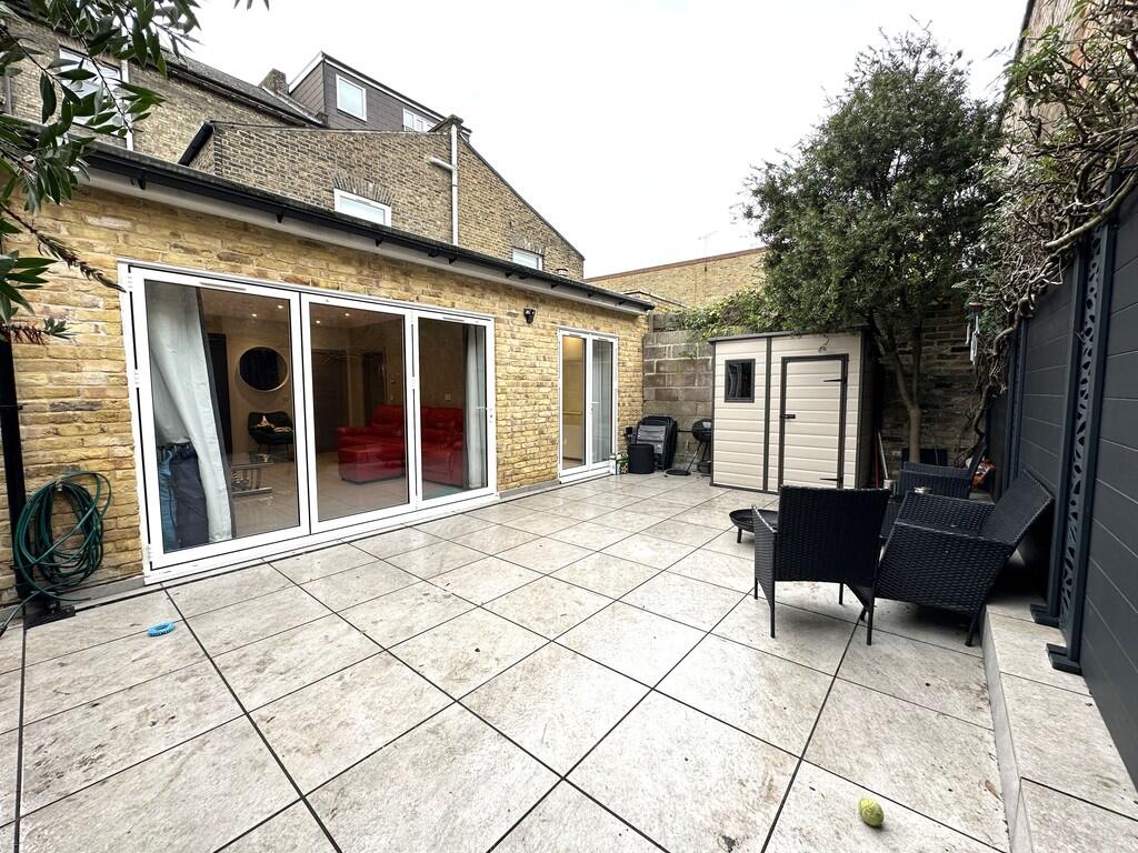
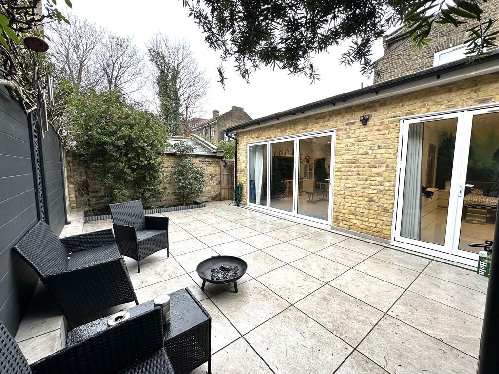
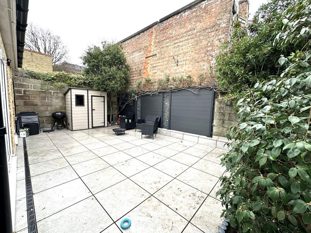
- Garden
Additional details
- Garden
- Yes
Description
12 months tenancy
Council tax band A
Deposit £2538
Listed by
Covering London
J W & SONS ESTATE AGENTS LTD
Reference: 171124427
EPC Rating & Upgrade Cost
Fetching EPC data… Refresh this page in a moment.
Flood risk
Zone: 1
Risk: Low
Job (default Low)
FENSA Certificates
This property has 6 FENSA certificate(s) on record, indicating window/door installations by FENSA-approved installers.
FENSA Certificate #11283950
Property Details
Street: 48 Birkbeck Road
Town: LONDON
Postcode: W3 6BQ
Installation Details
Items: 2 windows
Certificate Issued: 11/11/2015
Work Completed: 06/08/2015
This certificate data was retrieved from FENSA's database
FENSA Certificate #10983071
Property Details
Street: 48 Birkbeck Road
Town: LONDON
Postcode: W3 6BQ
Installation Details
Items: 2 windows
Certificate Issued: 12/05/2015
Work Completed: 17/04/2015
This certificate data was retrieved from FENSA's database
FENSA Certificate #11371106
Property Details
Street: 48 Birkbeck Road
Town: LONDON
Postcode: W3 6BQ
Installation Details
Items: 3 windows
Certificate Issued: 23/12/2015
Work Completed: 28/10/2015
This certificate data was retrieved from FENSA's database
FENSA Certificate #11414082
Property Details
Street: 48 Birkbeck Road
Town: LONDON
Postcode: W3 6BQ
Installation Details
Items: 3 windows
Certificate Issued: 13/01/2016
Work Completed: 11/12/2015
This certificate data was retrieved from FENSA's database
FENSA Certificate #11552549
Property Details
Street: 48 Birkbeck Road
Town: LONDON
Postcode: W3 6BQ
Installation Details
Items: 1 window and 1 door
Certificate Issued: 11/04/2016
Work Completed: 03/03/2016
This certificate data was retrieved from FENSA's database
FENSA Certificate #11636339
Property Details
Street: 48 Birkbeck Road
Town: LONDON
Postcode: W3 6BQ
Installation Details
Items: 5 windows
Certificate Issued: 23/05/2016
Work Completed: 15/04/2016
This certificate data was retrieved from FENSA's database
What is FENSA? FENSA (Fenestration Self-Assessment Scheme) is a government-authorised scheme that monitors building regulation compliance for replacement windows and doors. Certificates indicate that work was completed by FENSA-approved installers.
Company ownership
Registered legal owner is a company.
Company: CROWNFERN LIMITED (4410799)
Rental Range
Estimated market rent for Ealing. Low = conservative, Realistic = average, Optimistic = best case.
Based on Local Authority from postcode lookup → Ealing.
LHA (30th percentile) floor for Bedford: £648/mo (Apr 2025 – Mar 2026)
Location
Nearby
Nearest stations, universities and amenities (distance from property).
| Type | Name | Distance |
|---|---|---|
| Shop | Paint | 0.0 miles |
| Shop | Cloudy Vape | 0.0 miles |
| Train station | Acton Central | 0.1 miles |
| Bus stop | Acton Central Station | 0.1 miles |
| Train station | Acton Main Line | 0.6 miles |
| University | Richmond American University London | 1.1 miles |
| University | Scale Space White City | 1.8 miles |
| Hospital | Bridge Lane Health Centre | 4.9 miles |
| Hospital | The Portland Hospital | 5.3 miles |
Street-level crime
| Category | Count |
|---|---|
| Anti-social behaviour | 195 |
| Violence and sexual offences | 185 |
| Vehicle crime | 78 |
| Shoplifting | 57 |
| Public order | 56 |
| Other theft | 46 |
| Criminal damage and arson | 30 |
| Drugs | 21 |
| Burglary | 18 |
| Robbery | 12 |
| Bicycle theft | 11 |
| Possession of weapons | 8 |
| Theft from the person | 7 |
| Other crime | 4 |
| Total incidents | 728 |
Within 1 mile during Apr 2026. Source: data.police.uk (England & Wales).
Schools nearby
Nearest open schools with Ofsted ratings (England). Closed schools are not shown. Data from Get Information about Schools and Ofsted.
| Name | Type | Distance | Ofsted |
|---|---|---|---|
| Ark Byron Primary Academy | Primary | 0.1 miles | Good — 11 Dec 2018 |
| Maples Nursery School and Children's Centre | Nursery | 0.1 miles | Requires improvement — 13 Jul 2023 |
| Derwentwater Primary School | Primary | 0.3 miles | Good — 24 Jul 2019 |
| Ark Priory Primary Academy | Primary | 0.3 miles | Outstanding — 9 Jul 2015 |
| Snowflake School | Other | 0.4 miles | Good — 11 Jul 2023 |
Rental Comparables
Residential lets from OpenRent and Rightmove for the area (same bedroom count). Use to validate rent estimates. Student lets are excluded.
| Title | Rent | Beds | Distance | As seen on |
|---|---|---|---|---|
| 1 Bed Flat, Churchfield Road, W3 | £1,750/mo | 1 | 0.07 miles | OpenRent |
| 1 Bed Flat, High Street, W3 | £1,420/mo | 1 | 0.22 miles | OpenRent |
| 1 Bed Flat, Church Road, W3 | £2,100/mo | 1 | 0.32 miles | OpenRent |
| 1 Bed Flat, High Street, W3 | £1,650/mo | 1 | 0.4 miles | OpenRent |
| 1 Bed Flat, Very Near Morrisons Supermarket Area, W3 | £1,650/mo | 1 | 0.43 miles | OpenRent |
| 1 Bed Flat, Beechwood Grove, W3 | £1,850/mo | 1 | 0.46 miles | OpenRent |
Average rent: £1,737/mo (6 listings)