11 EARL SPENCER COURT
PETERBOROUGH, CITY OF PETERBOROUGH PE2 9PQ
£550 pcm
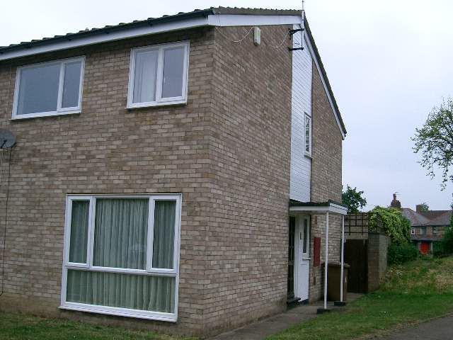
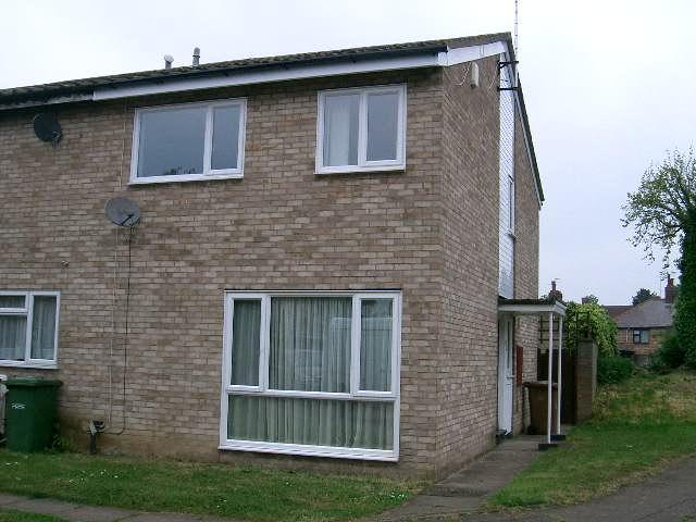
Photo 1 Photo 2
/ 2
Property details
Deprivation
Decile 3 (9,127 of 33,755)
Street crime
502 incidents within 1 mile (Apr 2026)
Key features
- Kitchen/Diner
- Lounge
- garden
- 1x family bathroom
- 2x double bedroom
- 1x large single
- 1downstairs toilet
- Gardens front and rear
- Garage
Additional details
- Parking
- Yes
Description
Listed by
Peterborough
Platinum Estates Derby Ltd
Reference: 13470016
EPC Rating & Upgrade Cost
Fetching EPC data… Refresh this page in a moment.
Flood risk
Zone: 1
Risk: Low
Job (default Low)
FENSA Certificates
This property has 1 FENSA certificate(s) on record, indicating window/door installations by FENSA-approved installers.
FENSA Certificate #552824
Property Details
Street: 11 EARL SPENCER COURT
Town: WOODSTON
Postcode: PE2 9PQ
Installation Details
Items: 8 windows
Certificate Issued: 31/03/2003
Work Completed: 27/02/2003
This certificate data was retrieved from FENSA's database
What is FENSA? FENSA (Fenestration Self-Assessment Scheme) is a government-authorised scheme that monitors building regulation compliance for replacement windows and doors. Certificates indicate that work was completed by FENSA-approved installers.
Rental Range
Estimated market rent for Peterborough. Low = conservative, Realistic = average, Optimistic = best case.
Based on Local Authority from postcode lookup → Peterborough.
LHA (30th percentile) floor for Lincoln: £673/mo (Apr 2025 – Mar 2026)
Location
Nearby
Nearest stations, universities and amenities (distance from property).
| Type | Name | Distance |
|---|---|---|
| Bus stop | Adjacent Earl Spencer Court | 0.1 miles |
| Bus stop | Earl Spencer Court | 0.1 miles |
| Shop | Tesco Express | 0.1 miles |
| Shop | Ironing Plus | 0.2 miles |
| Train station | Peterborough (NVR) | 0.4 miles |
| Train station | Peterborough | 0.8 miles |
| University | ARU Peterborough | 0.9 miles |
| University | City College Peterborough | 1.1 miles |
| Hospital | Peterborough City Hospital | 1.8 miles |
| Hospital | Stamford & Rutland Hospital | 11.0 miles |
Street-level crime
| Category | Count |
|---|---|
| Violence and sexual offences | 157 |
| Anti-social behaviour | 86 |
| Shoplifting | 75 |
| Public order | 44 |
| Criminal damage and arson | 35 |
| Burglary | 19 |
| Drugs | 16 |
| Other theft | 16 |
| Bicycle theft | 13 |
| Vehicle crime | 13 |
| Other crime | 11 |
| Possession of weapons | 9 |
| Robbery | 4 |
| Theft from the person | 4 |
| Total incidents | 502 |
Within 1 mile during Apr 2026. Source: data.police.uk (England & Wales).
Schools nearby
Nearest open schools with Ofsted ratings (England). Closed schools are not shown. Data from Get Information about Schools and Ofsted.
| Name | Type | Distance | Ofsted |
|---|---|---|---|
| Brewster Avenue Infant School | Primary | 0.1 miles | Good — 22 Jan 2014 |
| St Augustine's CofE (Voluntary Aided) Junior School | Primary | 0.1 miles | Good — 10 Oct 2017 |
| Nene Valley Primary School | Primary | 0.4 miles | Good — 3 Nov 2011 |
| Woodston Primary School | Primary | 0.4 miles | Good — 20 Sep 2023 |
| Old Fletton Primary School | Primary | 0.5 miles | Good — 14 Dec 2011 |
Rental Comparables
Residential lets from OpenRent and Rightmove for the area (same bedroom count). Use to validate rent estimates. Student lets are excluded.
| Title | Rent | Beds | Distance | As seen on |
|---|---|---|---|---|
| 3 Bed Terraced House, Earl Spencer Court, PE2 | £1,150/mo | 3 | 0.03 miles | OpenRent |
| 3 Bed Terraced House, Orchard St, PE2 | £1,100/mo | 3 | 0.24 miles | OpenRent |
| 3 Bed Terraced House, Belsize Avenue, PE2 | £1,150/mo | 3 | 0.39 miles | OpenRent |
| 3 Bed Semi-Detached House, Hawksbill Way, PE2 | £550/mo | 3 | 0.59 miles | OpenRent |
Average rent: £988/mo (4 listings)