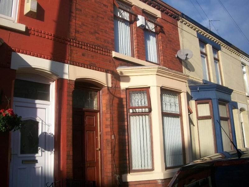
85 TAUNTON STREET
LIVERPOOL, MERSEYSIDE L15 4ND
£525 pcm
Property details
Deprivation
Decile 2 (4,475 of 33,755)
Street crime
495 incidents within 1 mile (Apr 2026)
Key features
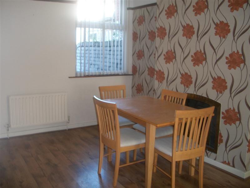
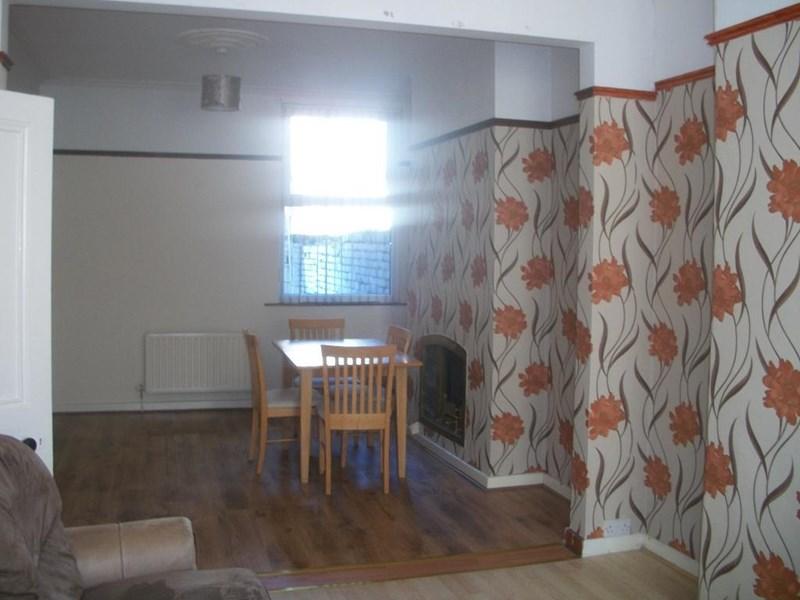
- Through lounge
- double glazing
- gas central heating
- 3 bedrooms
Additional details
- Garden
- Yes
Description
Listed by
Liverpool
Golding Property Services Ltd
Reference: 62269756
EPC Rating & Upgrade Cost
Fetching EPC data… Refresh this page in a moment.
Flood risk
Zone: 1
Risk: Low
Job (default Low)
FENSA Certificates
This property has 1 FENSA certificate(s) on record, indicating window/door installations by FENSA-approved installers.
FENSA Certificate #16816159 Recent
Property Details
Street: 85 Taunton Street
Town: LIVERPOOL
Postcode: L15 4ND
Installation Details
Items: 1 door
Certificate Issued: 25/05/2025
Work Completed: 12/05/2025
This certificate data was retrieved from FENSA's database
What is FENSA? FENSA (Fenestration Self-Assessment Scheme) is a government-authorised scheme that monitors building regulation compliance for replacement windows and doors. Certificates indicate that work was completed by FENSA-approved installers.
Rental Range
Estimated market rent for Liverpool. Low = conservative, Realistic = average, Optimistic = best case.
Based on Local Authority from postcode lookup → Liverpool.
LHA (30th percentile) floor for Greater Liverpool: £648/mo (Apr 2025 – Mar 2026)
Location
Nearby
Nearest stations, universities and amenities (distance from property).
| Type | Name | Distance |
|---|---|---|
| Shop | The Bridge | 0.1 miles |
| Shop | Chestnut Building Centres | 0.1 miles |
| Bus stop | PICTON ROAD/DUNSTAN STREET | 0.2 miles |
| Bus stop | RATHBONE ROAD/PICTON ROAD | 0.2 miles |
| Train station | Wavertree Technology Park | 0.3 miles |
| Hospital | Wavertree Lodge | 0.6 miles |
| Hospital | Rathbone Hospital | 0.7 miles |
| Train station | Edge Hill | 0.8 miles |
| University | Greenbank Halls of Residence | 1.3 miles |
| University | University of Liverpool | 1.5 miles |
Street-level crime
| Category | Count |
|---|---|
| Violence and sexual offences | 214 |
| Public order | 51 |
| Anti-social behaviour | 44 |
| Criminal damage and arson | 37 |
| Other theft | 35 |
| Drugs | 30 |
| Shoplifting | 29 |
| Burglary | 16 |
| Vehicle crime | 12 |
| Other crime | 8 |
| Robbery | 8 |
| Possession of weapons | 6 |
| Bicycle theft | 3 |
| Theft from the person | 2 |
| Total incidents | 495 |
Within 1 mile during Apr 2026. Source: data.police.uk (England & Wales).
Schools nearby
Nearest open schools with Ofsted ratings (England). Closed schools are not shown. Data from Get Information about Schools and Ofsted.
| Name | Type | Distance | Ofsted |
|---|---|---|---|
| Heygreen Primary School | Primary | 0.1 miles | Good — 4 Nov 2018 |
| Nazene Danielle School of Performing Arts | Other | 0.3 miles | Good — 24 Jan 2023 |
| Assess Education | Other | 0.3 miles | Inadequate — 7 Sep 2023 |
| Lawrence Community Primary School | Primary | 0.5 miles | Good — 21 Sep 2022 |
| Our Lady of Good Help Catholic Primary School | Primary | 0.5 miles | Good — 12 Jun 2024 |
Rental Comparables
Rental listings exist nearby, but none matched the 3-bedroom count for this property.