FLAT 3
PENDENNIS, 8, ELTON ROAD, CLEVEDON, NORTH SOMERSET BS21 7RF
Property details
Floor area
40 m²
Council tax band
A
Deprivation
Decile 9 (27,836 of 33,755)
Street crime
99 incidents within 1 mile (Apr 2026)
Key features
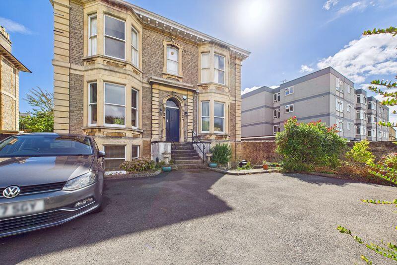
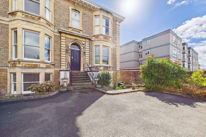
- Ground floor apartment forming part of this wonderful Victorian building
- One double size bedroom accommodation
- Holding Deposit - £206.00
- Security Deposit - £1,032.00
- Tenancy Term - from 12 months
- EPC Rating - D
- Council Tax Rating - A
Additional details
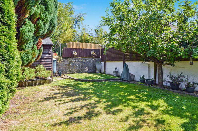
- Garden
- Yes
Description
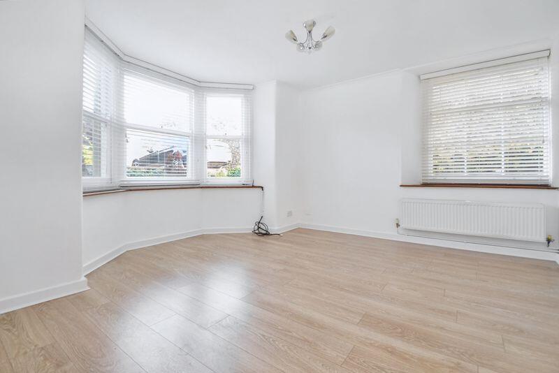
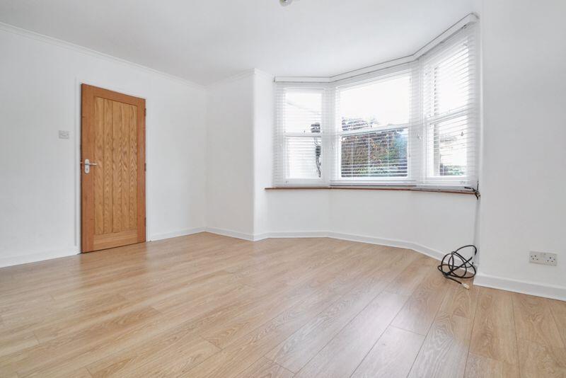
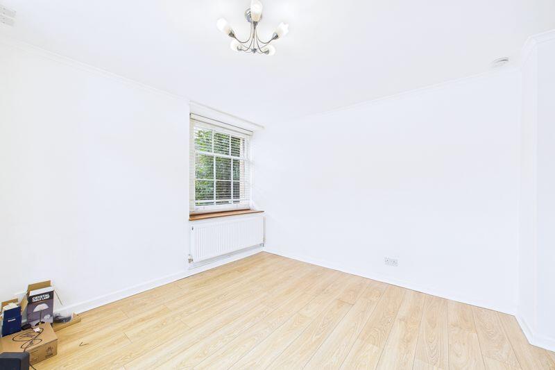
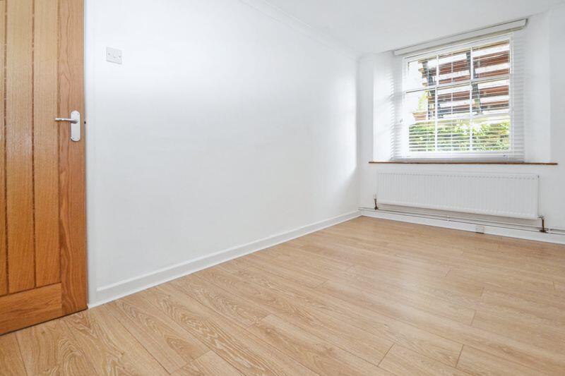
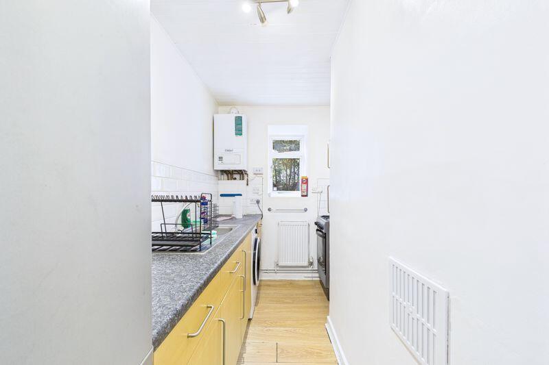
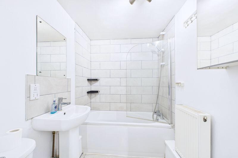
The well planned accommodation is gas centrally heated and offers a lounge/dining room which has the bay window to the front. From the hallway you can access the separate kitchen, the double size bedroom and the bathroom that is complete with shower over the bath.
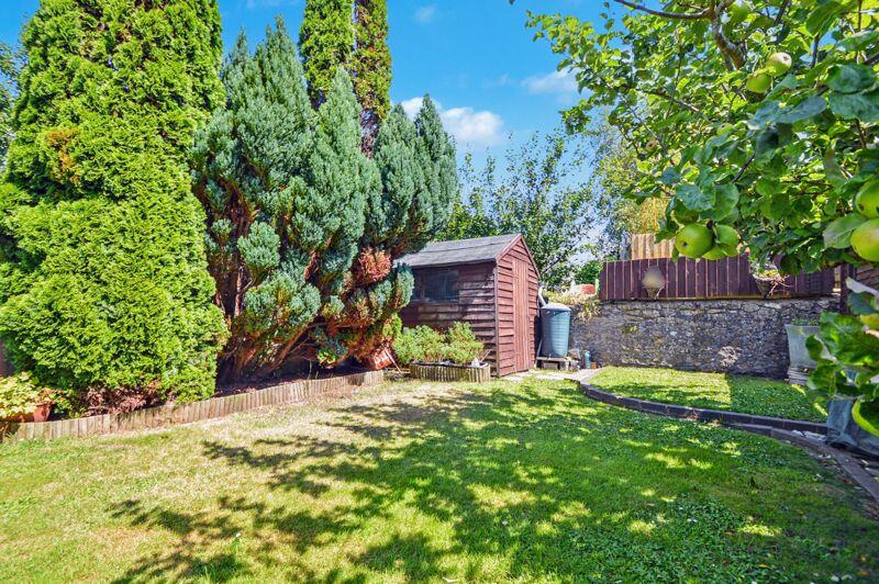
Outside to the front the property has the provision to park one vehicle while at the rear you have the surprising feature of your own allocated garden area. The garden is laid mainly to lawn and is well established and also has a shed for extra storage.
Located along Elton Road gives you this excellent position in which to live as you are only yards from Clevedon's historic sea front with the pier just a short walk away along with the cafe culture and eclectic shops of Hill Road.
Listed by
Clevedon
Mark Templer and Company Limited
Reference: 166423301
EPC Rating & Upgrade Cost
Fetching EPC data… Refresh this page in a moment.
Flood risk
Zone: 1
Risk: Low
Job (default Low)
Floorplans
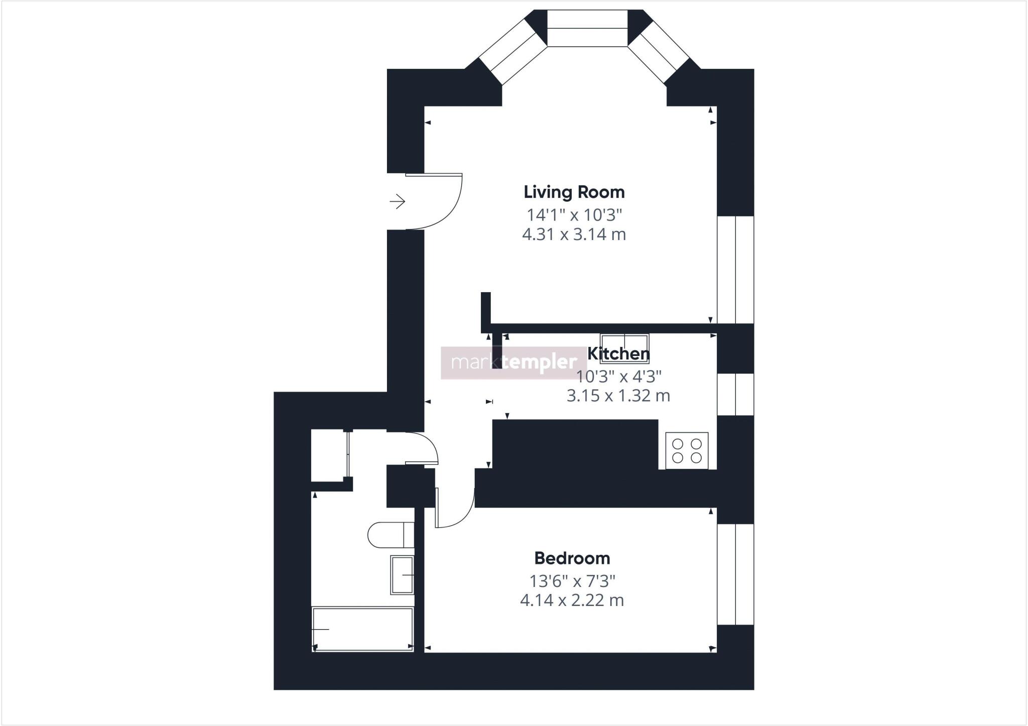
Floorplan 1
EPC Graphs

Energy Performance Certificate
Rental Range
Estimated market rent for North Somerset. Low = conservative, Realistic = average, Optimistic = best case.
Based on Local Authority from postcode lookup → North Somerset.
LHA (30th percentile) floor for Bristol: £898/mo (Apr 2025 – Mar 2026)
Location
Address
8 Elton Road
Nearby
Nearest stations, universities and amenities (distance from property).
| Type | Name | Distance |
|---|---|---|
| Shop | R G Rawlings Funeralcare | 0.1 miles |
| Shop | Clevedon Community Bookshop | 0.1 miles |
| Bus stop | Elton Road | 0.1 miles |
| Hospital | Clevedon Community Hospital | 0.6 miles |
| Train station | Yatton | 3.7 miles |
| Train station | Nailsea and Backwell | 5.0 miles |
| Hospital | Cygnet Hospital Kewstoke | 6.8 miles |
| University | University of Bristol Langford Campus | 7.5 miles |
| University | University of Bristol | 7.8 miles |
Street-level crime
| Category | Count |
|---|---|
| Violence and sexual offences | 25 |
| Public order | 15 |
| Anti-social behaviour | 13 |
| Vehicle crime | 13 |
| Shoplifting | 7 |
| Burglary | 6 |
| Criminal damage and arson | 6 |
| Other theft | 6 |
| Bicycle theft | 3 |
| Drugs | 2 |
| Other crime | 1 |
| Possession of weapons | 1 |
| Robbery | 1 |
| Total incidents | 99 |
Within 1 mile during Apr 2026. Source: data.police.uk (England & Wales).
Schools nearby
Nearest open schools with Ofsted ratings (England). Closed schools are not shown. Data from Get Information about Schools and Ofsted.
| Name | Type | Distance | Ofsted |
|---|---|---|---|
| St Nicholas Chantry Church of England Primary School | Primary | 0.6 miles | — (Inspected (no overall grade)) |
| Seven Hills | Other | 0.6 miles | Good — 11 Dec 2023 |
| St John the Evangelist Church School | Primary | 0.8 miles | Good — 26 Jun 2013 |
| Yeo Moor Primary School | Primary | 0.8 miles | Good — 18 Jul 2023 |
| All Saints Church of England Primary School | Primary | 0.9 miles | Good — 19 Jun 2012 |
Rental Comparables
Rental listings exist nearby, but none matched the 1-bedroom count for this property.