APARTMENT 801
PICO HOUSE, 2, PROSPECT WAY, LONDON, GREATER LONDON SW11 8DL
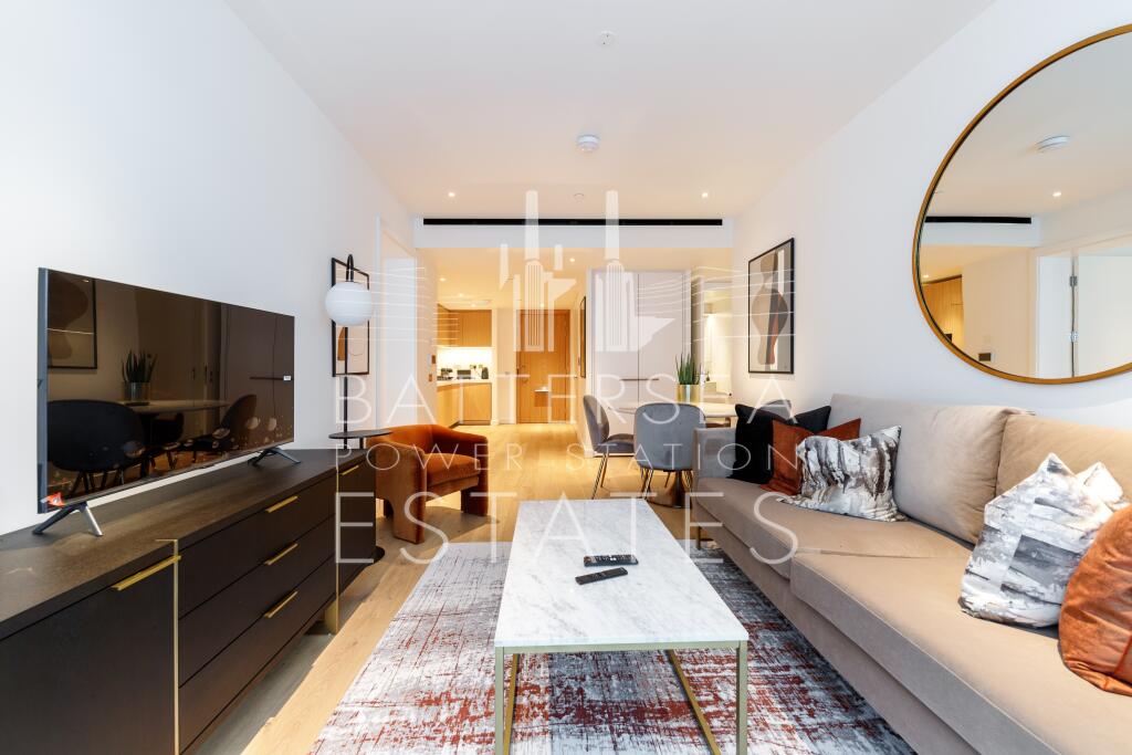
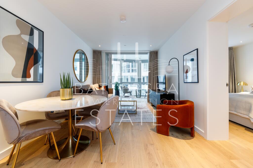
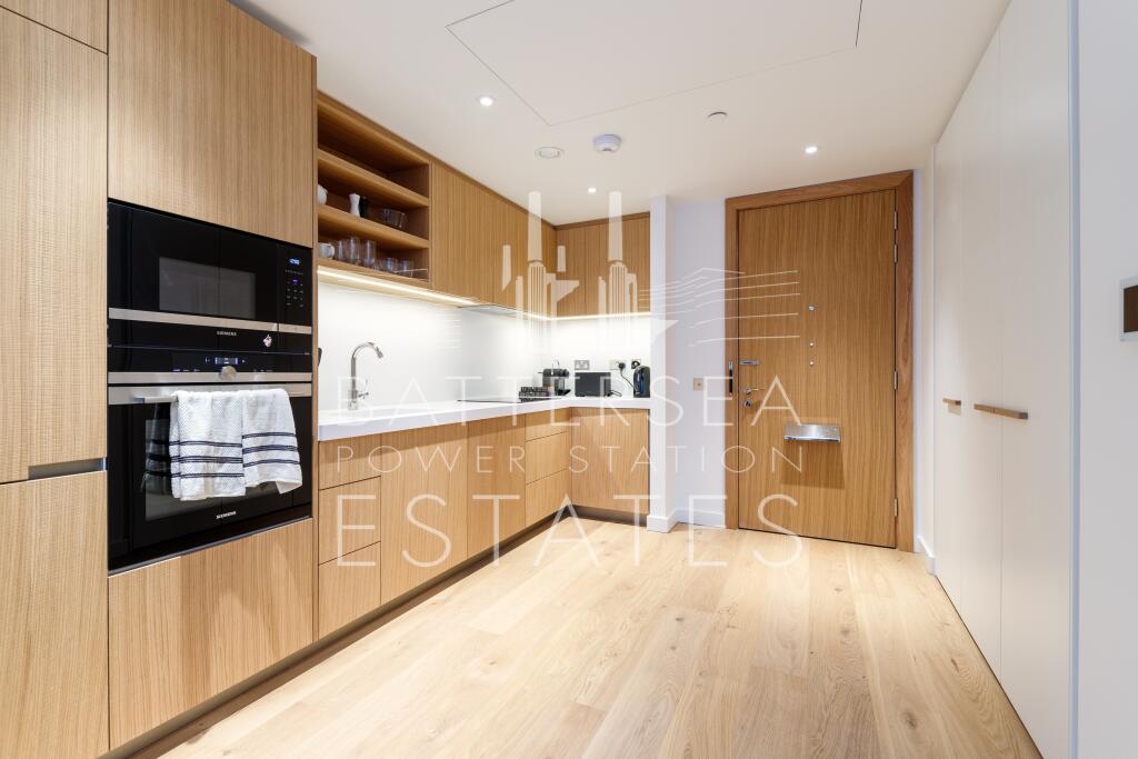
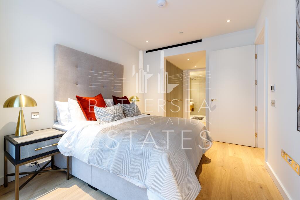
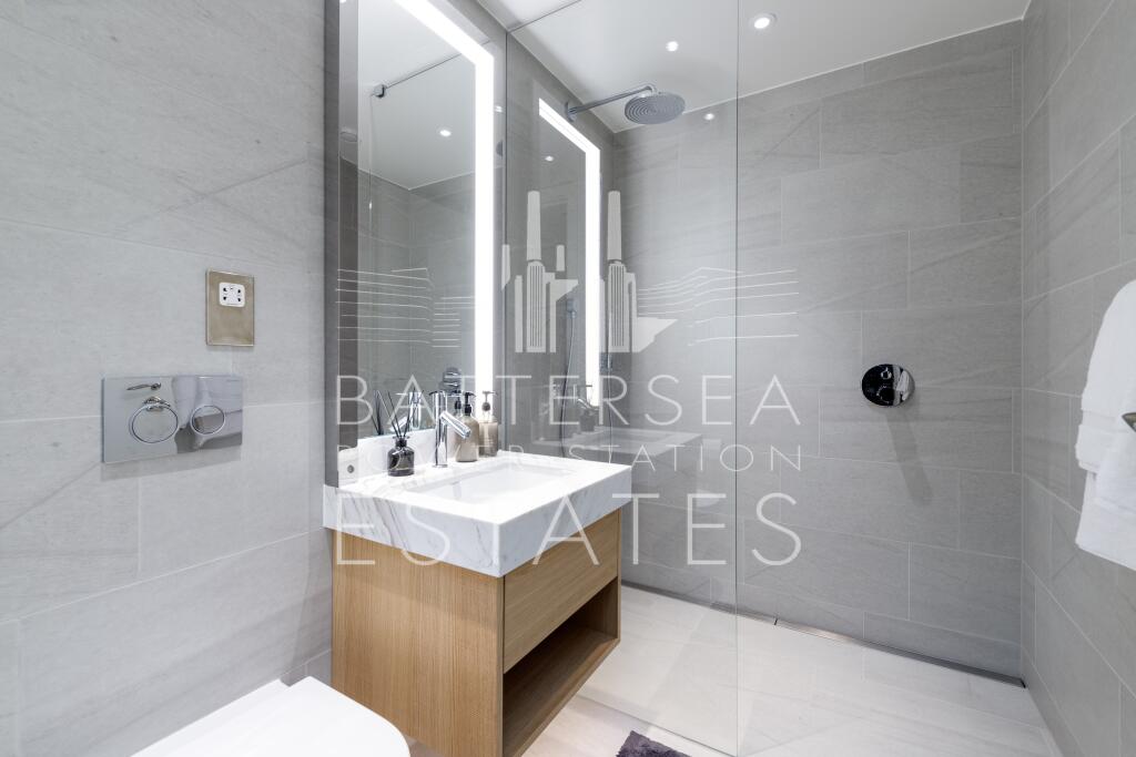
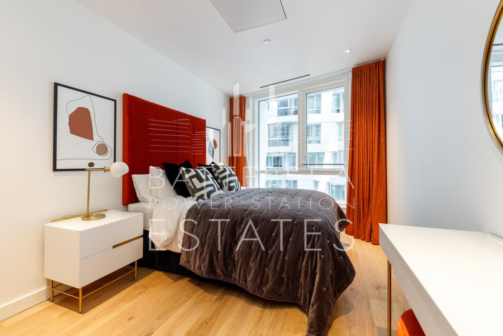
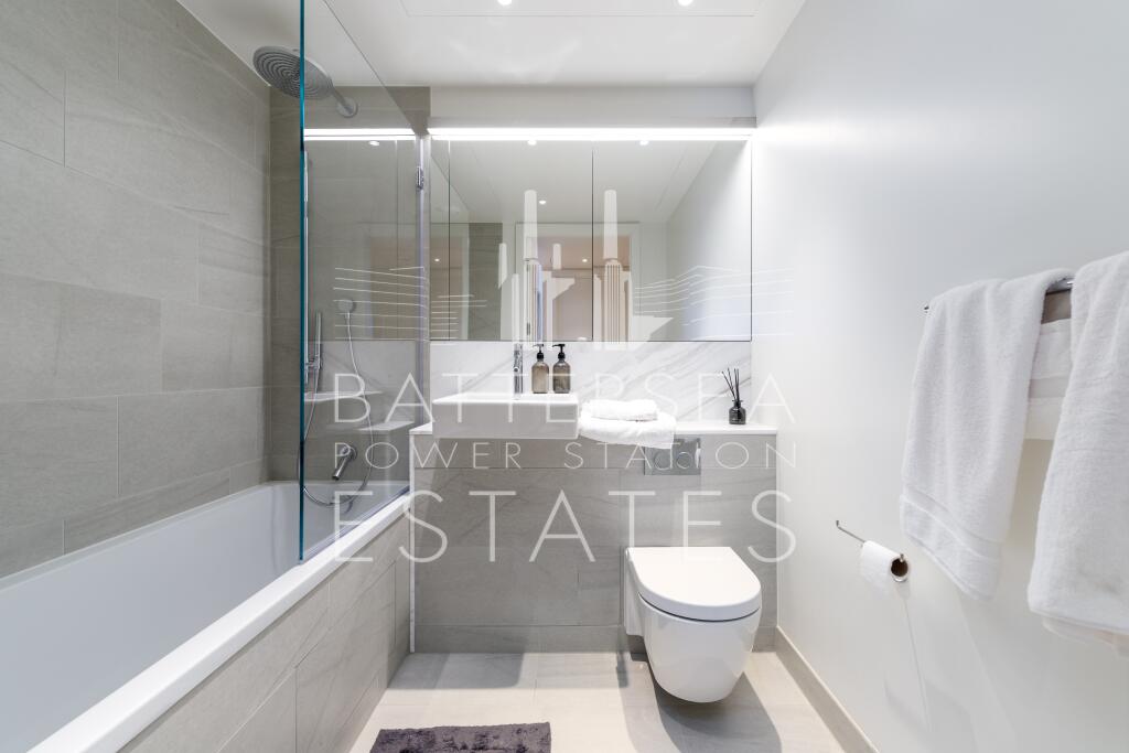
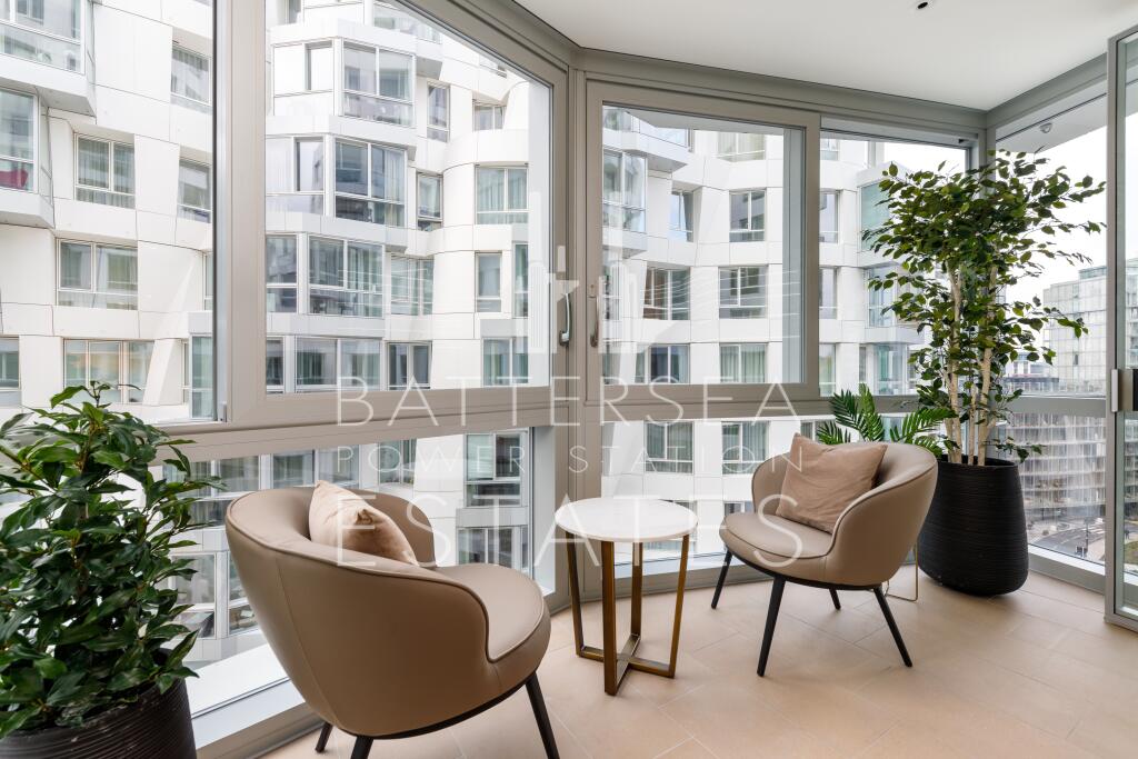

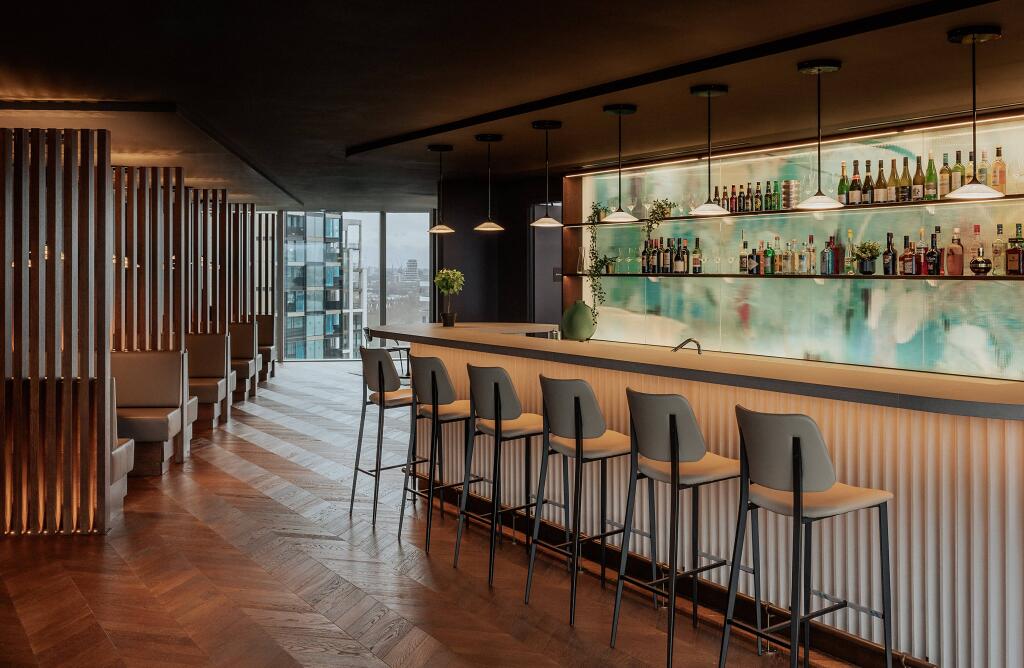
Photo 1 Photo 2 Photo 3 Photo 4 Photo 5 Photo 6 Photo 7 Photo 8 Photo 9 Photo 10
/ 10
Property details
Council tax band
F
Street crime
1120 incidents within 1 mile (Apr 2026)
Additional details
- Heating
- Under floor
- Accessibility
- Lift access
- Garden
- Communal garden
Description
Finished to an exacting standard with wood flooring throughout, the apartment has a heating and cooling system in the living room and bedrooms and underfloor heating in the bathrooms.
Residents of Battersea Roof Gardens will have access to 8000 sq ft of residential lounges, including a kitchen/bar, area, work spaces, a screening room, a 5000 sq ft gym, rooftop garden and concierge service.
Available 22nd of April
Council Tax band F - Wandsworth Borough
Listed by
Battersea - Lettings
Battersea Power Station Estates
Reference: 172333952
EPC Rating & Upgrade Cost
Fetching EPC data… Refresh this page in a moment.
Flood risk
Zone: 1
Risk: Low
Job (default Low)
Floorplans
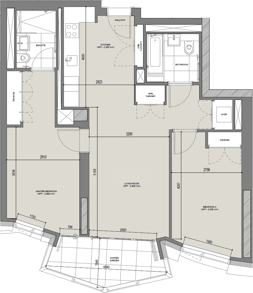
Floorplan 1
EPC Graphs
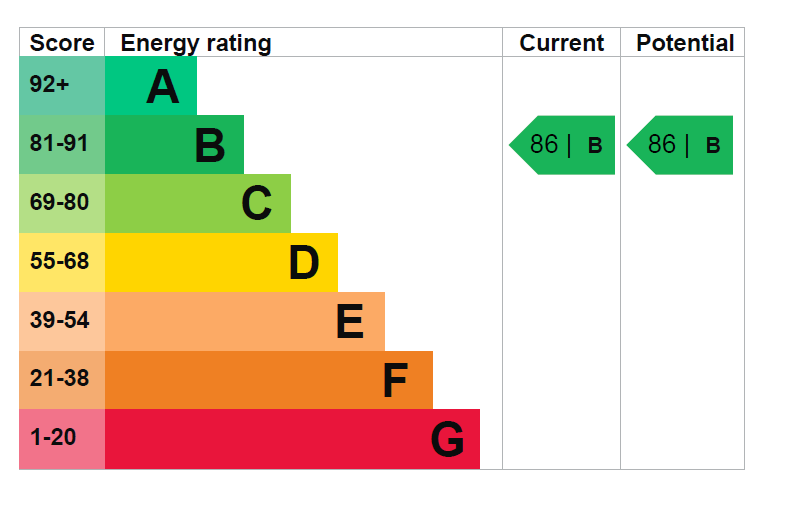
EPC 1
Rental Range
Estimated market rent for London. Low = conservative, Realistic = average, Optimistic = best case.
Based on Postcode area SW → London.
LHA (30th percentile) floor for Stevenage & North Herts: £972/mo (Apr 2025 – Mar 2026)
Location
Address
8 Circus Road West
Nearby
Nearest stations, universities and amenities (distance from property).
| Type | Name | Distance |
|---|---|---|
| Shop | The Battersea General Store | 0.0 miles |
| Shop | ME+EM | 0.0 miles |
| Bus stop | Battersea Park / Chelsea Gate | 0.1 miles |
| Bus stop | Unknown | 0.2 miles |
| Train station | Battersea Power Station | 0.2 miles |
| Train station | Battersea Park | 0.3 miles |
| Hospital | Bridge Lane Health Centre | 1.1 miles |
| University | National Heart and Lung Institute | 1.1 miles |
| University | University of Wales Trinity Saint David London Campus | 1.6 miles |
| Hospital | Tunica Diagnostics | 2.4 miles |
Street-level crime
| Category | Count |
|---|---|
| Anti-social behaviour | 272 |
| Violence and sexual offences | 208 |
| Theft from the person | 125 |
| Other theft | 109 |
| Shoplifting | 97 |
| Burglary | 58 |
| Public order | 58 |
| Vehicle crime | 45 |
| Robbery | 44 |
| Criminal damage and arson | 42 |
| Drugs | 26 |
| Bicycle theft | 23 |
| Other crime | 8 |
| Possession of weapons | 5 |
| Total incidents | 1120 |
Within 1 mile during Apr 2026. Source: data.police.uk (England & Wales).
Schools nearby
Nearest open schools with Ofsted ratings (England). Closed schools are not shown. Data from Get Information about Schools and Ofsted.
| Name | Type | Distance | Ofsted |
|---|---|---|---|
| St Gabriel's CofE Primary School | Primary | 0.3 miles | Good — 31 Mar 2014 |
| Newton Preparatory School | Other | 0.4 miles | — (No rating) |
| St Mary's RC Voluntary Aided Primary School | Primary | 0.4 miles | Good — 13 Jul 2023 |
| St George's CofE Primary School | Primary | 0.5 miles | Good — 11 Feb 2019 |
| Ada National College for Digital Skills | Other | 0.5 miles | — (No rating) |
Rental Comparables
Residential lets from OpenRent and Rightmove for the area (same bedroom count). Use to validate rent estimates. Student lets are excluded.
| Title | Rent | Beds | Distance | As seen on |
|---|---|---|---|---|
| 2 Bed Flat, Faraday House, SW11 | £4,850/mo | 2 | 0.06 miles | OpenRent |
| 2 Bed Flat, Hawker Building, SW11 | £3,500/mo | 2 | 0.09 miles | OpenRent |
| 2 Bed Flat, Palmers Road, SW11 | £4,500/mo | 2 | 0.18 miles | OpenRent |
| 2 Bed Flat, Queenstown Road, SW8 | £2,150/mo | 2 | 0.37 miles | OpenRent |
Average rent: £3,750/mo (4 listings)