85E
WARRINGTON CRESCENT, LONDON, GREATER LONDON W9 1EH
£434,950
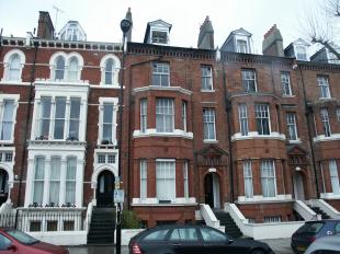
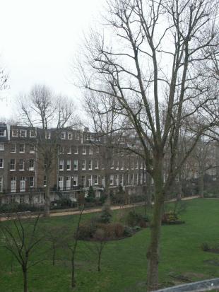
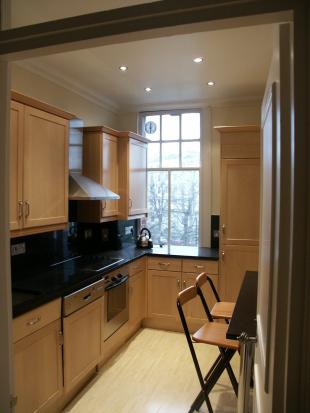
Photo 1 Photo 2 Photo 3 Photo 4
/ 4
Property details
Last sold
£890,000 Jul 2025
Local average
£440,800 (-1.3%)
Deprivation
Decile 7 (23,604 of 33,755)
Street crime
1713 incidents within 1 mile (Apr 2026)
Key features
- Communal Gardens
- Close to the tube
- Fitted Kitchen
Description
Lease: Share of Freehold
Service Charge: £1,620 approx
Ground Rent: Peppercorn
Listed by
London - Lettings
Residential Land Ltd
Reference: 2673402
Flood risk
Zone: 1
Risk: Low
Job (default Low)
Floorplans
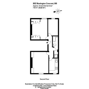
Floorplan 1
Price history
| Event | Date | Price | % change |
|---|---|---|---|
| Sold | 11/07/2025 (11 months ago) | £890,000 | — |
Source: HM Land Registry Price Paid Data. Crown copyright.
Sold Comparables
Same street and nearby sales within 0.25 miles (last 5 years). Data from Land Registry Price Paid.
| Address | Price | Date | Type |
|---|---|---|---|
| Same street 75 FLAT 2 WARRINGTON CRESCENT, LONDON, CITY OF WESTMINSTER, GREATER LONDON, W9 1EH | £1,380,000 | 25/07/2025 | Flat |
| STUART TOWER, 105 FLAT 1M MAIDA VALE, LONDON, CITY OF WESTMINSTER, GREATER LONDON, W9 1UD | £295,500 | 04/04/2025 | Other |
| 79 FLAT 4 RANDOLPH AVENUE, LONDON, CITY OF WESTMINSTER, GREATER LONDON, W9 1DW | £820,000 | 05/09/2022 | Other |
| 15H RANDOLPH CRESCENT, LONDON, CITY OF WESTMINSTER, GREATER LONDON, W9 1DP | £3,000,000 | 02/06/2022 | Other |
| 11H RANDOLPH CRESCENT, LONDON, CITY OF WESTMINSTER, GREATER LONDON, W9 1DP | £3,700,000 | 04/03/2022 | Other |
| Same street 73C WARRINGTON CRESCENT, LONDON, CITY OF WESTMINSTER, GREATER LONDON, W9 1EH | £1,150,000 | 14/02/2022 | Terraced |
| GARAGE 13, 102 RANDOLPH AVENUE, LONDON, CITY OF WESTMINSTER, GREATER LONDON, W9 1PQ | £62,500 | 25/01/2022 | Other |
| Same street 87 - 89 FLAT 4 WARRINGTON CRESCENT, LONDON, CITY OF WESTMINSTER, GREATER LONDON, W9 1EH | £875,000 | 14/01/2022 | Flat |
| Same street 73A WARRINGTON CRESCENT, LONDON, CITY OF WESTMINSTER, GREATER LONDON, W9 1EH | £1,400,000 | 17/12/2021 | Flat |
| 14 GROUND FLOOR AND BASEMENT PREMISES FORMOSA STREET, LONDON, CITY OF WESTMINSTER, GREATER LONDON, W9 1EE | £25,000 | 04/10/2021 | Other |
| Same street 69 FLAT E WARRINGTON CRESCENT, LONDON, CITY OF WESTMINSTER, GREATER LONDON, W9 1EH | £1,799,912 | 24/09/2021 | Flat |
| LAUDERDALE MANSIONS ROOF SPACE ABOVE FLAT 18 LAUDERDALE ROAD, LONDON, CITY OF WESTMINSTER, GREATER LONDON, W9 1NE | £1,280,000 | 29/06/2021 | Other |
| 35C RANDOLPH CRESCENT, LONDON, CITY OF WESTMINSTER, GREATER LONDON, W9 1DP | £1,667,000 | 29/06/2021 | Other |
Street average: £1,320,982 (5 sales)
Area average: £1,356,250 (8 sales)
Capital growth trend
Land Registry outcode average: last 12 months vs 5y and 10y ago (from sold prices).
House Price Index (HM Land Registry — official index, not sold-price averages): City of Westminster. Series: All dwelling types. As of March 2026.
Rental Range
Estimated market rent for Westminster. Low = conservative, Realistic = average, Optimistic = best case.
Based on Local Authority from postcode lookup → Westminster.
LHA (30th percentile) floor for Lincoln: £598/mo (Apr 2025 – Mar 2026)
Location
Nearby
Nearest stations, universities and amenities (distance from property).
| Type | Name | Distance |
|---|---|---|
| Shop | Formosa Flowers & Chocolaterie | 0.1 miles |
| Shop | Real Drinks | 0.1 miles |
| Bus stop | Maida Vale | 0.2 miles |
| Bus stop | Hall Road | 0.2 miles |
| Train station | Warwick Avenue | 0.2 miles |
| Train station | Maida Vale | 0.3 miles |
| University | Kennet West Skills Centre | 0.8 miles |
| University | LBS Behaviour Lab | 1.0 miles |
| Hospital | The Portland Hospital | 1.7 miles |
| Hospital | Sleep & Health Clinic | 1.9 miles |
Street-level crime
| Category | Count |
|---|---|
| Anti-social behaviour | 421 |
| Violence and sexual offences | 364 |
| Shoplifting | 166 |
| Other theft | 143 |
| Theft from the person | 109 |
| Burglary | 105 |
| Public order | 91 |
| Drugs | 74 |
| Criminal damage and arson | 72 |
| Vehicle crime | 70 |
| Robbery | 39 |
| Bicycle theft | 33 |
| Possession of weapons | 17 |
| Other crime | 9 |
| Total incidents | 1713 |
Within 1 mile during Apr 2026. Source: data.police.uk (England & Wales).
Schools nearby
Nearest open schools with Ofsted ratings (England). Closed schools are not shown. Data from Get Information about Schools and Ofsted.
| Name | Type | Distance | Ofsted |
|---|---|---|---|
| St Joseph's RC Primary School | Primary | 0.1 miles | Outstanding — 14 May 2024 |
| St Saviour's CofE Primary School | Primary | 0.2 miles | Good — 14 Dec 2023 |
| Paddington Academy | Secondary | 0.4 miles | Outstanding — 8 May 2023 |
| St Mary Magdalene CofE Primary School | Primary | 0.4 miles | Good — 12 Nov 2012 |
| Ark Atwood Primary Academy | Primary | 0.4 miles | Outstanding — 9 Sep 2024 |
Rental Comparables
Rental listings exist nearby, but none matched the 2-bedroom count for this property.
Rent-driven metrics
Based on Area rent estimate.
- Rent ratio — Monthly rent ÷ purchase price (1% rule). 1%+ = strong, 0.8–1% = okay, <0.8% = weak for cashflow.
- Max investor price — Rent ÷ 0.8%; the price at which rent would be 0.8% of price (Stoke-style target).
- Target investor price — Rent ÷ 1%; the price at which rent would be 1% of price (strong cashflow band).
- Gross yield — Annual rent as % of purchase price (no costs).