FLAT 2
38 BIRKBECK ROAD, LONDON, GREATER LONDON W3 6BQ
£1,600 pcm
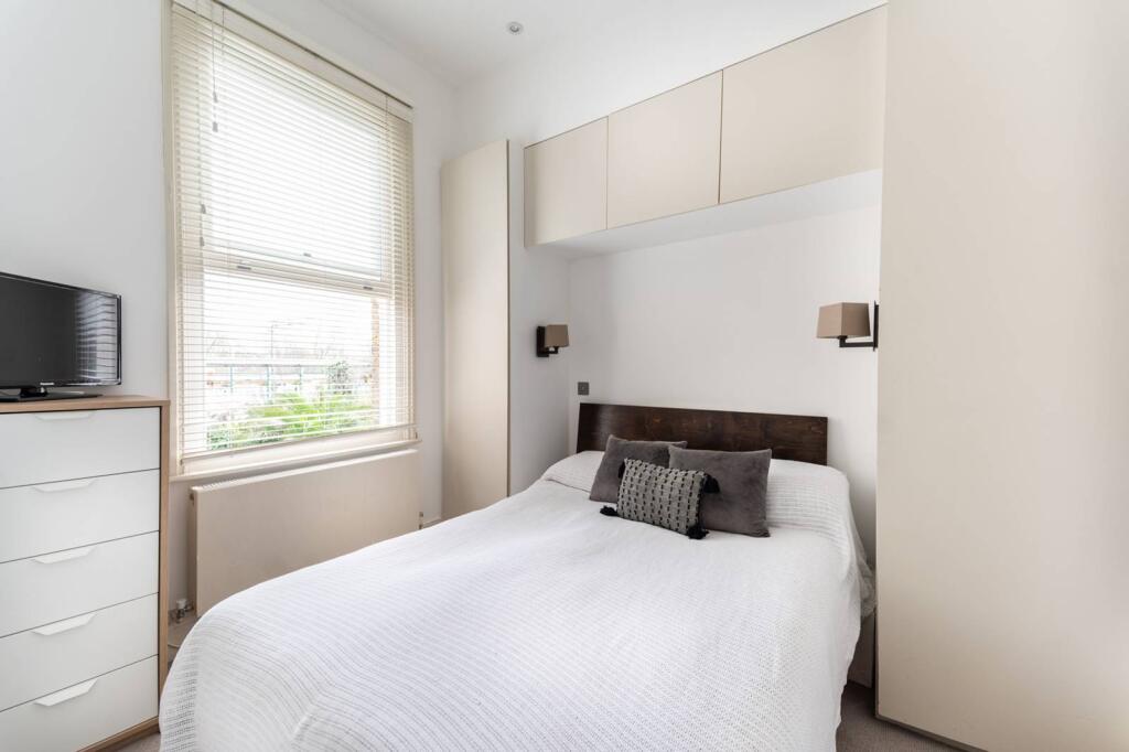
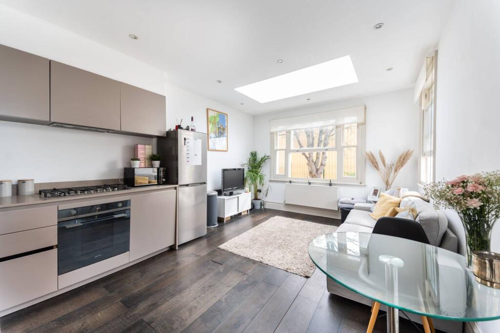
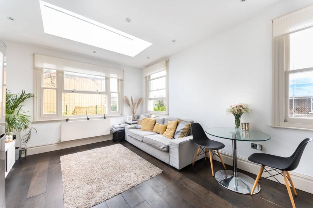
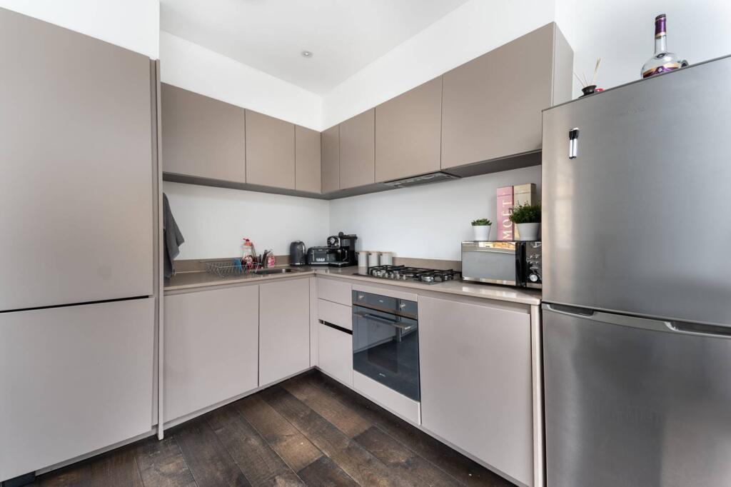
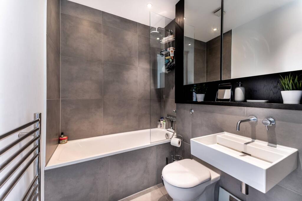
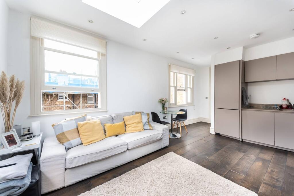
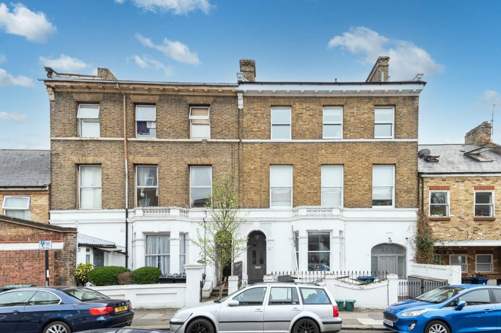
Photo 1 Photo 2 Photo 3 Photo 4 Photo 5 Photo 6 Photo 7
/ 7
Property details
Floor area
35 m²
Deprivation
Decile 2 (5,515 of 33,755)
Street crime
731 incidents within 1 mile (Apr 2026)
Key features
- Excellent 1 bedroom flat
- Reception room with dining area
- Contemporary kitchen
- Fabulous shower room
- Double bedroom
- Period conversion
- Built in storage
- Peaceful residential area
- Available with Zero Deposit
Description
The Vale and Acton High Street are on the doorstep and offer a wide selection of shops and restaurants. The amenities of Chiswick are also within easy reach.
Please use the reference CHPK4335598 when contacting Foxtons.
Listed by
Chiswick
Foxtons
Reference: 172079795
EPC Rating & Upgrade Cost
Fetching EPC data… Refresh this page in a moment.
Flood risk
Zone: 1
Risk: Low
Job (default Low)
Floorplans
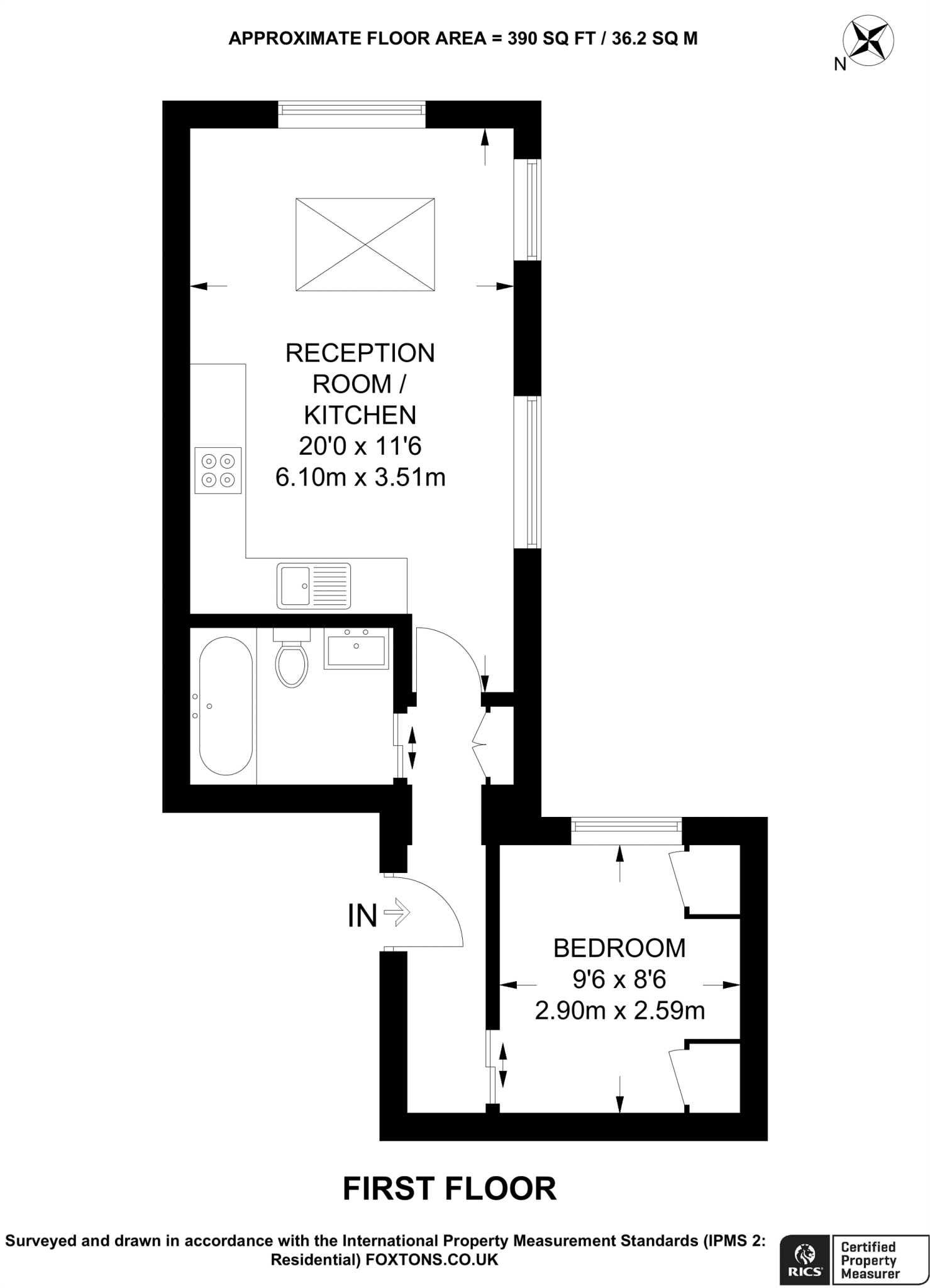
Floorplan area for info only, not for £/sq. ft valuation

Floorplan 2
EPC Graphs
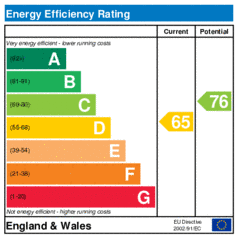
EER
Company ownership
Registered legal owner is a company.
Rental Range
Estimated market rent for Ealing. Low = conservative, Realistic = average, Optimistic = best case.
Based on Local Authority from postcode lookup → Ealing.
LHA (30th percentile) floor for Bedford: £648/mo (Apr 2025 – Mar 2026)
Location
Nearby
Nearest stations, universities and amenities (distance from property).
| Type | Name | Distance |
|---|---|---|
| Shop | Jewson | 0.1 miles |
| Shop | Paint | 0.1 miles |
| Train station | Acton Central | 0.1 miles |
| Bus stop | Acton Central Station | 0.1 miles |
| Train station | South Acton | 0.6 miles |
| University | Richmond American University London | 1.1 miles |
| University | Scale Space White City | 1.8 miles |
| Hospital | Bridge Lane Health Centre | 4.9 miles |
| Hospital | The Portland Hospital | 5.3 miles |
Street-level crime
| Category | Count |
|---|---|
| Anti-social behaviour | 193 |
| Violence and sexual offences | 187 |
| Vehicle crime | 76 |
| Shoplifting | 58 |
| Public order | 57 |
| Other theft | 49 |
| Criminal damage and arson | 32 |
| Drugs | 19 |
| Burglary | 18 |
| Bicycle theft | 11 |
| Robbery | 11 |
| Possession of weapons | 8 |
| Theft from the person | 8 |
| Other crime | 4 |
| Total incidents | 731 |
Within 1 mile during Apr 2026. Source: data.police.uk (England & Wales).
Schools nearby
Nearest open schools with Ofsted ratings (England). Closed schools are not shown. Data from Get Information about Schools and Ofsted.
| Name | Type | Distance | Ofsted |
|---|---|---|---|
| Ark Byron Primary Academy | Primary | 0.1 miles | Good — 11 Dec 2018 |
| Maples Nursery School and Children's Centre | Nursery | 0.2 miles | Requires improvement — 13 Jul 2023 |
| Ark Priory Primary Academy | Primary | 0.2 miles | Outstanding — 9 Jul 2015 |
| Derwentwater Primary School | Primary | 0.3 miles | Good — 24 Jul 2019 |
| Snowflake School | Other | 0.4 miles | Good — 11 Jul 2023 |
Rental Comparables
Residential lets from OpenRent and Rightmove for the area (same bedroom count). Use to validate rent estimates. Student lets are excluded.
| Title | Rent | Beds | Distance | As seen on |
|---|---|---|---|---|
| 1 Bed Flat, Churchfield Road, W3 | £1,750/mo | 1 | 0.07 miles | OpenRent |
| 1 Bed Flat, High Street, W3 | £1,420/mo | 1 | 0.21 miles | OpenRent |
| 1 Bed Flat, Church Road, W3 | £2,100/mo | 1 | 0.3 miles | OpenRent |
| 1 Bed Flat, High Street, W3 | £1,650/mo | 1 | 0.4 miles | OpenRent |
| 1 Bed Flat, Very Near Morrisons Supermarket Area, W3 | £1,650/mo | 1 | 0.42 miles | OpenRent |
| 1 Bed Flat, Beechwood Grove, W3 | £1,850/mo | 1 | 0.48 miles | OpenRent |
Average rent: £1,737/mo (6 listings)