School House
HEATH ROAD, MANNINGTREE, BRADFIELD, ESSEX CO11 2UZ
£575,000
Property details
Tenure
FREEHOLD
Floor area
106 m²
EPC rating
E
Last sold
£575,000 Jan 2022
Price per m²
£5,425/m²
Local average
£524,289 (+9.7%)
Deprivation
Decile 7 (20,605 of 33,755)
Street crime
4 incidents within 1 mile (May 2026)
Key features
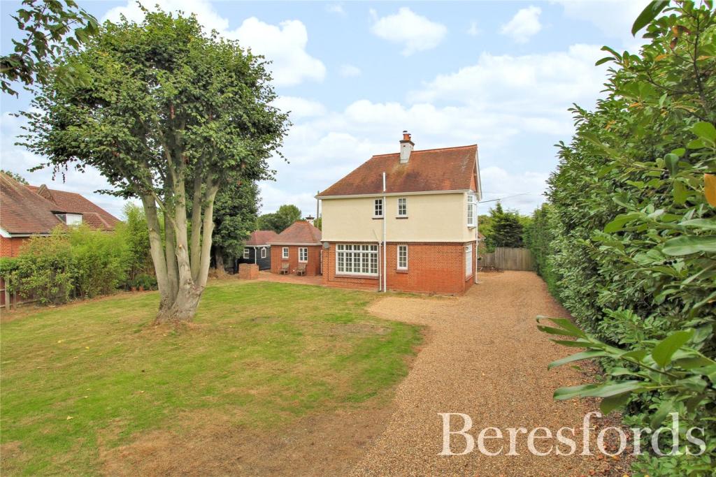
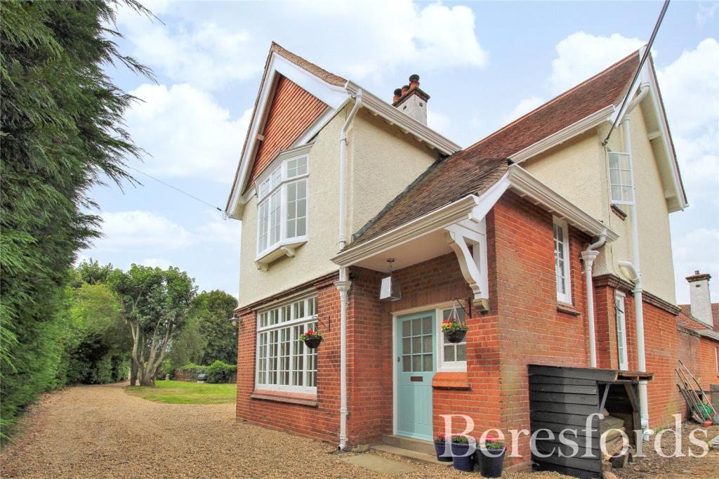
- DETACHED HOUSE
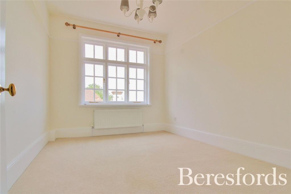
- THREE DOUBLE BEDROOMS
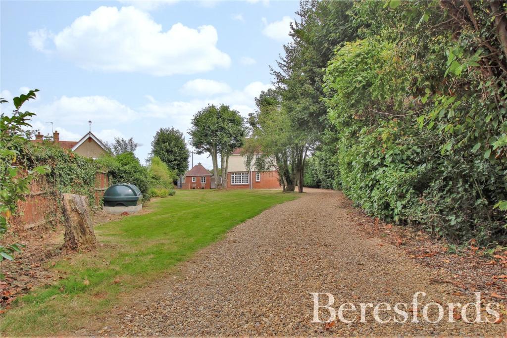
- 1/3 ACRE PLOT
- CONCEALED ENTRANCE
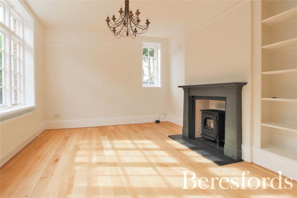
- LOUNGE
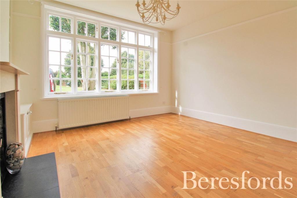
- DINING ROOM
- UTILITY ROOM
- AMPLE PARKING
- PERIOD PROPERTY
- CHARACTER FEATURES
Additional details
- Parking
- Yes
- Garden
- Yes
Description
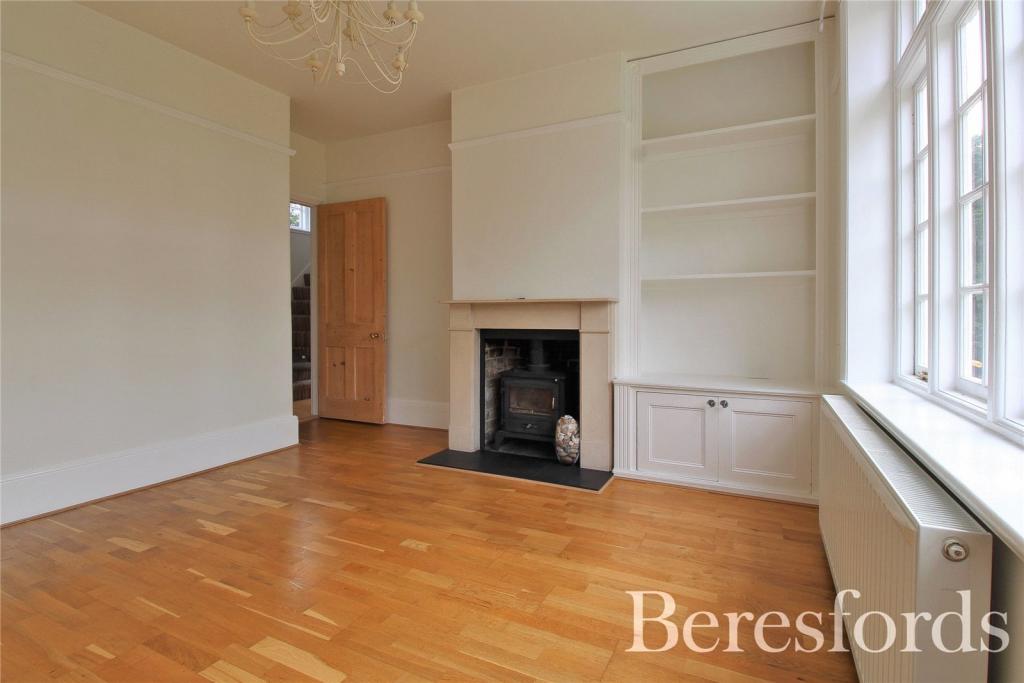
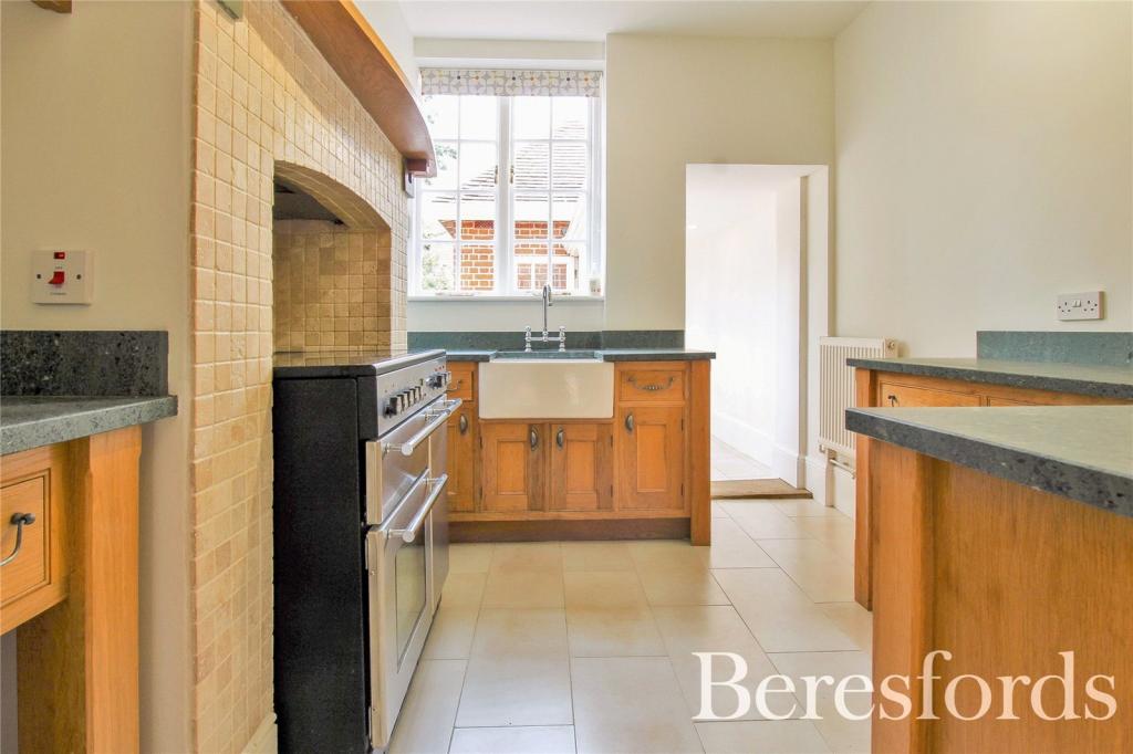
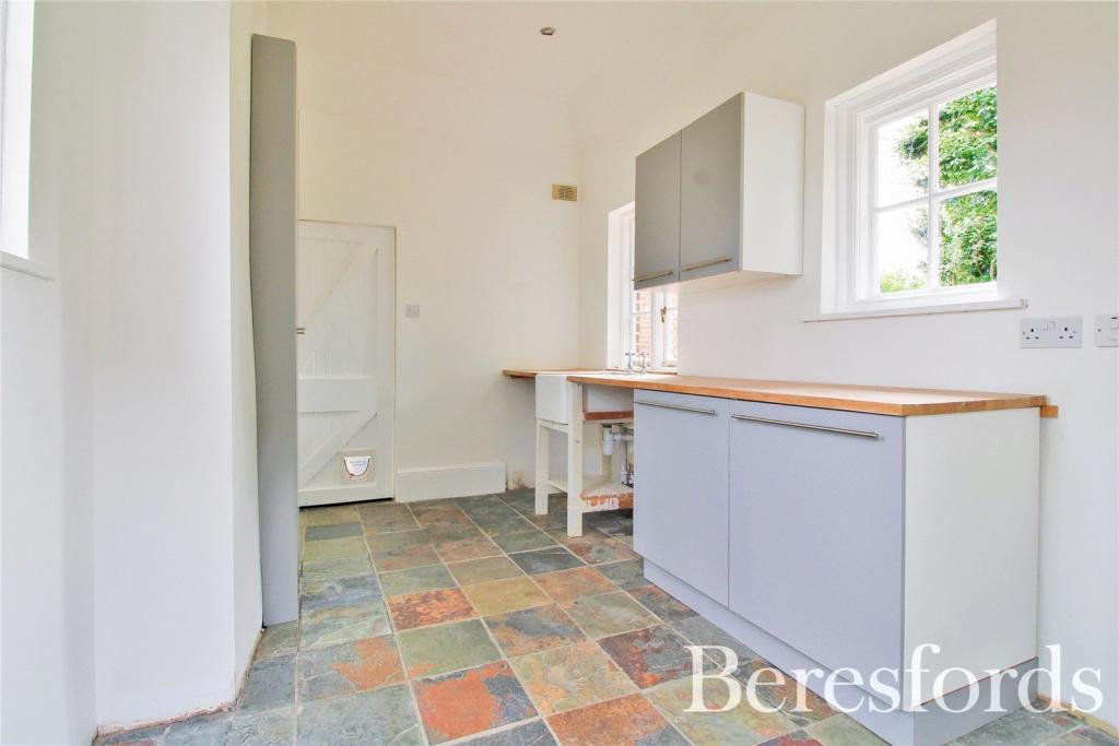
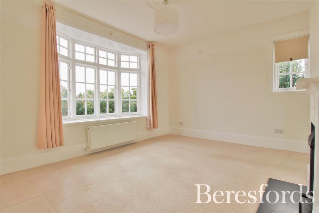
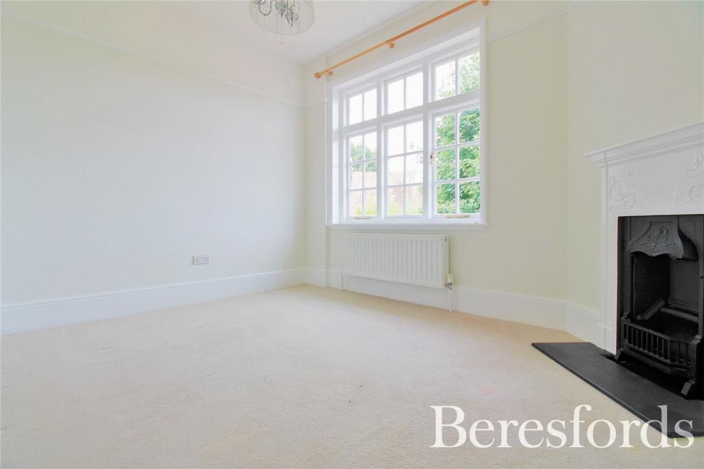
The accommodation offers exposed wood floors, feature fireplaces and high ceilings throughout. Whilst the space and plot on offer is already excellent, the current owners have planning permission in place to extend and bring out the inner hall between the kitchen and utility. (Please ask for more details) This could be utilised to add additional or a new dining space / study, then making the dining room already there a viable bedroom option for those with a growing family.
Whether you’re looking for a property to add space to over time or an already great sized family home, this is sure to tick your boxes.
Please call Beresfords to arrange your private viewing.
Listed by
Colchester
Beresfords Residential
Reference: 113461304
EPC Rating & Upgrade Cost
Current rating: E
Potential rating: C
Inspection date: 12/02/2020
Expiry date: 11/02/2030
Current heating cost: £1,099/year
Potential heating cost: £502/year
Est. upgrade cost to C: £24,400
Recommendations
- 50 mm internal or external wall insulation (£4,000 - £14,000)
- Floor insulation (suspended floor) (£800 - £1,200)
- Solar water heating (£4,000 - £6,000)
- Replace single glazed windows with low-E double glazing (£3,300 - £6,500)
- Solar photovoltaic panels, 2.5 kWp (£3,500 - £5,500)
Flood risk
Zone: 1
Risk: Low
Job (default Low)
Floorplans
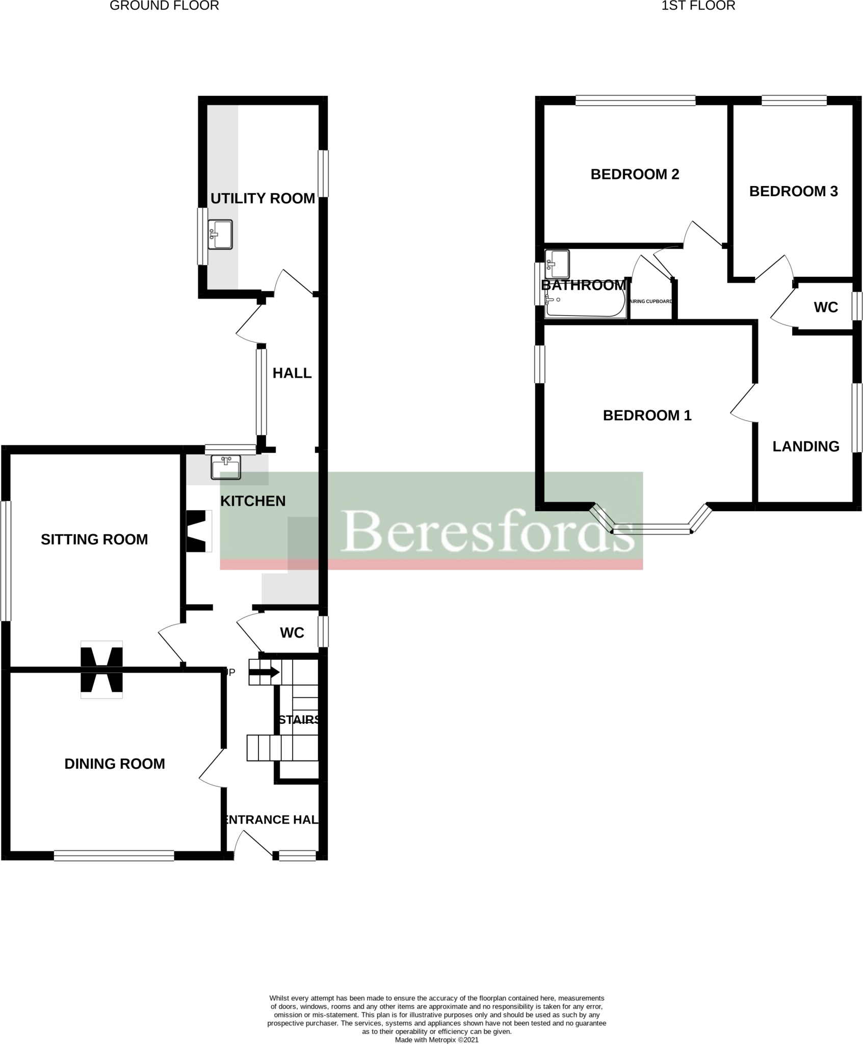
Floorplan
EPC Graphs
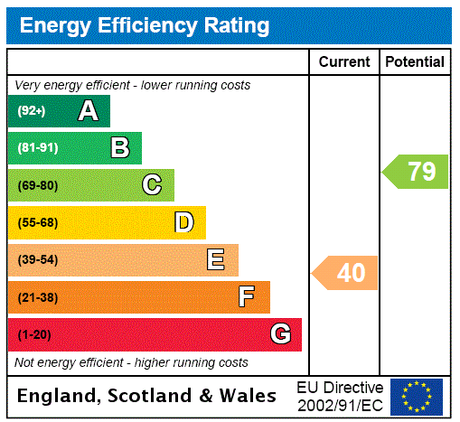
EPC Rating Graph
Price history
130% since 2003
| Event | Date | Price | % change |
|---|---|---|---|
| Sold | 14/01/2022 (4 years ago) | £575,000 | +69.1% |
| Sold | 09/05/2008 (18 years ago) | £339,995 | +36% |
| Sold | 10/03/2003 (23 years ago) | £250,000 | — |
Source: HM Land Registry Price Paid Data. Crown copyright.
Sold Comparables
Same street and nearby sales within 0.25 miles (last 5 years). Data from Land Registry Price Paid.
| Address | Price | Date | Type |
|---|---|---|---|
| PARKVIEW THE STREET, BRADFIELD, MANNINGTREE, TENDRING, ESSEX, CO11 2UU | £430,000 | 07/01/2026 | Detached |
| SUNSET VIEW THE STREET, BRADFIELD, MANNINGTREE, TENDRING, ESSEX, CO11 2UU | £490,000 | 07/01/2025 | Detached |
| STREET FARM HEATH ROAD, BRADFIELD, MANNINGTREE, TENDRING, ESSEX, CO11 2XD | £375,000 | 08/09/2023 | Detached |
| PLUM COTTAGE HEATH ROAD, BRADFIELD, MANNINGTREE, TENDRING, ESSEX, CO11 2XD | £615,000 | 11/08/2023 | Detached |
| PLUM COTTAGE HEATH ROAD, BRADFIELD, MANNINGTREE, TENDRING, ESSEX, CO11 2XD | £615,000 | 11/08/2023 | Detached |
| THE BRAMBLES WIX ROAD, BRADFIELD, MANNINGTREE, TENDRING, ESSEX, CO11 2UX | £480,000 | 05/10/2022 | Detached |
| BRADSTOCK THE STREET, BRADFIELD, MANNINGTREE, TENDRING, ESSEX, CO11 2UU | £780,000 | 08/08/2022 | Detached |
| Same street MILWOOD HEATH ROAD, BRADFIELD, MANNINGTREE, TENDRING, ESSEX, CO11 2UZ | £598,000 | 30/03/2022 | Other |
Street average: £598,000 (1 sale)
Area average: £540,714 (7 sales)
Capital growth trend
Land Registry outcode average: last 12 months vs 5y and 10y ago (from sold prices).
House Price Index (HM Land Registry — official index, not sold-price averages): Tendring. Series: Detached. As of April 2026.
Rental Range
Estimated market rent for Tendring. Low = conservative, Realistic = average, Optimistic = best case.
Based on Local Authority from postcode lookup → Tendring.
LHA (30th percentile) floor for Ipswich: £798/mo (Apr 2025 – Mar 2026)
Location
Address
Heath Road
Nearby
Nearest stations, universities and amenities (distance from property).
| Type | Name | Distance |
|---|---|---|
| Bus stop | The Village Maid | 0.1 miles |
| Shop | Abbott Saab | 1.4 miles |
| Train station | Mistley | 1.7 miles |
| Shop | Adept Design & Construction | 2.2 miles |
| Train station | Wrabness | 2.6 miles |
| Hospital | Fryatt Hospital | 6.3 miles |
| University | The Pastures | 8.2 miles |
| University | The Quays | 8.4 miles |
| Hospital | Cygnet Hospital Colchester | 9.4 miles |
Street-level crime
| Category | Count |
|---|---|
| Vehicle crime | 2 |
| Violence and sexual offences | 2 |
| Total incidents | 4 |
Within 1 mile during May 2026. Source: data.police.uk (England & Wales).
Schools nearby
Nearest open schools with Ofsted ratings (England). Closed schools are not shown. Data from Get Information about Schools and Ofsted.
| Name | Type | Distance | Ofsted |
|---|---|---|---|
| Bradfield Primary School | Primary | 0.0 miles | Good — 13 Nov 2022 |
| Mistley Norman Church of England Primary School | Primary | 1.4 miles | Requires improvement — 23 Jan 2022 |
| Wix and Wrabness Primary School | Primary | 1.6 miles | Good — 22 Jan 2023 |
| Highfields Primary School | Primary | 2.7 miles | Outstanding — 8 Sep 2016 |
| Manningtree High School | Secondary | 2.7 miles | Good — 12 Jan 2015 |
Rental Comparables
Loading rental comparables for this postcode. Refresh in a few minutes.
Rent-driven metrics
Based on Area rent estimate.
- Rent ratio — Monthly rent ÷ purchase price (1% rule). 1%+ = strong, 0.8–1% = okay, <0.8% = weak for cashflow.
- Max investor price — Rent ÷ 0.8%; the price at which rent would be 0.8% of price (Stoke-style target).
- Target investor price — Rent ÷ 1%; the price at which rent would be 1% of price (strong cashflow band).
- Gross yield — Annual rent as % of purchase price (no costs).
Enter House Number
Enter the house number to help us retrieve more accurate pricing history and property data.
Please log in to submit or correct the house number for this listing.
Log in to continue