Merrial Street Newcastle
ST5 2AW
£450 pcm
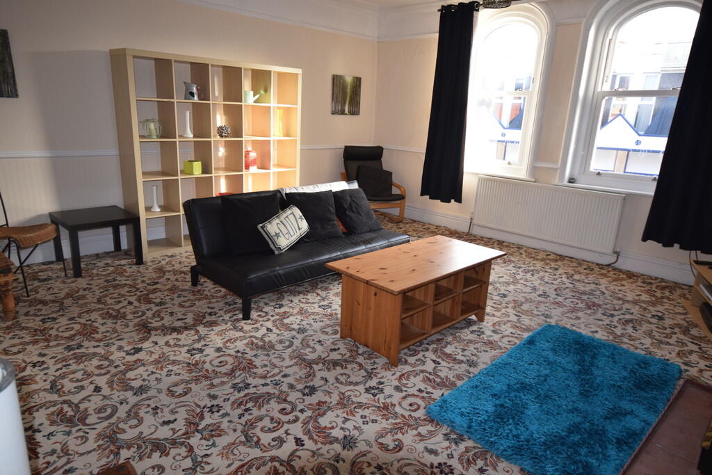
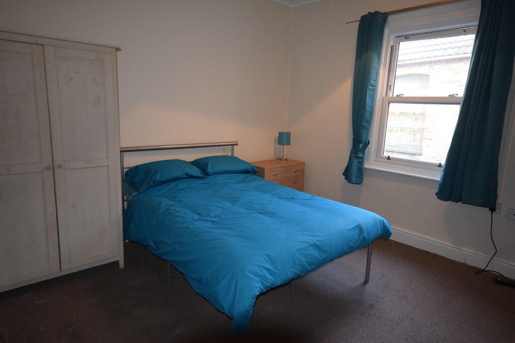
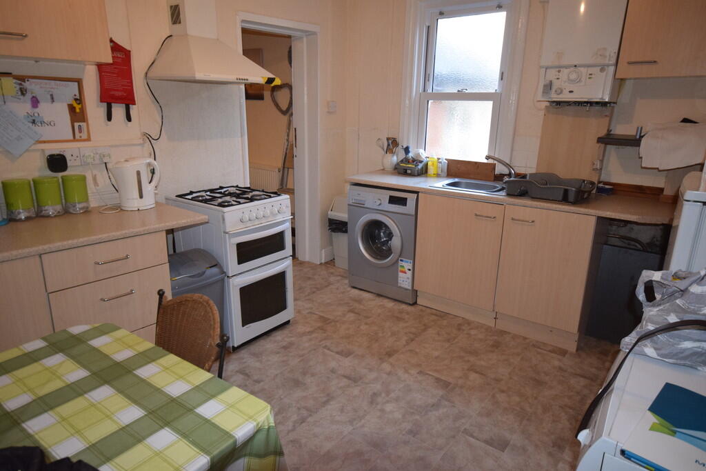
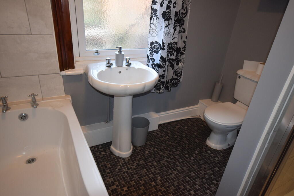
Photo 1 Photo 2 Photo 3 Photo 4
/ 4
Property details
Council tax band
A
Deprivation
Decile 2 (4,637 of 33,755)
Street crime
404 incidents within 1 mile (Mar 2026)
Key features
- Fully Furnished
- Bills Included
- Shared Kitchen
- Shared Bathroom
- Located In The Heart of Newcastle
- Large shared lounge
- Double room
Additional details
- Heating
- Gas central
Description
KITCHEN Fitted kitchen comprising of a range of base units with contrasting worktops over, wall units, stainless steel sink and drainer. Free standing gas cooker, fridge freezer, washing machine. Wall mounted gas boiler and a UPVC double glazed window.
BATHROOM White suite comprising of WC, pedestal wash hand basin and a bath with a shower over. Additional separate shower. Vinyl flooring, part tiled walls and UPVC double glazed obscure window.
BEDROOM Carpeted flooring, wall mounted radiator and UPVC double glazed window. Fully furnished room with single bed.
LIVING ROOM ** Spacious furnished living room with carpeted flooring, wall mounted radiator, UPVC double glazed window and a feature fireplace.
Listed by
Stoke On Trent
The Property Franchise Group
Reference: 160975850
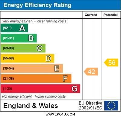
EPC ratings on this postcode
We don't have a matched EPC for this property yet. Below are efficiency scores and details for other addresses on this postcode.
| Address | Current | Potential | Floor area | Age band | Type |
|---|---|---|---|---|---|
| 46a, Merrial Street, NEWCASTLE | 42 | 56 | 135 m² | England and Wales: before 1900 | Flat |
Flood risk
Zone: 1
Risk: Low
Job (default Low)
EPC Graphs
EPC 1
Rental Range
Estimated market rent for Newcastle-under-Lyme. Low = conservative, Realistic = average, Optimistic = best case.
Based on Local Authority from postcode lookup → Newcastle-under-Lyme.
LHA (30th percentile) floor for Staffordshire North: £424/mo (Apr 2025 – Mar 2026)
Location
Address
Merrial Street
Nearby
Nearest stations, universities and amenities (distance from property).
| Type | Name | Distance |
|---|---|---|
| Bus stop | Merrial Street | 0.0 miles |
| Shop | The ECig and CBD store | 0.1 miles |
| Shop | The Barber Club | 0.1 miles |
| Hospital | Hartshill Medical Centre | 0.8 miles |
| Hospital | Royal Stoke University Hospital | 0.9 miles |
| University | Keele University | 1.9 miles |
| University | University of Staffordshire Stoke Campus | 2.0 miles |
| Train station | Stoke-on-Trent | 2.0 miles |
| Train station | Silverdale | 2.1 miles |
Street-level crime
| Category | Count |
|---|---|
| Violence and sexual offences | 173 |
| Anti-social behaviour | 71 |
| Public order | 41 |
| Other theft | 23 |
| Shoplifting | 21 |
| Criminal damage and arson | 20 |
| Vehicle crime | 18 |
| Other crime | 10 |
| Burglary | 9 |
| Drugs | 8 |
| Possession of weapons | 4 |
| Robbery | 3 |
| Theft from the person | 2 |
| Bicycle theft | 1 |
| Total incidents | 404 |
Within 1 mile during Mar 2026. Source: data.police.uk (England & Wales).
Schools nearby
Nearest open schools with Ofsted ratings (England). Closed schools are not shown. Data from Get Information about Schools and Ofsted.
| Name | Type | Distance | Ofsted |
|---|---|---|---|
| St Mary's Catholic Primary School | Primary | 0.2 miles | Good — 17 Feb 2017 |
| Hassell Primary School | Primary | 0.3 miles | Good — 25 Oct 2023 |
| St Giles' and St George's Church of England Academy | Primary | 0.3 miles | Good — 21 May 2023 |
| Blackfriars Academy | Other | 0.3 miles | Outstanding — 6 Feb 2013 |
| St John Fisher Catholic College | Secondary | 0.4 miles | Requires improvement — 5 Mar 2024 |
Rental Comparables
Residential lets from OpenRent and Rightmove for the area (same bedroom count). Use to validate rent estimates. Student lets are excluded.
Average rent: £634/mo (32 listings)
Enter House Number
Enter the house number to help us retrieve more accurate pricing history and property data.
Please log in to submit or correct the house number for this listing.
Log in to continue