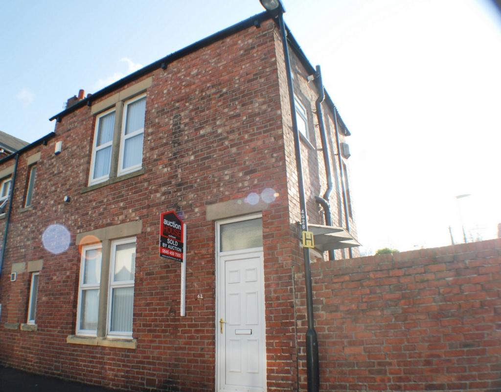
62 GILLIES STREET
NEWCASTLE UPON TYNE, TYNE AND WEAR NE6 2JP
£385 pcm
Property details
Floor area
51 m²
Deprivation
Decile 1 (747 of 33,755)
Street crime
486 incidents within 1 mile (Apr 2026)
Key features
- END TERRACED HOUSE
- ONE BEDROOM
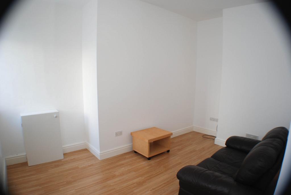
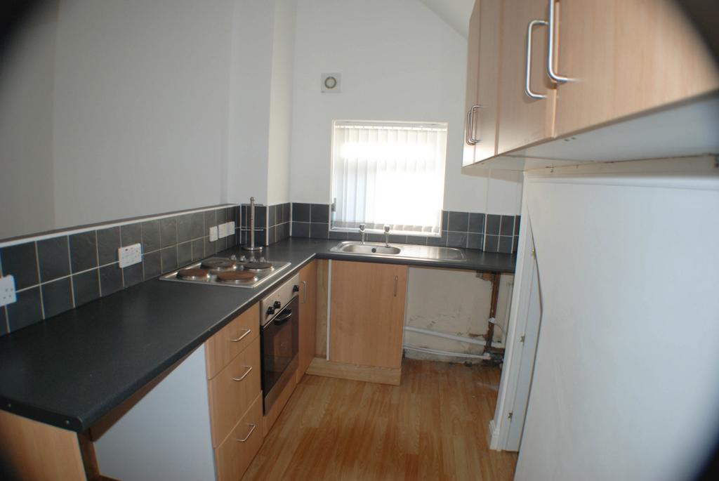
- OPEN PLAN LOUNGE / KITCHEN
- GAS CENTRAL HEATING
- DOUBLE GLAZING
- PRIVATE YARD
- DSS WELCOME
- BOND AND REFERENCES REQUIRED
Additional details
- Garden
- Yes
Description
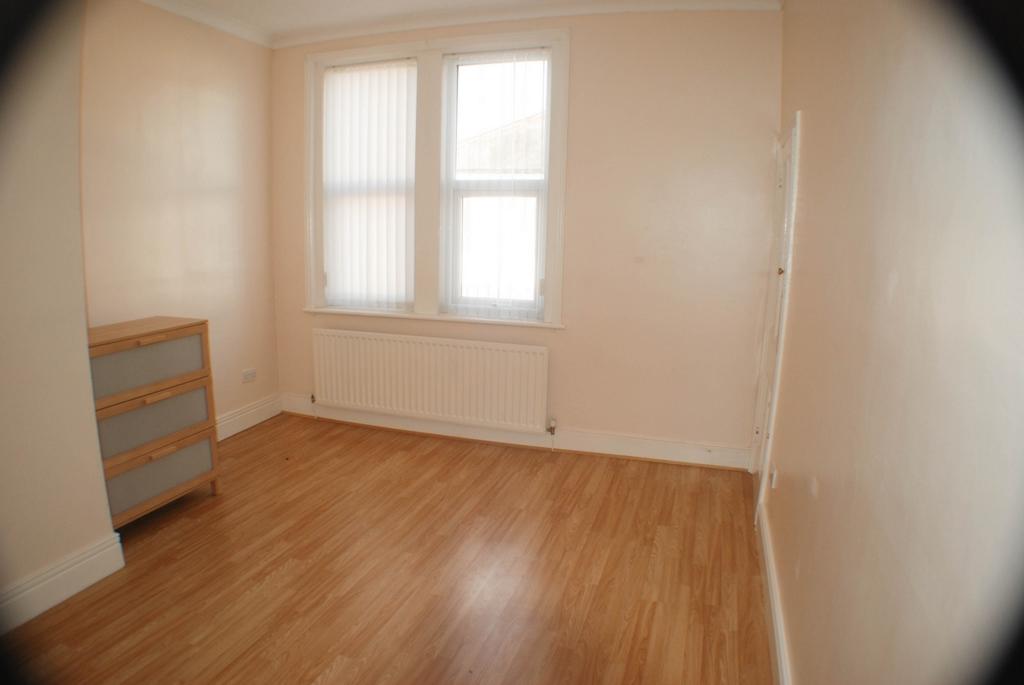
Lounge and Kitchen : 5.06m x 4.25m (16'7" x 13'11") , Lounge Area - 2 x Upvc windows to front elevation, central heating radiator, laminate wood floor, television point.
Kitchen Area - Upvc windows to side and rear elevations, wall and base units with laminate work surfaces, integral oven with electric hob, stainless stell sink and drainer unit, plumbed for automatic washing machine, understairs cupboard, tiled splashbacks, laminate flooring.
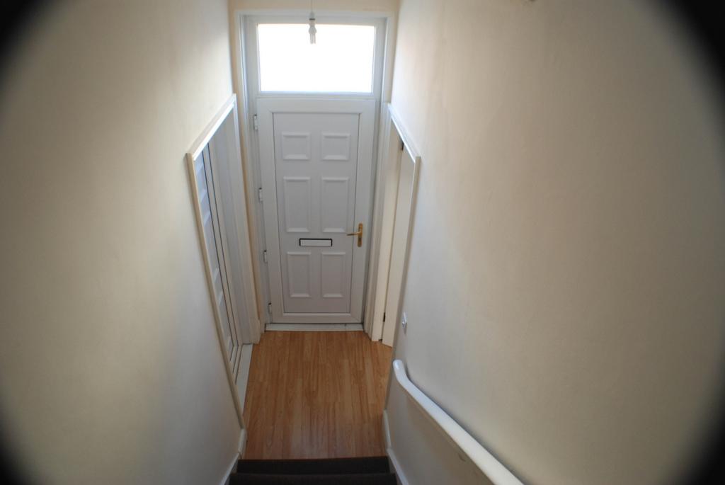
First Floor Landing : Laminate wood flooring, Upvc window to side, laminate wood flooring, loft access, central heating radiator.
Bedroom : 4.38m x 3.50m (14'4" x 11'6") , Upvc window to front elevation, built in cupboard, laminate wood flooring, central heating radiator.
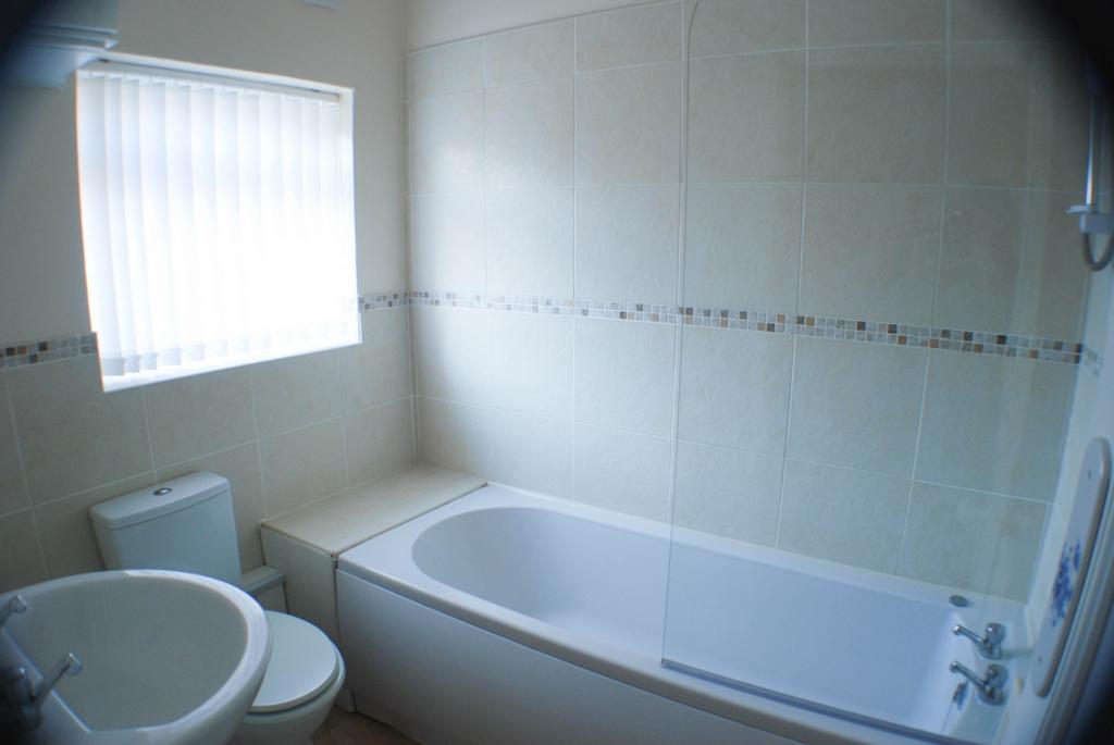
Bathroom : 2.16m x 1.72m (7'1" x 5'8") , White suite comprising of bath with electric shower over and glazed shower screen, pedestal wash hand basin, low level wc, tiled splashbacks, extractor, central heating radiator, Upvc window to side.
Yard to rear
Listed by
Prudhoe
Gilmore Estates Limited
Reference: 72043576
EPC Rating & Upgrade Cost
Fetching EPC data… Refresh this page in a moment.
Flood risk
Zone: 1
Risk: Low
Job (default Low)
EPC Graphs
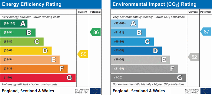
EPC
Rental Range
Estimated market rent for Newcastle upon Tyne. Low = conservative, Realistic = average, Optimistic = best case.
Based on Local Authority from postcode lookup → Newcastle upon Tyne.
LHA (30th percentile) floor for Tyneside: £489/mo (Apr 2025 – Mar 2026)
Location
Nearby
Nearest stations, universities and amenities (distance from property).
| Type | Name | Distance |
|---|---|---|
| Bus stop | Welbeck Road-Gillies Street | 0.0 miles |
| Bus stop | Bothal Street | 0.0 miles |
| Shop | Unknown | 0.1 miles |
| Shop | Little Tyre Centre | 0.1 miles |
| Train station | Byker | 0.5 miles |
| Hospital | Molineux Street NHS Centre | 0.6 miles |
| Train station | Chillingham Road | 0.6 miles |
| Hospital | Walkergate Park Hospital | 1.1 miles |
| University | Northumbria University City Campus | 1.5 miles |
| University | Ellison Building B Block | 1.5 miles |
Street-level crime
| Category | Count |
|---|---|
| Violence and sexual offences | 92 |
| Shoplifting | 91 |
| Anti-social behaviour | 86 |
| Criminal damage and arson | 63 |
| Vehicle crime | 35 |
| Public order | 34 |
| Burglary | 19 |
| Other theft | 19 |
| Robbery | 10 |
| Theft from the person | 10 |
| Other crime | 9 |
| Possession of weapons | 7 |
| Bicycle theft | 6 |
| Drugs | 5 |
| Total incidents | 486 |
Within 1 mile during Apr 2026. Source: data.police.uk (England & Wales).
Schools nearby
Nearest open schools with Ofsted ratings (England). Closed schools are not shown. Data from Get Information about Schools and Ofsted.
| Name | Type | Distance | Ofsted |
|---|---|---|---|
| Welbeck Academy | Primary | 0.2 miles | Requires improvement — 25 Feb 2024 |
| St Lawrence's Catholic Primary School | Primary | 0.2 miles | Good — 17 Jan 2018 |
| Monkchester Road Nursery School | Nursery | 0.4 miles | Outstanding — 12 Dec 2013 |
| Byker Primary School | Primary | 0.4 miles | Outstanding — 29 Sep 2017 |
| St Vincents Catholic Primary School, Newcastle | Primary | 0.6 miles | Good — 17 Sep 2023 |
Rental Comparables
Rental listings exist nearby, but none matched the 1-bedroom count for this property.