498 DUNSTABLE ROAD
LUTON, LUTON LU4 8DL
£275,000
Property details
Tenure
FREEHOLD
Floor area
72 m²
EPC rating
E
Year built
England and Wales: 1930-1949
Last sold
£245,000 Feb 2022
Price per m²
£3,819/m²
Local average
£379,550 (-27.5%)
Deprivation
Decile 2 (4,383 of 33,755)
Street crime
375 incidents within 1 mile (May 2026)
Key features
- Venture Residential
- No onward chain
- Great location
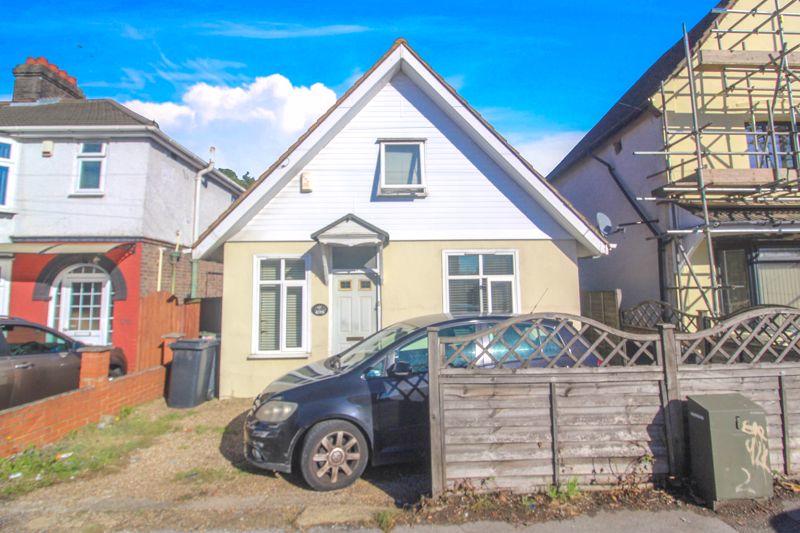
- Detached
- Off road parking
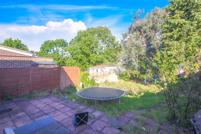
- Large rear garden
Additional details
- Parking
- Yes
- Garden
- Yes
Description
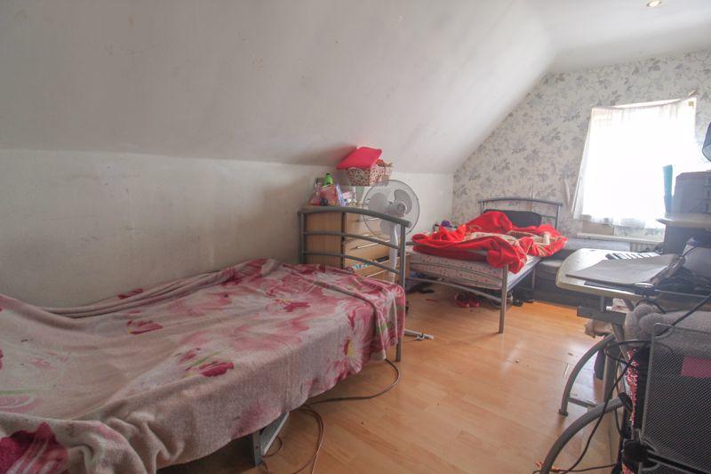
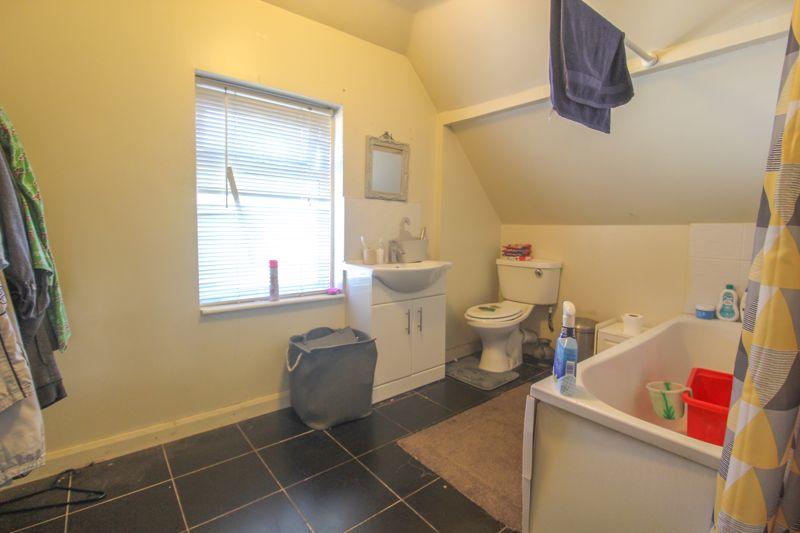
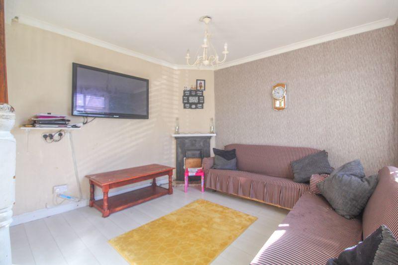
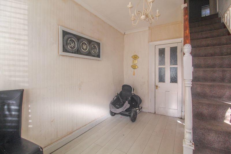
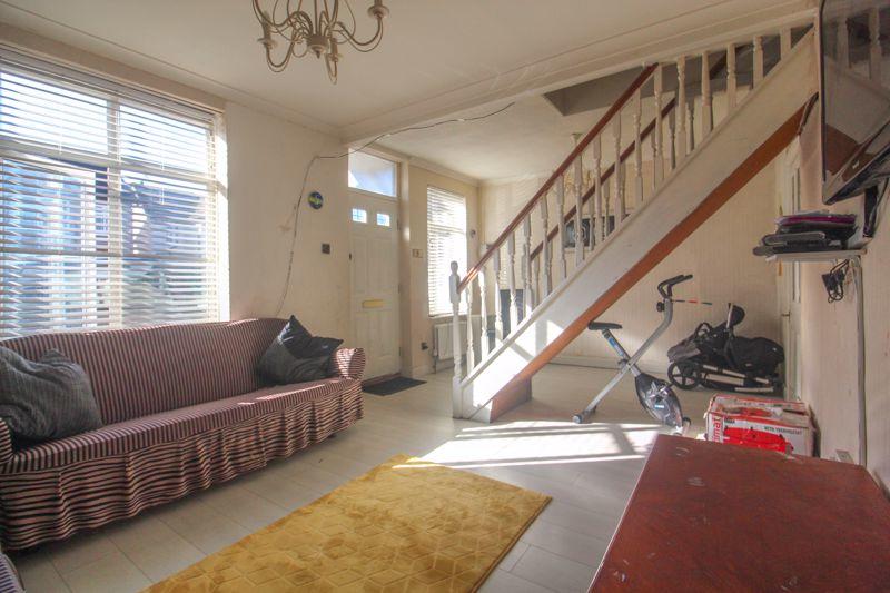
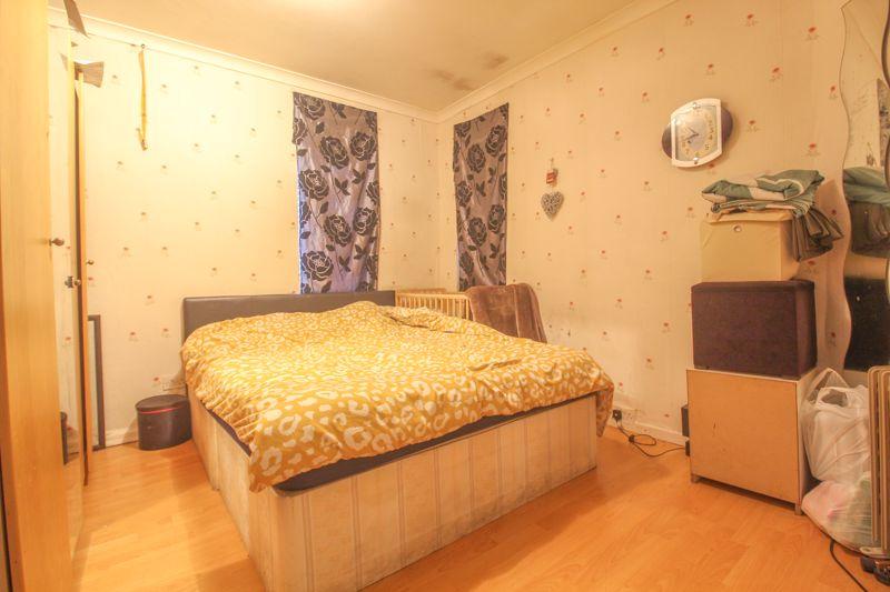
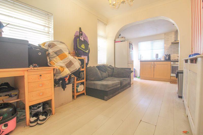
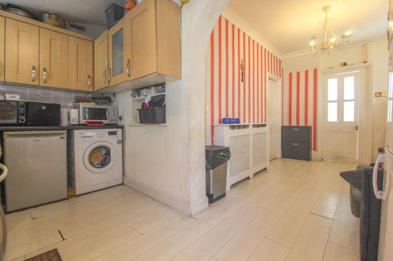
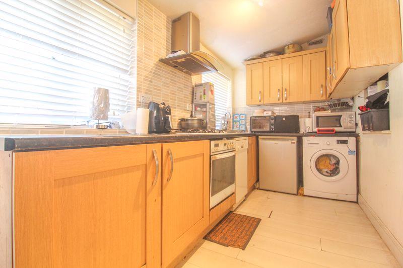
Internally the property offers a large lounge with stairs rising to the first floor, spacious kitchen/ diner with ample cupboard space and access to the rear garden and a ground floor bedroom. On the first floor you will find another double bedroom and a family bathroom. Externally the property offers off road parking and a large rear garden.
Dunstable Road is a popular thoroughfare and is situated in the favoured Challney Senior Girls & Boys School catchment area. The area also has a number of shops and amenities close by as well as the Guided Busway offering a regular link to Luton and Dunstable town centres. Transport links are also well served with nearby Leagrave mainline railway station which offers fast direct trains into London St.Pancras and beyond. You also have junction 11 of the M1 close by so this is ideal for transport/commuter links.
Listed by
Luton
Venture Residential
Reference: 115030094
EPC Rating & Upgrade Cost
Current rating: E
Potential rating: B
Inspection date: 20/01/2020
Expiry date: 19/01/2030
Current heating cost: £1,064/year
Potential heating cost: £378/year
Recommendations
- Flat roof or sloping ceiling insulation (1,500)
- Room-in-roof insulation (2,700)
- 50 mm internal or external wall insulation (14,000)
- Floor insulation (suspended floor) (1,200)
- Low energy lighting for all fixed outlets (35)
- Upgrade heating controls (450)
- Replace boiler with new condensing boiler (3,000)
- Solar water heating (6,000)
- Solar photovoltaic panels, 2.5 kWp (5,500)
Flood risk
Zone: 1
Risk: Low
Job (default Low)
Floorplans
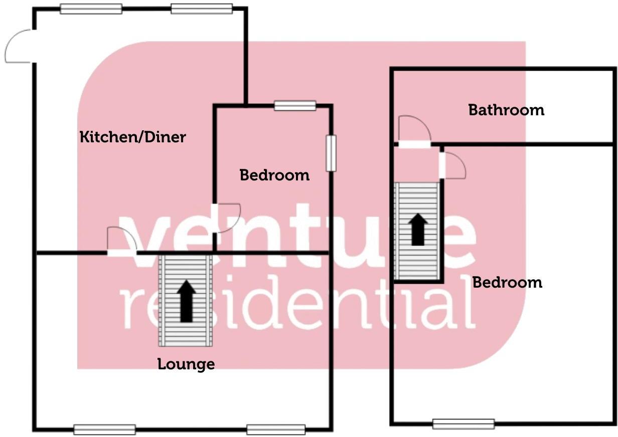
Floorplan
FENSA Certificates
This property has 1 FENSA certificate(s) on record, indicating window/door installations by FENSA-approved installers.
FENSA Certificate #2022426
Property Details
Street: 498 Dunstable Road
Town: LUTON
Postcode: LU4 8DL
Installation Details
Items: 3 windows
Certificate Issued: 07/09/2004
Work Completed: 10/08/2004
This certificate data was retrieved from FENSA's database
What is FENSA? FENSA (Fenestration Self-Assessment Scheme) is a government-authorised scheme that monitors building regulation compliance for replacement windows and doors. Certificates indicate that work was completed by FENSA-approved installers.
Price history
| Event | Date | Price | % change |
|---|---|---|---|
| Sold | 16/02/2022 (4 years ago) | £245,000 | — |
Source: HM Land Registry Price Paid Data. Crown copyright.
Sold Comparables
Sold comparables data is not available for this property.
Capital growth trend
Land Registry outcode average: last 12 months vs 5y and 10y ago (from sold prices).
House Price Index (HM Land Registry — official index, not sold-price averages): Luton. Series: Detached. As of April 2026.
Rental Range
Estimated market rent for Luton. Low = conservative, Realistic = average, Optimistic = best case.
Based on Local Authority from postcode lookup → Luton.
LHA (30th percentile) floor for Luton: £873/mo (Apr 2025 – Mar 2026)
Location
Nearby
Nearest stations, universities and amenities (distance from property).
| Type | Name | Distance |
|---|---|---|
| Shop | Unknown | 0.0 miles |
| Bus stop | Unknown | 0.0 miles |
| Shop | MDS Parts | 0.1 miles |
| Bus stop | Maidenhall Beechwood | 0.2 miles |
| Train station | Leagrave | 1.0 miles |
| Hospital | Luton and Dunstable Hospital | 1.1 miles |
| Train station | Luton | 1.7 miles |
| Hospital | Widecombe Nursing Home | 2.0 miles |
| University | University of Bedfordshire : Putteridge Bury Campus | 3.4 miles |
| University | University of Bedfordshire | 8.4 miles |
Street-level crime
| Category | Count |
|---|---|
| Violence and sexual offences | 161 |
| Anti-social behaviour | 55 |
| Criminal damage and arson | 29 |
| Other theft | 23 |
| Public order | 22 |
| Vehicle crime | 22 |
| Drugs | 16 |
| Other crime | 11 |
| Shoplifting | 11 |
| Possession of weapons | 10 |
| Burglary | 6 |
| Robbery | 6 |
| Bicycle theft | 2 |
| Theft from the person | 1 |
| Total incidents | 375 |
Within 1 mile during May 2026. Source: data.police.uk (England & Wales).
Schools nearby
Nearest open schools with Ofsted ratings (England). Closed schools are not shown. Data from Get Information about Schools and Ofsted.
| Name | Type | Distance | Ofsted |
|---|---|---|---|
| Downside Primary School | Primary | 0.3 miles | Good — 5 Jun 2015 |
| Maidenhall Primary School | Primary | 0.4 miles | Good — 23 Jan 2022 |
| Jamiatul Uloom Al - Islamia | Other | 0.6 miles | Good — 1 Aug 2022 |
| Foxdell Primary School | Primary | 0.6 miles | Good — 5 Mar 2018 |
| Norton Road Primary School | Primary | 0.7 miles | Good — 13 May 2024 |
Rental Comparables
Rental comparables are temporarily unavailable while listing-site fetches are paused. Try again later.
Rent-driven metrics
Based on Area rent estimate.
- Rent ratio — Monthly rent ÷ purchase price (1% rule). 1%+ = strong, 0.8–1% = okay, <0.8% = weak for cashflow.
- Max investor price — Rent ÷ 0.8%; the price at which rent would be 0.8% of price (Stoke-style target).
- Target investor price — Rent ÷ 1%; the price at which rent would be 1% of price (strong cashflow band).
- Gross yield — Annual rent as % of purchase price (no costs).