East Betham
TIVERTON, WITHERIDGE, DEVON EX16 8QE
Property details
Tenure
FREEHOLD
Floor area
92 m²
Year built
England and Wales: 1930-1949
Last sold
£394,500 Apr 2023
Price per m²
£489/m²
Local average
£573,399 (-92.2%)
Deprivation
Decile 4 (10,366 of 33,755)
Street crime
1 incident within 1 mile (Apr 2026)
Key features
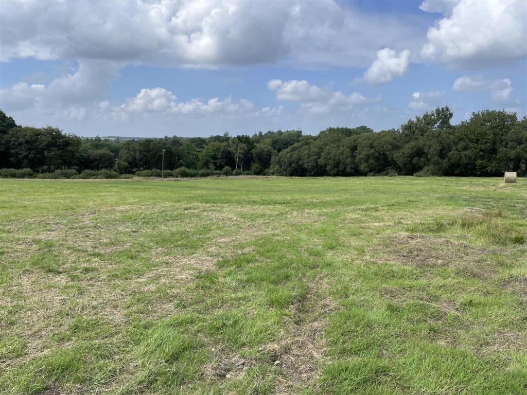
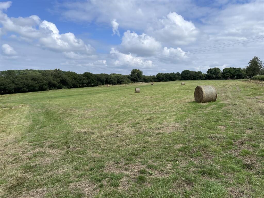
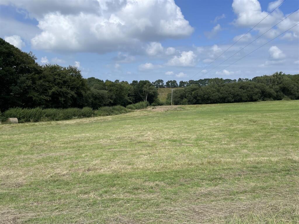
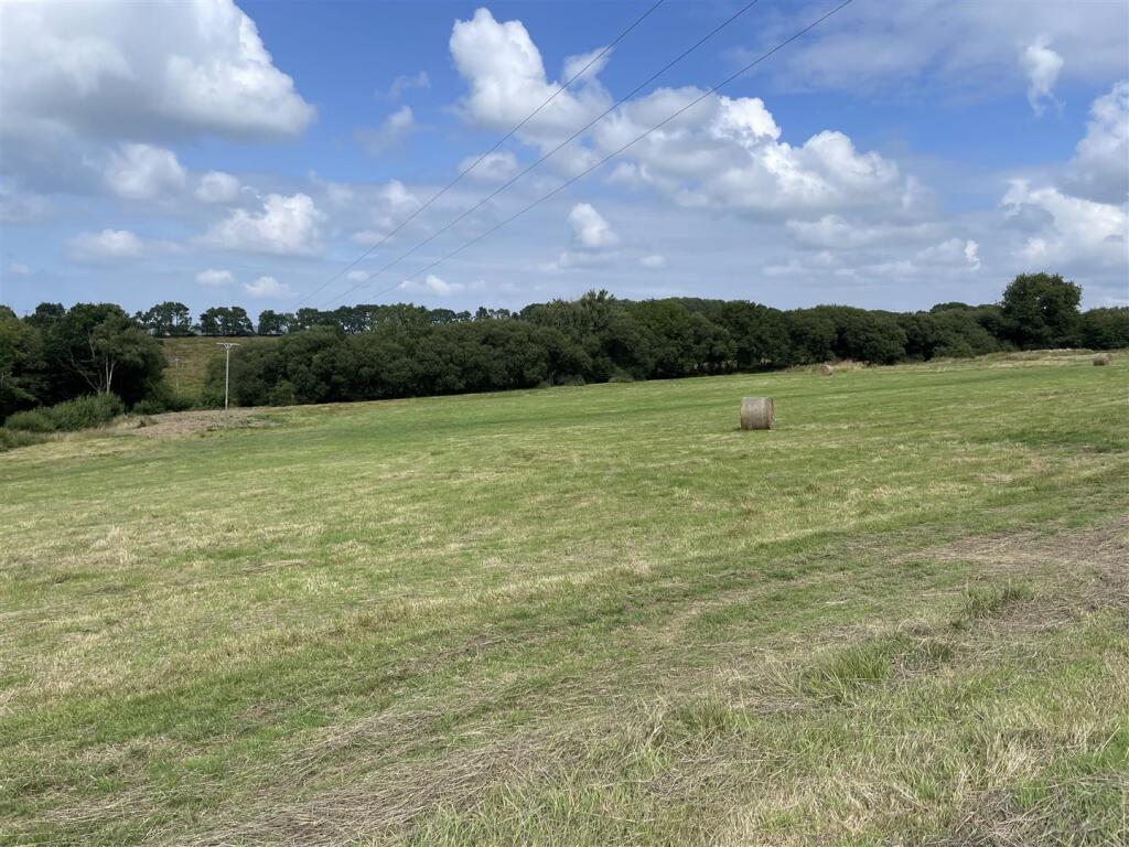
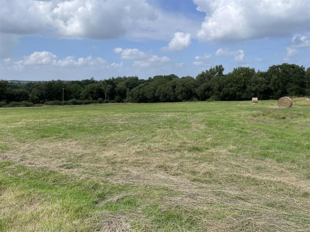
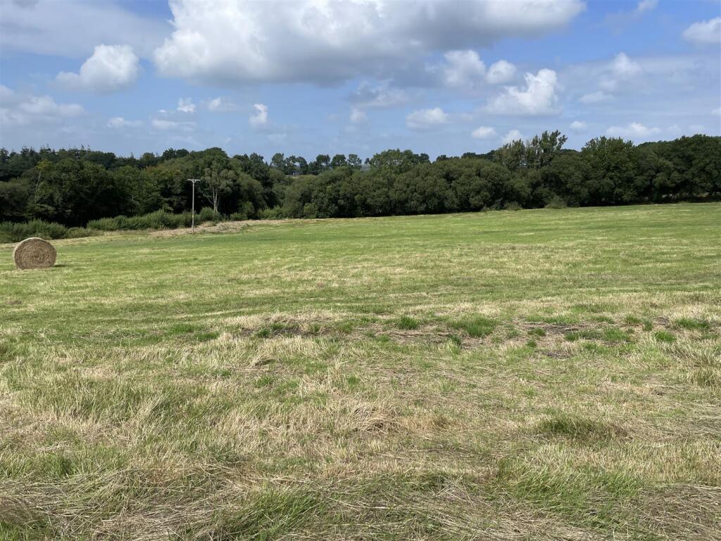
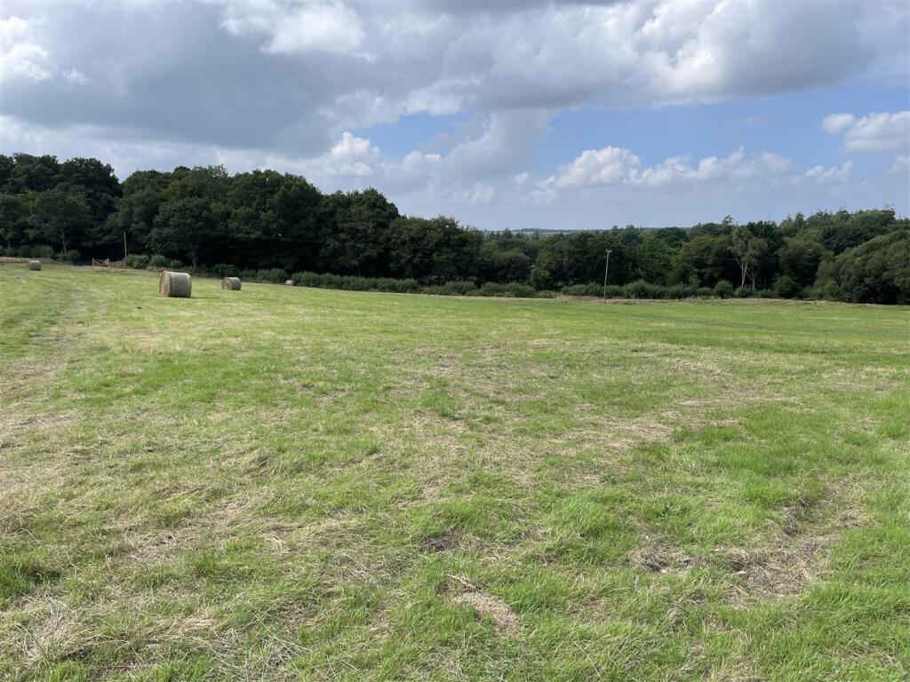
- Gently Sloping Farm Land
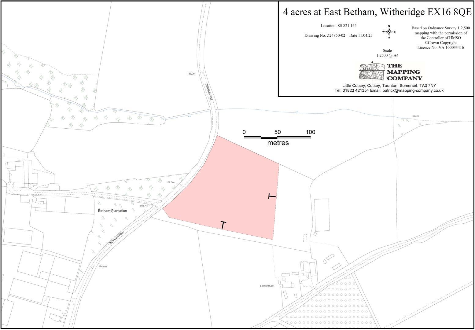
- 4.06 Acres (1.64 Hectares)
- Direct Road Access
- Short Distance from Witheridge
- For Sale by Private Treaty
- FREEHOLD
Description
Situation - The land lies in an accessible part of north Devon, near to the north / mid Devon border and with very easy access to the A361 (North Devon Link Road) at Stonelands Cross 4.6 miles away.
The village of Witheridge lies 1.2 miles to the west and the smaller settlement of Nomansland lies 3 mile to the south.
The market towns of Tiverton (11 miles) and South Molton (11.8 miles) are nearby and the A361 (North Devon Link Road) provides a direct link to the M5 motorway at Junction 27.
Description - The land on Betham Hill totals approximately 4.06 acres (1.64 hectares) and comprises part of a gently sloping grass field which lies at between 190 and 200 metres above sea level with a north-west facing aspect.
The land is classified as grade 3 and the soils are described as being slowly permeable seasonally wet acid loamy and clayey soils.
Services - There are no mains services connected. We are informed by the seller that a mains water connection may be available nearby.
Access - There is direct access on to the adjoining road (public highway).
Tenure - The land is owned freehold and is registered on the Land Registry. Vacant possession will be available from the completion date.
Method Of Sale - The land is offered for sale by private treaty, as one lot.
Covenant - A restrictive covenant will be placed on the land limiting its use to agricultural and equestrian purposes only and preventing the storage of scrap or other non functioning machinery on the land.
Designations - The land is within a Nitrate Vulnerable Zone (NVZ).
Local Authority - North Devon District Council.
Sporting And Mineral Rights - The sporting and mineral rights insofar as they are owned are included with the freehold.
Wayleaves & Rights Of Way - The property is sold subject to and with the benefit of any wayleave agreement and any public or private rights of way that may affect it.
There are no public rights of way passing through the land.
Boundary Plan - A plan which is not to scale, is included with these sale particulars for identification purposes only.
The seller will erect a new boundary fence. The responsibility for maintaining this fence will pass to the purchaser of the land from the completion date.
Viewing - Please contact Stags to arrange a viewing appointment. Tel: . Email: .
Directions - From Witheridge proceed east out of the village on North Street signed towards Witheridge and after a short distance follow the road around to the left towards Rackenford (on Rackenford Road). After approximately 1 mile, at Pilliven Cross, follow the road around to the left and the entrance into the land will be found on the right after 0.2 miles.
What3words - Reference/// koala.decks.modifies
Disclaimer - These particulars are a guide only and are not to be relied upon for any purpose.
Listed by
Exeter
Stags
Reference: 165141395
EPC ratings on this postcode
We don't have a matched EPC for this property yet. Below are efficiency scores and details for other addresses on this postcode.
| Address | Current | Potential | Floor area | Age band | Type |
|---|---|---|---|---|---|
| East Betham, Witheridge, TIVERTON | 19 | 89 | 92 m² | England and Wales: 1930-1949 | Detached |
Flood risk
Zone: 1
Risk: Low
Job (default Low)
Floorplans
Land at East Betham (Alto plan).jpg
Price history
| Event | Date | Price | % change |
|---|---|---|---|
| Sold | 11/04/2023 (3 years ago) | £394,500 | — |
Source: HM Land Registry Price Paid Data. Crown copyright.
Sold Comparables
Same street and nearby sales within 0.25 miles (last 5 years). Data from Land Registry Price Paid.
| Address | Price | Date | Type |
|---|---|---|---|
| EAST BETHAM FOXBROOK, WITHERIDGE, TIVERTON, NORTH DEVON, DEVON, EX16 8QE | £541,111 | 28/03/2023 | Other |
Area average: £541,111 (1 sale)
Capital growth trend
Land Registry outcode average: last 12 months vs 5y and 10y ago (from sold prices).
House Price Index (HM Land Registry — official index, not sold-price averages): North Devon. Series: All dwelling types. As of March 2026.
Rental Range
Estimated market rent for North Devon. Low = conservative, Realistic = average, Optimistic = best case.
Based on Local Authority from postcode lookup → North Devon.
LHA (30th percentile) floor for Mid & East Devon: Apr 2025 – Mar 2026
Location
Address
Pilliven Lane
Nearby
Nearest stations, universities and amenities (distance from property).
| Type | Name | Distance |
|---|---|---|
| Shop | West Middlewick Farm shop | 0.9 miles |
| Shop | Two Moors Store | 1.3 miles |
| Bus stop | Page's Cross | 3.5 miles |
| Bus stop | Unknown | 4.9 miles |
| Train station | Lapford | 7.5 miles |
| Train station | Morchard Road | 7.7 miles |
| Hospital | Tiverton and District Hospital | 8.0 miles |
| Hospital | Crediton Hospital (No A & E) | 9.1 miles |
Street-level crime
| Category | Count |
|---|---|
| Other theft | 1 |
| Total incidents | 1 |
Within 1 mile during Apr 2026. Source: data.police.uk (England & Wales).
Schools nearby
Nearest open schools with Ofsted ratings (England). Closed schools are not shown. Data from Get Information about Schools and Ofsted.
| Name | Type | Distance | Ofsted |
|---|---|---|---|
| Witheridge Church of England Primary Academy | Primary | 1.2 miles | Good — 22 Jan 2014 |
| Rackenford Church of England Primary School | Primary | 2.5 miles | Good — 17 Dec 2014 |
| East Worlington Primary School | Primary | 3.1 miles | Good — 16 Jul 2014 |
Rental Comparables
Loading rental comparables for this postcode. Refresh in a few minutes.
Rent-driven metrics
Based on Area rent estimate.
- Rent ratio — Monthly rent ÷ purchase price (1% rule). 1%+ = strong, 0.8–1% = okay, <0.8% = weak for cashflow.
- Max investor price — Rent ÷ 0.8%; the price at which rent would be 0.8% of price (Stoke-style target).
- Target investor price — Rent ÷ 1%; the price at which rent would be 1% of price (strong cashflow band).
- Gross yield — Annual rent as % of purchase price (no costs).
Enter House Number
Enter the house number to help us retrieve more accurate pricing history and property data.
Please log in to submit or correct the house number for this listing.
Log in to continue