Spencer Street
Mansfield, NG18, NG18 5LR
£795 pcm
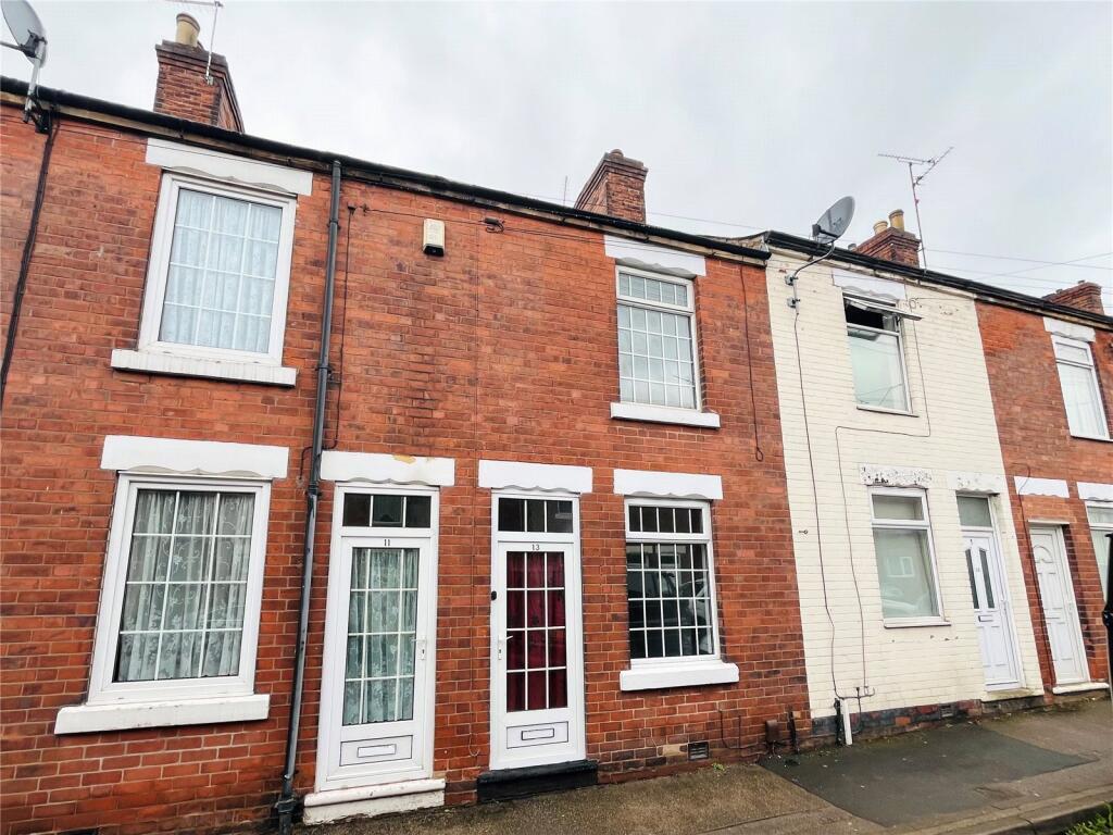
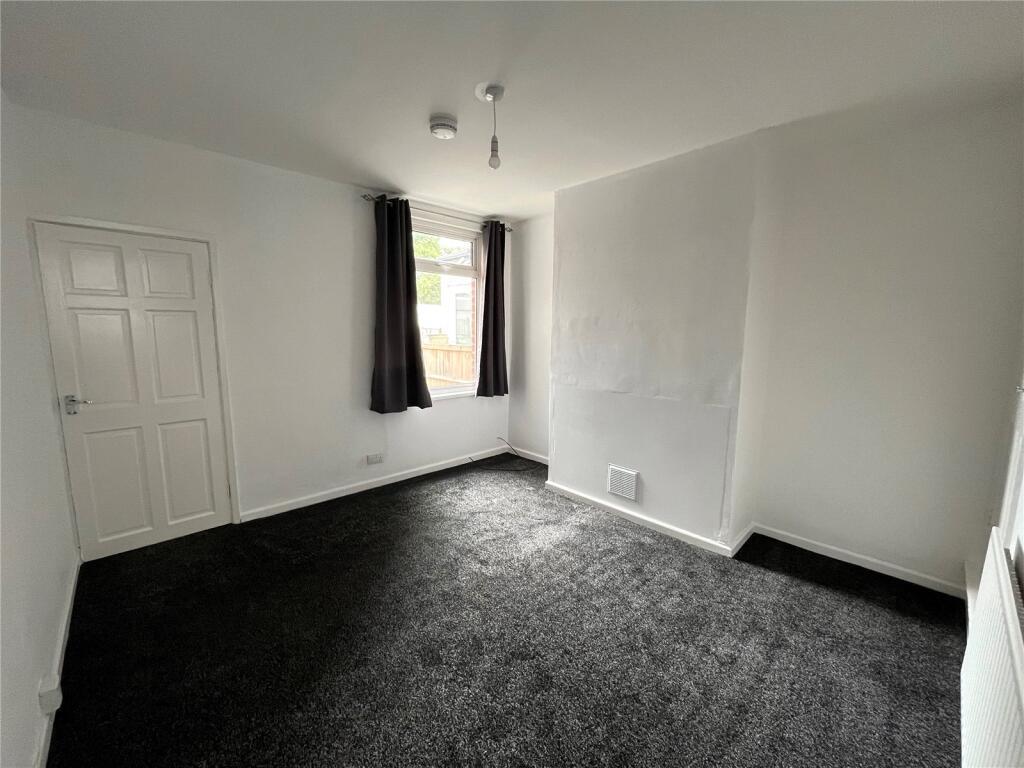
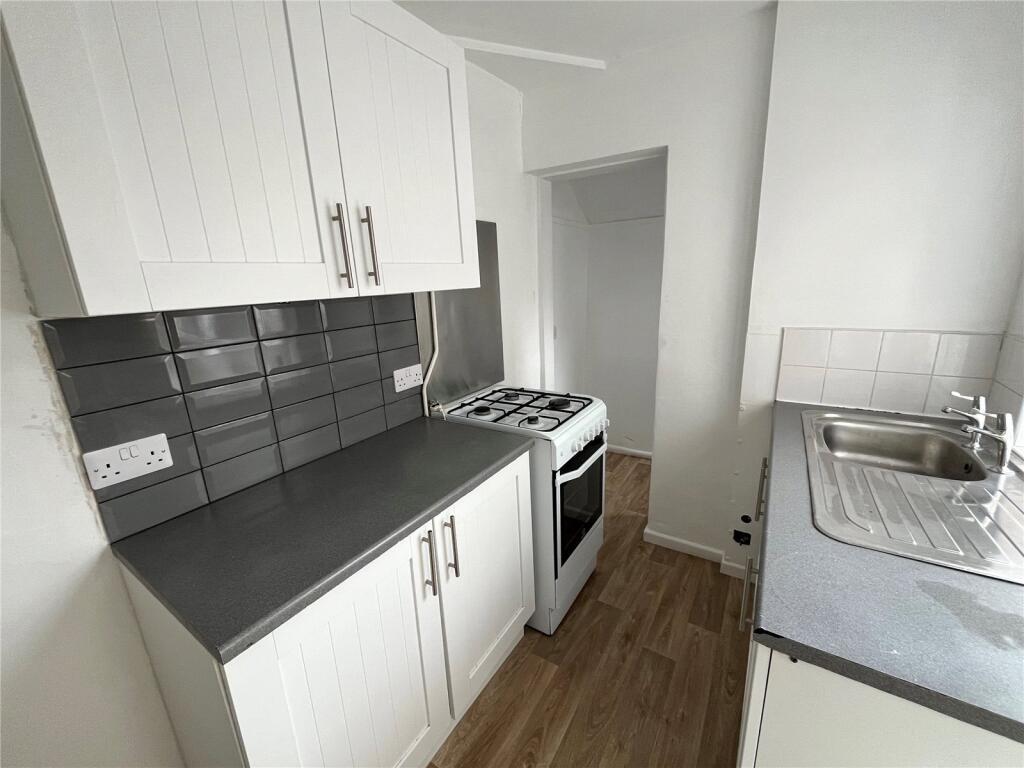
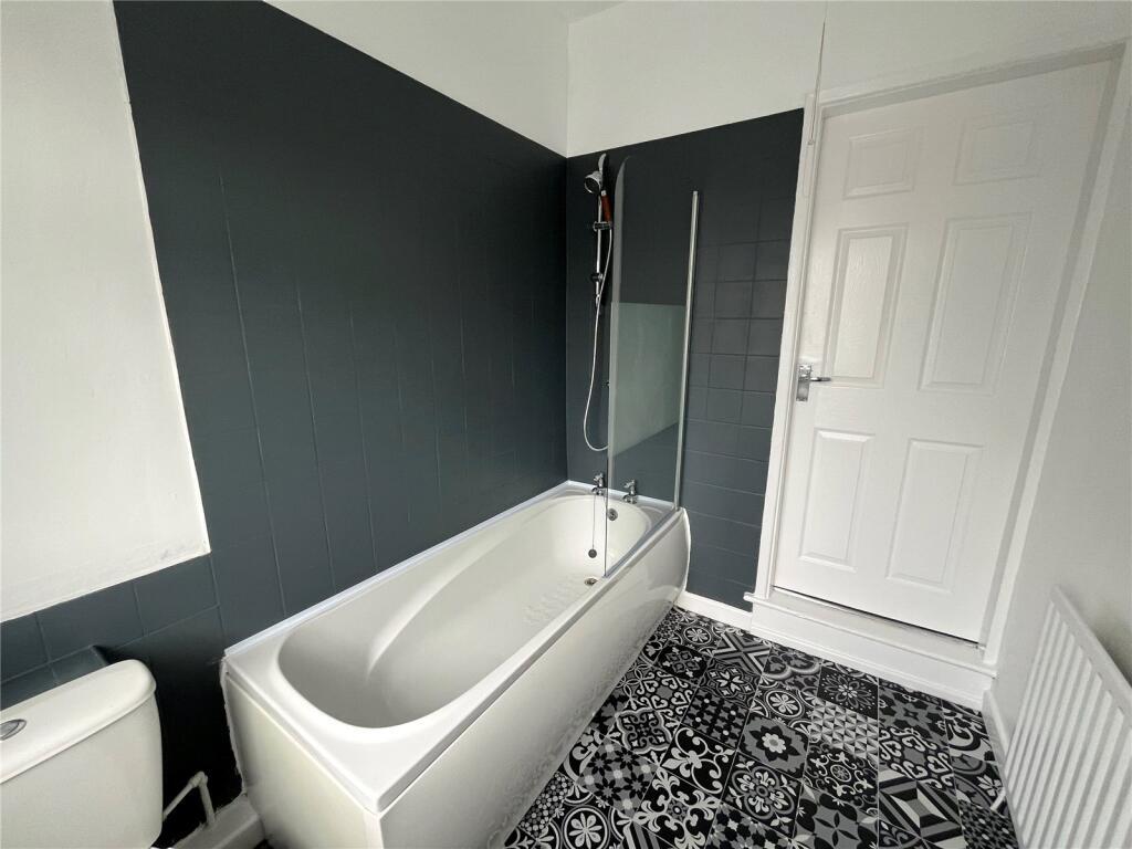
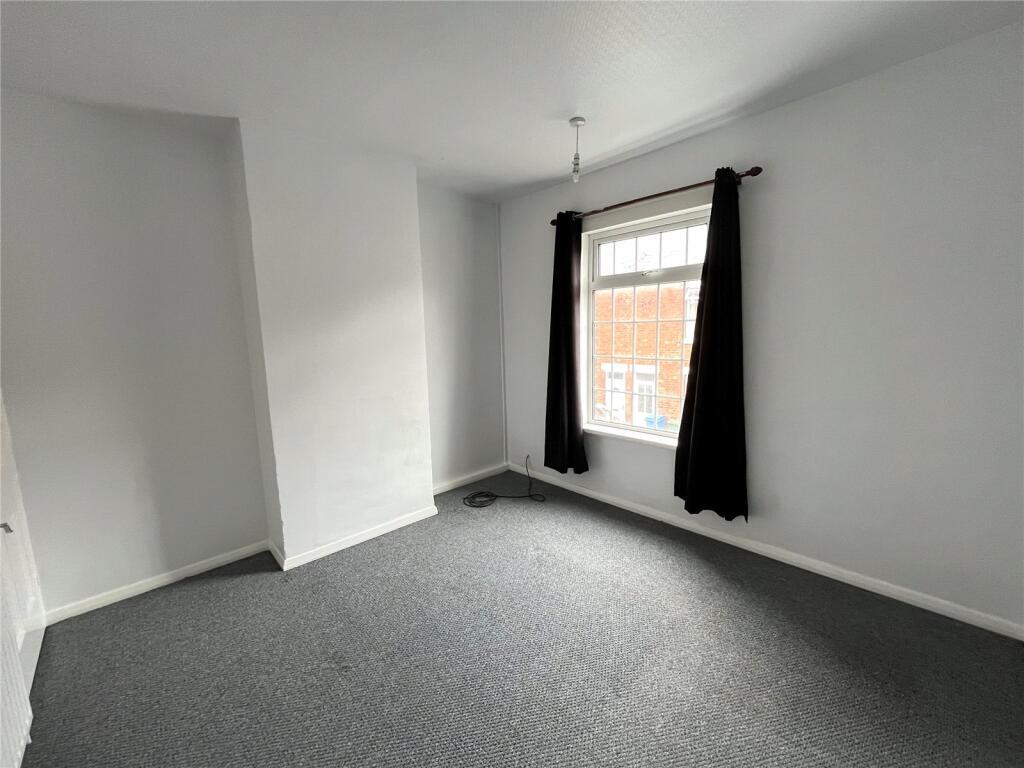
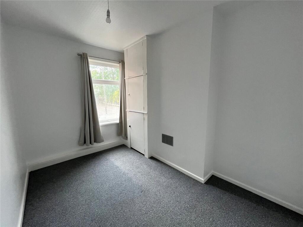
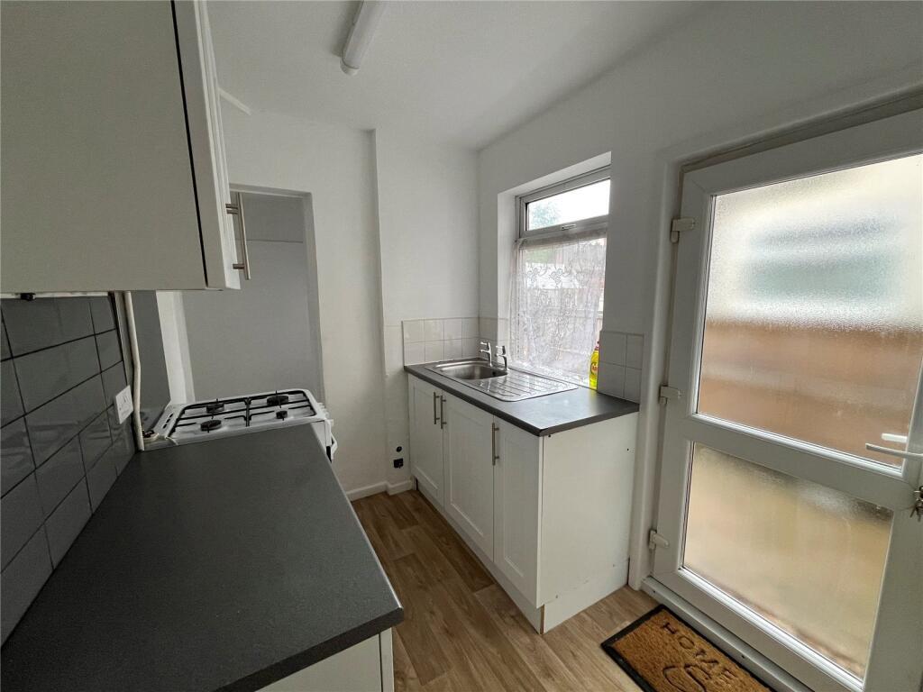
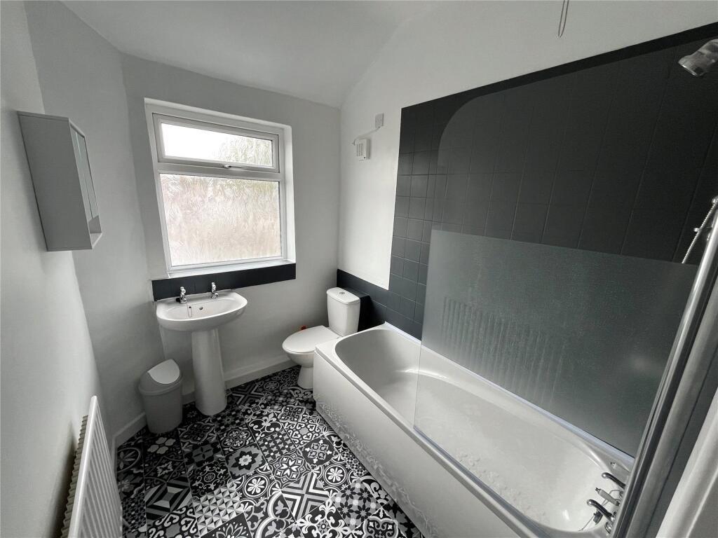
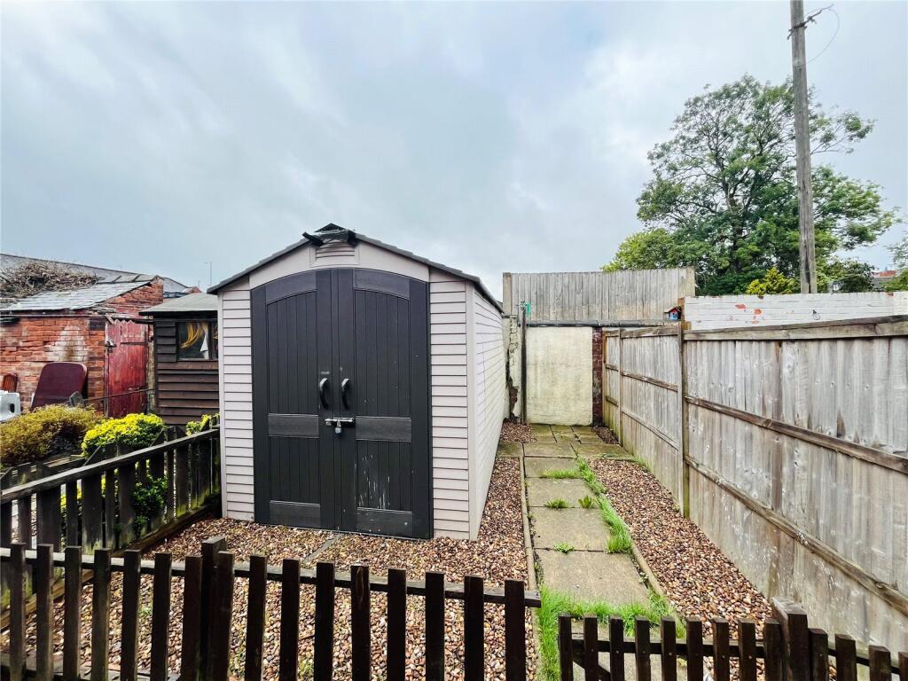
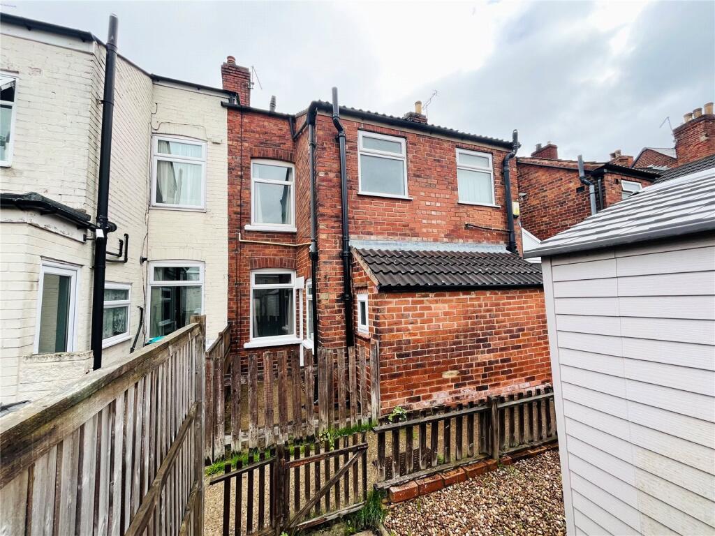
Photo 1 Photo 2 Photo 3 Photo 4 Photo 5 Photo 6 Photo 7 Photo 8 Photo 9 Photo 10
/ 10
Property details
Deprivation
Decile 1 (1,958 of 33,755)
Street crime
562 incidents within 1 mile (Apr 2026)
Key features
- Two Bedrooms
- Low maintenance rear garden
- Two reception rooms
- Neutral Decor
- Walking distance to the town centre
- Council tax band: A
Additional details
- Garden
- Yes
Description
This well-presented two-bedroom mid-terrace property is ideally located within walking distance to the town centre and further benefits from a low maintenance rear garden.
The accommodation briefly comprises two reception rooms, kitchen which benefits from wall and base units and space for appliances. Up the stairs is the family bathroom which benefits from a three piece suite with shower over bath and the two well-proportioned bedrooms.
To the rear of the property is the low maintenance rear garden. Council Tax Band: Holding Deposit: £183.00
Listed by
Mansfield
Countrywide UK Lettings - Connells
Reference: 172701050
EPC ratings on this postcode
We don't have a matched EPC for this property yet. Below are efficiency scores and details for other addresses on this postcode.
| Address | Current | Potential | Floor area | Age band | Type |
|---|---|---|---|---|---|
| 1 Spencer Street, MANSFIELD | 42 | 83 | 87 m² | England and Wales: 1900-1929 | Terraced |
| 13, Spencer Street, MANSFIELD | 69 | 88 | 67 m² | England and Wales: before 1900 | Terraced |
| 14 Spencer Street, MANSFIELD | 63 | 83 | 92 m² | England and Wales: 1900-1929 | Terraced |
| 15 Spencer Street, MANSFIELD | 71 | 88 | 67 m² | England and Wales: 1900-1929 | Terraced |
| 15, Spencer Street, MANSFIELD | 67 | 89 | 66 m² | England and Wales: 1900-1929 | Terraced |
| 16, Spencer Street, MANSFIELD | 52 | 86 | 87 m² | England and Wales: 1900-1929 | Terraced |
| 16, Spencer Street, MANSFIELD | 48 | 83 | 85 m² | England and Wales: 1900-1929 | Terraced |
| 17, Spencer Street, MANSFIELD | 72 | 81 | 67 m² | England and Wales: 1900-1929 | Terraced |
| 17, Spencer Street, MANSFIELD | 68 | 86 | 68 m² | England and Wales: 1900-1929 | Terraced |
| 18 Spencer Street, MANSFIELD | 70 | 78 | 46 m² | England and Wales: 1900-1929 | Flat |
| 18, Spencer Street, MANSFIELD | 60 | 75 | 45 m² | England and Wales: 1900-1929 | Flat |
| 19, Spencer Street, MANSFIELD | 63 | 78 | 84 m² | England and Wales: 1930-1949 | Terraced |
| 21 Spencer Street, MANSFIELD | 72 | 89 | 67 m² | England and Wales: 1900-1929 | Terraced |
| 21 Spencer Street, MANSFIELD | 46 | 88 | 68 m² | England and Wales: 1900-1929 | Terraced |
| 22, Spencer Street, MANSFIELD | 60 | 89 | 75 m² | England and Wales: 1900-1929 | Terraced |
Flood risk
Zone: 1
Risk: Low
Job (default Low)
Rental Range
Estimated market rent for Mansfield. Low = conservative, Realistic = average, Optimistic = best case.
Based on Local Authority from postcode lookup → Mansfield.
LHA (30th percentile) floor for North Nottingham: £549/mo (Apr 2025 – Mar 2026)
Location
Address
Spencer Street
Nearby
Nearest stations, universities and amenities (distance from property).
| Type | Name | Distance |
|---|---|---|
| Bus stop | Community Hospital | 0.1 miles |
| Shop | Unknown | 0.1 miles |
| Shop | NOT Motors | 0.1 miles |
| Hospital | Mansfield Community Hospital | 0.1 miles |
| Train station | Mansfield | 0.4 miles |
| Hospital | Kings Mill Hospital | 1.2 miles |
| Train station | Mansfield Woodhouse | 1.5 miles |
| University | Nottingham Trent University Vision University Centre | 1.7 miles |
| University | Clinical Sciences | 10.6 miles |
Street-level crime
| Category | Count |
|---|---|
| Violence and sexual offences | 188 |
| Shoplifting | 87 |
| Anti-social behaviour | 80 |
| Criminal damage and arson | 39 |
| Public order | 38 |
| Vehicle crime | 36 |
| Other theft | 30 |
| Drugs | 21 |
| Burglary | 12 |
| Possession of weapons | 11 |
| Robbery | 11 |
| Other crime | 7 |
| Theft from the person | 2 |
| Total incidents | 562 |
Within 1 mile during Apr 2026. Source: data.police.uk (England & Wales).
Schools nearby
Nearest open schools with Ofsted ratings (England). Closed schools are not shown. Data from Get Information about Schools and Ofsted.
| Name | Type | Distance | Ofsted |
|---|---|---|---|
| Sutton Road Primary School | Primary | 0.2 miles | Good — 14 Jun 2012 |
| St Philip Neri With St Bede Catholic Voluntary Academy | Primary | 0.5 miles | Good — 31 Oct 2012 |
| Wainwright Primary Academy | Primary | 0.6 miles | Good — 19 Sep 2023 |
| Intake Farm Primary School | Primary | 0.6 miles | Good — 16 Feb 2018 |
| R.E.A.L. Independent Schools Mansfield | Other | 0.7 miles | Good — 2 May 2024 |
Rental Comparables
Rental comparables are temporarily unavailable while listing-site fetches are paused. Try again later.
Enter House Number
Enter the house number to help us retrieve more accurate pricing history and property data.
Please log in to submit or correct the house number for this listing.
Log in to continue