7 SUFFOLK ROAD
LONDON, GREATER LONDON SE25 6EY
£675,000
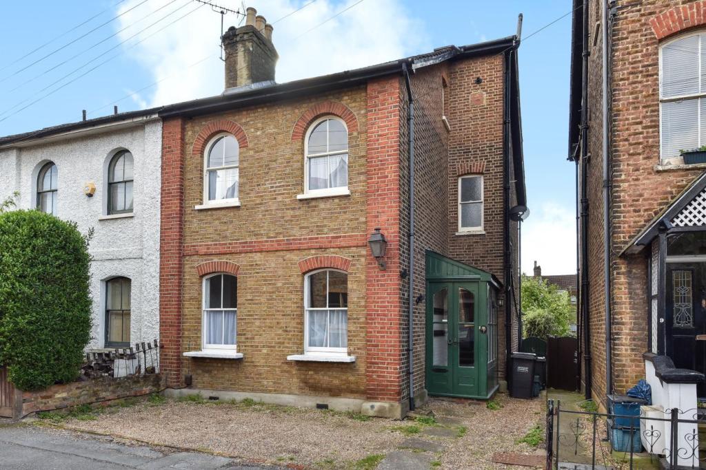
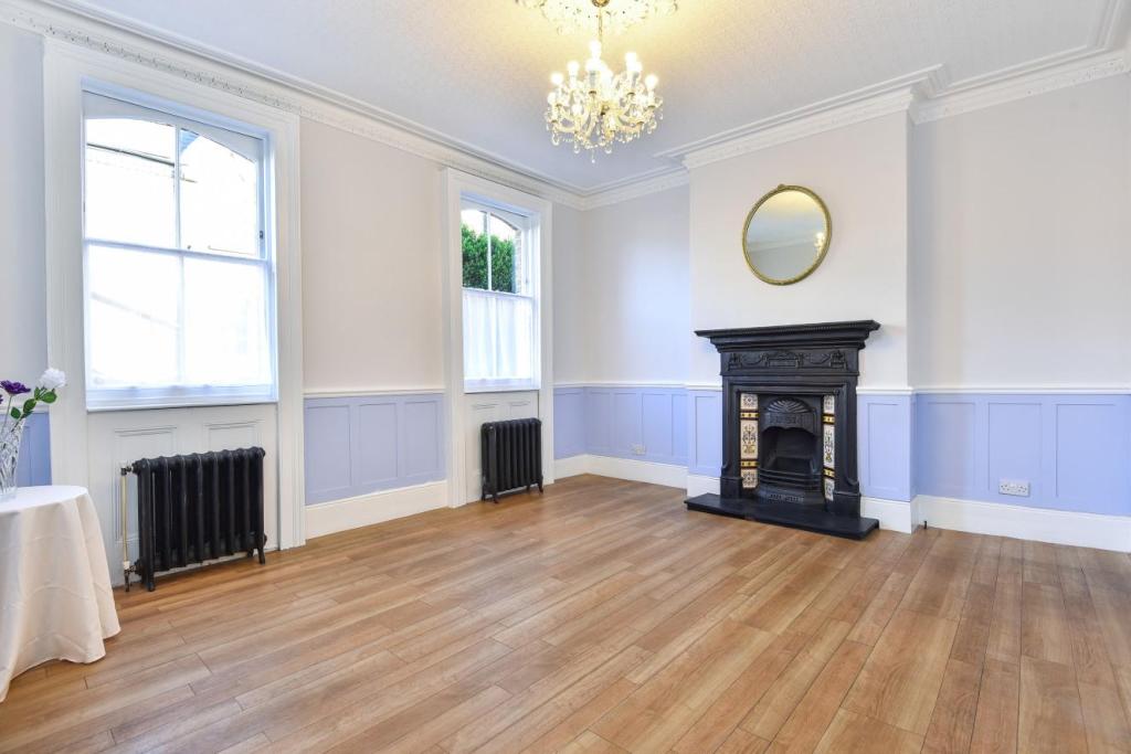
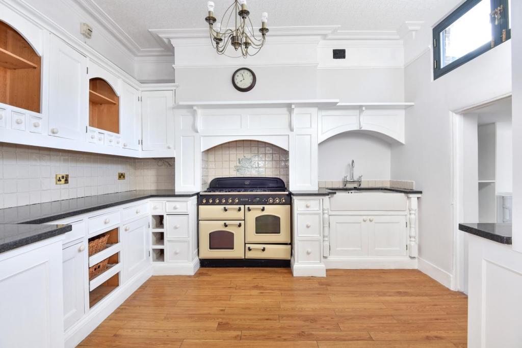
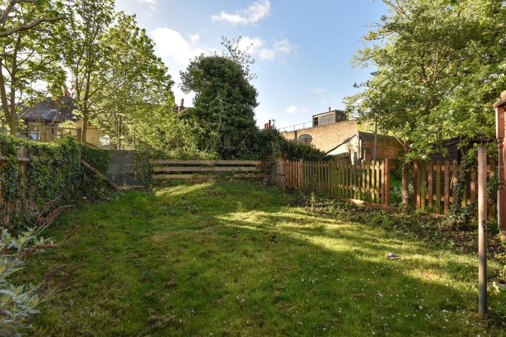
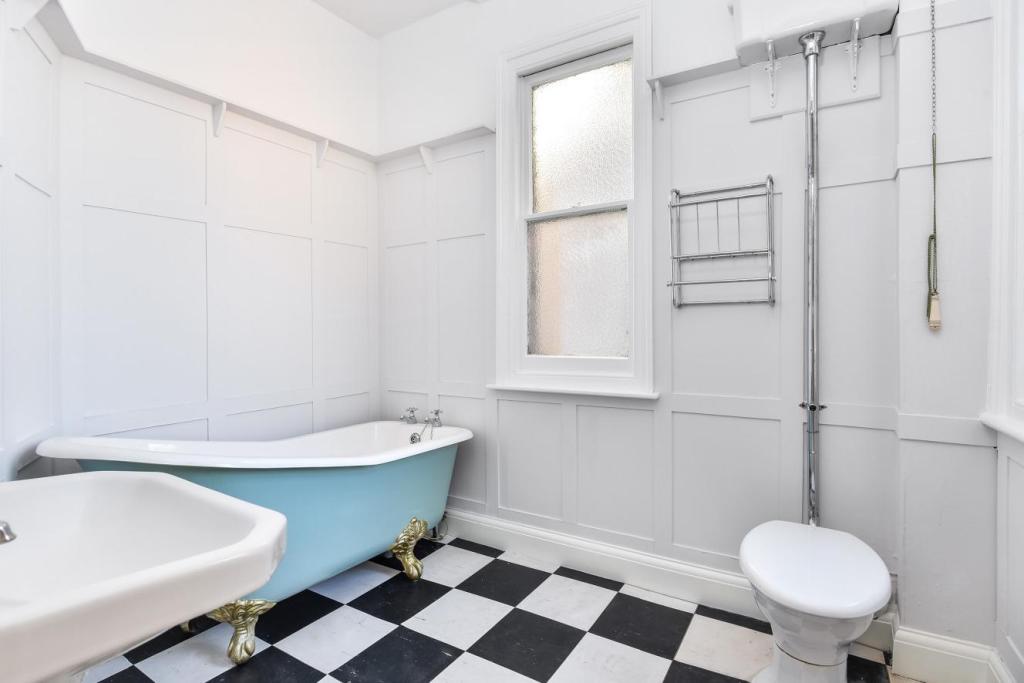
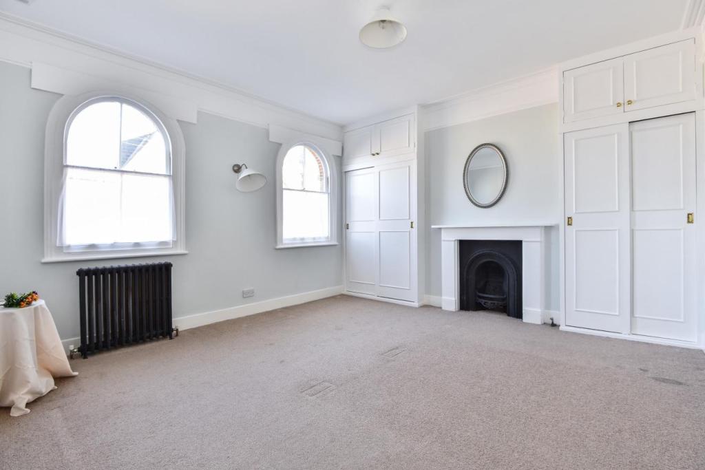
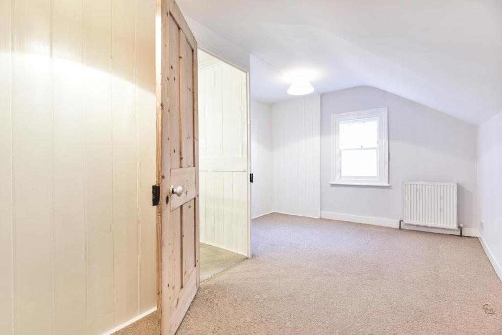
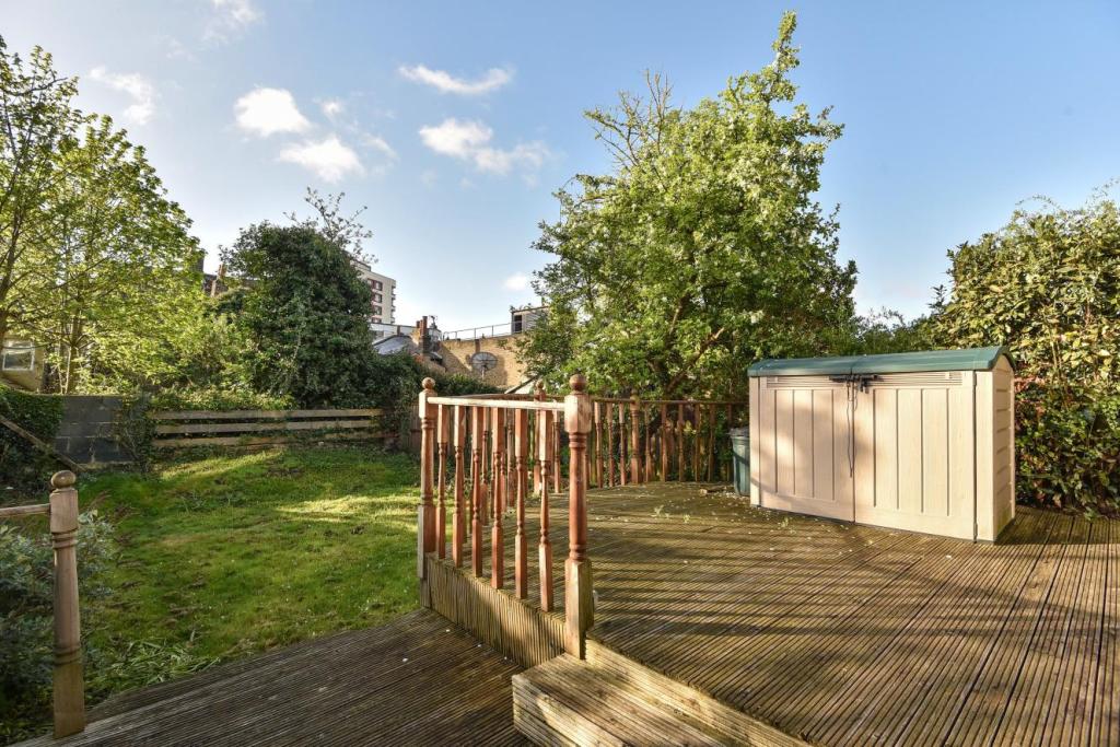
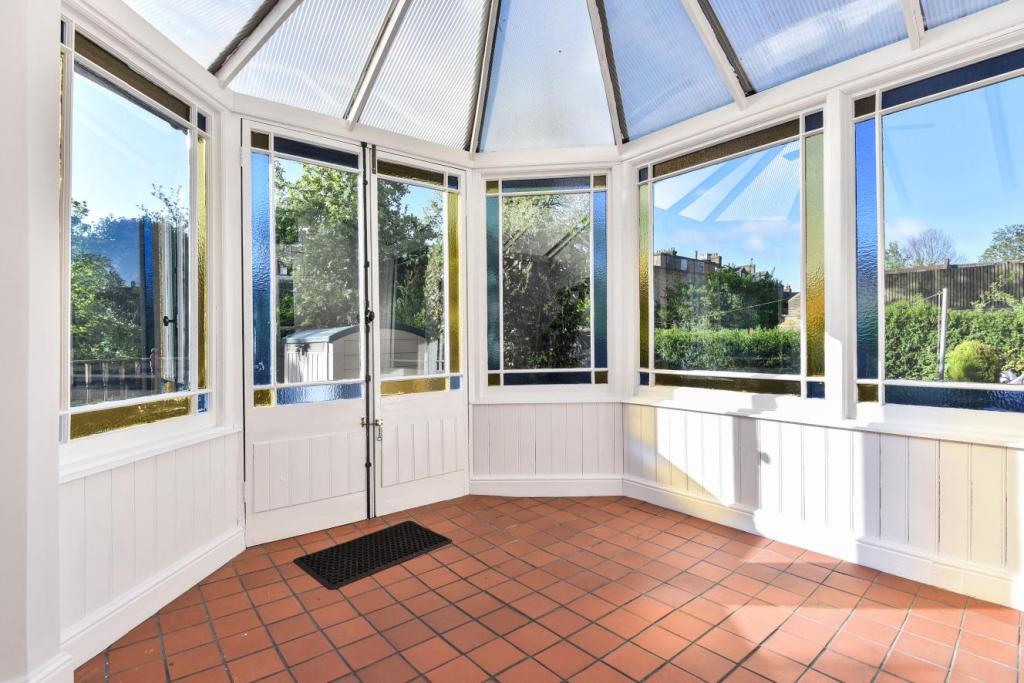
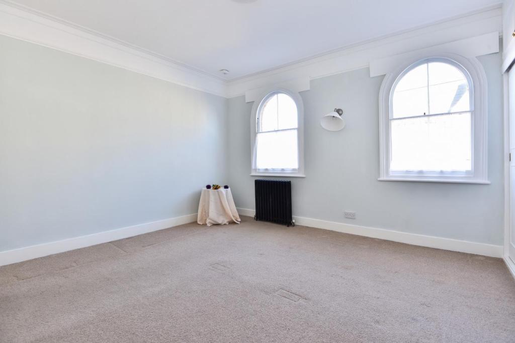
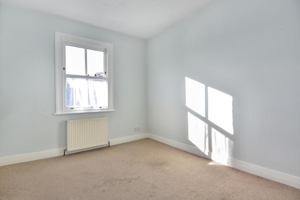
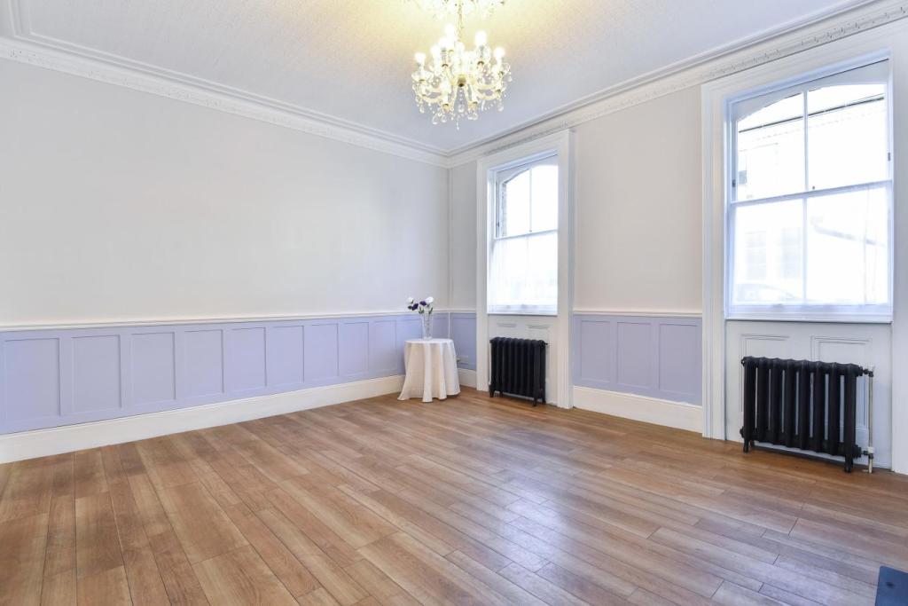
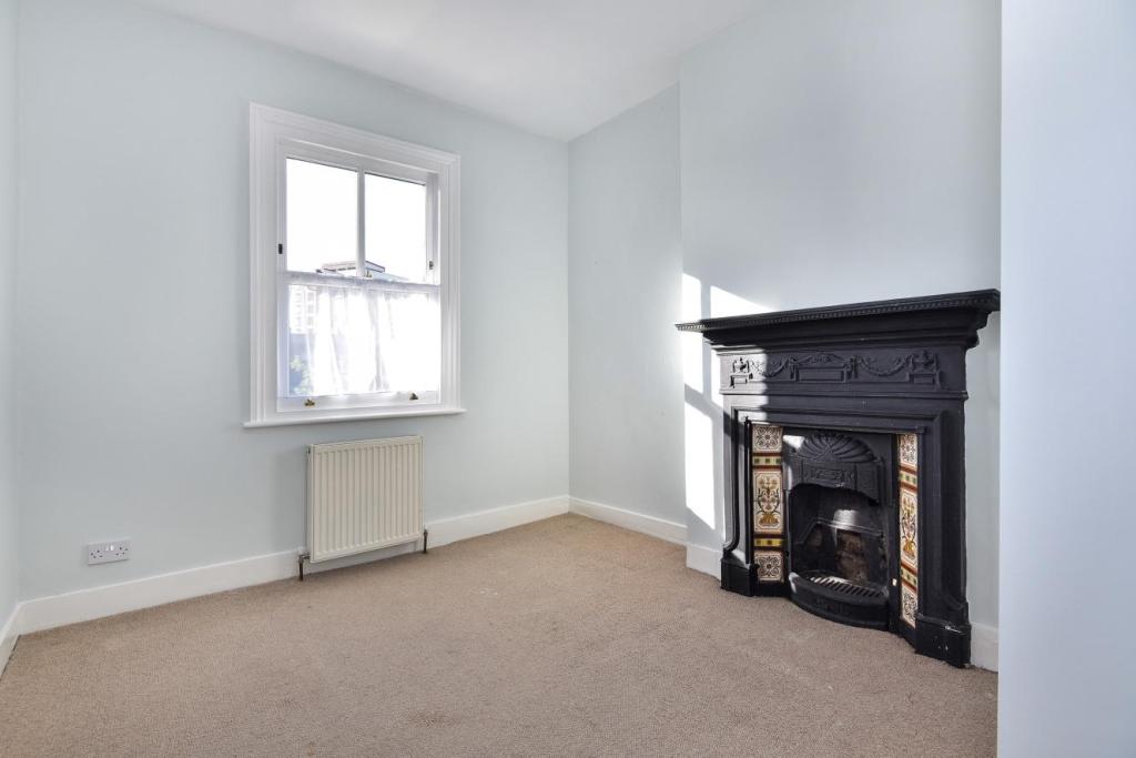
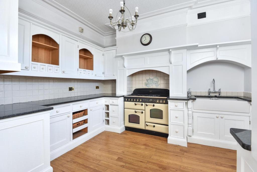
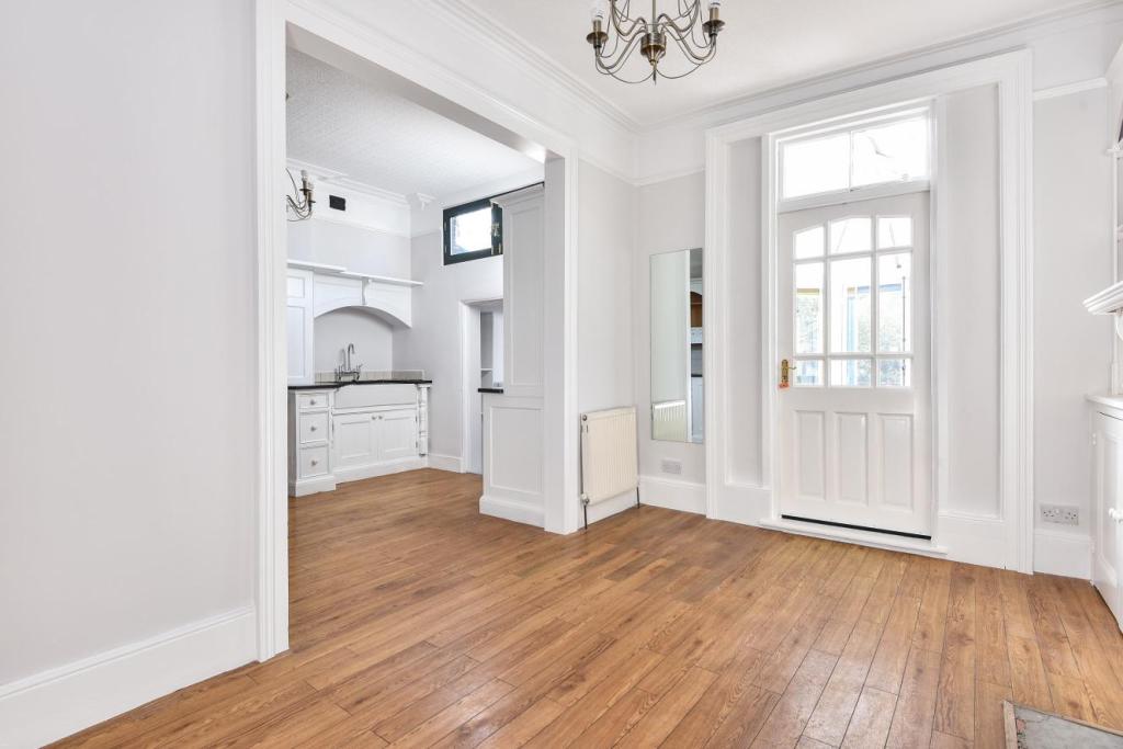
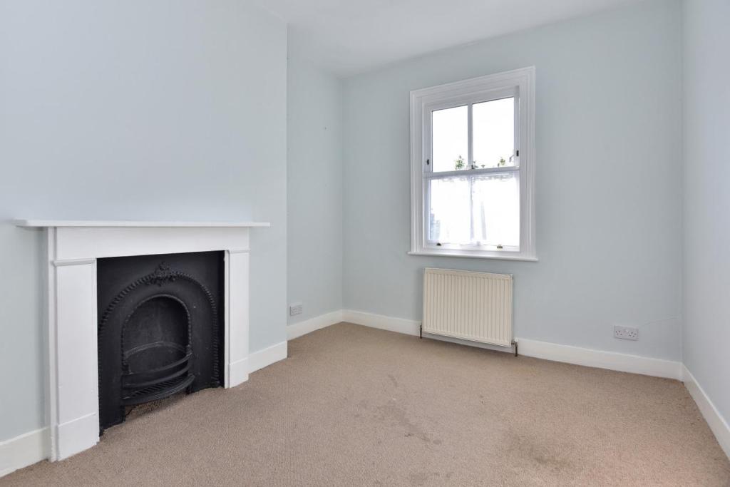
Photo 1 Photo 2 Photo 3 Photo 4 Photo 5 Photo 6 Photo 7 Photo 8 Photo 9 Photo 10 Photo 11 Photo 12 Photo 13 Photo 14 Photo 15 Photo 16
/ 16
Property details
Tenure
FREEHOLD
Floor area
151 m²
Last sold
£645,000 Jun 2018
Local average
£564,000 (+19.7%)
Deprivation
Decile 3 (7,952 of 33,755)
Street crime
572 incidents within 1 mile (Apr 2026)
Key features
- Five bedrooms
- Off street parking
- Beautiful period features
- Spacious conservatory
- Large stylish kitchen
- Grand entrance hall
- 1728 sq ft / 160.5 sqm
- EPC rating F
Additional details
- Parking
- Yes
- Garden
- Yes
Description
Listed by
Crystal Palace
The Lomond Group
Reference: 54163950
EPC Rating & Upgrade Cost
Fetching EPC data… Refresh this page in a moment.
Flood risk
Zone: 1
Risk: Low
Job (default Low)
Floorplans
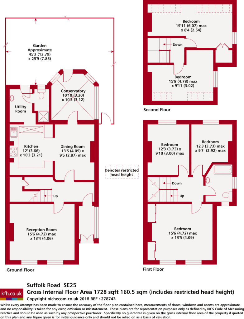
Floorplan 1
EPC Graphs
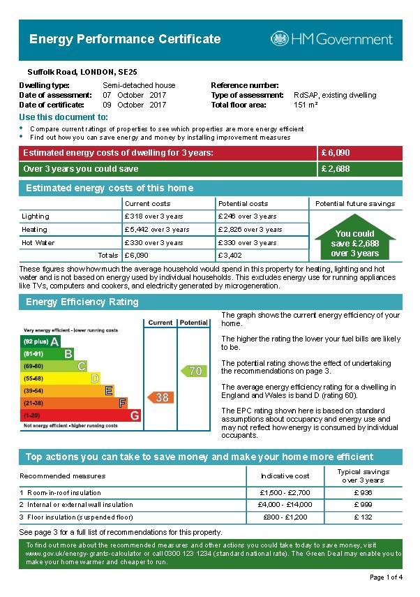
EPC 1
Price history
389% since 2000
| Event | Date | Price | % change |
|---|---|---|---|
| Sold | 14/06/2018 (8 years ago) | £645,000 | +388.6% |
| Sold | 27/10/2000 (25 years ago) | £132,000 | — |
Source: HM Land Registry Price Paid Data. Crown copyright.
Sold Comparables
Same street and nearby sales within 0.25 miles (last 5 years). Data from Land Registry Price Paid.
| Address | Price | Date | Type |
|---|---|---|---|
| Same street LANDFIELD COURT, 13D FLAT 1 SUFFOLK ROAD, LONDON, CROYDON, GREATER LONDON, SE25 6EY | £200,000 | 03/08/2023 | Flat |
| Same street LANDFIELD COURT, 13D FLAT 2 SUFFOLK ROAD, LONDON, CROYDON, GREATER LONDON, SE25 6EY | £300,000 | 03/08/2023 | Flat |
| Same street LANDFIELD COURT, 13D FLAT 3 SUFFOLK ROAD, LONDON, CROYDON, GREATER LONDON, SE25 6EY | £250,000 | 03/08/2023 | Flat |
| Same street LANDFIELD COURT, 13D FLAT 5 SUFFOLK ROAD, LONDON, CROYDON, GREATER LONDON, SE25 6EY | £300,000 | 03/08/2023 | Flat |
| 381 HOLMESDALE ROAD, LONDON, CROYDON, GREATER LONDON, SE25 6PN | £300,000 | 31/07/2023 | Semi-detached |
| 365 HOLMESDALE ROAD, LONDON, CROYDON, GREATER LONDON, SE25 6PN | £730,000 | 21/07/2023 | Semi-detached |
| 4 SOUTH NORWOOD HILL, LONDON, CROYDON, GREATER LONDON, SE25 6AB | £540,000 | 19/04/2022 | Semi-detached |
| 27 ST DUNSTANS ROAD, LONDON, CROYDON, GREATER LONDON, SE25 6EU | £260,000 | 07/01/2022 | Semi-detached |
| Same street 15 SUFFOLK ROAD, LONDON, CROYDON, GREATER LONDON, SE25 6EY | £3,410 | 26/11/2021 | Other |
Street average: £210,682 (5 sales)
Area average: £457,500 (4 sales)
Capital growth trend
Land Registry outcode average: last 12 months vs 5y and 10y ago (from sold prices).
House Price Index (HM Land Registry — official index, not sold-price averages): Croydon. Series: Semi-detached. As of March 2026.
Rental Range
Estimated market rent for Croydon. Low = conservative, Realistic = average, Optimistic = best case.
Based on Local Authority from postcode lookup → Croydon.
LHA (30th percentile) floor for Stevenage & North Herts: £1,596/mo (Apr 2025 – Mar 2026)
Location
Nearby
Nearest stations, universities and amenities (distance from property).
| Type | Name | Distance |
|---|---|---|
| Bus stop | Portland Road | 0.0 miles |
| Shop | Tesco Express | 0.1 miles |
| Shop | Just Computers | 0.1 miles |
| Bus stop | Stanley Hall | 0.1 miles |
| Train station | Norwood Junction | 0.2 miles |
| Train station | Selhurst | 0.7 miles |
| Hospital | Shirley Oaks Hospital | 1.5 miles |
| Hospital | Unknown | 1.5 miles |
| University | City St Georges Tooting | 4.7 miles |
| University | King's College London, Denmark Hill Campus (West) | 4.9 miles |
Street-level crime
| Category | Count |
|---|---|
| Violence and sexual offences | 177 |
| Anti-social behaviour | 130 |
| Vehicle crime | 50 |
| Other theft | 37 |
| Criminal damage and arson | 36 |
| Drugs | 34 |
| Shoplifting | 28 |
| Public order | 19 |
| Burglary | 17 |
| Theft from the person | 14 |
| Robbery | 9 |
| Other crime | 8 |
| Possession of weapons | 8 |
| Bicycle theft | 5 |
| Total incidents | 572 |
Within 1 mile during Apr 2026. Source: data.police.uk (England & Wales).
Schools nearby
Nearest open schools with Ofsted ratings (England). Closed schools are not shown. Data from Get Information about Schools and Ofsted.
| Name | Type | Distance | Ofsted |
|---|---|---|---|
| Harris Academy South Norwood | Secondary | 0.1 miles | Good — 21 Sep 2022 |
| Harris Aspire Academy | Other | 0.1 miles | Outstanding — 17 Dec 2023 |
| Harris Professional Skills Sixth Form | Other | 0.1 miles | — (No rating) |
| St Mark's Church of England Primary Academy | Primary | 0.2 miles | Good — 5 Jul 2017 |
| Beckmead College | Other | 0.3 miles | Good — 9 Jun 2024 |
Rental Comparables
Rental listings exist nearby, but none matched the 5-bedroom count for this property.
Rent-driven metrics
Based on Area rent estimate.
- Rent ratio — Monthly rent ÷ purchase price (1% rule). 1%+ = strong, 0.8–1% = okay, <0.8% = weak for cashflow.
- Max investor price — Rent ÷ 0.8%; the price at which rent would be 0.8% of price (Stoke-style target).
- Target investor price — Rent ÷ 1%; the price at which rent would be 1% of price (strong cashflow band).
- Gross yield — Annual rent as % of purchase price (no costs).