37 SEFTON PARK ROAD
BRISTOL, CITY OF BRISTOL BS7 9AN
£750,000
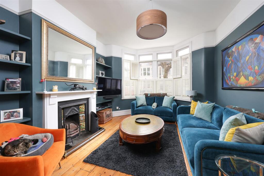
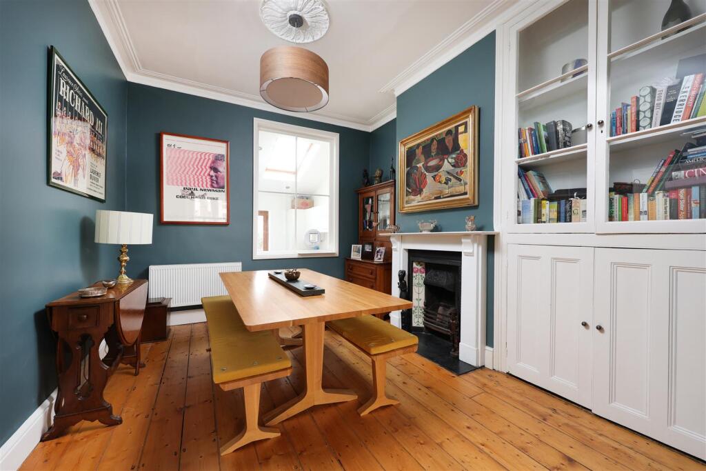
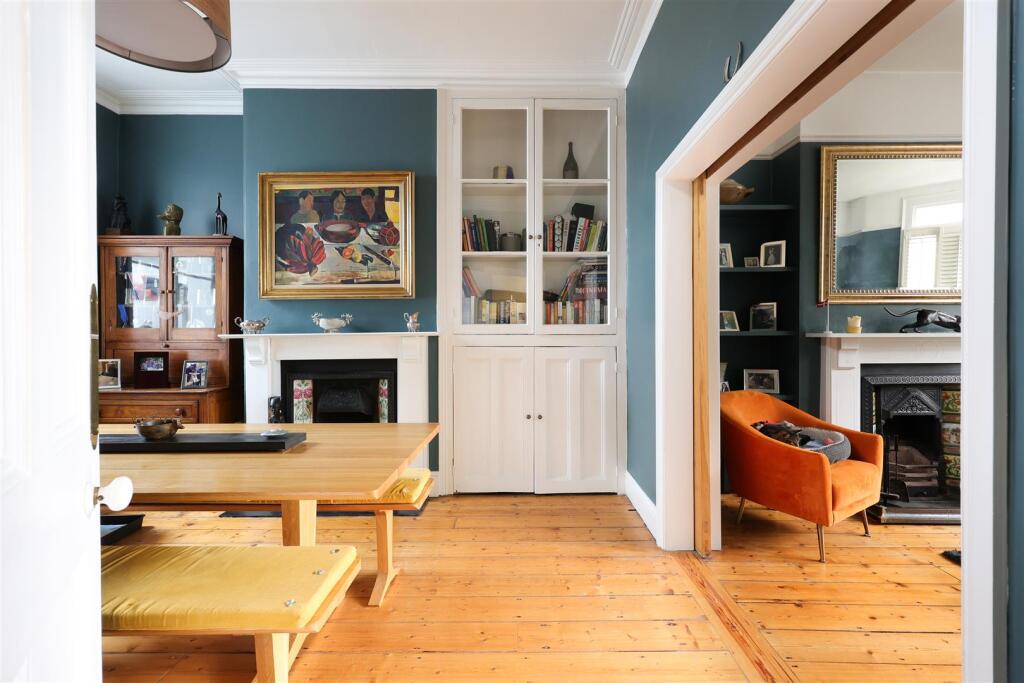
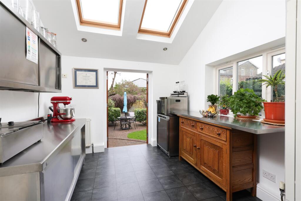
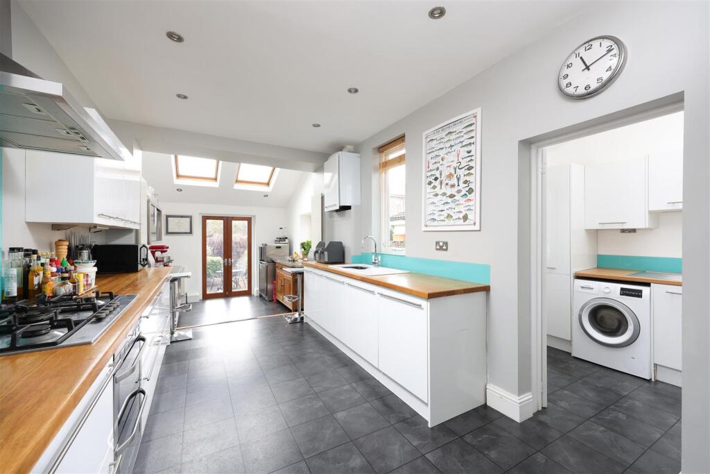
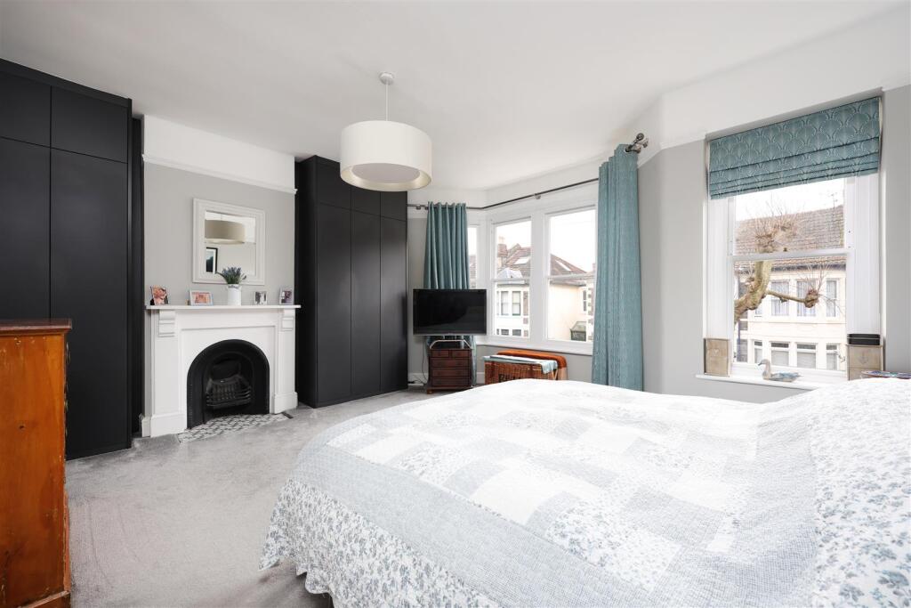
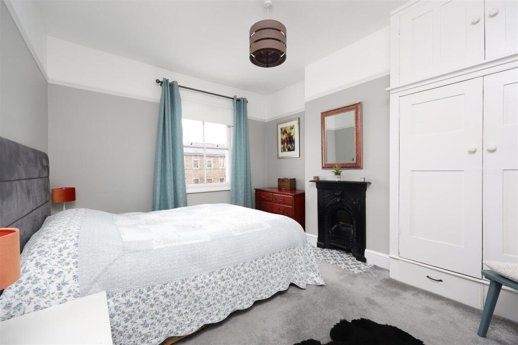
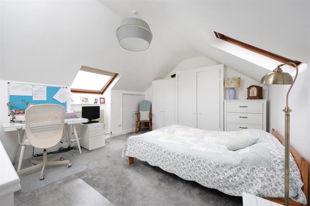
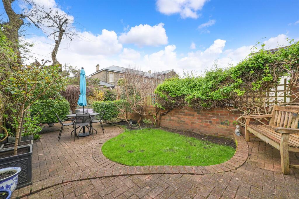
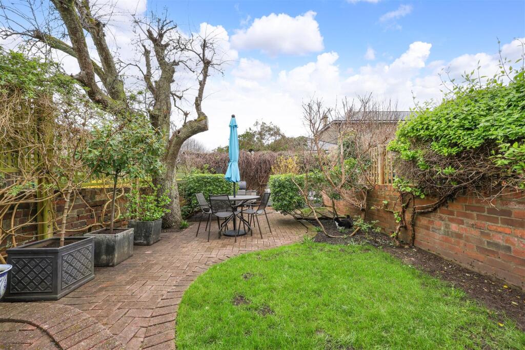
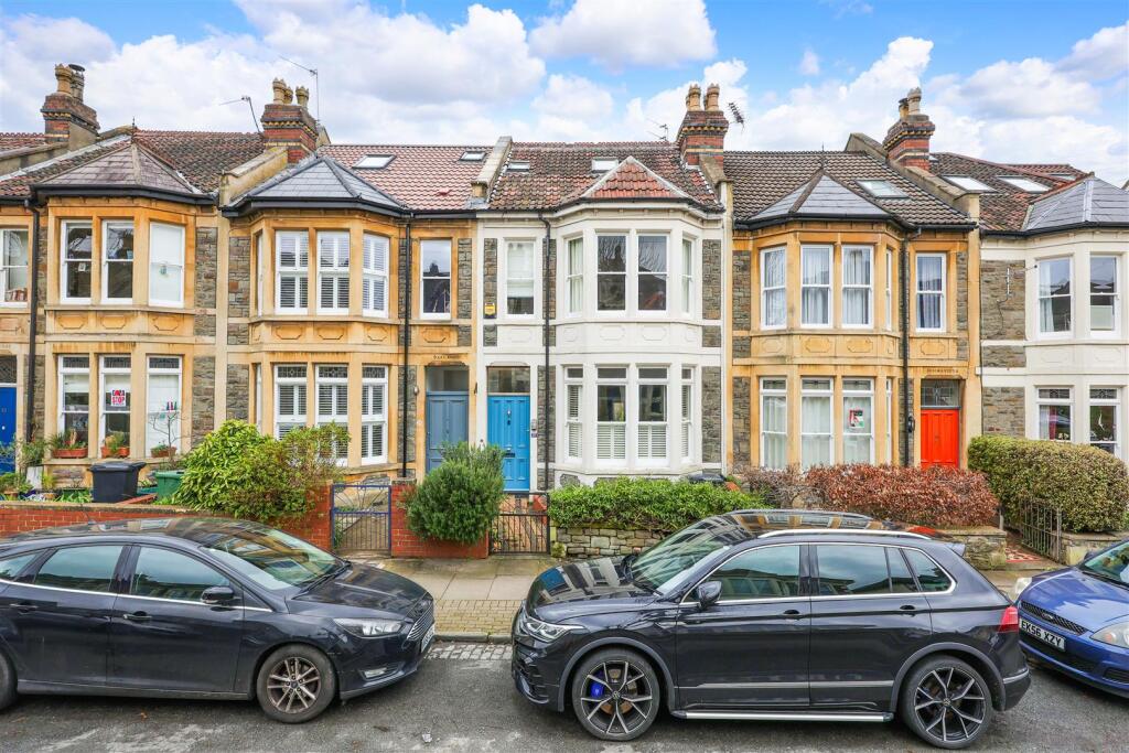
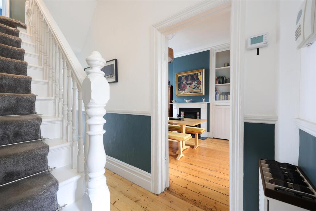
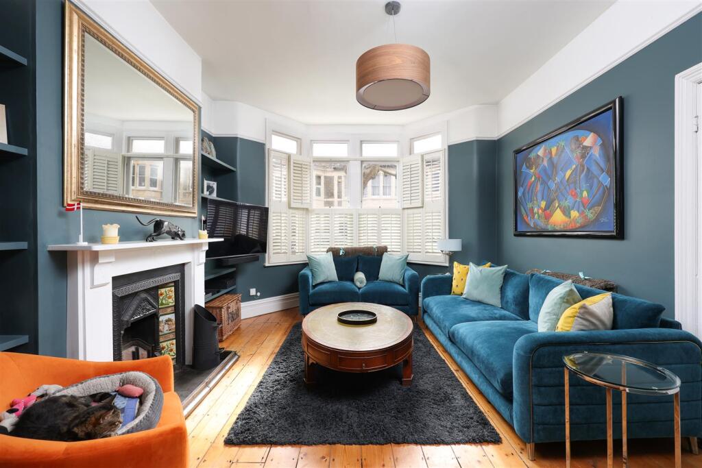
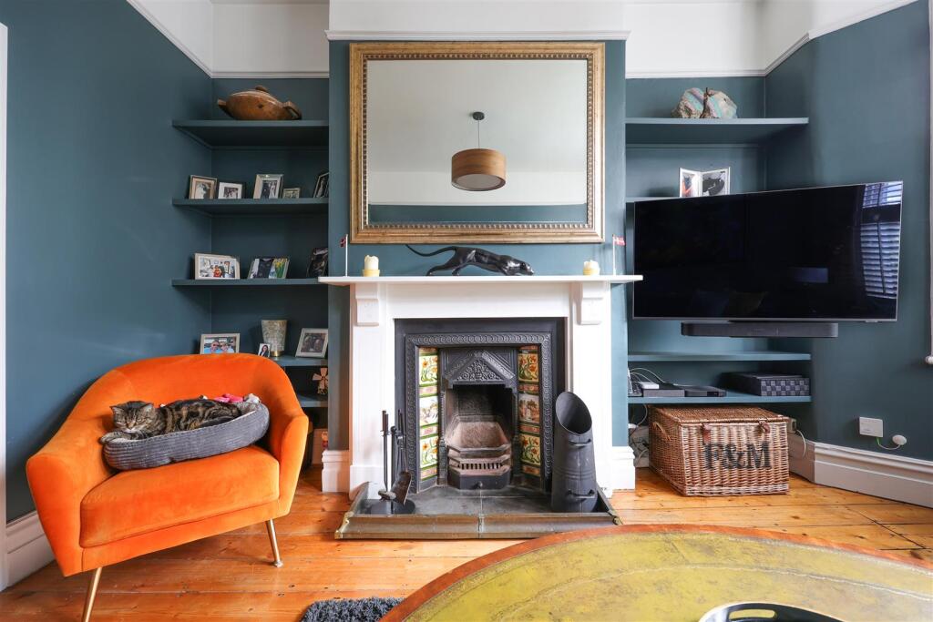
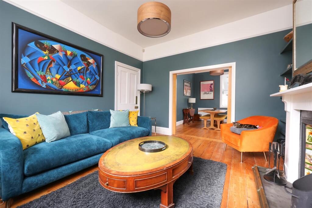

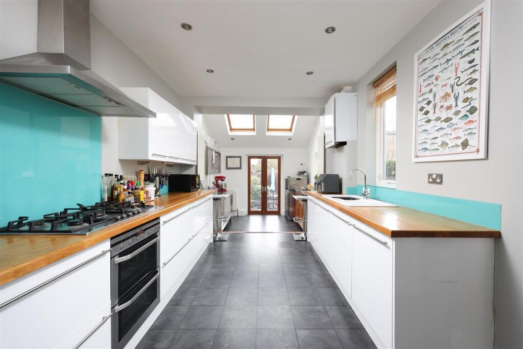
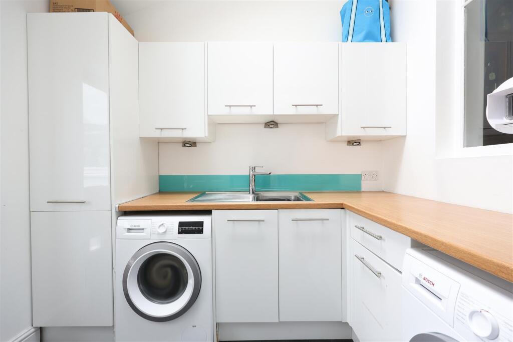
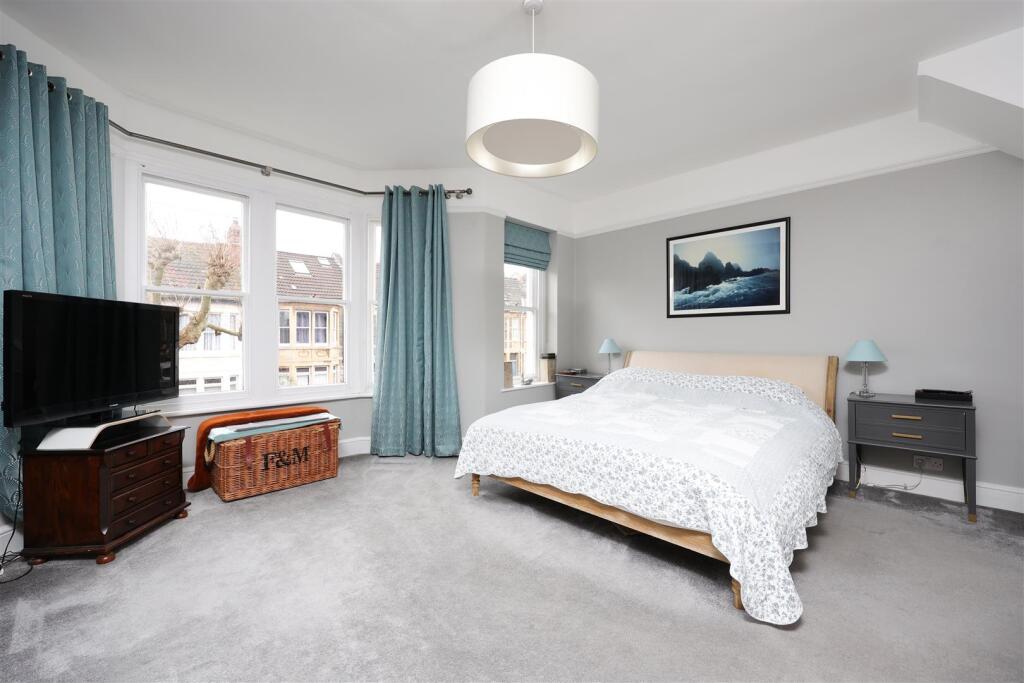
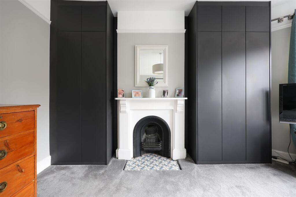
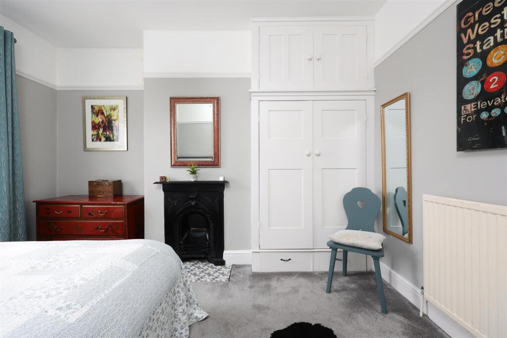
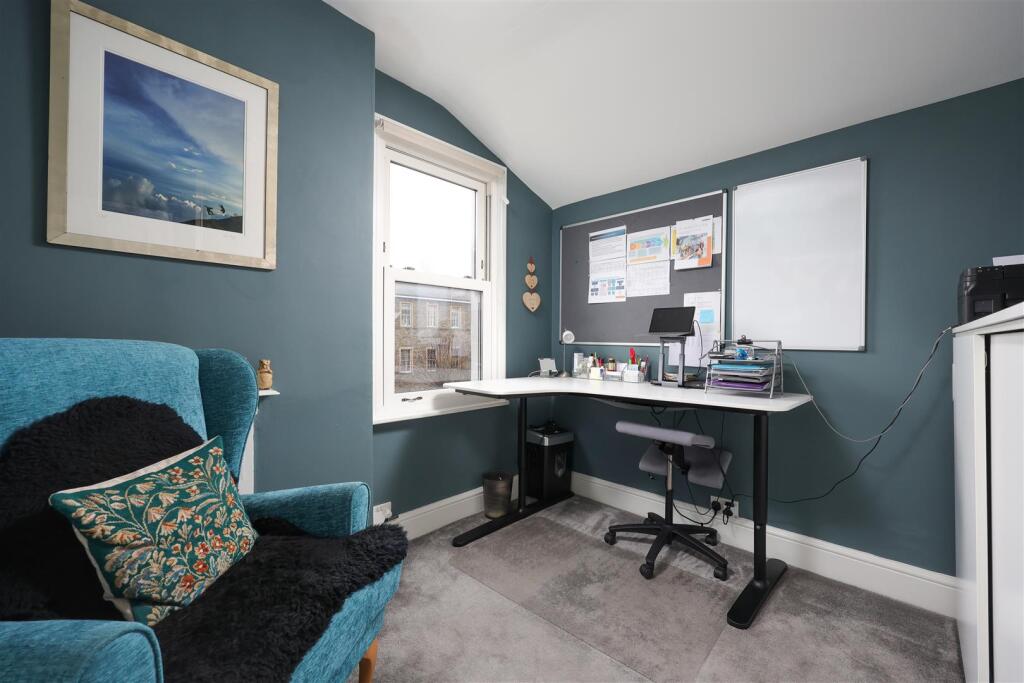
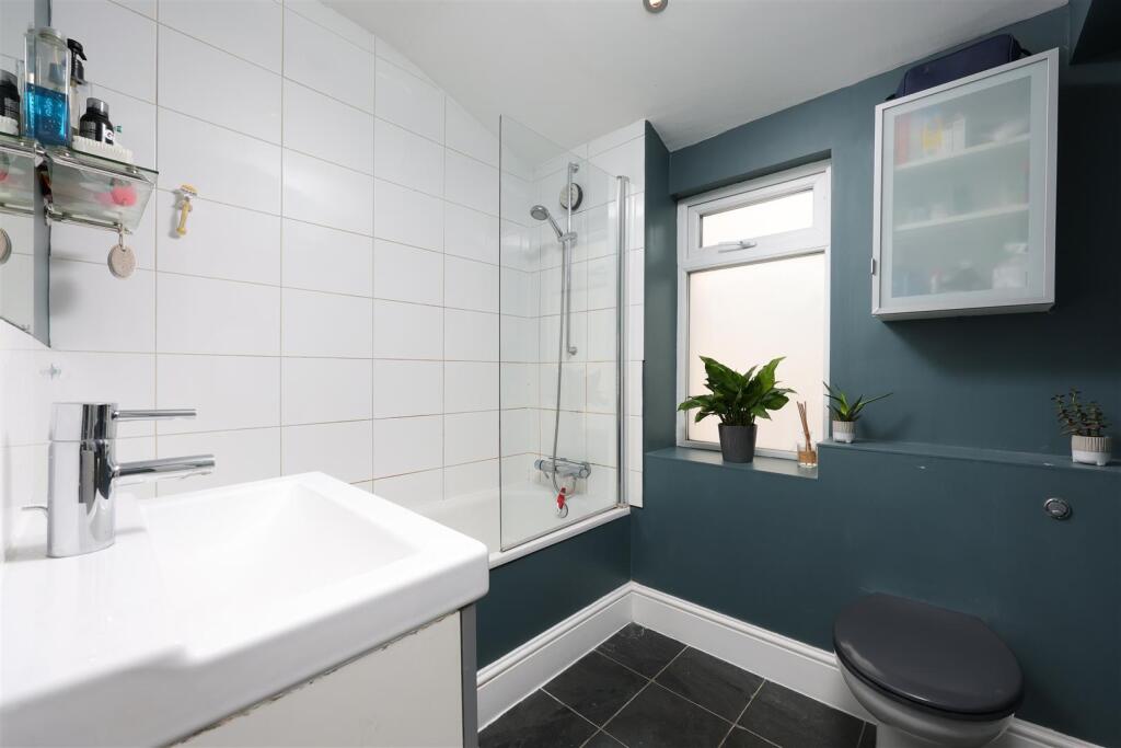
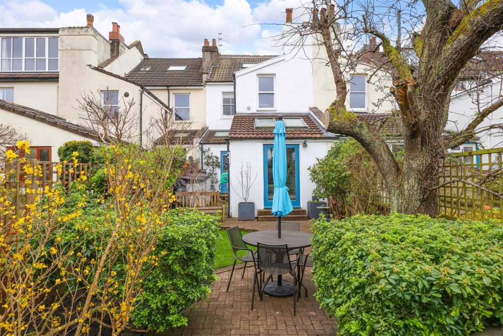
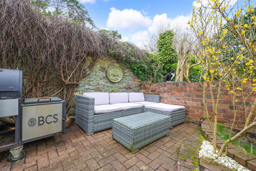
Photo 1 Photo 2 Photo 3 Photo 4 Photo 5 Photo 6 Photo 7 Photo 8 Photo 9 Photo 10 Photo 11 37 Sefton Park Road 19.JPG Photo 13 Photo 14 Photo 15 37 Sefton Park Road 22.JPG Photo 17 Photo 18 Photo 19 Photo 20 Photo 21 Photo 22 Photo 23 Photo 24 Photo 25
/ 25
Property details
Tenure
FREEHOLD
Floor area
143 m²
Council tax band
D
Last sold
£732,500 Dec 2025
Local average
£499,987 (+50%)
Deprivation
Decile 9 (27,359 of 33,755)
Street crime
754 incidents within 1 mile (Apr 2026)
Key features
- Stylish Victorian home
- Three bedrooms
- Plus a loft room
- Living room with bay window
- Dining room with fireplace
- Open kitchen breakfast room
- Downstairs utility and w/c
- Great location
- First floor bathroom
- Enclosed garden with lawn
Additional details
- Garden
- Yes
Description
The reception rooms have been opened, creating spacious and light accommodation. The classically proportioned sitting room has bay sash windows, a period fireplace and stripped wood floorboards. It opens onto a dining room with a fireplace, period dresser and stripped wood floors.
At the rear, the impressive split-level kitchen/dining room has contemporary units and double doors that seamlessly connect to the garden. In addition to this, there is a separate utility room and downstairs w/c.
Stairs rise to three bedrooms and a family bathroom on the first floor. The principal bedroom extends the entire property width at the front and features a decorative period fireplace and bay sash windows. Next door, the second double bedroom has a cast iron feature fireplace, fitted wardrobes, and a sash window to the rear. Beyond, the family bathroom is fitted with a bathtub with shower over, wash hand basin, W/C, and a window to the side aspect. The third bedroom has a period fireplace and a double-glazed sash window overlooking the rear garden.
On the second floor, the loft room has two skylight windows and access to eaves.
At the rear, the garden is laid to block paved seating and dining areas and lawn. The garden is bordered by trees and shrubbery and enclosed by a brick wall and trellis.
Listed by
Bristol
Elephant
Reference: 165911591
EPC Rating & Upgrade Cost
Fetching EPC data… Refresh this page in a moment.
Flood risk
Zone: 1
Risk: Low
Job (default Low)
Floorplans
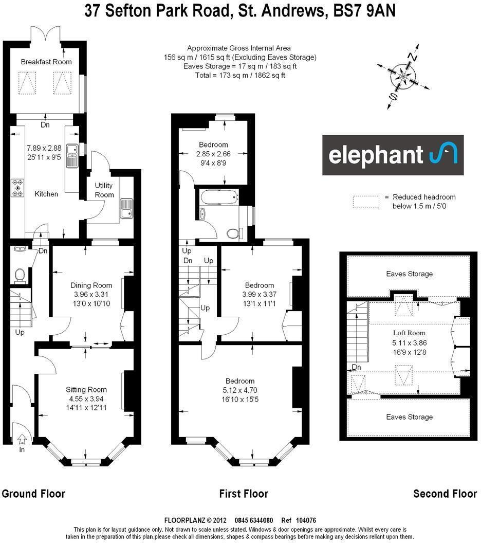
Sefton Park Road.jpg
EPC Graphs
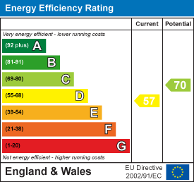
EE Rating
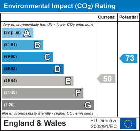
EI Rating
Price history
75% since 2013
| Event | Date | Price | % change |
|---|---|---|---|
| Sold | 08/12/2025 (6 months ago) | £732,500 | +75.4% |
| Sold | 16/04/2013 (13 years ago) | £417,500 | — |
Source: HM Land Registry Price Paid Data. Crown copyright.
Sold Comparables
Same street and nearby sales within 0.25 miles (last 5 years). Data from Land Registry Price Paid.
| Address | Price | Date | Type |
|---|---|---|---|
| 23 WALSINGHAM ROAD, BRISTOL, CITY OF BRISTOL, BS6 5BU | £580,000 | 16/01/2026 | Terraced |
| 28 KATHDENE GARDENS, BRISTOL, CITY OF BRISTOL, BS7 9BN | £450,000 | 29/10/2025 | Terraced |
| 26 NOTTINGHAM ROAD, BRISTOL, CITY OF BRISTOL, BS7 9DH | £241,480 | 15/11/2024 | Terraced |
| 131 SEFTON PARK ROAD, BRISTOL, CITY OF BRISTOL, BS7 9AW | £725,000 | 02/11/2023 | Terraced |
| 12 SEFTON PARK ROAD, BRISTOL, CITY OF BRISTOL, BS7 9AJ | £736,250 | 23/08/2023 | Terraced |
| 38 LONGFIELD ROAD, BRISTOL, CITY OF BRISTOL, BS7 9AG | £1,160,000 | 12/07/2023 | Terraced |
| 27 STANLEY AVENUE, BISHOPSTON, BRISTOL, CITY OF BRISTOL, BS7 9AH | £635,000 | 05/06/2023 | Terraced |
| 15 LONGFIELD ROAD, BRISTOL, CITY OF BRISTOL, BS7 9AG | £780,000 | 11/05/2023 | Terraced |
| 98 BELMONT ROAD, ST ANDREWS, BRISTOL, CITY OF BRISTOL, BS6 5AU | £860,000 | 05/05/2023 | Terraced |
| 150 SEFTON PARK ROAD, BRISTOL, CITY OF BRISTOL, BS7 9AL | £750,000 | 25/04/2023 | Terraced |
| Same street 35 SEFTON PARK ROAD, BRISTOL, CITY OF BRISTOL, BS7 9AN | £700,000 | 14/04/2023 | Terraced |
| 37 LONGFIELD ROAD, BRISTOL, CITY OF BRISTOL, BS7 9AG | £340,000 | 14/04/2023 | Terraced |
| 26 KATHDENE GARDENS, BRISTOL, CITY OF BRISTOL, BS7 9BN | £500,000 | 05/04/2023 | Terraced |
| 21 SURREY ROAD, BRISTOL, CITY OF BRISTOL, BS7 9DJ | £800,000 | 23/09/2022 | Terraced |
| SEFTON LODGE, 1 SURREY ROAD, BRISTOL, CITY OF BRISTOL, BS7 9DJ | £825,000 | 26/08/2022 | Terraced |
| 22 NOTTINGHAM ROAD, BRISTOL, CITY OF BRISTOL, BS7 9DH | £1,025,000 | 18/08/2022 | Terraced |
| 140 SEFTON PARK ROAD, BRISTOL, CITY OF BRISTOL, BS7 9AL | £767,000 | 16/08/2022 | Terraced |
| Same street 61 SEFTON PARK ROAD, BRISTOL, CITY OF BRISTOL, BS7 9AN | £500,000 | 05/08/2022 | Terraced |
| 5 MORLEY SQUARE, BRISTOL, CITY OF BRISTOL, BS7 9DW | £967,000 | 15/07/2022 | Terraced |
| 316 ASHLEY DOWN ROAD, BRISTOL, CITY OF BRISTOL, BS7 9BQ | £650,000 | 12/07/2022 | Terraced |
| 17 KATHDENE GARDENS, BRISTOL, CITY OF BRISTOL, BS7 9BN | £390,000 | 08/07/2022 | Terraced |
| 324 ASHLEY DOWN ROAD, BRISTOL, CITY OF BRISTOL, BS7 9BQ | £550,000 | 13/05/2022 | Terraced |
| Same street 9 GROUND FLOOR FLAT SEFTON PARK ROAD, BRISTOL, CITY OF BRISTOL, BS7 9AN | £350,000 | 30/06/2021 | Flat |
Street average: £516,667 (3 sales)
Area average: £686,587 (20 sales)
Capital growth trend
Land Registry outcode average: last 12 months vs 5y and 10y ago (from sold prices).
House Price Index (HM Land Registry — official index, not sold-price averages): City of Bristol. Series: Terraced. As of March 2026.
Rental Range
Estimated market rent for Bristol, City of. Low = conservative, Realistic = average, Optimistic = best case.
Based on Local Authority from postcode lookup → Bristol, City of.
LHA (30th percentile) floor for Bristol: £1,296/mo (Apr 2025 – Mar 2026)
Location
Nearby
Nearest stations, universities and amenities (distance from property).
| Type | Name | Distance |
|---|---|---|
| Bus stop | Osborne Avenue | 0.1 miles |
| Bus stop | Ashley Park | 0.2 miles |
| Shop | inspiral glass | 0.3 miles |
| Shop | Hotwax | 0.3 miles |
| Train station | Ashley Down | 0.4 miles |
| Train station | Montpelier | 0.5 miles |
| Hospital | South West Regional Laboratories | 1.3 miles |
| University | 5 Priory Road, Life Sciences | 1.4 miles |
| Hospital | Southmead Hospital | 1.5 miles |
| University | dBs Institute Bristol Campus | 1.6 miles |
Street-level crime
| Category | Count |
|---|---|
| Violence and sexual offences | 248 |
| Anti-social behaviour | 101 |
| Shoplifting | 81 |
| Vehicle crime | 55 |
| Public order | 54 |
| Criminal damage and arson | 50 |
| Other theft | 46 |
| Burglary | 45 |
| Robbery | 24 |
| Bicycle theft | 16 |
| Other crime | 14 |
| Drugs | 12 |
| Theft from the person | 5 |
| Possession of weapons | 3 |
| Total incidents | 754 |
Within 1 mile during Apr 2026. Source: data.police.uk (England & Wales).
Schools nearby
Nearest open schools with Ofsted ratings (England). Closed schools are not shown. Data from Get Information about Schools and Ofsted.
| Name | Type | Distance | Ofsted |
|---|---|---|---|
| Sefton Park Infant School | Primary | 0.1 miles | Good — 27 Apr 2020 |
| Sefton Park Junior School | Primary | 0.1 miles | Good — 27 Jun 2013 |
| Brunel Field Primary School | Primary | 0.2 miles | Good — 15 Jan 2024 |
| Bristol Hospital Education Service | Other | 0.4 miles | Outstanding — 6 Dec 2013 |
| E-Act Fairlawn Primary School | Primary | 0.4 miles | Good — 5 Jun 2018 |
Rental Comparables
Loading rental comparables for this postcode. Refresh in a few minutes.
Rent-driven metrics
Based on Area rent estimate.
- Rent ratio — Monthly rent ÷ purchase price (1% rule). 1%+ = strong, 0.8–1% = okay, <0.8% = weak for cashflow.
- Max investor price — Rent ÷ 0.8%; the price at which rent would be 0.8% of price (Stoke-style target).
- Target investor price — Rent ÷ 1%; the price at which rent would be 1% of price (strong cashflow band).
- Gross yield — Annual rent as % of purchase price (no costs).