Northcote Place
Newcastle, ST5 1HU
£800 pcm
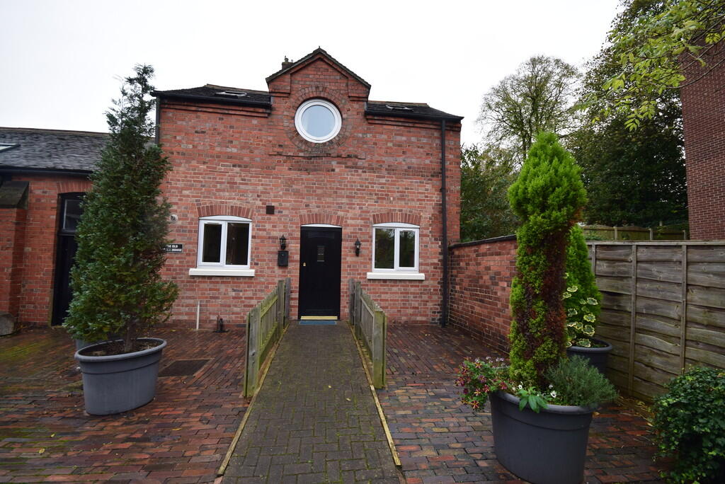
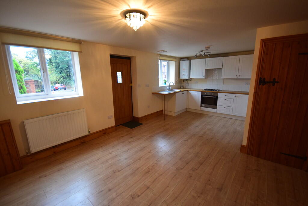
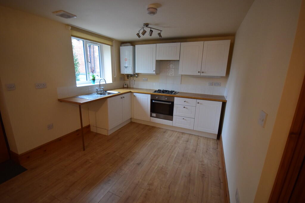
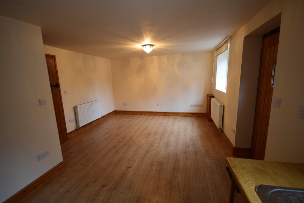
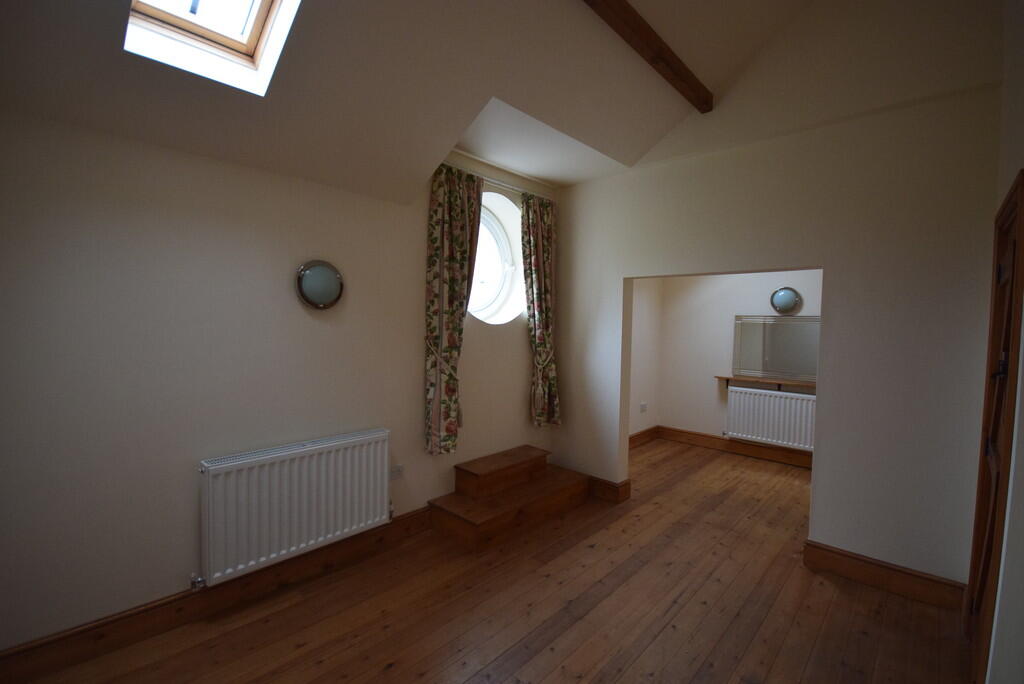
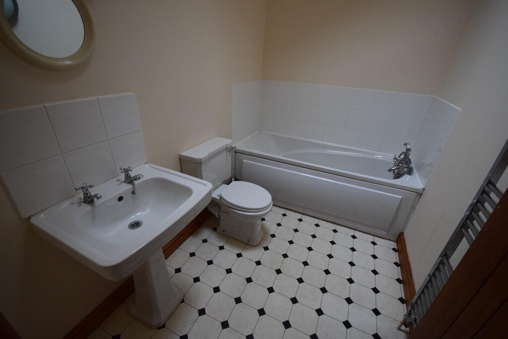
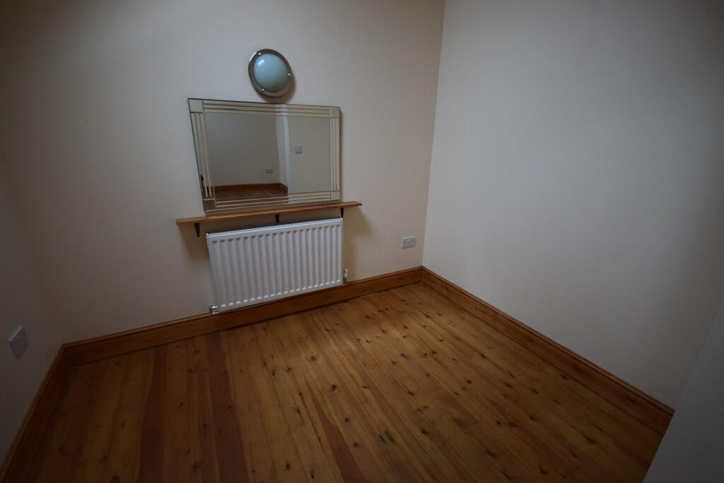
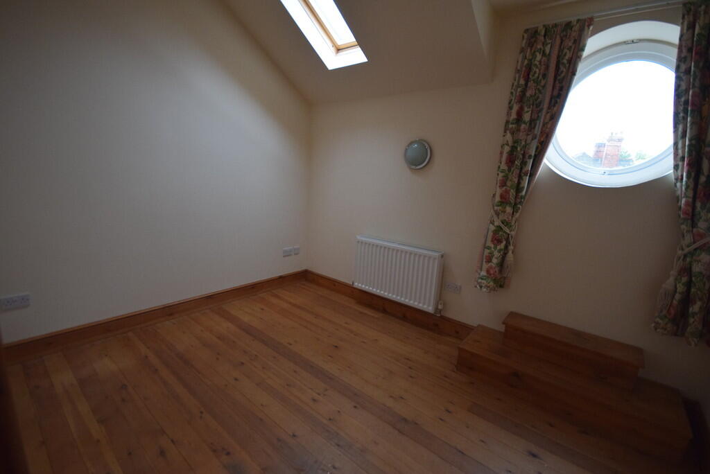
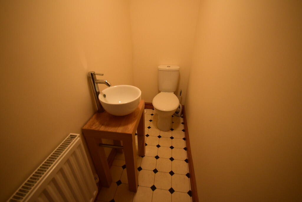
Photo 1 Photo 2 Photo 3 Photo 4 Photo 5 Photo 6 Photo 7 Photo 8 Photo 9
/ 9
Property details
Floor area
90 m²
Council tax band
A
Deprivation
Decile 4 (11,363 of 33,755)
Street crime
366 incidents within 1 mile (Apr 2026)
Key features
- One Double Bedroom
- Dressing Room
- Double Glazed
- Gas Central Heating
- Off Road Parking
- Family Bathroom on First Floor
- Cloakroom on Ground Floor
- Open plan lounge and kitchen
- Council tax band A
Additional details
- Heating
- Gas central
- Parking
- Off street
Description
OPEN PLAN LIVING SPACE Entered via hardwood door, wood effect laminate flooring, two wall mounted radiators, two UPVC double glazed windows. Fitted kitchen comprising of a range of base units with worktops over, wall units, stainless steel sink and drainer with mixer tap over, gas hob with extractor hood over, electric oven, wall mounted "Glow Worm" boiler and a large under stairs storage cupboard.
CLOAKROOM White WC and contemporary style wash hand basin. Vinyl tile effect flooring and wall mounted radiator.
STAIRS AND LANDING Solid wood flooring, velux window.
FAMILY BATHROOM White suite comprising of WC, pedestal wash hand basin and bath with shower head off taps. Vinyl tile effect flooring, heated towel rain and Velux window.
BEDROOM Double bedroom with wooden flooring, wall mounted radiator, Velux window and feature round window. Archway leading to:-
DRESSING ROOM ** Wooden flooring, wall mounted radiator and Velux window.
Listed by
Stoke On Trent
The Property Franchise Group
Reference: 174694982
EPC Rating & Upgrade Cost
Fetching EPC data… Refresh this page in a moment.
Flood risk
Zone: 1
Risk: Low
Job (default Low)
EPC Graphs
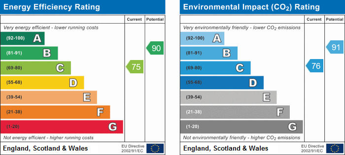
EPC 1
Rental Range
Estimated market rent for Newcastle-under-Lyme. Low = conservative, Realistic = average, Optimistic = best case.
Based on Local Authority from postcode lookup → Newcastle-under-Lyme.
LHA (30th percentile) floor for Staffordshire North: £424/mo (Apr 2025 – Mar 2026)
Location
Address
5 Northcote Place
Nearby
Nearest stations, universities and amenities (distance from property).
| Type | Name | Distance |
|---|---|---|
| Shop | John Belfield | 0.1 miles |
| Shop | Embassy Hair | 0.1 miles |
| Bus stop | Borough Arms Hotel | 0.1 miles |
| Bus stop | Albert Street | 0.1 miles |
| Hospital | Hartshill Medical Centre | 0.5 miles |
| Hospital | North Staffordshire Hospital | 0.8 miles |
| University | University of Staffordshire Stoke Campus | 1.7 miles |
| Train station | Stoke-on-Trent | 1.7 miles |
| Train station | Longport | 1.9 miles |
Street-level crime
| Category | Count |
|---|---|
| Violence and sexual offences | 104 |
| Anti-social behaviour | 75 |
| Public order | 40 |
| Shoplifting | 30 |
| Criminal damage and arson | 25 |
| Other theft | 21 |
| Drugs | 19 |
| Burglary | 16 |
| Vehicle crime | 11 |
| Other crime | 10 |
| Possession of weapons | 8 |
| Robbery | 4 |
| Theft from the person | 2 |
| Bicycle theft | 1 |
| Total incidents | 366 |
Within 1 mile during Apr 2026. Source: data.police.uk (England & Wales).
Schools nearby
Nearest open schools with Ofsted ratings (England). Closed schools are not shown. Data from Get Information about Schools and Ofsted.
| Name | Type | Distance | Ofsted |
|---|---|---|---|
| Demetae Academy | Other | 0.0 miles | Good — 30 Jun 2022 |
| Lyme Brook Independent School | Other | 0.1 miles | Good — 22 Oct 2023 |
| Newcastle-under-Lyme School | Other | 0.3 miles | — (No rating) |
| Hassell Primary School | Primary | 0.3 miles | Good — 25 Oct 2023 |
| Harpfield Primary Academy | Primary | 0.4 miles | Good — 10 Feb 2015 |
Rental Comparables
Residential lets from OpenRent and Rightmove for the area (same bedroom count). Use to validate rent estimates. Student lets are excluded.
Average rent: £636/mo (36 listings)