The Old Barn
HUNSTERSON ROAD, NANTWICH, HATHERTON, CHESHIRE EAST CW5 7RA
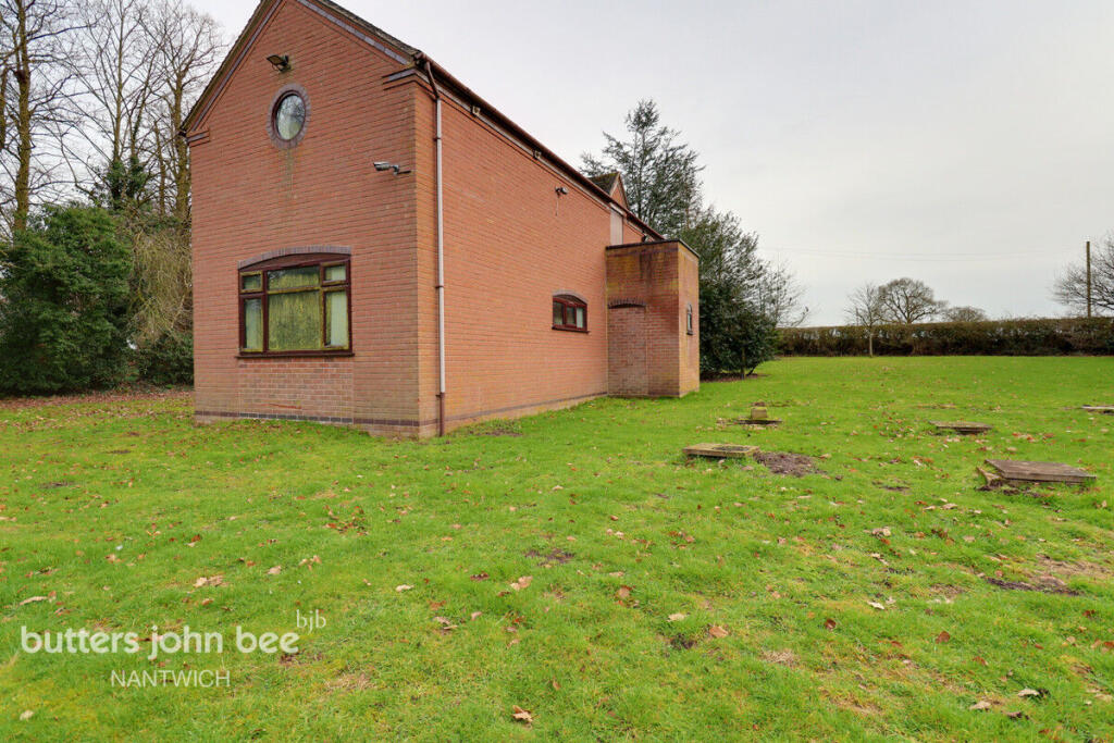
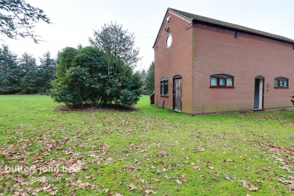
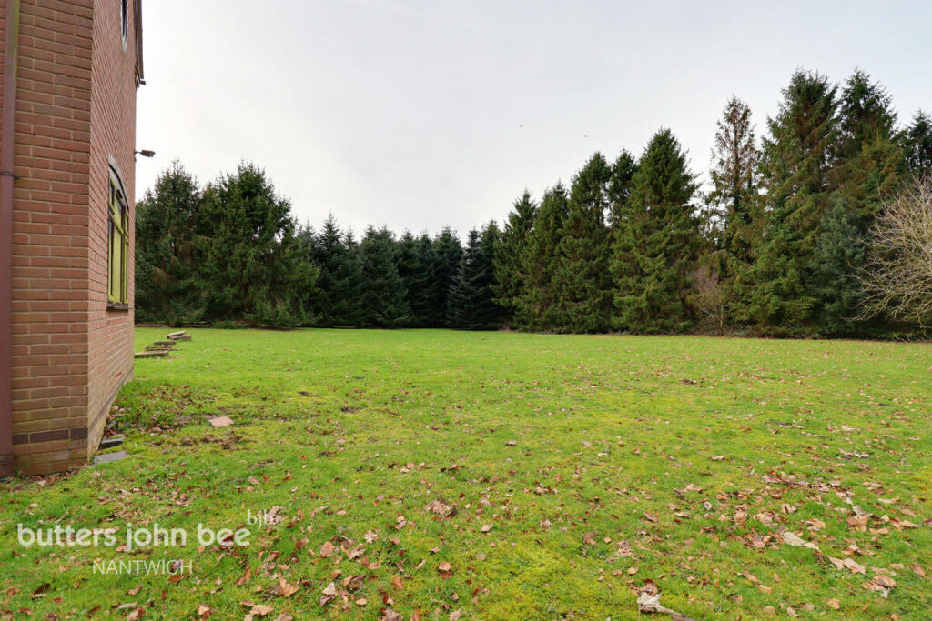
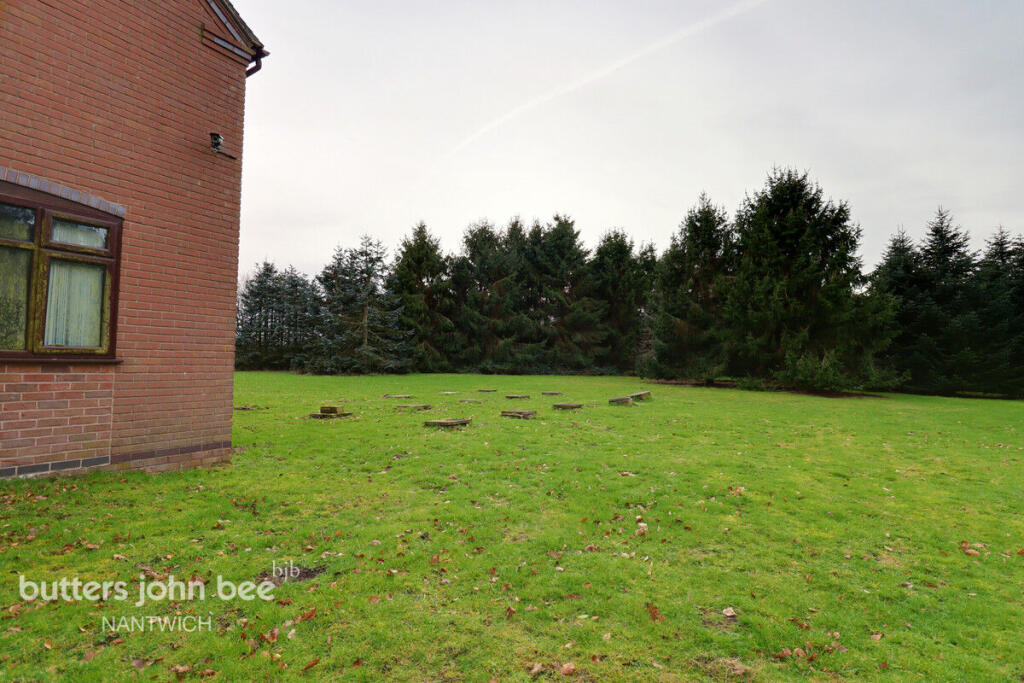
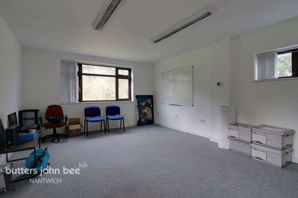
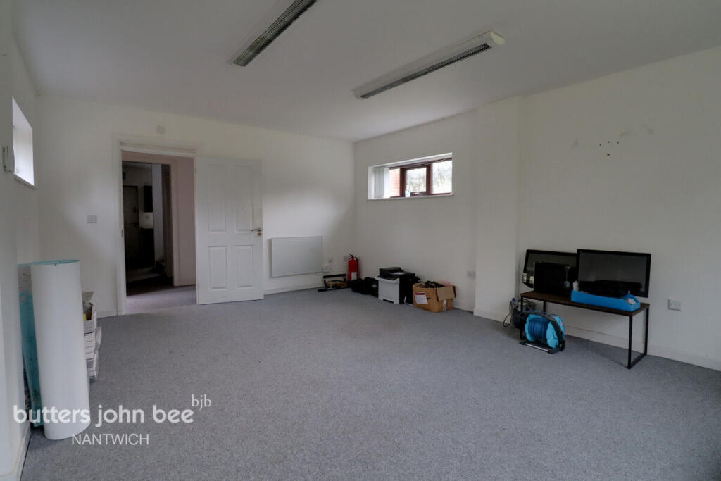
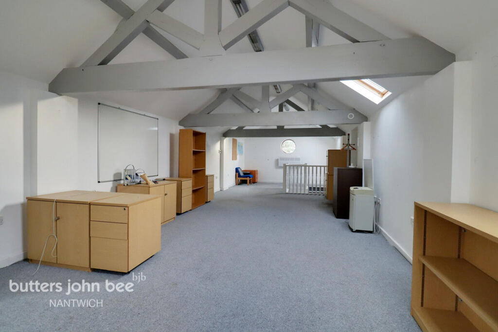
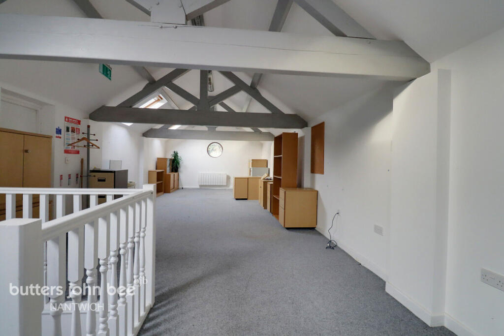
Photo 1 Photo 2 Photo 3 Photo 4 Photo 5 Photo 6 Photo 7 Photo 8
/ 8
Property details
Tenure
FREEHOLD
Last sold
£275,000 Oct 2011
Local average
£303,844 (+64.6%)
Deprivation
Decile 8 (25,646 of 33,755)
Street crime
0 incidents within 1 mile (Apr 2026)
Key features
- Development Opportunity
- Rural Location
- Circa 5 Acre site.
- Desirable Location
- Fantastic Potential
- Perfect Self Build
Description
The existing barn is ready to be converted. Properties like this really are rare. Book an appointment today to avoid disappointment.
Details of the panning are available from the agent.
Listed by
Nantwich
Spicerhaart
Reference: 172721585
EPC ratings on this postcode
We don't have a matched EPC for this property yet. Below are efficiency scores and details for other addresses on this postcode.
| Address | Current | Potential | Floor area | Age band | Type |
|---|---|---|---|---|---|
| 10, Hunsterson Road, Hatherton | 61 | 104 | 83 m² | England and Wales: 1967-1975 | House |
| 10, Hunsterson Road, Hatherton, NANTWICH | 61 | 104 | 83 m² | England and Wales: 1967-1975 | Detached |
| 9, Hunsterson Road, Hatherton | 62 | 78 | 81 m² | England and Wales: 1930-1949 | House |
| 9, Hunsterson Road, Hatherton, NANTWICH | 62 | 78 | 81 m² | England and Wales: 1930-1949 | Detached |
| Ashfields, Hunsterson Road, Hatherton | 69 | 72 | 117 m² | England and Wales: 1950-1966 | House |
| Hatherton Grange, Hunsterson Road, Hatherton | 62 | 73 | 343 m² | England and Wales: 1996-2002 | House |
| Hatherton Grange, Hunsterson Road, Hatherton, NANTWICH | 62 | 73 | 343 m² | England and Wales: 1996-2002 | Detached |
| Hatherton Lodge Farm, Hunsterson Road, Hatherton | 49 | 70 | 342 m² | England and Wales: before 1900 | House |
| Hatherton Lodge Farm, Hunsterson Road, Hatherton, NANTWICH | 49 | 70 | 342 m² | England and Wales: before 1900 | Detached |
| Hunters Grove, Hunsterson Road, Hatherton | 64 | 84 | 110 m² | England and Wales: 1976-1982 | Bungalow |
| Hunters Grove, Hunsterson Road, Hatherton, NANTWICH | 64 | 84 | 110 m² | England and Wales: 1976-1982 | Detached |
| The Old Stables, Hatherton Lodge | 16 | 56 | 399 m² | England and Wales: before 1900 | House |
| The Old Stables, Hatherton Lodge, NANTWICH | 16 | 56 | 399 m² | England and Wales: before 1900 | Detached |
Flood risk
Zone: 1
Risk: Low
Job (default Low)
Price history
34% since 2009
| Event | Date | Price | % change |
|---|---|---|---|
| Listed for sale | — | £500,000 | +81.8% |
| Sold | 18/10/2011 (14 years ago) | £275,000 | +34.1% |
| Sold | 31/07/2009 (16 years ago) | £205,000 | — |
Source: HM Land Registry Price Paid Data. Crown copyright.
Sold Comparables
Same street and nearby sales within 0.25 miles (last 5 years). Data from Land Registry Price Paid.
| Address | Price | Date | Type |
|---|---|---|---|
| NORTHWOOD LODGE LANE, HATHERTON, NANTWICH, CHESHIRE EAST, CW5 7LD | £1,300,000 | 04/08/2022 | Other |
Area average: £1,300,000 (1 sale)
Capital growth trend
Land Registry outcode average: last 12 months vs 5y and 10y ago (from sold prices).
House Price Index (HM Land Registry — official index, not sold-price averages): Cheshire East. Series: All dwelling types. As of March 2026.
Rental Range
Estimated market rent for Cheshire East. Low = conservative, Realistic = average, Optimistic = best case.
Based on Local Authority from postcode lookup → Cheshire East.
LHA (30th percentile) floor for Bolton and Bury: £474/mo (Apr 2025 – Mar 2026)
Location
Address
Hunsterston Road
Nearby
Nearest stations, universities and amenities (distance from property).
| Type | Name | Distance |
|---|---|---|
| Bus stop | Hatherton, Hunsterson Road / Lodge Lane | 0.2 miles |
| Shop | Wybunbury Garage | 1.5 miles |
| Shop | Wybunbury PO & General Stores | 1.6 miles |
| Train station | Nantwich | 3.7 miles |
| Train station | Crewe | 4.7 miles |
| University | University of Buckingham Crewe Campus | 5.1 miles |
| Hospital | Leighton Hospital | 6.6 miles |
| University | Keele University | 8.1 miles |
| Hospital | Bradwell Hospital | 9.3 miles |
Street-level crime
| Category | Count |
|---|---|
| Total incidents | 0 |
Within 1 mile during Apr 2026. Source: data.police.uk (England & Wales).
Schools nearby
Nearest open schools with Ofsted ratings (England). Closed schools are not shown. Data from Get Information about Schools and Ofsted.
| Name | Type | Distance | Ofsted |
|---|---|---|---|
| Wybunbury Delves CofE Primary School | Primary | 1.3 miles | Good — 7 Jun 2012 |
| Bridgemere CofE Primary School | Primary | 2.0 miles | Good — 23 Jul 2018 |
| Stapeley Broad Lane CofE Primary School | Primary | 2.6 miles | Outstanding — 6 Feb 2015 |
| Audlem St James' CofE Primary School | Primary | 2.8 miles | Good — 9 Nov 2023 |
| Shavington Primary School | Primary | 2.9 miles | Good — 10 Oct 2014 |
Rental Comparables
Loading rental comparables for this postcode. Refresh in a few minutes.
Rent-driven metrics
Based on Area rent estimate.
- Rent ratio — Monthly rent ÷ purchase price (1% rule). 1%+ = strong, 0.8–1% = okay, <0.8% = weak for cashflow.
- Max investor price — Rent ÷ 0.8%; the price at which rent would be 0.8% of price (Stoke-style target).
- Target investor price — Rent ÷ 1%; the price at which rent would be 1% of price (strong cashflow band).
- Gross yield — Annual rent as % of purchase price (no costs).
Enter House Number
Enter the house number to help us retrieve more accurate pricing history and property data.
Please log in to submit or correct the house number for this listing.
Log in to continue