42 BIRKBECK ROAD
LONDON, GREATER LONDON W3 6BQ
£950 pcm
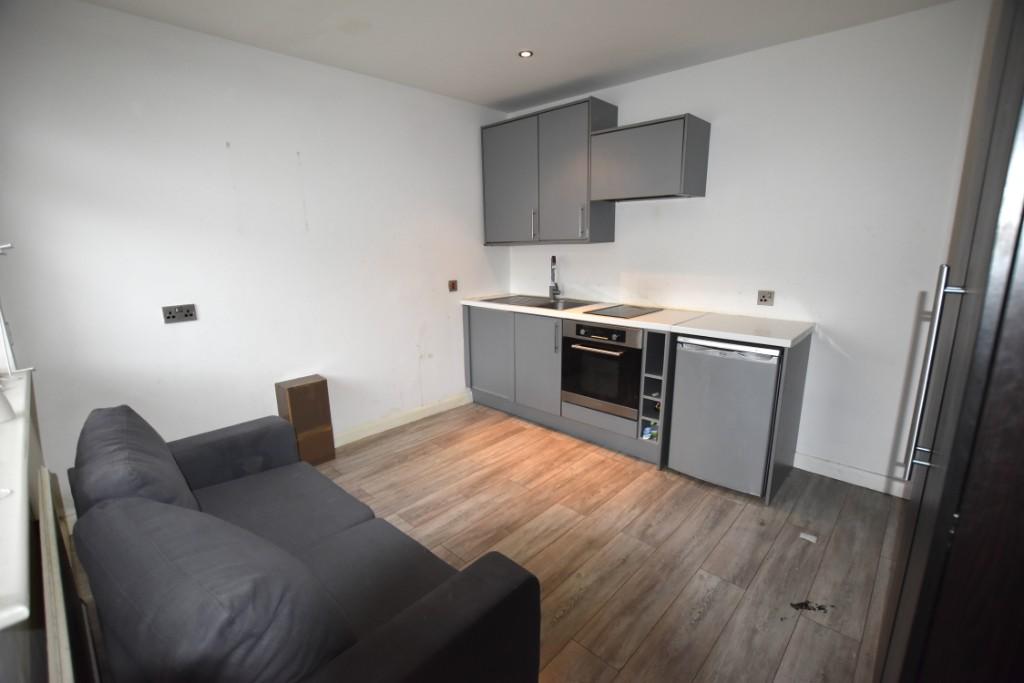
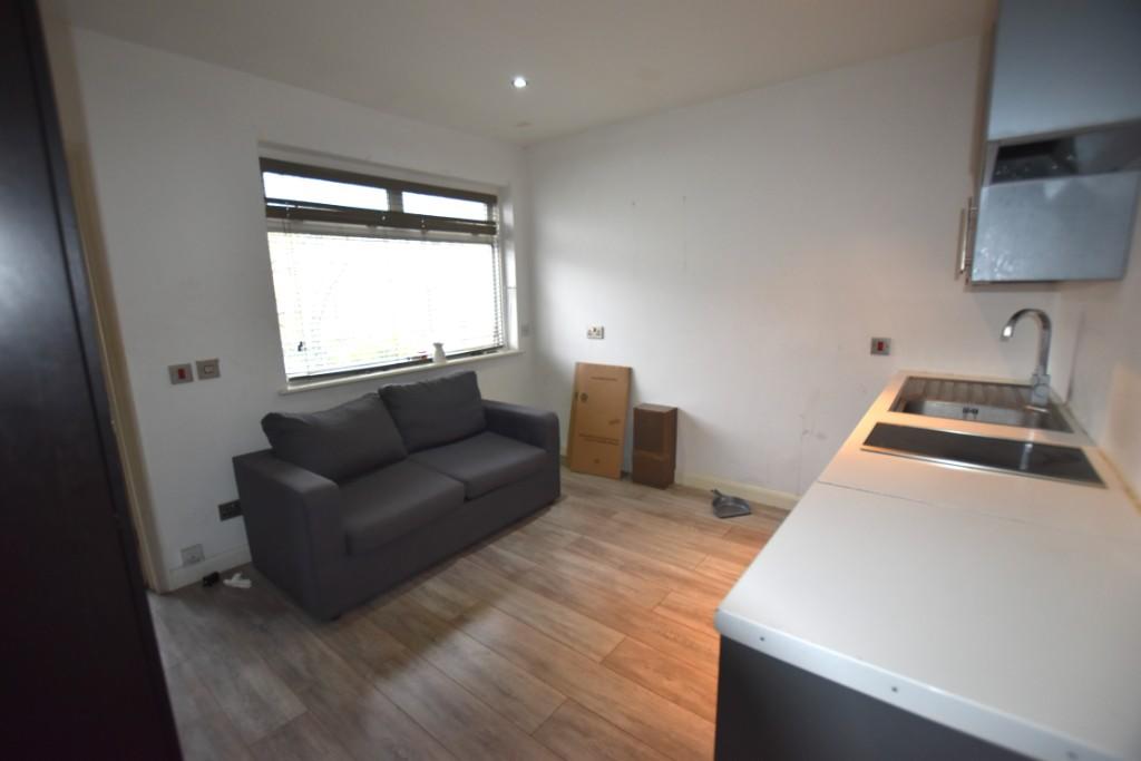
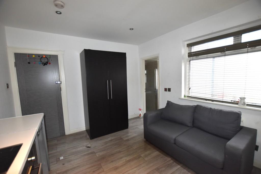
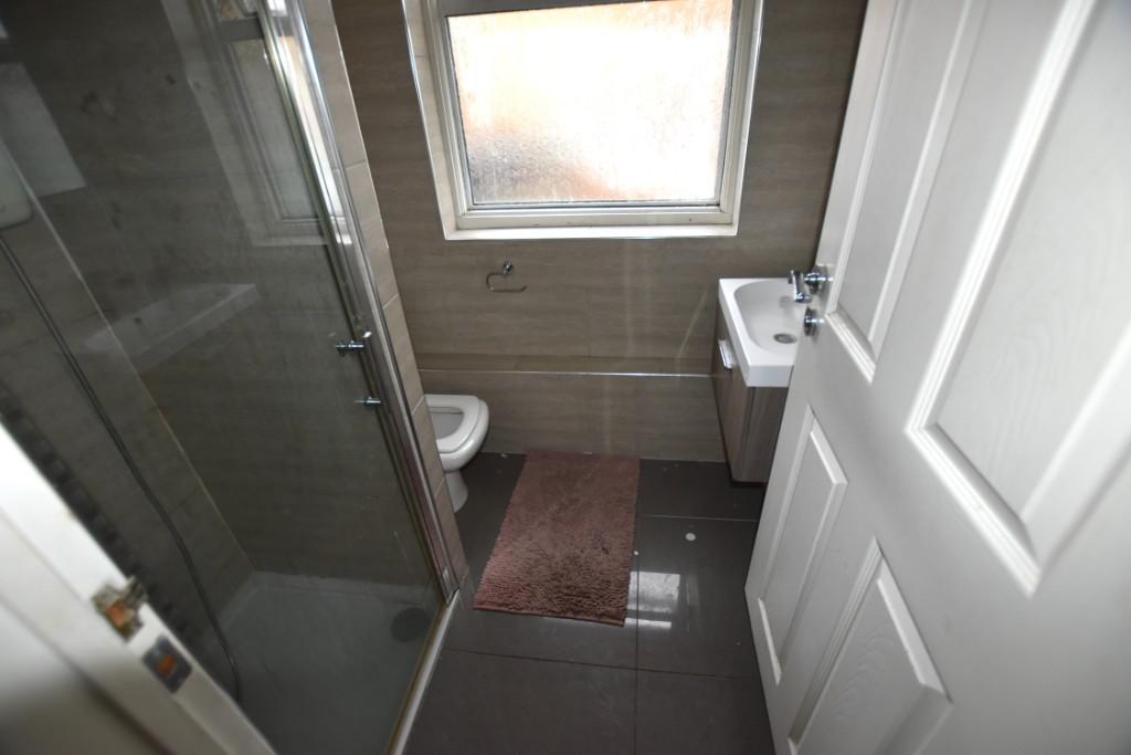
Photo 1 Photo 2 Photo 3 Photo 4
/ 4
Property details
Floor area
14 m²
Year built
England and Wales: 1900-1929
Deprivation
Decile 2 (5,515 of 33,755)
Street crime
728 incidents within 1 mile (Apr 2026)
Key features
- ALL BILLS & WIFI INCLUDED
- AVAILABLE NOW
Description
The Studio comprises of a living space, fitted kitchen with all mod cons inc washing machine and a large fully tiled shower room.
Birkbeck Road is located moments from Churchfield Road with its array of coffee shops and amenities. Both Acton Central station (Overground) and Acton Town (District and Piccadilly line) are within a few minutes walking distance.
ALL BILLS & WIFI INCLUDED. AVAILABLE NOW!
Listed by
London
MJ Estates Ltd
Reference: 90664904
EPC Rating & Upgrade Cost
Fetching EPC data… Refresh this page in a moment.
Flood risk
Zone: 1
Risk: Low
Job (default Low)
Rental Range
Estimated market rent for Ealing. Low = conservative, Realistic = average, Optimistic = best case.
Based on Local Authority from postcode lookup → Ealing.
LHA (30th percentile) floor for Bedford: Apr 2025 – Mar 2026
Location
Nearby
Nearest stations, universities and amenities (distance from property).
| Type | Name | Distance |
|---|---|---|
| Shop | Paint | 0.0 miles |
| Shop | Cloudy Vape | 0.0 miles |
| Train station | Acton Central | 0.1 miles |
| Bus stop | Acton Central Station | 0.1 miles |
| Train station | Acton Main Line | 0.6 miles |
| University | Richmond American University London | 1.1 miles |
| University | Scale Space White City | 1.8 miles |
| Hospital | Bridge Lane Health Centre | 4.9 miles |
| Hospital | The Portland Hospital | 5.3 miles |
Street-level crime
| Category | Count |
|---|---|
| Anti-social behaviour | 195 |
| Violence and sexual offences | 185 |
| Vehicle crime | 78 |
| Shoplifting | 57 |
| Public order | 56 |
| Other theft | 46 |
| Criminal damage and arson | 30 |
| Drugs | 21 |
| Burglary | 18 |
| Robbery | 12 |
| Bicycle theft | 11 |
| Possession of weapons | 8 |
| Theft from the person | 7 |
| Other crime | 4 |
| Total incidents | 728 |
Within 1 mile during Apr 2026. Source: data.police.uk (England & Wales).
Schools nearby
Nearest open schools with Ofsted ratings (England). Closed schools are not shown. Data from Get Information about Schools and Ofsted.
| Name | Type | Distance | Ofsted |
|---|---|---|---|
| Ark Byron Primary Academy | Primary | 0.1 miles | Good — 11 Dec 2018 |
| Maples Nursery School and Children's Centre | Nursery | 0.1 miles | Requires improvement — 13 Jul 2023 |
| Derwentwater Primary School | Primary | 0.3 miles | Good — 24 Jul 2019 |
| Ark Priory Primary Academy | Primary | 0.3 miles | Outstanding — 9 Jul 2015 |
| Snowflake School | Other | 0.4 miles | Good — 11 Jul 2023 |
Rental Comparables
Residential lets from OpenRent and Rightmove for the area. Bedroom counts vary — use the Beds column to compare like-for-like lets. Student lets are excluded.
| Title | Rent | Beds | Distance | As seen on |
|---|---|---|---|---|
| 1 Bed Flat, Churchfield Road, W3 | £1,750/mo | 1 | 0.07 miles | OpenRent |
| 1 Bed Flat, High Street, W3 | £1,420/mo | 1 | 0.22 miles | OpenRent |
| 3 Bed Flat, Very Near Morrisons Supermarket Area, W3 | £2,750/mo | 3 | 0.29 miles | OpenRent |
| 1 Bed Flat, Church Road, W3 | £2,100/mo | 1 | 0.32 miles | OpenRent |
| 2 Bed Flat, Coopers Court, W3 | £2,000/mo | 2 | 0.35 miles | OpenRent |
| 1 Bed Flat, High Street, W3 | £1,650/mo | 1 | 0.4 miles | OpenRent |
| 1 Bed Flat, Very Near Morrisons Supermarket Area, W3 | £1,650/mo | 1 | 0.43 miles | OpenRent |
| 1 Bed Flat, Beechwood Grove, W3 | £1,850/mo | 1 | 0.46 miles | OpenRent |
| 3 Bed Flat, Messaline Avenue, W3 | £3,200/mo | 3 | 0.47 miles | OpenRent |
| 2 Bed Flat, Beechwood Grove, W3 | £2,300/mo | 2 | 0.48 miles | OpenRent |
| 3 Bed Flat, Essex Park Mews, W3 | £3,300/mo | 3 | 0.48 miles | OpenRent |
Average rent: £2,179/mo (11 listings)