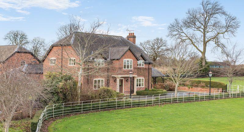
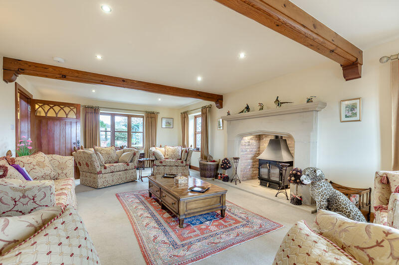
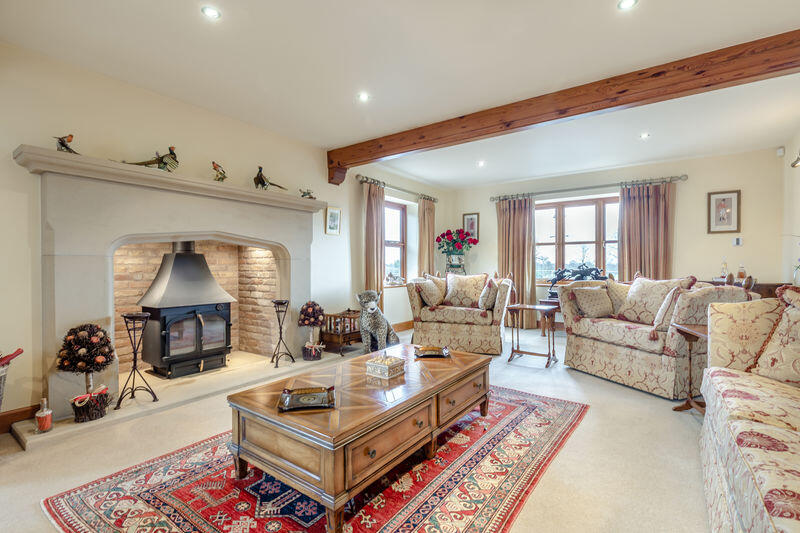
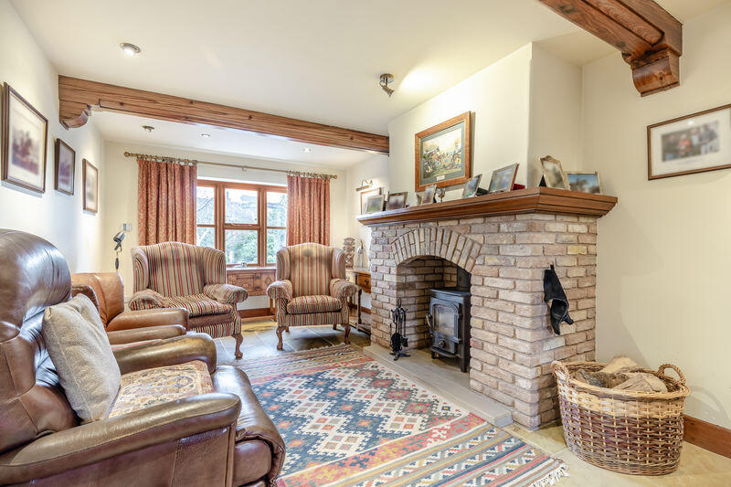
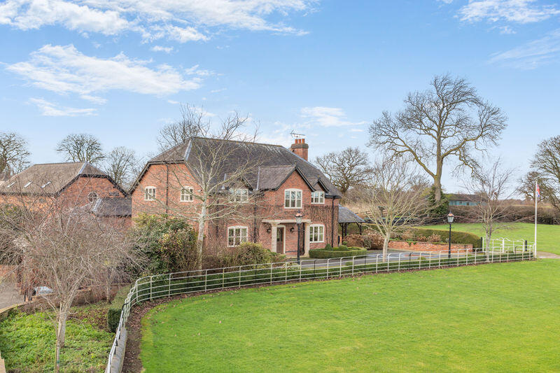
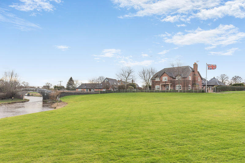
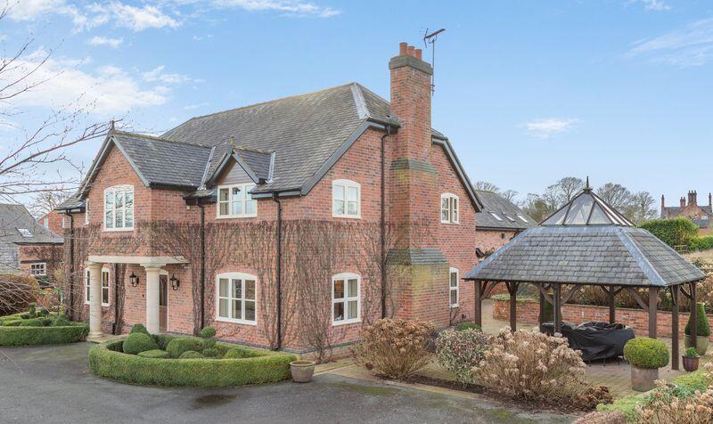
Detached Country House With Annexe & Equestrian Facilities Set In 4.5 Acres.
CW5 6BT

Property details
Council tax band
G
Local average
£303,844 (+212.7%)
Street crime
1 incident within 1 mile (May 2026)
Key features
- Occupational planning restrictions apply that state the owner/occupier of the property should run the premises as a Stud Farm.
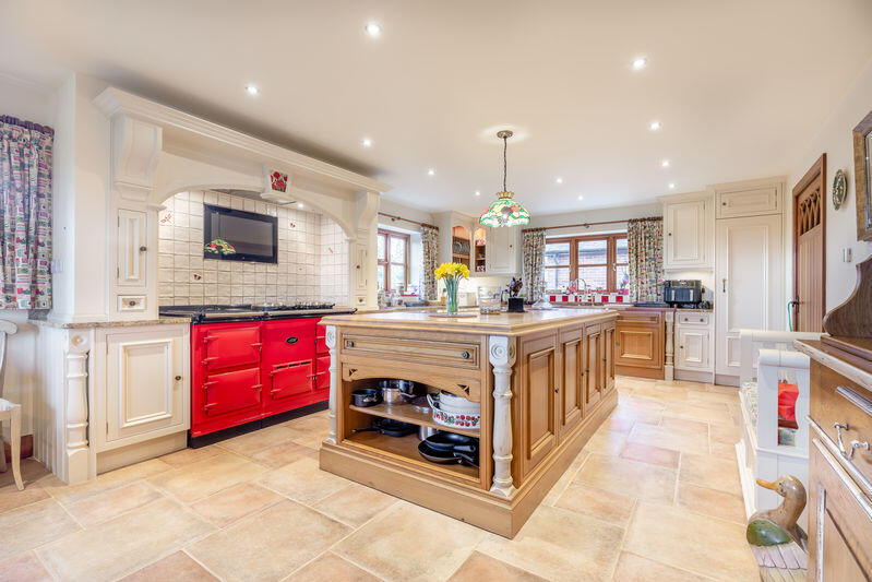
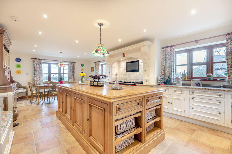
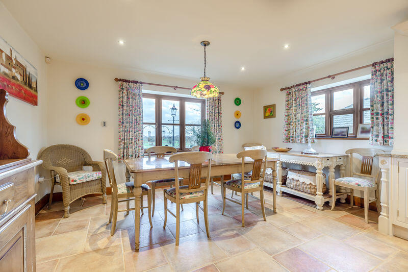
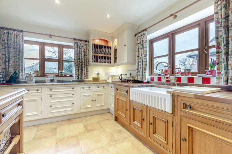
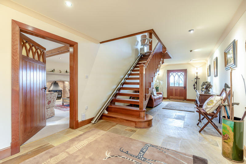
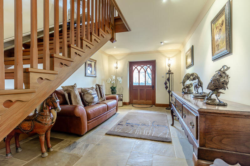
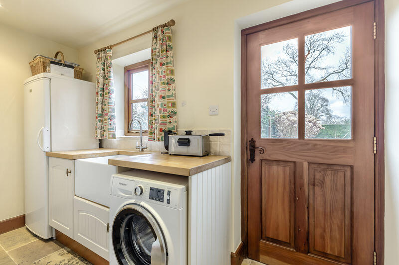
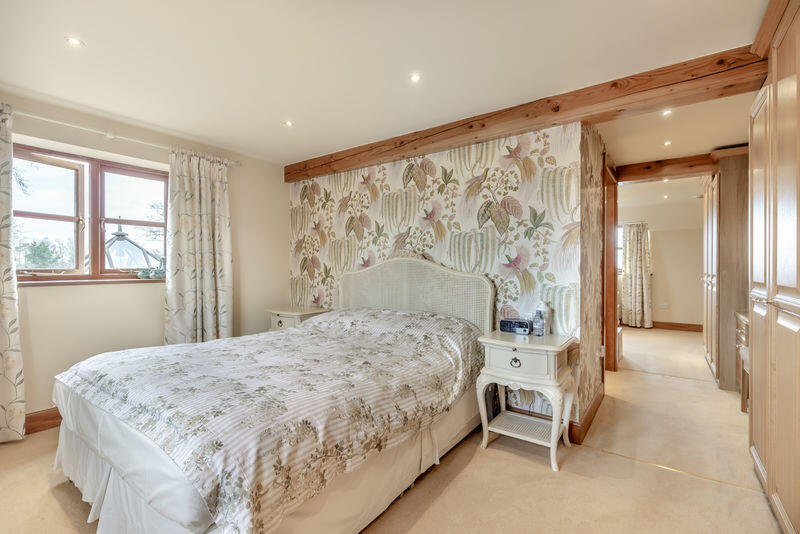
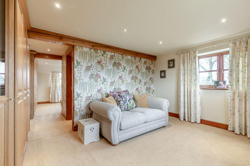
- Main House 2820sqft
- 1 Bedroom self-contained Guest / Staff accommodation
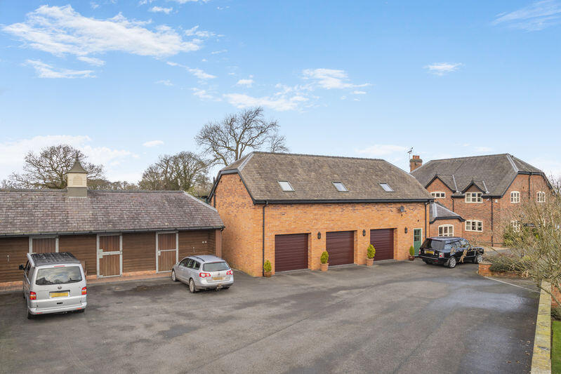
- 8 Monarch Stables
- Set within a total of 4.5 Acres.
- Nantwich 3 miles, Tarporley 6.5miles, Chester 16 miles, Crewe mainline Train Station 8 miles.
Additional details
- Parking
- Yes
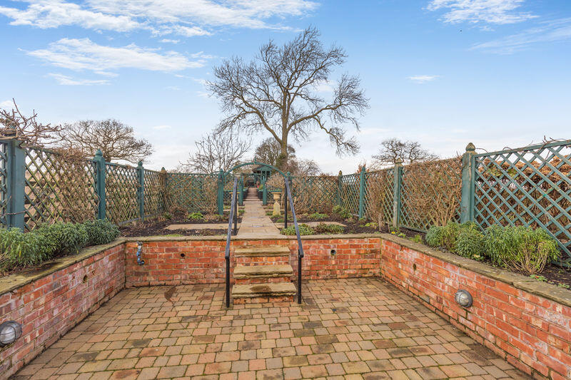
- Garden
- Yes
Description
Listed by
Tarporley
Cheshire Lamont
Reference: 171731351
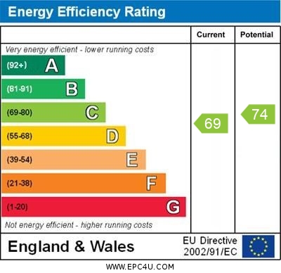
EPC ratings on this postcode
We don't have a matched EPC for this property yet. Below are efficiency scores and details for other addresses on this postcode.
| Address | Current | Potential | Floor area | Age band | Type |
|---|---|---|---|---|---|
| 1 Stoke Grange Barns, Chester Road, Stoke | 70 | 79 | 136 m² | England and Wales: 1983-1990 | House |
| 1 Stoke Grange Barns, Chester Road, Stoke, NANTWICH | 70 | 79 | 136 m² | England and Wales: 1983-1990 | Detached |
| 1 Stoke Manor Flats, Chester Road, Stoke | 59 | 84 | 155 m² | England and Wales: before 1900 | Flat |
| 1 Stoke Manor Flats, Chester Road, Stoke, NANTWICH | 59 | 84 | 155 m² | England and Wales: before 1900 | Flat |
| 2 Stoke Grange Barns, Chester Road, Stoke | 58 | 86 | 58 m² | England and Wales: 1996-2002 | House |
| 2 Stoke Grange Barns, Chester Road, Stoke, NANTWICH | 58 | 86 | 58 m² | England and Wales: 1996-2002 | Terraced |
| 2 Stoke Manor Flats, Chester Road, Stoke | 30 | 73 | 112 m² | England and Wales: before 1900 | Flat |
| 2 Stoke Manor Flats, Chester Road, Stoke, NANTWICH | 30 | 73 | 112 m² | England and Wales: before 1900 | Flat |
| 3 Stoke Grange Barns, Chester Road, Stoke | 53 | 75 | 61 m² | England and Wales: 1983-1990 | House |
| 3 Stoke Grange Barns, Chester Road, Stoke, NANTWICH | 53 | 75 | 61 m² | England and Wales: 1983-1990 | Terraced |
| 3 Stoke Grange Mews, Chester Road, Stoke Grange Farm | 25 | 28 | 34 m² | England and Wales: 1930-1949 | House |
| 5 Stoke Manor Flats, Chester Road, Stoke | 36 | 41 | 169 m² | England and Wales: before 1900 | Flat |
| 5 Stoke Manor Flats, Chester Road, Stoke | 16 | 43 | 175 m² | England and Wales: 1900-1929 | Flat |
| 5 Stoke Manor Flats, Chester Road, Stoke, NANTWICH | 16 | 43 | 175 m² | England and Wales: 1900-1929 | Flat |
| 5 Stoke Manor Flats, Chester Road, Stoke, NANTWICH | 36 | 41 | 169 m² | England and Wales: before 1900 | Flat |
Flood risk
Zone: 1
Risk: Low
Job (default Low)
Floorplans
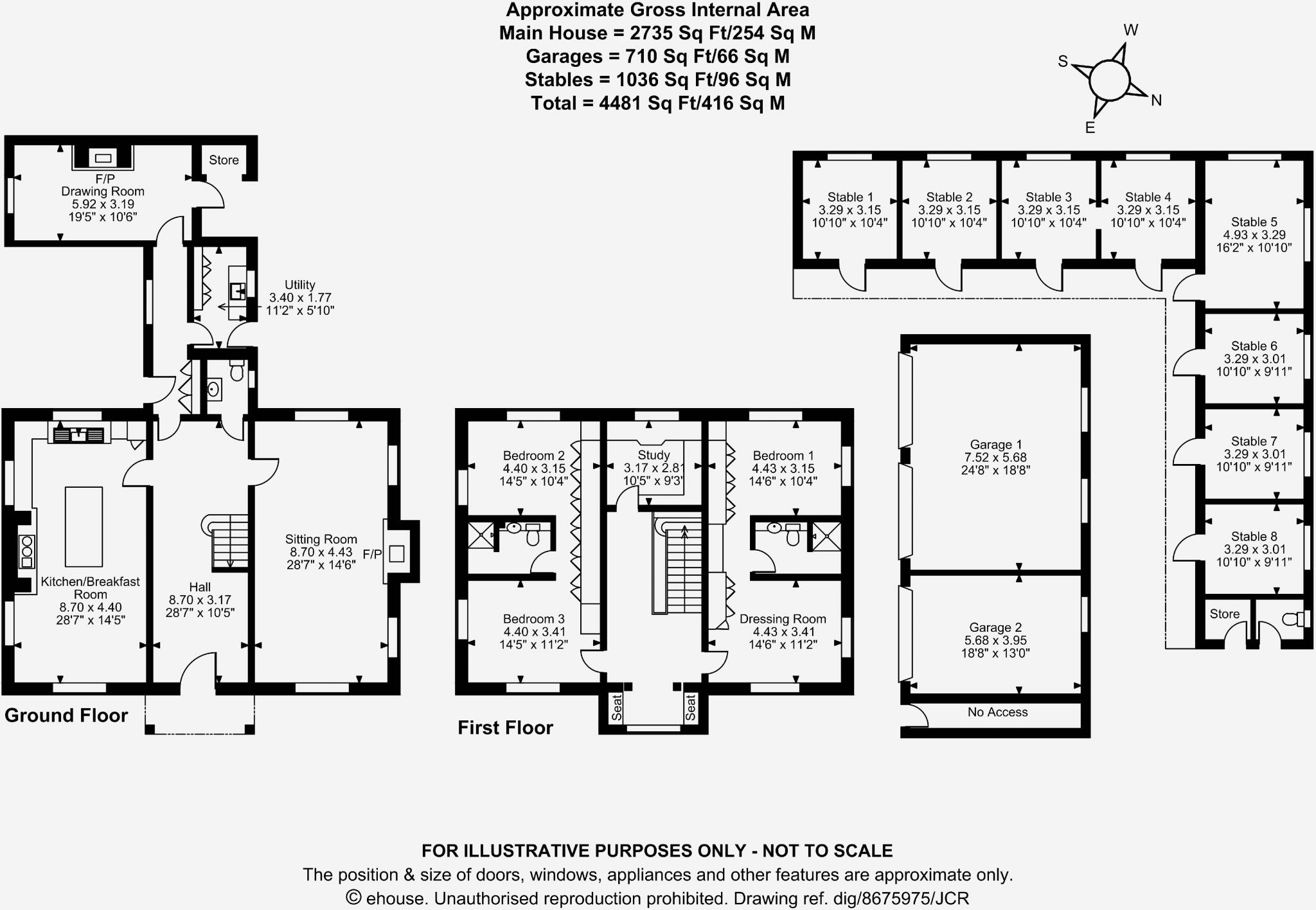
Floorplan 1
EPC Graphs
EPC

EPC Certificate
Price history
| Event | Date | Price | % change |
|---|---|---|---|
| Listed for sale | — | £950,000 | — |
Source: HM Land Registry Price Paid Data. Crown copyright.
Sold Comparables
Same street and nearby sales within 0.25 miles (last 5 years). Data from Land Registry Price Paid.
| Address | Price | Date | Type |
|---|---|---|---|
| STOKE GRANGE FARM CHESTER ROAD, STOKE, NANTWICH, CHESHIRE EAST, CW5 6BT | £725,000 | 06/08/2021 | Other |
Area average: £725,000 (1 sale)
Capital growth trend
Land Registry outcode average: last 12 months vs 5y and 10y ago (from sold prices).
House Price Index (HM Land Registry — official index, not sold-price averages): Cheshire East. Series: All dwelling types. As of April 2026.
Rental Range
Estimated market rent for Cheshire East. Low = conservative, Realistic = average, Optimistic = best case.
Based on Local Authority from postcode lookup → Cheshire East.
LHA (30th percentile) floor for Bolton and Bury: £947/mo (Apr 2025 – Mar 2026)
Location
Address
Old Chester Road
Nearby
Nearest stations, universities and amenities (distance from property).
| Type | Name | Distance |
|---|---|---|
| Bus stop | Stoke, Chester Road / Stoke Manor | 0.1 miles |
| Shop | Blackberry Farm, Farm Shop | 0.6 miles |
| Shop | Snugburys | 0.8 miles |
| Train station | Nantwich | 3.2 miles |
| Hospital | Leighton Hospital | 4.1 miles |
| Train station | Wrenbury | 5.6 miles |
| Hospital | Tarporley War Memorial Hospital | 5.8 miles |
| University | University of Buckingham Crewe Campus | 6.2 miles |
Street-level crime
| Category | Count |
|---|---|
| Violence and sexual offences | 1 |
| Total incidents | 1 |
Within 1 mile during May 2026. Source: data.police.uk (England & Wales).
Schools nearby
Nearest open schools with Ofsted ratings (England). Closed schools are not shown. Data from Get Information about Schools and Ofsted.
| Name | Type | Distance | Ofsted |
|---|---|---|---|
| Acton Church of England Primary Academy | Primary | 1.8 miles | Good — 22 Nov 2023 |
| Calveley Primary Academy | Primary | 2.0 miles | Good — 22 Jul 2019 |
| Reaseheath College | Other | 2.1 miles | — (No rating) |
| St Oswald's Worleston CofE Primary School | Primary | 2.1 miles | Good — 11 Jul 2023 |
| Malbank School and Sixth Form College | Secondary | 2.5 miles | Good — 21 Sep 2022 |
Rental Comparables
Loading rental comparables for this postcode. Refresh in a few minutes.
Rent-driven metrics
Based on Area rent estimate.
- Rent ratio — Monthly rent ÷ purchase price (1% rule). 1%+ = strong, 0.8–1% = okay, <0.8% = weak for cashflow.
- Max investor price — Rent ÷ 0.8%; the price at which rent would be 0.8% of price (Stoke-style target).
- Target investor price — Rent ÷ 1%; the price at which rent would be 1% of price (strong cashflow band).
- Gross yield — Annual rent as % of purchase price (no costs).
Enter House Number
Enter the house number to help us retrieve more accurate pricing history and property data.
Please log in to submit or correct the house number for this listing.
Log in to continue