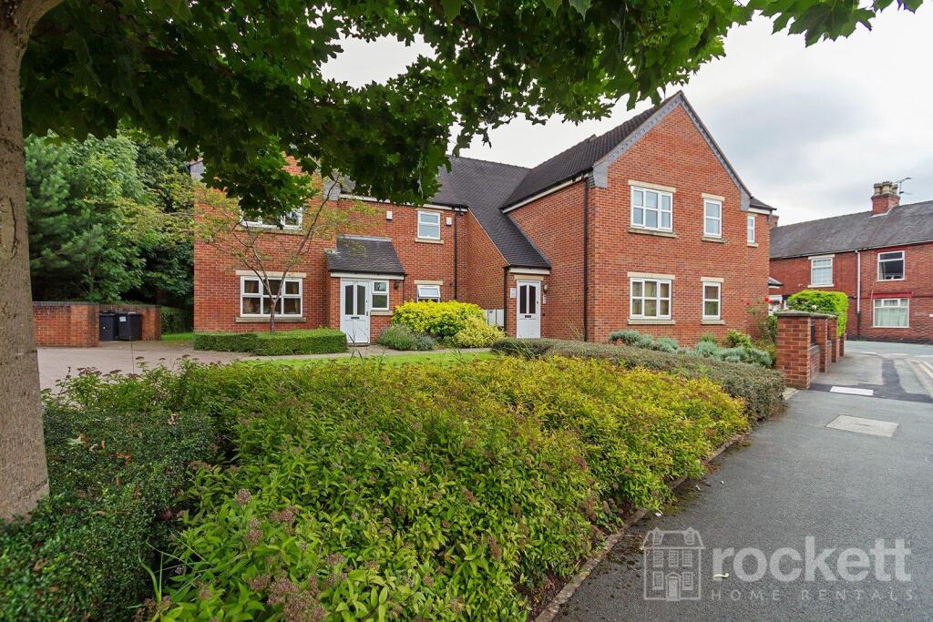
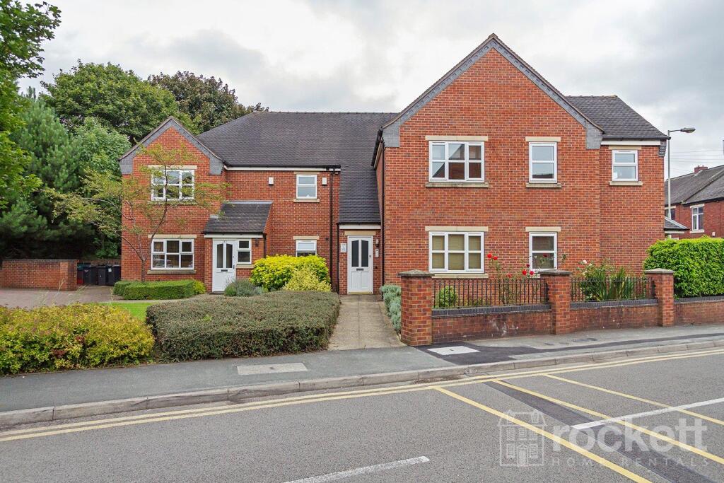
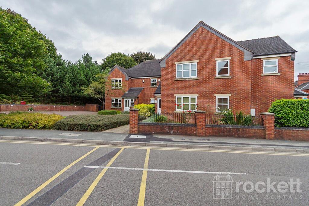
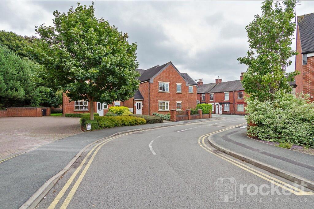
The Mill
Enderley Street, Newcastle Under Lyme, Staffordshire, ST5, ST5 2AN
£1,295 pcm
Picture 1 Picture 2 Picture 3 Picture 4 Picture 5 Picture 6 Picture 7 Picture 8 Picture 9 Picture 10 Picture 11 Picture 12 Picture 13 Picture 14 Picture 15 Picture 16 Picture 17 Picture 18 Picture 19 Picture 20 Picture 21 Picture 22 Picture 23 Picture 24 Picture 25 Picture 26 Picture 27 Picture 28 Picture 29
/ 29
Property details
Council tax band
B
Deprivation
Decile 2 (4,637 of 33,755)
Street crime
335 incidents within 1 mile (Apr 2026)
Key features
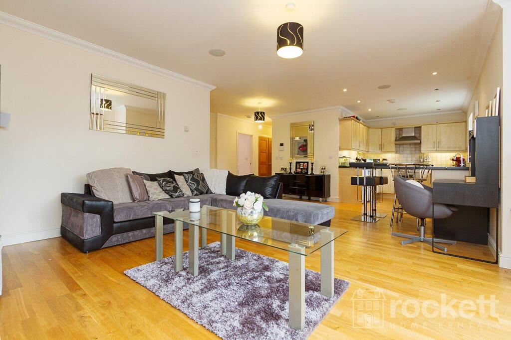
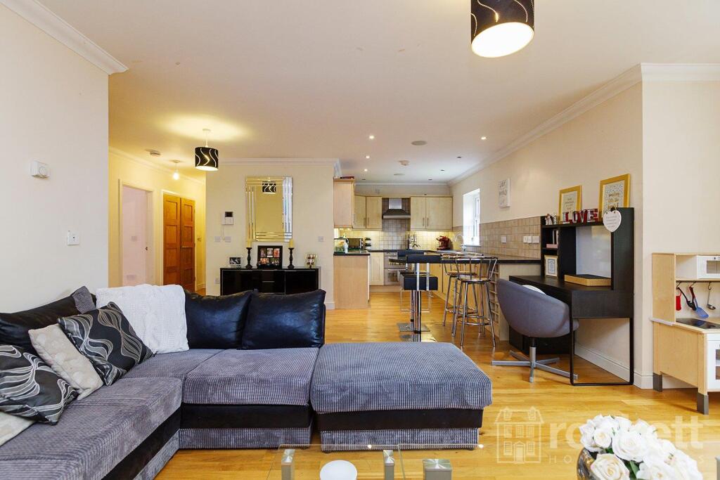
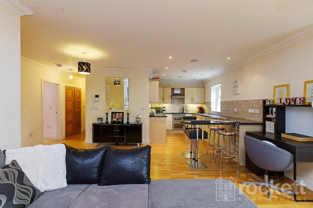
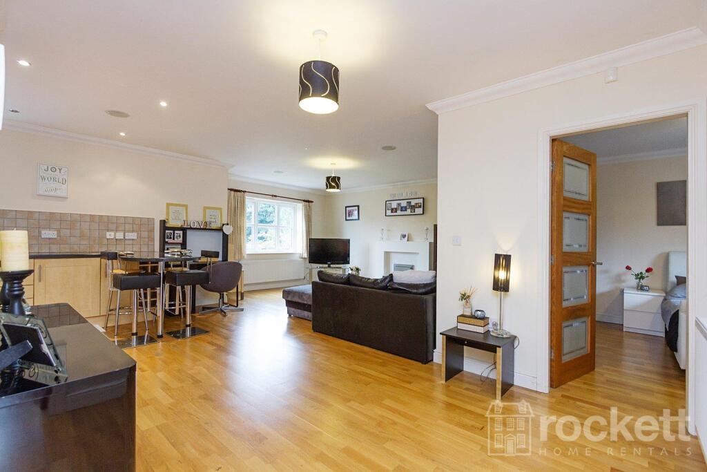
- 2 bed furnished penthouse
- 2 parking spaces
Additional details
- Parking
- Yes
Description
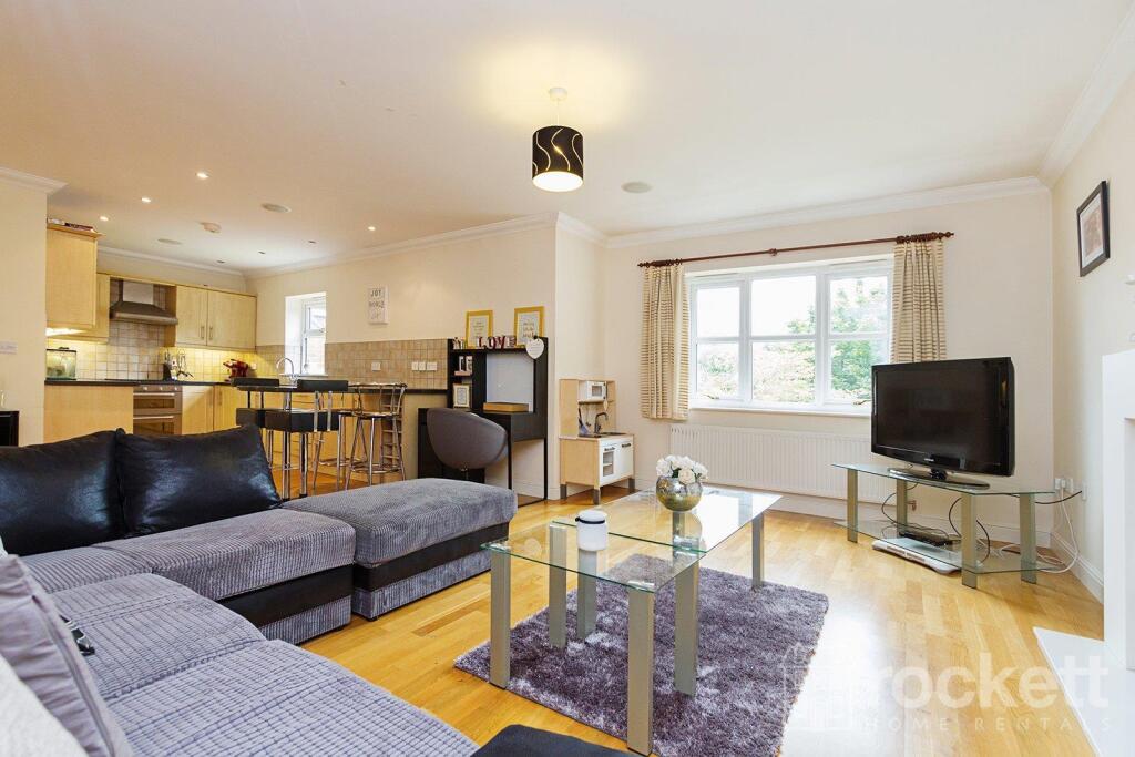
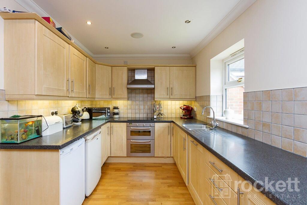
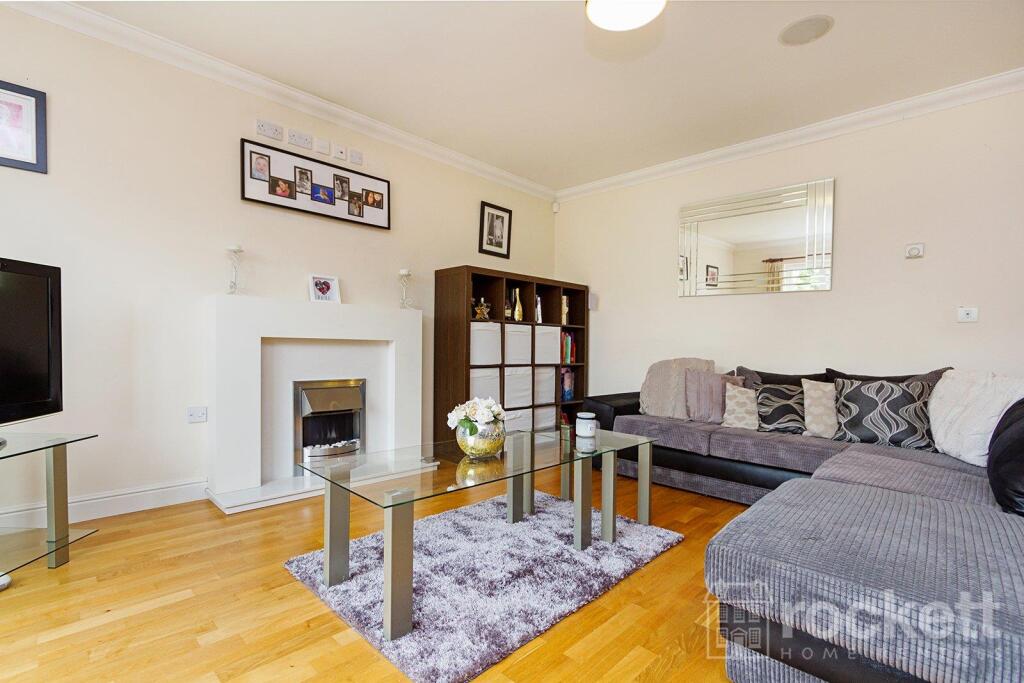
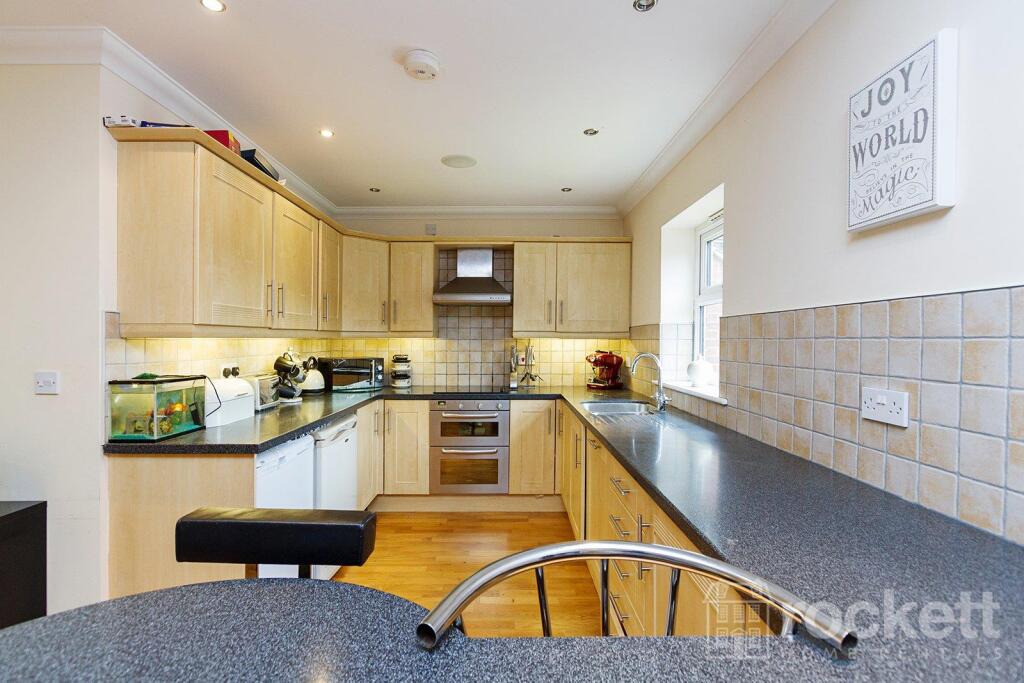
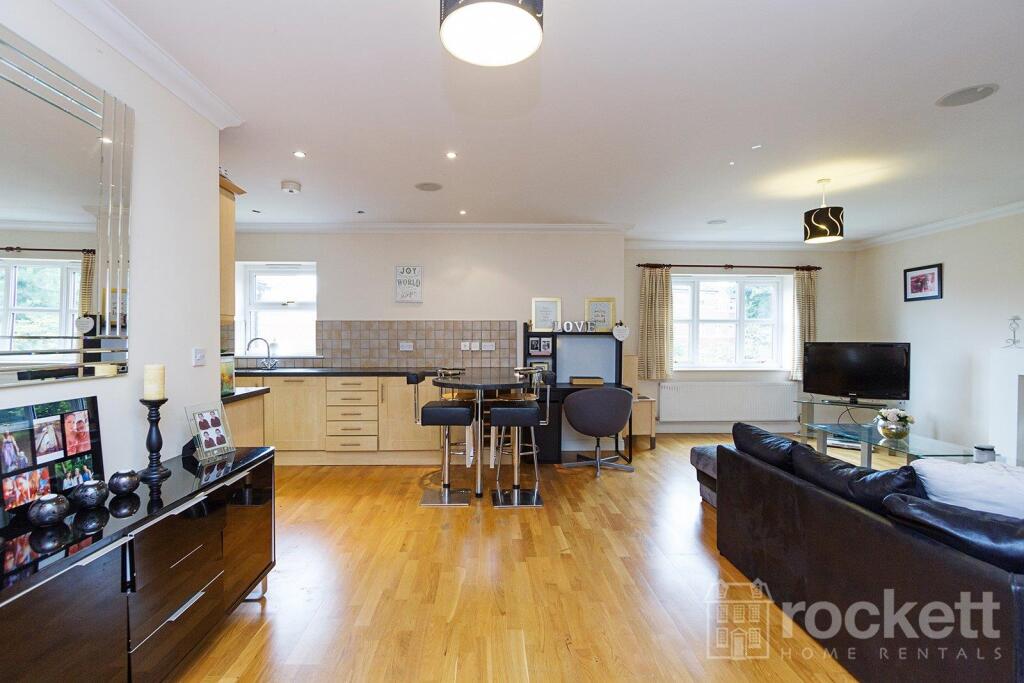
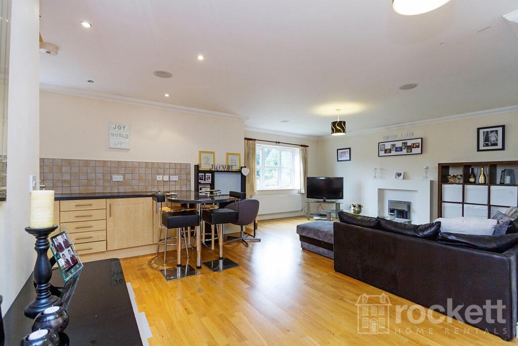
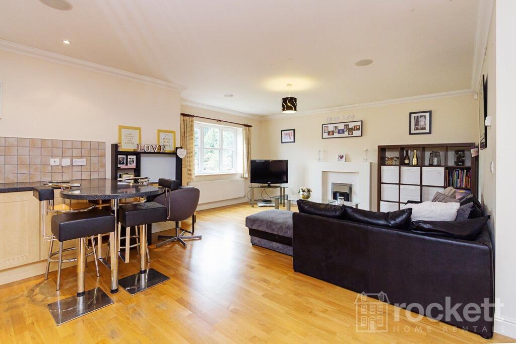
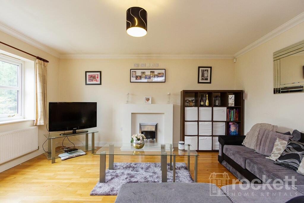
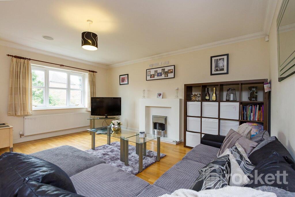
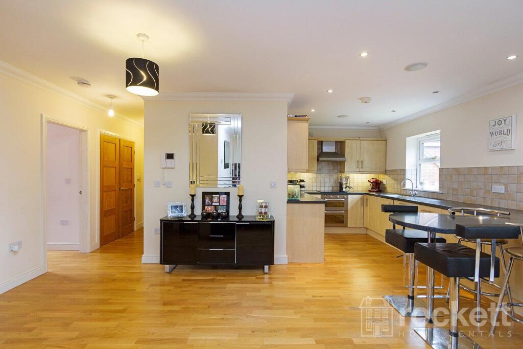
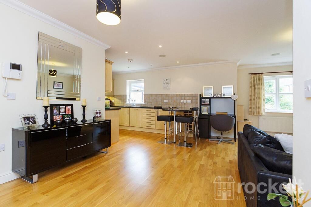
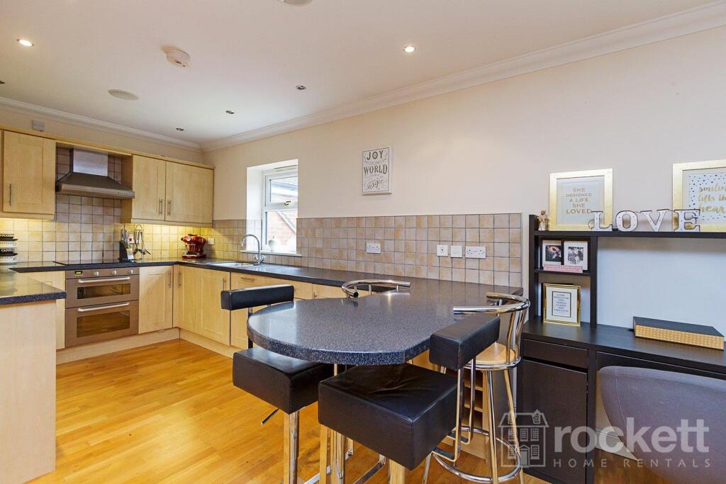
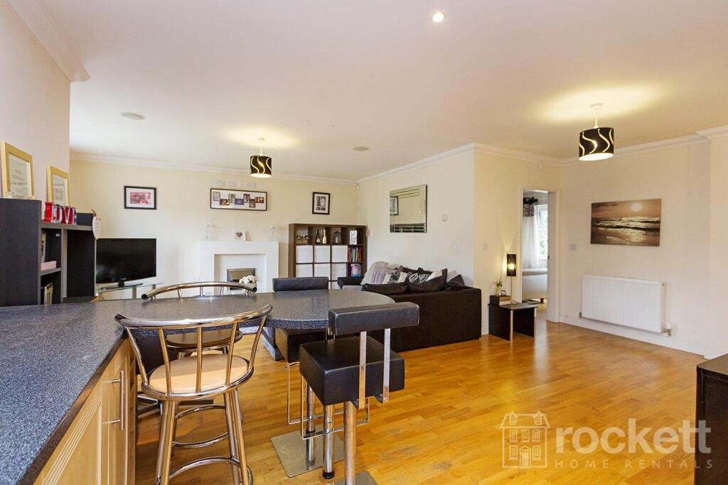
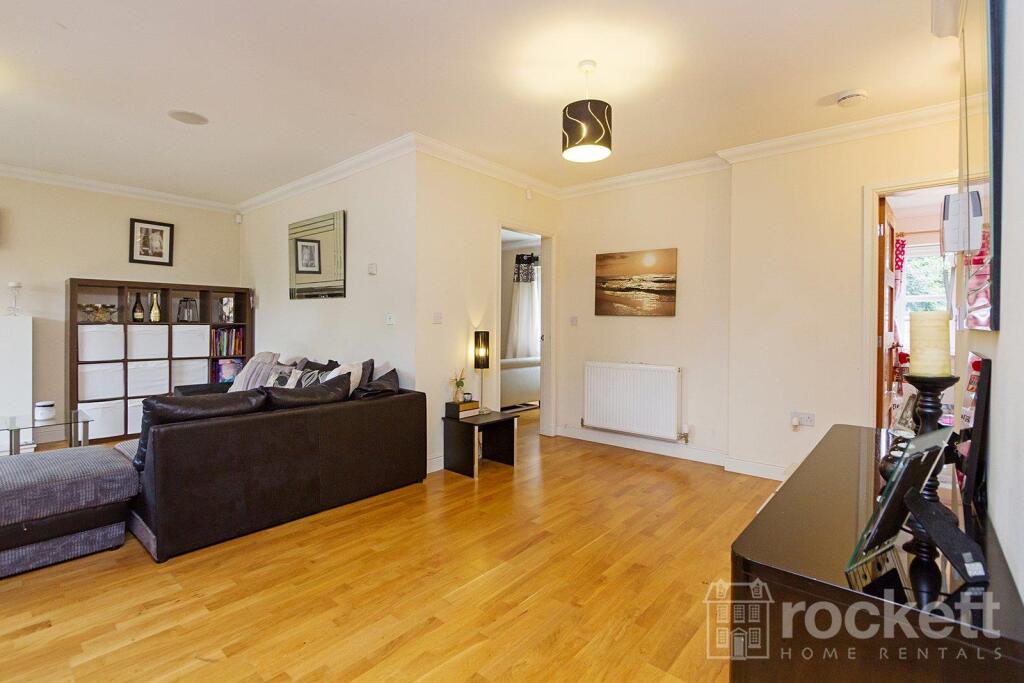
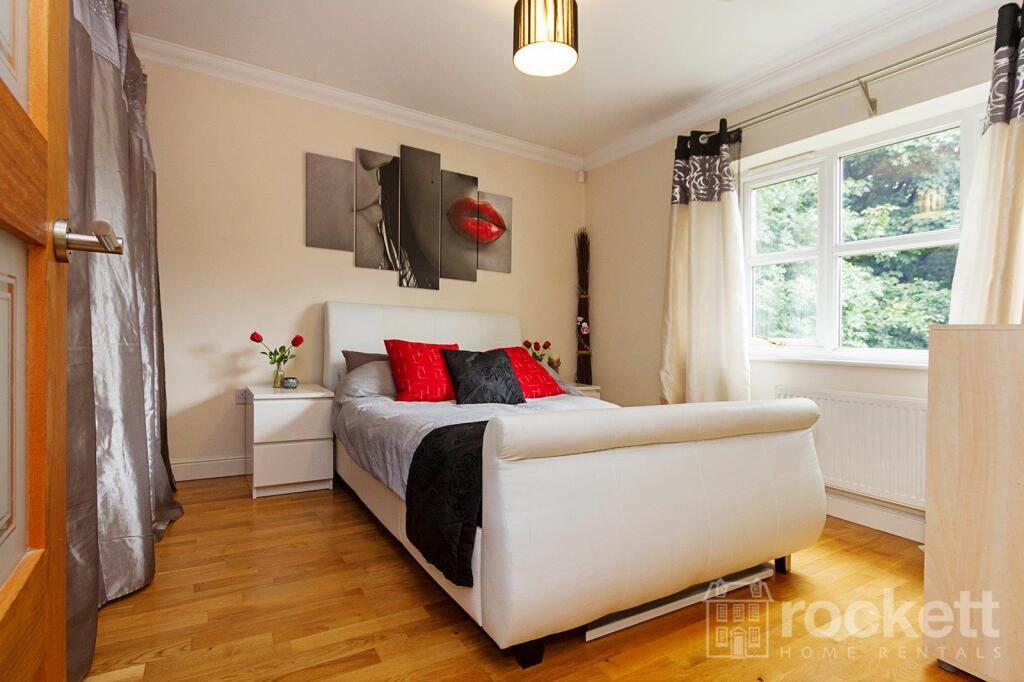
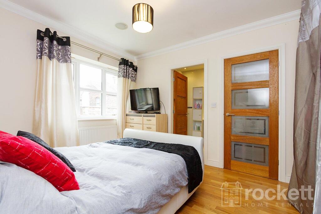
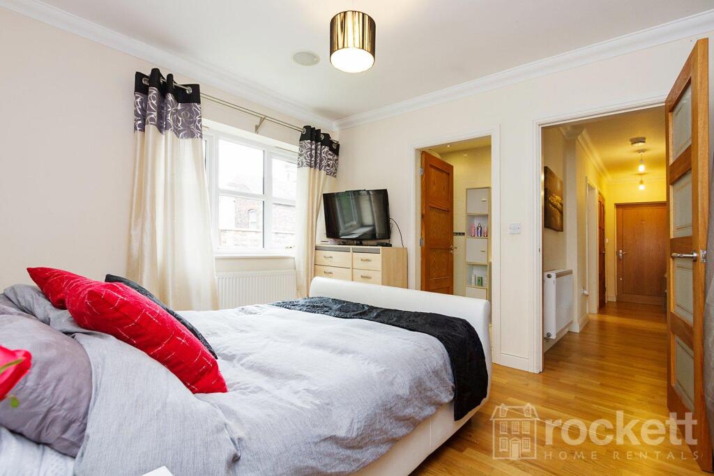
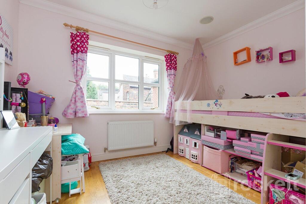
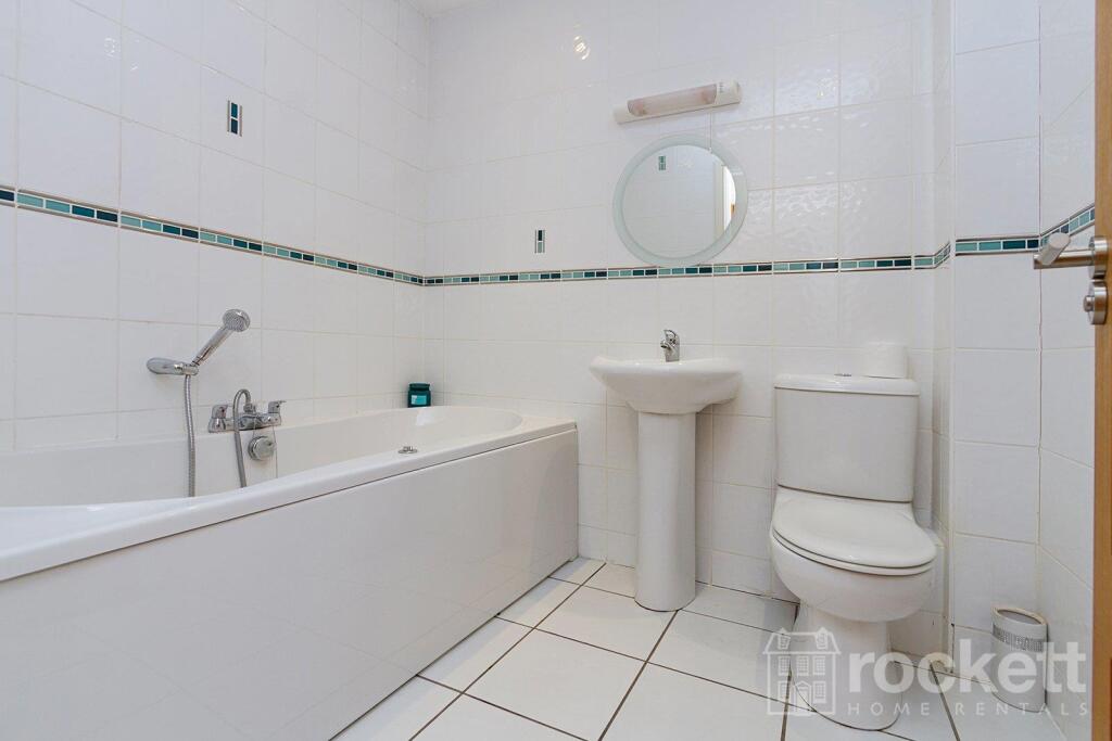
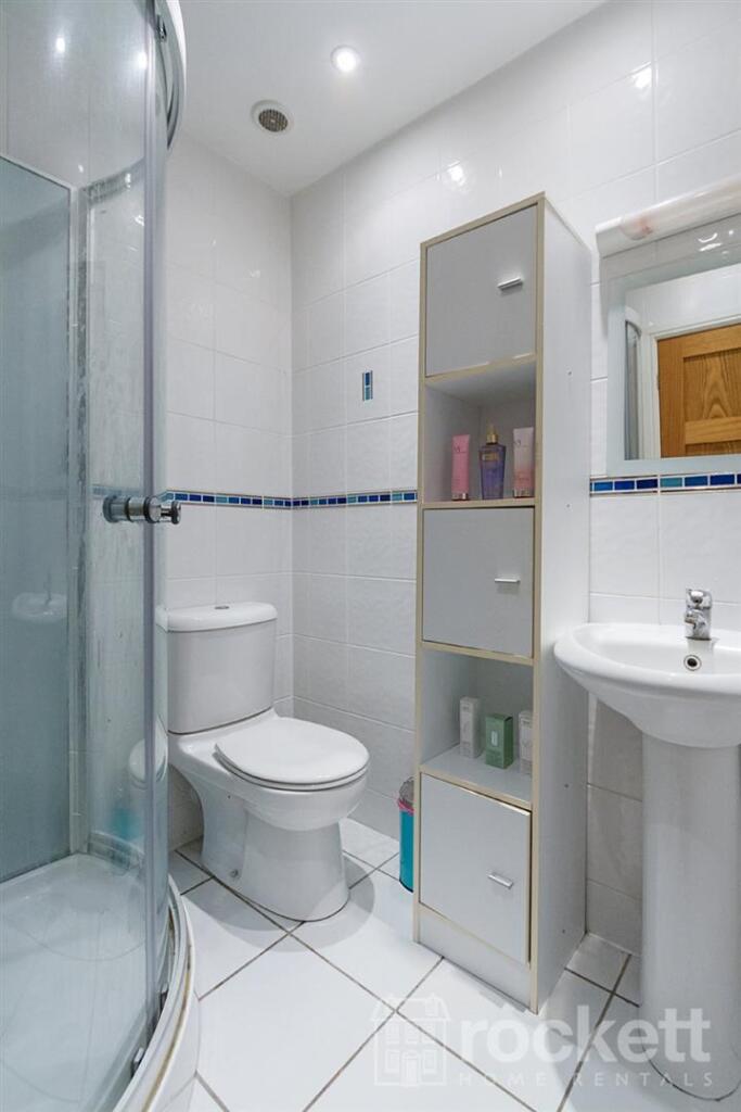
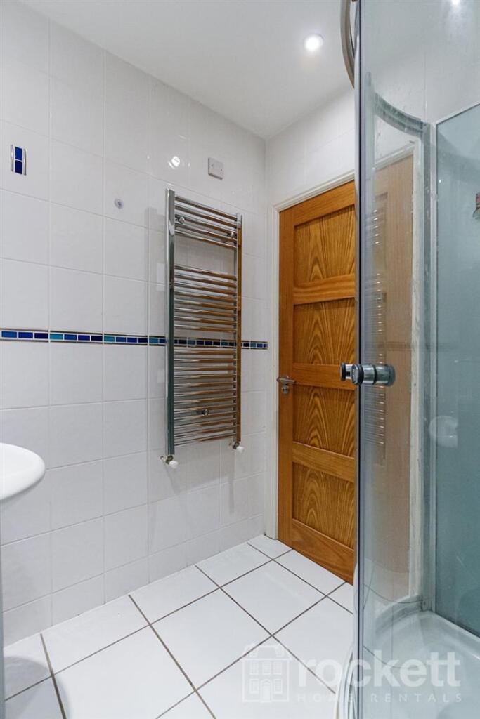
This is the largest apartment in the development and was the showpiece apartment. It has a fitted kitchen (including all appliances), with features such as soft close doors and drawers. There are two bedrooms, (one en-suite) and a family bathroom.
The apartment comes with two allocated parking spaces.
The Mill is just off the A34 giving access to the National Road Network and is conveniently placed for access to St Joseph`s College, Newcastle High School, Keele and Staffordshire Universities with both the Royal Infirmary and the City General hospital being within two miles of the site.
This property is managed by the landlord.
Please see our walkthrough video:
Pleaase also see our absolutely fabulous inspired commercial for this property:
We have created a brochure for you full of lots of information on the property:
ROC160026
Listed by
Wolstanton
Rockett Home Rentals Ltd
Reference: 89613228
EPC ratings on this postcode
We don't have a matched EPC for this property yet. Below are efficiency scores and details for other addresses on this postcode.
| Address | Current | Potential | Floor area | Age band | Type |
|---|---|---|---|---|---|
| 102 The Mill, Enderley Street, NEWCASTLE | 74 | 86 | 97 m² | England and Wales: 2003-2006 | Detached |
| 103 THE MILL, ENDERLEY STREET, NEWCASTLE | 74 | 85 | 108 m² | England and Wales: 2003-2006 | Terraced |
| 104 The Mill, Enderley Street, NEWCASTLE | 74 | 85 | 97 m² | England and Wales: 2003-2006 | Detached |
| 105 The Mill, Enderley Street, NEWCASTLE | 63 | 83 | 104 m² | England and Wales: 1996-2002 | Terraced |
| 105 The Mill, Enderley Street, NEWCASTLE | 77 | 89 | 98 m² | England and Wales: 2003-2006 | Terraced |
| 106 The Mill, Enderley Street, NEWCASTLE | 78 | 86 | 108 m² | England and Wales: 2003-2006 | Terraced |
| 109 The Mill, Enderley Street, NEWCASTLE | 80 | 80 | 66 m² | England and Wales: 2007-2011 | Flat |
| 110 The Mill, Enderley Street, NEWCASTLE | 78 | 79 | 56 m² | England and Wales: 2003-2006 | Flat |
| 111 The Mill, Enderley Street, NEWCASTLE | 78 | 78 | 60 m² | England and Wales: 1996-2002 | Flat |
| 111 The Mill, Enderley Street, NEWCASTLE | 80 | 80 | 65 m² | England and Wales: 2003-2006 | Flat |
| 113 The Mill, Enderley Street, NEWCASTLE | 79 | 79 | 58 m² | England and Wales: 2003-2006 | Flat |
| 115 The Mill, Enderley Street, NEWCASTLE | 75 | 76 | 56 m² | England and Wales: 2003-2006 | Flat |
| 118 The Mill, Enderley Street, NEWCASTLE | 80 | 80 | 64 m² | England and Wales: 2007-2011 | Flat |
| 118 The Mill, Enderley Street, NEWCASTLE | 76 | 77 | 64 m² | England and Wales: 2003-2006 | Flat |
| 119 The Mill, Enderley Street, NEWCASTLE | 78 | 79 | 62 m² | England and Wales: 2003-2006 | Flat |
Flood risk
Zone: 1
Risk: Low
Job (default Low)
EPC Graphs
EPC Rating Graph
Rental Range
Estimated market rent for Newcastle-under-Lyme. Low = conservative, Realistic = average, Optimistic = best case.
Based on Local Authority from postcode lookup → Newcastle-under-Lyme.
LHA (30th percentile) floor for Staffordshire North: £479/mo (Apr 2025 – Mar 2026)
Location
Address
The Mill
Nearby
Nearest stations, universities and amenities (distance from property).
| Type | Name | Distance |
|---|---|---|
| Bus stop | Heath Street | 0.0 miles |
| Bus stop | Wilson Street | 0.0 miles |
| Shop | Betd | 0.2 miles |
| Shop | Argos | 0.2 miles |
| Hospital | Royal Stoke University Hospital | 1.1 miles |
| Train station | Longport | 1.9 miles |
| Train station | Silverdale | 2.0 miles |
| Hospital | North Staffordshire Nuffield Hospital | 2.0 miles |
| University | Keele University | 2.1 miles |
| University | University of Buckingham Crewe Campus | 9.6 miles |
Street-level crime
| Category | Count |
|---|---|
| Violence and sexual offences | 98 |
| Anti-social behaviour | 74 |
| Public order | 33 |
| Shoplifting | 30 |
| Other theft | 22 |
| Criminal damage and arson | 19 |
| Burglary | 14 |
| Drugs | 13 |
| Vehicle crime | 12 |
| Other crime | 9 |
| Possession of weapons | 4 |
| Robbery | 4 |
| Theft from the person | 2 |
| Bicycle theft | 1 |
| Total incidents | 335 |
Within 1 mile during Apr 2026. Source: data.police.uk (England & Wales).
Schools nearby
Nearest open schools with Ofsted ratings (England). Closed schools are not shown. Data from Get Information about Schools and Ofsted.
| Name | Type | Distance | Ofsted |
|---|---|---|---|
| St John Fisher Catholic College | Secondary | 0.3 miles | Requires improvement — 5 Mar 2024 |
| St Mary's Catholic Primary School | Primary | 0.3 miles | Good — 17 Feb 2017 |
| Demetae Academy | Other | 0.4 miles | Good — 30 Jun 2022 |
| Newcastle and Stafford Colleges Group | Other | 0.4 miles | — (No rating) |
| Hassell Primary School | Primary | 0.4 miles | Good — 25 Oct 2023 |
Rental Comparables
Residential lets from OpenRent and Rightmove for the area (same bedroom count). Use to validate rent estimates. Student lets are excluded.
Average rent: £842/mo (54 listings)
Enter House Number
Enter the house number to help us retrieve more accurate pricing history and property data.
Please log in to submit or correct the house number for this listing.
Log in to continue