2 bedroom Terraced House in Lower Milehouse Lane
Newcastle-Under-Lyme, ST5 9AN
£800 pcm
Property details
Deprivation
Decile 2 (6,554 of 33,755)
Street crime
231 incidents within 1 mile (Apr 2026)
Key features
- AVAILABLE NOW!
- OFF ROAD PARKING SPACE
- WHITE GOODS INCLUDED
- ENCLOSED GARDEN
- PETS CONSIDERED
Additional details
- Parking
- Yes
- Garden
- Yes
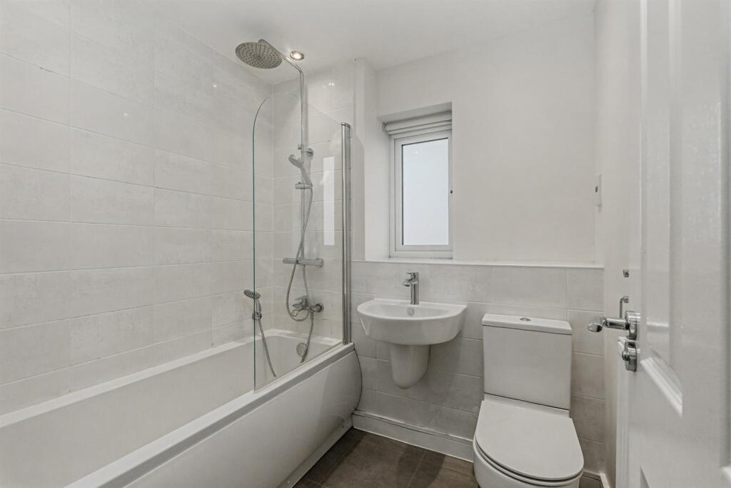
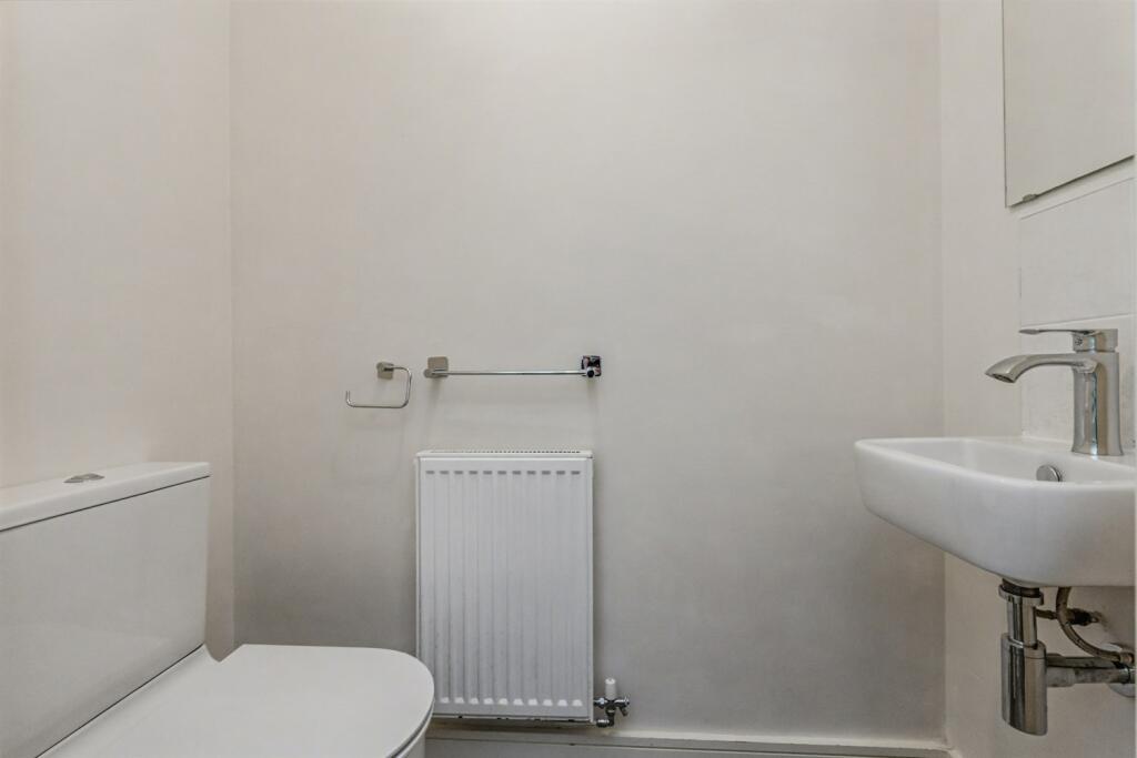
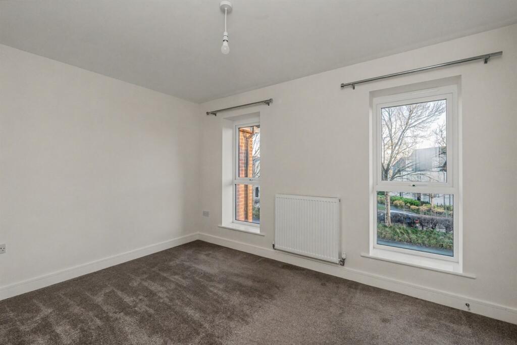
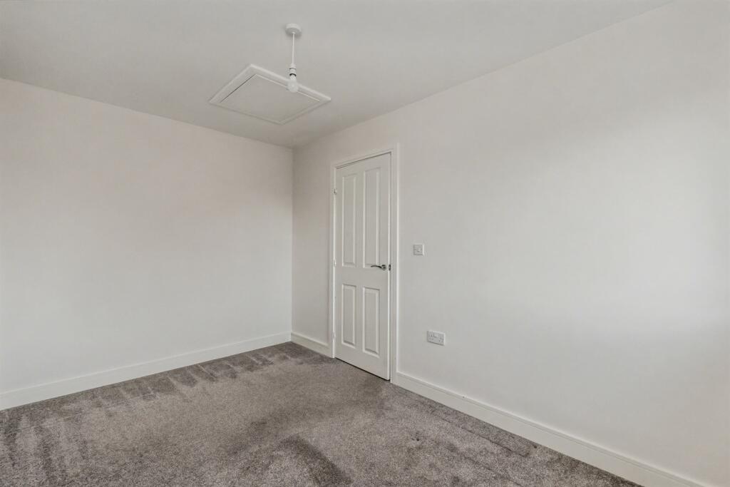
Description
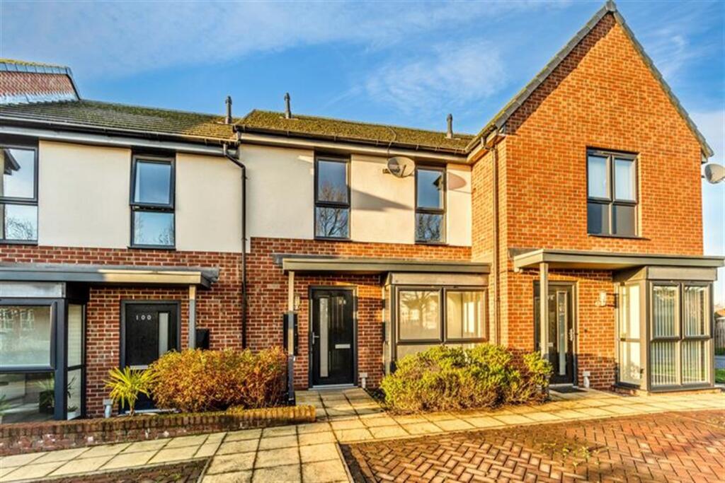
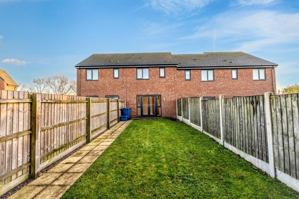
Lomond are delighted to offer this two-bedroom modern terrace house in the popular Paddocks estate on the outskirts of Newcastle.
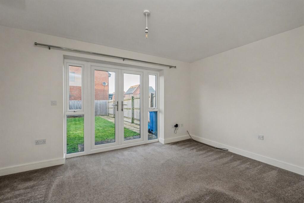
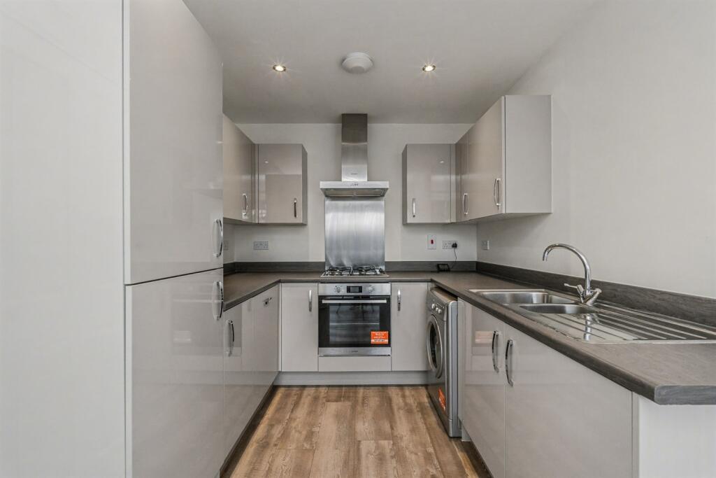
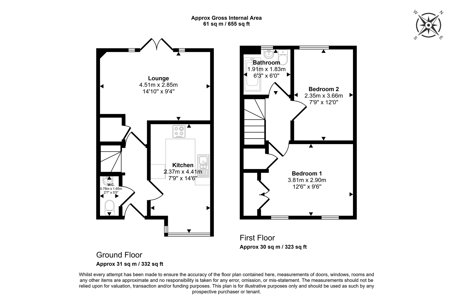
Comprising of entrance hall , downstairs w/c & modern kitchen with White good included and then the lounge with French doors open onto the lawned rear garden.
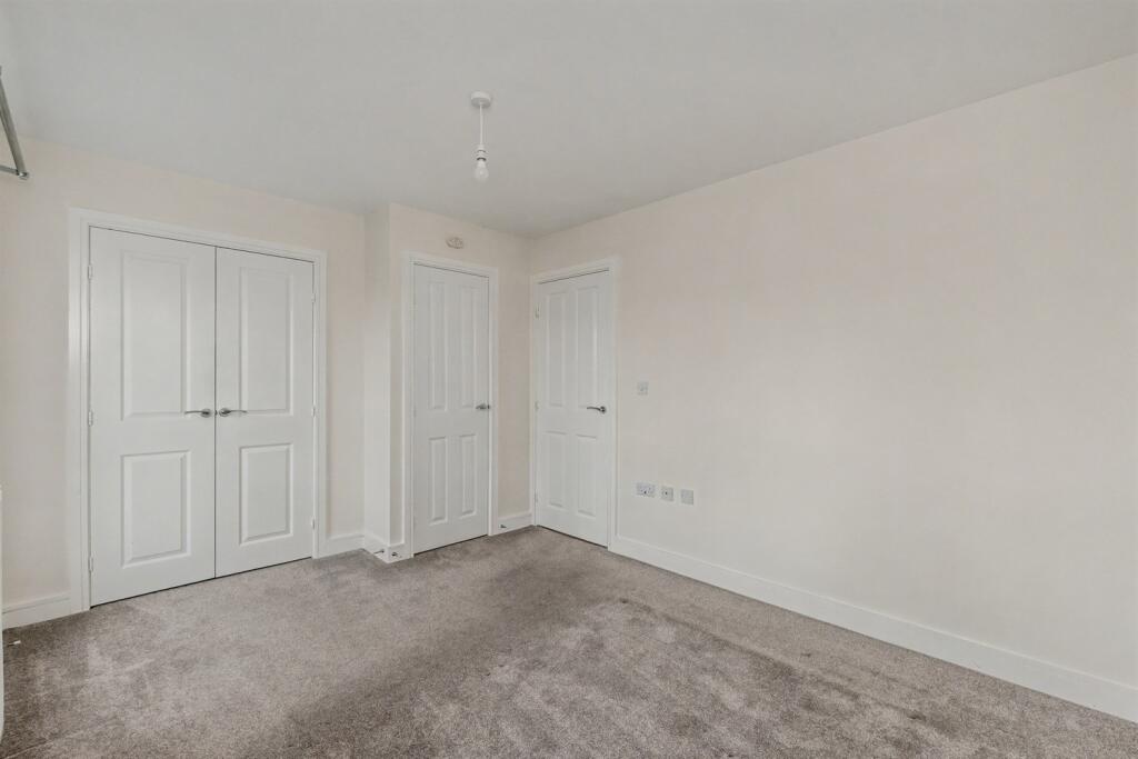
Leading upstairs to the first floor are two double bedrooms and family bathroom.
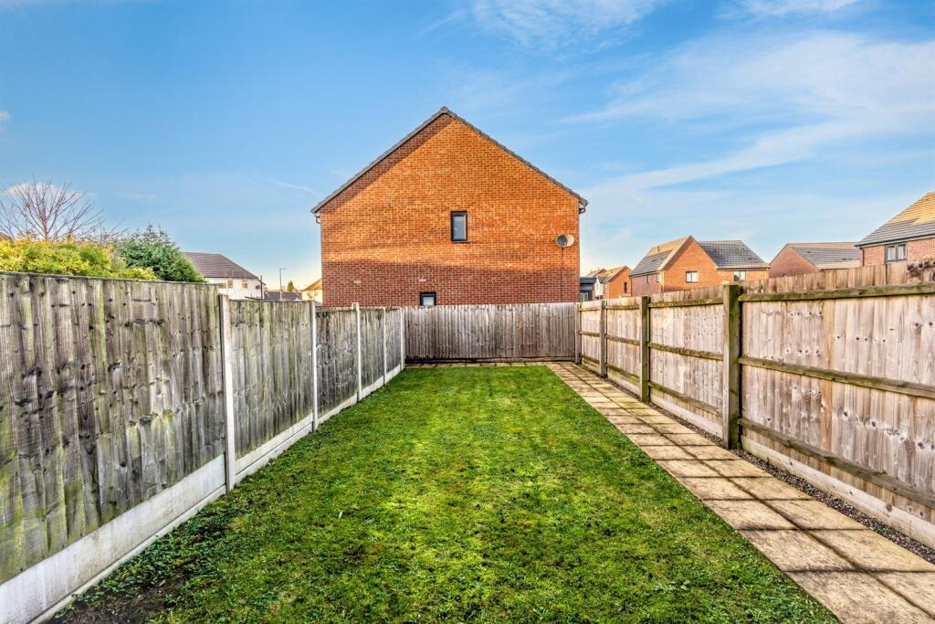
The rear garden offers a low maintenance outdoor space perfect for enjoying the sunshine or relaxing with family. To the front there's a driveway providing off road parking space.
Key Features:
The property has an enclosed rear garden, White good included and driveway for an off road parking space.
Prime Location:
Located in the popular residential area of Newcastle within close proximity to Newcastle Town Centre, A34, A500 and Junctions 15 & 16 of the M6 Motorway.
IF THIS PROPERTY SUITS YOU THEN PLEASE DO NOT HESITATE TO CONTACT US!
* Council Tax Band - B
* EPC - B
* All applicants will need to earn annually in excess of £28,000 combined
**
**
We are regulated by The Property Ombudsman (TPO) and also a member of Client Money Protection.
Listed by
covering National
The Lomond Group
Reference: 170549639
EPC Rating & Upgrade Cost
Fetching EPC data… Refresh this page in a moment.
Flood risk
Zone: 1
Risk: Low
Job (default Low)
Floorplans
Other
Rental Range
Estimated market rent for Newcastle-under-Lyme. Low = conservative, Realistic = average, Optimistic = best case.
Based on Local Authority from postcode lookup → Newcastle-under-Lyme.
LHA (30th percentile) floor for Staffordshire North: £479/mo (Apr 2025 – Mar 2026)
Location
Address
Lower Milehouse Lane
Nearby
Nearest stations, universities and amenities (distance from property).
| Type | Name | Distance |
|---|---|---|
| Bus stop | Weston Close | 0.1 miles |
| Shop | Argos | 0.6 miles |
| Shop | CTD Tiles | 0.7 miles |
| Train station | Silverdale | 1.2 miles |
| Train station | Apedale Road | 1.4 miles |
| Hospital | Royal Stoke University Hospital | 1.8 miles |
| University | Keele University | 1.9 miles |
| Hospital | North Staffordshire Nuffield Hospital | 2.5 miles |
| University | University of Staffordshire Stoke Campus | 2.7 miles |
Street-level crime
| Category | Count |
|---|---|
| Violence and sexual offences | 79 |
| Anti-social behaviour | 48 |
| Public order | 25 |
| Shoplifting | 18 |
| Criminal damage and arson | 15 |
| Other theft | 14 |
| Burglary | 7 |
| Other crime | 7 |
| Vehicle crime | 7 |
| Drugs | 4 |
| Robbery | 3 |
| Bicycle theft | 2 |
| Possession of weapons | 1 |
| Theft from the person | 1 |
| Total incidents | 231 |
Within 1 mile during Apr 2026. Source: data.police.uk (England & Wales).
Schools nearby
Nearest open schools with Ofsted ratings (England). Closed schools are not shown. Data from Get Information about Schools and Ofsted.
| Name | Type | Distance | Ofsted |
|---|---|---|---|
| Knutton St Marys CofE Academy | Primary | 0.4 miles | Good — 4 Jun 2019 |
| St John Fisher Catholic College | Secondary | 0.5 miles | Requires improvement — 5 Mar 2024 |
| Newcastle and Stafford Colleges Group | Other | 0.5 miles | — (No rating) |
| Hempstalls Primary School | Primary | 0.7 miles | — (Inspected (no overall grade)) |
| Merryfields School | Other | 0.7 miles | Good — 30 Apr 2014 |
Rental Comparables
Residential lets from OpenRent and Rightmove for the area (same bedroom count). Use to validate rent estimates. Student lets are excluded.
Average rent: £836/mo (47 listings)