5 MANOR ROAD
ST ALBANS, WHEATHAMPSTEAD, HERTFORDSHIRE AL4 8JG
£750,000
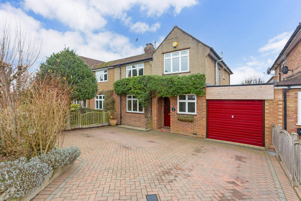
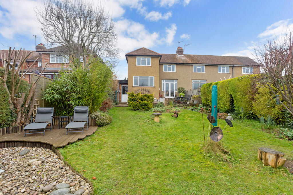
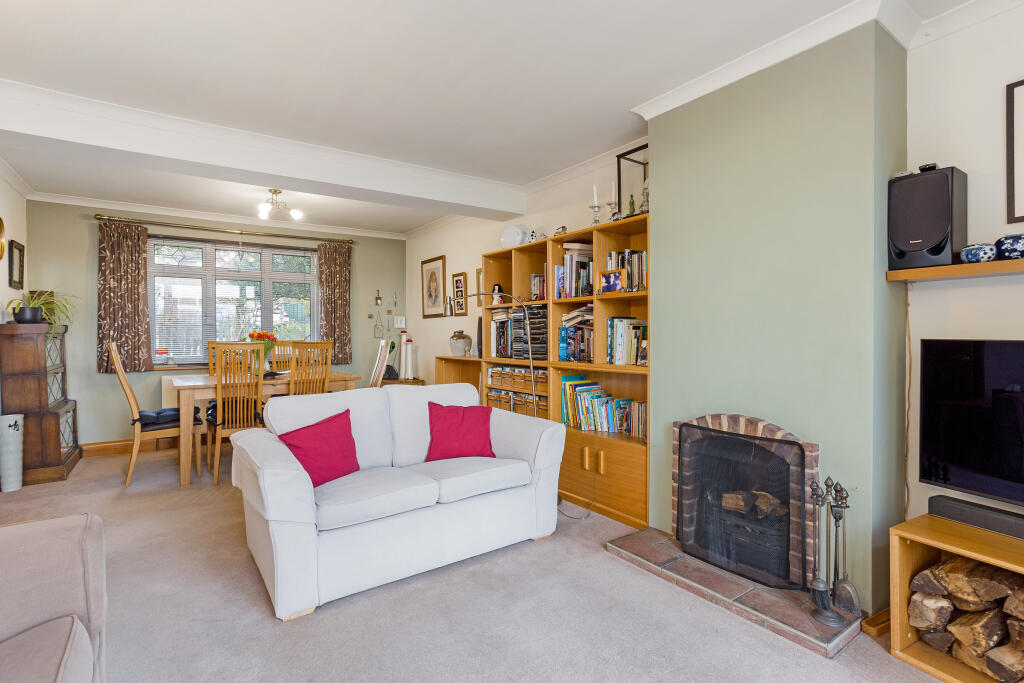
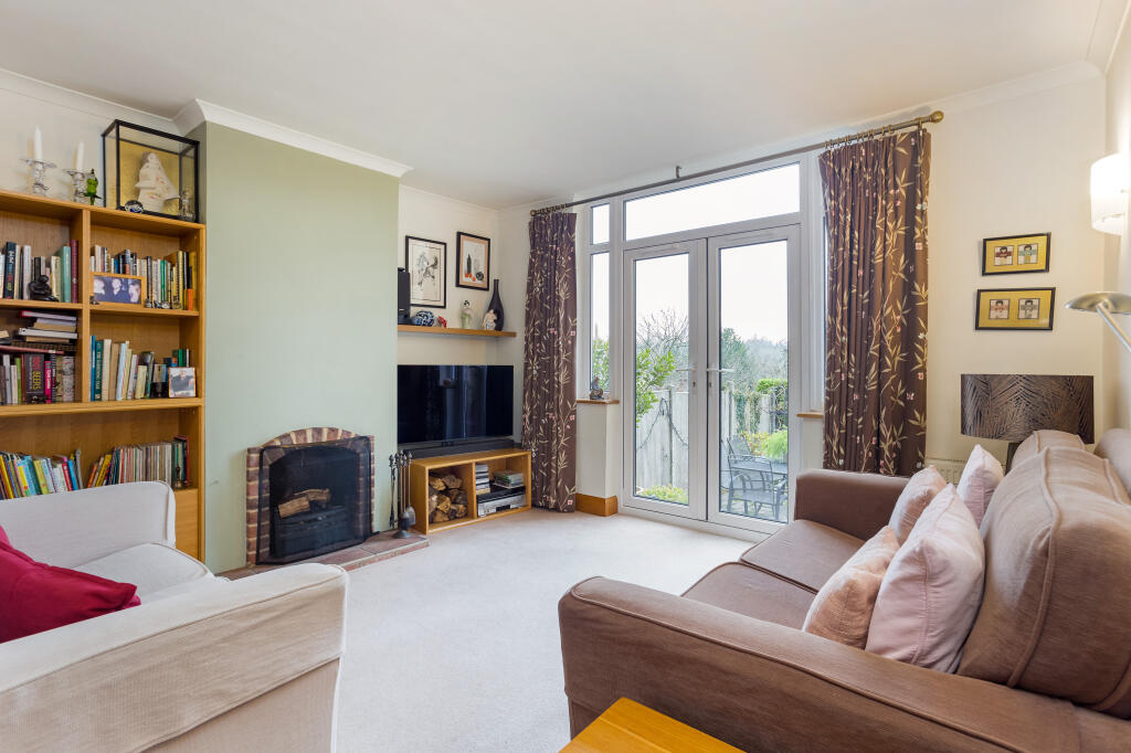
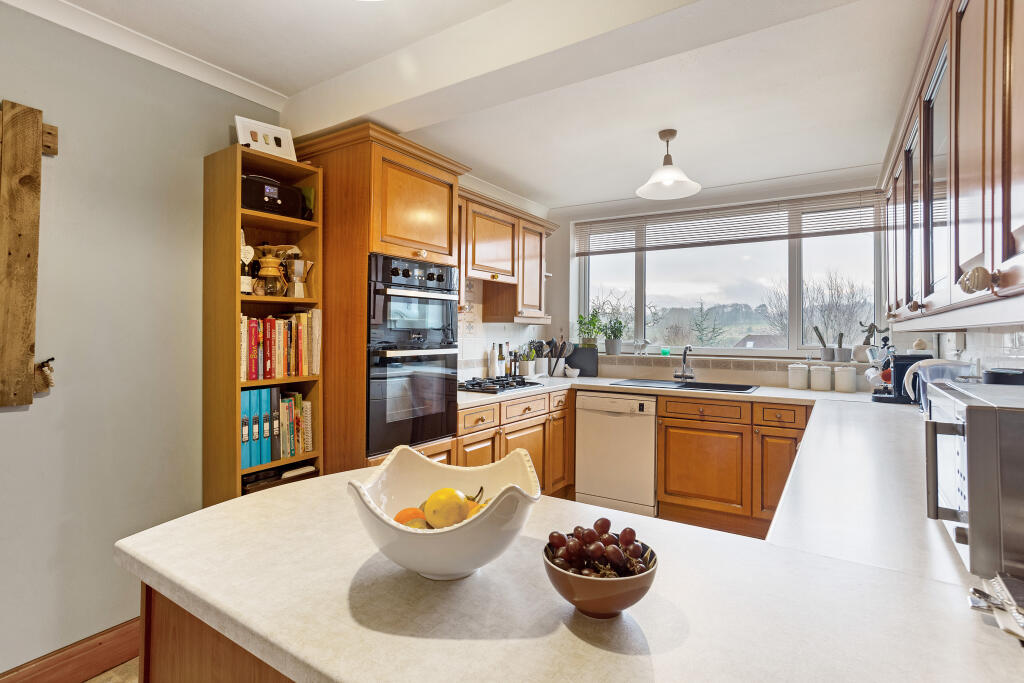
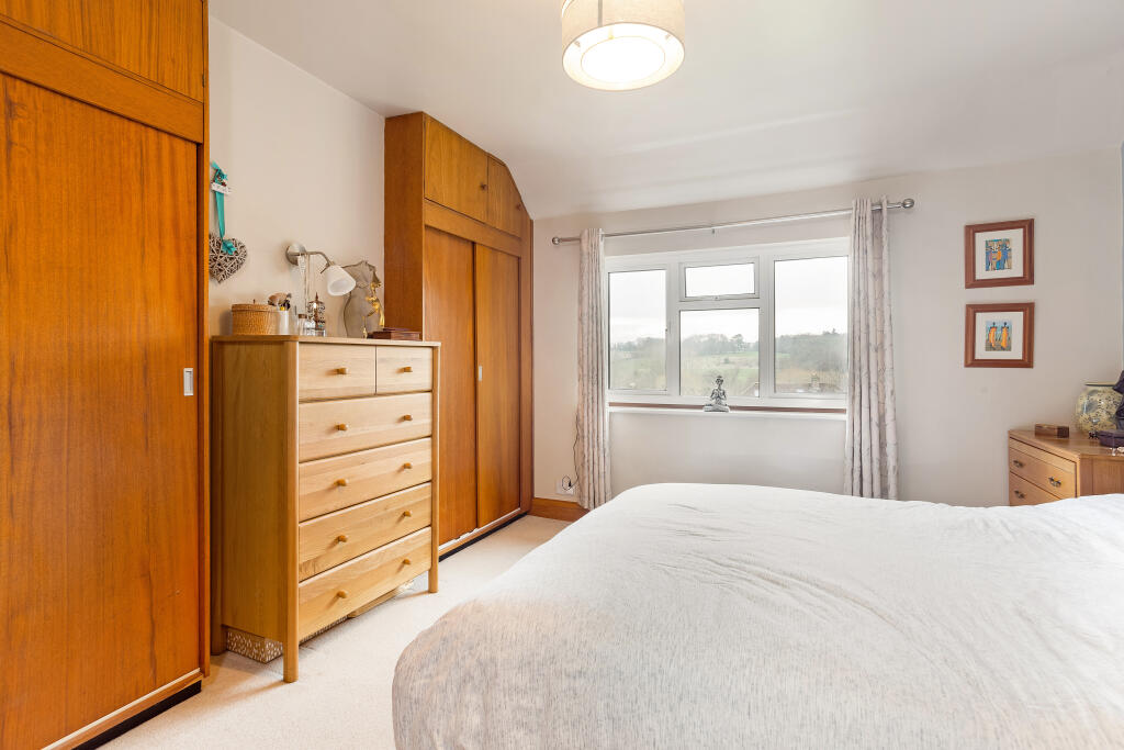
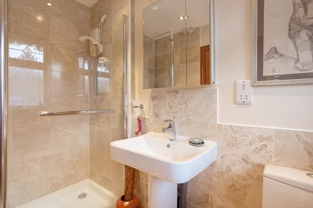
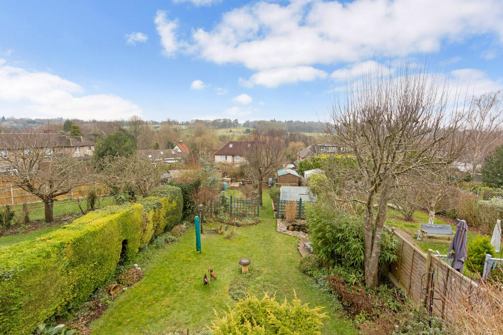
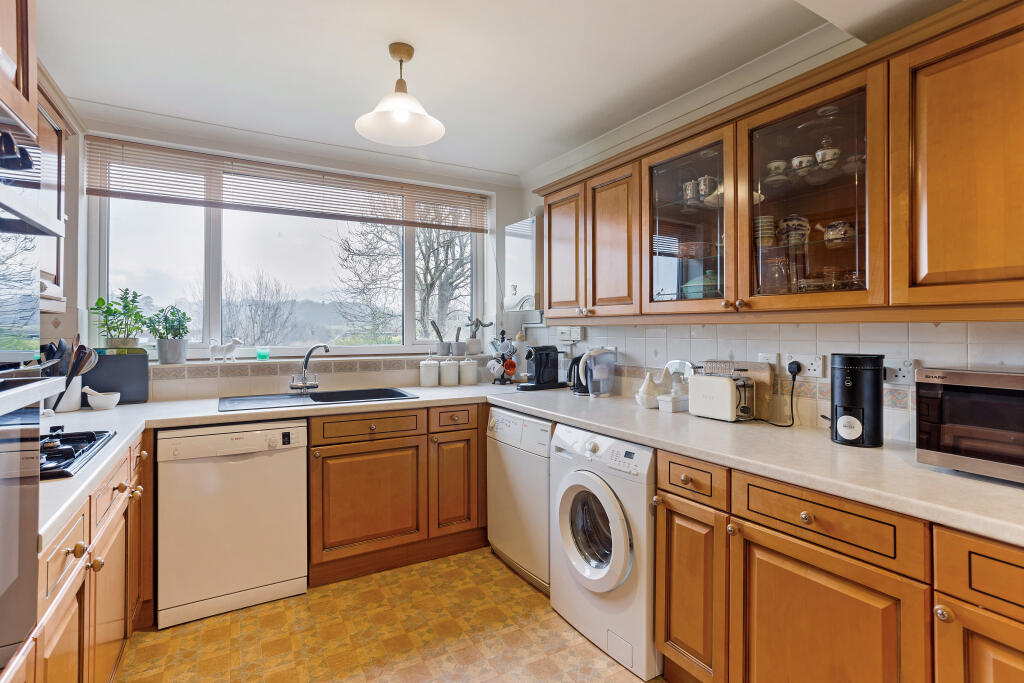
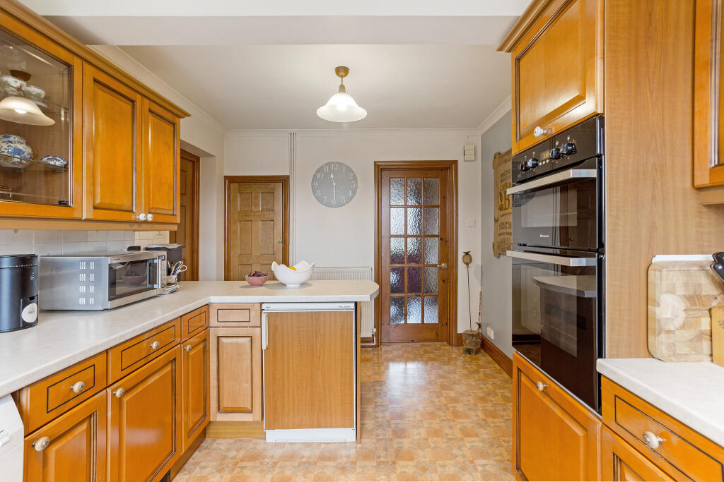
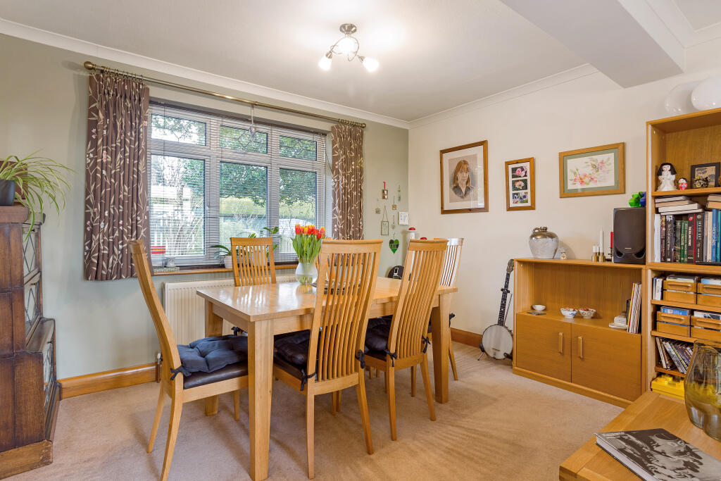
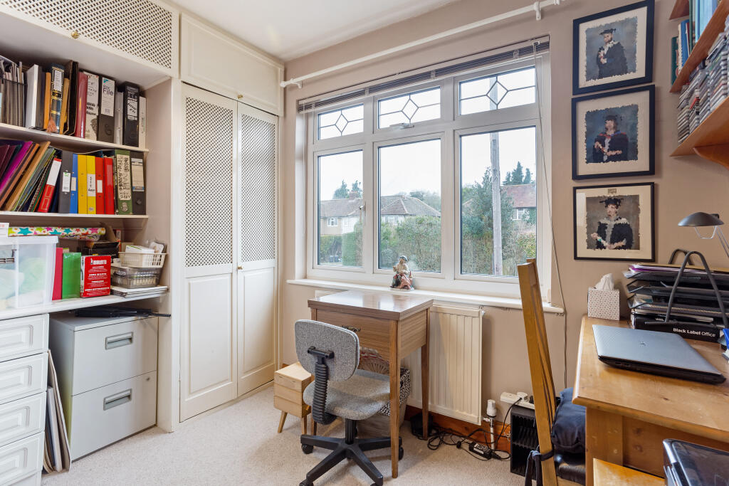
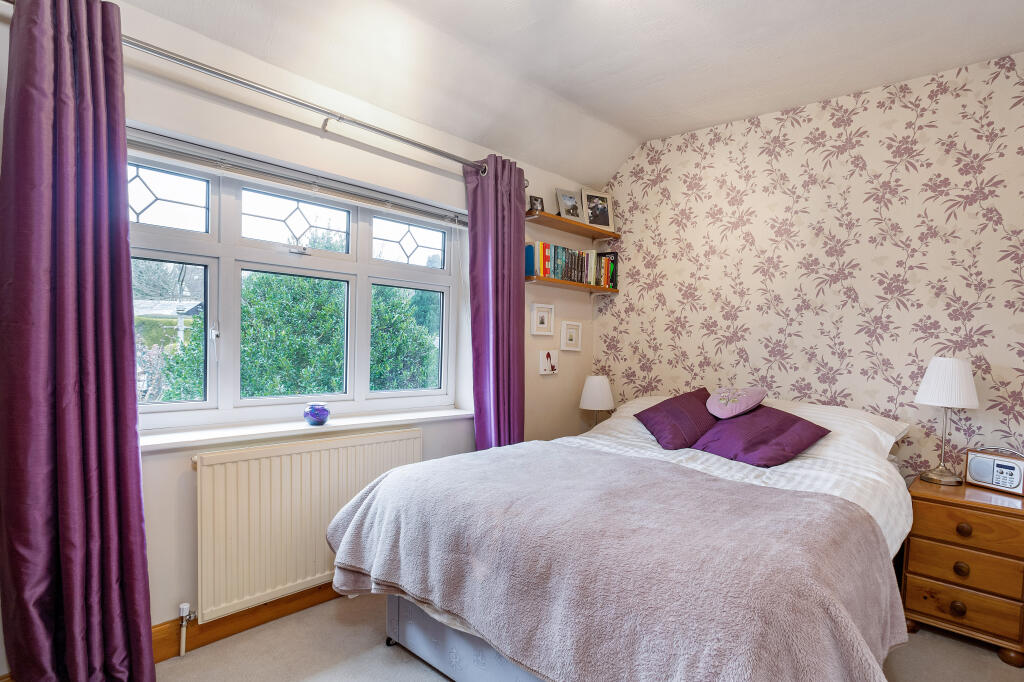
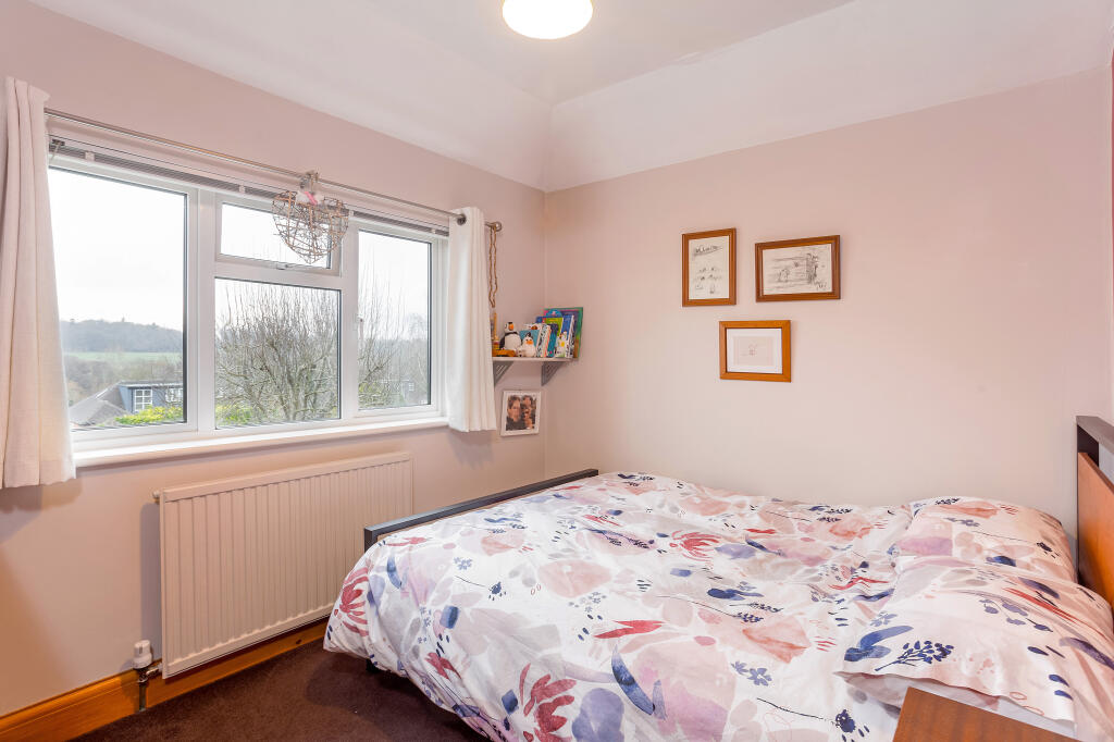
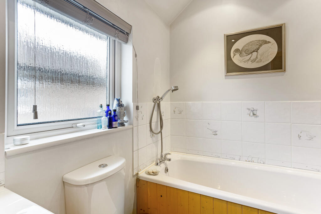
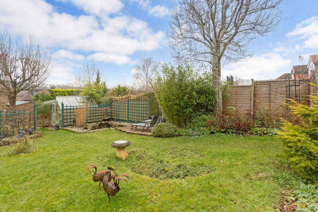
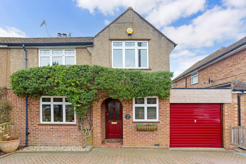
Photo 1 Photo 2 Photo 3 Photo 4 Photo 5 Photo 6 Photo 7 Photo 8 Photo 9 Photo 10 Photo 11 Photo 12 Photo 13 Photo 14 Photo 15 Photo 16 Photo 17
/ 17
Property details
Tenure
FREEHOLD
Floor area
99 m²
Council tax band
E
Last sold
£725,000 Jul 2025
Local average
£743,810 (+0.8%)
Deprivation
Decile 10 (33,026 of 33,755)
Street crime
35 incidents within 1 mile (Apr 2026)
Key features
- Entrance Hall
- Shower Room
- Sitting/Dining Room
- Kitchen/Breakfast Room
- Four Bedrooms
- Family Bathroom
- 28'11 Garage with Workshop
- Driveway
- Large Southerly Garden
- Fabulous Views.
Additional details
- Parking
- Garage, Off street
- Garden
- Private garden
Description
The ground floor features a large dining/sitting room, with french doors opening onto the garden. The extended kitchen/breakfast room has a large picture window to the rear enjoying superb views across open countryside and golf course.
The first floor accommodates four bedrooms and a family bathroom.
There is a large garage with workshop offering tremendous scope to convert (STPP) to create a further reception room/study and the option to expand the kitchen to create a large open plan kitchen/dining/family room.
Outside
The property benefits from a large southerly rear garden with patio areas. There is a good size driveway to the front leading to the garage.
Situation
Manor Road forms part of the popular residential enclave of Lea Valley, situated between Wheathampstead and Harpenden. The area is noted for being surrounded by countryside and for having lovely views across the valley while being within easy reach of Katherine Warrington School, Mainline Station and shopping areas in Harpenden. Property Ref Number:
HAM-0808
Listed by
Harpenden
Countrywide Hamptons Sales - Connells
Reference: 157617362
EPC Rating & Upgrade Cost
Fetching EPC data… Refresh this page in a moment.
Flood risk
Zone: 1
Risk: Low
Job (default Low)
Floorplans
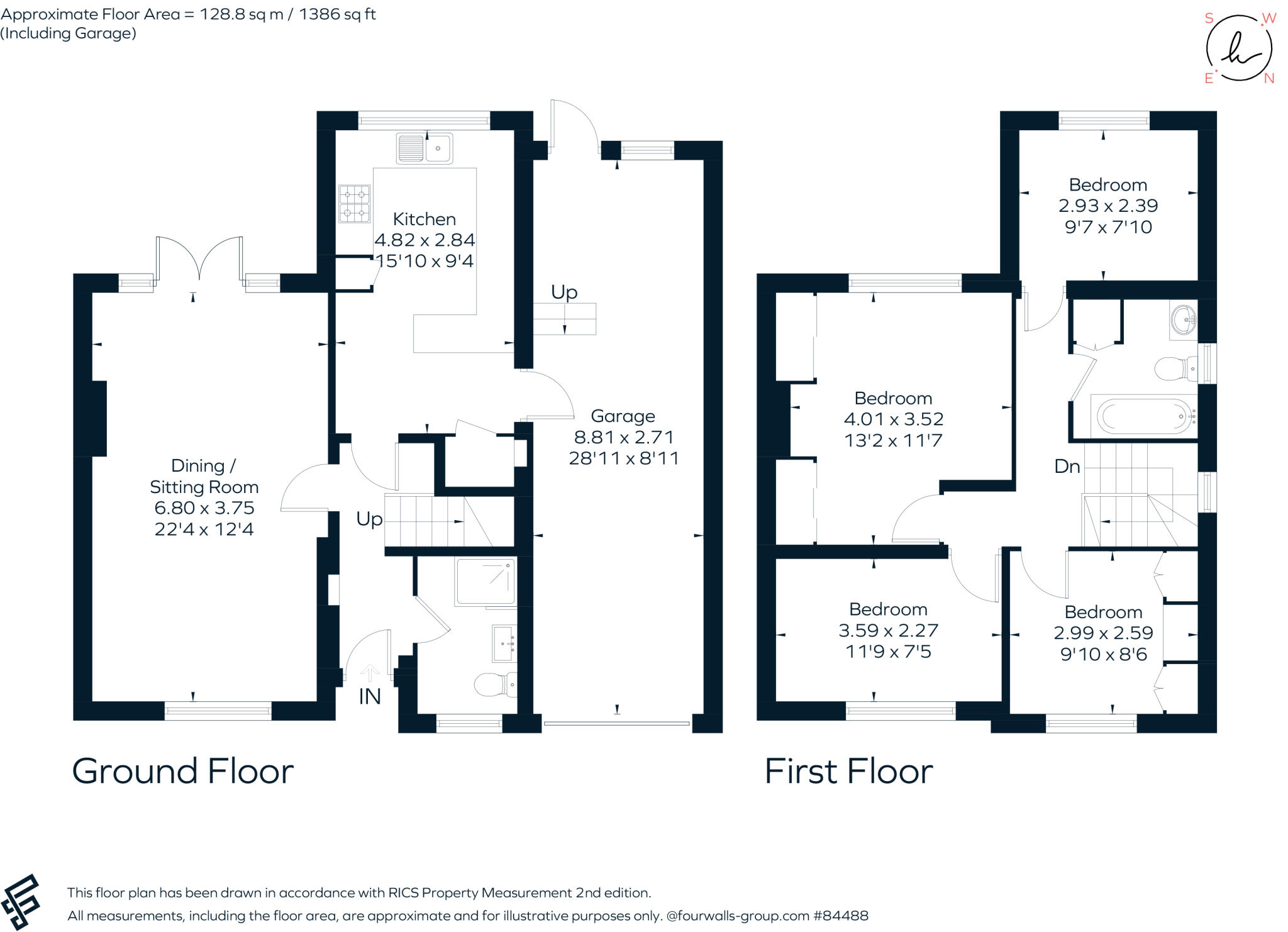
Floorplan 1
EPC Graphs
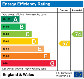
EPC 1
Price history
| Event | Date | Price | % change |
|---|---|---|---|
| Sold | 31/07/2025 (10 months ago) | £725,000 | — |
Source: HM Land Registry Price Paid Data. Crown copyright.
Sold Comparables
Same street and nearby sales within 0.25 miles (last 5 years). Data from Land Registry Price Paid.
| Address | Price | Date | Type |
|---|---|---|---|
| 334 LOWER LUTON ROAD, WHEATHAMPSTEAD, ST ALBANS, HERTFORDSHIRE, AL4 8JQ | £616,500 | 19/12/2025 | Semi-detached |
| 3 MARSHALLS HEATH LANE, WHEATHAMPSTEAD, ST ALBANS, HERTFORDSHIRE, AL4 8HR | £417,000 | 12/12/2025 | Semi-detached |
| 316 LOWER LUTON ROAD, WHEATHAMPSTEAD, ST ALBANS, HERTFORDSHIRE, AL4 8HT | £650,000 | 01/06/2023 | Semi-detached |
| Same street 15 MANOR ROAD, WHEATHAMPSTEAD, ST ALBANS, HERTFORDSHIRE, AL4 8JG | £759,950 | 30/05/2023 | Semi-detached |
| 284 LOWER LUTON ROAD, WHEATHAMPSTEAD, ST ALBANS, HERTFORDSHIRE, AL4 8HT | £535,000 | 14/04/2022 | Semi-detached |
| 15 MARSHALLS HEATH LANE, WHEATHAMPSTEAD, ST ALBANS, HERTFORDSHIRE, AL4 8HR | £335,000 | 29/06/2021 | Semi-detached |
| 7 CASTLE RISE, WHEATHAMPSTEAD, ST ALBANS, HERTFORDSHIRE, AL4 8HX | £565,000 | 28/06/2021 | Semi-detached |
Street average: £759,950 (1 sale)
Area average: £519,750 (6 sales)
Capital growth trend
Land Registry outcode average: last 12 months vs 5y and 10y ago (from sold prices).
House Price Index (HM Land Registry — official index, not sold-price averages): St Albans. Series: Semi-detached. As of March 2026.
Rental Range
Estimated market rent for St Albans. Low = conservative, Realistic = average, Optimistic = best case.
Based on Local Authority from postcode lookup → St Albans.
LHA (30th percentile) floor for South West Herts: £1,995/mo (Apr 2025 – Mar 2026)
Location
Nearby
Nearest stations, universities and amenities (distance from property).
| Type | Name | Distance |
|---|---|---|
| Bus stop | Castle Rise | 0.1 miles |
| Shop | Creature Comforts | 1.3 miles |
| Shop | The Beautique | 1.3 miles |
| Train station | Harpenden | 1.3 miles |
| Train station | Central Terminal | 4.6 miles |
| University | University of Hertfordshire | 7.4 miles |
| Hospital | Widecombe Nursing Home | 8.1 miles |
| Hospital | Luton and Dunstable Hospital | 8.4 miles |
Street-level crime
| Category | Count |
|---|---|
| Anti-social behaviour | 12 |
| Violence and sexual offences | 6 |
| Criminal damage and arson | 4 |
| Other theft | 3 |
| Shoplifting | 3 |
| Other crime | 2 |
| Public order | 2 |
| Vehicle crime | 2 |
| Drugs | 1 |
| Total incidents | 35 |
Within 1 mile during Apr 2026. Source: data.police.uk (England & Wales).
Schools nearby
Nearest open schools with Ofsted ratings (England). Closed schools are not shown. Data from Get Information about Schools and Ofsted.
| Name | Type | Distance | Ofsted |
|---|---|---|---|
| Aldwickbury School | Other | 0.7 miles | — (No rating) |
| Batford Nursery School | Nursery | 0.8 miles | Outstanding — 15 Feb 2013 |
| High Beeches Primary School | Primary | 0.8 miles | Outstanding — 26 Apr 2017 |
| Sauncey Wood Primary School | Primary | 0.8 miles | Good — 4 Apr 2014 |
| Crabtree Junior School | Primary | 0.9 miles | Outstanding — 15 Jan 2024 |
Rental Comparables
Residential lets from OpenRent and Rightmove for the area (same bedroom count). Use to validate rent estimates. Student lets are excluded.
| Title | Rent | Beds | Distance | As seen on |
|---|---|---|---|---|
| 4 Bed Semi-Detached House, Grove Avenue, AL5 | £2,690/mo | 4 | 1.02 miles | OpenRent |
Average rent: £2,690/mo (1 listing)
Rent-driven metrics
Based on OpenRent comparables.
- Rent ratio — Monthly rent ÷ purchase price (1% rule). 1%+ = strong, 0.8–1% = okay, <0.8% = weak for cashflow.
- Max investor price — Rent ÷ 0.8%; the price at which rent would be 0.8% of price (Stoke-style target).
- Target investor price — Rent ÷ 1%; the price at which rent would be 1% of price (strong cashflow band).
- Gross yield — Annual rent as % of purchase price (no costs).
- Cost-to-rent — Price ÷ annual rent (from OpenRent comparables). Under 14× = strong, 14–16× = acceptable, 17×+ = compressed.
- Cashflow — Rent minus mortgage, 10% maintenance, £25/mo compliance. Assumes 75% LTV, 3.95% APR (5yr fixed), 25yr term.
- ROI — Annual profit ÷ cash in (deposit + 4% purchase costs).