Farthings
Heathfield Road, Audlem, CW3, CW3 0HH
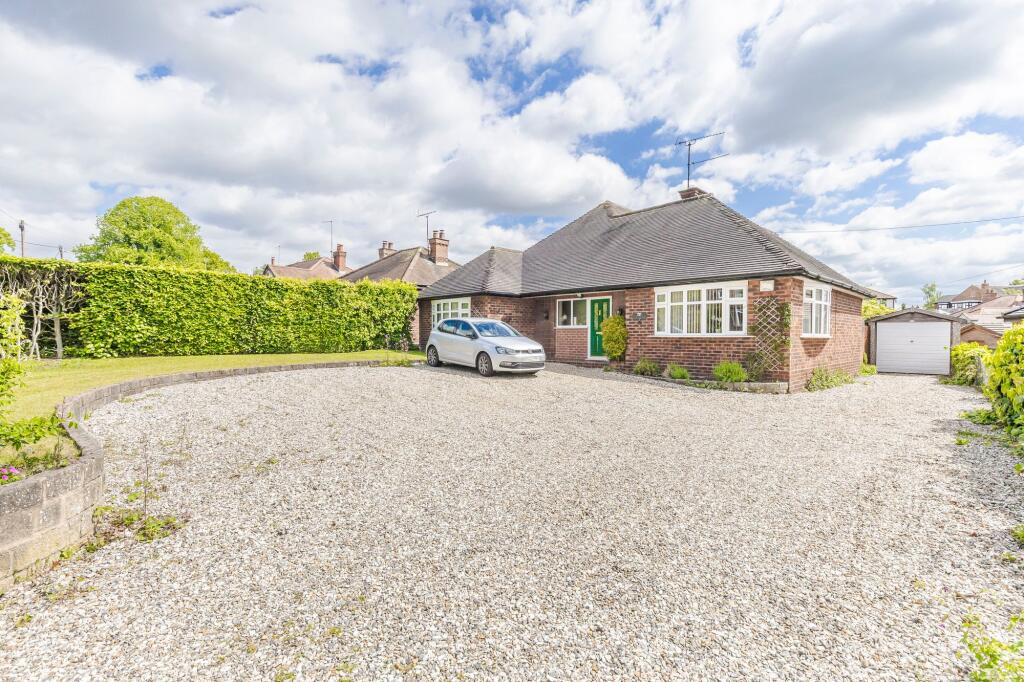
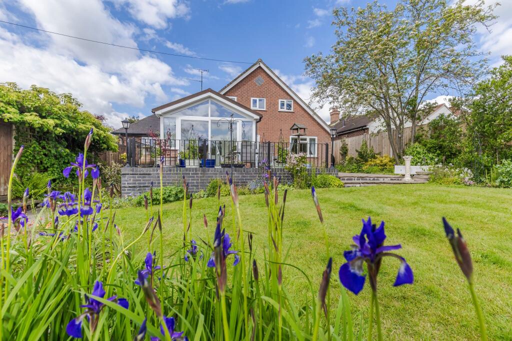
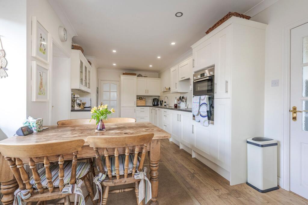
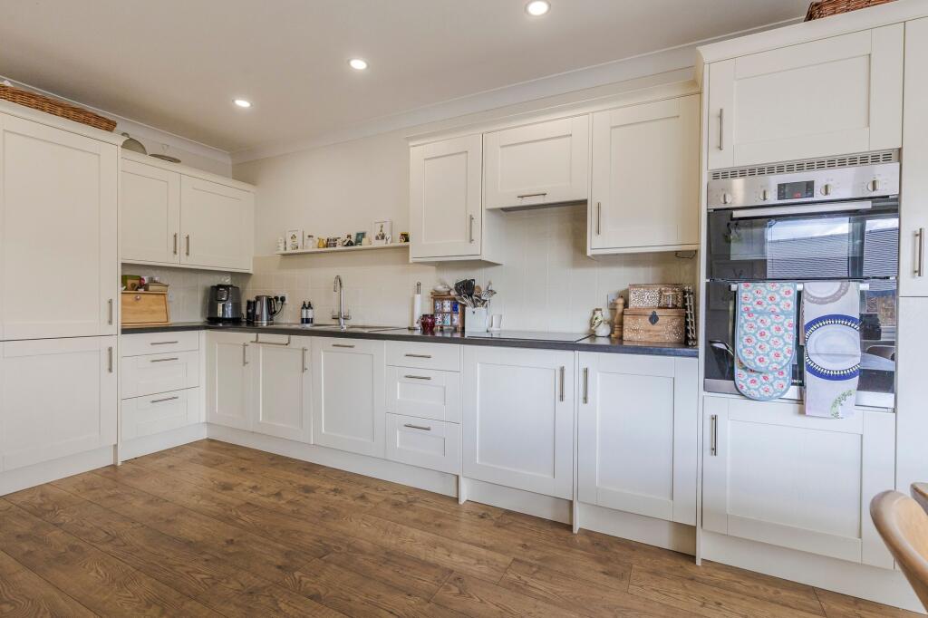
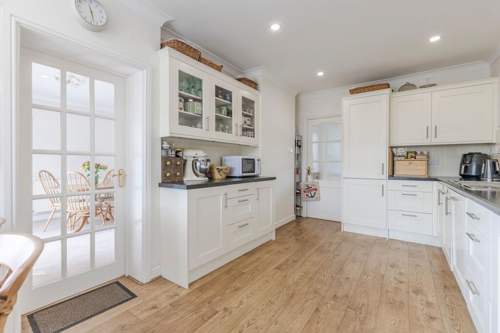
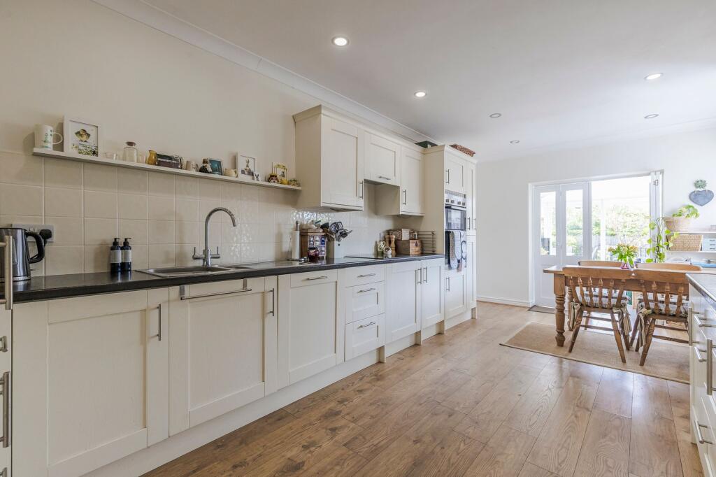
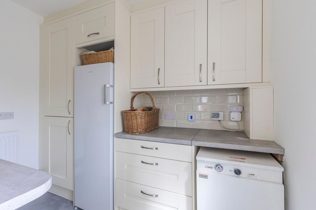
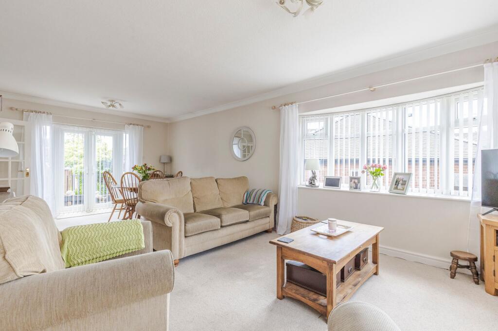
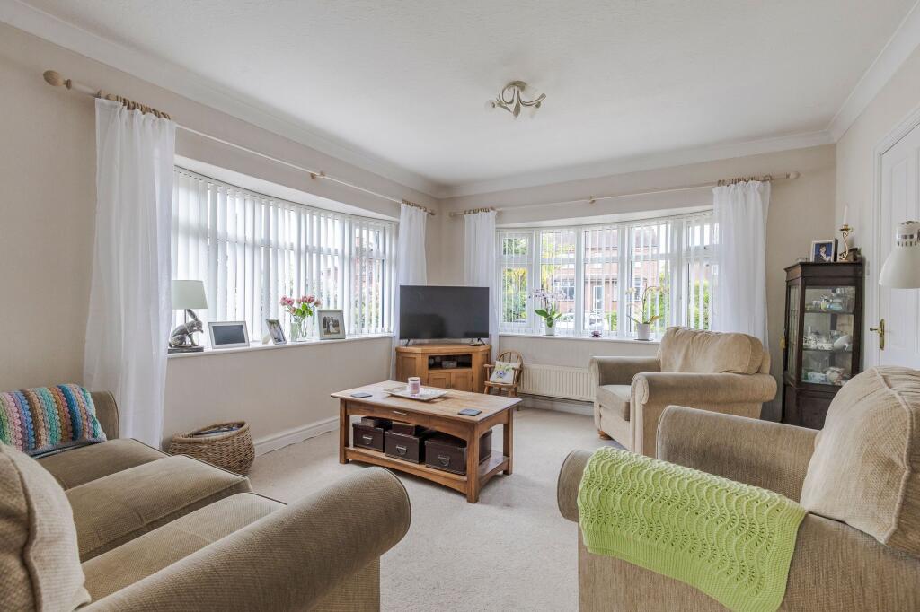
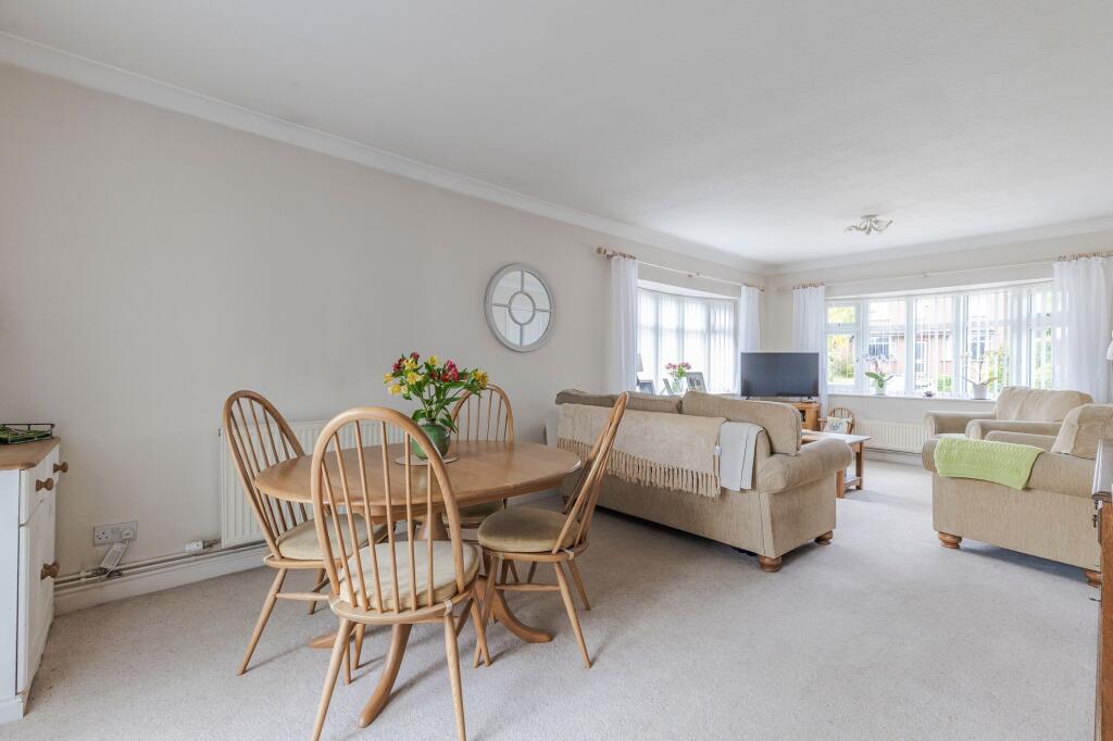
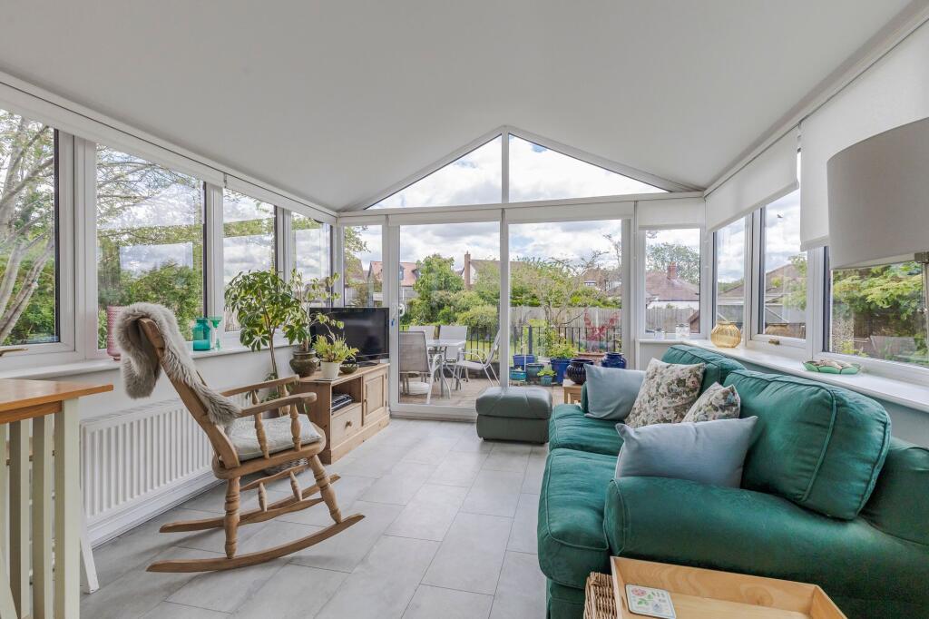
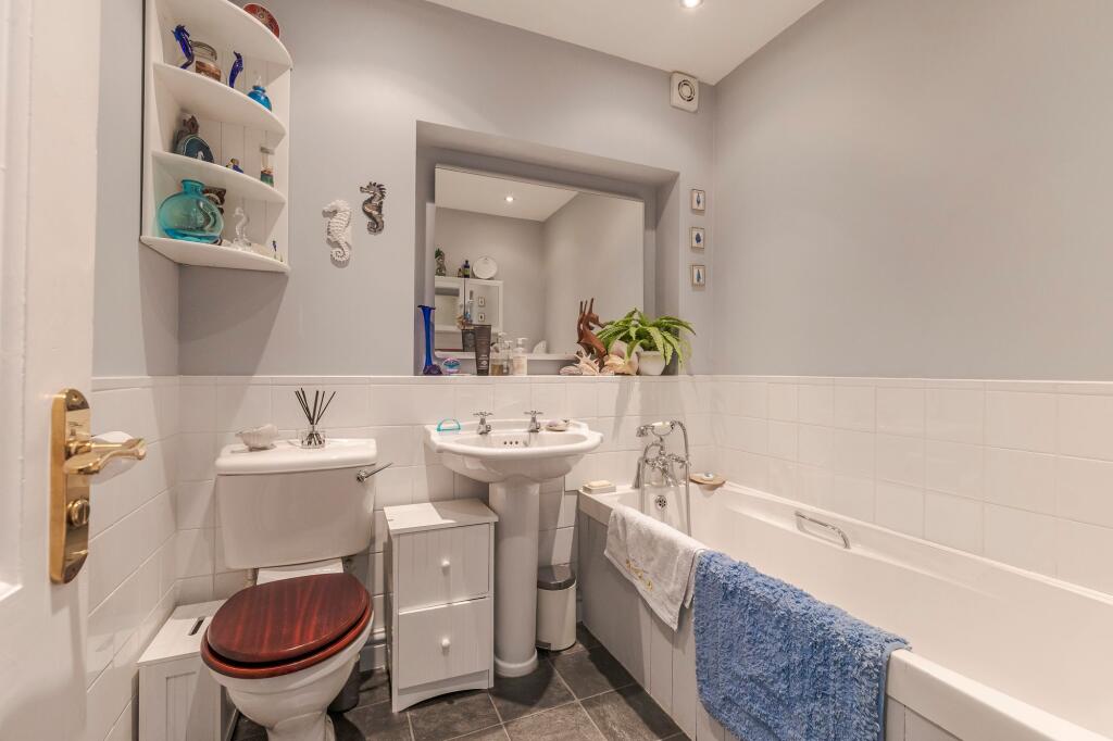
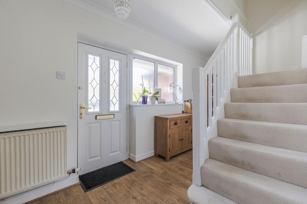
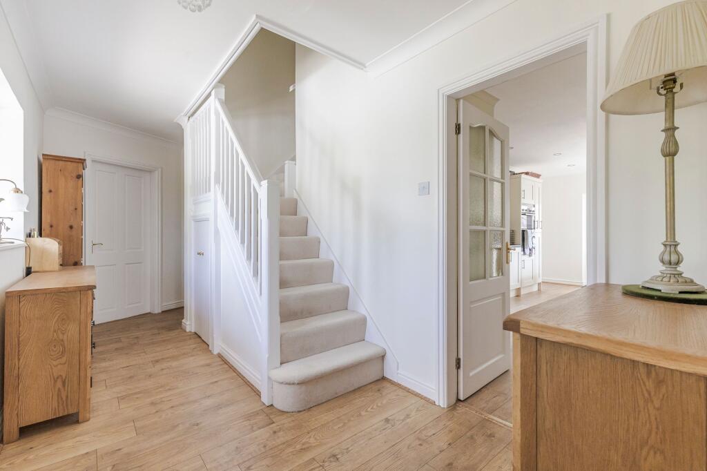
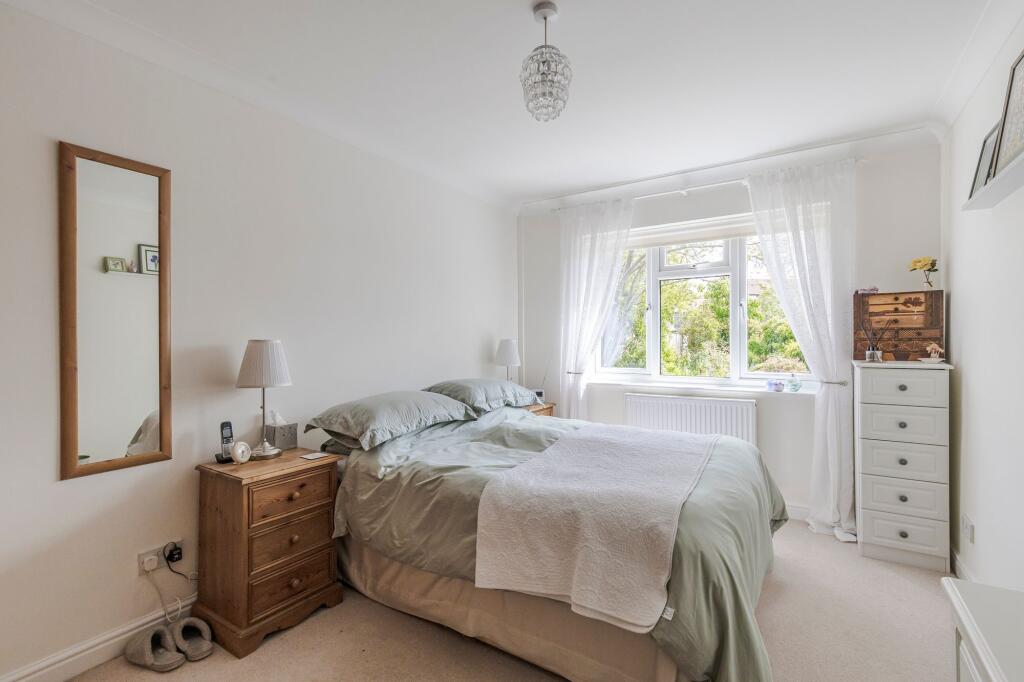
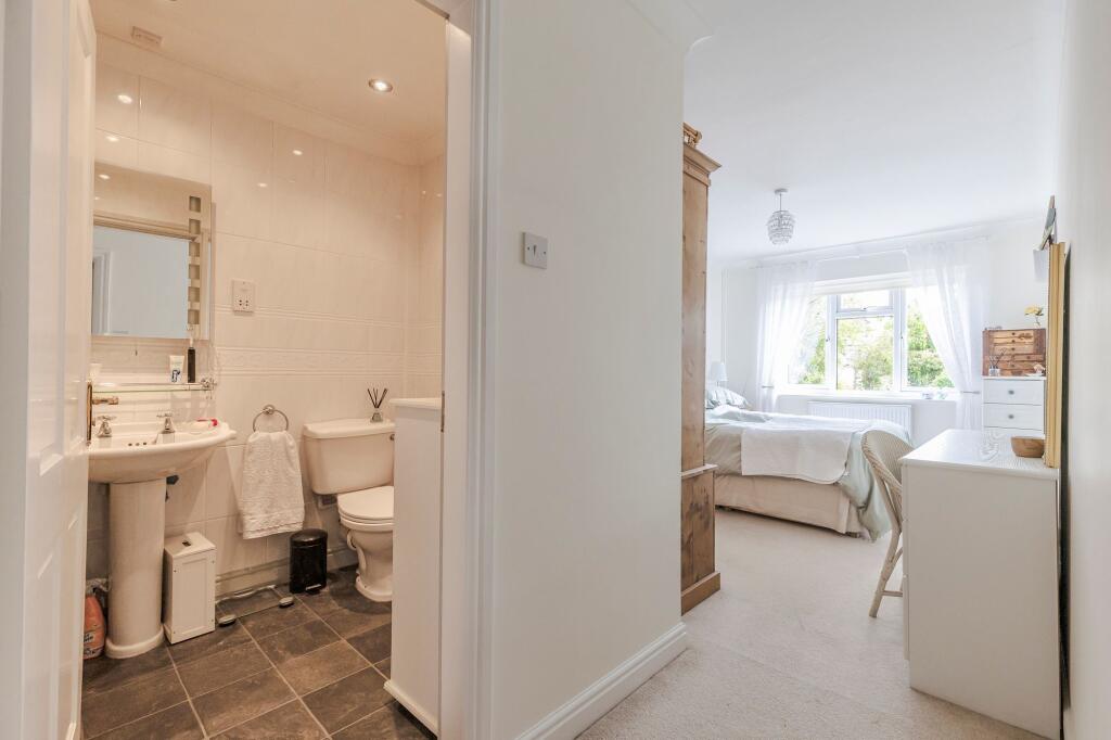
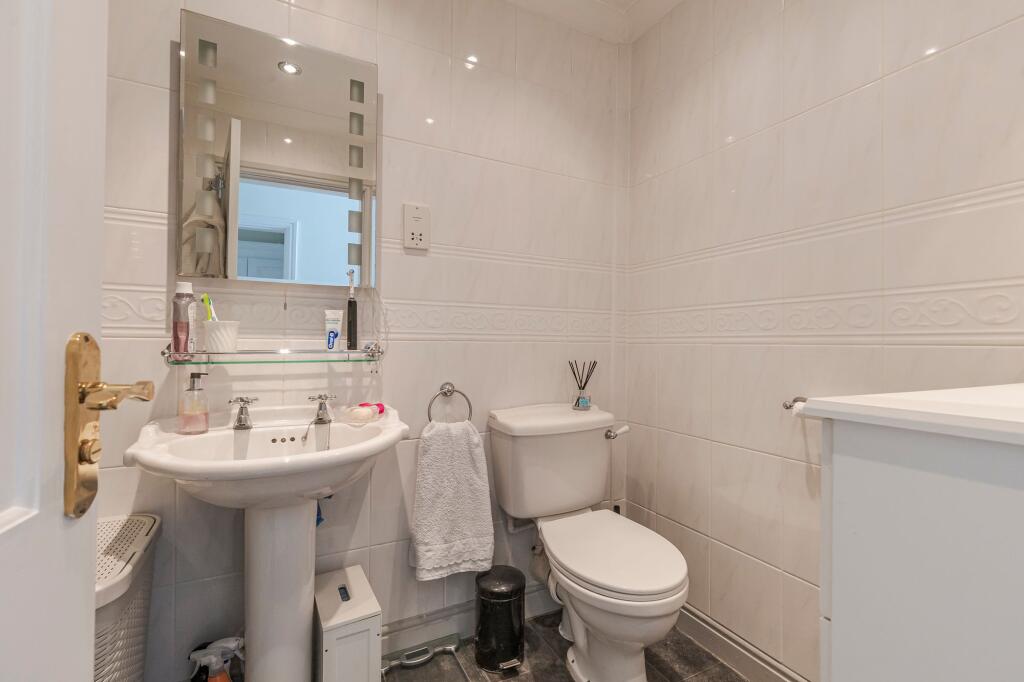
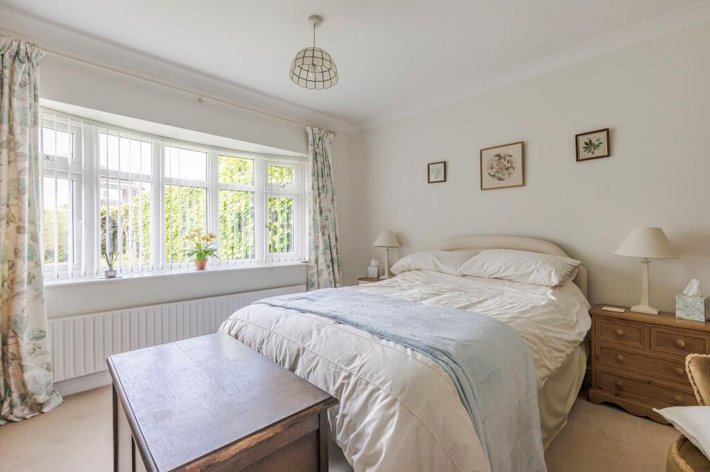
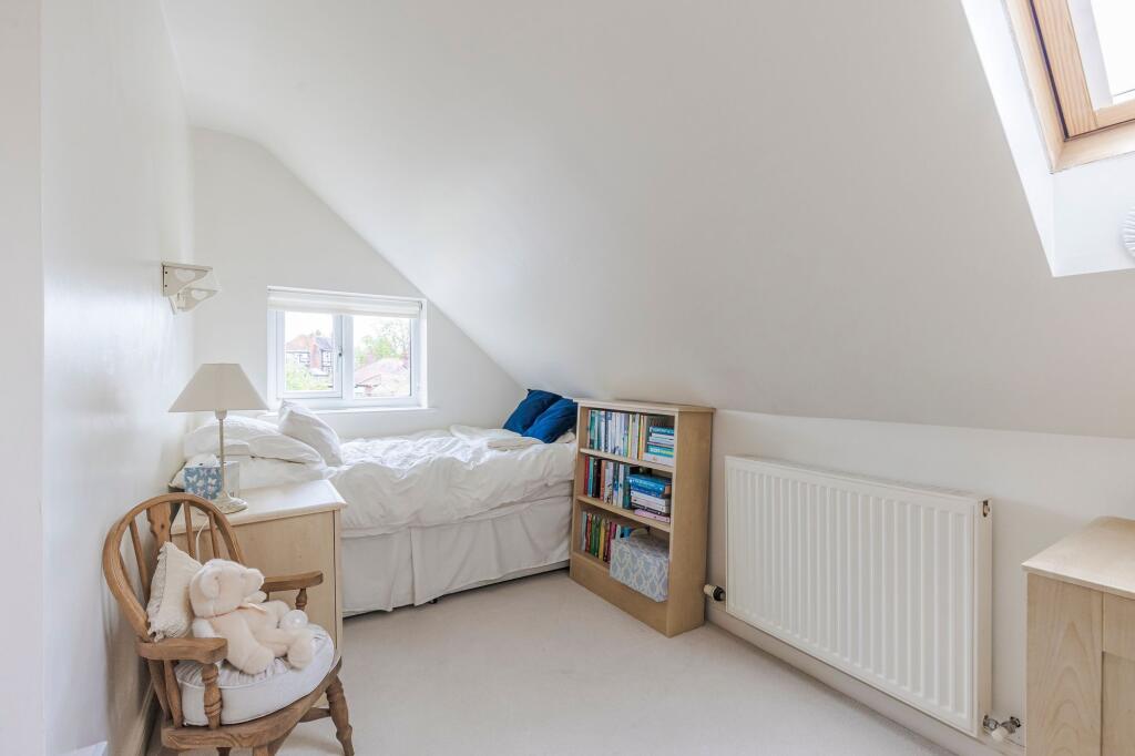
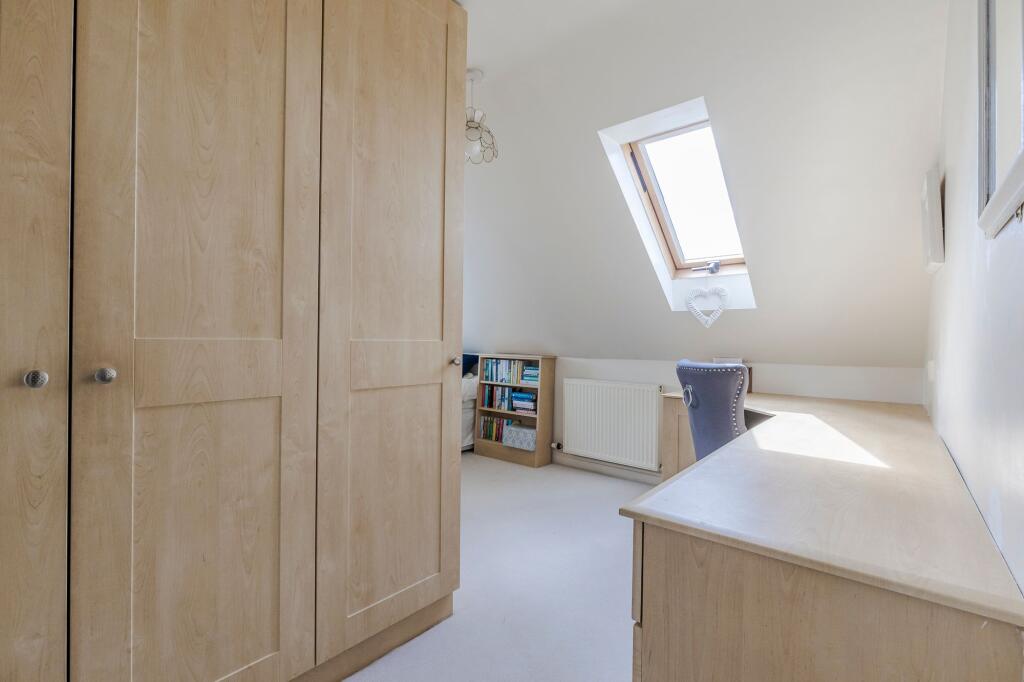
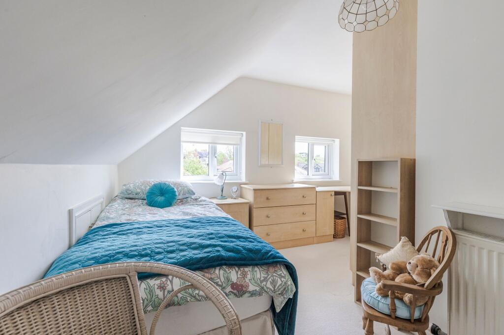
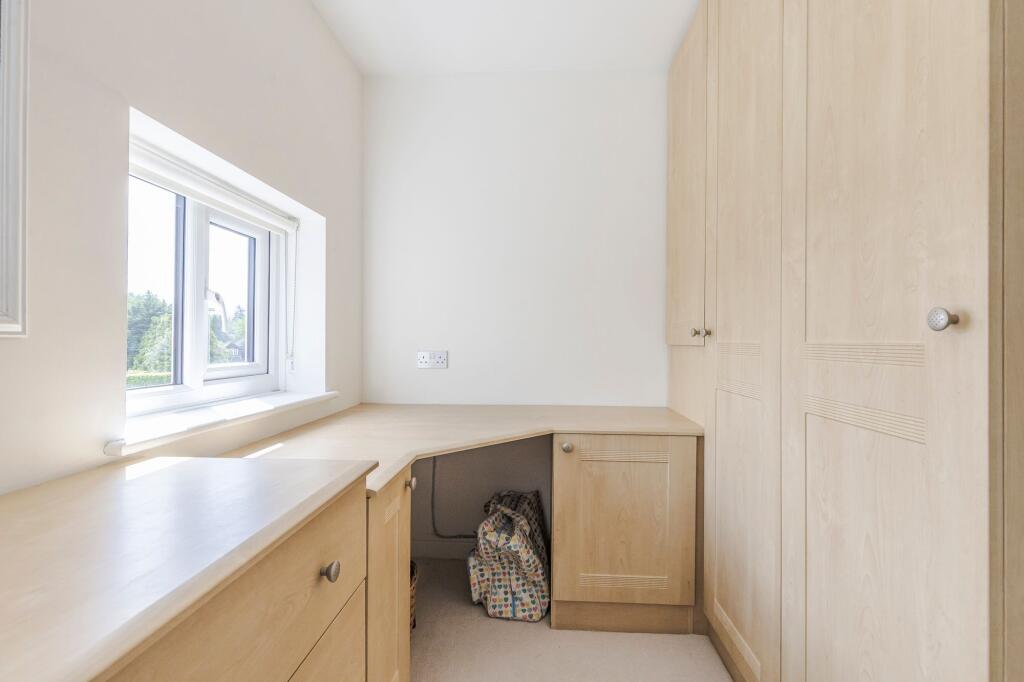
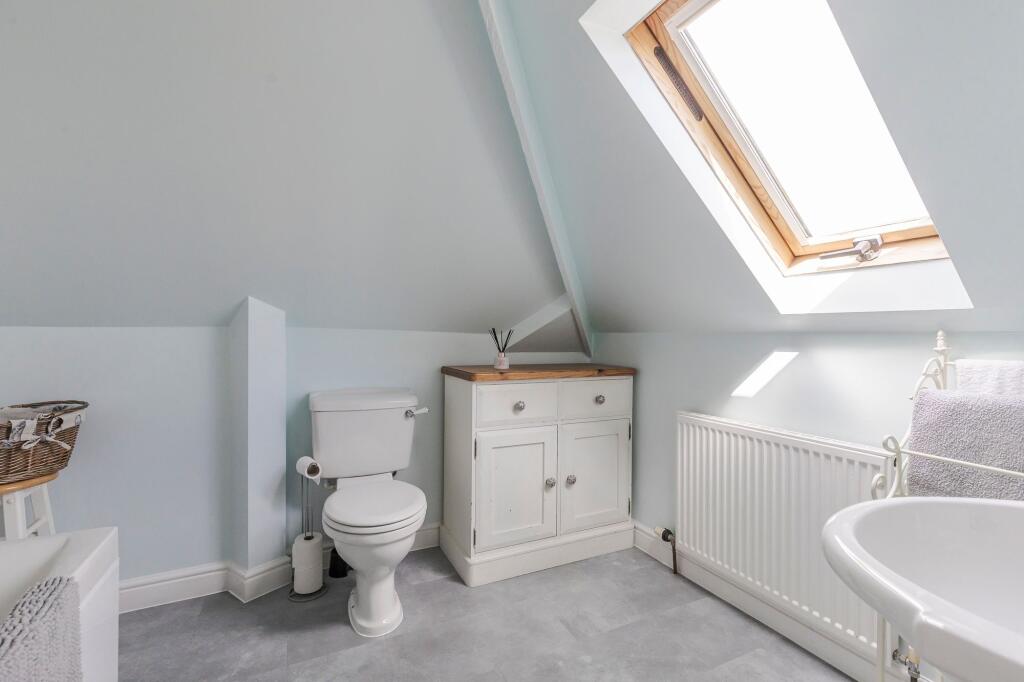
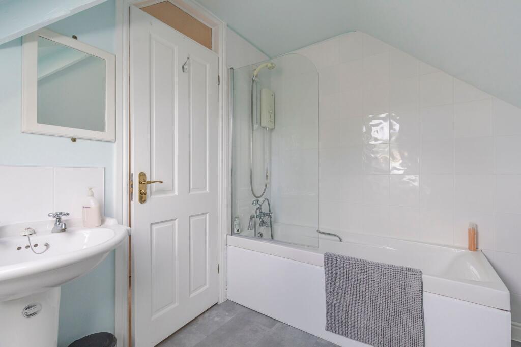
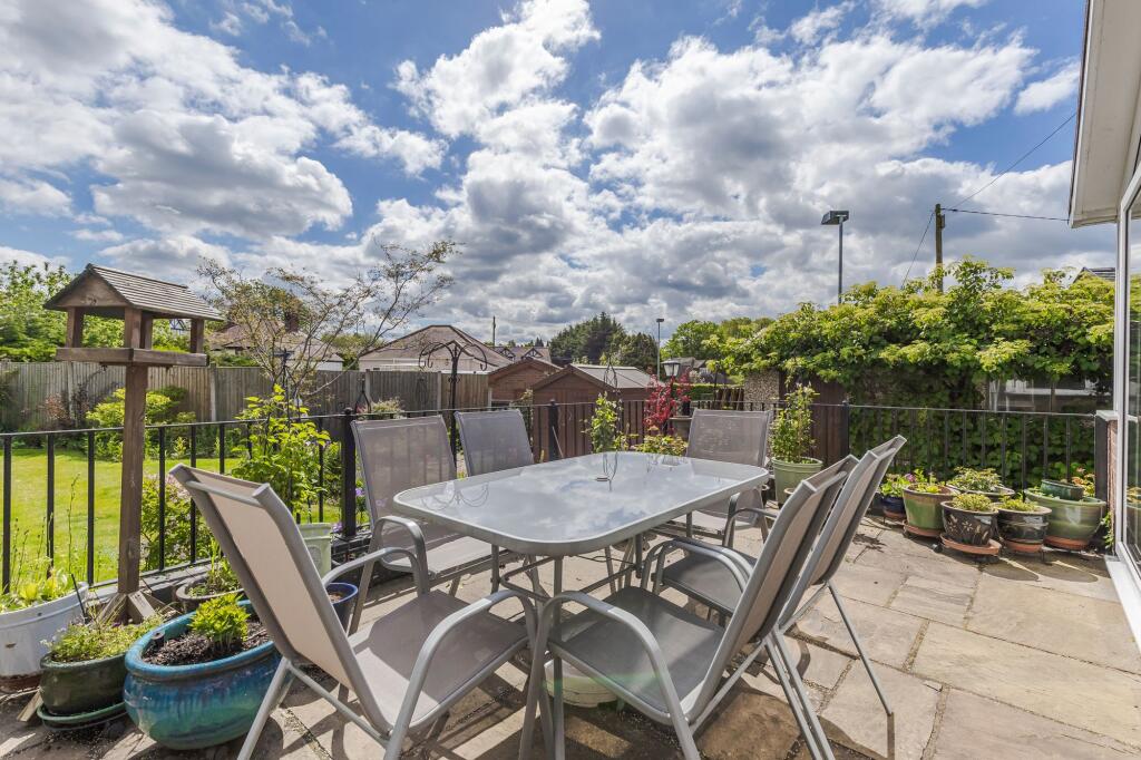
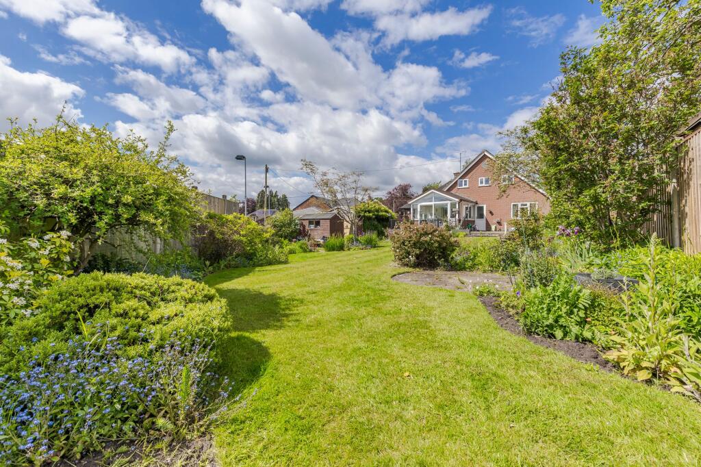
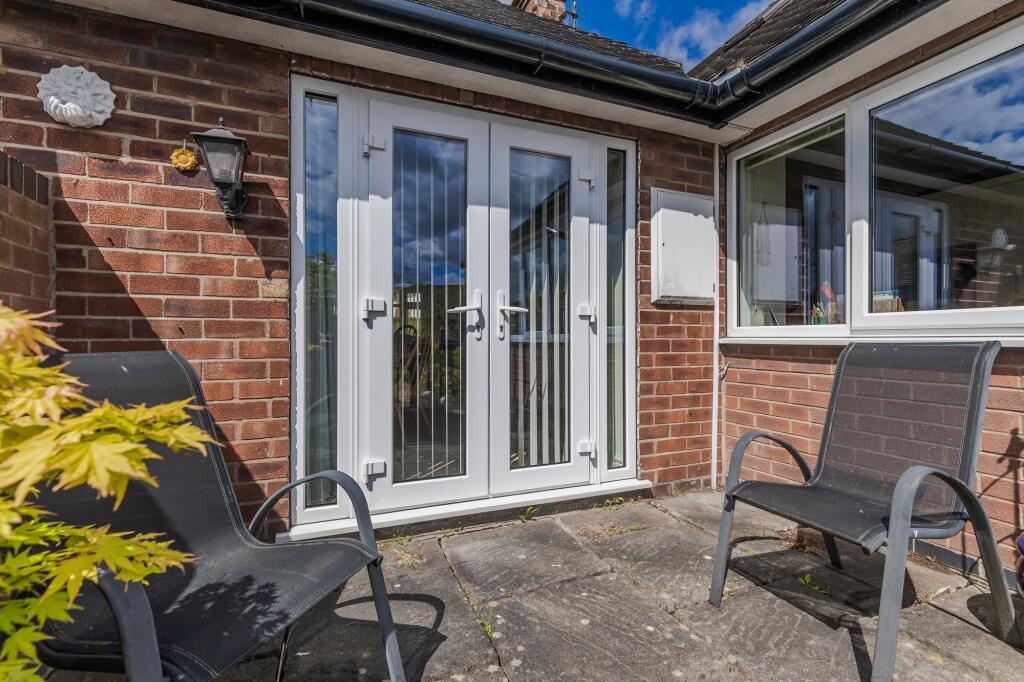
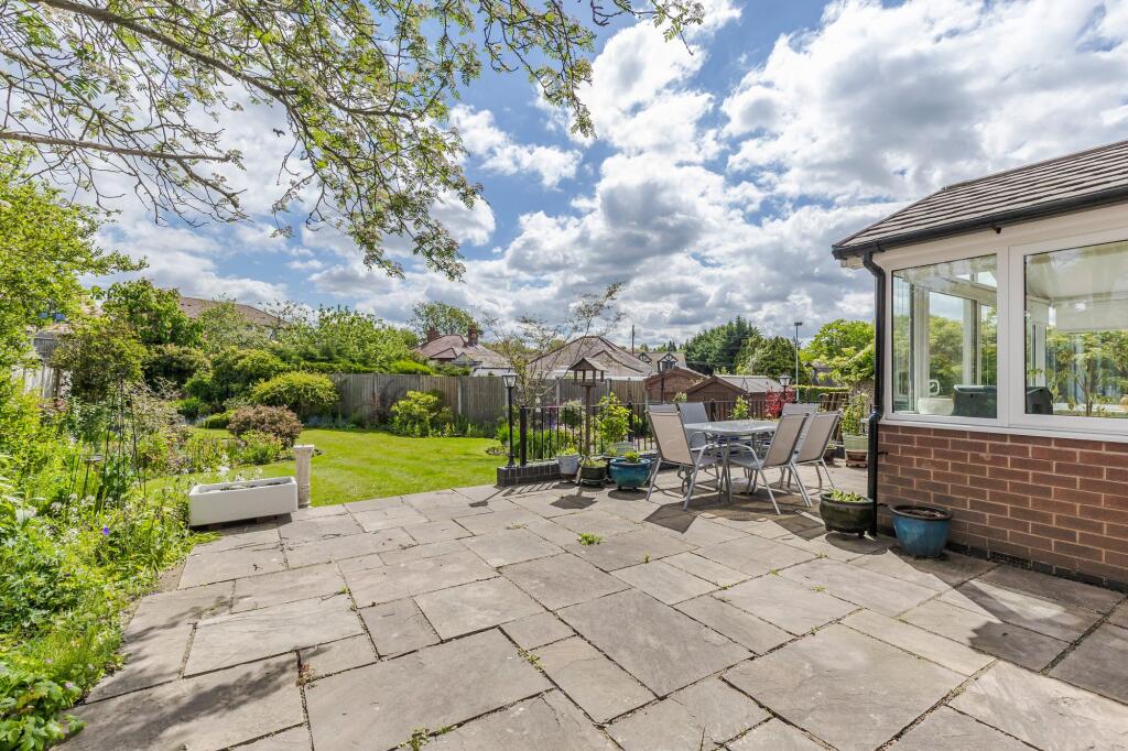
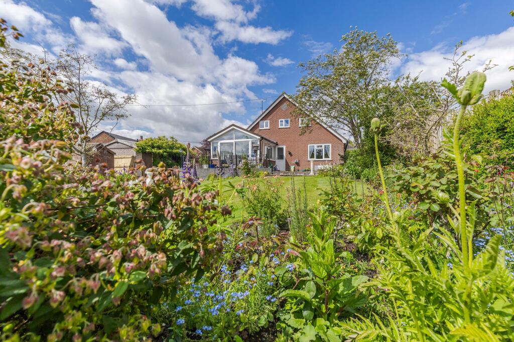
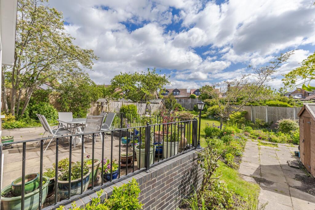
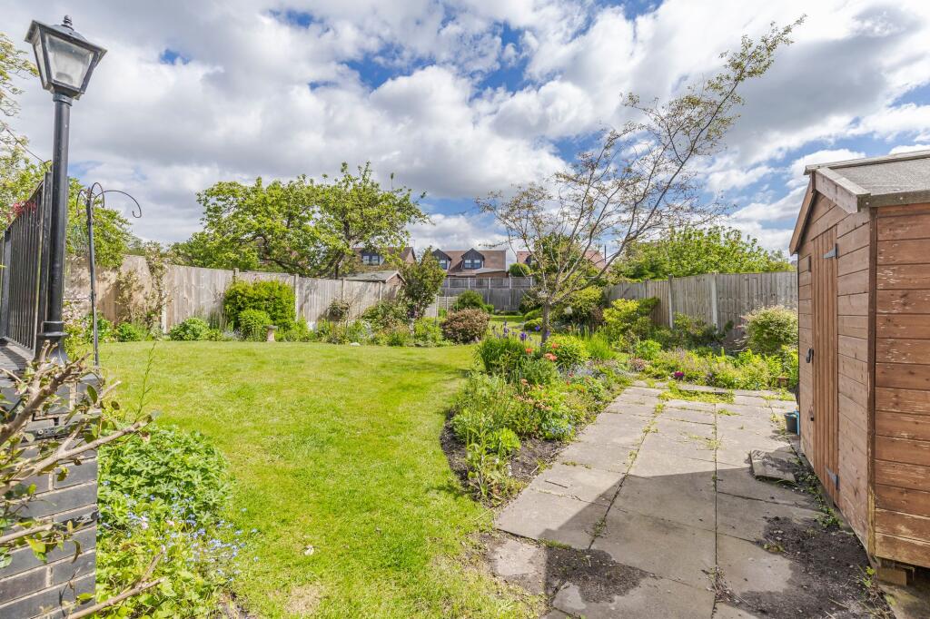
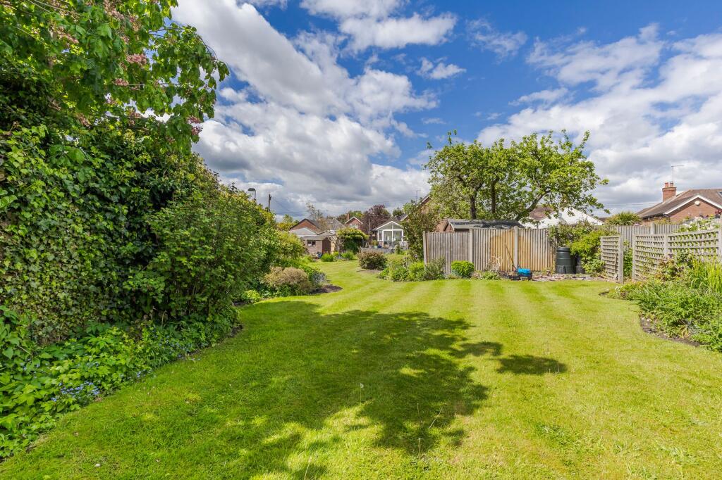
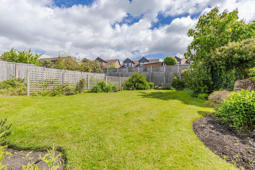
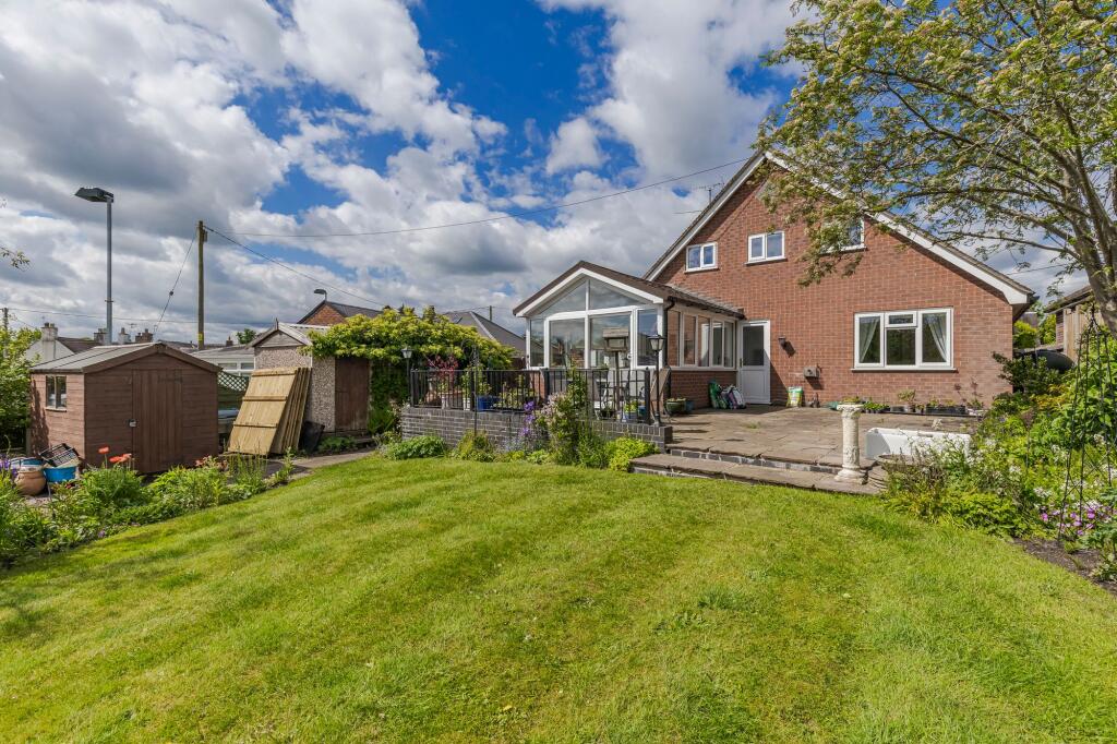
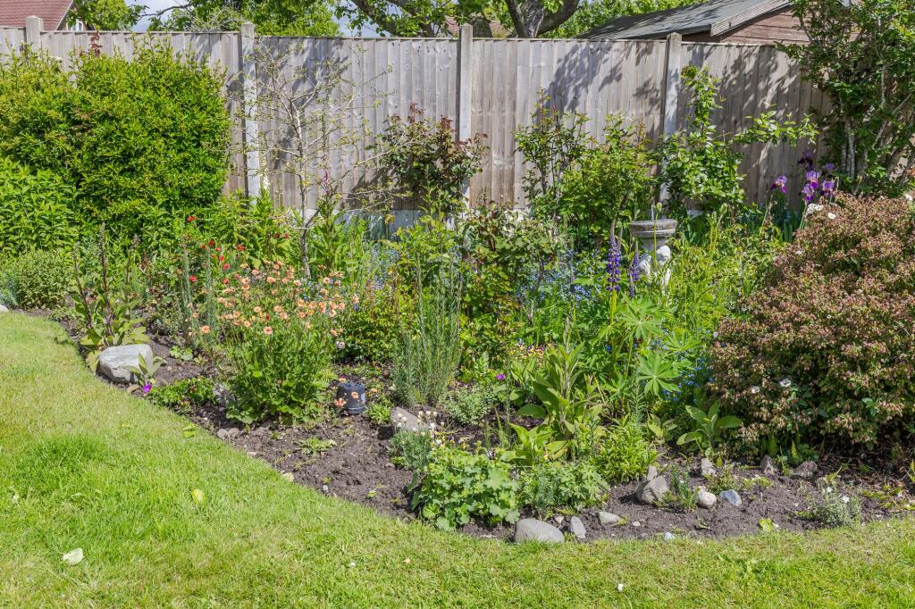
Photo 1 Photo 2 Photo 3 Photo 4 Photo 5 Photo 6 Photo 7 Photo 8 Photo 9 Photo 10 Photo 11 Photo 12 Photo 13 Photo 14 Photo 15 Photo 16 Photo 17 Photo 18 Photo 19 Photo 20 Photo 21 Photo 22 Photo 23 Photo 24 Photo 25 Photo 26 Photo 27 Photo 28 Photo 29 Photo 30 Photo 31 Photo 32 Photo 33 Photo 34 Photo 35 Photo 36
/ 36
Property details
Tenure
FREEHOLD
Council tax band
D
Local average
£435,107 (+37.9%)
Deprivation
Decile 7 (22,045 of 33,755)
Street crime
8 incidents within 1 mile (Apr 2026)
Additional details
- Parking
- Yes
- Garden
- Yes
- Listed property
- No
- Restrictions
- No
- Required access
- No
- Rights of way
- No
- Flooded in last 5 years
- No
- Flood defences
- No
Description
DESCRIPTION
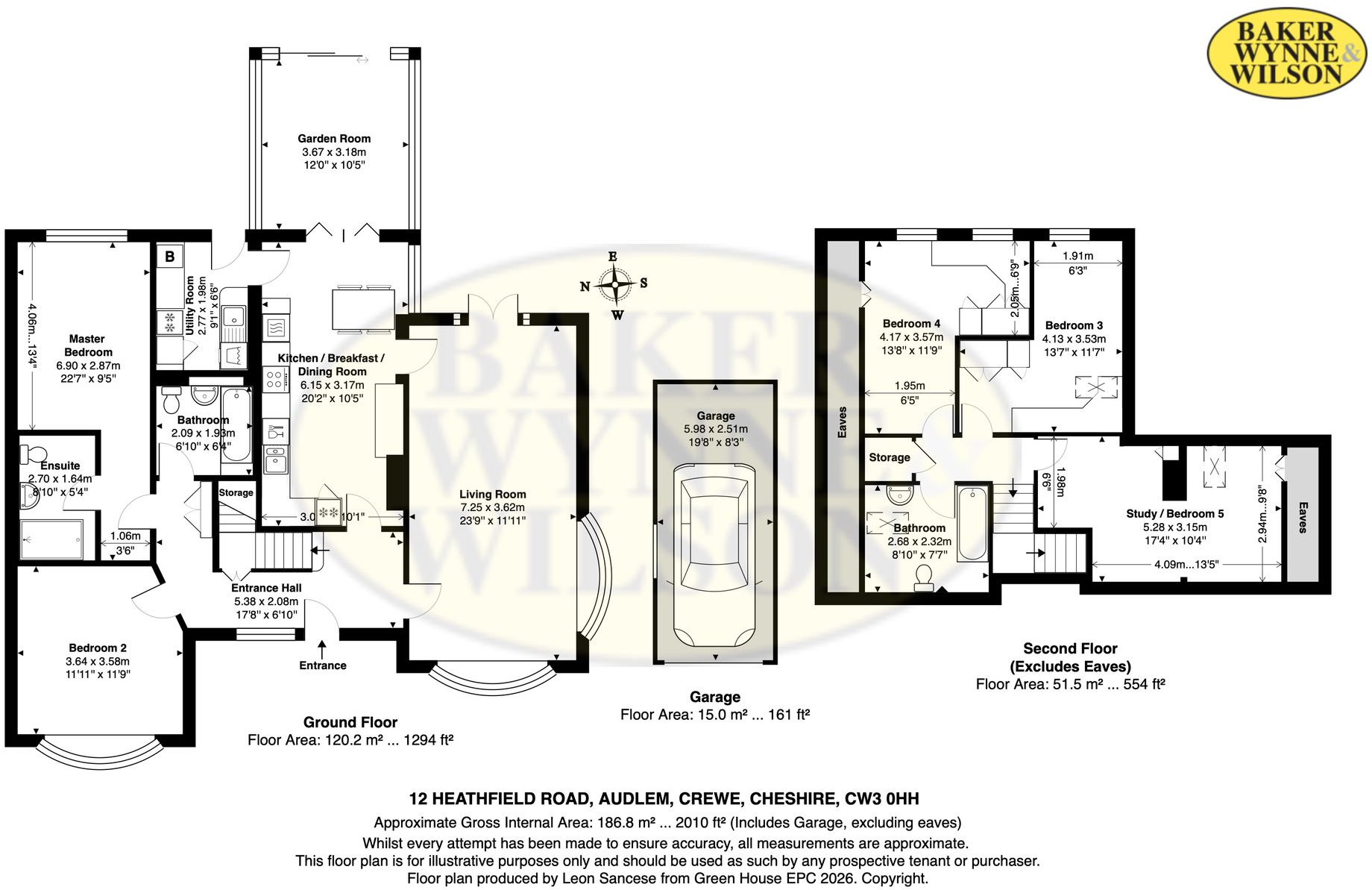
Farthings is constructed of brick under a tiled roof and approached over a gravel drive leading to a car parking and turning area. This excellent detached property represents a very rare buying opportunity within Audlem village. It was built in 1954 and offers the ultimate in flexibility with both ground and first floor bedrooms. It will be suitable for both family’s and those looking to downsize into a prime village location. From the front Farthings looks fairly typical of its 1950’s architecture type being appealing, characterful and interesting. But it doesn’t look particularly large. However, the bungalow has been extended through the years to 1,850 square feet. The majority of the accommodation is at ground floor level with just two bedrooms, a bathroom and an office/store at first floor level.
The rear garden is an absolute delight being South Easterly in its aspect. In addition to the well tendered lawn there is a large raised flagged terrace, well stocked flower and herbaceous borders and a kitchen garden.
LOCATION & AMENITIES
Farthings occupies a fantastic, slightly elevated position, 300 yards from Audlem village centre. Audlem was mentioned in the Doomsday book as Aldelyme, and Edward 1 granted a market charter in 1295. Audlem is on the Shropshire Union canal, which has a run of 15 locks, designed by Thomas Telford to raise the canal 93 feet from the Cheshire plain to the Shropshire plain. The River Weaver passes West of the village. The sought after, award winning, village of Audlem caters for daily needs with local co-operative store, newsagents, dry cleaners, butchers, flower shop, two restaurants, café, three public houses and a medical centre. Nantwich (7 miles) offers a more comprehensive range of services with High Street Retailers, banks, restaurants, leisure facilities and supermarkets. Crewe station (11 miles) provides a fast intercity rail network (London Euston 90 minutes, Manchester 40 minutes). The M6 motorway (Junction 16) is 11 miles. Manchester Airport is 40 miles. There are numerous sports facilities in the area including tennis, bowling, cricket, football, running and cycling clubs in Audlem. There are two 18 hole golf courses at nearby Whitchurch.
DIRECTIONS
From Nantwich proceed along Wellington Road (this becomes Audlem Road) for about 3.5 miles into Audlem, with a church on your left, turn left, proceed for 150 yards, turn left, before the bridge, continue for 100 yards, turn left onto Heathfield Road and the property is located almost immediately on the right hand side.
EPC Rating: D
Listed by
Nantwich
Gascoigne Halman - Connells
Reference: 88740477
EPC ratings on this postcode
We don't have a matched EPC for this property yet. Below are efficiency scores and details for other addresses on this postcode.
| Address | Current | Potential | Floor area | Age band | Type |
|---|---|---|---|---|---|
| 11a, Heathfield Road, Audlem, CREWE | 60 | 94 | 131 m² | England and Wales: 1950-1966 | Detached |
| 12 Heathfield Road, Audlem, CREWE | 66 | 75 | 175 m² | England and Wales: 1967-1975 | Detached |
| 14 Heathfield Road, Audlem, CREWE | 57 | 79 | 67 m² | England and Wales: 1950-1966 | Detached |
| 14, Heathfield Road, Audlem, CREWE | 18 | 64 | 148 m² | England and Wales: 1967-1975 | Detached |
| 18, Heathfield Road, Audlem, CREWE | 64 | 75 | 154 m² | England and Wales: 1976-1982 | Detached |
| 19 Heathfield Road, Audlem, CREWE | 52 | 81 | 79 m² | England and Wales: before 1900 | Detached |
| 19, Heathfield Road, Audlem, CREWE | 30 | 73 | 80 m² | England and Wales: before 1900 | Detached |
| 20 Heathfield Road, Audlem, CREWE | 60 | 80 | 108 m² | England and Wales: 1930-1949 | Detached |
| 20, Heathfield Road, Audlem, CREWE | 51 | 79 | 110 m² | England and Wales: 1900-1929 | Detached |
| 21 Heathfield Road, Audlem, CREWE | 49 | 73 | 128 m² | England and Wales: 1967-1975 | Detached |
| 21, Heathfield Road, Audlem, CREWE | 40 | 70 | 147 m² | England and Wales: 1950-1966 | Detached |
| 22, Heathfield Road, Audlem, CREWE | 62 | 81 | 142 m² | England and Wales: 1976-1982 | Detached |
| 23, Heathfield Road, Audlem, CREWE | 42 | 69 | 105 m² | — | Detached |
| 25 Heathfield Road, Audlem, CREWE | 58 | 75 | 94 m² | England and Wales: 1967-1975 | Detached |
| 25, Heathfield Road, Audlem, CREWE | 63 | 81 | 95 m² | England and Wales: 1967-1975 | Detached |
Flood risk
Zone: 1
Risk: Low
Job (default Low)
Floorplans
All
EPC Graphs
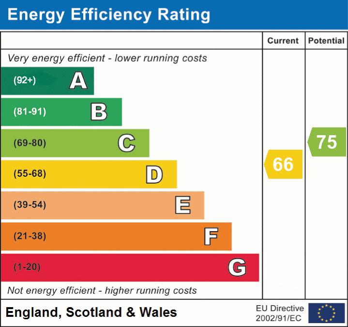
EPC 1
Price history
| Event | Date | Price | % change |
|---|---|---|---|
| Listed for sale | — | £600,000 | — |
Source: HM Land Registry Price Paid Data. Crown copyright.
Sold Comparables
Same street and nearby sales within 0.25 miles (last 5 years). Data from Land Registry Price Paid.
| Address | Price | Date | Type |
|---|---|---|---|
| 4 SYCAMORE CLOSE, AUDLEM, CREWE, CHESHIRE EAST, CW3 0EZ | £370,000 | 13/01/2026 | Detached |
| 45 CHESHIRE STREET, AUDLEM, CREWE, CHESHIRE EAST, CW3 0HB | £800,000 | 30/09/2025 | Detached |
| SPRING WOOD SCHOOL LANE, AUDLEM, CREWE, CHESHIRE EAST, CW3 0BA | £850,000 | 27/03/2023 | Detached |
| 6 VILLAGE VIEW CLOSE, AUDLEM, CREWE, CHESHIRE EAST, CW3 0HY | £410,000 | 10/10/2022 | Detached |
| 23 CHESHIRE STREET, AUDLEM, CREWE, CHESHIRE EAST, CW3 0AH | £430,000 | 30/09/2022 | Detached |
| 36A SALFORD, AUDLEM, CREWE, CHESHIRE EAST, CW3 0BJ | £600,000 | 30/09/2022 | Detached |
| MILL COTTAGE SALFORD, AUDLEM, CREWE, CHESHIRE EAST, CW3 0BJ | £585,000 | 26/09/2022 | Detached |
| 40 HEATHFIELD ROAD, AUDLEM, CREWE, CHESHIRE EAST, CW3 0HH | £665,000 | 07/09/2022 | Detached |
| 11A SYCAMORE CLOSE, AUDLEM, CREWE, CHESHIRE EAST, CW3 0EZ | £377,500 | 27/07/2022 | Detached |
| 3 EATON WAY, AUDLEM, CREWE, CHESHIRE EAST, CW3 0JR | £350,000 | 22/07/2022 | Detached |
| 27 HEATHFIELD ROAD, AUDLEM, CREWE, CHESHIRE EAST, CW3 0HH | £337,500 | 28/02/2022 | Detached |
| 4 SALFORD, AUDLEM, CREWE, CHESHIRE EAST, CW3 0AT | £395,000 | 20/12/2021 | Detached |
| 3 WILLOW CLOSE, AUDLEM, CREWE, CHESHIRE EAST, CW3 0JT | £545,000 | 30/06/2021 | Detached |
| 15 BROADWAYS, AUDLEM, CREWE, CHESHIRE EAST, CW3 0EY | £349,995 | 24/06/2021 | Detached |
| 7 WILLOW CLOSE, AUDLEM, CREWE, CHESHIRE EAST, CW3 0JT | £640,000 | 18/06/2021 | Detached |
Area average: £513,666 (15 sales)
Capital growth trend
Land Registry outcode average: last 12 months vs 5y and 10y ago (from sold prices).
House Price Index (HM Land Registry — official index, not sold-price averages): Cheshire East. Series: Detached. As of March 2026.
Rental Range
Estimated market rent for Cheshire East. Low = conservative, Realistic = average, Optimistic = best case.
Based on Local Authority from postcode lookup → Cheshire East.
LHA (30th percentile) floor for South Cheshire: £992/mo (Apr 2025 – Mar 2026)
Location
Address
Heathfield Road
Nearby
Nearest stations, universities and amenities (distance from property).
| Type | Name | Distance |
|---|---|---|
| Bus stop | Audlem, Stafford Street / Post Office | 0.2 miles |
| Bus stop | Little Heath, Heathfield Road / St James' CE Primary | 0.2 miles |
| Shop | Oxtail & Trotter | 0.2 miles |
| Shop | Audlem Dry Cleaners | 0.2 miles |
| Train station | Wrenbury | 4.3 miles |
| Train station | Nantwich | 5.1 miles |
| Hospital | Whitchurch Community Hospital | 7.4 miles |
| University | University of Buckingham Crewe Campus | 7.9 miles |
| University | Keele University | 9.7 miles |
| Hospital | North Staffordshire Nuffield Hospital | 11.7 miles |
Street-level crime
| Category | Count |
|---|---|
| Violence and sexual offences | 5 |
| Anti-social behaviour | 1 |
| Public order | 1 |
| Vehicle crime | 1 |
| Total incidents | 8 |
Within 1 mile during Apr 2026. Source: data.police.uk (England & Wales).
Schools nearby
Nearest open schools with Ofsted ratings (England). Closed schools are not shown. Data from Get Information about Schools and Ofsted.
| Name | Type | Distance | Ofsted |
|---|---|---|---|
| Audlem St James' CofE Primary School | Primary | 0.2 miles | Good — 9 Nov 2023 |
| Adderley CofE Primary School | Primary | 2.2 miles | Outstanding — 4 Jul 2024 |
| Sound and District Primary School | Primary | 3.5 miles | Good — 24 Apr 2024 |
| Stapeley Broad Lane CofE Primary School | Primary | 4.1 miles | Outstanding — 6 Feb 2015 |
| Wybunbury Delves CofE Primary School | Primary | 4.2 miles | Good — 7 Jun 2012 |
Rental Comparables
Loading rental comparables for this postcode. Refresh in a few minutes.
Rent-driven metrics
Based on Area rent estimate.
- Rent ratio — Monthly rent ÷ purchase price (1% rule). 1%+ = strong, 0.8–1% = okay, <0.8% = weak for cashflow.
- Max investor price — Rent ÷ 0.8%; the price at which rent would be 0.8% of price (Stoke-style target).
- Target investor price — Rent ÷ 1%; the price at which rent would be 1% of price (strong cashflow band).
- Gross yield — Annual rent as % of purchase price (no costs).
Enter House Number
Enter the house number to help us retrieve more accurate pricing history and property data.
Please log in to submit or correct the house number for this listing.
Log in to continue