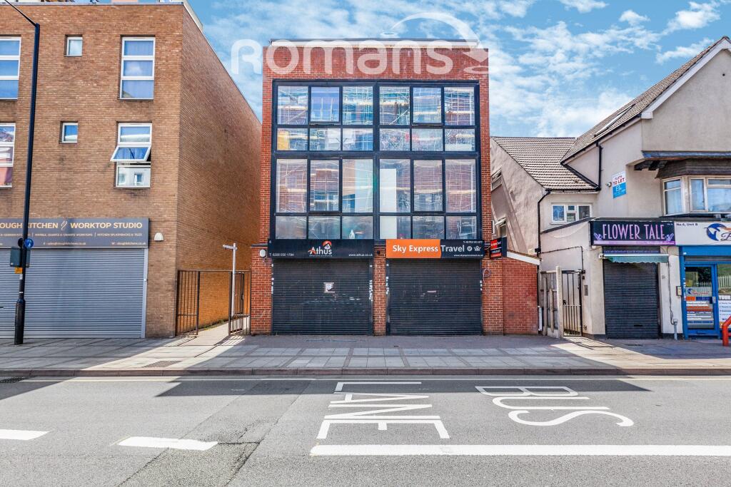
High Street
Slough, SL1, SL1 1EE
Property details
Council tax band
B
Deprivation
Decile 3 (9,645 of 33,755)
Street crime
606 incidents within 1 mile (Apr 2026)
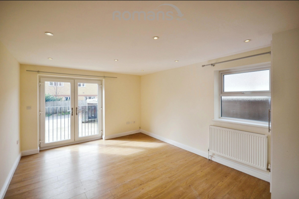
Key features
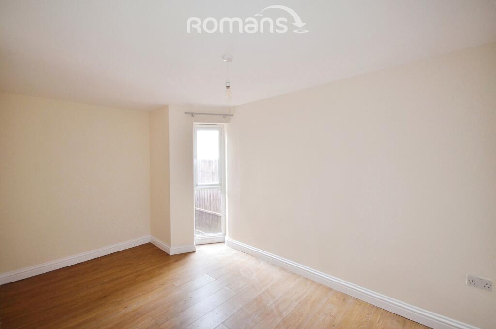
- One bedroom
- Short walk to station
- Gas central heating
- Close to High Street
- Unfurnished
- Juliett balcony
- Easy access to Heathrow
- Easy access to M4
- No parking
Additional details
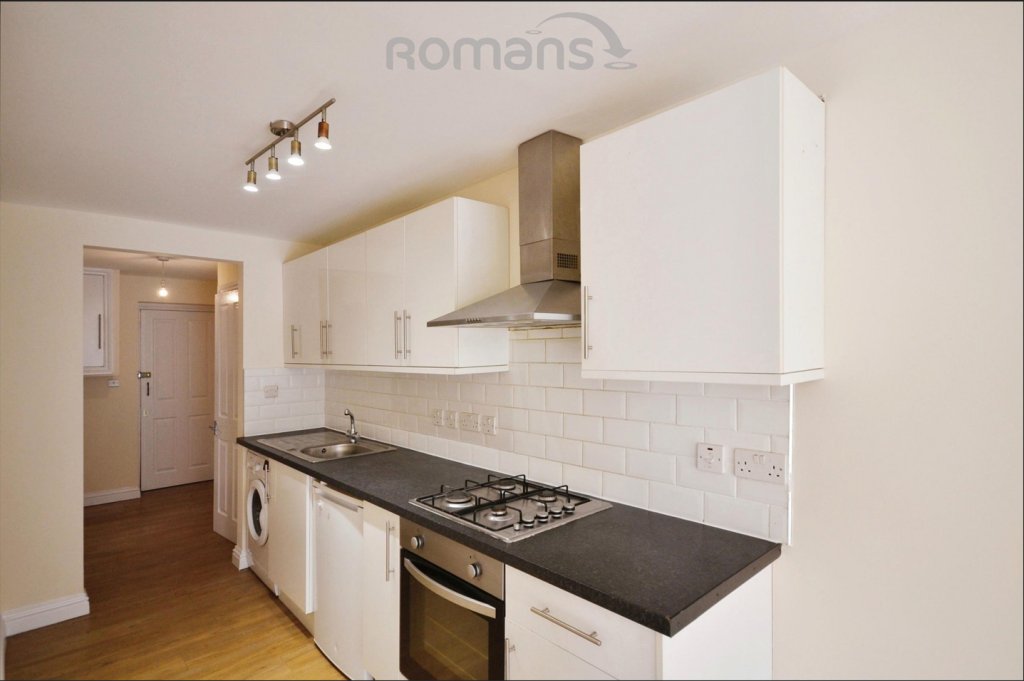
- Heating
- Gas central
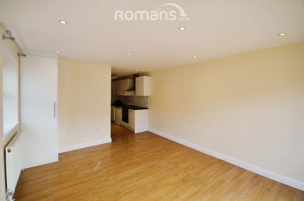
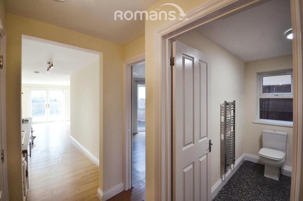
Description
EPC Rating: C
Council Tax Band: B
Rent excludes the tenancy deposit and any other permitted payments.
Deposit payable is £1182.69
A Holding Deposit of £236.53 based on the advertised rent, is required to reserve this property.
Min Term 1 years fixed term.
Parking: No parking
Flood Risk Verification: No risk of flooding
Utility Information
Heating type: Gas central
Electricity: Mains electric.
Water and Sewerage: Mains metered water/sewerage
Internet and Mobile Phone/Broadband Coverage: Ofcom suggest that Ultrafast broadband is available to this property and 5g Mobile signal may be available on some networks. Information regarding broadband options and phone signal can be obtained from the Ofcom broadband and mobile coverage checker
Listed by
Burnham
Leaders and Romans Group
Reference: 173673836
EPC ratings on this postcode
We don't have a matched EPC for this property yet. Below are efficiency scores and details for other addresses on this postcode.
| Address | Current | Potential | Floor area | Age band | Type |
|---|---|---|---|---|---|
| Flat 1, 4-6 High Street, SLOUGH | 75 | 75 | 57 m² | England and Wales: 2007-2011 | Flat |
| Flat 1, 4, High Street, SLOUGH | 65 | 68 | 22 m² | England and Wales: 1991-1995 | Flat |
| Flat 1, 6-8, High Street, SLOUGH | 78 | 78 | 44 m² | England and Wales: 2012 onwards | Flat |
| Flat 1, 6-8, High Street, SLOUGH | 76 | 76 | 45 m² | — | Flat |
| Flat 10, 6-8, High Street, SLOUGH | 80 | 80 | 49 m² | England and Wales: 2003-2006 | Flat |
| Flat 10, 6-8, High Street, SLOUGH | 76 | 76 | 30 m² | — | Flat |
| Flat 11, 6-8, High Street, SLOUGH | 76 | 76 | 59 m² | — | Flat |
| Flat 12, 6-8, High Street, SLOUGH | 79 | 79 | 72 m² | England and Wales: 2007-2011 | Flat |
| Flat 12, 6-8, High Street, SLOUGH | 76 | 76 | 59 m² | — | Flat |
| Flat 2, 4-6 High Street, SLOUGH | 83 | 83 | 82 m² | England and Wales: 2007-2011 | Flat |
| Flat 2, 4, High Street, SLOUGH | 71 | 73 | 29 m² | England and Wales: 1991-1995 | Flat |
| Flat 2, 6-8, High Street, SLOUGH | 76 | 76 | 45 m² | — | Flat |
| Flat 3, 4-6 High Street, SLOUGH | 79 | 79 | 91 m² | England and Wales: 2007-2011 | Flat |
| Flat 3, 4, High Street, SLOUGH | 75 | 77 | 29 m² | England and Wales: 1991-1995 | Flat |
| Flat 3, 6-8, High Street, SLOUGH | 75 | 75 | 30 m² | — | Flat |
Flood risk
Zone: 1
Risk: Low
Job (default Low)
Floorplans
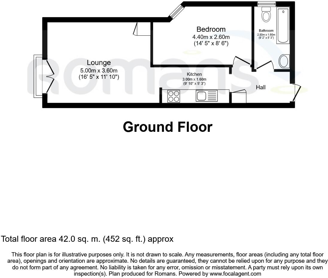
Floorplan. 6-8 High
EPC Graphs

Capture. Flat 1
Rental Range
Estimated market rent for Slough. Low = conservative, Realistic = average, Optimistic = best case.
Based on Local Authority from postcode lookup → Slough.
LHA (30th percentile) floor for East Thames Valley: £898/mo (Apr 2025 – Mar 2026)
Location
Address
Wellington Street
Nearby
Nearest stations, universities and amenities (distance from property).
| Type | Name | Distance |
|---|---|---|
| Shop | Sky Express Travel | 0.0 miles |
| Shop | Athus | 0.0 miles |
| Bus stop | Bingo Hall | 0.1 miles |
| Bus stop | Library | 0.1 miles |
| Train station | Slough | 0.4 miles |
| Hospital | Upton Hospital | 0.4 miles |
| Train station | Windsor and Eton Riverside | 1.7 miles |
| Hospital | Wexham Park Hospital | 1.9 miles |
| University | Unknown | 5.4 miles |
Street-level crime
| Category | Count |
|---|---|
| Violence and sexual offences | 203 |
| Anti-social behaviour | 76 |
| Public order | 50 |
| Criminal damage and arson | 47 |
| Other theft | 43 |
| Drugs | 37 |
| Shoplifting | 35 |
| Vehicle crime | 31 |
| Burglary | 27 |
| Bicycle theft | 21 |
| Robbery | 15 |
| Other crime | 10 |
| Possession of weapons | 6 |
| Theft from the person | 5 |
| Total incidents | 606 |
Within 1 mile during Apr 2026. Source: data.police.uk (England & Wales).
Schools nearby
Nearest open schools with Ofsted ratings (England). Closed schools are not shown. Data from Get Information about Schools and Ofsted.
| Name | Type | Distance | Ofsted |
|---|---|---|---|
| Darul Madinah | Other | 0.3 miles | Good — 9 Sep 2024 |
| Littledown School | Other | 0.4 miles | Good — 6 Jun 2013 |
| Slough and Eton Church of England Business and Enterprise College | Secondary | 0.5 miles | Outstanding — 13 Dec 2013 |
| Grove Academy | Other | 0.6 miles | Inadequate — 5 May 2022 |
| Chalvey Nursery School & Early Years Centre | Nursery | 0.6 miles | Outstanding — 25 Jul 2019 |
Rental Comparables
Residential lets from OpenRent and Rightmove for the area (same bedroom count). Use to validate rent estimates. Student lets are excluded.
| Title | Rent | Beds | Distance | As seen on |
|---|---|---|---|---|
| 1 Bed Flat, Brisbane Court, SL1 | £1,200/mo | 1 | 0.24 miles | OpenRent |
| Studio Flat, King Edward Street, SL1 | £945/mo | 1 | 0.31 miles | OpenRent |
Average rent: £1,073/mo (2 listings)
Enter House Number
Enter the house number to help us retrieve more accurate pricing history and property data.
Please log in to submit or correct the house number for this listing.
Log in to continue