Basford Park Road
Newcastle, ST5, ST5 0PS
£1,200 pcm
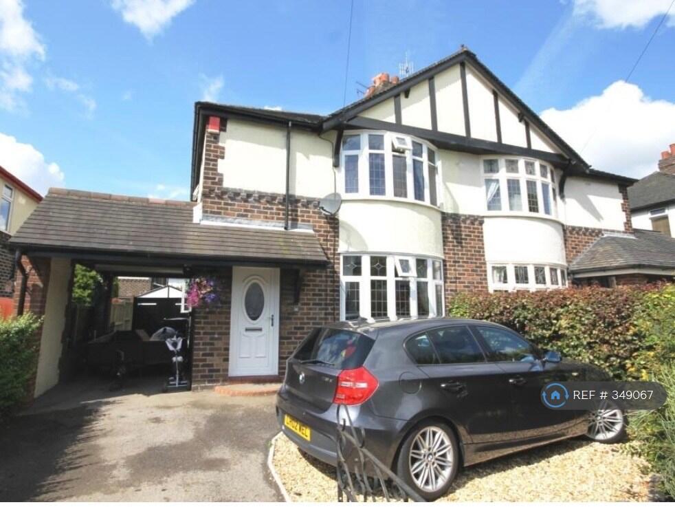
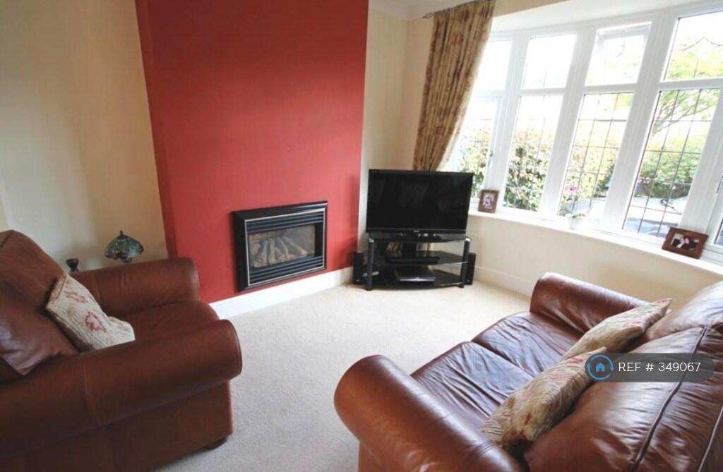
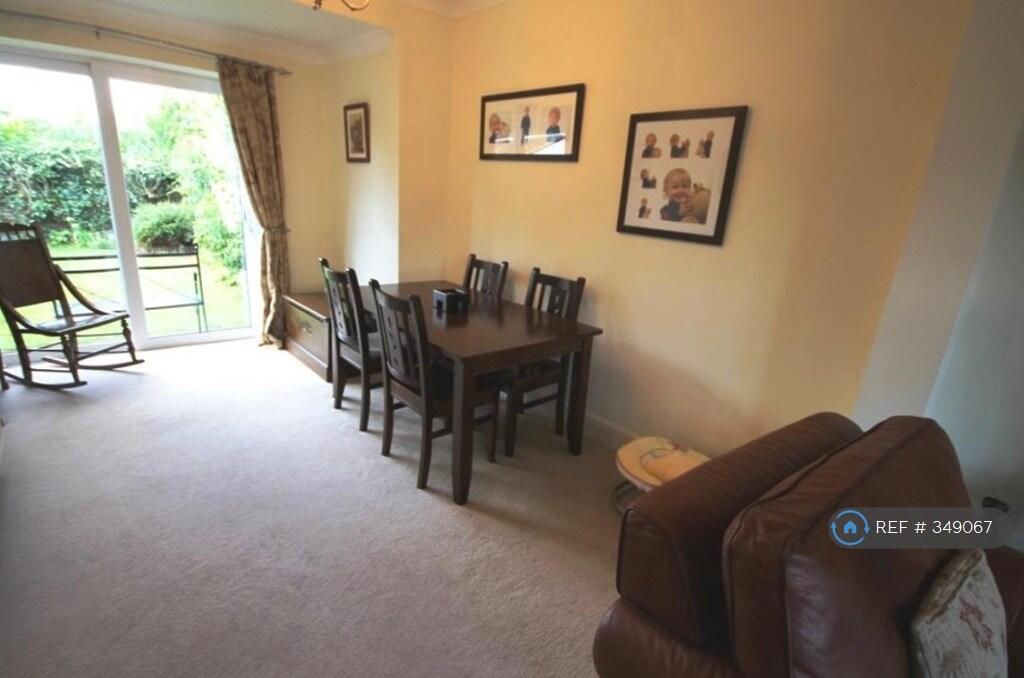
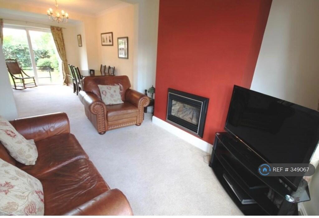
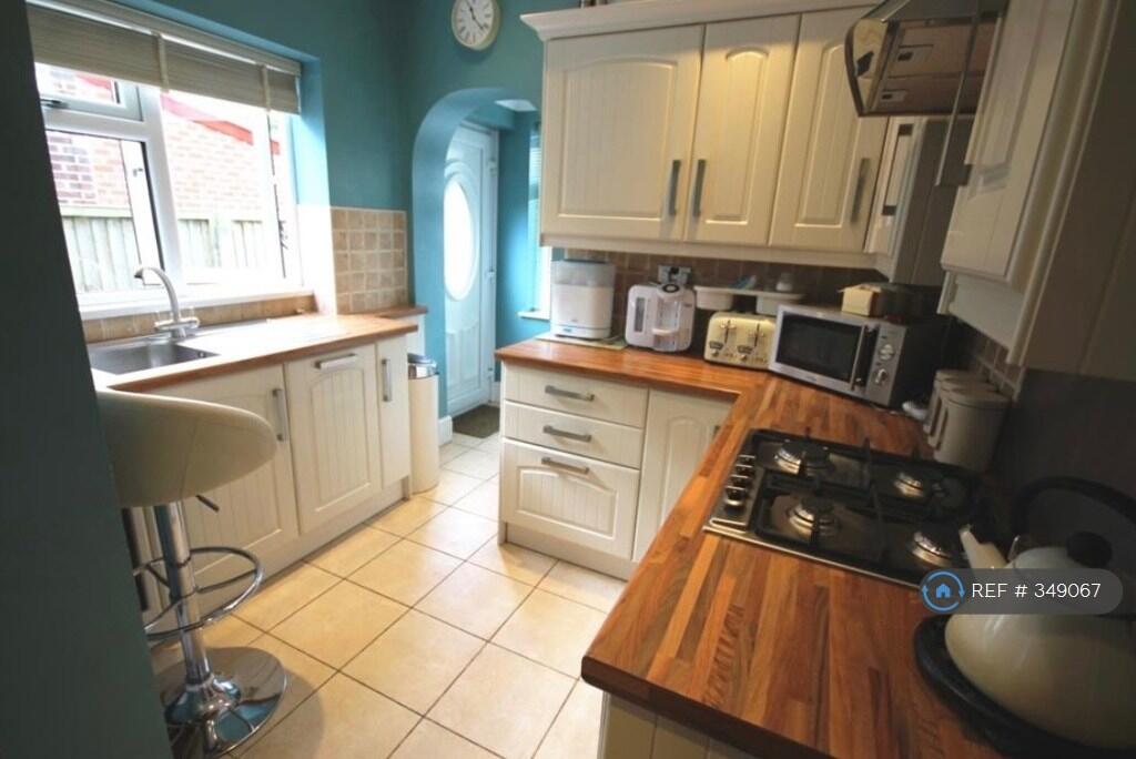
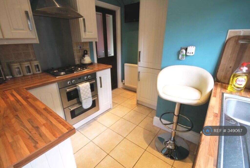
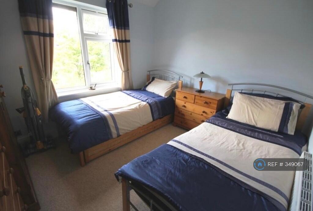
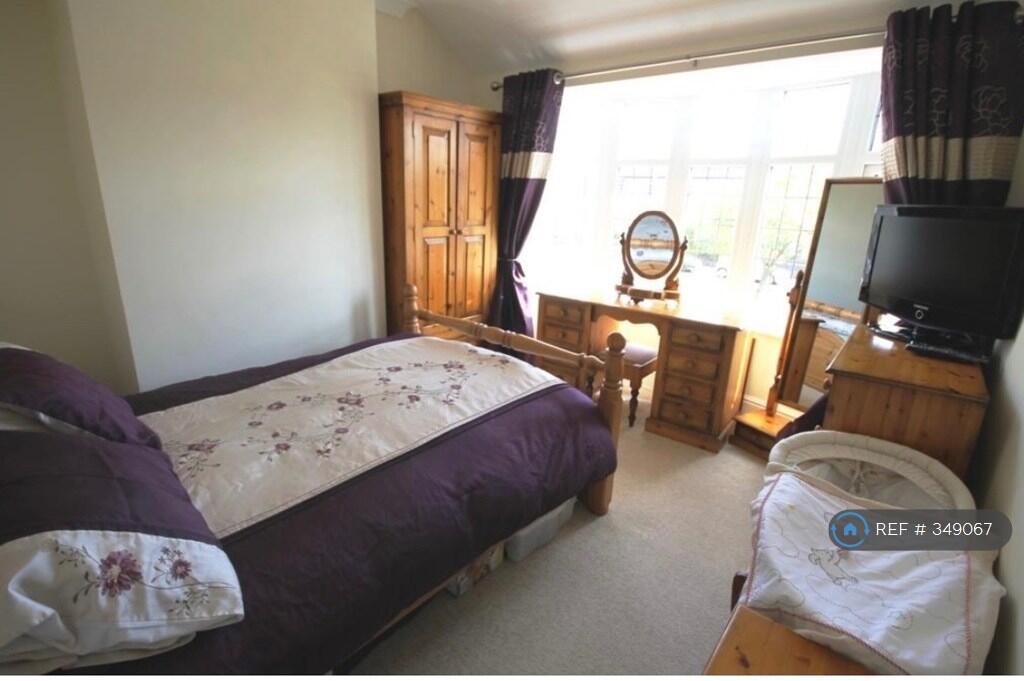
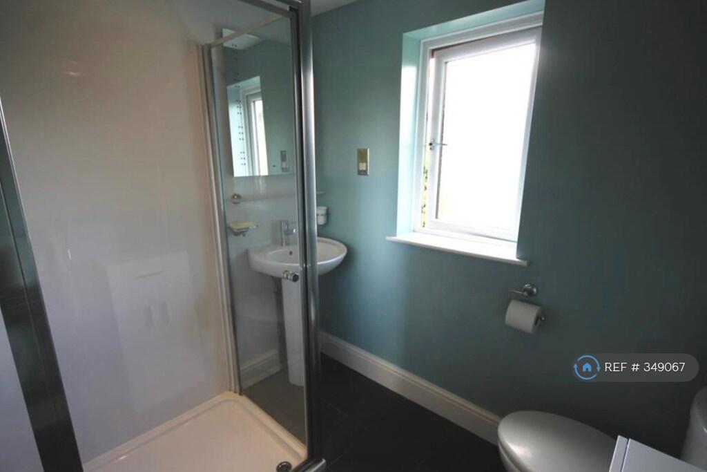
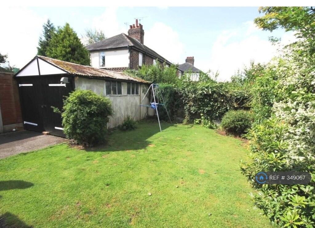
Photo 1 Photo 2 Photo 3 Photo 4 Photo 5 Photo 6 Photo 7 Photo 8 Photo 9 Photo 10
/ 10
Property details
Deprivation
Decile 8 (25,661 of 33,755)
Street crime
383 incidents within 1 mile (Mar 2026)
Key features
- No Agent Fees
- Property Reference Number: 349067
Additional details
- Parking
- Private
- Garden
- Private garden
Description
We are delighted to bring to the rental market this desirable and spacious bay fronted semi detached home situated in this ever popular and convenient May Bank location which provides ease of access to local shops, schools and amenities as well as offering good road links to the A500. This desirable home offers the modern day comforts of Upvc double glazing along with gas combination central heating.
The accommodation comprises of entrance hall, bay fronted lounge through dining room with patio doors, fitted kitchen/laundry area.
To the first floor are three bedrooms along with a modern bathroom.
Externally the property to the front has been landscaped to provide off road parking with a car port to the side, and to the rear a single garage and enclosed rear garden.
This home should be viewed at a potential renters earliest convenience to avoid disappointment.
Note whist pictures show furnished this is not included, and property will be unfurnished.
Summary & Exclusions:
- Rent Amount: £1,200.00 per month (£276.92 per week)
- Deposit / Bond: £1,200.00
- 3 Bedrooms
- 1 Bathrooms
- Property comes unfurnished
- Available to move in from 29 May 2026
- Maximum number of tenants is 2
- No Students
- No Smokers
- Bills not included
- Property has parking
- Property has garden access
- Property has fireplace
- EPC Rating: E
If calling, please quote reference: 349067
Fees:
You will not be charged any admin fees.
Contact today to book a viewing and have the landlord show you round!
Request Details form responded to 24/7, with phone bookings available 9am-9pm, 7 days a week.
Listed by
London
Techbeard Ltd
Reference: 89097690
EPC ratings on this postcode
We don't have a matched EPC for this property yet. Below are efficiency scores and details for other addresses on this postcode.
| Address | Current | Potential | Floor area | Age band | Type |
|---|---|---|---|---|---|
| 101 Basford Park Road, NEWCASTLE | 70 | 80 | 65 m² | England and Wales: 1900-1929 | Terraced |
| 103, Basford Park Road | 58 | 83 | 72 m² | England and Wales: 1900-1929 | House |
| 103, Basford Park Road | 48 | 61 | 85 m² | England and Wales: 1900-1929 | House |
| 103, Basford Park Road, NEWCASTLE | 58 | 83 | 72 m² | England and Wales: 1900-1929 | Terraced |
| 105 Basford Park Road | 73 | 87 | 73 m² | England and Wales: 1930-1949 | House |
| 105 Basford Park Road, NEWCASTLE | 73 | 87 | 73 m² | England and Wales: 1930-1949 | Terraced |
| 105, Basford Park Road | 21 | 65 | 67 m² | England and Wales: 1900-1929 | House |
| 105, Basford Park Road, NEWCASTLE | 21 | 65 | 67 m² | England and Wales: 1900-1929 | Terraced |
| 107 Basford Park Road | 53 | 75 | 71 m² | England and Wales: 1930-1949 | House |
| 107 Basford Park Road, NEWCASTLE | 53 | 75 | 71 m² | England and Wales: 1930-1949 | Terraced |
| 107, Basford Park Road | 46 | 79 | 79 m² | England and Wales: 1930-1949 | House |
| 107, Basford Park Road, NEWCASTLE | 46 | 79 | 79 m² | England and Wales: 1930-1949 | Terraced |
| 109 Basford Park Road | 67 | 80 | 90 m² | England and Wales: 1930-1949 | House |
| 109 Basford Park Road, NEWCASTLE | 67 | 80 | 90 m² | England and Wales: 1930-1949 | Detached |
| 109, Basford Park Road | 71 | 71 | 102 m² | England and Wales: 1930-1949 | House |
Flood risk
Zone: 1
Risk: Low
Job (default Low)
Rental Range
Estimated market rent for Newcastle-under-Lyme. Low = conservative, Realistic = average, Optimistic = best case.
Based on Local Authority from postcode lookup → Newcastle-under-Lyme.
LHA (30th percentile) floor for Staffordshire North: £593/mo (Apr 2025 – Mar 2026)
Location
Address
Basford Park Road
Nearby
Nearest stations, universities and amenities (distance from property).
| Type | Name | Distance |
|---|---|---|
| Bus stop | Bleak Street | 0.0 miles |
| Bus stop | Pitfield Avenue | 0.1 miles |
| Shop | Morrisons Daily | 0.1 miles |
| Shop | Decisions Hair Studio | 0.4 miles |
| Hospital | Royal Stoke University Hospital | 1.3 miles |
| Train station | Longport | 1.4 miles |
| Train station | Stoke-on-Trent | 1.7 miles |
| Hospital | North Staffordshire Nuffield Hospital | 2.4 miles |
| University | Keele University | 2.8 miles |
| University | Buxton & Leek College | 9.9 miles |
Street-level crime
| Category | Count |
|---|---|
| Violence and sexual offences | 131 |
| Anti-social behaviour | 91 |
| Public order | 38 |
| Criminal damage and arson | 24 |
| Shoplifting | 23 |
| Other theft | 19 |
| Vehicle crime | 17 |
| Drugs | 11 |
| Burglary | 9 |
| Other crime | 8 |
| Possession of weapons | 5 |
| Robbery | 3 |
| Bicycle theft | 2 |
| Theft from the person | 2 |
| Total incidents | 383 |
Within 1 mile during Mar 2026. Source: data.police.uk (England & Wales).
Schools nearby
Nearest open schools with Ofsted ratings (England). Closed schools are not shown. Data from Get Information about Schools and Ofsted.
| Name | Type | Distance | Ofsted |
|---|---|---|---|
| May Bank Infants' School | Primary | 0.1 miles | Good — 21 Jan 2024 |
| St Wulstan's Catholic Primary School | Primary | 0.5 miles | Good — 19 Jul 2013 |
| St Margaret's CofE (VC) Junior School | Primary | 0.5 miles | Good — 1 May 2014 |
| The Orme Academy | Secondary | 0.5 miles | Good — 9 Jul 2024 |
| Lyme Brook Independent School | Other | 0.5 miles | Good — 22 Oct 2023 |
Rental Comparables
Residential lets from OpenRent and Rightmove for the area (same bedroom count). Use to validate rent estimates. Student lets are excluded.
Average rent: £921/mo (29 listings)
Enter House Number
Enter the house number to help us retrieve more accurate pricing history and property data.
Please log in to submit or correct the house number for this listing.
Log in to continue