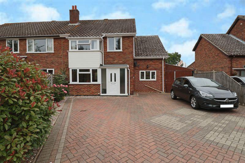
115 WESTWOOD AVENUE
LOWESTOFT, SUFFOLK NR33 9RS
£250,000
Property details
Tenure
FREEHOLD
Floor area
106 m²
EPC rating
C
Last sold
£240,000 Jun 2020
Price per m²
£2,358/m²
Local average
£226,023 (+10.6%)
Deprivation
Decile 9 (27,726 of 33,755)
Street crime
118 incidents within 1 mile (Mar 2026)
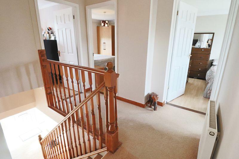
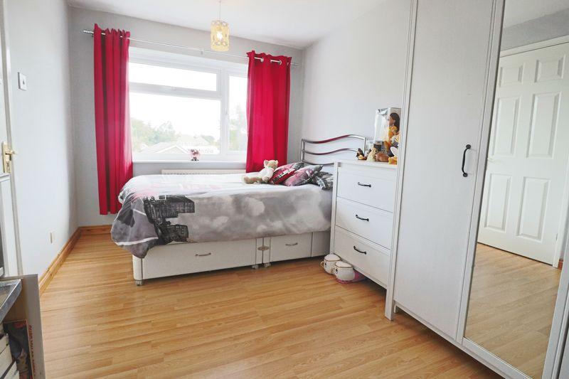
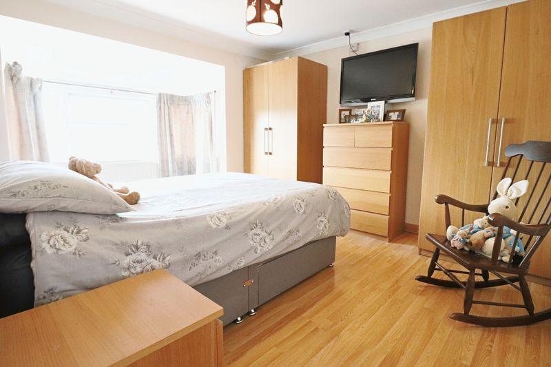
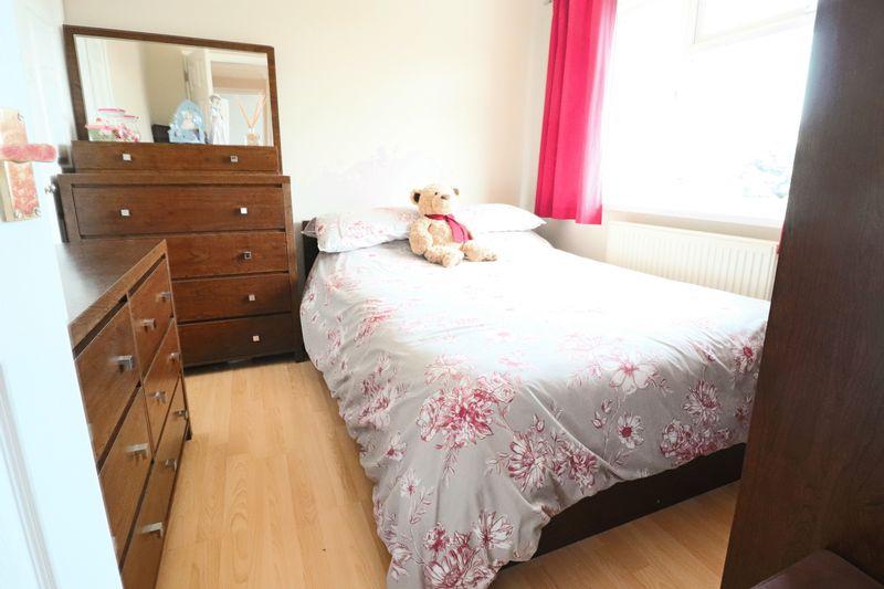
Key features
- LARGE EXTENSIONS
- 4 GENEROUS SIZE BEDROOMS
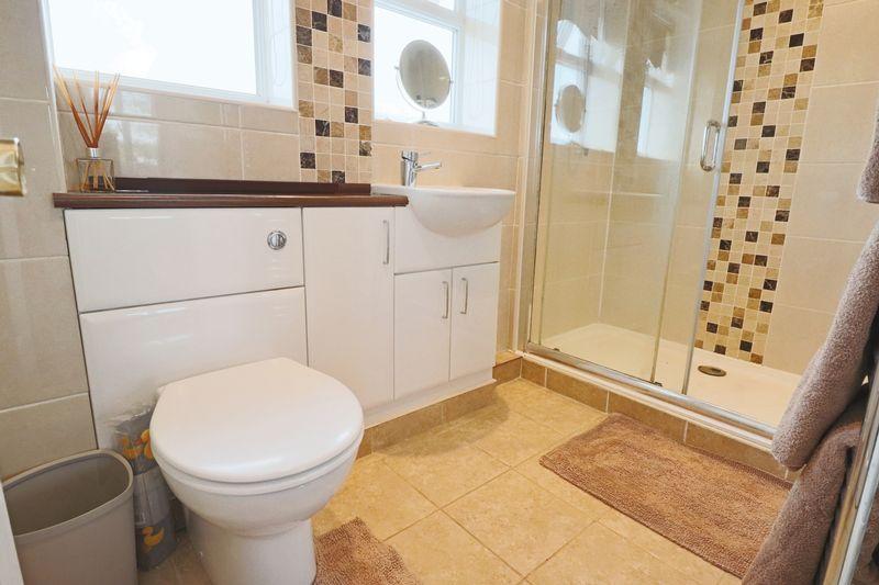
- VERY WELL FITTED FAMILY SHOWER ROOM
- DOWNSTAIRS CLOAKROOM
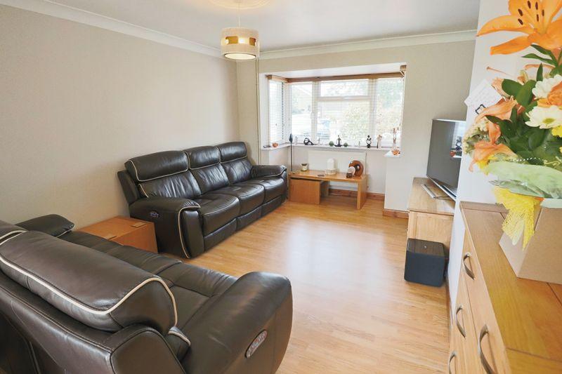
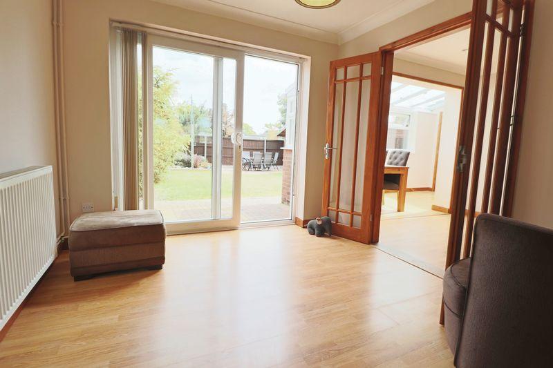
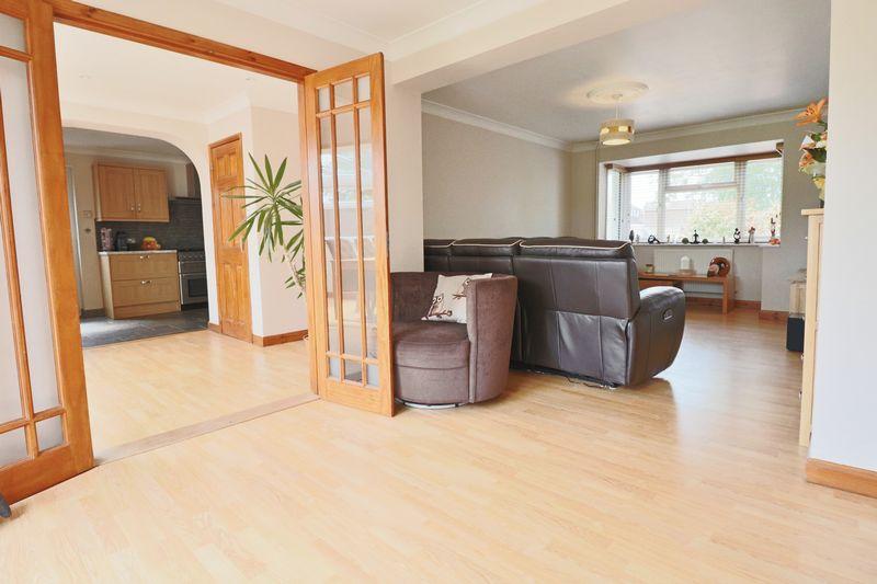
- SPACIOUS THROUGH LOUNGE/DINER
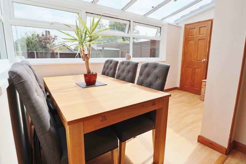
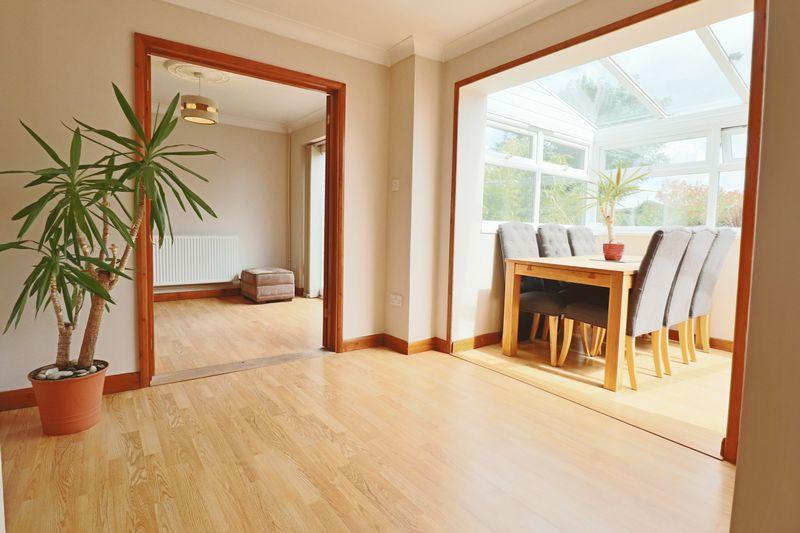
- SUPERB SUN ROOM
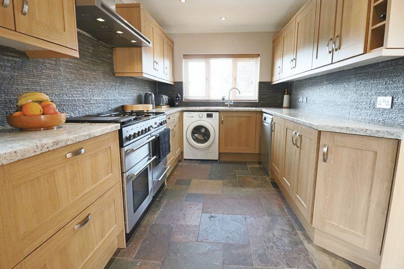
- FULLY FITTED MODERN KITCHEN
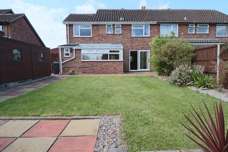
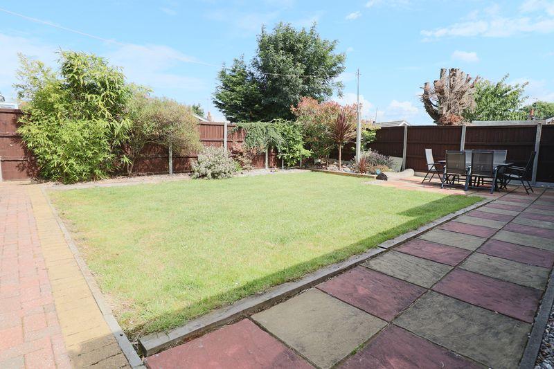
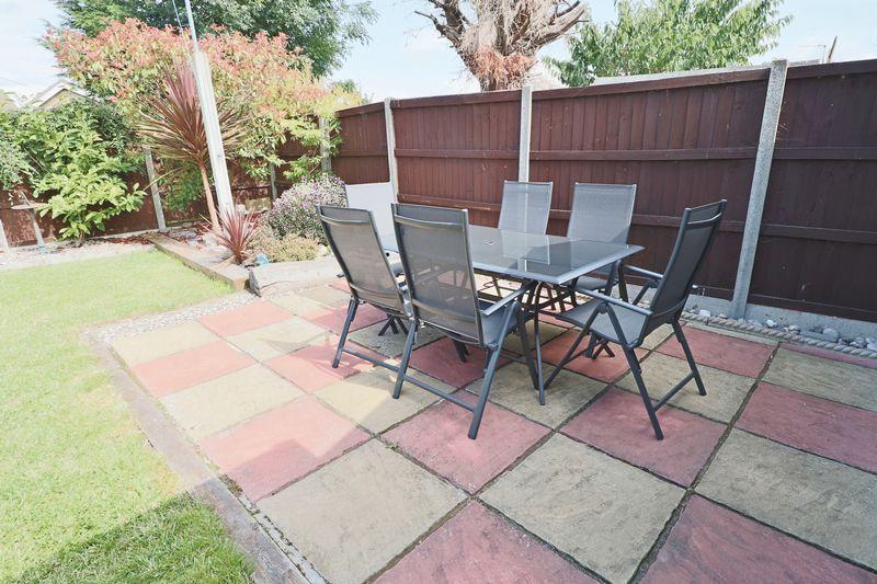
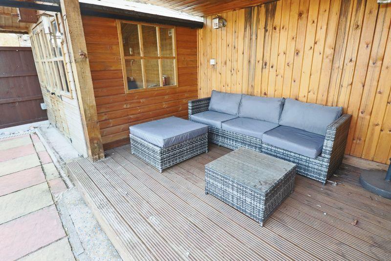
- DELIGHTFUL GARDENS WITH COVERED LOGGIAS AND SUMMER HOUSE
- LARGE DRIVEWAY PROVIDING AMPLE PARKING
Additional details
- Parking
- Yes
- Garden
- Yes
Description
Listed by
Lowestoft
LSL Franchise
Reference: 63682329
EPC Rating & Upgrade Cost
Current rating: C
Potential rating: B
Inspection date: 10/03/2020
Current heating cost: £595/year
Potential heating cost: £534/year
Recommendations
- Cavity wall insulation (1,500)
- Floor insulation (solid floor) (6,000)
- Low energy lighting for all fixed outlets (20)
- Solar water heating (6,000)
- Solar photovoltaic panels, 2.5 kWp (5,500)
Flood risk
Zone: 1
Risk: Low
Job (default Low)
Floorplans
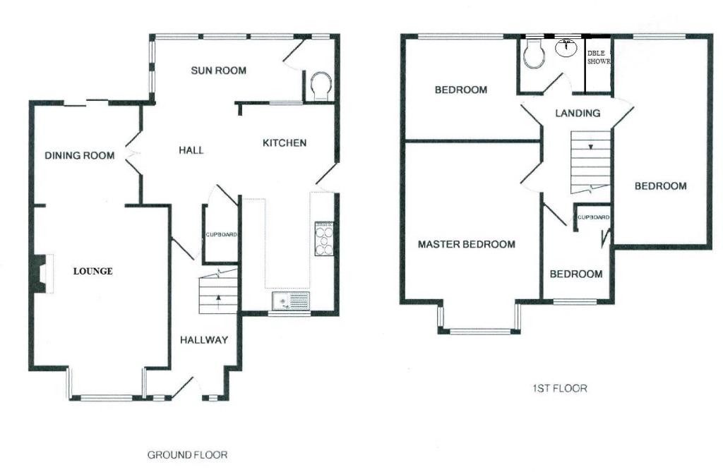
Floorplan 1
EPC Graphs

EPC (FULL DOCU...
FENSA Certificates
This property has 2 FENSA certificate(s) on record, indicating window/door installations by FENSA-approved installers.
FENSA Certificate #7304104
Property Details
Street: 115 Westwood Avenue
Town: LOWESTOFT
Postcode: NR33 9RS
Installation Details
Items: 2 windows and 1 door
Certificate Issued: 21/04/2010
Work Completed: 01/04/2010
This certificate data was retrieved from FENSA's database
FENSA Certificate #9311228
Property Details
Street: 115 Westwood Avenue
Town: LOWESTOFT
Postcode: NR33 9RS
Installation Details
Items: 2 windows
Certificate Issued: 28/01/2013
Work Completed: 17/11/2012
This certificate data was retrieved from FENSA's database
What is FENSA? FENSA (Fenestration Self-Assessment Scheme) is a government-authorised scheme that monitors building regulation compliance for replacement windows and doors. Certificates indicate that work was completed by FENSA-approved installers.
Price history
| Event | Date | Price | % change |
|---|---|---|---|
| Sold | 26/06/2020 (5 years ago) | £240,000 | — |
Source: HM Land Registry Price Paid Data. Crown copyright.
Sold Comparables
Same street and nearby sales within 0.25 miles (last 5 years). Data from Land Registry Price Paid.
| Address | Price | Date | Type |
|---|---|---|---|
| Same street 103 WESTWOOD AVENUE, LOWESTOFT, EAST SUFFOLK, SUFFOLK, NR33 9RS | £285,000 | 26/09/2025 | Semi-detached |
| 5 STANSFIELD CLOSE, LOWESTOFT, EAST SUFFOLK, SUFFOLK, NR33 9AE | £320,000 | 28/11/2023 | Semi-detached |
| 25 HIGHLAND WAY, LOWESTOFT, EAST SUFFOLK, SUFFOLK, NR33 9AP | £155,000 | 14/11/2023 | Semi-detached |
| 53 HIGHLAND WAY, LOWESTOFT, EAST SUFFOLK, SUFFOLK, NR33 9AP | £195,000 | 05/10/2023 | Semi-detached |
| Same street 117 WESTWOOD AVENUE, LOWESTOFT, EAST SUFFOLK, SUFFOLK, NR33 9RS | £345,000 | 21/09/2023 | Semi-detached |
| 4 HIGHLAND WAY, LOWESTOFT, EAST SUFFOLK, SUFFOLK, NR33 9AR | £215,000 | 11/08/2023 | Semi-detached |
| 55 HIGHLAND WAY, LOWESTOFT, EAST SUFFOLK, SUFFOLK, NR33 9AP | £225,000 | 01/08/2023 | Semi-detached |
| 18 WESTLAND ROAD, LOWESTOFT, EAST SUFFOLK, SUFFOLK, NR33 9AB | £240,000 | 21/07/2023 | Semi-detached |
| 49 HIGHLAND WAY, LOWESTOFT, EAST SUFFOLK, SUFFOLK, NR33 9AP | £310,000 | 14/07/2023 | Semi-detached |
| 96 COLVILLE ROAD, LOWESTOFT, EAST SUFFOLK, SUFFOLK, NR33 9QY | £260,000 | 21/06/2023 | Semi-detached |
| 4 RANWORTH AVENUE, LOWESTOFT, EAST SUFFOLK, SUFFOLK, NR33 9HN | £270,000 | 31/03/2023 | Semi-detached |
| 69 HIGHLAND WAY, LOWESTOFT, EAST SUFFOLK, SUFFOLK, NR33 9AP | £265,000 | 12/01/2023 | Semi-detached |
| 28 HIGHLAND WAY, LOWESTOFT, EAST SUFFOLK, SUFFOLK, NR33 9AR | £172,500 | 16/12/2022 | Semi-detached |
| 3 LOXLEY ROAD, LOWESTOFT, EAST SUFFOLK, SUFFOLK, NR33 9PG | £290,000 | 21/11/2022 | Semi-detached |
| 42 LOXLEY ROAD, LOWESTOFT, EAST SUFFOLK, SUFFOLK, NR33 9PG | £280,000 | 16/11/2022 | Semi-detached |
| 1 BREYDON WAY, LOWESTOFT, EAST SUFFOLK, SUFFOLK, NR33 9AS | £235,000 | 31/10/2022 | Semi-detached |
| 13 HIGHLAND WAY, LOWESTOFT, EAST SUFFOLK, SUFFOLK, NR33 9AP | £212,000 | 19/10/2022 | Semi-detached |
| 25 DIXON DRIVE, LOWESTOFT, EAST SUFFOLK, SUFFOLK, NR33 9PE | £235,000 | 09/09/2022 | Semi-detached |
| 16 DIXON DRIVE, LOWESTOFT, EAST SUFFOLK, SUFFOLK, NR33 9PE | £260,000 | 16/08/2022 | Semi-detached |
| 3 BOLLARD WAY, LOWESTOFT, EAST SUFFOLK, SUFFOLK, NR33 9HH | £260,000 | 15/07/2022 | Semi-detached |
| 1 WINDWARD WAY, LOWESTOFT, EAST SUFFOLK, SUFFOLK, NR33 9HF | £267,600 | 08/07/2022 | Semi-detached |
| 25 WESTLAND ROAD, LOWESTOFT, EAST SUFFOLK, SUFFOLK, NR33 9AA | £223,000 | 06/07/2022 | Semi-detached |
| Same street 117 WESTWOOD AVENUE, LOWESTOFT, EAST SUFFOLK, SUFFOLK, NR33 9RS | £260,000 | 30/06/2021 | Semi-detached |
Street average: £296,667 (3 sales)
Area average: £244,505 (20 sales)
Capital growth trend
Land Registry outcode average: last 12 months vs 5y and 10y ago (from sold prices).
House Price Index (HM Land Registry — official index, not sold-price averages): East Suffolk. Series: Semi-detached. As of February 2026.
Rental Range
Estimated market rent for East Suffolk. Low = conservative, Realistic = average, Optimistic = best case.
Based on Local Authority from postcode lookup → East Suffolk.
LHA (30th percentile) floor for Lowestoft & Great Yarmouth: £823/mo (Apr 2025 – Mar 2026)
Location
Nearby
Nearest stations, universities and amenities (distance from property).
| Type | Name | Distance |
|---|---|---|
| Bus stop | Landspring Lane | 0.1 miles |
| Shop | HairWorld | 0.1 miles |
| Shop | Solebay Fish Co. | 0.2 miles |
| Train station | Oulton Broad South | 0.4 miles |
| Train station | Oulton Broad North | 0.9 miles |
| Hospital | Carlton Court Hospital | 1.1 miles |
| Hospital | Airey Close | 2.3 miles |
Street-level crime
| Category | Count |
|---|---|
| Violence and sexual offences | 48 |
| Criminal damage and arson | 15 |
| Vehicle crime | 10 |
| Anti-social behaviour | 8 |
| Public order | 8 |
| Other theft | 7 |
| Shoplifting | 7 |
| Bicycle theft | 4 |
| Robbery | 4 |
| Burglary | 3 |
| Other crime | 3 |
| Possession of weapons | 1 |
| Total incidents | 118 |
Within 1 mile during Mar 2026. Source: data.police.uk (England & Wales).
Schools nearby
Nearest open schools with Ofsted ratings (England). Closed schools are not shown. Data from Get Information about Schools and Ofsted.
| Name | Type | Distance | Ofsted |
|---|---|---|---|
| Elm Tree Primary School | Primary | 0.2 miles | Good — 26 Sep 2022 |
| Dell Primary School | Primary | 0.3 miles | Good — 30 Jun 2022 |
| Westwood Primary School | Primary | 0.4 miles | Good — 20 Apr 2017 |
| Warren School | Other | 0.6 miles | — (Inspected (no overall grade)) |
| East Point Academy | Secondary | 0.7 miles | Good — 21 Nov 2016 |
Rental Comparables
Rental listings exist nearby, but none matched the 4-bedroom estimate from EPC for this property.
Rent-driven metrics
Based on Area rent estimate.
- Rent ratio — Monthly rent ÷ purchase price (1% rule). 1%+ = strong, 0.8–1% = okay, <0.8% = weak for cashflow.
- Max investor price — Rent ÷ 0.8%; the price at which rent would be 0.8% of price (Stoke-style target).
- Target investor price — Rent ÷ 1%; the price at which rent would be 1% of price (strong cashflow band).
- Gross yield — Annual rent as % of purchase price (no costs).