13 ALLEN STREET
STOKE-ON-TRENT, STOKE-ON-TRENT, STOKE-ON-TRENT ST4 7NP
£725 pcm
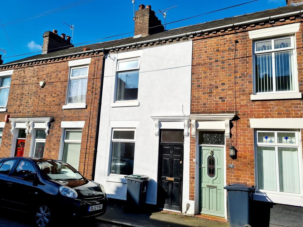
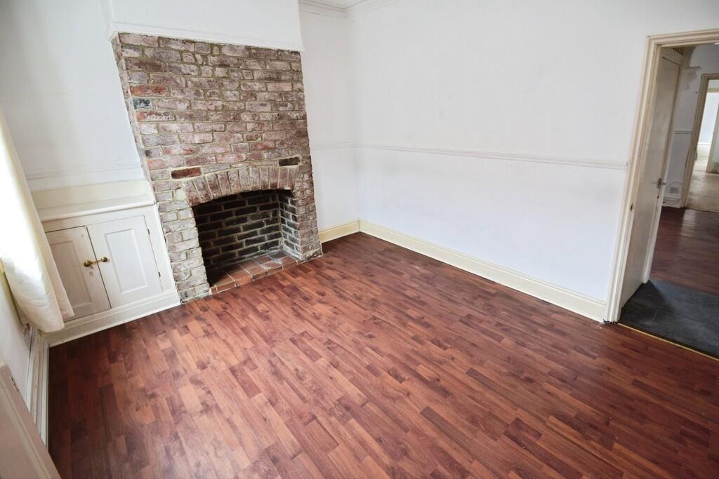
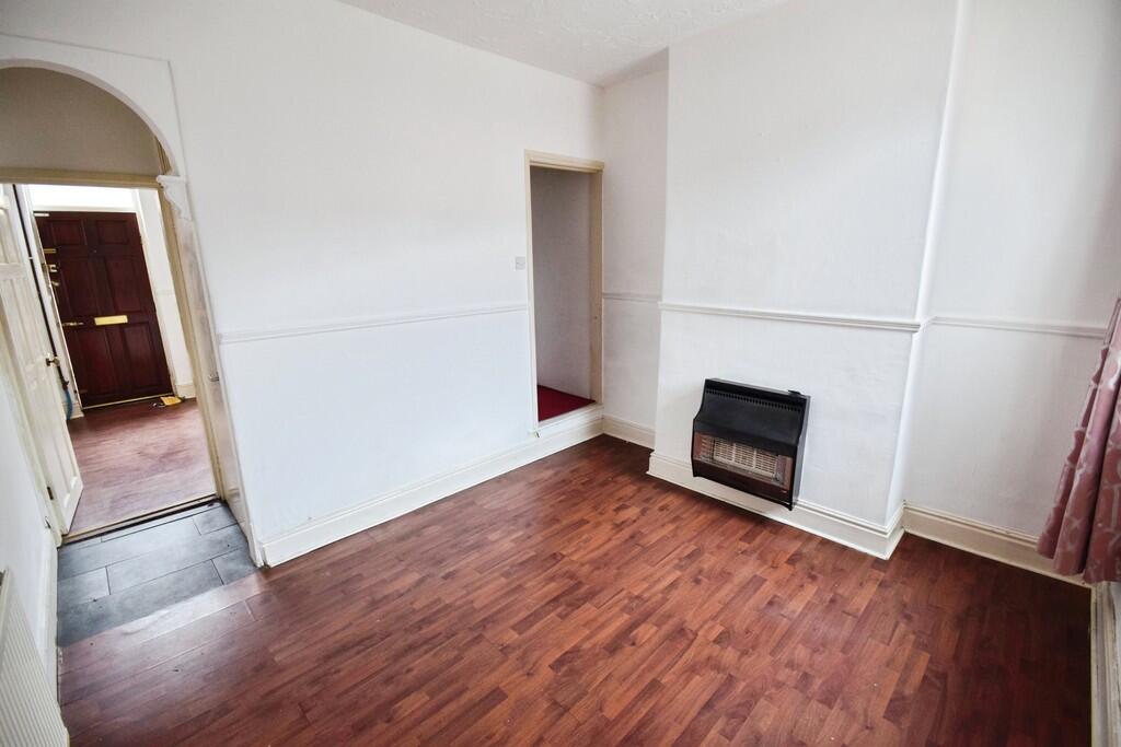
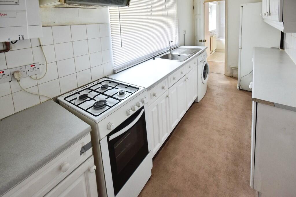
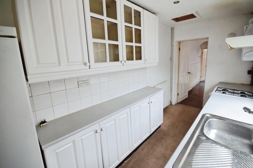
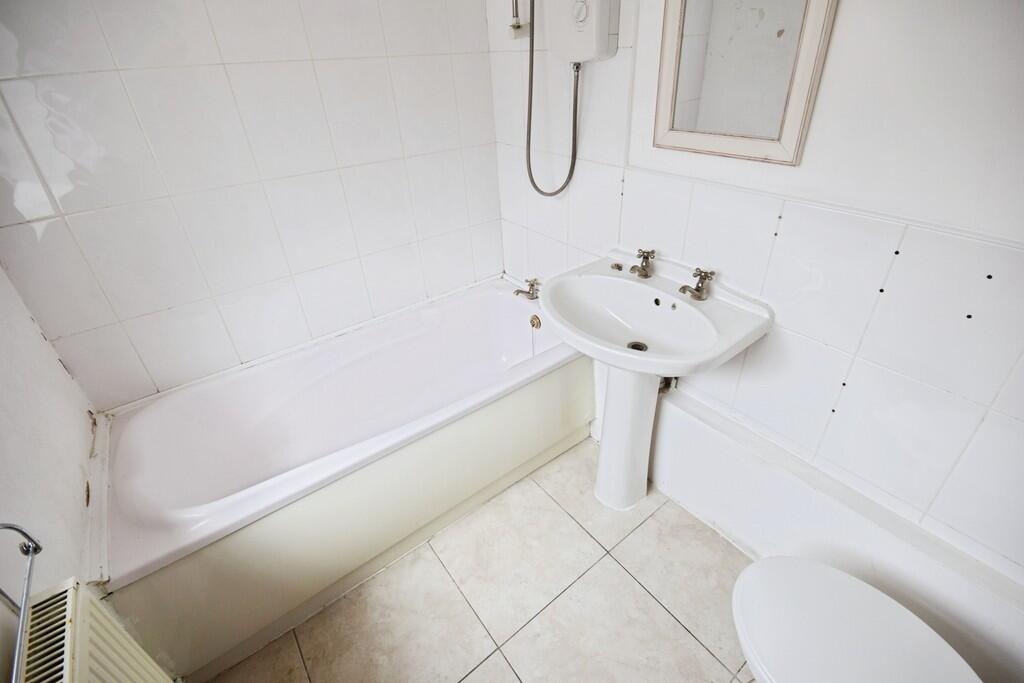
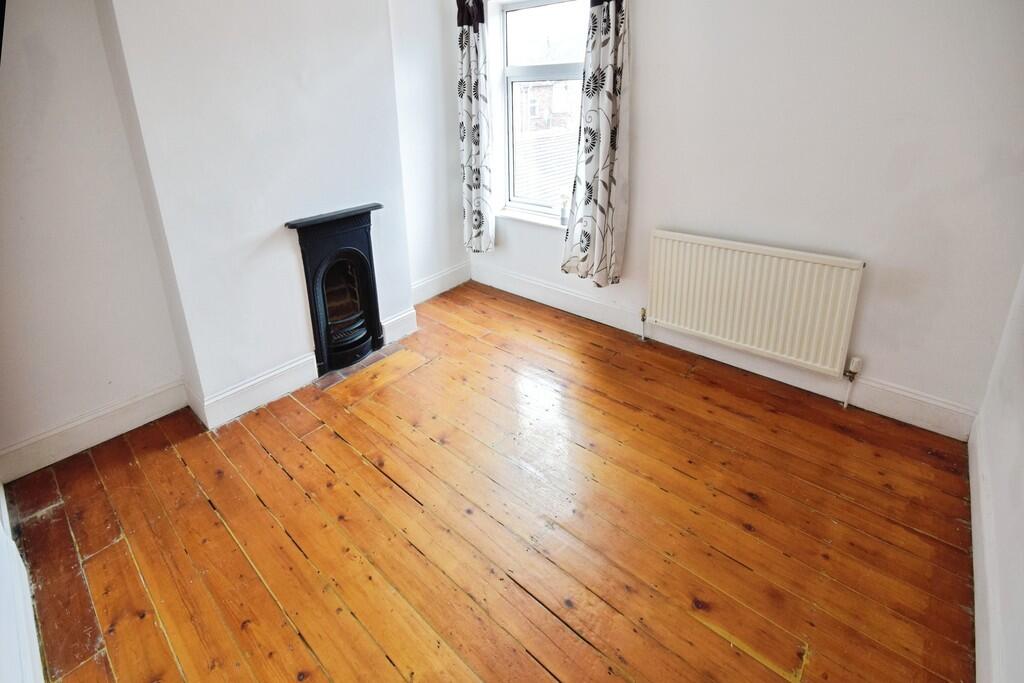
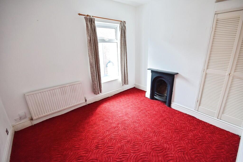
Photo 1 Photo 2 Photo 3 Photo 4 Photo 5 Photo 6 Photo 7 Photo 8
/ 8
Property details
Floor area
63 m²
Council tax band
A
Deprivation
Decile 6 (18,288 of 33,755)
Street crime
465 incidents within 1 mile (May 2026)
Key features
- Walking Distance to Royal Stoke Hospital
- Mid terraced house
- 2 reception rooms
- Short Distance from Town Centre
- Two Double Bedrooms
- Kitchen
- Bathroom
- Council tax band A
Description
The property briefly comprises of two reception rooms, fitted kitchen and a bathroom to the ground floor and 2 double bedrooms to the first floor
Listed by
Stoke On Trent
The Property Franchise Group
Reference: 89001870
EPC Rating & Upgrade Cost
Fetching EPC data… Refresh this page in a moment.
Flood risk
Zone: 1
Risk: Low
Job (default Low)
EPC Graphs
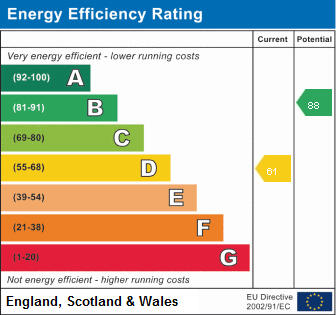
EPC 1
FENSA Certificates
This property has 1 FENSA certificate(s) on record, indicating window/door installations by FENSA-approved installers.
FENSA Certificate #1651124
Property Details
Street: 13 Allen Street
Town: Stoke-on-Trent
Postcode: ST4 7NP
Installation Details
Items: 5 windows
Certificate Issued: 13/04/2004
Work Completed: 10/10/2003
This certificate data was retrieved from FENSA's database
What is FENSA? FENSA (Fenestration Self-Assessment Scheme) is a government-authorised scheme that monitors building regulation compliance for replacement windows and doors. Certificates indicate that work was completed by FENSA-approved installers.
Rental Range
Estimated market rent for Stoke-on-Trent. Low = conservative, Realistic = average, Optimistic = best case.
Based on Local Authority from postcode lookup → Stoke-on-Trent.
LHA (30th percentile) floor for Staffordshire North: £479/mo (Apr 2025 – Mar 2026)
Location
Nearby
Nearest stations, universities and amenities (distance from property).
| Type | Name | Distance |
|---|---|---|
| Shop | Terry's Textiles | 0.0 miles |
| Shop | E2 Lighting | 0.0 miles |
| Bus stop | Hartshill Road, opposite Holy Trinity Church | 0.1 miles |
| Bus stop | Holy Trinity Church | 0.1 miles |
| Hospital | Royal Stoke University Hospital | 0.6 miles |
| Train station | Stoke-on-Trent | 0.9 miles |
| Hospital | North Staffordshire Nuffield Hospital | 1.7 miles |
| Train station | Longport | 2.3 miles |
| University | Keele University | 2.9 miles |
| University | Buxton & Leek College | 10.1 miles |
Street-level crime
| Category | Count |
|---|---|
| Violence and sexual offences | 157 |
| Anti-social behaviour | 90 |
| Public order | 48 |
| Criminal damage and arson | 41 |
| Shoplifting | 34 |
| Other theft | 25 |
| Drugs | 22 |
| Burglary | 18 |
| Other crime | 11 |
| Vehicle crime | 6 |
| Bicycle theft | 5 |
| Robbery | 4 |
| Possession of weapons | 3 |
| Theft from the person | 1 |
| Total incidents | 465 |
Within 1 mile during May 2026. Source: data.police.uk (England & Wales).
Schools nearby
Nearest open schools with Ofsted ratings (England). Closed schools are not shown. Data from Get Information about Schools and Ofsted.
| Name | Type | Distance | Ofsted |
|---|---|---|---|
| St Thomas Aquinas Catholic Primary School | Primary | 0.3 miles | Good — 15 Jan 2023 |
| Harpfield Primary Academy | Primary | 0.4 miles | Good — 10 Feb 2015 |
| The Willows Primary School | Primary | 0.5 miles | Good — 14 Dec 2010 |
| Newcastle-under-Lyme School | Other | 0.6 miles | — (No rating) |
| Lyme Brook Independent School | Other | 0.7 miles | Good — 22 Oct 2023 |
Rental Comparables
Residential lets from OpenRent and Rightmove for the area (same bedroom count). Use to validate rent estimates. Student lets are excluded.
Average rent: £788/mo (72 listings)