424 WARGRAVE ROAD
NEWTON-LE-WILLOWS, MERSEYSIDE WA12 8RT
£625 pcm
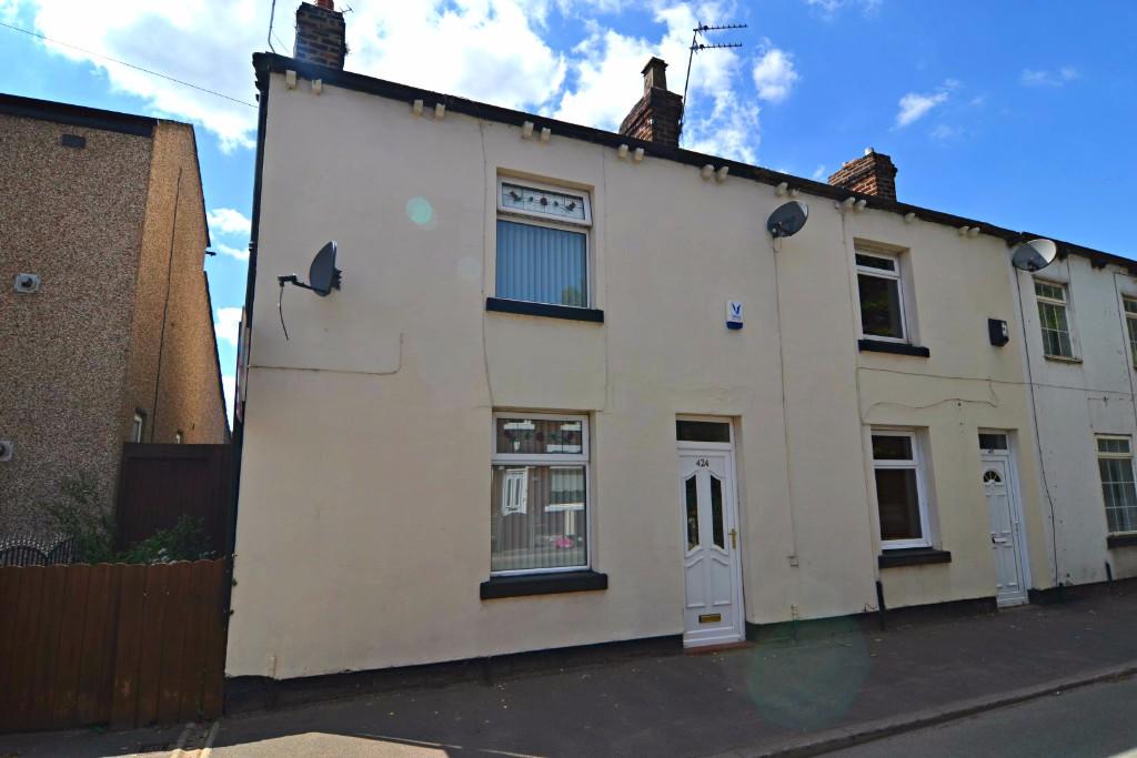
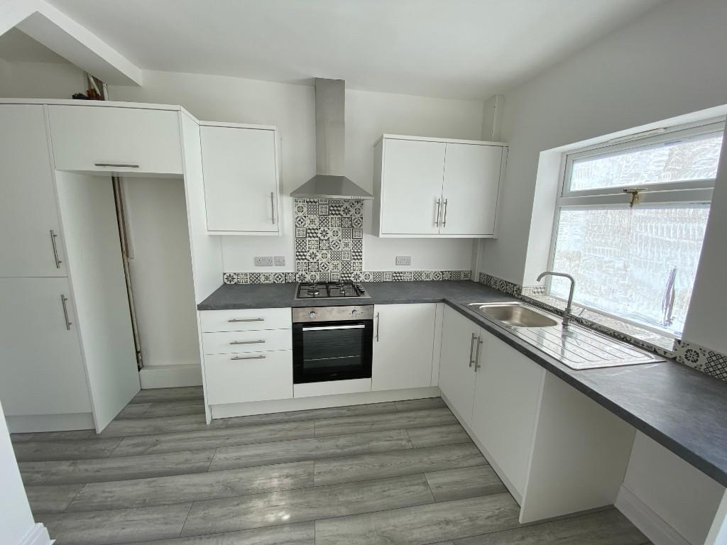
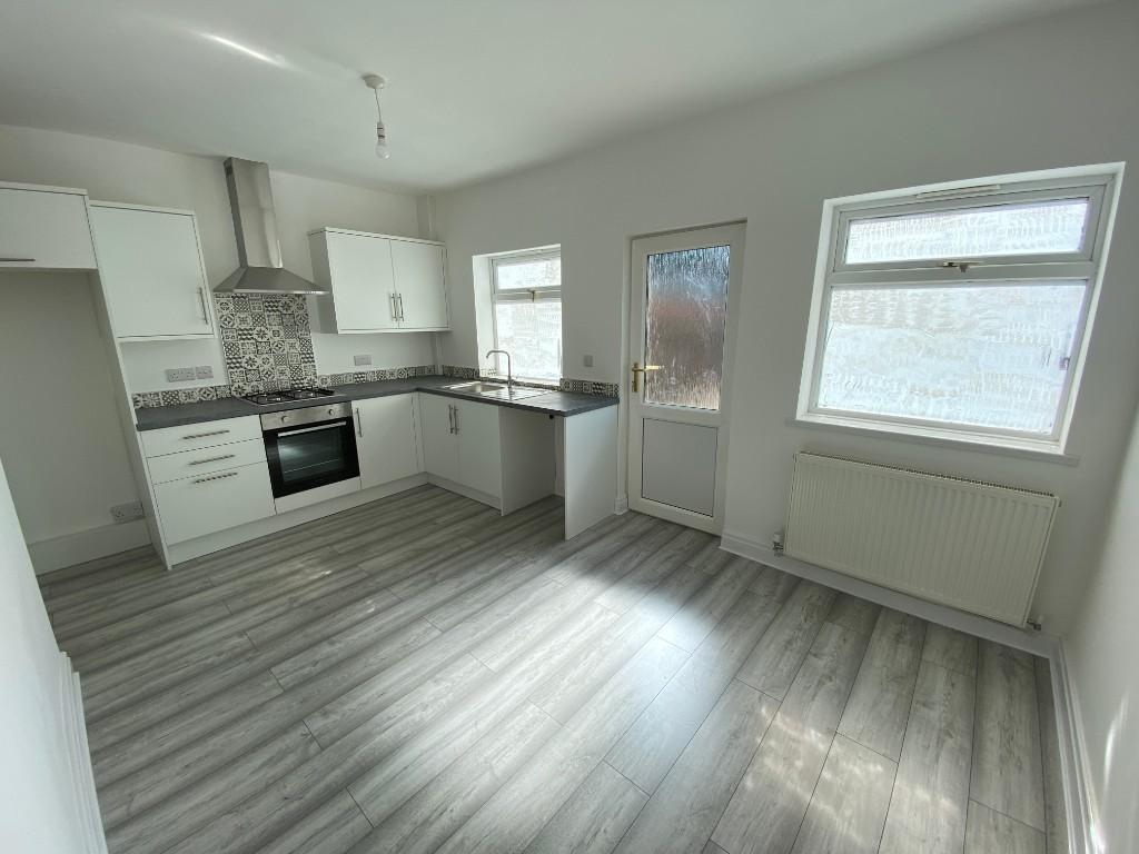
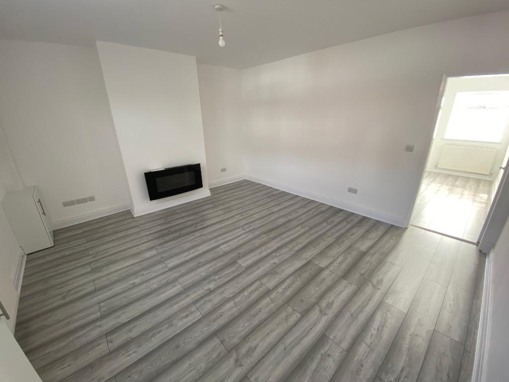
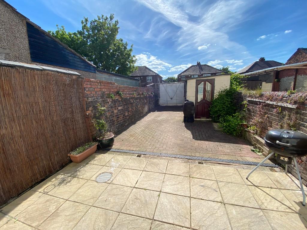
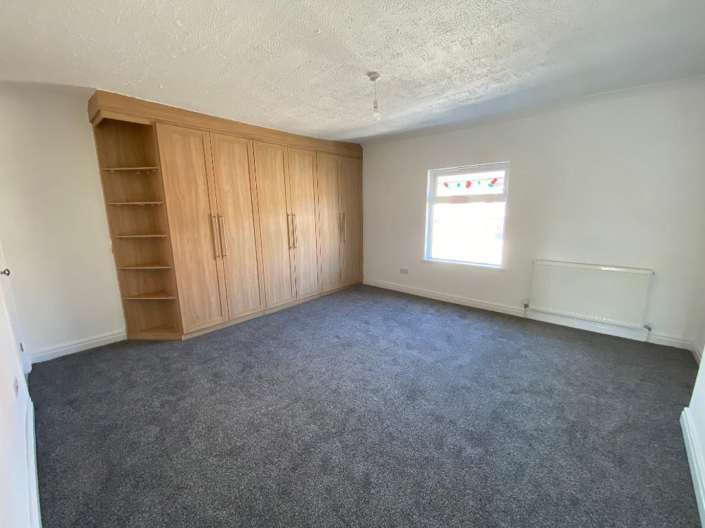
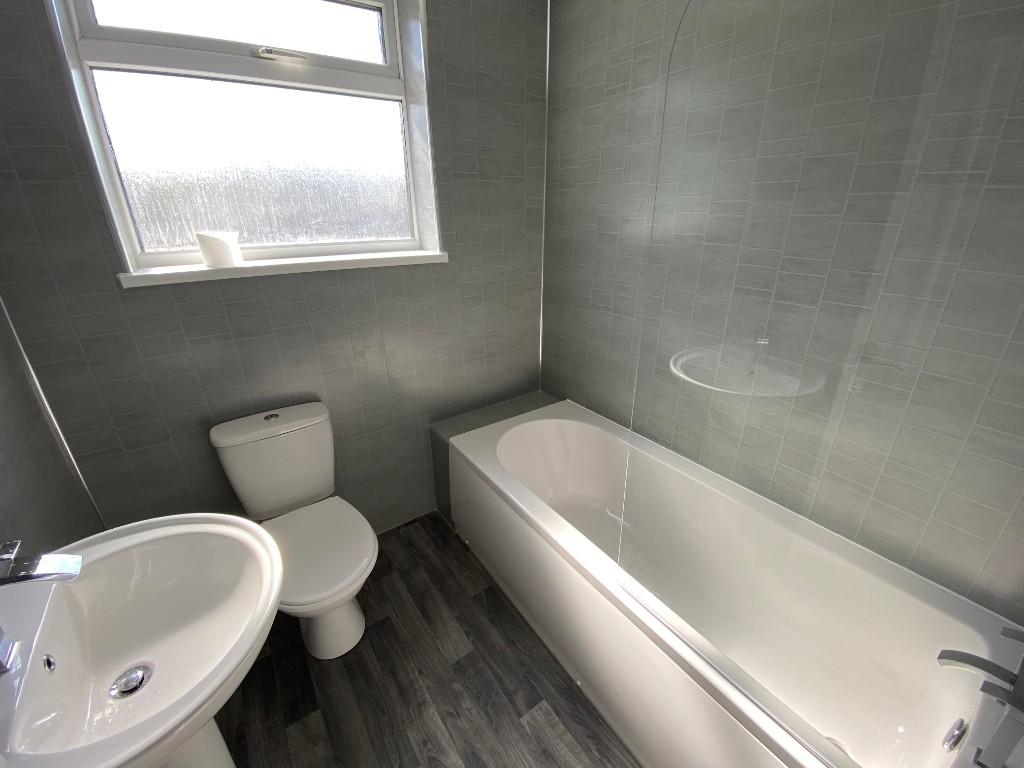
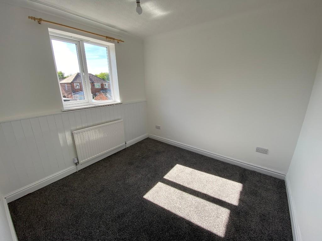
Photo 1 Photo 2 Photo 3 Photo 4 Photo 5 Photo 6 Photo 7 Photo 8
/ 8
Property details
Floor area
75 m²
Deprivation
Decile 5 (13,863 of 33,755)
Street crime
160 incidents within 1 mile (Apr 2026)
Key features
- TWO Bedrooms
- End Terraced Home
- Two Reception Rooms
- Upstairs Bathroom
- Double Glazed and Central Heating
- Good Size rear yard
- Kitchen Diner
- Brand New flooring
- Brand New Kitchen
- Brand New Bathroom
Additional details
- Heating
- Gas central
- Garden
- Yes
Description
The accommodation comprises:
*Entrance Hallway- 4.28m X 0.97m
*Front Reception - 4.22m X 3.55m
* Kitchen / Diner - 4.66m X 2.91m
* FIRST FLOOR
* Bedroom One - 4.67m X 4.25m
* Bedroom Two - 2.94m X 2.69m
* Bathroom 1.94m X 1.88m
The property is warmed by Gas Central Heating, and is double glazed.
Listed by
Newton-le-Willows
Think Rentals Ltd
Reference: 46520772
EPC Rating & Upgrade Cost
Fetching EPC data… Refresh this page in a moment.
Flood risk
Zone: 1
Risk: Low
Job (default Low)
Floorplans
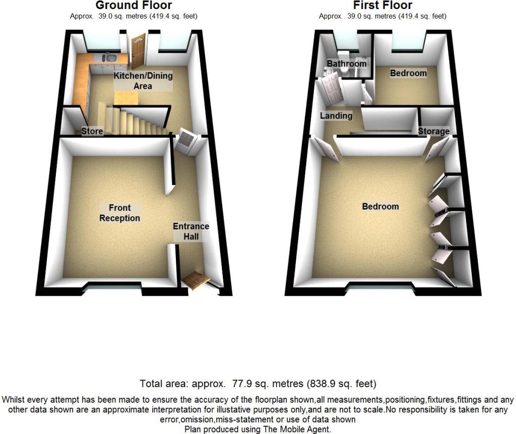
Floor Plan 1
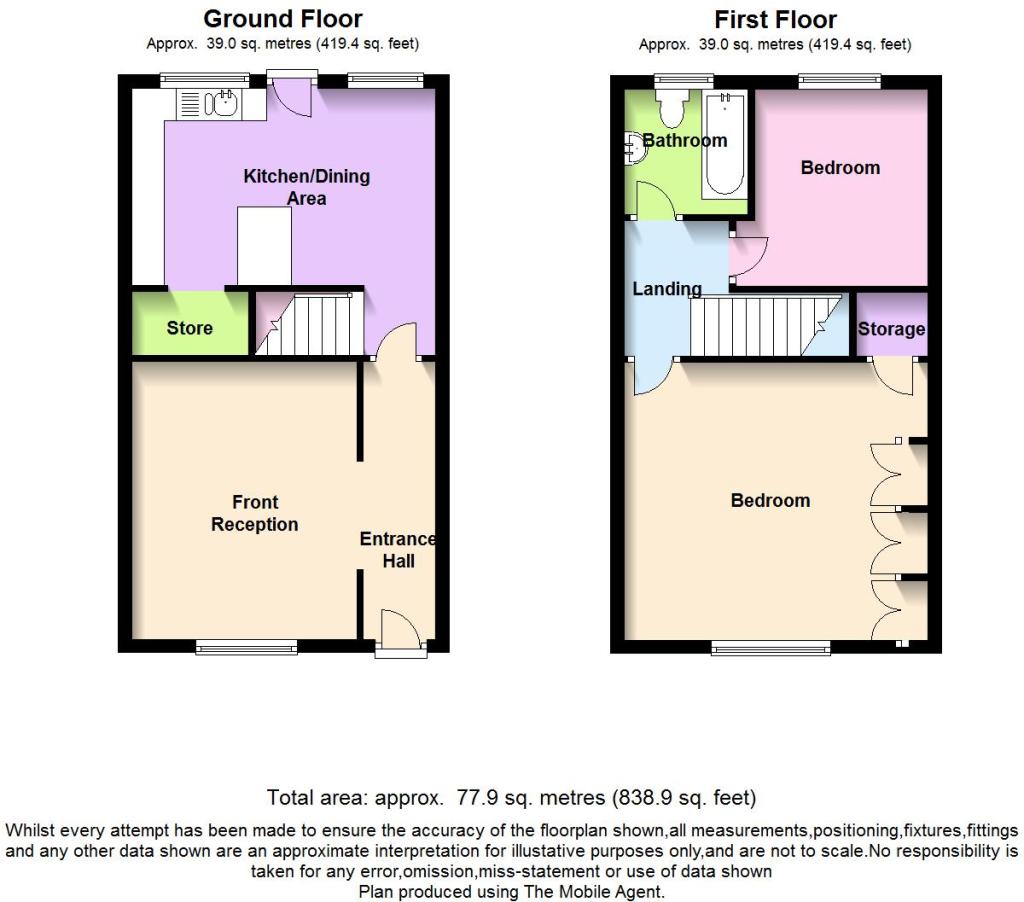
Floor Plan 2
EPC Graphs

EPC
Rental Range
Estimated market rent for St. Helens. Low = conservative, Realistic = average, Optimistic = best case.
Based on Local Authority from postcode lookup → St. Helens.
LHA (30th percentile) floor for Kendal: £648/mo (Apr 2025 – Mar 2026)
Location
Nearby
Nearest stations, universities and amenities (distance from property).
| Type | Name | Distance |
|---|---|---|
| Bus stop | WARGRAVE RD/WARGRAVE SCH | 0.0 miles |
| Shop | The Art of Barber | 0.3 miles |
| Shop | Thrifty's | 0.3 miles |
| Train station | Earlestown | 0.6 miles |
| Train station | Newton-le-Willows | 0.9 miles |
| Hospital | St Helens Hospital | 3.7 miles |
| University | University of Chester - Warrington Campus | 3.9 miles |
| Hospital | Leigh Health Centre | 6.4 miles |
| University | University of Bolton | 11.8 miles |
Street-level crime
| Category | Count |
|---|---|
| Violence and sexual offences | 63 |
| Shoplifting | 23 |
| Public order | 18 |
| Anti-social behaviour | 13 |
| Criminal damage and arson | 9 |
| Vehicle crime | 9 |
| Drugs | 7 |
| Other theft | 7 |
| Other crime | 5 |
| Burglary | 3 |
| Possession of weapons | 2 |
| Robbery | 1 |
| Total incidents | 160 |
Within 1 mile during Apr 2026. Source: data.police.uk (England & Wales).
Schools nearby
Nearest open schools with Ofsted ratings (England). Closed schools are not shown. Data from Get Information about Schools and Ofsted.
| Name | Type | Distance | Ofsted |
|---|---|---|---|
| Wargrave House School | Other | 0.1 miles | Good — 30 Jun 2022 |
| Ascent Autism Specialist College | Other | 0.1 miles | — (No rating) |
| Wargrave CofE Primary School | Primary | 0.2 miles | — (Inspected (no overall grade)) |
| Newton-le-Willows Primary School | Primary | 0.7 miles | Good — 16 Jun 2016 |
| St Mary's Catholic Junior Academy | Primary | 0.7 miles | Requires improvement — 23 Jan 2023 |
Rental Comparables
Residential lets from OpenRent and Rightmove for the area (same bedroom count). Use to validate rent estimates. Student lets are excluded.
| Title | Rent | Beds | Distance | As seen on |
|---|---|---|---|---|
| 2 Bed Flat, Catherine Way, WA12 | £488/mo | 2 | 0.32 miles | OpenRent |
Average rent: £488/mo (1 listing)