Forastero House
24 Farine Avenue, Hayes, UB3 4GE
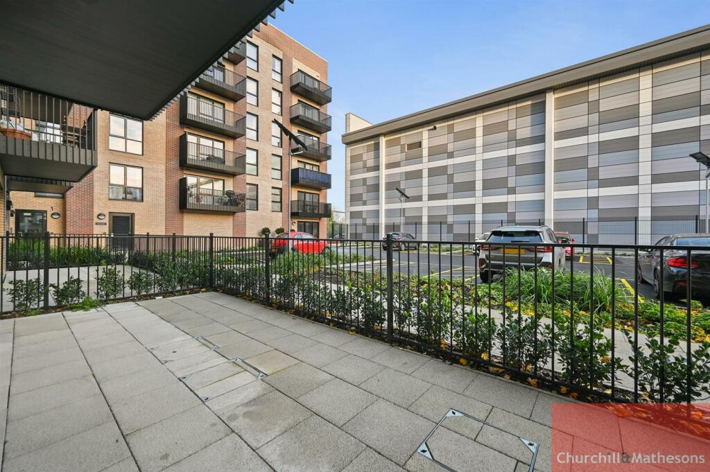
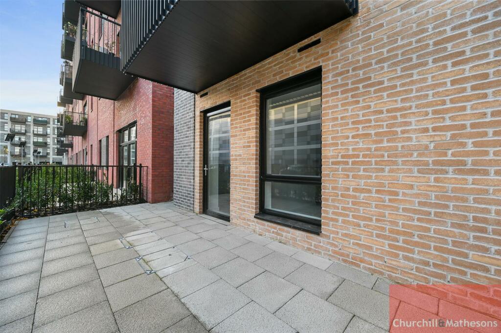
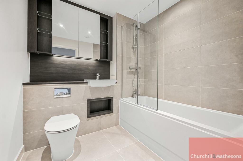
BCCHMAA - Forastero House (10).jpg BCCHMAA - Forastero House (11).jpg BCCHMAA - Forastero House (1).jpg BCCHMAA - Forastero House (2).jpg BCCHMAA - Forastero House (3).jpg BCCHMAA - Forastero House (4).jpg BCCHMAA - Forastero House (5).jpg BCCHMAA - Forastero House (6).jpg BCCHMAA - Forastero House (7).jpg BCCHMAA - Forastero House (8).jpg BCCHMAA - Forastero House (9).jpg
/ 11
Property details
Street crime
384 incidents within 1 mile (Mar 2026)
Key features
- Ground Floor Apartment
- New Build
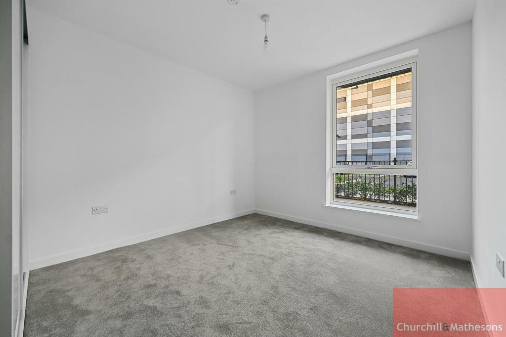
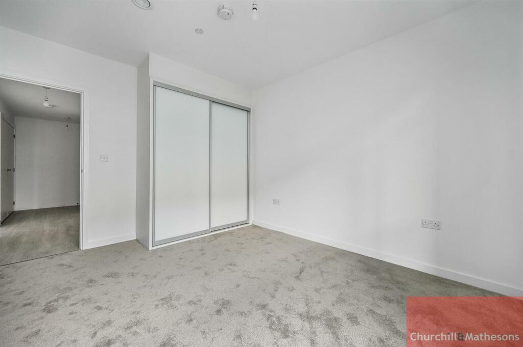
- One Double Bedroom
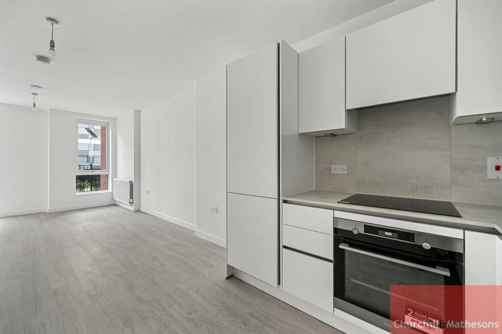
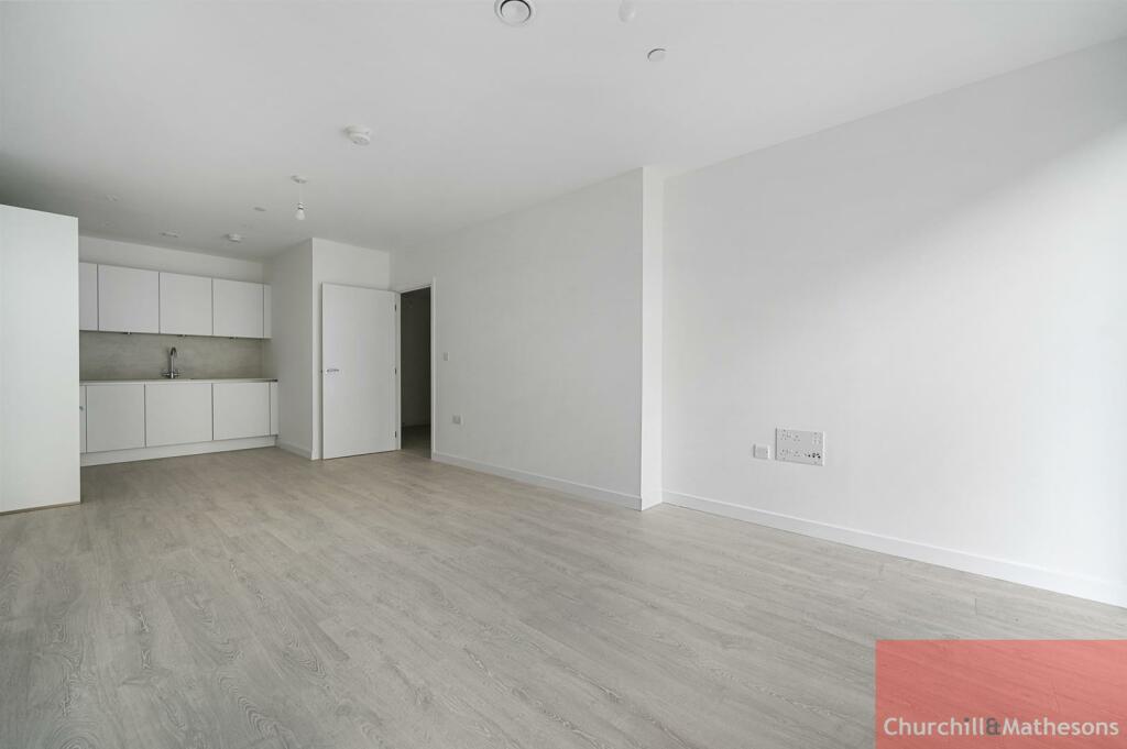
- Open Plan Lounge - Kitchen
- Bathroom
- Balcony
- Unfurnished
- Available Now
Description
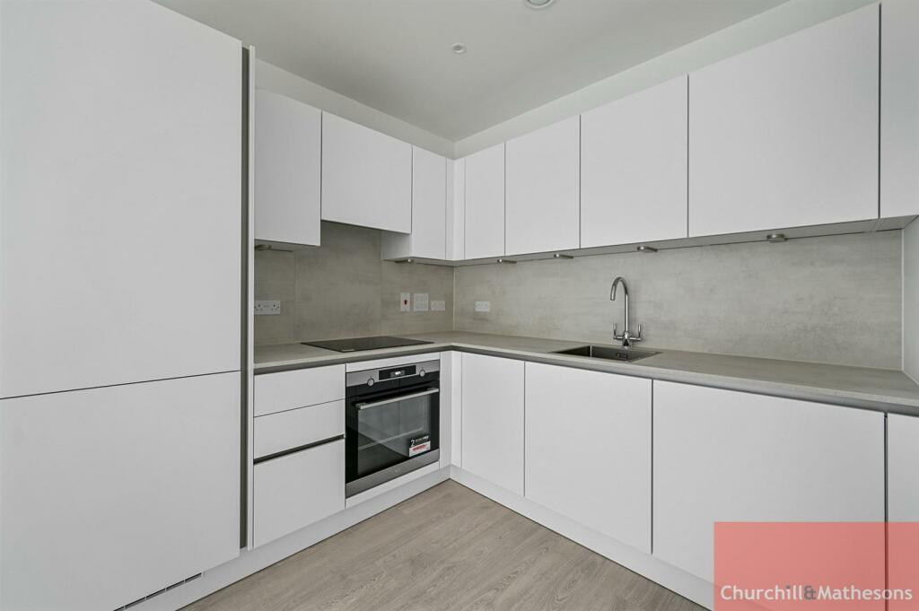
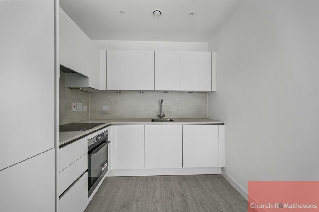
* Modern fully fitted kitchen with integrated appliances including Dishwasher
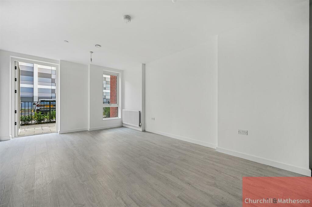
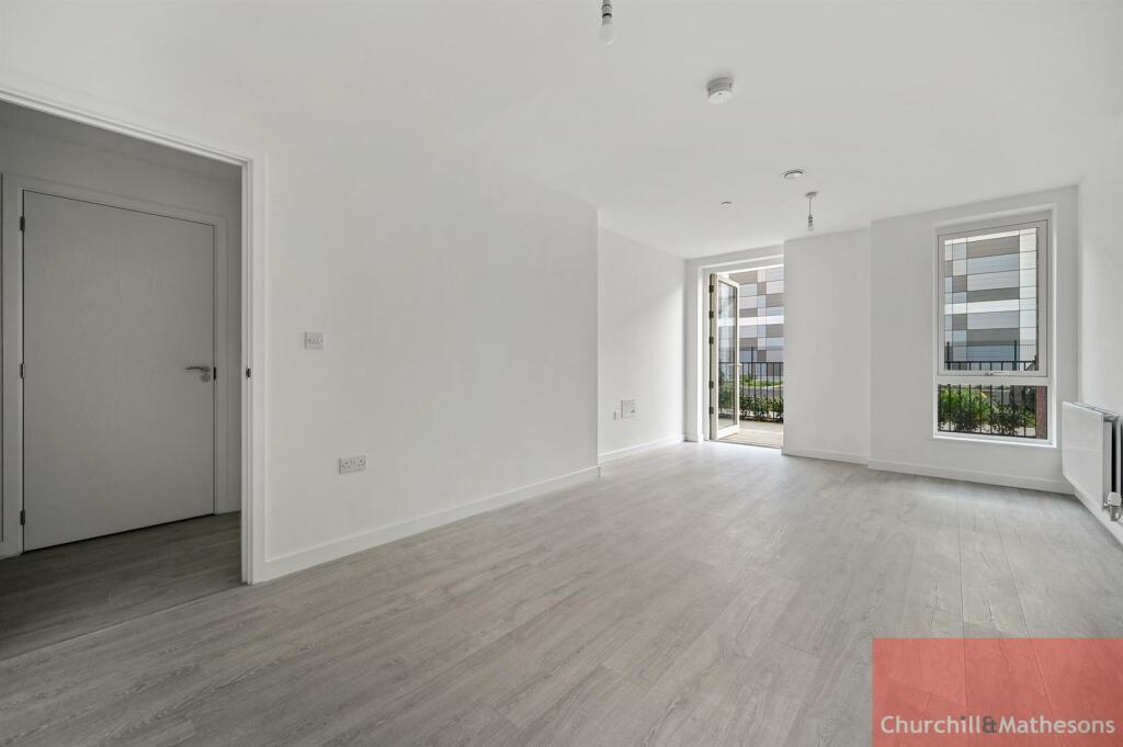
* Open plan reception with private Balcony
* Spacious bedroom with built in Wardrobe
* Stylish fully tiled bathroom
* Close to transport
* Residents Gym
* Video Entryphone System
* integrated appliances
UNFURNISHED ~ AVAILABLE NOW
Listed by
Acton
Churchills Estate Agents
Reference: 142293959
EPC Rating & Upgrade Cost
Fetching EPC data… Refresh this page in a moment.
Flood risk
Zone: 1
Risk: Low
Job (default Low)
Floorplans
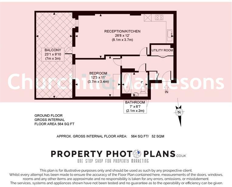
BCCHMAA - Forastero House WM.jpg
Rental Range
Estimated market rent for London. Low = conservative, Realistic = average, Optimistic = best case.
Based on Postcode area UB → London.
LHA (30th percentile) floor for South West Herts: £947/mo (Apr 2025 – Mar 2026)
Location
Address
14 Nestle's Avenue
Nearby
Nearest stations, universities and amenities (distance from property).
| Type | Name | Distance |
|---|---|---|
| Train station | Hayes and Harlington | 0.2 miles |
| Shop | Unknown | 0.2 miles |
| Bus stop | Harold Avenue | 0.2 miles |
| Shop | Tesco Express | 0.2 miles |
| Train station | Southall | 1.6 miles |
| Hospital | The Broadway Health Centre | 1.7 miles |
| Hospital | Hillingdon Hospital | 2.6 miles |
| University | Faraday Complex | 3.1 miles |
| University | Chepstow Hall | 3.2 miles |
Street-level crime
| Category | Count |
|---|---|
| Violence and sexual offences | 107 |
| Anti-social behaviour | 80 |
| Vehicle crime | 39 |
| Other theft | 31 |
| Theft from the person | 25 |
| Criminal damage and arson | 23 |
| Shoplifting | 18 |
| Public order | 15 |
| Drugs | 13 |
| Burglary | 12 |
| Robbery | 8 |
| Bicycle theft | 5 |
| Other crime | 4 |
| Possession of weapons | 4 |
| Total incidents | 384 |
Within 1 mile during Mar 2026. Source: data.police.uk (England & Wales).
Schools nearby
Nearest open schools with Ofsted ratings (England). Closed schools are not shown. Data from Get Information about Schools and Ofsted.
| Name | Type | Distance | Ofsted |
|---|---|---|---|
| Botwell House Catholic Primary School | Primary | 0.5 miles | Good — 5 Nov 2014 |
| Cranford Park Academy | Primary | 0.5 miles | Good — 12 Jul 2013 |
| Global Academy | Secondary | 0.6 miles | Good — 10 Jun 2019 |
| Minet Junior School | Primary | 0.7 miles | Good — 12 Oct 2015 |
| Minet Infant and Nursery School | Primary | 0.7 miles | Good — 13 Jan 2014 |
Rental Comparables
Residential lets from OpenRent and Rightmove for the area (same bedroom count). Use to validate rent estimates. Student lets are excluded.
| Title | Rent | Beds | Distance | As seen on |
|---|---|---|---|---|
| Studio Flat, Station Road, UB3 | £1,375/mo | 1 | 0.27 miles | OpenRent |
| 1 Bed Flat, Gramophone Lane, UB3 | £1,500/mo | 1 | 0.54 miles | OpenRent |
Average rent: £1,438/mo (2 listings)