WA15 6LU
WA15 6LU
Picture No. 17 Picture No. 07 Picture No. 24 Picture No. 25 Picture No. 27 Picture No. 28 Picture No. 29 Picture No. 31 Picture No. 32 Picture No. 35 Picture No. 22 Picture No. 23 Picture No. 34 Picture No. 36 Picture No. 37 Picture No. 39 Picture No. 40 Picture No. 41 Picture No. 04 Picture No. 05 Picture No. 03 Picture No. 33 Picture No. 38 Picture No. 42 Picture No. 06 Picture No. 02 Picture No. 11 Picture No. 08 Picture No. 10 Picture No. 09 Picture No. 14 Picture No. 20 Picture No. 12 Picture No. 19 Picture No. 21 Picture No. 13 Picture No. 15 Picture No. 16
/ 38
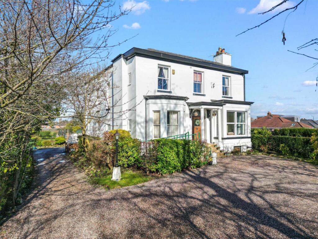
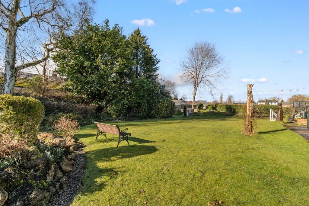
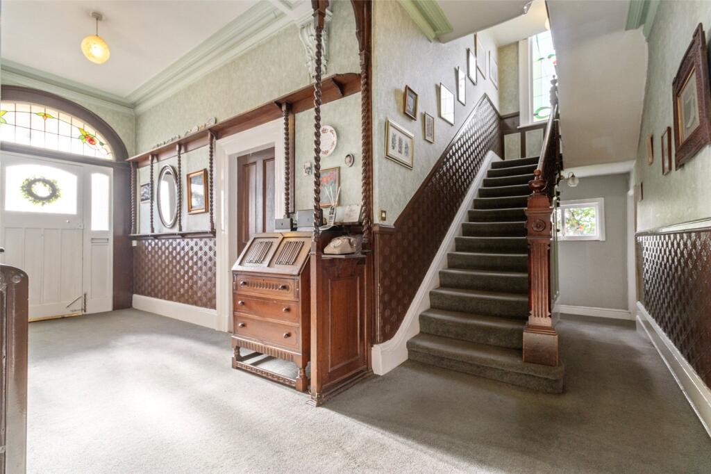
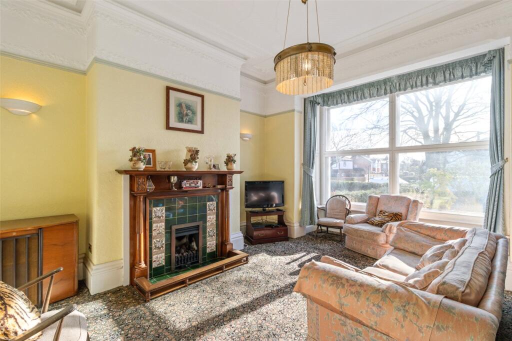
Property details
Floor area
244 m²
Council tax band
G
Deprivation
Decile 9 (30,118 of 33,755)
EPC Rating & Upgrade Cost
Fetching EPC data… Refresh this page in a moment.
Flood risk
Zone: 1
Risk: Low
Not in Flood Risk Area (no data)
Floorplans
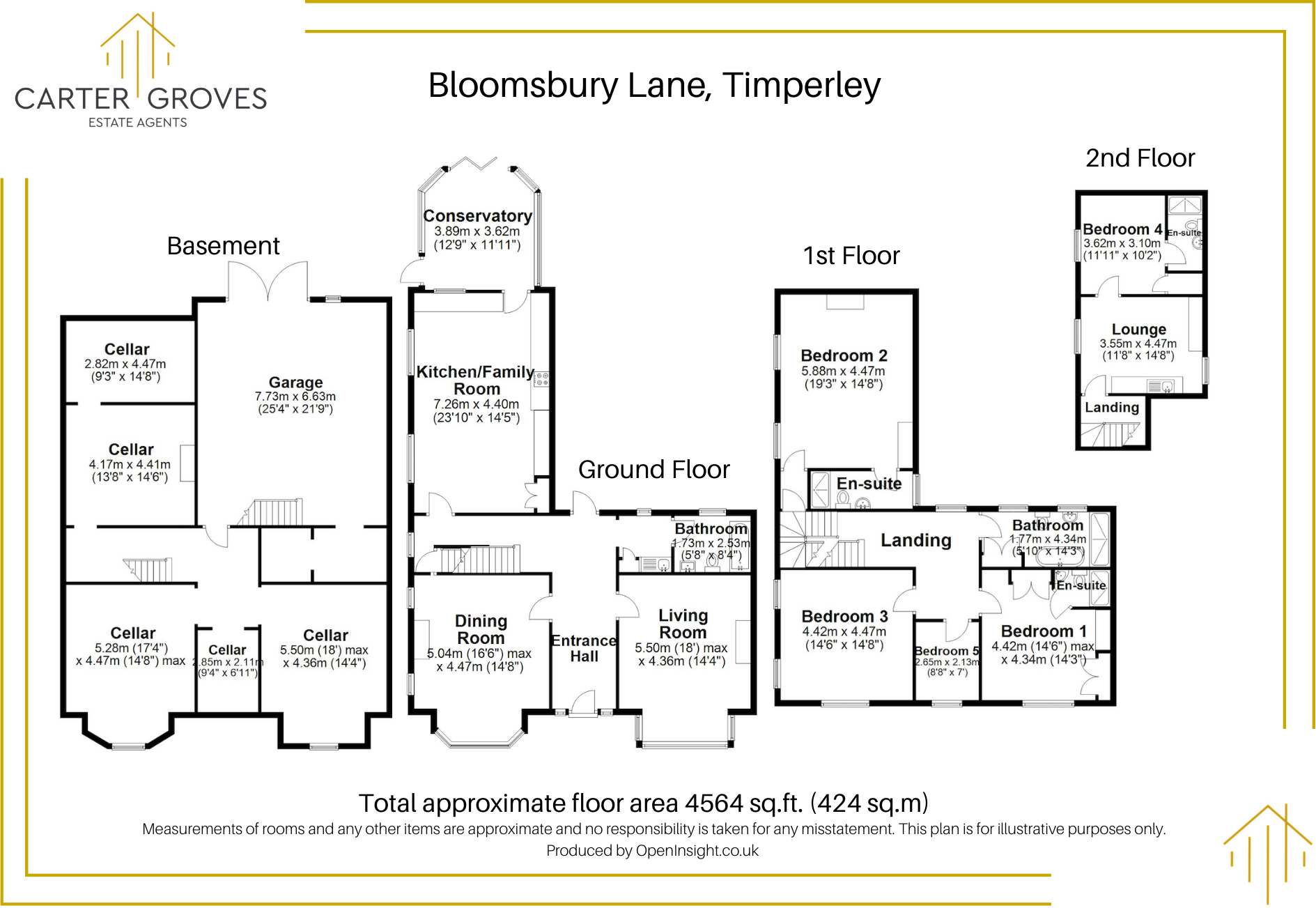
Floorplan
EPC Graphs
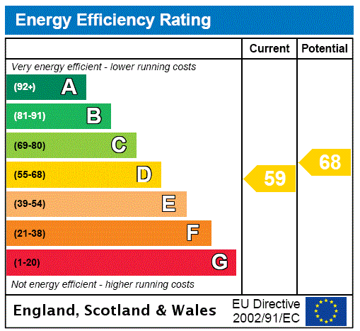
EPC Rating Graph
Price history
No sales history found for this property in Land Registry Price Paid data.
Sold Comparables
Same street and nearby sales within 0.25 miles (last 5 years). Data from Land Registry Price Paid.
| Address | Price | Date | Type |
|---|---|---|---|
| 27 BLOOMSBURY LANE, TIMPERLEY, ALTRINCHAM, TRAFFORD, GREATER MANCHESTER, WA15 6LU | £1,100,000 | 14/11/2025 | Detached |
| 63 BLOOMSBURY LANE, TIMPERLEY, ALTRINCHAM, TRAFFORD, GREATER MANCHESTER, WA15 6LU | £260,000 | 29/06/2021 | Terraced |
Area average: £680,000 (2 sales)
Capital growth trend
Land Registry outcode average: last 12 months vs 5y and 10y ago (from sold prices).
House Price Index (HM Land Registry — official index, not sold-price averages): Trafford. Series: All dwelling types. As of March 2026.
Rental Range
Estimated market rent for Trafford. Low = conservative, Realistic = average, Optimistic = best case.
Based on Local Authority from postcode lookup → Trafford.
LHA (30th percentile) floor for North Cumbria: £738/mo (Apr 2025 – Mar 2026)
Location
Street-level crime
Crime data is not yet available for this property.
Rental Comparables
Loading rental comparables for this postcode. Refresh in a few minutes.