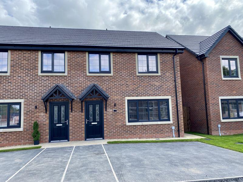
65 FALCON DRIVE
CONGLETON CW12 3UJ
£1,350 pcm
Property details
Floor area
51 m²
Council tax band
D
Deprivation
Decile 6 (19,544 of 33,755)
Street crime
156 incidents within 1 mile (Apr 2026)
Key features
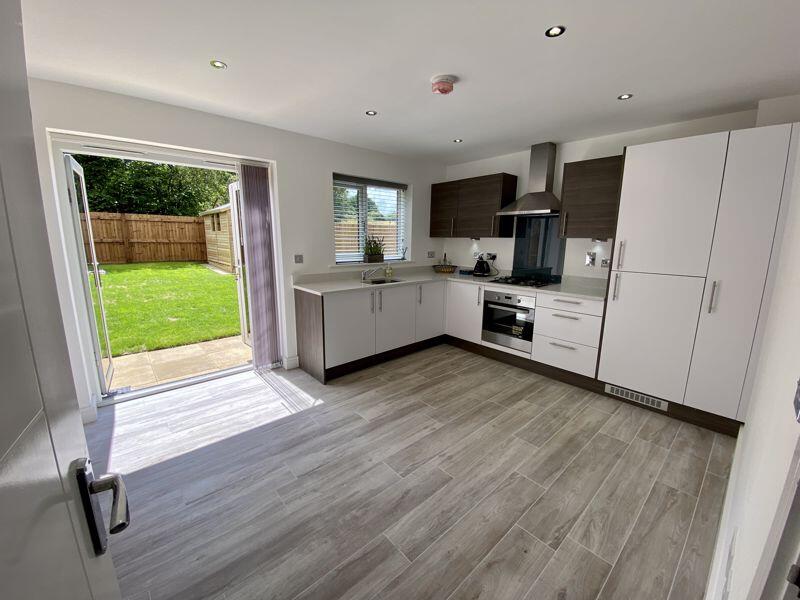
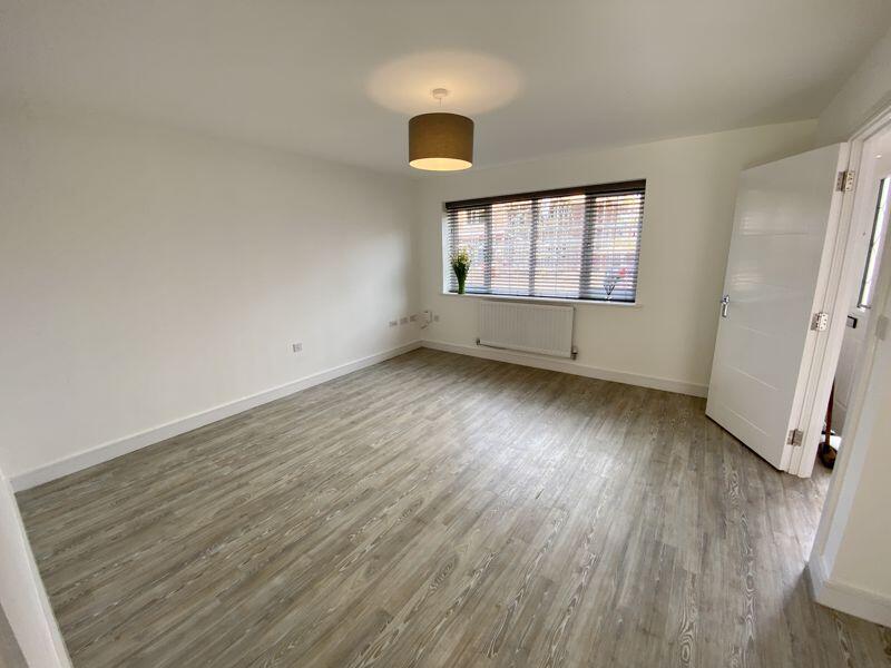
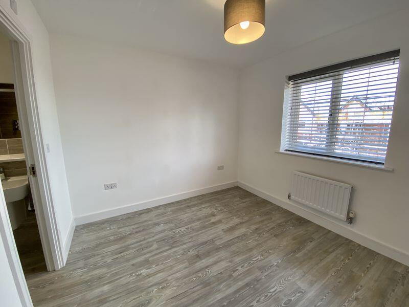
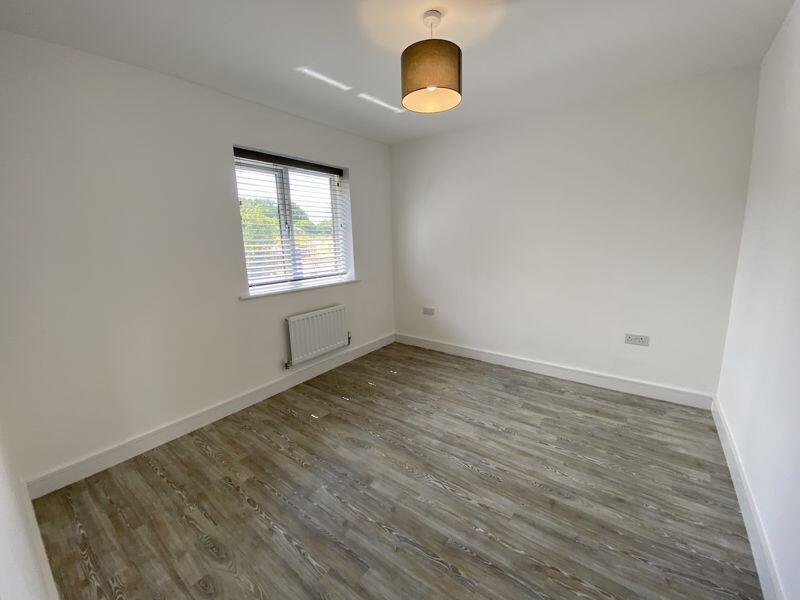
- MODERN RECENTLY BUILT SEDDONS HOME
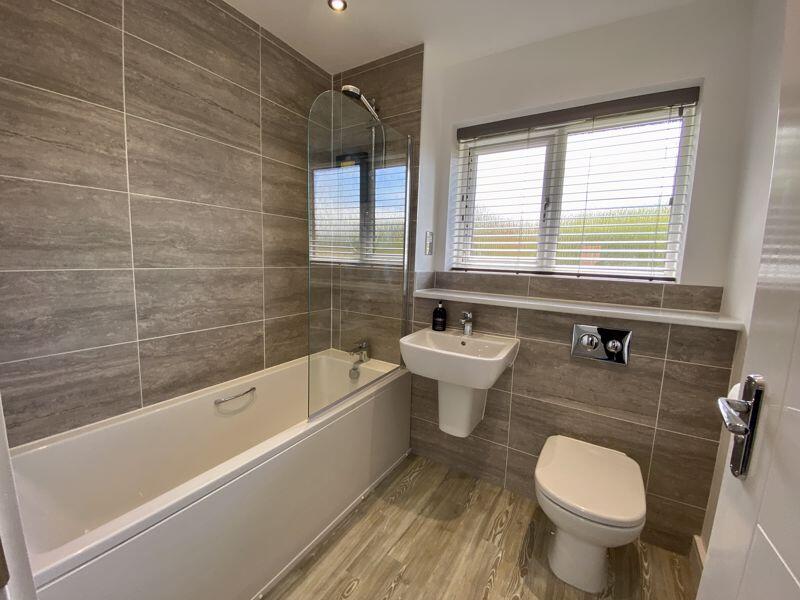
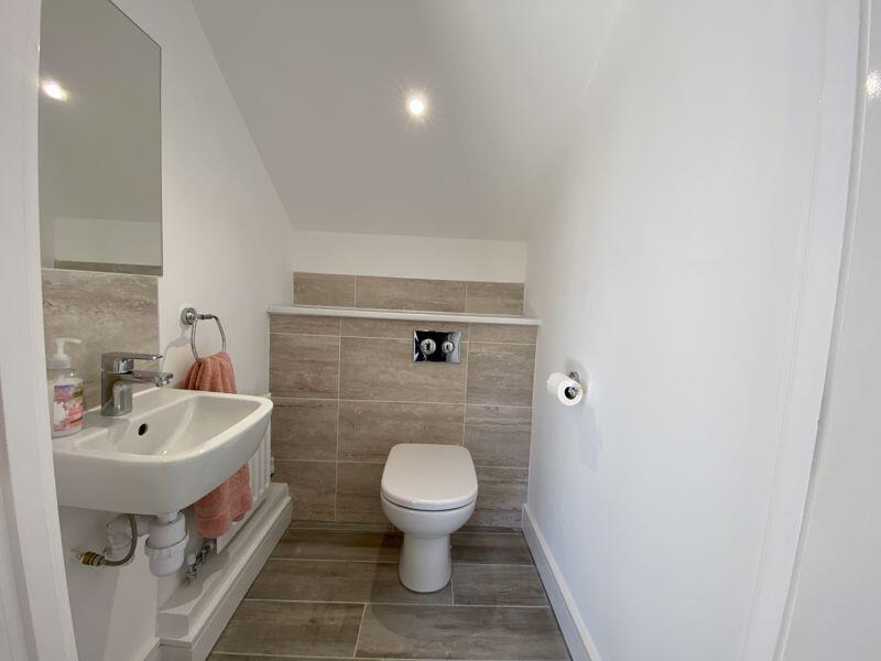
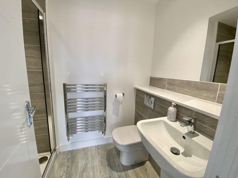
- THREE BEDROOMS, BATHROOM & EN SUITE
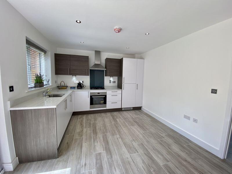
- HIGH SPEC INTERIOR
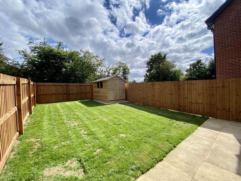
- GENEROUS SOUTH FACING LAWNED GARDEN
- DOUBLE WIDTH DRIVEWAY
- WALKING DISTANCE OF TOWN CENTRE
- OPEN COUNTRYSIDE ON ITS DOORSTEP
Additional details
- Parking
- Yes
- Garden
- Yes
Description
Listed by
Congleton
Timothy A Brown Ltd
Reference: 172609895
EPC Rating & Upgrade Cost
Fetching EPC data… Refresh this page in a moment.
Flood risk
Zone: 1
Risk: Low
Job (default Low)
EPC Graphs

Energy Performance Certificate
Rental Range
Estimated market rent for Cheshire East. Low = conservative, Realistic = average, Optimistic = best case.
Based on Local Authority from postcode lookup → Cheshire East.
LHA (30th percentile) floor for Oldham & Rochdale: £693/mo (Apr 2025 – Mar 2026)
Location
Nearby
Nearest stations, universities and amenities (distance from property).
| Type | Name | Distance |
|---|---|---|
| Shop | Burns Garages | 0.3 miles |
| Shop | Amery Garage Services | 0.3 miles |
| Bus stop | Congleton, Canal Road / Daven Road | 0.3 miles |
| Bus stop | Congleton, Falmouth Road (Hail & Ride) | 0.4 miles |
| Hospital | Congleton War Memorial Hospital | 0.4 miles |
| Train station | Congleton | 0.8 miles |
| Train station | Kidsgrove | 5.1 miles |
| Hospital | John Munroe Hospital | 5.8 miles |
| University | Buxton & Leek College | 8.5 miles |
| University | Tovell Building, Buxton & Leek College | 8.6 miles |
Street-level crime
| Category | Count |
|---|---|
| Violence and sexual offences | 74 |
| Public order | 21 |
| Anti-social behaviour | 10 |
| Criminal damage and arson | 9 |
| Shoplifting | 8 |
| Burglary | 7 |
| Drugs | 7 |
| Other crime | 7 |
| Vehicle crime | 6 |
| Other theft | 4 |
| Bicycle theft | 2 |
| Robbery | 1 |
| Total incidents | 156 |
Within 1 mile during Apr 2026. Source: data.police.uk (England & Wales).
Schools nearby
Nearest open schools with Ofsted ratings (England). Closed schools are not shown. Data from Get Information about Schools and Ofsted.
| Name | Type | Distance | Ofsted |
|---|---|---|---|
| Daven Primary School | Primary | 0.3 miles | Requires improvement — 8 Nov 2023 |
| Marlfields Primary School | Primary | 0.4 miles | Requires improvement — 7 May 2024 |
| Aidenswood School | Other | 0.6 miles | Good — 24 Apr 2024 |
| Saint Mary's Catholic Primary School | Primary | 0.7 miles | Requires improvement — 1 Jul 2024 |
| Astbury St Mary's CofE Primary School | Primary | 0.8 miles | Good — 3 May 2023 |
Rental Comparables
Residential lets from OpenRent and Rightmove for the area (same bedroom count). Use to validate rent estimates. Student lets are excluded.
| Title | Rent | Beds | Distance | As seen on |
|---|---|---|---|---|
| Canal Road, Congleton, CW12 | £1,300/mo | 3 | 0.42 miles | Rightmove |
| Southbank Grove, Congleton | £1,100/mo | 3 | 0.52 miles | Rightmove |
| Moss Road, Astbury, CW12 | £1,500/mo | 3 | 0.73 miles | Rightmove |
| Boundary Lane, Congleton | £1,350/mo | 3 | 1.08 miles | Rightmove |
| Dobson Way, Congleton, CW12 | £2,200/mo | 3 | 1.49 miles | Rightmove |
| Burgess Place, Congleton, CW12 | £1,400/mo | 3 | 1.68 miles | Rightmove |
| Ormiston Way, Congleton | £1,495/mo | 3 | 1.68 miles | Rightmove |
| Loachbrook Farm Way, Congleton, CW12 | £1,300/mo | 3 | 1.8 miles | Rightmove |
| Wallhill Lane, Brownlow, CW12 | £1,500/mo | 3 | 2.08 miles | Rightmove |
| Congleton, Staffordshire | £2,000/mo | 3 | 3.04 miles | Rightmove |
Average rent: £1,515/mo (10 listings)