38 HARGRAVE AVENUE
IPSWICH, NEEDHAM MARKET, SUFFOLK IP6 8ES
£1,000 pcm
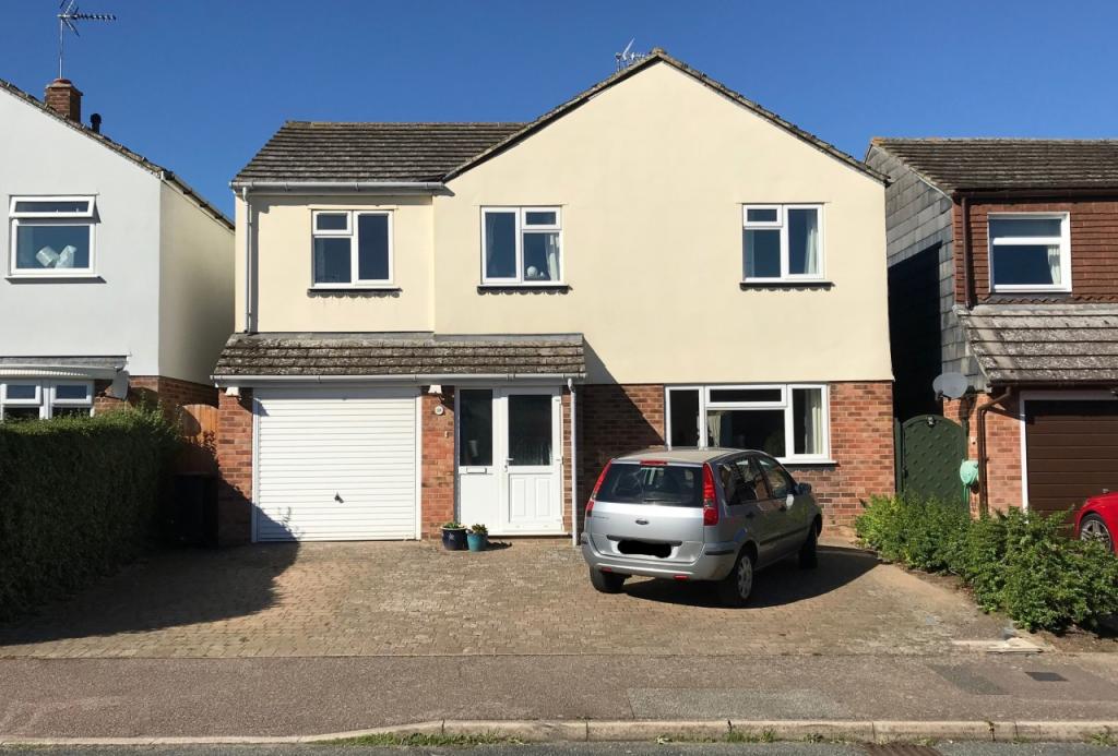
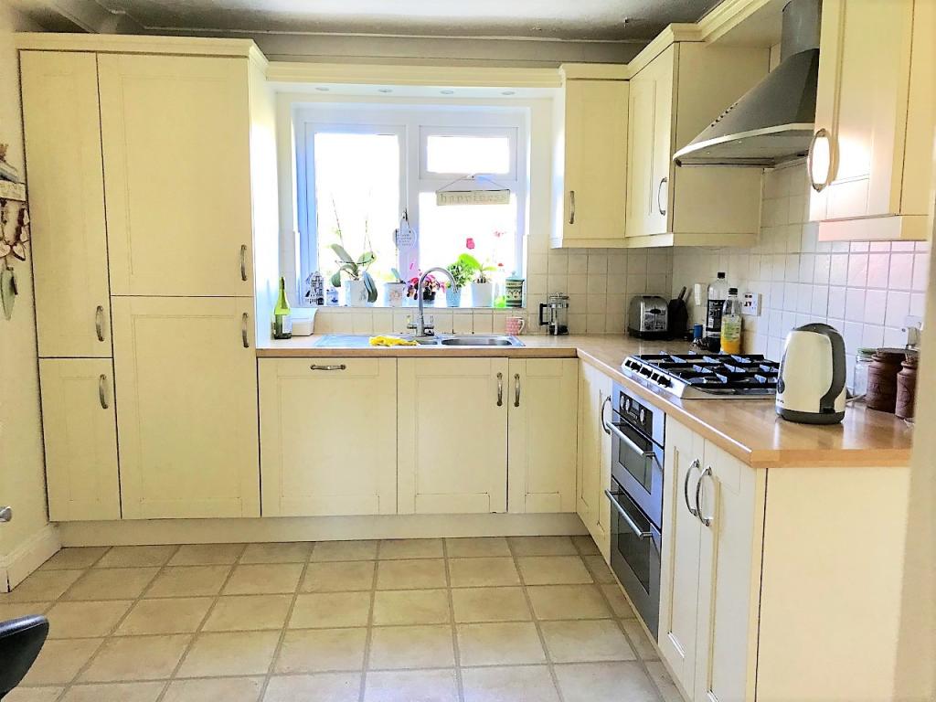
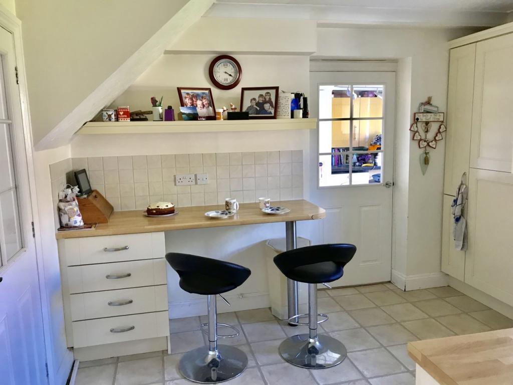
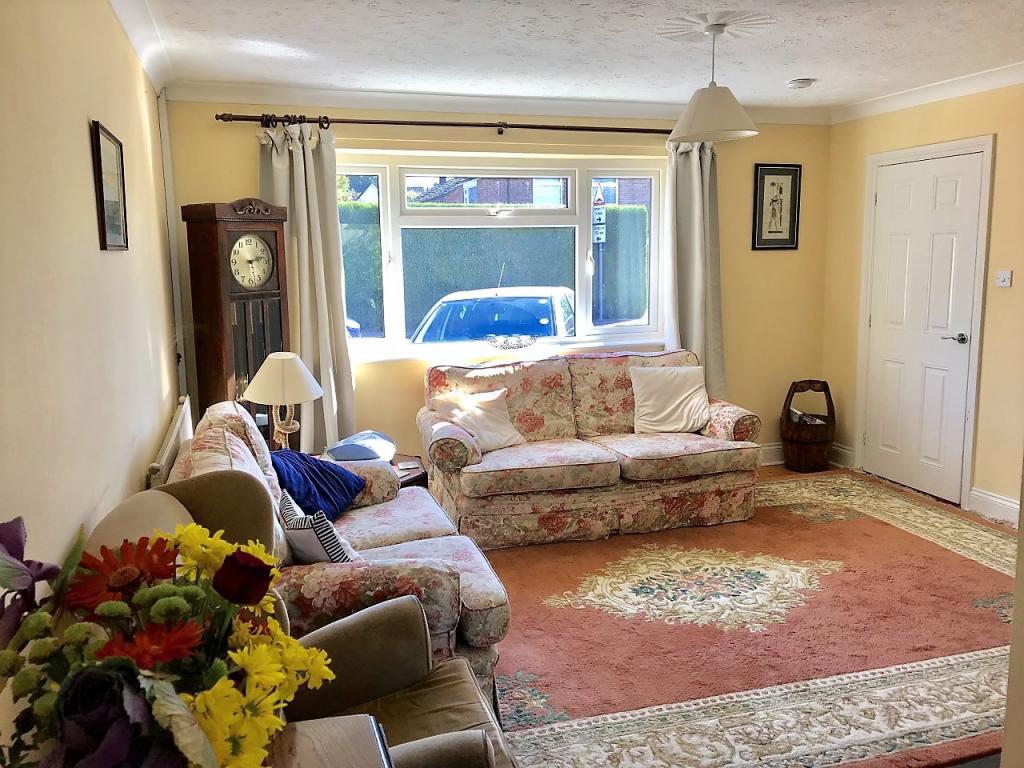
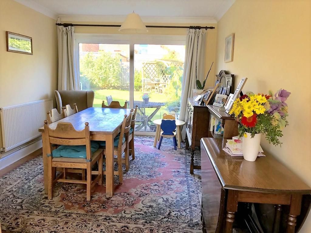
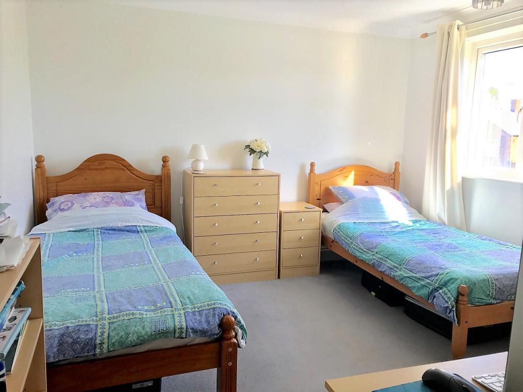
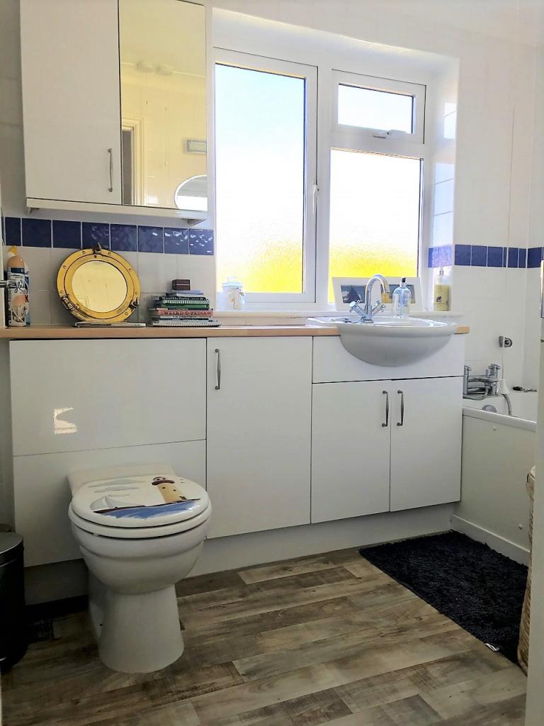
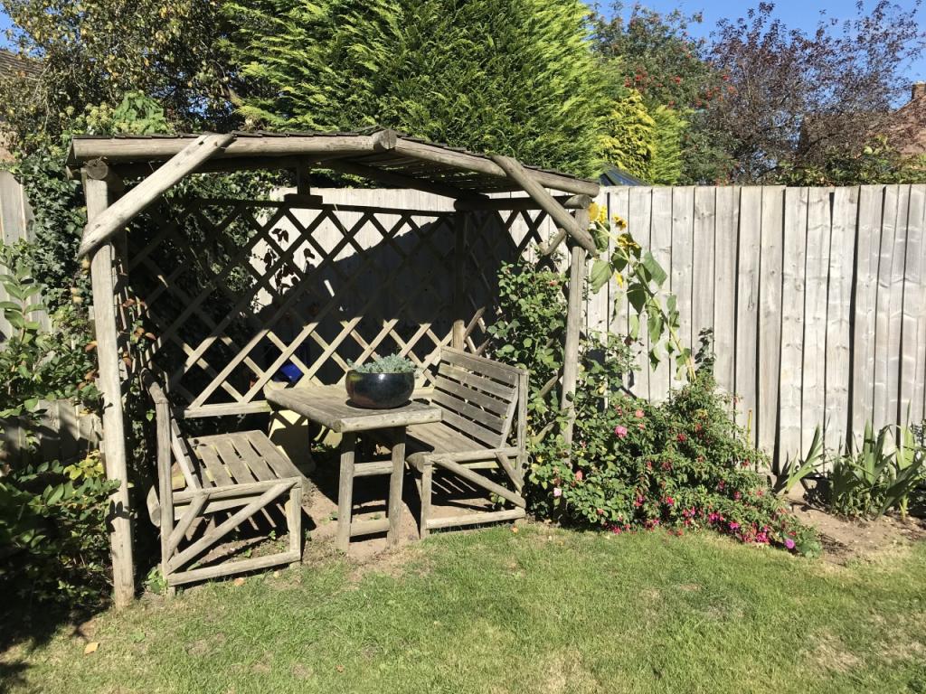
Photo 1 Photo 2 Photo 3 Photo 4 Photo 5 Photo 6 Photo 7 Photo 8
/ 8
Property details
Floor area
122 m²
Deprivation
Decile 9 (29,165 of 33,755)
Street crime
30 incidents within 1 mile (Apr 2026)
Key features
- Ensuite Master Bedroom
- Enclosed Rear Garden
- Gas Central Heating
- Integral Garage
- Four Double Bedrooms
- Two Reception Rooms
- Extended Property
- Large Driveway
Additional details
- Parking
- Yes
- Garden
- Yes
Description
The large block paved drive offers parking for at least three cars.
The property occupies a convenient location within walking distance of all the town amenities, schools and railway station.
Deposit: £1200
Sorry, no housing benefit claimants or students
Pets considered
Please quote reference number: 005016
Please note, by submitting an enquiry regarding this property you agree that we may send your details to the landlord of this property so they may contact you in order to answer any questions, or arrange a convenient viewing time. STRICTLY NO AGENT OR SUB-LETTING CALLS.
Listed by
Bury St Edmunds
The Online Letting Agents Ltd
Reference: 67954552
EPC Rating & Upgrade Cost
Fetching EPC data… Refresh this page in a moment.
Flood risk
Zone: 1
Risk: Low
Job (default Low)
EPC Graphs
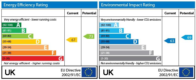
EPC Graph
Rental Range
Estimated market rent for Mid Suffolk. Low = conservative, Realistic = average, Optimistic = best case.
Based on Local Authority from postcode lookup → Mid Suffolk.
LHA (30th percentile) floor for Ipswich: £1,097/mo (Apr 2025 – Mar 2026)
Location
Nearby
Nearest stations, universities and amenities (distance from property).
| Type | Name | Distance |
|---|---|---|
| Bus stop | Orchid Way | 0.1 miles |
| Shop | Coop Daily | 0.1 miles |
| Shop | Kerridges | 0.2 miles |
| Train station | Needham Market | 0.4 miles |
| Train station | Unknown | 3.0 miles |
| University | Suffolk Rural Campus (Suffolk New College) | 7.0 miles |
| University | University of Suffolk | 8.2 miles |
| Hospital | Ipswich Hospital | 8.8 miles |
| Hospital | Nuffield Hospital Ipswich | 10.2 miles |
Street-level crime
| Category | Count |
|---|---|
| Violence and sexual offences | 14 |
| Criminal damage and arson | 4 |
| Anti-social behaviour | 3 |
| Bicycle theft | 2 |
| Other theft | 2 |
| Vehicle crime | 2 |
| Other crime | 1 |
| Public order | 1 |
| Shoplifting | 1 |
| Total incidents | 30 |
Within 1 mile during Apr 2026. Source: data.police.uk (England & Wales).
Schools nearby
Nearest open schools with Ofsted ratings (England). Closed schools are not shown. Data from Get Information about Schools and Ofsted.
| Name | Type | Distance | Ofsted |
|---|---|---|---|
| Bosmere Community Primary School | Primary | 0.3 miles | Good — 12 Feb 2020 |
| Creeting St Mary Church of England Voluntary Aided Primary School | Primary | 1.6 miles | Good — 24 May 2012 |
| Trinity Church of England Voluntary Aided Primary School | Primary | 2.8 miles | Good — 23 Jun 2019 |
| Combs Ford Primary School | Primary | 3.0 miles | Good — 21 Jul 2011 |
| Ringshall School | Primary | 3.0 miles | Good — 2 Jul 2019 |
Rental Comparables
Loading rental comparables for this postcode. Refresh in a few minutes.