Mosslea Farm
Knowl Bank, Audley, ST7 8DT
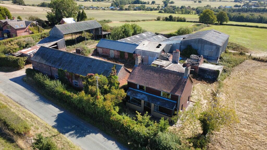
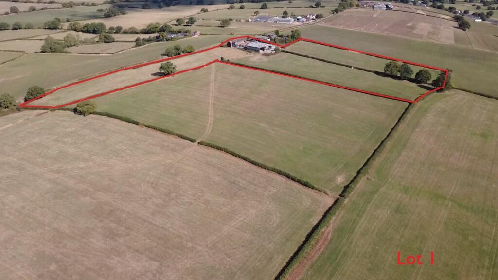
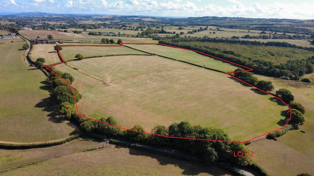
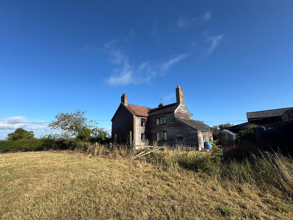
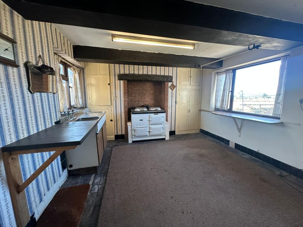
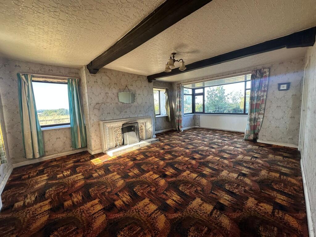
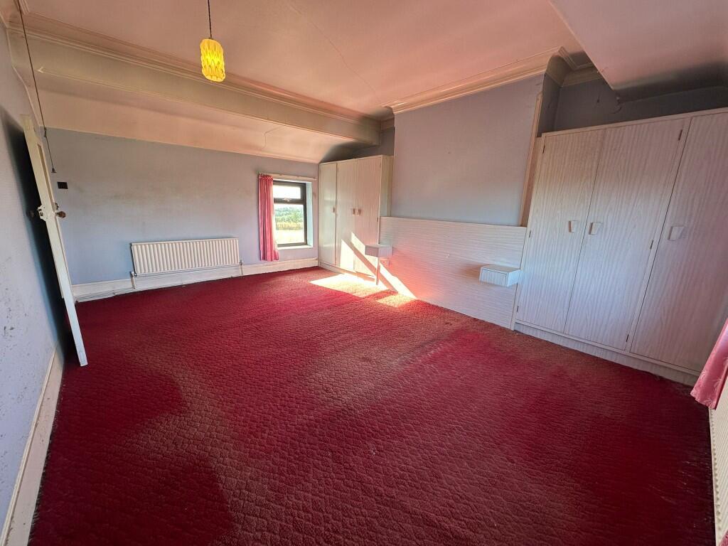
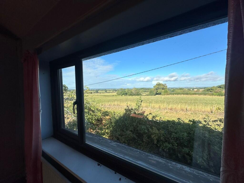
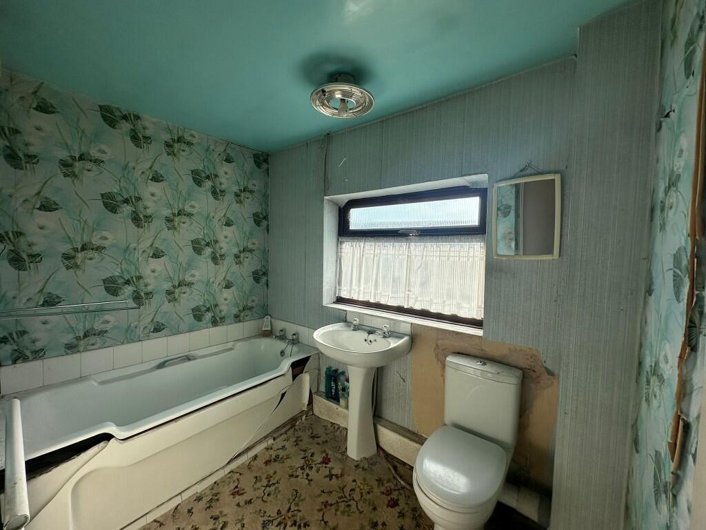
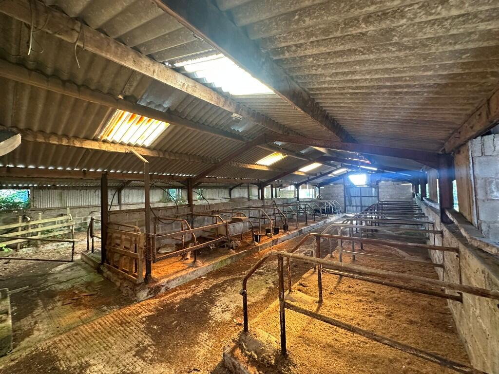
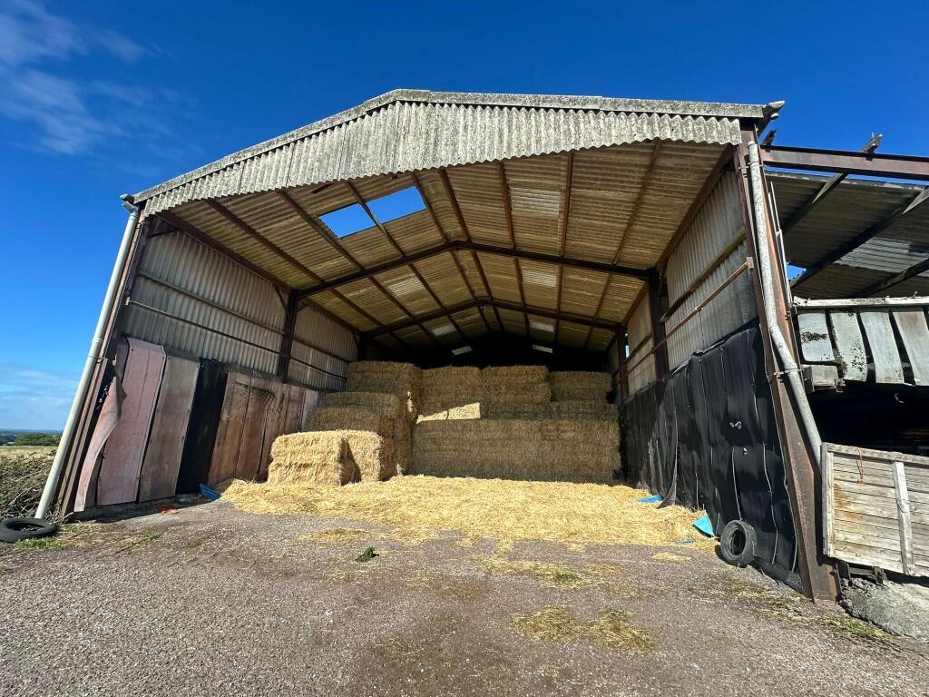
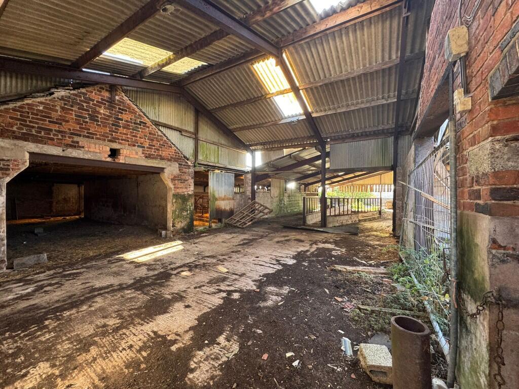
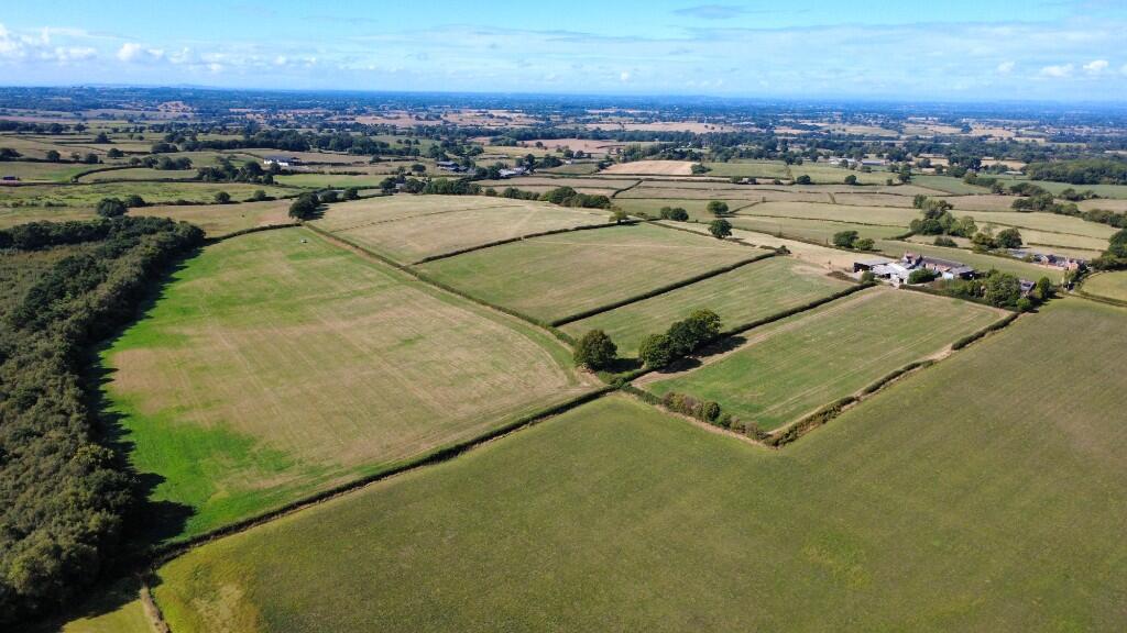
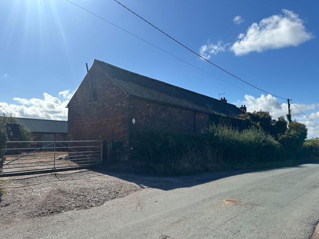
Photo 1 Photo 2 Photo 3 Photo 4 Photo 5 Photo 6 Photo 7 Photo 8 Photo 9 Photo 10 Photo 11 Photo 12 Photo 13 Photo 14
/ 14
Property details
Tenure
FREEHOLD
Local average
£724,965 (+55.2%)
Deprivation
Decile 6 (18,883 of 33,755)
Street crime
2 incidents within 1 mile (Apr 2026)
Key features
- Attractive three-bedroom detached property
- Extensive range of traditional buildings
- 51.33 acres of grassland
- Picturesque views over Stafforshire and Cheshire
Additional details
- Heating
- Electric, Double glazing, Oil
- Parking
- Secure, Driveway, Gated, Private
Description
MOSSLEA FARM
An exciting opportunity to purchase a former farm with lots of potential on the Staffordshire/ Cheshire boarder. It offers an excellent project a potential for a livestock rearing unit or equestrian facility.
LOCATION
Located on the outskirts of Audley and Betley , the farm is accessed off Knowl bank road , with links to both the A500 and M6.
BUILDINGS
A range of traditional and modern buildings in need of repair that could be utilised for many purposes.
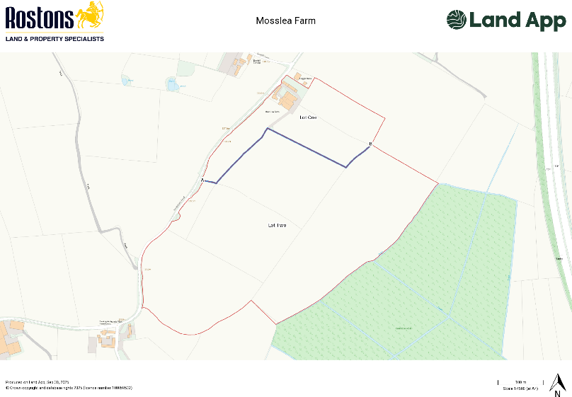
THE LAND
Ring-fenced block of productive grassland surrounding the farm, with road access to both lots.
OVERAGE
Please note that Mosslea farm is subject to a development reservation as follows: The vendor will be entitled to 30% of the uplift in value should planning consent be granted for any use other than agricultural or equestrian. This will be in place for a period of 25 years and be triggered upon the implementation of planning or sale of the property whichever is earlier.
SITE DESIGNATIONS
Our searches have found Mosslea farm is within a greenbelt and national character area.
NITRATE VUNERABLE ZONE
The farm is within a Nitrate Vulnerable Zone.
SERVICES
Mains water and electricity, private drainage and oil central heating.
SOIL TYPE & LAND GRADE
According to Soilscapes of England & Wales the soil is classed as soilscape 8, described as slightly acid loamy and clayey soils with impeded drainage. The soil is reasonably flexible but more suited to autumn sown crops and grassland.
The land is classed as Grade 3 on the Land Classification Series for England & Wales (Grade 1 - best, Grade 5 - worst).
WAYLEAVES AND EASEMENTS
We understand a gas pipeline crosses lot two.
FENCING
The purchaser would be responsible for maintaining the boundary fencing. Please note if sold separately, the purchaser of lot one will be responsible for the erection of stock proof fencing to separate lots one and two along boundary A to B.
SERVICES
Mains water and electricity, private drainage and oil central heating.
MINERAL RIGHTS
No mineral rights are included with the farm.
EASEMENTS, WAYLEAVES AND RIGHTS OF WAY
The land is sold subject to, and with the benefit of all public and private rights of way, lights, drainage, cable, pylons or other easements, restrictions or obligations whether or not the same are described in these particulars of sale.
VIEWINGS
We ask that all viewings of the property are made by prior appointment with the selling agents, by calling the office .
MONEY LAUNDERING LEGISLATION
Rostons Ltd must comply with Anti Money Laundering legislation. As part of the requirements, Rostons must obtain evidence of the identity and proof of address of potential buyers. Prior to an offer being accepted, all parties who are purchasing must provide the necessary evidence.
SALE PLAN AND PARTICULARS
The sale plan is based on the Ordnance Survey sheet. Prospective purchasers should check the contract documents. The purchasers shall raise no objection or query in respect of any variation between the physical boundaries on the site and the Ordnance Survey sheet plan. The plans are strictly for identification purposes only.
TOWN AND COUNTRY PLANNING ACT
The property not withstanding any description contained in these particulars, is sold subject to any development plan, tree preservation order, town planning scheme or agreement, resolution or notice.
TITLE
The property is being sold freehold with vacant possession upon completion.
SELLING AGENTS
James Parton / Amelia Palmer
Rostons Limited
Chester, CH3 9AU
Listed by
Hatton Heath
Rostons
Reference: 167594267
EPC ratings on this postcode
We don't have a matched EPC for this property yet. Below are efficiency scores and details for other addresses on this postcode.
| Address | Current | Potential | Floor area | Age band | Type |
|---|---|---|---|---|---|
| 1 Knowl Bank Barns, Knowl Bank Road, Audley | 54 | 88 | 99 m² | England and Wales: 2007 onwards | House |
| 1 Knowl Bank Barns, Knowl Bank Road, Audley, STOKE-ON-TRENT | 54 | 88 | 99 m² | England and Wales: 2007-2011 | Terraced |
| 2 Knowl Bank Barns, Knowl Bank Road, Audley | 52 | 68 | 98 m² | England and Wales: 2003-2006 | House |
| 2 Knowl Bank Barns, Knowl Bank Road, Audley, STOKE-ON-TRENT | 52 | 68 | 98 m² | England and Wales: 2003-2006 | Terraced |
| 3 Knowl Bank Barns, Knowl Bank Road, Audley | 65 | 68 | 156 m² | England and Wales: 2007 onwards | House |
| 3 Knowl Bank Barns, Knowl Bank Road, Audley | 58 | 60 | 192 m² | England and Wales: 2007 onwards | House |
| 4 Knowl Bank Barns, Knowl Bank Road, Audley | 56 | 85 | 122 m² | England and Wales: 2003-2006 | House |
| 4 Knowl Bank Barns, Knowl Bank Road, Audley | 73 | 75 | 89 m² | England and Wales: 2007 onwards | House |
| 4 Knowl Bank Barns, Knowl Bank Road, Audley | 63 | 66 | 89 m² | England and Wales: 2007 onwards | House |
| 4 Knowl Bank Barns, Knowl Bank Road, Audley, STOKE-ON-TRENT | 56 | 85 | 122 m² | England and Wales: 2003-2006 | Terraced |
| Cheshire View, Knowl Bank Road | 39 | 68 | 77 m² | England and Wales: 1967-1975 | Bungalow |
| Cheshire View, Knowl Bank Road, Audley | 36 | 49 | 77 m² | England and Wales: 1950-1966 | Bungalow |
| Cheshire View, Knowl Bank Road, STOKE-ON-TRENT | 39 | 68 | 77 m² | England and Wales: 1967-1975 | Detached |
| Hillside Farm, Knowl Bank Road, Audley | 16 | 81 | 175 m² | England and Wales: before 1900 | House |
| Hillside Farm, Knowl Bank Road, Audley | 3 | 17 | 173 m² | England and Wales: before 1900 | House |
Flood risk
Zone: 1
Risk: Low
Job (default Low)
Floorplans
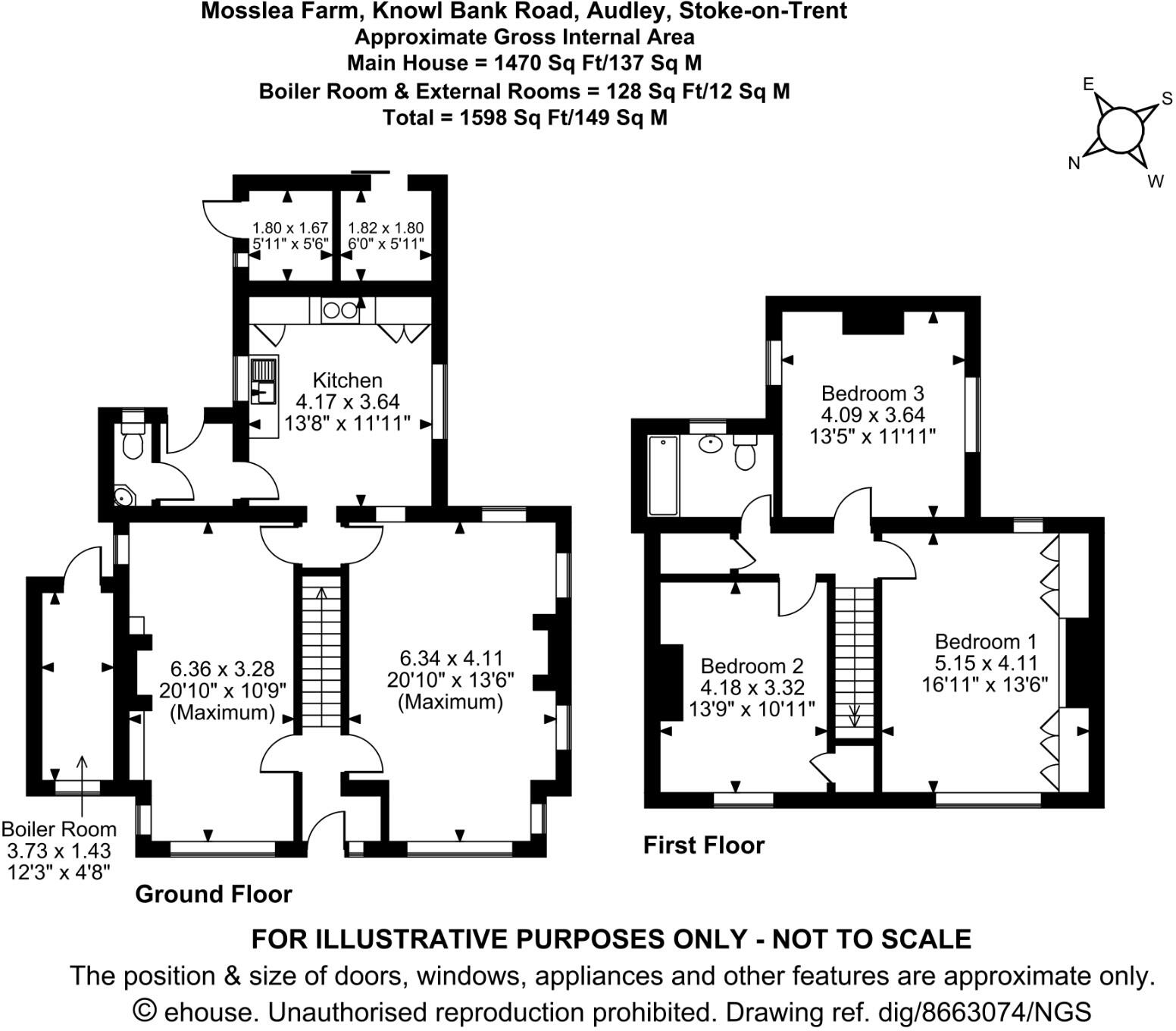
House
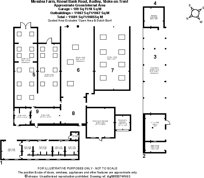
Buildings
Site Plan
EPC Graphs

EPC
Price history
| Event | Date | Price | % change |
|---|---|---|---|
| Listed for sale | — | £1,125,000 | — |
Source: HM Land Registry Price Paid Data. Crown copyright.
Sold Comparables
Sold comparables data is not available for this property.
Capital growth trend
Land Registry outcode average: last 12 months vs 5y and 10y ago (from sold prices).
House Price Index (HM Land Registry — official index, not sold-price averages): Newcastle-under-Lyme. Series: All dwelling types. As of March 2026.
Rental Range
Estimated market rent for Newcastle-under-Lyme. Low = conservative, Realistic = average, Optimistic = best case.
Based on Local Authority from postcode lookup → Newcastle-under-Lyme.
LHA (30th percentile) floor for South Cheshire: £678/mo (Apr 2025 – Mar 2026)
Location
Address
Knowlbank Road
Nearby
Nearest stations, universities and amenities (distance from property).
| Type | Name | Distance |
|---|---|---|
| Bus stop | Limbrick Road | 1.0 miles |
| Bus stop | Old Peel Farm | 1.0 miles |
| Shop | Elmside Garden Centre | 1.6 miles |
| Shop | Tesco Express | 1.9 miles |
| Train station | Apedale Road | 3.0 miles |
| Train station | Silverdale | 3.0 miles |
| University | Keele University | 3.7 miles |
| Hospital | Bradwell Hospital | 4.1 miles |
| University | University of Buckingham Crewe Campus | 5.2 miles |
| Hospital | Hartshill Medical Centre | 5.6 miles |
Street-level crime
| Category | Count |
|---|---|
| Burglary | 1 |
| Violence and sexual offences | 1 |
| Total incidents | 2 |
Within 1 mile during Apr 2026. Source: data.police.uk (England & Wales).
Schools nearby
Nearest open schools with Ofsted ratings (England). Closed schools are not shown. Data from Get Information about Schools and Ofsted.
| Name | Type | Distance | Ofsted |
|---|---|---|---|
| Betley CofE VC Primary School | Primary | 1.2 miles | — (Inspected (no overall grade)) |
| Sir Thomas Boughey Academy | Secondary | 1.4 miles | Good — 22 Mar 2022 |
| Alsagers Bank Primary Academy | Primary | 1.9 miles | Good — 19 Nov 2012 |
| Castle Hill School | Other | 2.0 miles | Requires improvement — 18 Apr 2024 |
| The Meadows Primary School | Primary | 2.1 miles | Outstanding — 13 Mar 2024 |
Rental Comparables
Residential lets from OpenRent and Rightmove for the area (same bedroom count). Use to validate rent estimates. Student lets are excluded.
| Title | Rent | Beds | Distance | As seen on |
|---|---|---|---|---|
| High Street, Halmer End, Stoke-on-Trent, ST7 | £895/mo | 3 | 1.68 miles | Rightmove |
| High Street, Alsagers Bank, Stoke On Trent, Staffordshire, ST7 | £795/mo | 3 | 1.92 miles | Rightmove |
| Coalfield Close, Bignall End, Staffordsire | £1,200/mo | 3 | 2.31 miles | Rightmove |
| Boon Hill, Bignall End | £1,325/mo | 3 | 2.47 miles | Rightmove |
| Lincoln Road, STOKE-ON-TRENT | £850/mo | 3 | 6.02 miles | Rightmove |
| Boden Hall Cottages, Rode Heath, ST7 | £2,250/mo | 3 | 6.56 miles | Rightmove |
| Birch Tree Lane, Scholar Green, ST7 3LJ | £1,250/mo | 3 | 7.05 miles | Rightmove |
Average rent: £1,224/mo (7 listings)
Rent-driven metrics
Based on OpenRent comparables.
- Rent ratio — Monthly rent ÷ purchase price (1% rule). 1%+ = strong, 0.8–1% = okay, <0.8% = weak for cashflow.
- Max investor price — Rent ÷ 0.8%; the price at which rent would be 0.8% of price (Stoke-style target).
- Target investor price — Rent ÷ 1%; the price at which rent would be 1% of price (strong cashflow band).
- Gross yield — Annual rent as % of purchase price (no costs).
- Cost-to-rent — Price ÷ annual rent (from OpenRent comparables). Under 14× = strong, 14–16× = acceptable, 17×+ = compressed.
- Cashflow — Rent minus mortgage, 10% maintenance, £25/mo compliance. Assumes 75% LTV, 3.95% APR (5yr fixed), 25yr term.
- ROI — Annual profit ÷ cash in (deposit + 4% purchase costs).
Enter House Number
Enter the house number to help us retrieve more accurate pricing history and property data.
Please log in to submit or correct the house number for this listing.
Log in to continue