Ks711 - Birchington - 2 Bedroom Flat - £675 Pcm
CT7 9DR
£675 pcm
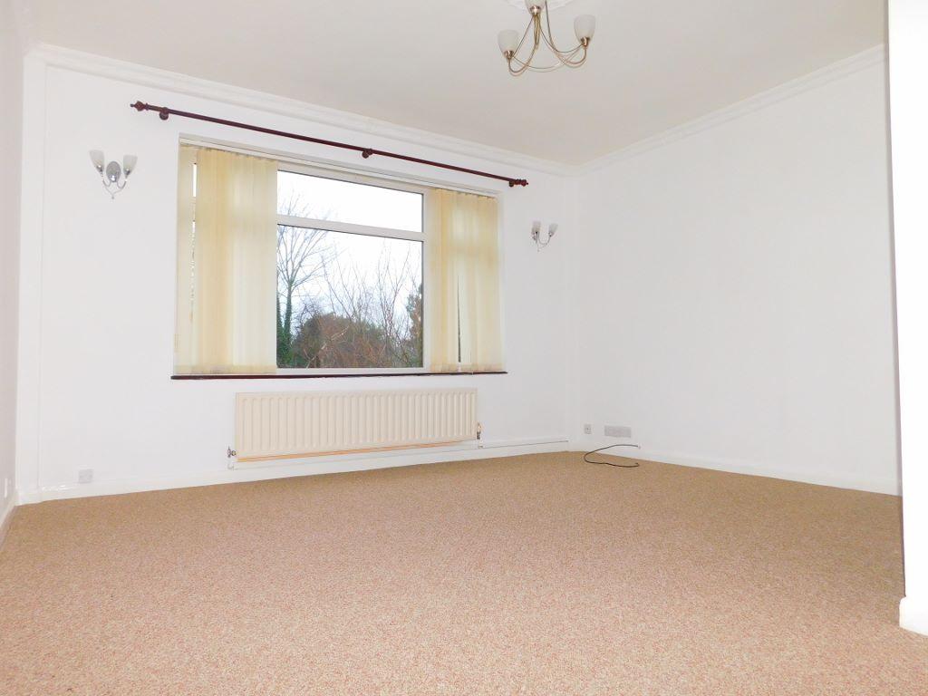
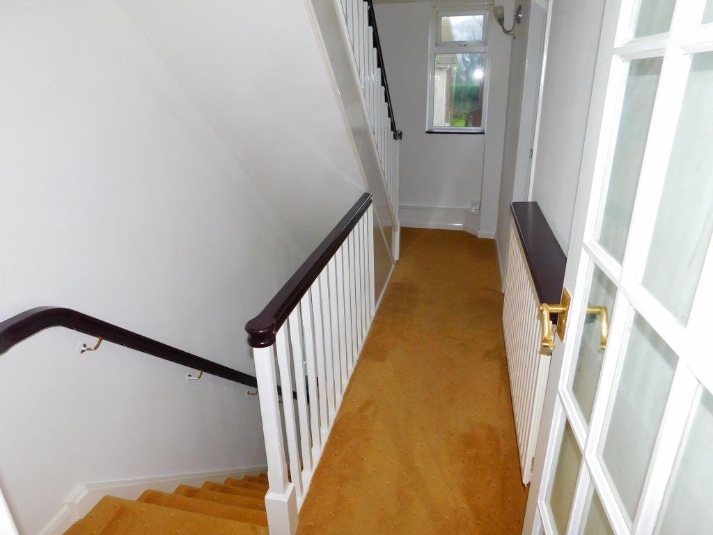
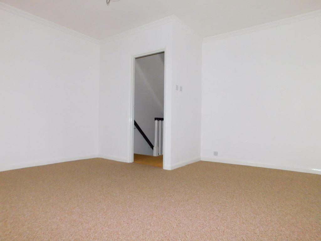
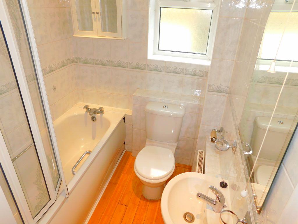
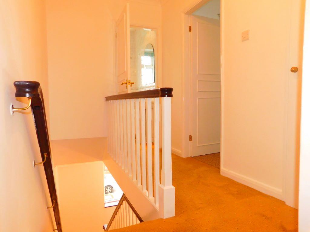
Property details
Deprivation
Decile 4 (11,195 of 33,755)
Street crime
50 incidents within 1 mile (Apr 2026)
Additional details
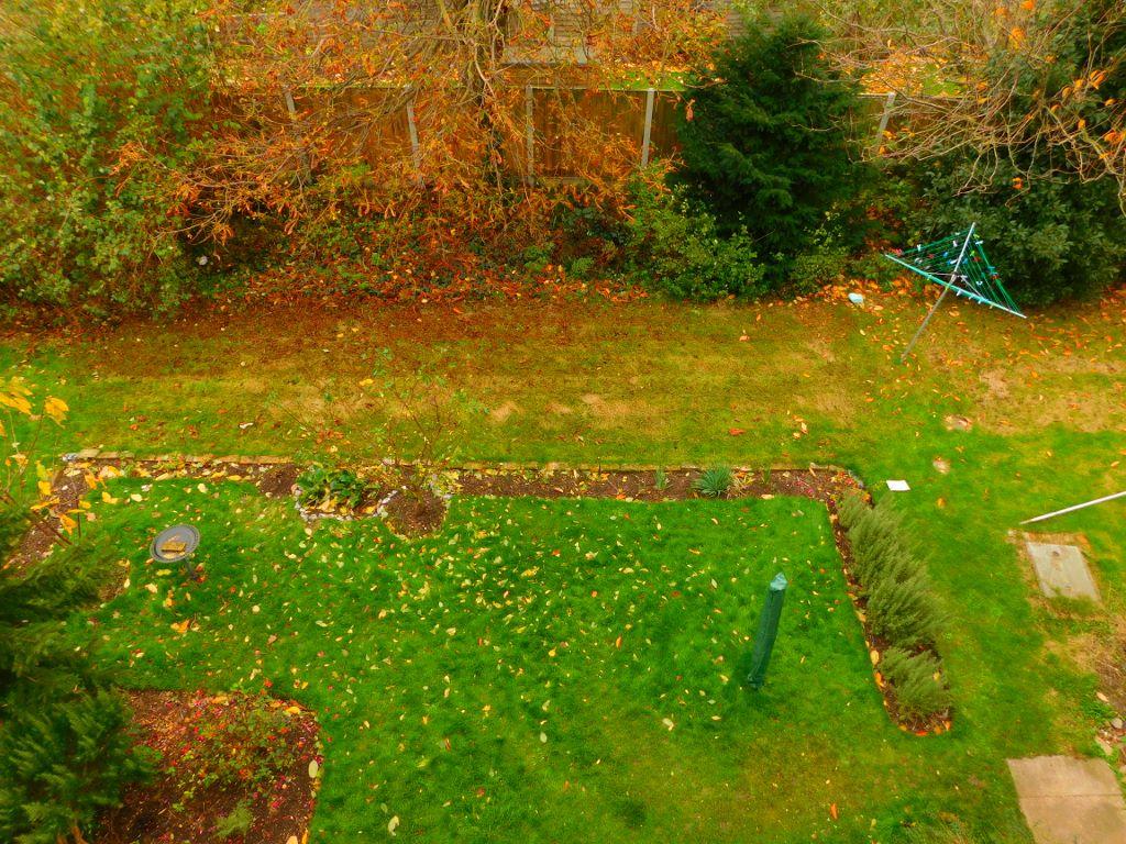
- Garden
- Yes
Description
Listed by
Kent
K S Property Rentals
Reference: 62609741
EPC ratings on this postcode
We don't have a matched EPC for this property yet. Below are efficiency scores and details for other addresses on this postcode.
| Address | Current | Potential | Floor area | Age band | Type |
|---|---|---|---|---|---|
| 10, Woodford Court, BIRCHINGTON | 59 | 80 | 63 m² | England and Wales: 1976-1982 | Flat |
| 11, Woodford Court, BIRCHINGTON | 69 | 75 | 63 m² | England and Wales: 1950-1966 | Flat |
| 12, Woodford Court, BIRCHINGTON | 62 | 77 | 58 m² | England and Wales: 1976-1982 | Flat |
| 14, Woodford Court, BIRCHINGTON | 65 | 76 | 64 m² | England and Wales: 1967-1975 | Flat |
| 15 Woodford Court, BIRCHINGTON | 75 | 78 | 64 m² | England and Wales: 1930-1949 | Flat |
| 16, Woodford Court, BIRCHINGTON | 71 | 72 | 63 m² | England and Wales: 1950-1966 | Flat |
| 19, Woodford Court, BIRCHINGTON | 71 | 76 | 58 m² | England and Wales: 1967-1975 | Flat |
| 19, Woodford Court, BIRCHINGTON | 65 | 73 | 63 m² | England and Wales: 1950-1966 | Flat |
| 19, Woodford Court, BIRCHINGTON | 65 | 74 | 69 m² | England and Wales: 1967-1975 | Flat |
| 2 WOODFORD COURT, BIRCHINGTON, BIRCHINGTON | 65 | 70 | 64 m² | England and Wales: 1967-1975 | Flat |
| 20, Woodford Court, BIRCHINGTON | 71 | 76 | 64 m² | England and Wales: 1950-1966 | Flat |
| 25, Woodford Court, BIRCHINGTON | 68 | 78 | 84 m² | England and Wales: 1967-1975 | Flat |
| 26 Woodford Court, BIRCHINGTON | 68 | 74 | 72 m² | England and Wales: 1967-1975 | Flat |
| 26, Woodford Court, BIRCHINGTON | 51 | 77 | 64 m² | England and Wales: 1950-1966 | Flat |
| 27 Woodford Court, BIRCHINGTON | 46 | 69 | 60 m² | England and Wales: 1950-1966 | Flat |
Flood risk
Zone: 1
Risk: Low
Job (default Low)
EPC Graphs

EPC
Rental Range
Estimated market rent for Thanet. Low = conservative, Realistic = average, Optimistic = best case.
Based on Local Authority from postcode lookup → Thanet.
LHA (30th percentile) floor for Thanet: £748/mo (Apr 2025 – Mar 2026)
Location
Address
Woodford Court
Nearby
Nearest stations, universities and amenities (distance from property).
| Type | Name | Distance |
|---|---|---|
| Bus stop | The Square | 0.1 miles |
| Train station | Birchington-on-Sea | 0.3 miles |
| Shop | Quex Craft Village | 0.6 miles |
| Shop | Minnis Bay Village Store | 0.8 miles |
| Train station | Westgate-on-Sea | 1.4 miles |
| Hospital | Queen Elizabeth The Queen Mother Hospital | 3.6 miles |
| Hospital | Queen Victoria Memorial Hospital | 7.1 miles |
| University | Careers and Employability Service | 11.5 miles |
| University | Skills for Academic Success | 11.5 miles |
Street-level crime
| Category | Count |
|---|---|
| Violence and sexual offences | 22 |
| Anti-social behaviour | 10 |
| Drugs | 4 |
| Other theft | 3 |
| Shoplifting | 3 |
| Bicycle theft | 2 |
| Burglary | 2 |
| Public order | 2 |
| Criminal damage and arson | 1 |
| Other crime | 1 |
| Total incidents | 50 |
Within 1 mile during Apr 2026. Source: data.police.uk (England & Wales).
Schools nearby
Nearest open schools with Ofsted ratings (England). Closed schools are not shown. Data from Get Information about Schools and Ofsted.
| Name | Type | Distance | Ofsted |
|---|---|---|---|
| Birchington Church of England Primary School | Primary | 0.4 miles | Good — 9 Feb 2016 |
| The Llewellyn School and Nursery | Other | 0.7 miles | Good — 21 Sep 2022 |
| King Ethelbert School | Secondary | 0.7 miles | Good — 7 Jul 2024 |
| Ursuline College | Secondary | 0.9 miles | Good — 12 Jan 2023 |
| St Saviour's Church of England Junior School | Primary | 1.2 miles | Good — 1 Apr 2014 |
Rental Comparables
Residential lets from OpenRent and Rightmove for the area (same bedroom count). Use to validate rent estimates. Student lets are excluded.
| Title | Rent | Beds | Distance | As seen on |
|---|---|---|---|---|
| 2 Bed Flat, Station Road, CT7 | £1,100/mo | 2 | 0.08 miles | OpenRent |
| 2 Bed Semi-Detached House, Station Road, CT7 | £1,280/mo | 2 | 0.09 miles | OpenRent |
| 2 Bed Flat, Station Road, CT7 | £995/mo | 2 | 0.11 miles | OpenRent |
| 2 Bed Flat, Station Road, CT7 | £995/mo | 2 | 0.11 miles | OpenRent |
| 2 Bed Maisonette, Station Road, CT7 | £1,050/mo | 2 | 0.12 miles | OpenRent |
| 2 Bed Bungalow, King Edward Road, CT7 | £1,550/mo | 2 | 0.55 miles | OpenRent |
| 2 Bed Terraced House, Coastguard Cottages, CT7 | £1,100/mo | 2 | 0.76 miles | OpenRent |
| 2 Bed Bungalow, The Warren Drive, CT8 | £1,550/mo | 2 | 0.82 miles | OpenRent |
Average rent: £1,203/mo (8 listings)
Enter House Number
Enter the house number to help us retrieve more accurate pricing history and property data.
Please log in to submit or correct the house number for this listing.
Log in to continue