Marston Road
Stafford, ST16 3BY
£190,000
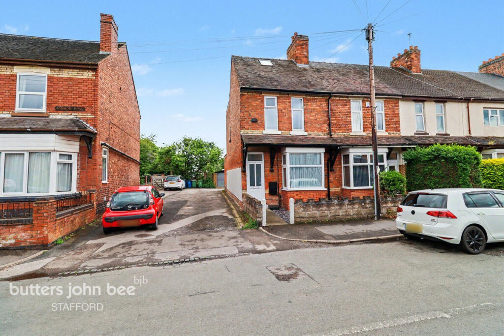
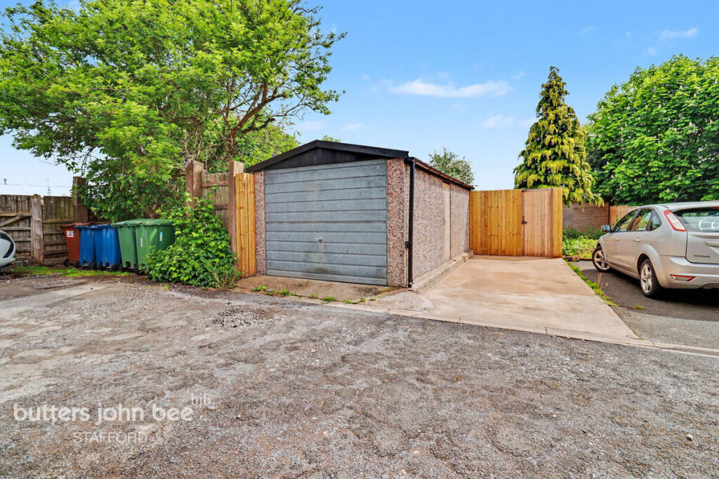
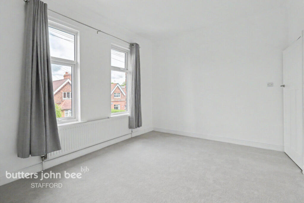
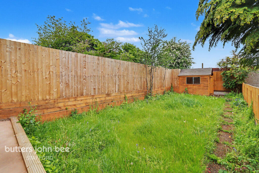
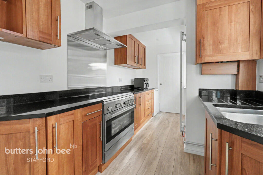
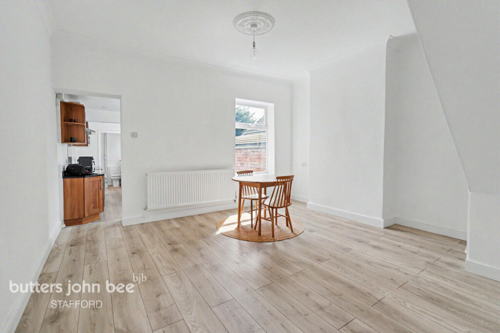

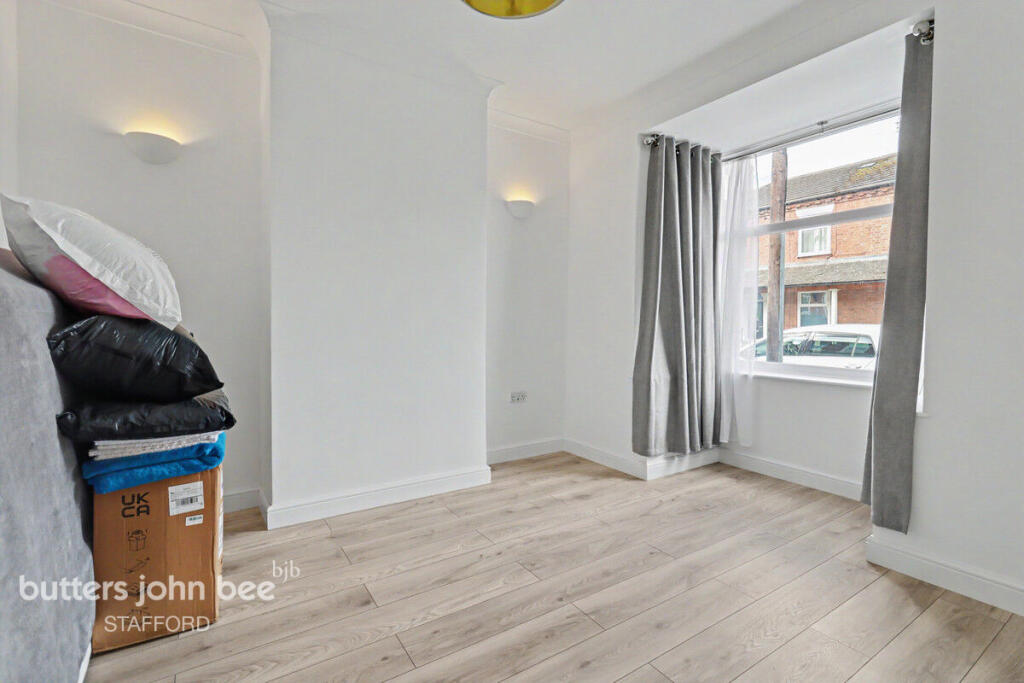

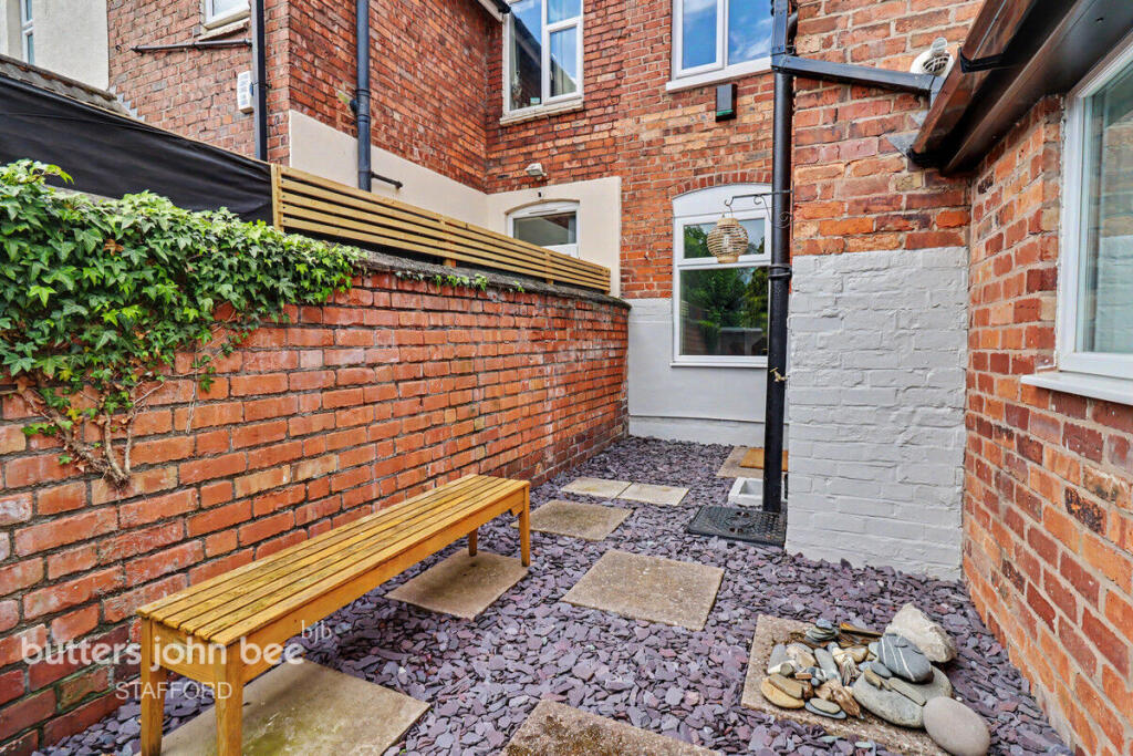
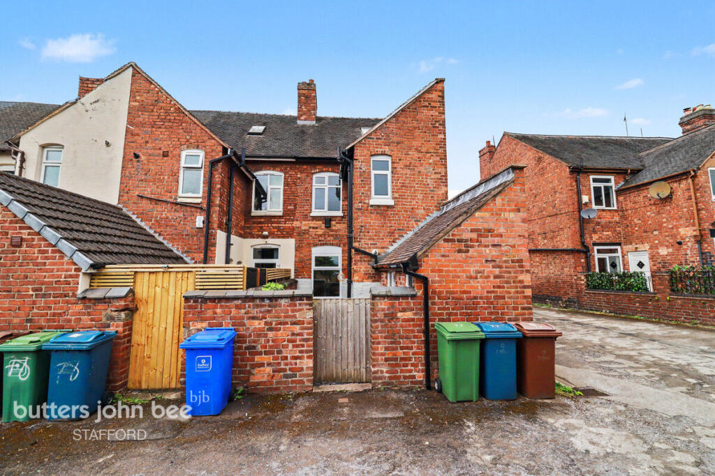
Photo 1 Photo 2 Photo 3 Photo 4 Photo 5 Photo 6 Photo 7 Photo 8 Photo 9 Photo 10 Photo 11
/ 11
Property details
Tenure
FREEHOLD
Local average
£178,296 (+6.6%)
Deprivation
Decile 4 (12,511 of 33,755)
Street crime
298 incidents within 1 mile (Apr 2026)
Key features
- Fully renovated end terrace
- 2 Good sized bedrooms
- Downstairs and upstairs bathroom
- Detached garage
- Private parking space
- Separate garden area
Additional details
- Parking
- Yes
- Garden
- Yes
Description
The ground floor features a bright and welcoming living space alongside a sleek galley-style kitchen fitted with modern cabinetry, contrasting worktops, and integrated cooking appliances. A useful downstairs bathroom adds extra convenience for busy households and guests alike.
Upstairs, the property offers two well-proportioned bedrooms and a stunning contemporary bathroom finished with elegant tiling and quality fittings, creating a luxurious feel throughout.
Externally, the property benefits from private parking, a detached garage, and an additional garden plot offering excellent potential for outdoor entertaining, gardening, or further landscaping. As an end-terrace home, it also enjoys added privacy and side access.
Situated in a great location close to local amenities, schools, and transport links, this move-in-ready home is sure to appeal to a wide range of buyers.
Early viewing is highly recommended.
Listed by
Stafford
Spicerhaart
Reference: 88518471
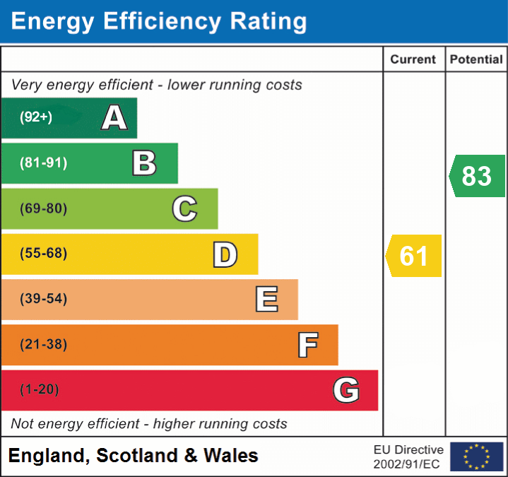
EPC ratings on this postcode
We don't have a matched EPC for this property yet. Below are efficiency scores and details for other addresses on this postcode.
| Address | Current | Potential | Floor area | Age band | Type |
|---|---|---|---|---|---|
| 62 Marston Road, STAFFORD | 68 | 71 | 140 m² | England and Wales: 1900-1929 | Terraced |
| 62, Marston Road, STAFFORD | 50 | 79 | 122 m² | England and Wales: before 1900 | Terraced |
| 63 Marston Road, STAFFORD | 69 | 86 | 96 m² | England and Wales: 1900-1929 | Terraced |
| 63, Marston Road, STAFFORD | 61 | 86 | 96 m² | England and Wales: before 1900 | Terraced |
| 64 Marston Road, STAFFORD | 63 | 79 | 80 m² | England and Wales: 1900-1929 | Terraced |
| 64, Marston Road, STAFFORD | 59 | 81 | 108 m² | England and Wales: 1900-1929 | Terraced |
| 66, Marston Road, STAFFORD | 62 | 84 | 100 m² | England and Wales: before 1900 | Terraced |
| 69, Marston Road, STAFFORD | 61 | 81 | 94 m² | England and Wales: 1900-1929 | Terraced |
| 70 MARSTON ROAD, STAFFORD, STAFFORD | 64 | 85 | 89 m² | England and Wales: 1900-1929 | Terraced |
| 70, Marston Road, STAFFORD | 56 | 85 | 94 m² | England and Wales: before 1900 | Terraced |
| 71, Marston Road, STAFFORD | 73 | 89 | 82 m² | England and Wales: 1900-1929 | Terraced |
| 72 Marston Road, STAFFORD | 72 | 80 | 87 m² | England and Wales: 1900-1929 | Terraced |
| 72, Marston Road, STAFFORD | 53 | 76 | 104 m² | England and Wales: before 1900 | Terraced |
| 73 MARSTON ROAD, STAFFORD, STAFFORD | 55 | 84 | 102 m² | England and Wales: 1900-1929 | Terraced |
| 75 Marston Road, STAFFORD | 62 | 78 | 104 m² | England and Wales: 1900-1929 | Terraced |
Flood risk
Zone: 1
Risk: Low
Job (default Low)
Floorplans
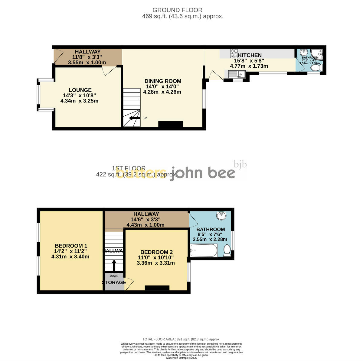
Floorplan 1
Floorplan 2
EPC Graphs
EPC 1
Price history
| Event | Date | Price | % change |
|---|---|---|---|
| Listed for sale | — | £190,000 | — |
Source: HM Land Registry Price Paid Data. Crown copyright.
Sold Comparables
Same street and nearby sales within 0.25 miles (last 5 years). Data from Land Registry Price Paid.
| Address | Price | Date | Type |
|---|---|---|---|
| 108 PEEL TERRACE, STAFFORD, STAFFORDSHIRE, ST16 3HD | £94,000 | 19/01/2026 | Terraced |
| 73 COOPERATIVE STREET, STAFFORD, STAFFORDSHIRE, ST16 3DA | £180,000 | 19/01/2026 | Terraced |
| 19 PEEL TERRACE, STAFFORD, STAFFORDSHIRE, ST16 3HD | £85,000 | 07/01/2026 | Terraced |
| 58 VICTORIA TERRACE, STAFFORD, STAFFORDSHIRE, ST16 3HB | £110,000 | 19/12/2025 | Terraced |
| 38 BELLASIS STREET, STAFFORD, STAFFORDSHIRE, ST16 3DD | £177,500 | 05/12/2025 | Terraced |
| 49 VICTORIA TERRACE, STAFFORD, STAFFORDSHIRE, ST16 3HB | £120,000 | 05/12/2025 | Terraced |
| 50 MARSTON ROAD, STAFFORD, STAFFORDSHIRE, ST16 3BU | £160,000 | 14/10/2025 | Terraced |
| 18 LOVATT STREET, STAFFORD, STAFFORDSHIRE, ST16 3DB | £160,000 | 23/11/2023 | Terraced |
| Same street 86 MARSTON ROAD, STAFFORD, STAFFORDSHIRE, ST16 3BY | £276,000 | 16/11/2023 | Terraced |
| 17 COMMONSIDE CLOSE, STAFFORD, STAFFORDSHIRE, ST16 3FP | £165,000 | 23/10/2023 | Terraced |
| 2 COMMON ROAD, STAFFORD, STAFFORDSHIRE, ST16 3DG | £185,000 | 10/10/2023 | Terraced |
| 15 COOPERATIVE STREET, STAFFORD, STAFFORDSHIRE, ST16 3BZ | £145,000 | 04/08/2023 | Terraced |
| 47 MARSTON ROAD, STAFFORD, STAFFORDSHIRE, ST16 3BU | £148,850 | 01/08/2023 | Terraced |
| 73 VICTORIA TERRACE, STAFFORD, STAFFORDSHIRE, ST16 3HB | £182,000 | 30/06/2023 | Terraced |
| 14 VICTORIA TERRACE, STAFFORD, STAFFORDSHIRE, ST16 3HA | £200,000 | 30/06/2023 | Terraced |
| 20 COOPERATIVE STREET, STAFFORD, STAFFORDSHIRE, ST16 3BZ | £121,000 | 12/05/2023 | Terraced |
| 57 PEEL TERRACE, STAFFORD, STAFFORDSHIRE, ST16 3HE | £117,000 | 05/05/2023 | Terraced |
| 58A PEEL TERRACE, STAFFORD, STAFFORDSHIRE, ST16 3HE | £205,000 | 21/04/2023 | Terraced |
| 45 PEEL TERRACE, STAFFORD, STAFFORDSHIRE, ST16 3HE | £170,000 | 31/03/2023 | Terraced |
| 24 COOPERATIVE STREET, STAFFORD, STAFFORDSHIRE, ST16 3BZ | £150,000 | 14/03/2023 | Terraced |
| 57 MARSTON ROAD, STAFFORD, STAFFORDSHIRE, ST16 3BX | £141,500 | 10/03/2023 | Terraced |
| Same street 91 MARSTON ROAD, STAFFORD, STAFFORDSHIRE, ST16 3BY | £175,000 | 16/12/2022 | Terraced |
| Same street 78 MARSTON ROAD, STAFFORD, STAFFORDSHIRE, ST16 3BY | £128,000 | 09/02/2022 | Terraced |
Street average: £193,000 (3 sales)
Area average: £150,843 (20 sales)
Capital growth trend
Land Registry outcode average: last 12 months vs 5y and 10y ago (from sold prices).
House Price Index (HM Land Registry — official index, not sold-price averages): Stafford. Series: Terraced. As of March 2026.
Rental Range
Estimated market rent for Stafford. Low = conservative, Realistic = average, Optimistic = best case.
Based on Local Authority from postcode lookup → Stafford.
LHA (30th percentile) floor for Mid Staffs: £623/mo (Apr 2025 – Mar 2026)
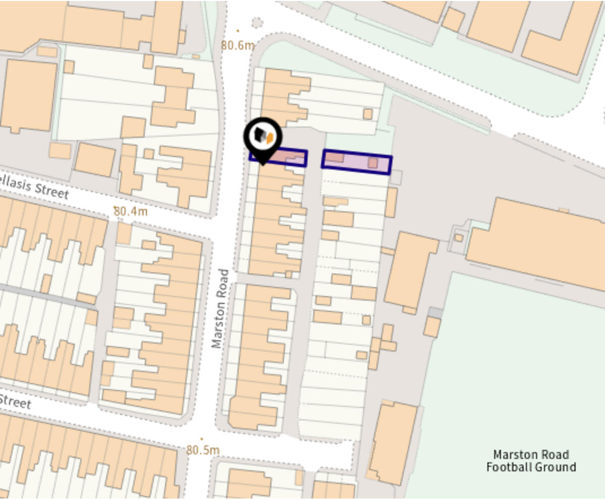
Location
Address
Marston Road
Nearby
Nearest stations, universities and amenities (distance from property).
| Type | Name | Distance |
|---|---|---|
| Bus stop | Co-operative Street | 0.0 miles |
| Shop | Morrisons Daily | 0.3 miles |
| Shop | Travis Perkins | 0.3 miles |
| Hospital | County Hospital | 1.1 miles |
| Train station | Stafford | 1.1 miles |
| Hospital | Rowley Hall Hospital | 1.7 miles |
| University | Staffordshire University Blackheath Lane Site | 1.9 miles |
| Train station | Amerton Station | 4.9 miles |
Street-level crime
| Category | Count |
|---|---|
| Violence and sexual offences | 107 |
| Anti-social behaviour | 56 |
| Public order | 31 |
| Shoplifting | 25 |
| Criminal damage and arson | 18 |
| Other theft | 17 |
| Burglary | 13 |
| Other crime | 10 |
| Vehicle crime | 7 |
| Bicycle theft | 6 |
| Drugs | 5 |
| Robbery | 2 |
| Possession of weapons | 1 |
| Total incidents | 298 |
Within 1 mile during Apr 2026. Source: data.police.uk (England & Wales).
Schools nearby
Nearest open schools with Ofsted ratings (England). Closed schools are not shown. Data from Get Information about Schools and Ofsted.
| Name | Type | Distance | Ofsted |
|---|---|---|---|
| St Patrick's Catholic Primary School | Primary | 0.3 miles | Good — 21 Nov 2022 |
| John Wheeldon Primary Academy | Primary | 0.4 miles | Good — 8 Oct 2019 |
| Tillington Manor Primary School | Primary | 0.5 miles | Requires improvement — 12 Jun 2023 |
| Sir Graham Balfour High School | Secondary | 0.7 miles | Good — 6 Jun 2014 |
| Parkside Primary School | Primary | 0.7 miles | Good — 27 Sep 2022 |
Rental Comparables
Loading rental comparables for this postcode. Refresh in a few minutes.
Rent-driven metrics
Based on Area rent estimate.
- Rent ratio — Monthly rent ÷ purchase price (1% rule). 1%+ = strong, 0.8–1% = okay, <0.8% = weak for cashflow.
- Max investor price — Rent ÷ 0.8%; the price at which rent would be 0.8% of price (Stoke-style target).
- Target investor price — Rent ÷ 1%; the price at which rent would be 1% of price (strong cashflow band).
- Gross yield — Annual rent as % of purchase price (no costs).
Enter House Number
Enter the house number to help us retrieve more accurate pricing history and property data.
Please log in to submit or correct the house number for this listing.
Log in to continue