5 MARLINGFORD WAY
NORWICH, EASTON, NORFOLK NR9 5HA
£1,600 pcm
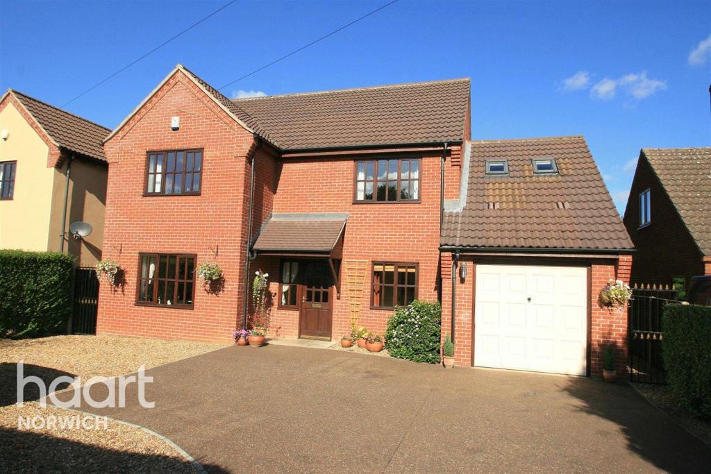
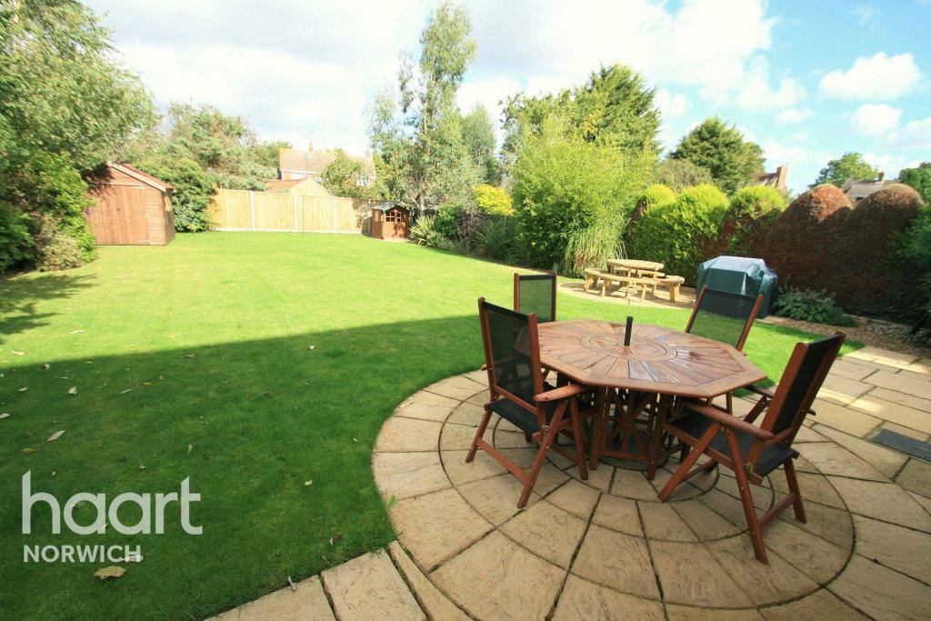
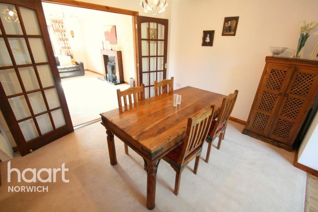
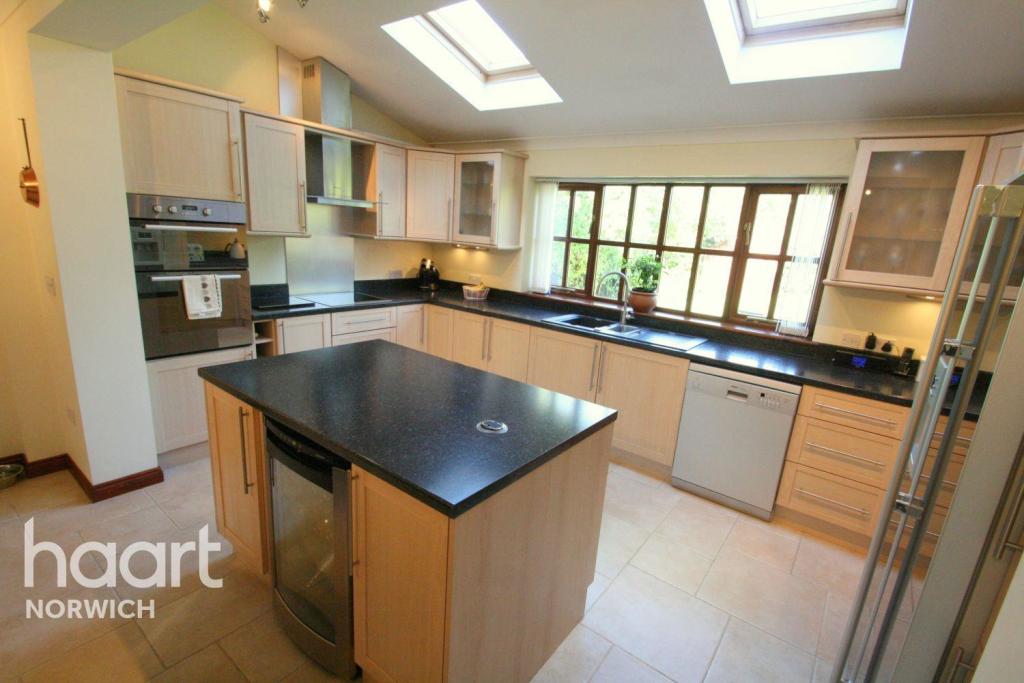
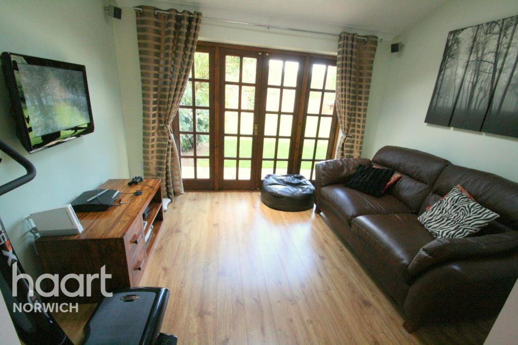
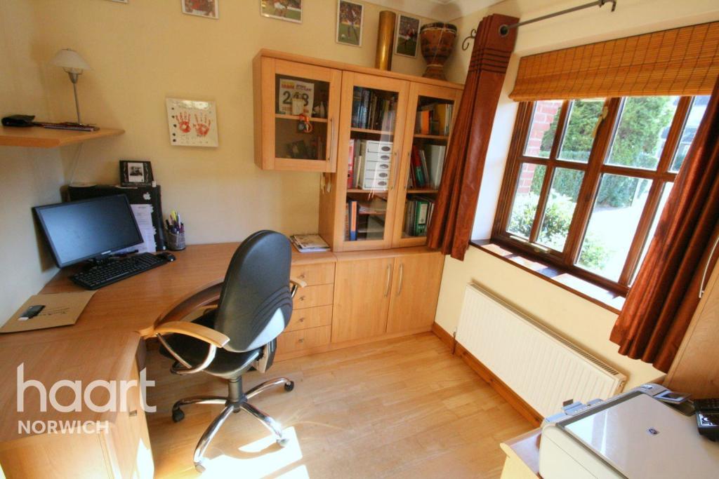
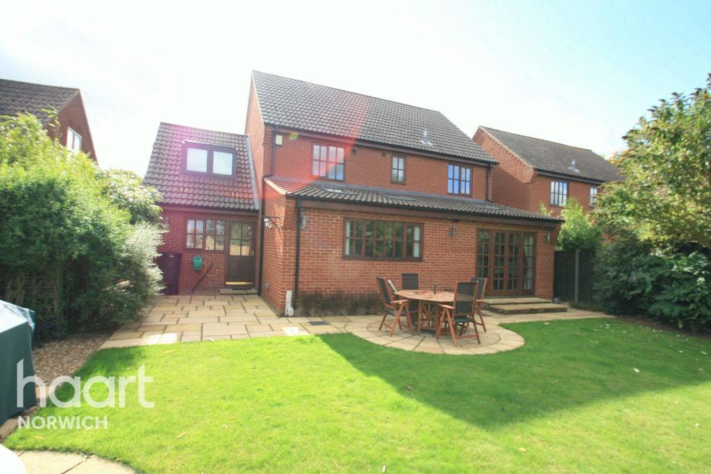
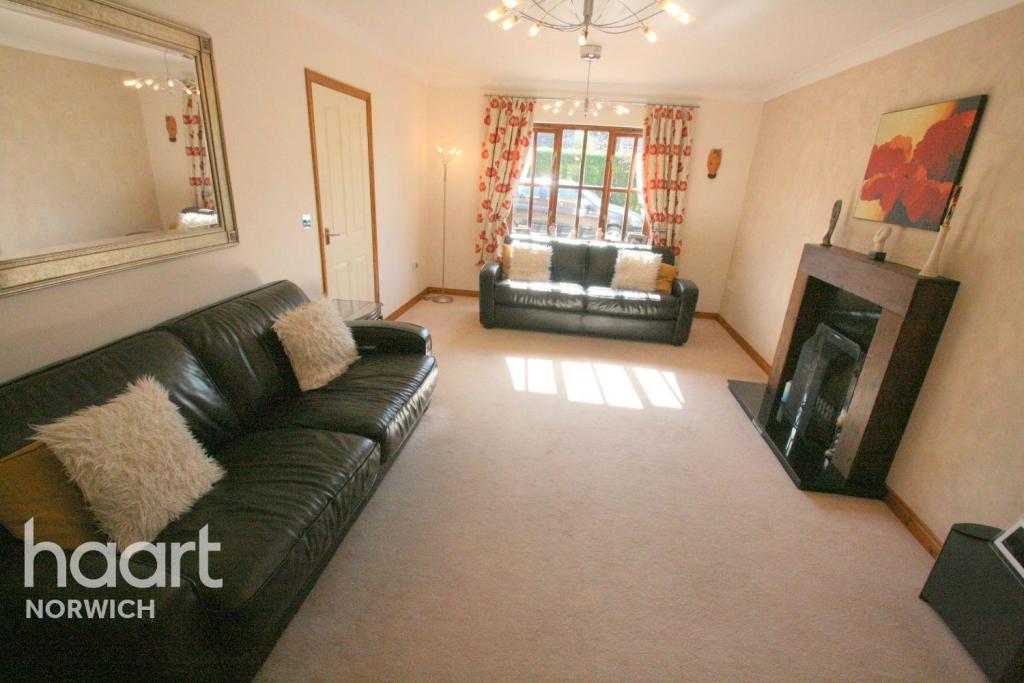
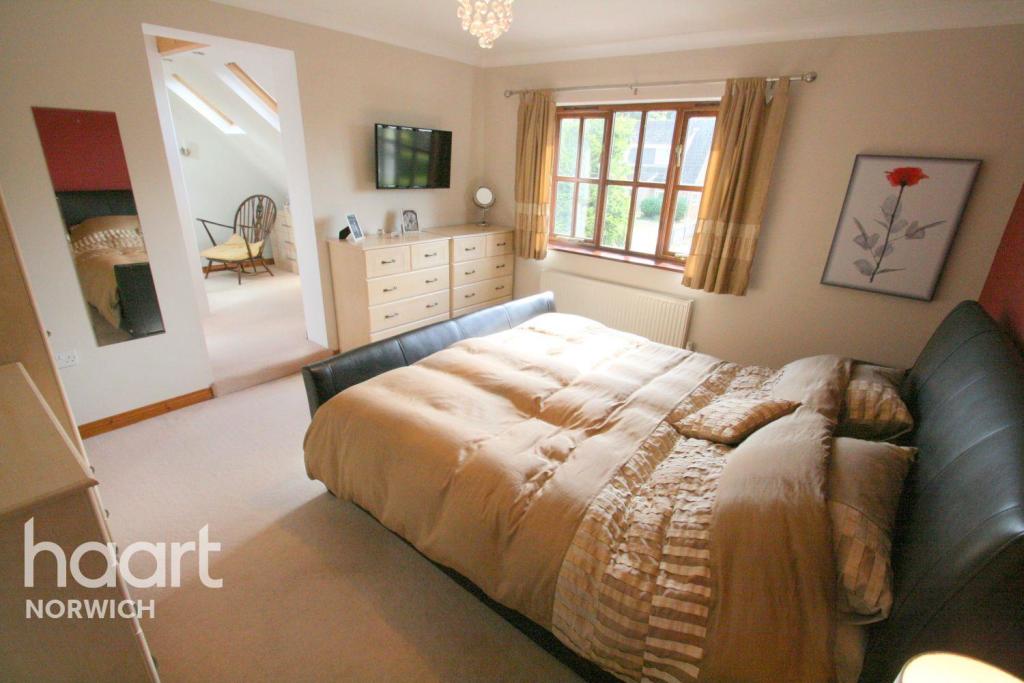
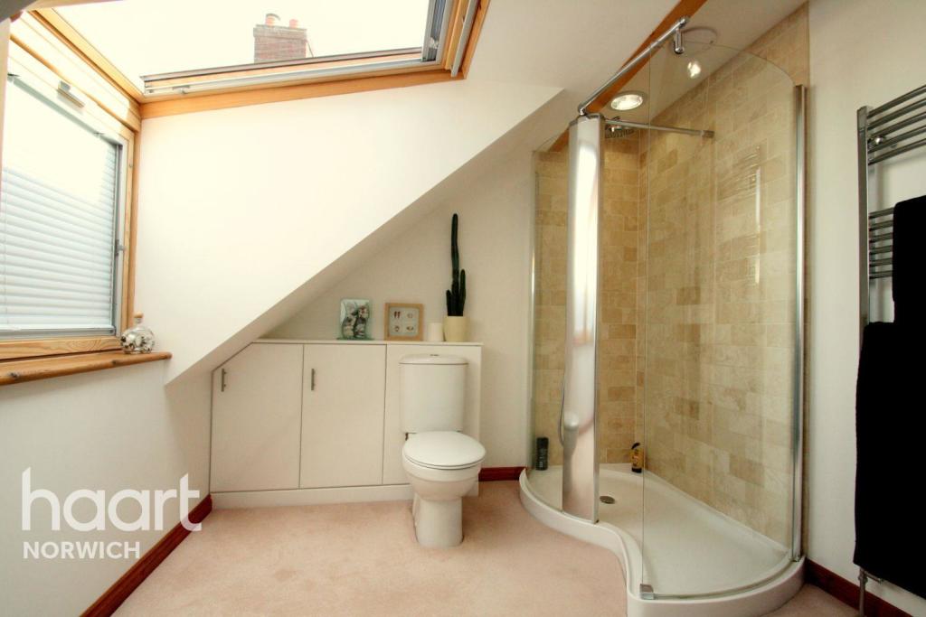
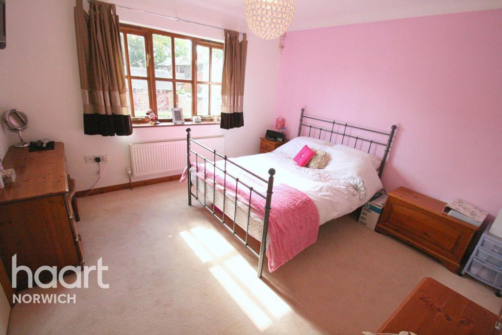
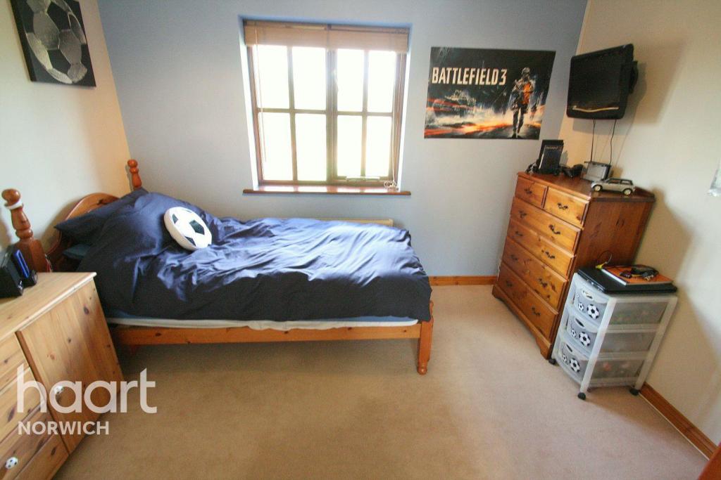
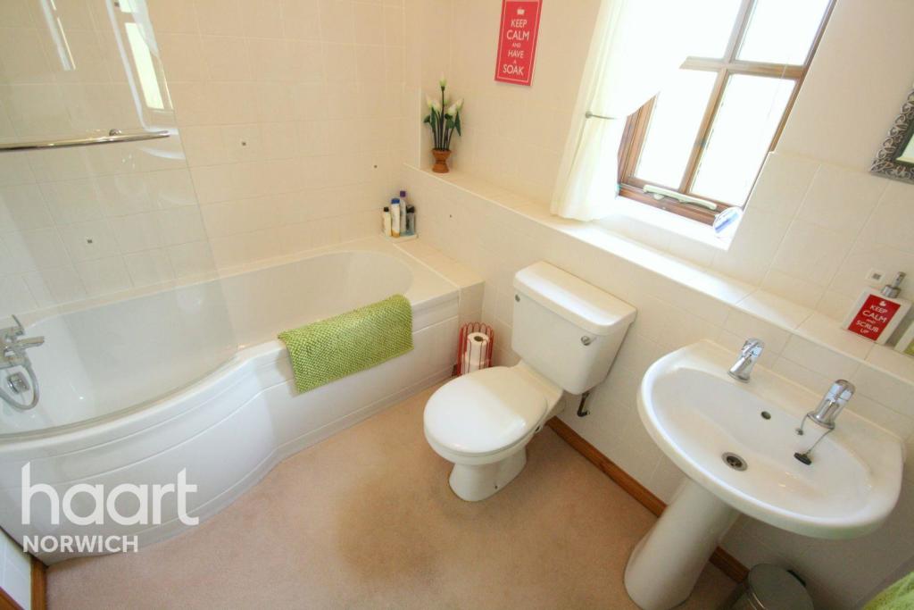
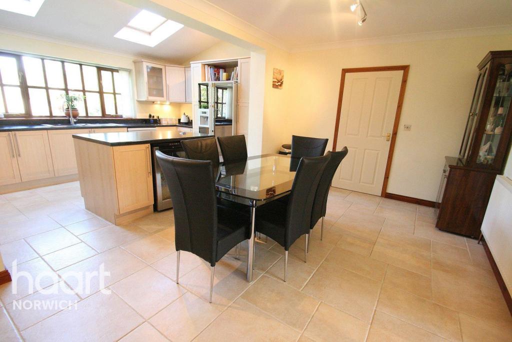
Photo 1 Photo 2 Photo 3 Photo 4 Photo 5 Photo 6 Photo 7 Photo 8 Photo 9 Photo 10 Photo 11 Photo 12 Photo 13 Photo 14
/ 14
Property details
Deprivation
Decile 7 (22,777 of 33,755)
Street crime
6 incidents within 1 mile (Apr 2026)
Key features
- DETATCHED FAMILY HOME
- EN-SUITE X 2
- VILLAGE LOCATION
- GARAGE & DRIVEWAY
- AVAILABLE APRIL
Additional details
- Parking
- Yes
- Garden
- Yes
Description
This spacious residence consists of an entrance hallway, office, kitchen, utility room, lounge, dining room and snug. Upstairs there is a family bathroom, four large bedrooms, two of which have en suite with the master also benefitting from a dressing room. Outside there is a beautiful lawned rear garden.
Situated in the semi rural location of Easton, the property offers easy access to the A47 both east and westbound. It is within close proximity to the Norfolk and Norwich University Hospital, local amenities such as Sainsbury's, local restaurants, college and schools.
Listed by
Norwich
Spicerhaart Lettings
Reference: 30537231
EPC Rating & Upgrade Cost
Fetching EPC data… Refresh this page in a moment.
Flood risk
Zone: 1
Risk: Low
Job (default Low)
Floorplans
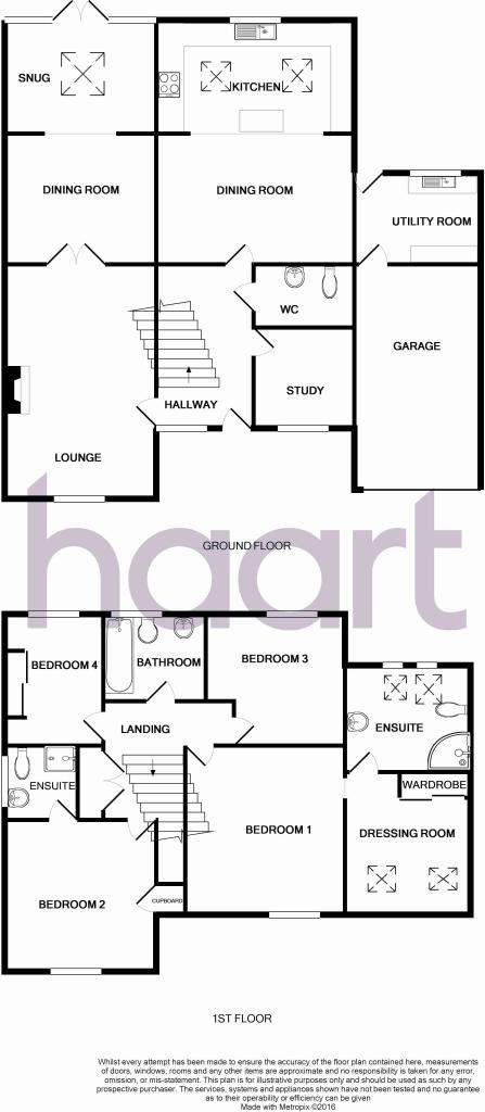
Floorplan 1
EPC Graphs
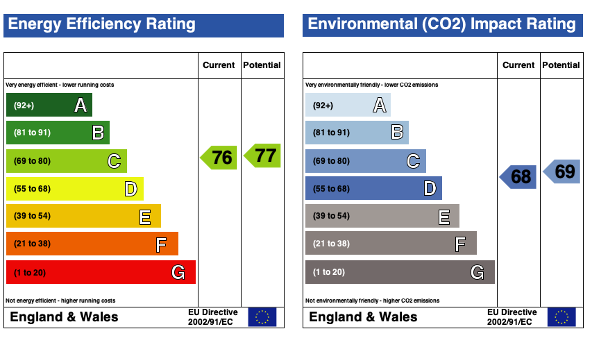
EPC 1
Rental Range
Estimated market rent for South Norfolk. Low = conservative, Realistic = average, Optimistic = best case.
Based on Local Authority from postcode lookup → South Norfolk.
LHA (30th percentile) floor for Central Norfolk & Norwich: £1,147/mo (Apr 2025 – Mar 2026)
Location
Nearby
Nearest stations, universities and amenities (distance from property).
| Type | Name | Distance |
|---|---|---|
| Bus stop | Chez Denis, adj | 0.2 miles |
| Bus stop | Bawburgh Road, adj | 0.2 miles |
| Shop | Peter Field | 0.6 miles |
| University | Easton College | 0.6 miles |
| Shop | Specsavers | 1.0 miles |
| Hospital | Norfolk and Norwich University Hospital:Emergency Department | 3.6 miles |
| University | Broadcast House | 5.8 miles |
| Train station | Wymondham Abbey | 6.2 miles |
| Train station | Kimberley Park | 6.2 miles |
| Hospital | Dereham Hospital | 9.3 miles |
Street-level crime
| Category | Count |
|---|---|
| Violence and sexual offences | 3 |
| Burglary | 2 |
| Criminal damage and arson | 1 |
| Total incidents | 6 |
Within 1 mile during Apr 2026. Source: data.police.uk (England & Wales).
Schools nearby
Nearest open schools with Ofsted ratings (England). Closed schools are not shown. Data from Get Information about Schools and Ofsted.
| Name | Type | Distance | Ofsted |
|---|---|---|---|
| St Peter's CofE Primary Academy, Easton | Primary | 0.1 miles | Good — 14 Mar 2024 |
| The Bridge Easton | Other | 0.3 miles | — (No rating) |
| Queen's Hill Primary School | Primary | 1.3 miles | Good — 13 Sep 2017 |
| The Bawburgh School | Primary | 1.9 miles | — (Inspected (no overall grade)) |
| Langley Preparatory School At Taverham Hall | Other | 2.0 miles | — (No rating) |
Rental Comparables
Residential lets from OpenRent and Rightmove for the area (same bedroom count). Use to validate rent estimates. Student lets are excluded.
| Title | Rent | Beds | Distance | As seen on |
|---|---|---|---|---|
| 4 Bed Detached House, Dereham Road, NR9 | £2,000/mo | 4 | 0.31 miles | OpenRent |
| 4 Bed Terraced House, Fairway, NR8 | £1,500/mo | 4 | 1.2 miles | OpenRent |
Average rent: £1,750/mo (2 listings)