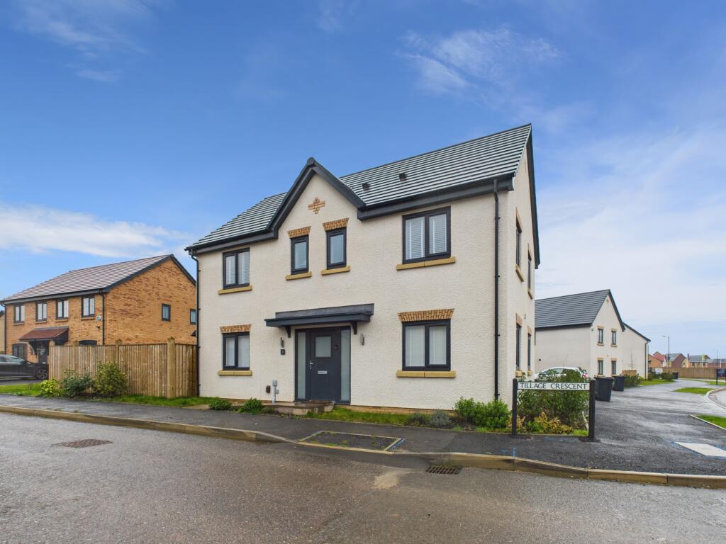
2 TILLAGE CRESCENT
DERBY, CHELLASTON, CITY OF DERBY DE73 6AS


Property details
Tenure
FREEHOLD
Floor area
124 m²
Council tax band
E
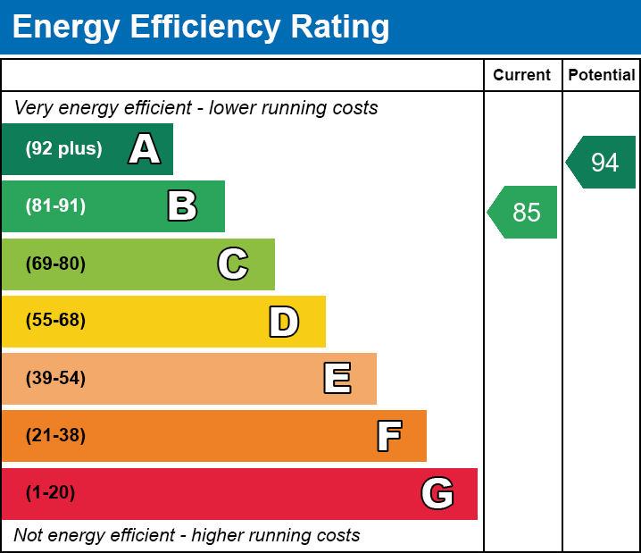
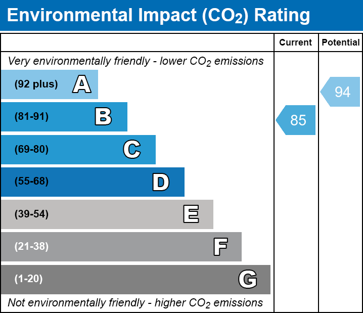
EPC rating
B
Last sold
£399,950 Oct 2024
Price per m²
£3,266/m²
Local average
£386,711 (+4.7%)
Street crime
127 incidents within 1 mile (Apr 2026)
Key features
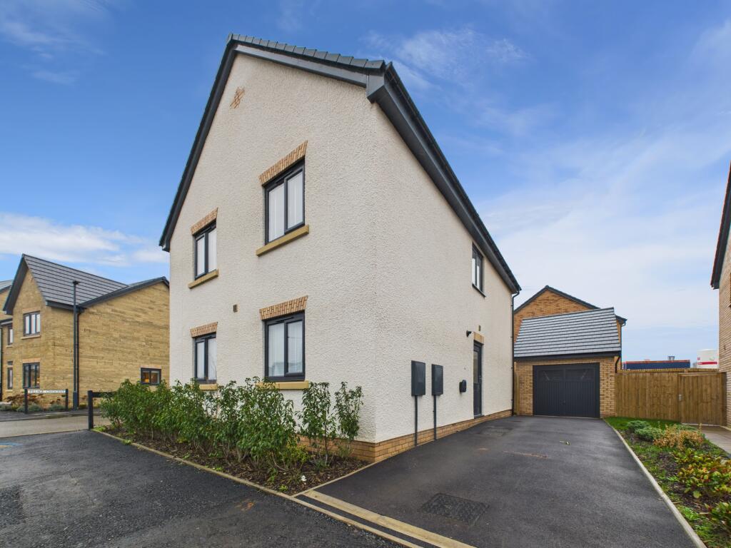
- Four-Bedroom Executive Detached Family Home of Standard Construction
- EPC Rating B
- Council Tax Band E
- Garage & Driveway Parking
- No Onward Chain
- Freehold
- Upgraded & Improved
- Desirable New Build Development
- Excellent Corner Plot Position
- Easy Access to Local Amenities & Major Roads
Additional details
- Parking
- Yes
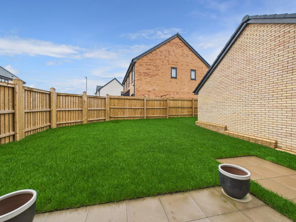
- Garden
- Yes
Description
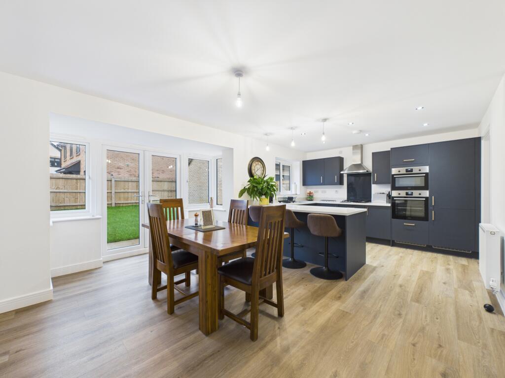
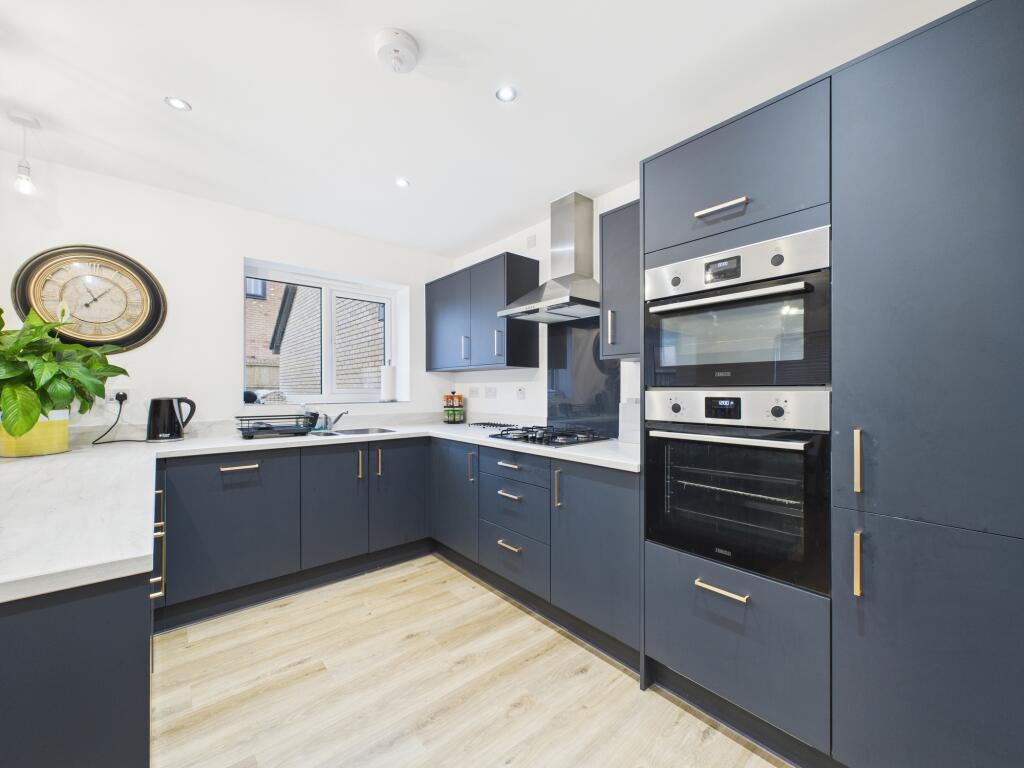
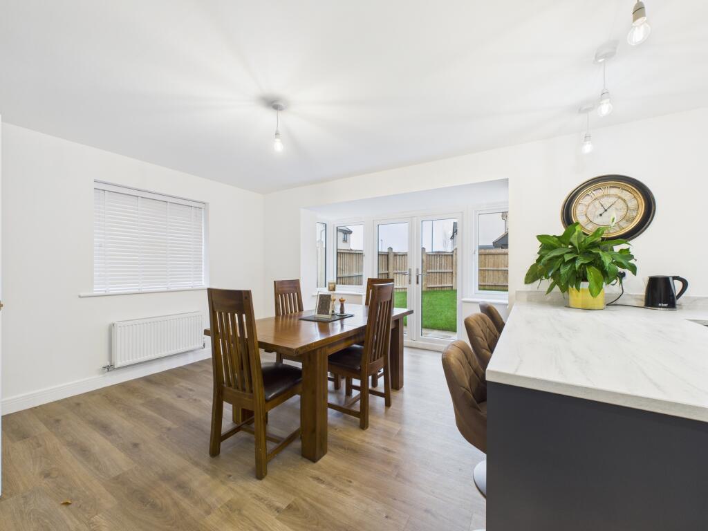
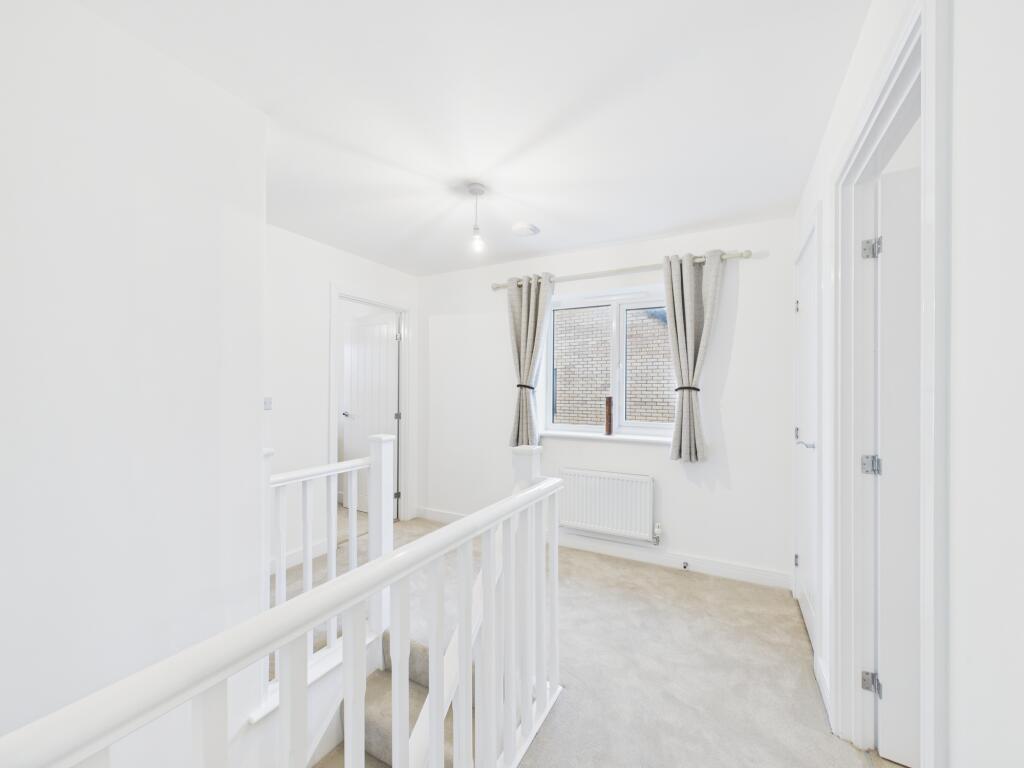
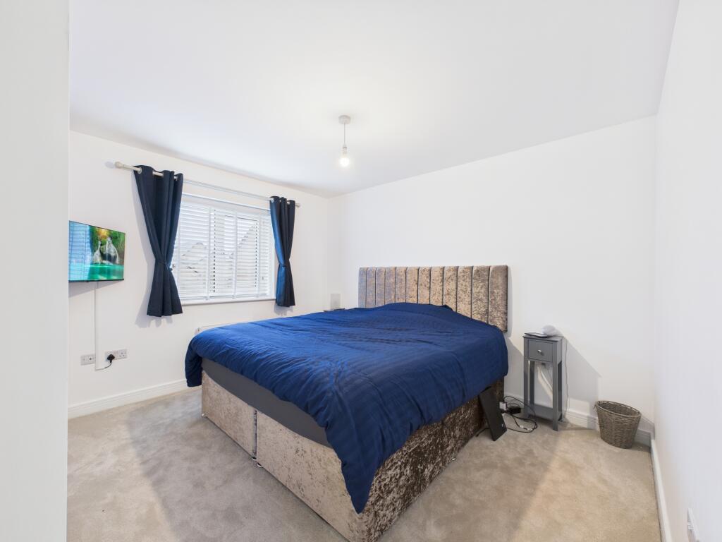
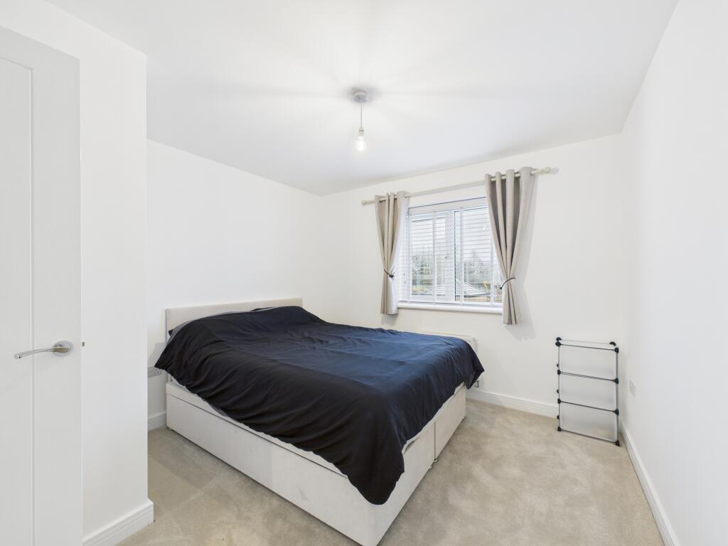
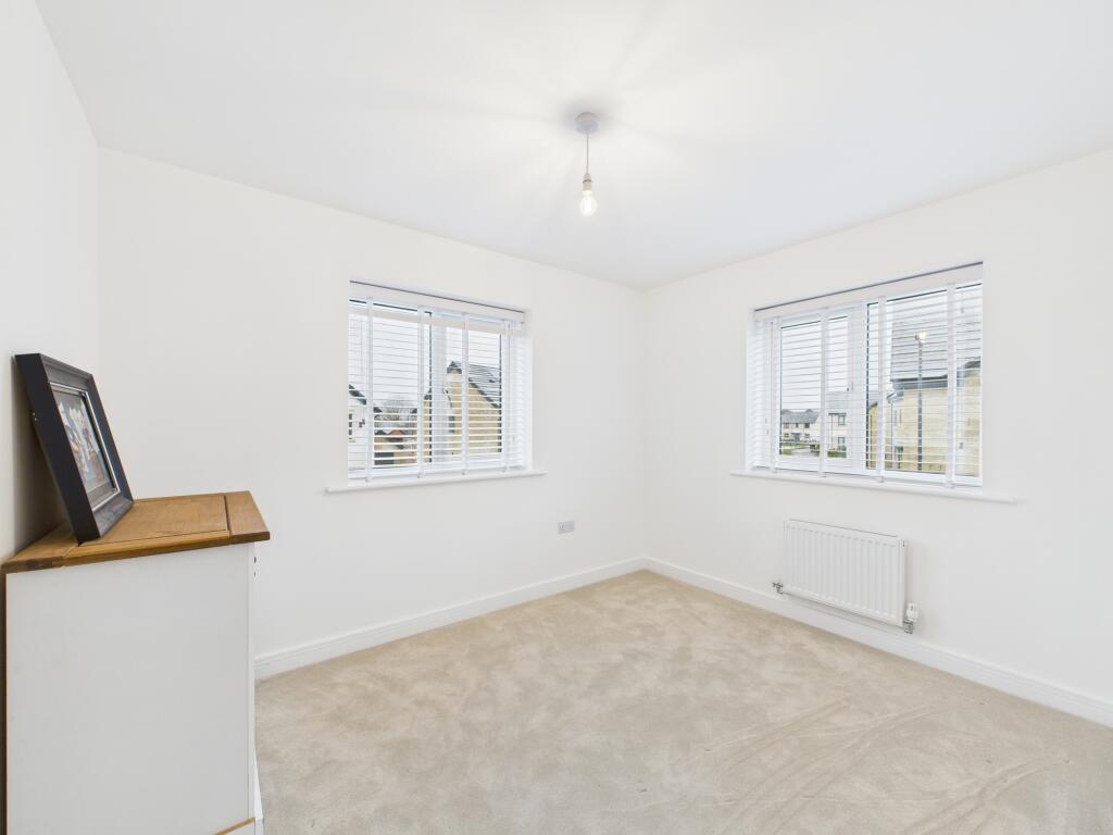
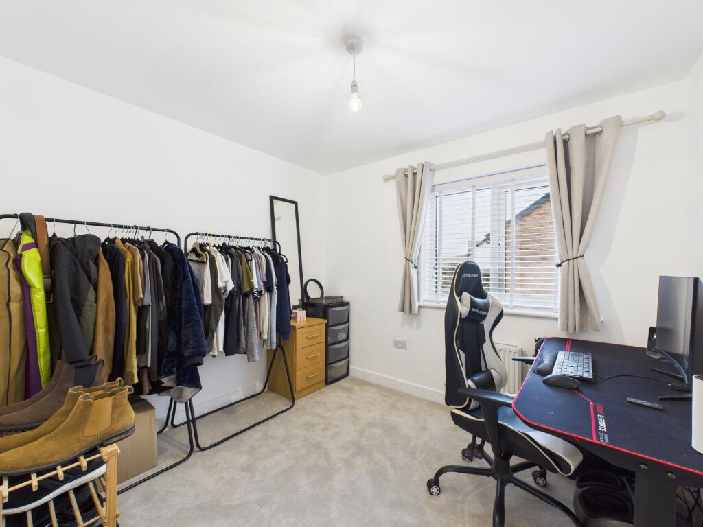
The accommodation on offer briefly comprises: Entrance hall; spacious dual-aspect lounge; large dining kitchen with an elegant, upgraded fitted peninsula kitchen with quartz worktops and a range of integrated appliances, together with twin French doors opening out onto the rear garden; separate utility room; cloakroom/WC; first floor landing; four excellent bedrooms, with a great en suite shower room to the master bedroom; fully tiled fitted family bathroom.
Outside, the property boasts a private, recently turfed rear garden, with patio pathway and seating areas. To the side of the property is a driveway providing ample off road parking for multiple vehicles and access to the detached single garage.
Tillage Crescent is conveniently situated for local amenities, including shops and schools as well as excellent public transport links to Chellaston, Derby City Centre and Rolls-Royce Sinfin.
Viewings are essential to appreciate the size and standard of the accommodation on offer.
Listed by
Chellaston
Hannells Estate Agents
Reference: 170759582
EPC Rating & Upgrade Cost
Current rating: B
Potential rating: A
Inspection date: 24/09/2024
Expiry date: 23/09/2034
Current heating cost: £449/year
Potential heating cost: £452/year
Est. upgrade cost to C: £9,500
Recommendations
- Solar water heating (£4,000 - £6,000)
- Solar photovoltaic panels, 2.5 kWp (£3,500 - £5,500)
Flood risk
Zone: 1
Risk: Low
Job (default Low)
Floorplans
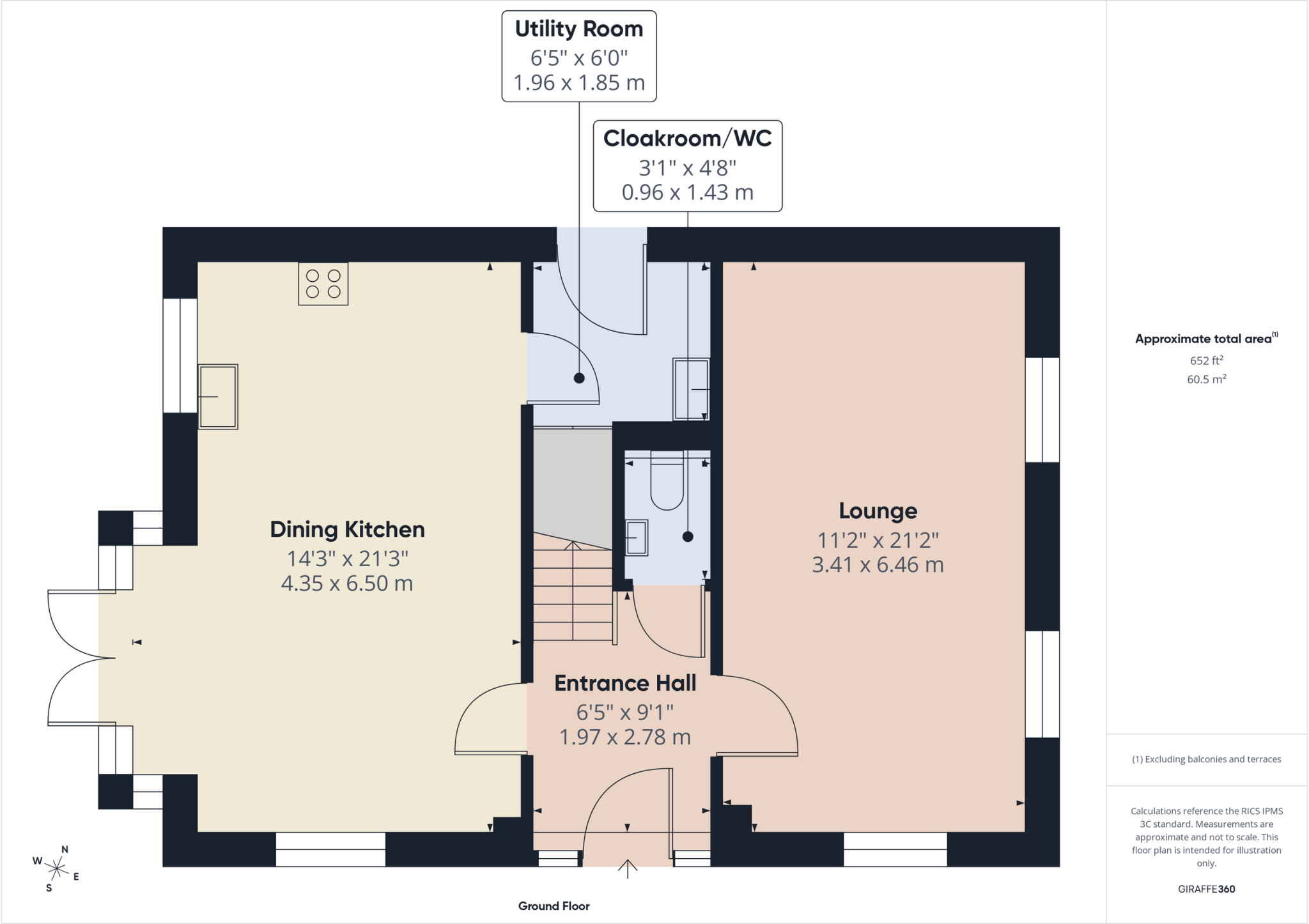
Ground Floor
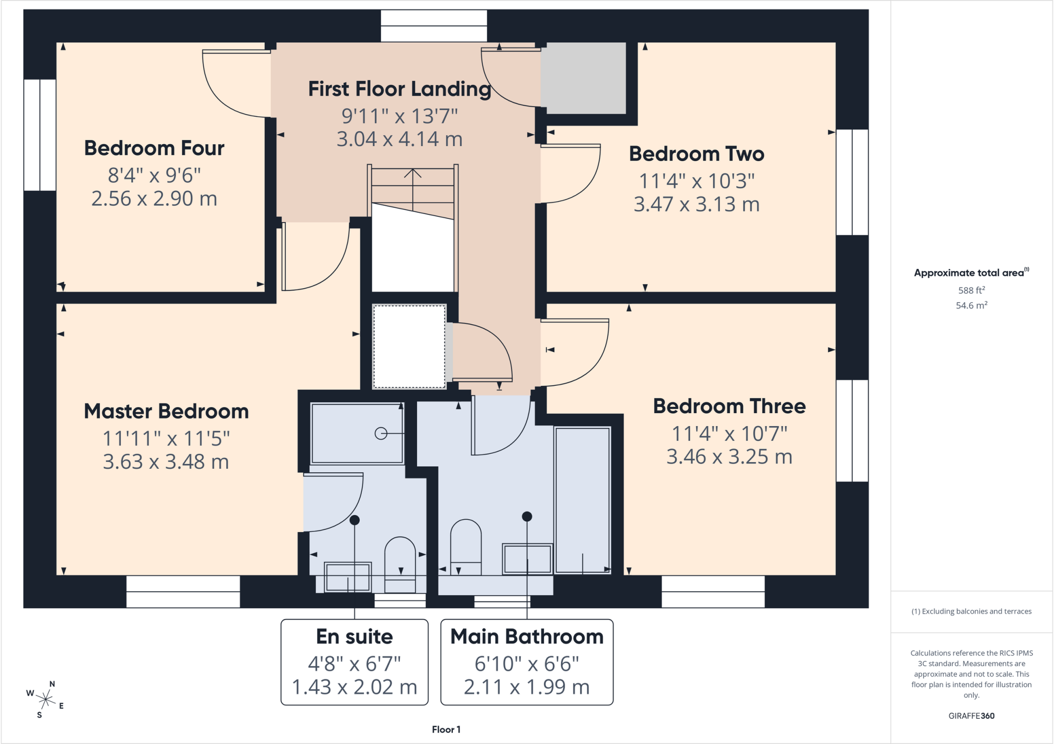
First Floor
EPC Graphs
EE
EI
Price history
| Event | Date | Price | % change |
|---|---|---|---|
| Sold | 25/10/2024 (1 year ago) | £399,950 | — |
Source: HM Land Registry Price Paid Data. Crown copyright.
Sold Comparables
Same street and nearby sales within 0.25 miles (last 5 years). Data from Land Registry Price Paid.
| Address | Price | Date | Type |
|---|---|---|---|
| Same street 41 TILLAGE CRESCENT, CHELLASTON, DERBY, CITY OF DERBY, DE73 6AS | £319,950 | 15/12/2023 | Semi-detached |
| Same street 45 TILLAGE CRESCENT, CHELLASTON, DERBY, CITY OF DERBY, DE73 6AS | £364,950 | 01/12/2023 | Detached |
| Same street 22 TILLAGE CRESCENT, CHELLASTON, DERBY, CITY OF DERBY, DE73 6AS | £289,950 | 27/10/2023 | Semi-detached |
| TWO CHIMNEYS SNELSMOOR LANE, CHELLASTON, DERBY, CITY OF DERBY, DE73 6TQ | £500,000 | 29/09/2021 | Detached |
Street average: £324,950 (3 sales)
Area average: £500,000 (1 sale)
Capital growth trend
Land Registry outcode average: last 12 months vs 5y and 10y ago (from sold prices).
House Price Index (HM Land Registry — official index, not sold-price averages): East Midlands. Series: Detached. As of March 2026.
Rental Range
Estimated market rent for East Midlands. Low = conservative, Realistic = average, Optimistic = best case.
Based on Postcode area DE → East Midlands.
LHA (30th percentile) floor for Derby: £932/mo (Apr 2025 – Mar 2026)
Location
Nearby
Nearest stations, universities and amenities (distance from property).
| Type | Name | Distance |
|---|---|---|
| Bus stop | Snelsmoor Village | 0.2 miles |
| Bus stop | Chase Close | 0.4 miles |
| Shop | Bembridge Convenience Store | 0.7 miles |
| Shop | The Co-operative Food | 0.7 miles |
| Train station | Spondon | 2.5 miles |
| Hospital | Cygnet Hospital Derby | 2.5 miles |
| Train station | Peartree | 2.6 miles |
| Hospital | Florence Nightingale Community Hospital | 3.2 miles |
| University | Derby Law School | 4.2 miles |
| University | Agard Court | 4.2 miles |
Street-level crime
| Category | Count |
|---|---|
| Violence and sexual offences | 53 |
| Shoplifting | 24 |
| Anti-social behaviour | 15 |
| Vehicle crime | 13 |
| Public order | 8 |
| Other theft | 5 |
| Drugs | 2 |
| Possession of weapons | 2 |
| Bicycle theft | 1 |
| Burglary | 1 |
| Criminal damage and arson | 1 |
| Other crime | 1 |
| Robbery | 1 |
| Total incidents | 127 |
Within 1 mile during Apr 2026. Source: data.police.uk (England & Wales).
Schools nearby
Nearest open schools with Ofsted ratings (England). Closed schools are not shown. Data from Get Information about Schools and Ofsted.
| Name | Type | Distance | Ofsted |
|---|---|---|---|
| Clover Leys Spencer Academy | Primary | 0.3 miles | Good — 3 Jul 2024 |
| Oak Grange Primary School | Primary | 0.5 miles | — (No rating) |
| Chellaston Infant School | Primary | 0.7 miles | Good — 12 Mar 2018 |
| Chellaston Junior School | Primary | 0.8 miles | Good — 28 Nov 2011 |
| Noel-Baker Academy | Secondary | 0.8 miles | Good — 3 Apr 2022 |
Rental Comparables
Rental listings exist nearby, but none matched the 4-bedroom count for this property.
Rent-driven metrics
Based on Area rent estimate.
- Rent ratio — Monthly rent ÷ purchase price (1% rule). 1%+ = strong, 0.8–1% = okay, <0.8% = weak for cashflow.
- Max investor price — Rent ÷ 0.8%; the price at which rent would be 0.8% of price (Stoke-style target).
- Target investor price — Rent ÷ 1%; the price at which rent would be 1% of price (strong cashflow band).
- Gross yield — Annual rent as % of purchase price (no costs).