152 ALEXANDRA ROAD
PETERBOROUGH, CITY OF PETERBOROUGH PE1 3DL
£800 pcm
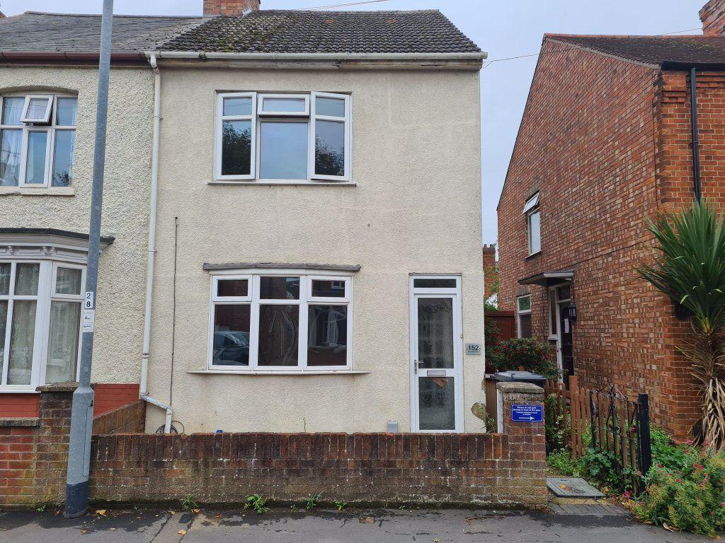
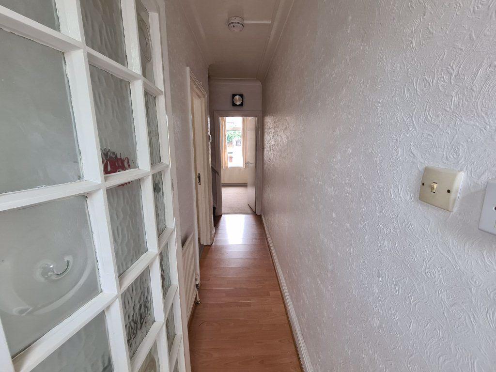
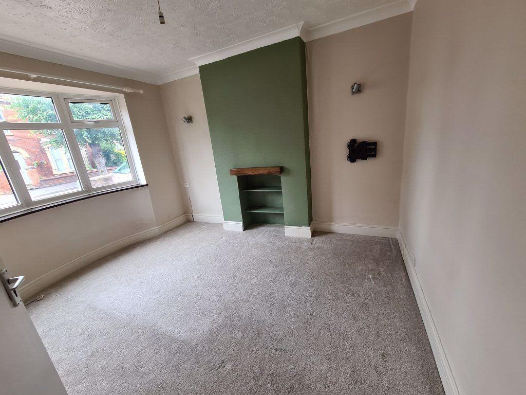
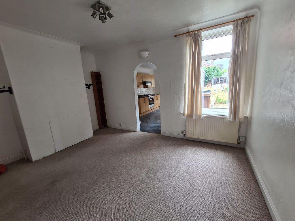
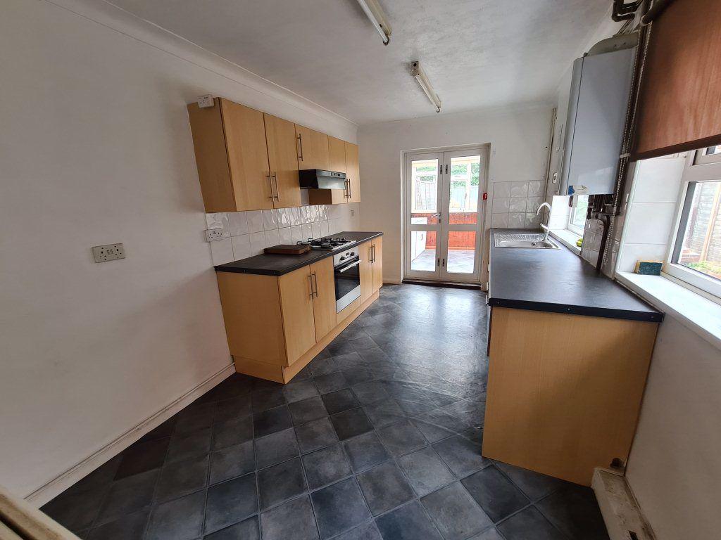
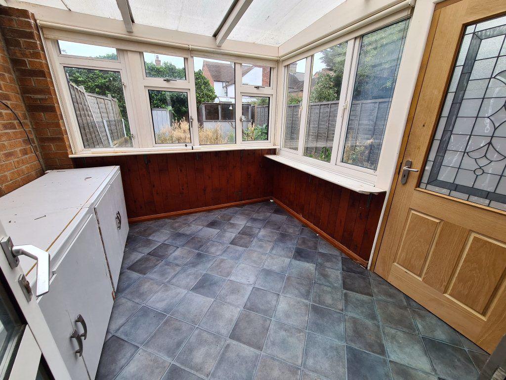
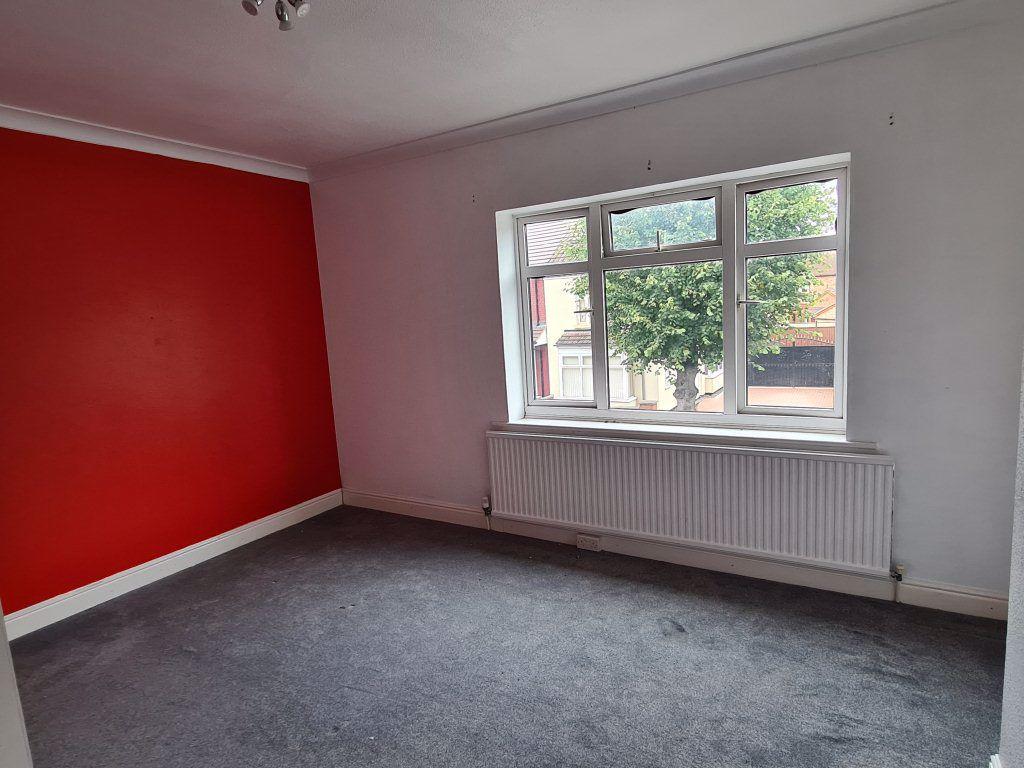
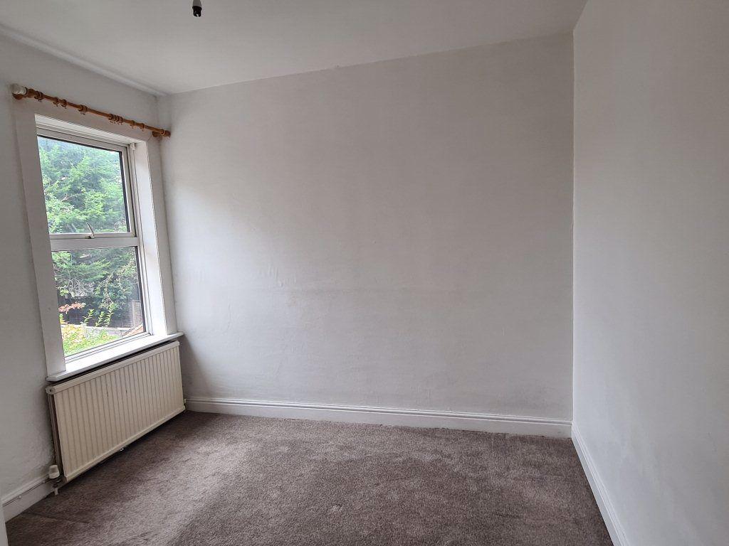
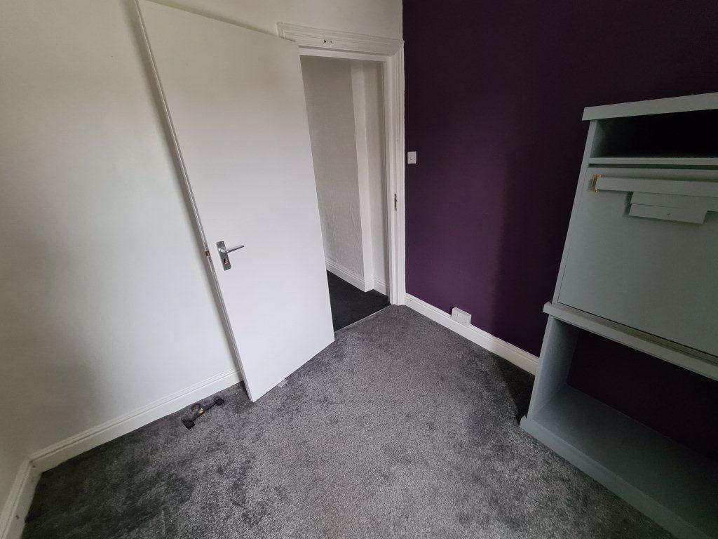
Photo 1 Photo 2 Photo 3 Photo 4 Photo 5 Photo 6 Photo 7 Photo 8 Photo 9
/ 9
Property details
Floor area
92 m²
EPC rating
D
Year built
England and Wales: 1900-1929
Deprivation
Decile 1 (1,260 of 33,755)
Street crime
566 incidents within 1 mile (Apr 2026)
Key features
- MILLFIELD
- Semi-Detached
- Unfurnished Property
- Children Welcome
- Sorry, No Smokers
- Sorry, No Pets Allowed
- Medium Sized Garden
- Street parking Available
- 3 Bedrooms
- 2 Receptions
Additional details
- Parking
- Yes
- Garden
- Yes
Description
Three bedroom semi-detached property situated in millfield. Accommodation briefly comprised entrance hall, living room, dining room, kitchen with dinning area and conservatory. To the first floor there are two double bedrooms, one single bedroom and family bathroom. Benefits include gas central heating, UPVC double glazing and rear garden.
Listed by
Peterborough
PropertyLine
Reference: 86072224
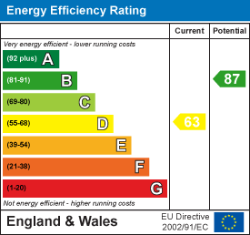
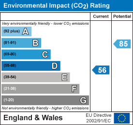
EPC Rating & Upgrade Cost
Current rating: D
Potential rating: B
Inspection date: 30/04/2025
Expiry date: 29/04/2035
Est. upgrade cost to C: £19,500
Recommendations
- 50 mm internal or external wall insulation (£4,000 - £14,000)
- Floor insulation (suspended floor) (£800 - £1,200)
- Solar water heating (£4,000 - £6,000)
- Solar photovoltaic panels, 2.5 kWp (£3,500 - £5,500)
Flood risk
Zone: 1
Risk: Low
Job (default Low)
EPC Graphs
EPC 1
EPC 2
Rental Range
Estimated market rent for Peterborough. Low = conservative, Realistic = average, Optimistic = best case.
Based on Local Authority from postcode lookup → Peterborough.
LHA (30th percentile) floor for Peterborough: £808/mo (Apr 2025 – Mar 2026)
Location
Nearby
Nearest stations, universities and amenities (distance from property).
| Type | Name | Distance |
|---|---|---|
| Bus stop | Occupation Road | 0.1 miles |
| Shop | Malcolm & Sue's Print Shop | 0.1 miles |
| Shop | Biil's Off Licence and Newsagent | 0.2 miles |
| University | City College Peterborough | 1.2 miles |
| Train station | Peterborough | 1.2 miles |
| Hospital | Peterborough City Hospital | 1.3 miles |
| University | ARU Peterborough | 1.6 miles |
| Train station | Peterborough (NVR) | 1.7 miles |
| Hospital | Unknown | 2.2 miles |
Street-level crime
| Category | Count |
|---|---|
| Violence and sexual offences | 183 |
| Anti-social behaviour | 90 |
| Shoplifting | 57 |
| Criminal damage and arson | 46 |
| Drugs | 39 |
| Public order | 29 |
| Other theft | 28 |
| Vehicle crime | 28 |
| Burglary | 25 |
| Other crime | 19 |
| Possession of weapons | 9 |
| Robbery | 8 |
| Theft from the person | 3 |
| Bicycle theft | 2 |
| Total incidents | 566 |
Within 1 mile during Apr 2026. Source: data.police.uk (England & Wales).
Schools nearby
Nearest open schools with Ofsted ratings (England). Closed schools are not shown. Data from Get Information about Schools and Ofsted.
| Name | Type | Distance | Ofsted |
|---|---|---|---|
| Fulbridge Academy | Primary | 0.3 miles | Outstanding — 6 May 2024 |
| All Saints' CofE (Aided) Primary School | Primary | 0.4 miles | Good — 10 Sep 2014 |
| Gladstone Primary Academy | Primary | 0.5 miles | Good — 5 Dec 2023 |
| Queen's Drive Infant School | Primary | 0.6 miles | Requires improvement — 28 Mar 2023 |
| Thomas Deacon Academy | Other | 0.7 miles | — (Inspected (no overall grade)) |
Rental Comparables
Residential lets from OpenRent and Rightmove for the area (same bedroom count). Use to validate rent estimates. Student lets are excluded.
| Title | Rent | Beds | Distance | As seen on |
|---|---|---|---|---|
| 3 Bed Semi-Detached House, Clarence Road, PE1 | £900/mo | 3 | 0.58 miles | OpenRent |
| 3 Bed Flat, Cobden Avenue, PE1 | £1,100/mo | 3 | 0.81 miles | OpenRent |
| 3 Bed Detached House, Mayors Walk, PE3 | £1,300/mo | 3 | 0.97 miles | OpenRent |
Average rent: £1,100/mo (3 listings)