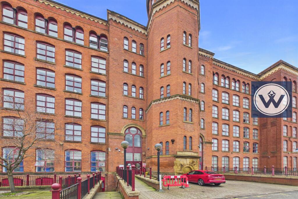
FLAT 207
VICTORIA MILL, 8, LOWER VICKERS STREET, MANCHESTER, GREATER MANCHESTER M40 7NA

Property details
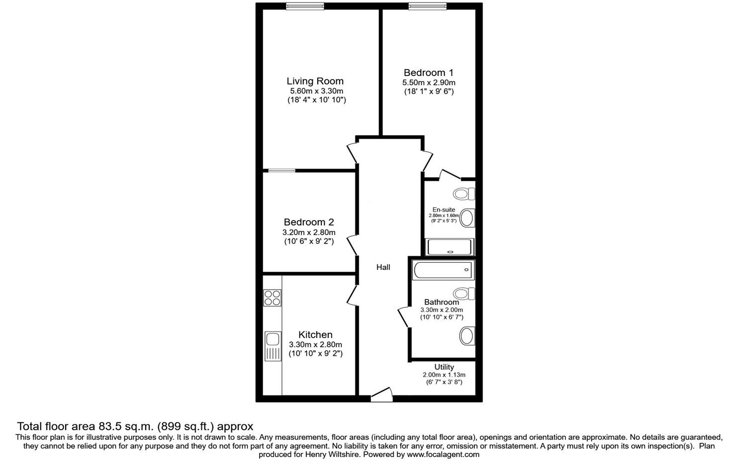
Floor area
75 m²
EPC rating
D
Deprivation
Decile 1 (2,128 of 33,755)
Street crime
2 incidents within 1 mile (Mar 2026)
Key features
- Now
- Second Floor
- Parking
- Unfurnished
Additional details
- Parking
- Yes
Description
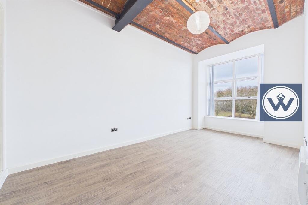
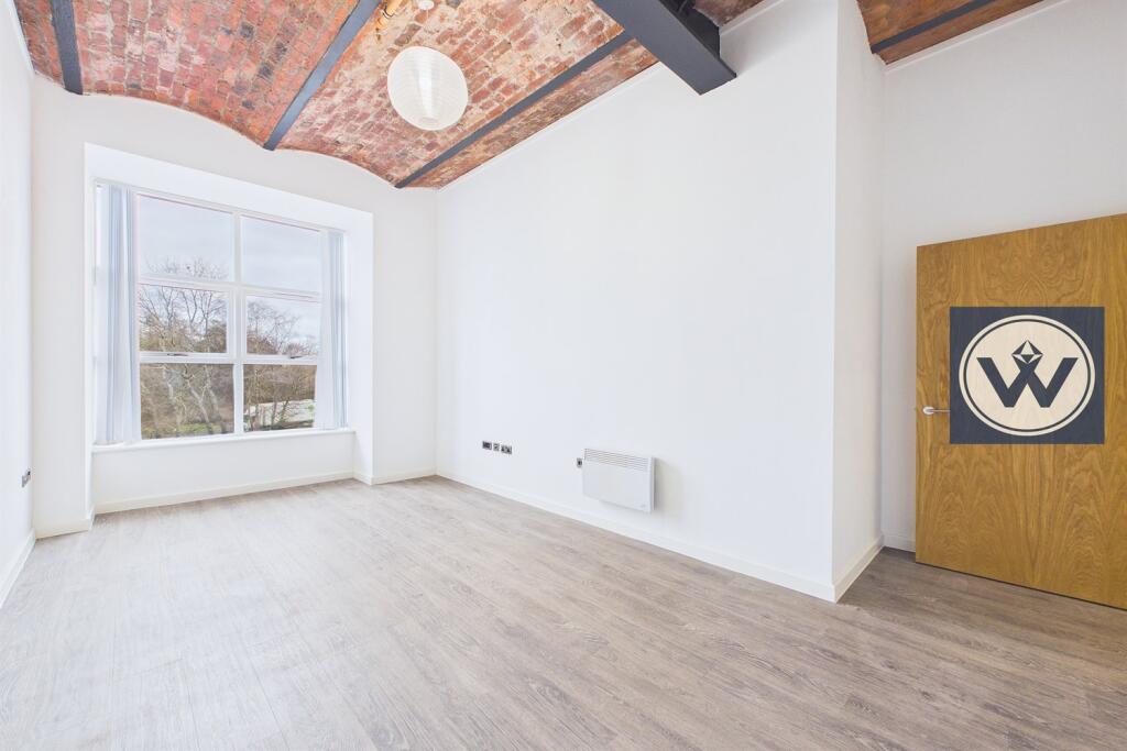
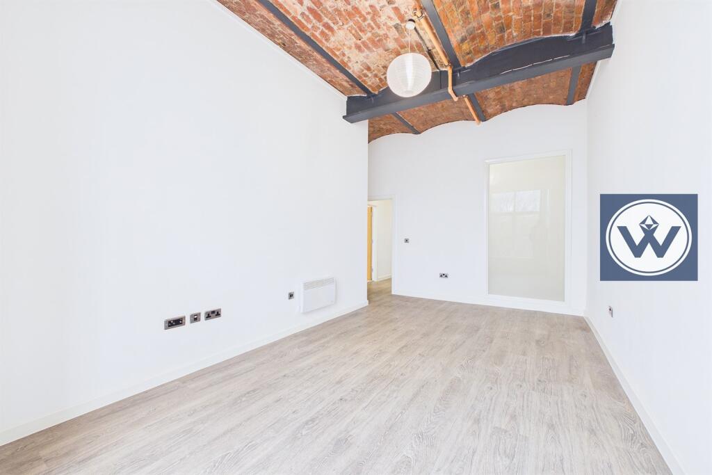
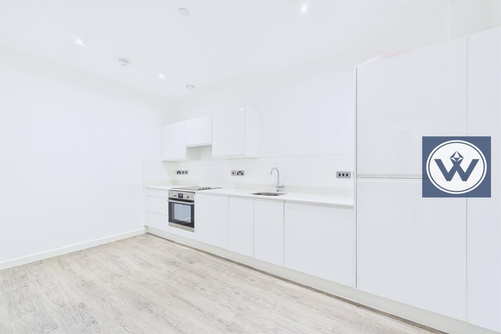
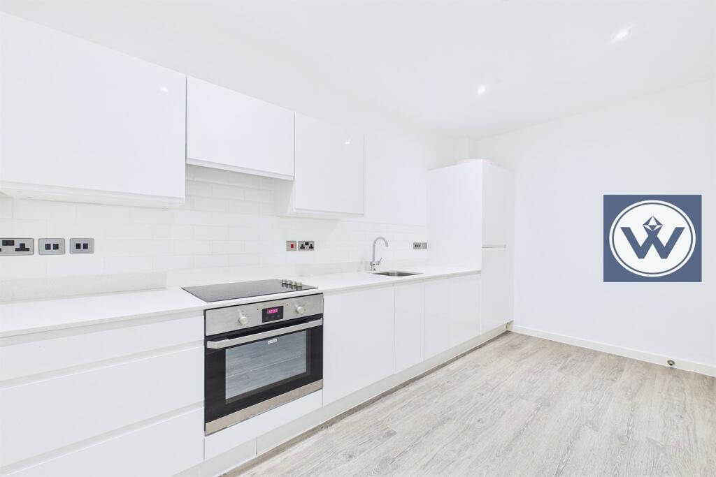
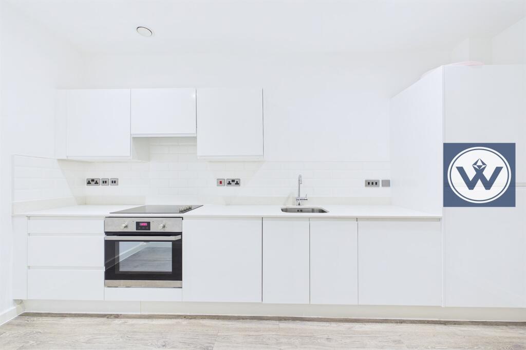
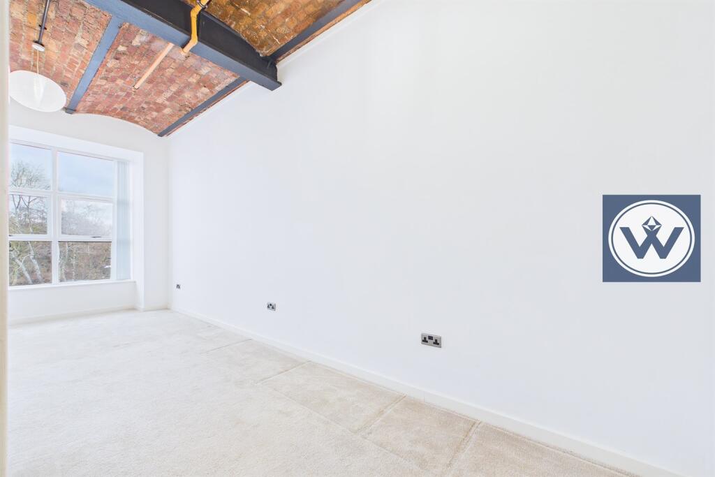
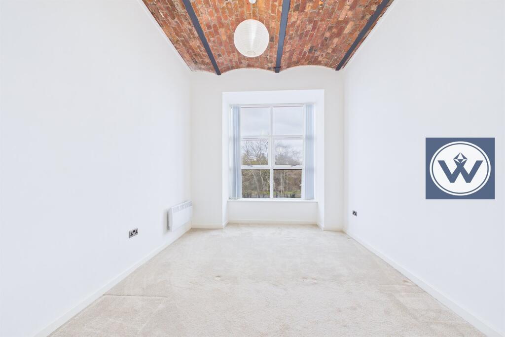
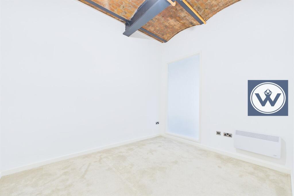
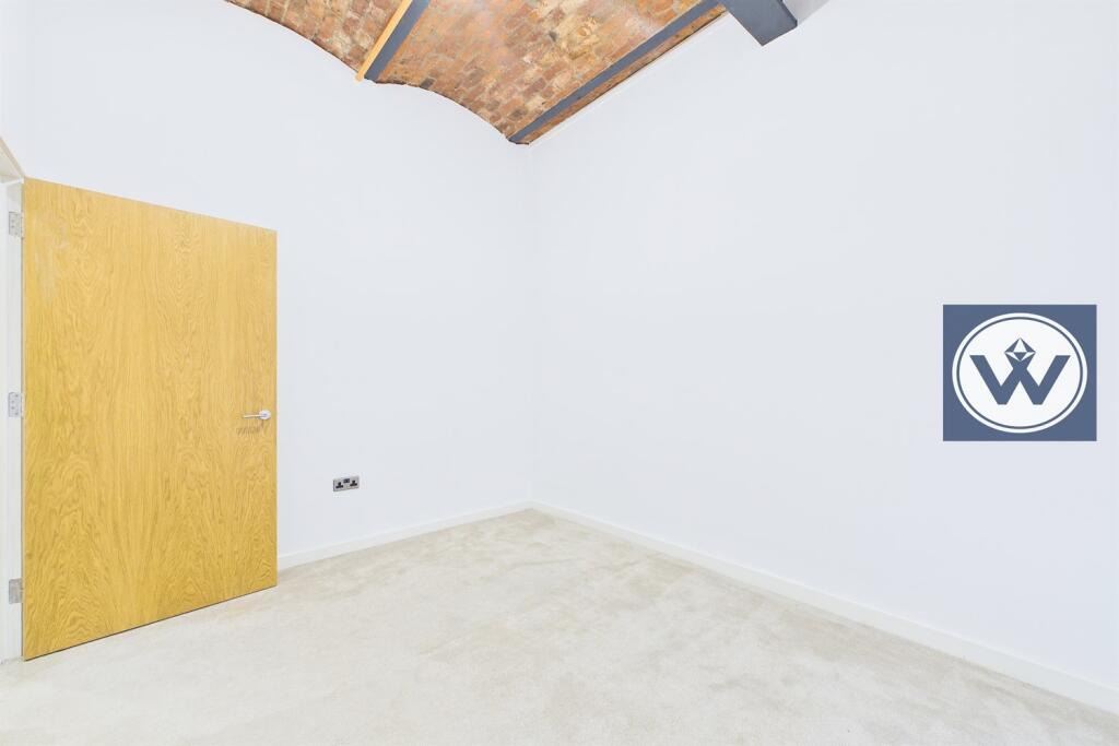
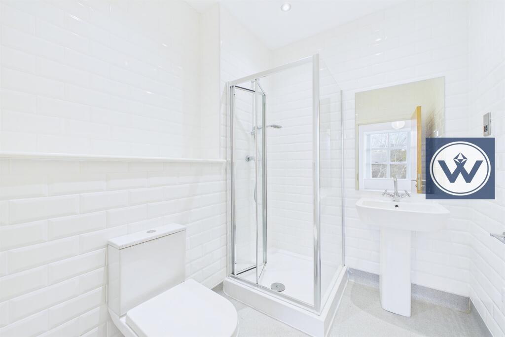
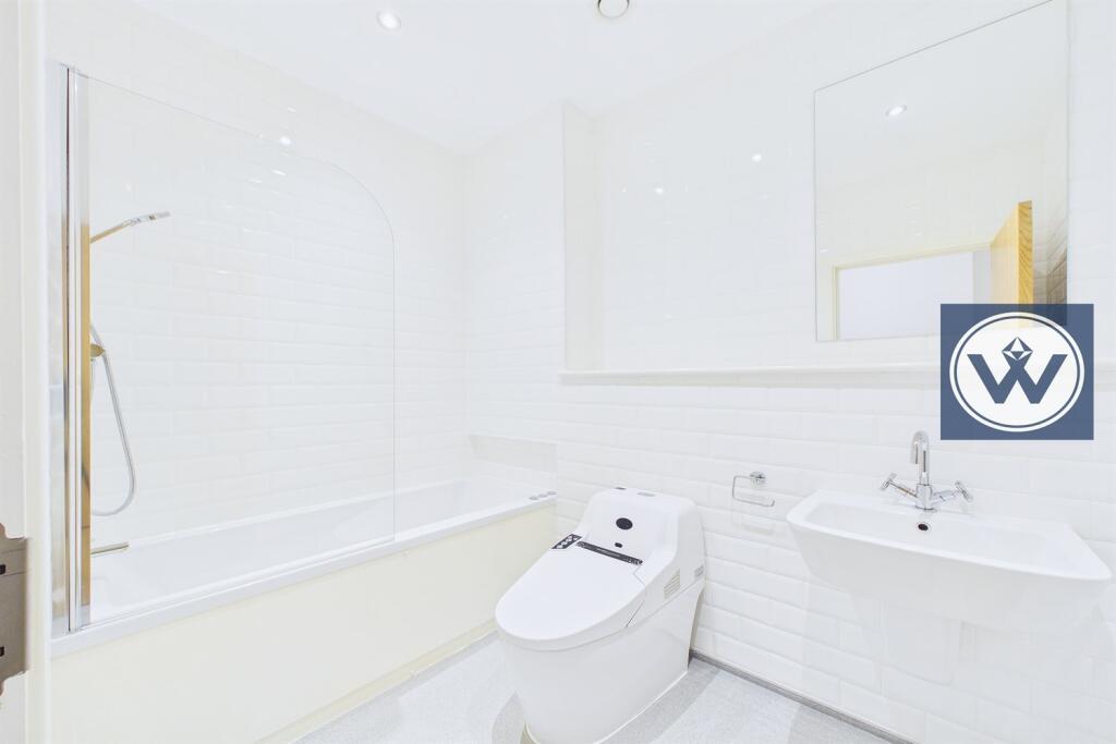
This SECOND floor apartment in brief comprises of : Secure communal entrance with lifts to all floors, private entrance hallway, spacious living room which has brick vaulted ceiling, separate kitchen complete with with integrated appliances, two double bedrooms with the main being en suite plus further bathroom.
Available NOW
Minimum household income £39,000
Reception 1
Kitchen
Bedroom 1
Bedroom 2
Bathroom 1
Bathroom 2
Parking
External
Listed by
Manchester
Henry Wiltshire Ltd
Reference: 170770208
EPC Rating & Upgrade Cost
Current rating: D
Potential rating: D
Inspection date: 27/01/2022
Current heating cost: £761/year
Potential heating cost: £761/year
Flood risk
Zone: 1
Risk: Low
Job (default Low)
Floorplans
Other
Rental Range
Estimated market rent for Manchester. Low = conservative, Realistic = average, Optimistic = best case.
Based on Local Authority from postcode lookup → Manchester.
LHA (30th percentile) floor for West Pennine: £449/mo (Apr 2025 – Mar 2026)
Location
Address
James Street
Nearby
Nearest stations, universities and amenities (distance from property).
| Type | Name | Distance |
|---|---|---|
| Bus stop | Holt Town, Bradford Road / outside Bradford Inn | 0.2 miles |
| Bus stop | Holt Town, Bradford Road / near Varley Street | 0.2 miles |
| Shop | Best-one | 0.3 miles |
| Shop | Miles Platting Newsagent | 0.3 miles |
| Train station | Manchester Piccadilly | 1.1 miles |
| Train station | Manchester Victoria | 1.2 miles |
| University | University of Law | 1.3 miles |
| University | UCEN Manchester (City Campus) | 1.3 miles |
| Hospital | Plymouth Grove Medical Centre | 1.9 miles |
| Hospital | Manchester Royal Infirmary | 1.9 miles |
Street-level crime
| Category | Count |
|---|---|
| Other theft | 2 |
| Total incidents | 2 |
Within 1 mile during Mar 2026. Source: data.police.uk (England & Wales).
Schools nearby
Nearest open schools with Ofsted ratings (England). Closed schools are not shown. Data from Get Information about Schools and Ofsted.
| Name | Type | Distance | Ofsted |
|---|---|---|---|
| Park View Community Primary Academy | Primary | 0.1 miles | Requires improvement — 18 Jul 2024 |
| St Patrick's RC Primary School | Primary | 0.5 miles | Good — 13 Jan 2022 |
| Collyhurst Nursery School | Nursery | 0.5 miles | Outstanding — 3 Dec 2014 |
| Abbott Community Primary School | Primary | 0.5 miles | Outstanding — 12 Feb 2019 |
| St Anne's RC Primary School | Primary | 0.6 miles | Good — 10 Jul 2015 |
Rental Comparables
Residential lets from OpenRent and Rightmove for the area (same bedroom count). Use to validate rent estimates. Student lets are excluded.
| Title | Rent | Beds | Distance | As seen on |
|---|---|---|---|---|
| 2 Bed Flat, Malta St, M4 | £1,250/mo | 2 | 0.68 miles | OpenRent |
| 2 Bed Flat, The Waterfront, M11 | £1,100/mo | 2 | 0.75 miles | OpenRent |
Average rent: £1,175/mo (2 listings)