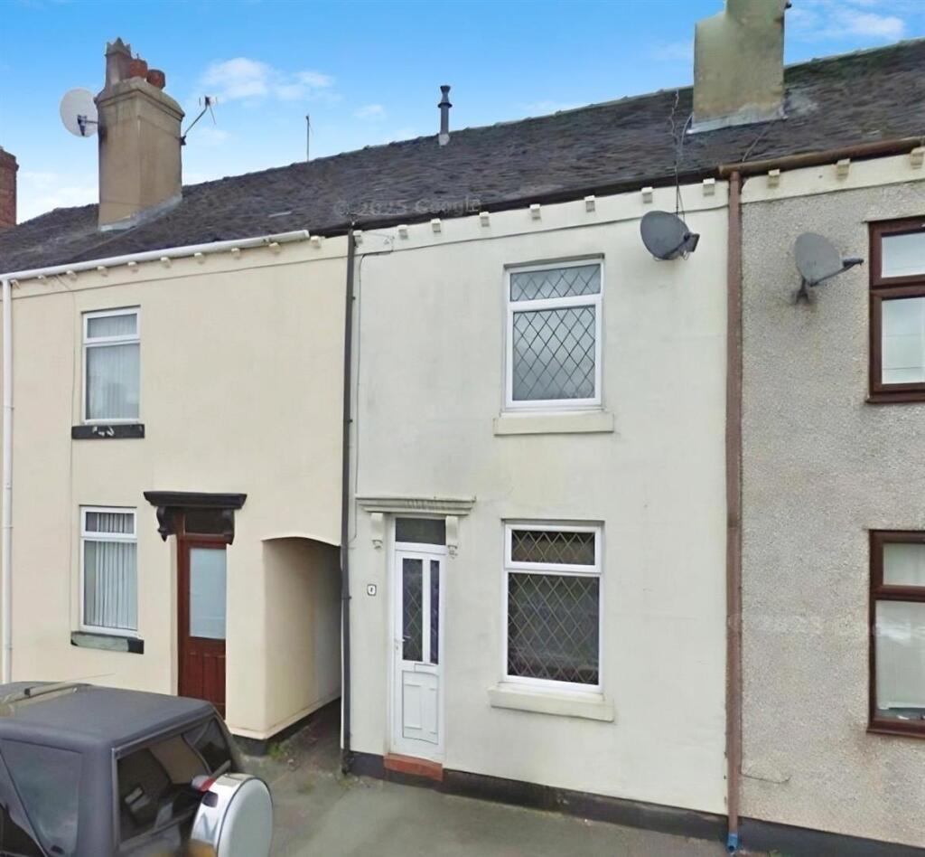
10 CHAPEL STREET
STOKE-ON-TRENT, BIGNALL END, STAFFORDSHIRE ST7 8QD
£775 pcm


d94385ed-1.jpg user_edited_photo-e7e8161a_user-edited-726b6813-04 19021e61-6.jpg e9598621-2.jpg 67ff4557-5.jpg 8cb86520-8.jpg 1bb8906a-7.jpg 7864770d-3.jpg e5f45c62-9.jpg user_edited_photo-877e17ab_user-edited-dbe38de2-78 user_edited_photo-01c5060c_user-edited-e46cbfa7-a2 Reposit Photo 1.png reposit description 2.jpg
/ 13
Property details
Floor area
63 m²
Council tax band
A
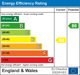
EPC rating
C
Year built
England and Wales: 1900-1929
Deprivation
Decile 5 (16,328 of 33,755)
Street crime
30 incidents within 1 mile (Mar 2026)
Key features
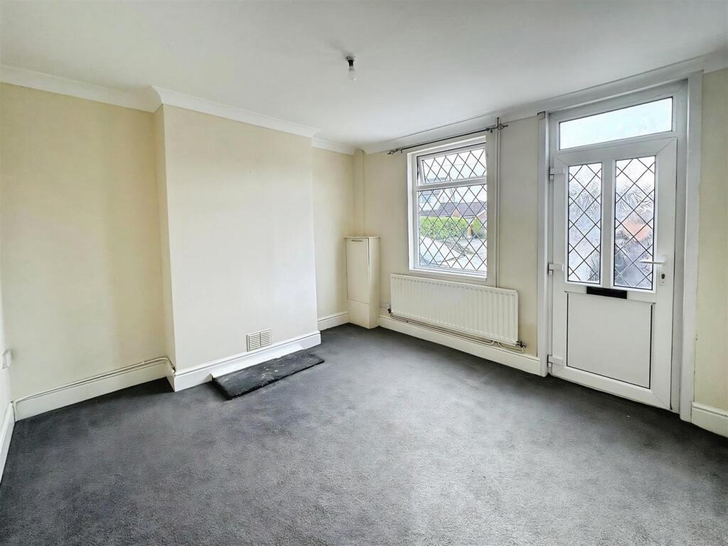
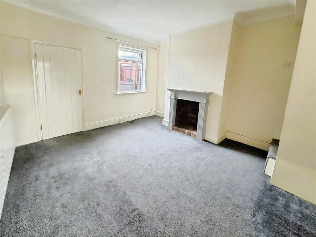
- Two bed mid terraced house
- First floor spacious bathroom
- Modern stylish kitchen
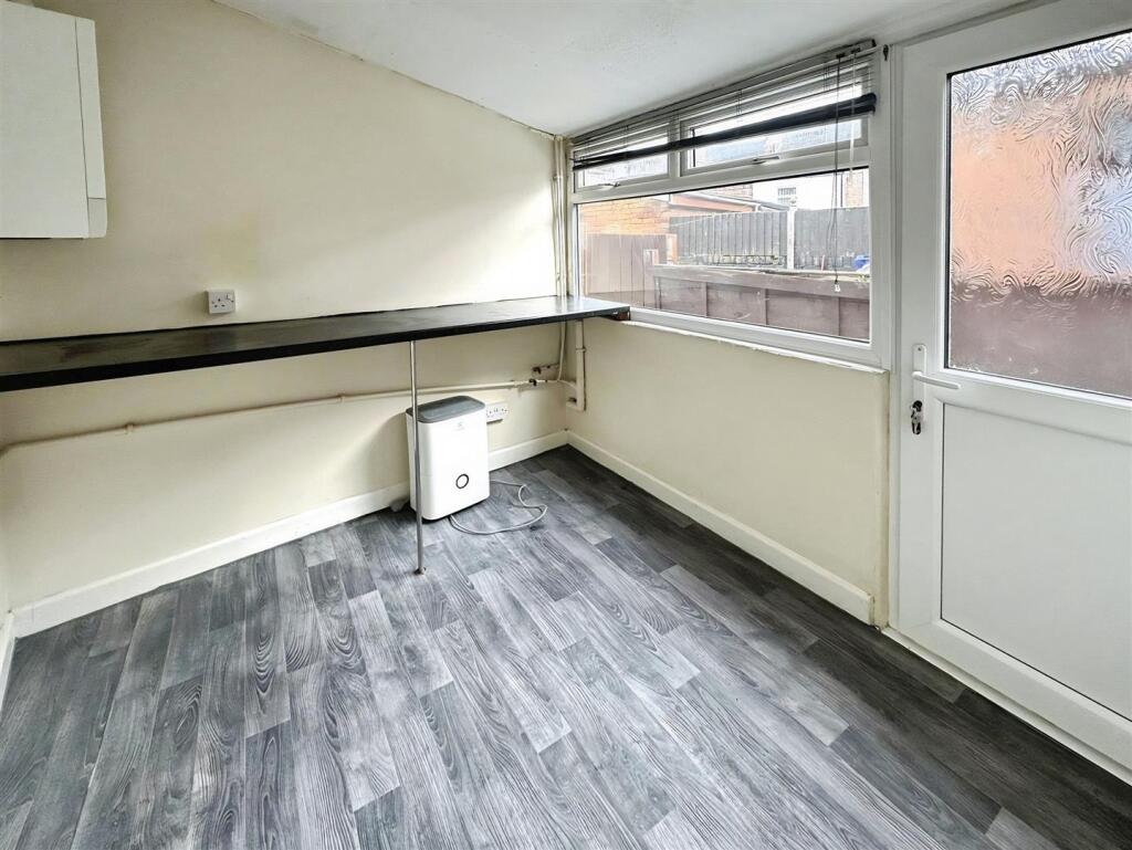
- Large utility area
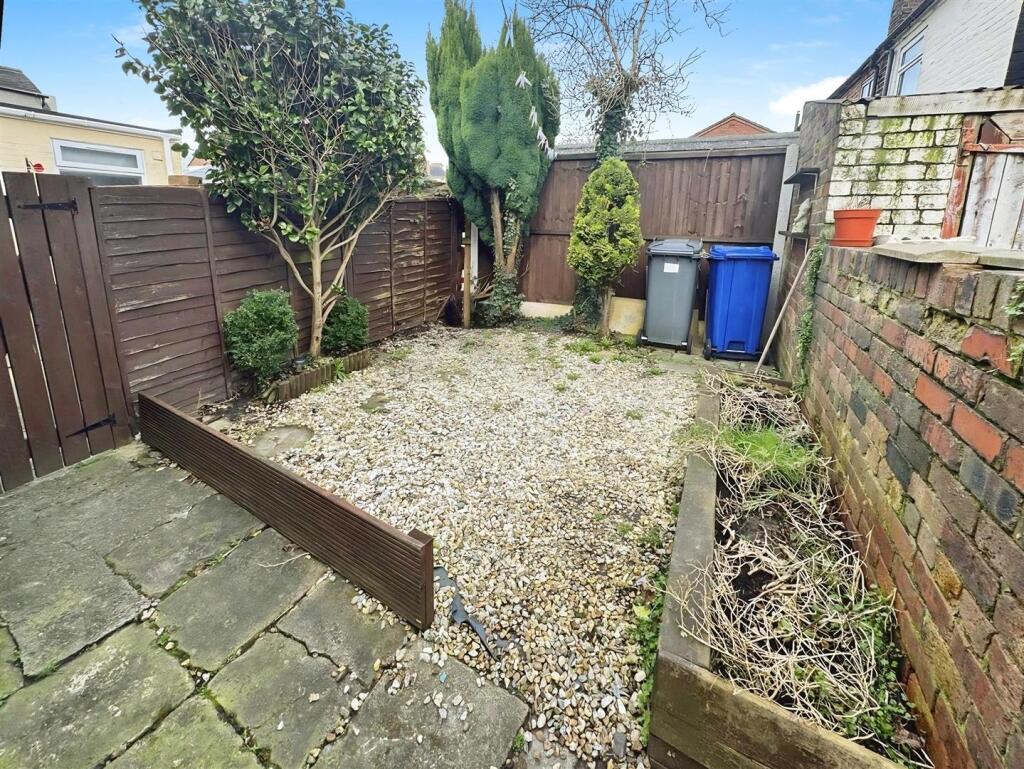
- Graveled patio to the rear
- On street parking
Additional details
- Garden
- Yes
Description
Graveled low maintenance seating area to the rear to enjoy those soon to be spring evenings. On Street parking, EPC rating C, Council Tax Band A and available mid - end March.
Listed by
Alsager
Stephenson Browne Ltd
Reference: 171875786
EPC Rating & Upgrade Cost
Current rating: C
Potential rating: C
Inspection date: 20/09/2025
Current heating cost: £761/year
Potential heating cost: £555/year
Est. upgrade cost to C: £25,750
Recommendations
- 50 mm internal or external wall insulation (£7,500 - £11,000)
- Floor insulation (solid floor) (£5,000 - £10,000)
- Solar photovoltaic panels, 2.5 kWp (£8,000 - £10,000)
Flood risk
Zone: 1
Risk: Low
Job (default Low)
EPC Graphs
EE Rating
Company ownership
Registered legal owner is a company.
Rental Range
Estimated market rent for Newcastle-under-Lyme. Low = conservative, Realistic = average, Optimistic = best case.
Based on Local Authority from postcode lookup → Newcastle-under-Lyme.
LHA (30th percentile) floor for South Cheshire: £573/mo (Apr 2025 – Mar 2026)
Location
Nearby
Nearest stations, universities and amenities (distance from property).
| Type | Name | Distance |
|---|---|---|
| Bus stop | Diglake Street | 0.0 miles |
| Bus stop | Chapel Street | 0.0 miles |
| Shop | Unknown | 0.2 miles |
| Shop | Tesco Express | 0.5 miles |
| Train station | Apedale Road | 1.7 miles |
| Train station | Silverdale | 1.9 miles |
| Hospital | Bradwell Hospital | 2.5 miles |
| University | Keele University | 3.9 miles |
| Hospital | Haywood Hospital | 4.2 miles |
| University | University of Staffordshire Stoke Campus | 5.6 miles |
Street-level crime
| Category | Count |
|---|---|
| Violence and sexual offences | 16 |
| Anti-social behaviour | 5 |
| Criminal damage and arson | 3 |
| Shoplifting | 2 |
| Drugs | 1 |
| Other crime | 1 |
| Other theft | 1 |
| Vehicle crime | 1 |
| Total incidents | 30 |
Within 1 mile during Mar 2026. Source: data.police.uk (England & Wales).
Schools nearby
Nearest open schools with Ofsted ratings (England). Closed schools are not shown. Data from Get Information about Schools and Ofsted.
| Name | Type | Distance | Ofsted |
|---|---|---|---|
| Ravensmead Primary School | Primary | 0.2 miles | Good — 13 Jun 2024 |
| Castle Hill School | Other | 0.4 miles | Requires improvement — 18 Apr 2024 |
| Wood Lane Primary School | Primary | 0.8 miles | Requires improvement — 21 May 2023 |
| Sir Thomas Boughey Academy | Secondary | 1.3 miles | Good — 22 Mar 2022 |
| St Chad's CofE (C) Primary School | Primary | 1.5 miles | Good — 10 Apr 2014 |
Rental Comparables
Residential lets from OpenRent and Rightmove for the area (same bedroom count). Use to validate rent estimates. Student lets are excluded.
| Title | Rent | Beds | Distance | As seen on |
|---|---|---|---|---|
| St Martins Road, STOKE-ON-TRENT | £1,100/mo | 2 | 1.76 miles | Rightmove |
Average rent: £1,100/mo (1 listing)