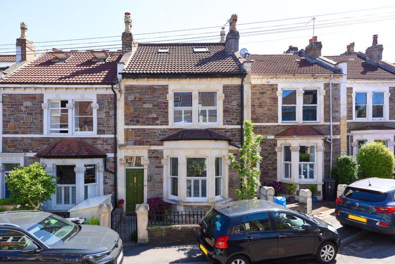
52 WOLSELEY ROAD
BRISTOL, CITY OF BRISTOL BS7 8EN

Property details
Tenure
LEASEHOLD (146 years remaining on lease)
Floor area
98 m²
Council tax band
D
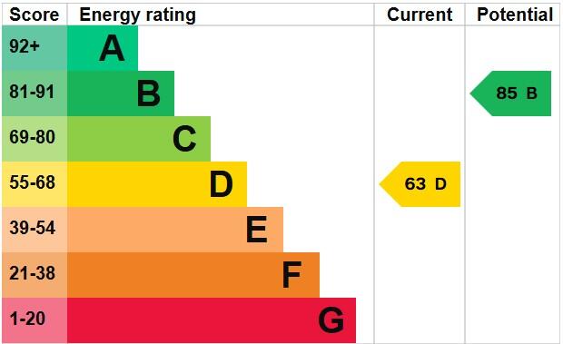
EPC rating
D
Year built
England and Wales: before 1900
Last sold
£675,000 Oct 2025
Price per m²
£6,888/m²
Local average
£496,325 (+36%)
Deprivation
Decile 9 (29,844 of 33,755)
Street crime
793 incidents within 1 mile (Apr 2026)
Key features
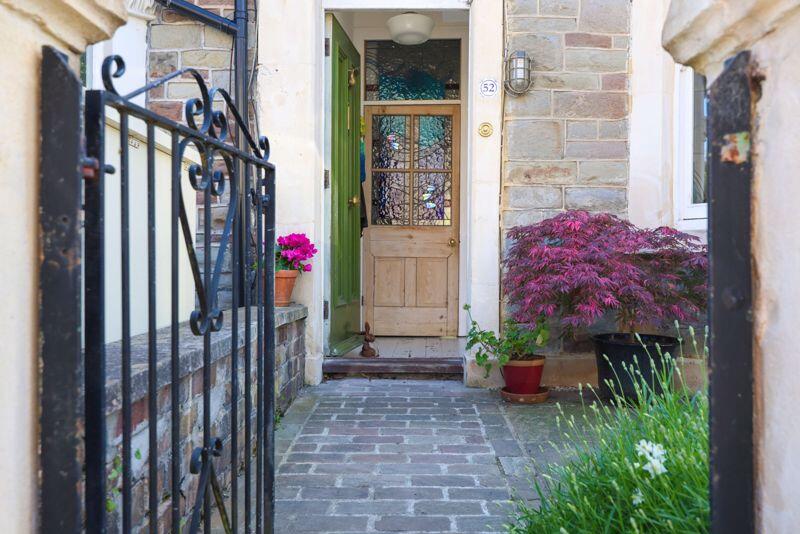
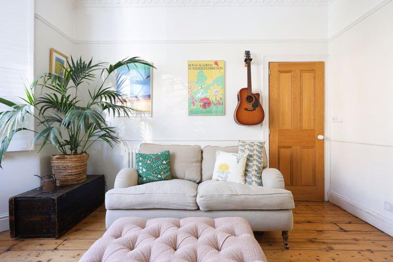
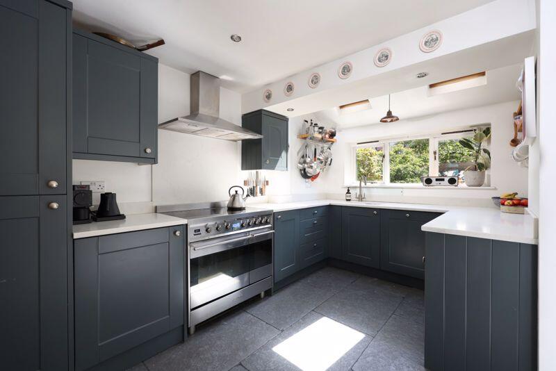
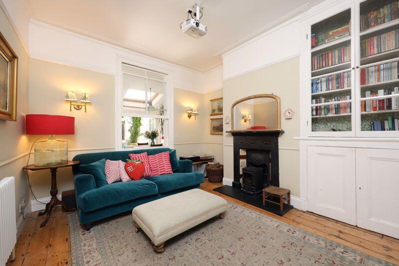
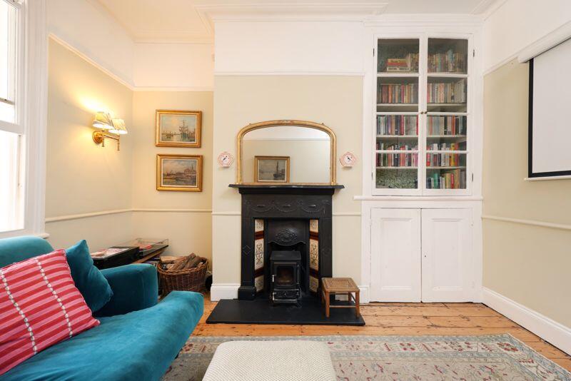
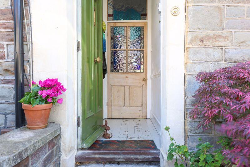
- An attractive well- arranged and beautifully presented Victorian family home
- Within a short level stroll of Gloucester Road
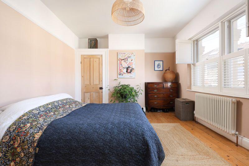
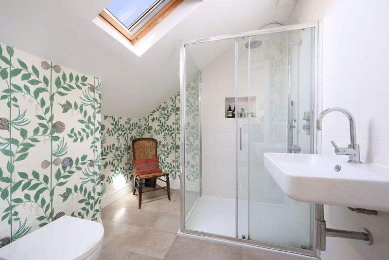
- 3 double bedrooms (1 with en-suite)
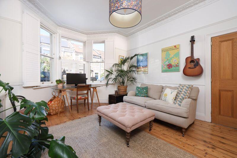
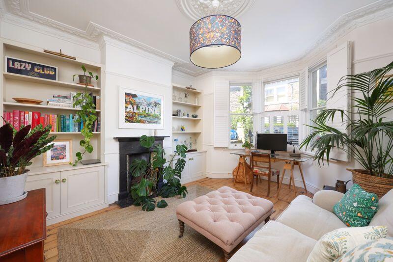
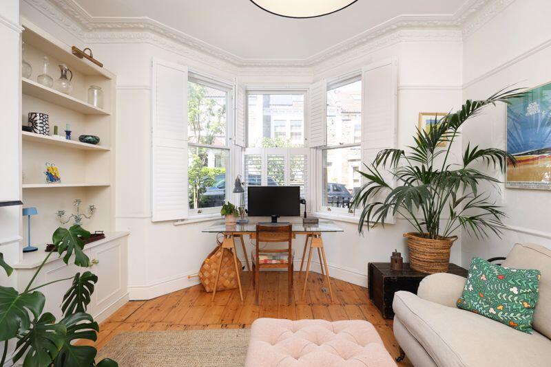
- 2 reception rooms
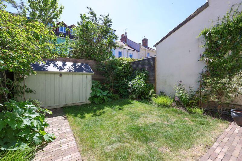
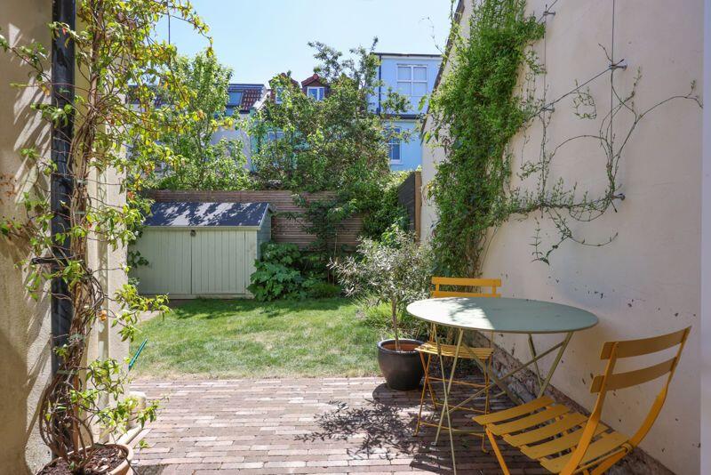
- Front garden and south facing rear garden
Additional details
- Garden
- Yes
Description
Situated towards the top of a popular side road within a short level stroll of the superb shops, restaurants, cafes and amenities of Gloucester Road. St Andrews Park, bus connections to central areas and excellent schools including the highly regarded Redland Green School (602 metres).
Gorgeous, landscaped front and rear gardens, with the rear garden attracting most of the day's sunshine with level lawned sections, flower borders, a secure bicycle shed and sun terrace.
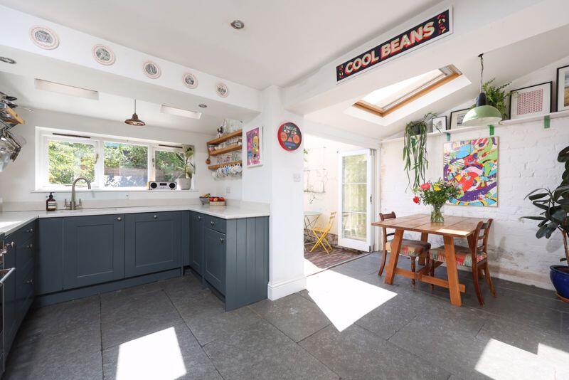
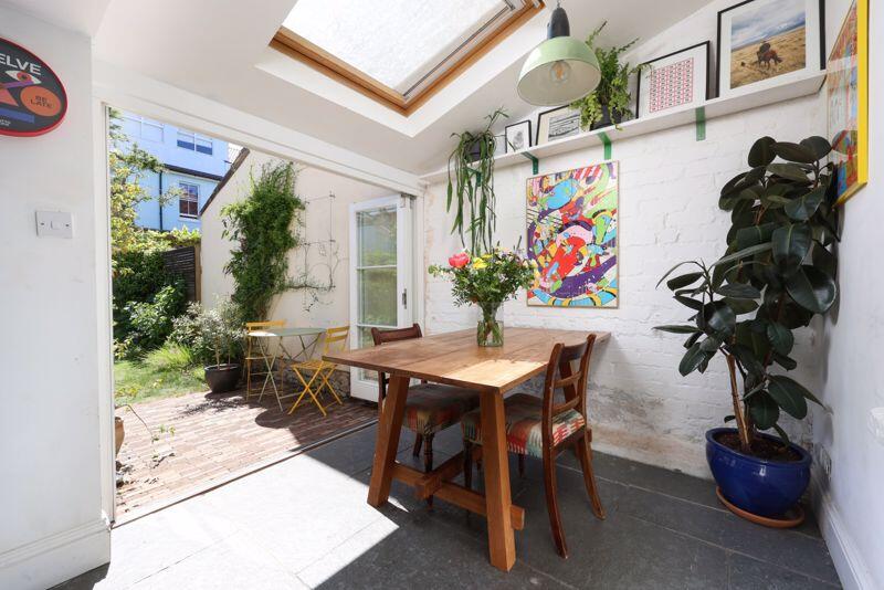
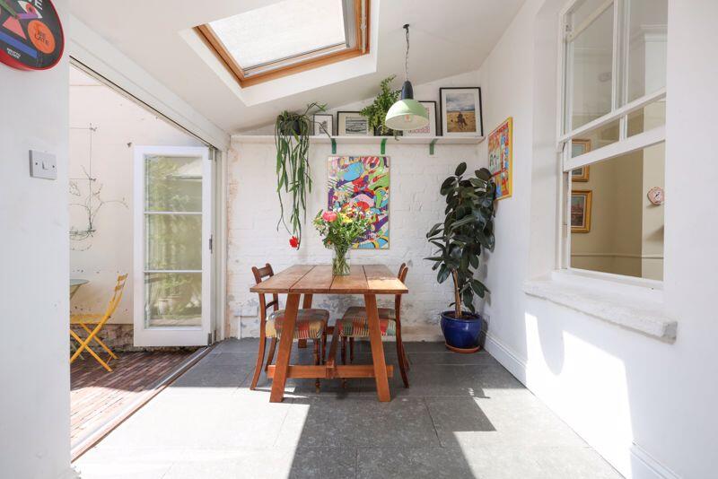
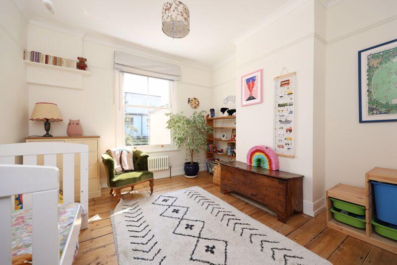
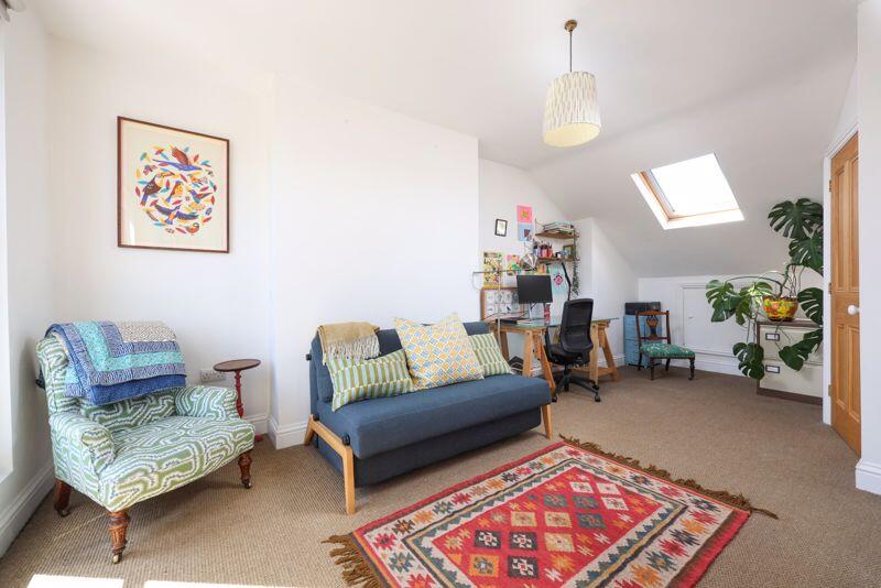
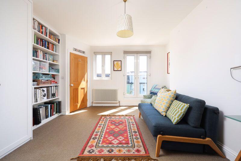
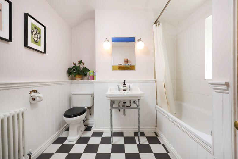
Well configured accommodation with 2 separate reception rooms and an extended kitchen/dining room with bi-folding doors.To the first floor there are 2 bedrooms and a good sized family bathroom, and a superb loft conversion to the second floor with Juliette balcony and en-suite.
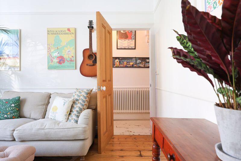
A charming period property with many original features, balanced with a fresh and modern interior.
Listed by
Bristol
Richard Harding Estate Agents Ltd
Reference: 162371243
EPC Rating & Upgrade Cost
Current rating: D
Potential rating: B
Inspection date: 29/10/2015
Current heating cost: £718/year
Potential heating cost: £460/year
Est. upgrade cost to C: £25,540
Recommendations
- 50 mm internal or external wall insulation (£4,000 - £14,000)
- Draughtproof single-glazed windows (£80 - £120)
- Low energy lighting for all fixed outlets (£40)
- Solar water heating (£4,000 - £6,000)
- Replace single glazed windows with low-E double glazing (£3,300 - £6,500)
- Solar photovoltaic panels, 2.5 kWp (£5,000 - £8,000)
Flood risk
Zone: 1
Risk: Low
Job (default Low)
Floorplans
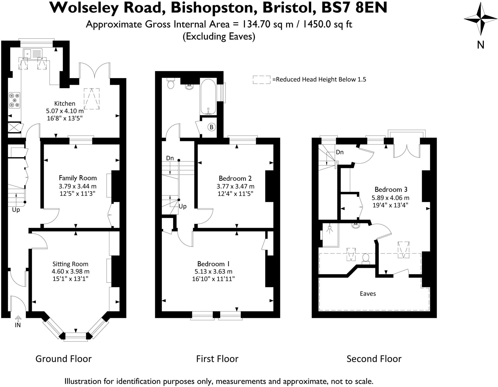
Floorplan 1
EPC Graphs
Energy Performance Graph
Price history
40% since 2016
| Event | Date | Price | % change |
|---|---|---|---|
| Sold | 28/10/2025 (7 months ago) | £675,000 | +10.9% |
| Sold | 17/12/2019 (6 years ago) | £608,500 | +26.2% |
| Sold | 26/04/2016 (10 years ago) | £482,000 | — |
Source: HM Land Registry Price Paid Data. Crown copyright.
Sold Comparables
Same street and nearby sales within 0.25 miles (last 5 years). Data from Land Registry Price Paid.
| Address | Price | Date | Type |
|---|---|---|---|
| 46 CODRINGTON ROAD, BRISTOL, CITY OF BRISTOL, BS7 8ET | £852,000 | 11/12/2025 | Terraced |
| 42 WOLSELEY ROAD, BRISTOL, CITY OF BRISTOL, BS7 8EN | £536,000 | 21/12/2023 | Terraced |
| 169 NORTH ROAD, ST ANDREWS, BRISTOL, CITY OF BRISTOL, BS6 5AH | £518,000 | 09/11/2023 | Terraced |
| 7 SHADWELL ROAD, BRISTOL, CITY OF BRISTOL, BS7 8EW | £475,000 | 27/04/2023 | Terraced |
| 17 SHADWELL ROAD, BRISTOL, CITY OF BRISTOL, BS7 8EW | £598,100 | 26/04/2023 | Terraced |
| 4 CODRINGTON ROAD, BRISTOL, CITY OF BRISTOL, BS7 8ET | £925,000 | 08/12/2022 | Terraced |
| 36 RAGLAN ROAD, BRISTOL, CITY OF BRISTOL, BS7 8EG | £735,250 | 22/11/2022 | Terraced |
| 2 RAGLAN ROAD, BRISTOL, CITY OF BRISTOL, BS7 8EH | £755,000 | 21/10/2022 | Terraced |
| 40 WOLSELEY ROAD, BRISTOL, CITY OF BRISTOL, BS7 8EN | £560,000 | 28/09/2022 | Terraced |
| 14 RAGLAN ROAD, BRISTOL, CITY OF BRISTOL, BS7 8EH | £530,000 | 18/08/2022 | Terraced |
| 15 RAGLAN ROAD, BRISTOL, CITY OF BRISTOL, BS7 8EF | £687,500 | 27/05/2022 | Terraced |
| 39 RAGLAN ROAD, BRISTOL, CITY OF BRISTOL, BS7 8EF | £647,500 | 10/12/2021 | Terraced |
| 48 RAGLAN ROAD, BRISTOL, CITY OF BRISTOL, BS7 8EG | £600,000 | 12/11/2021 | Terraced |
| 55 RAGLAN ROAD, BRISTOL, CITY OF BRISTOL, BS7 8EF | £665,000 | 30/09/2021 | Terraced |
| 6 RAGLAN PLACE, BRISTOL, CITY OF BRISTOL, BS7 8EQ | £626,000 | 21/09/2021 | Terraced |
| 36 WOLSELEY ROAD, BRISTOL, CITY OF BRISTOL, BS7 8EN | £615,000 | 09/09/2021 | Terraced |
| 9 SHADWELL ROAD, BRISTOL, CITY OF BRISTOL, BS7 8EW | £596,000 | 18/08/2021 | Terraced |
| 2 BROOKFIELD AVENUE, BRISTOL, CITY OF BRISTOL, BS7 8BP | £600,000 | 30/06/2021 | Terraced |
Area average: £640,075 (18 sales)
Capital growth trend
Land Registry outcode average: last 12 months vs 5y and 10y ago (from sold prices).
House Price Index (HM Land Registry — official index, not sold-price averages): City of Bristol. Series: Terraced. As of March 2026.
Rental Range
Estimated market rent for Bristol, City of. Low = conservative, Realistic = average, Optimistic = best case.
Based on Local Authority from postcode lookup → Bristol, City of.
LHA (30th percentile) floor for Bristol: £1,296/mo (Apr 2025 – Mar 2026)
Location
Nearby
Nearest stations, universities and amenities (distance from property).
| Type | Name | Distance |
|---|---|---|
| Shop | Wolseley Road Garage | 0.1 miles |
| Shop | Egg Box | 0.1 miles |
| Bus stop | Sommerville Road | 0.1 miles |
| Train station | Montpelier | 0.4 miles |
| Train station | Redland | 0.4 miles |
| University | University of the West of England | 0.5 miles |
| University | City of Bristol College Ashley Down Centre | 0.5 miles |
| Hospital | Spire Bristol | 1.0 miles |
| Hospital | Bristol Heart Institute | 1.0 miles |
Street-level crime
| Category | Count |
|---|---|
| Violence and sexual offences | 245 |
| Anti-social behaviour | 112 |
| Shoplifting | 94 |
| Vehicle crime | 60 |
| Public order | 58 |
| Other theft | 57 |
| Burglary | 49 |
| Criminal damage and arson | 46 |
| Bicycle theft | 18 |
| Robbery | 18 |
| Drugs | 14 |
| Other crime | 13 |
| Theft from the person | 5 |
| Possession of weapons | 4 |
| Total incidents | 793 |
Within 1 mile during Apr 2026. Source: data.police.uk (England & Wales).
Schools nearby
Nearest open schools with Ofsted ratings (England). Closed schools are not shown. Data from Get Information about Schools and Ofsted.
| Name | Type | Distance | Ofsted |
|---|---|---|---|
| E-Act Montpelier High School | Secondary | 0.4 miles | Inadequate — 16 Jun 2022 |
| St Bonaventure's Catholic Primary School | Primary | 0.4 miles | Good — 4 Jul 2013 |
| Bishop Road Primary School | Primary | 0.4 miles | Outstanding — 12 Dec 2023 |
| Sefton Park Infant School | Primary | 0.5 miles | Good — 27 Apr 2020 |
| Sefton Park Junior School | Primary | 0.5 miles | Good — 27 Jun 2013 |
Rental Comparables
Residential lets from OpenRent and Rightmove for the area (same bedroom count). Use to validate rent estimates. Student lets are excluded.
| Title | Rent | Beds | Distance | As seen on |
|---|---|---|---|---|
| 3 Bed Flat, Gloucester Road, BS7 | £2,250/mo | 3 | 0.14 miles | OpenRent |
Average rent: £2,250/mo (1 listing)
Rent-driven metrics
Based on OpenRent comparables.
- Rent ratio — Monthly rent ÷ purchase price (1% rule). 1%+ = strong, 0.8–1% = okay, <0.8% = weak for cashflow.
- Max investor price — Rent ÷ 0.8%; the price at which rent would be 0.8% of price (Stoke-style target).
- Target investor price — Rent ÷ 1%; the price at which rent would be 1% of price (strong cashflow band).
- Gross yield — Annual rent as % of purchase price (no costs).
- Cost-to-rent — Price ÷ annual rent (from OpenRent comparables). Under 14× = strong, 14–16× = acceptable, 17×+ = compressed.
- Cashflow — Rent minus mortgage, 10% maintenance, £25/mo compliance. Assumes 75% LTV, 3.95% APR (5yr fixed), 25yr term.
- ROI — Annual profit ÷ cash in (deposit + 4% purchase costs).