Apartment 7
FOREST EDGE, SNEYD STREET, STOKE-ON-TRENT, STOKE-ON-TRENT, STOKE-ON-TRENT ST6 2PY
£895 pcm
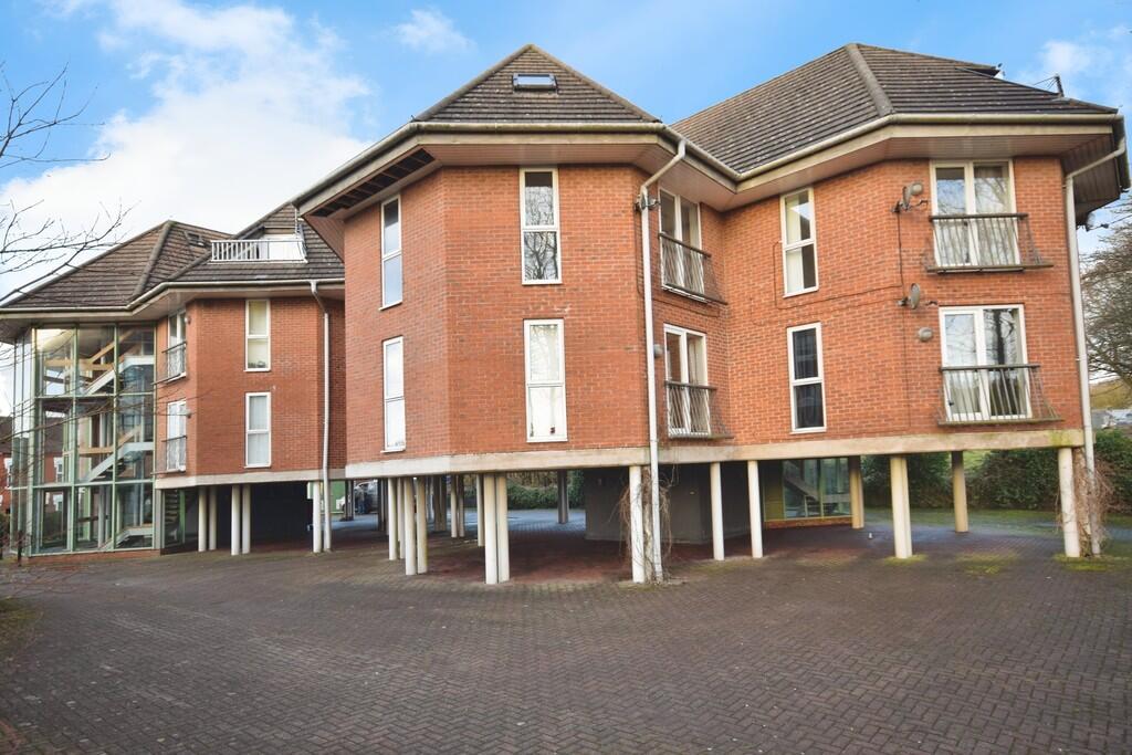
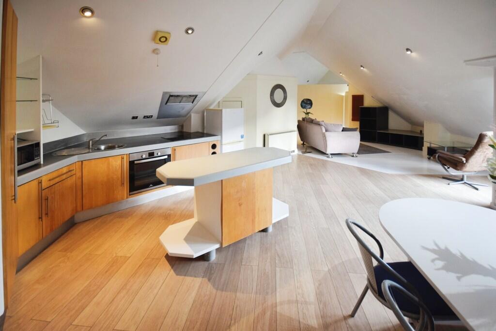
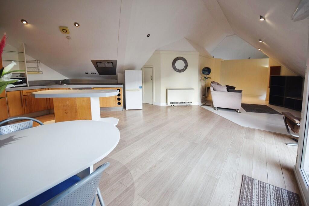
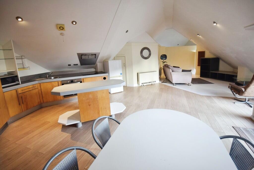
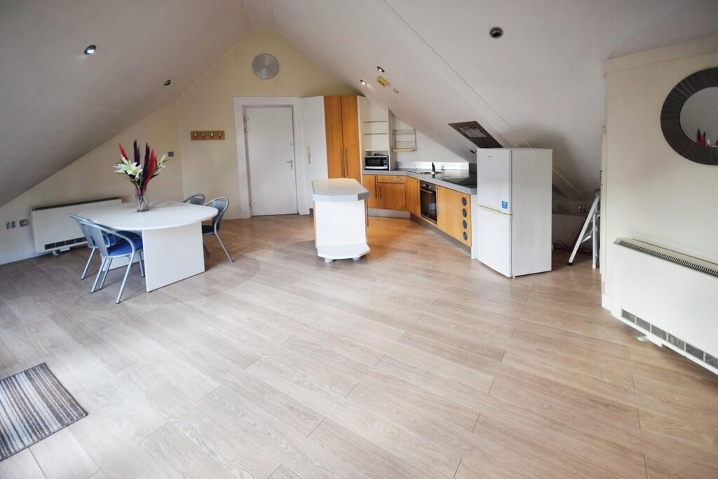
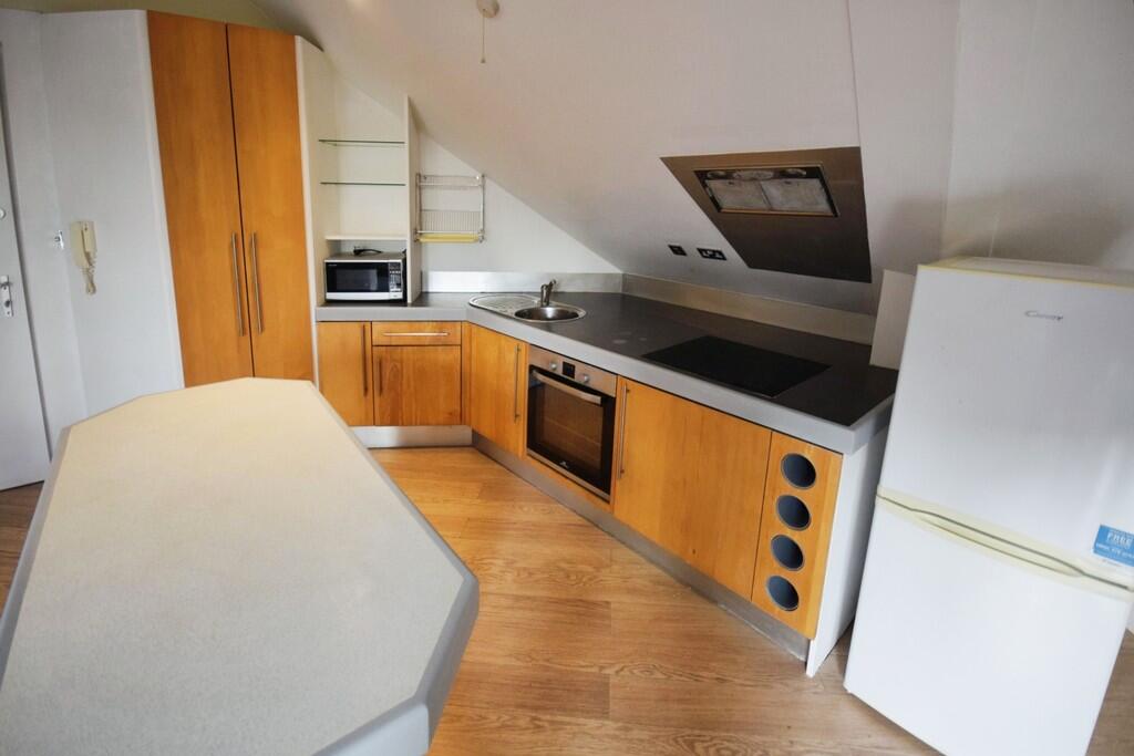
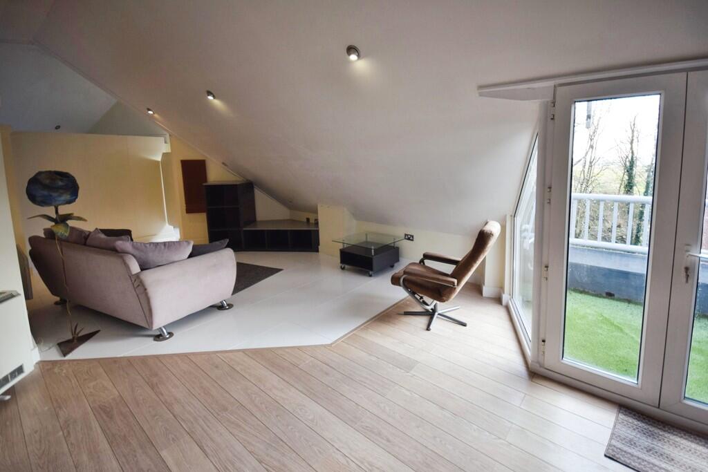
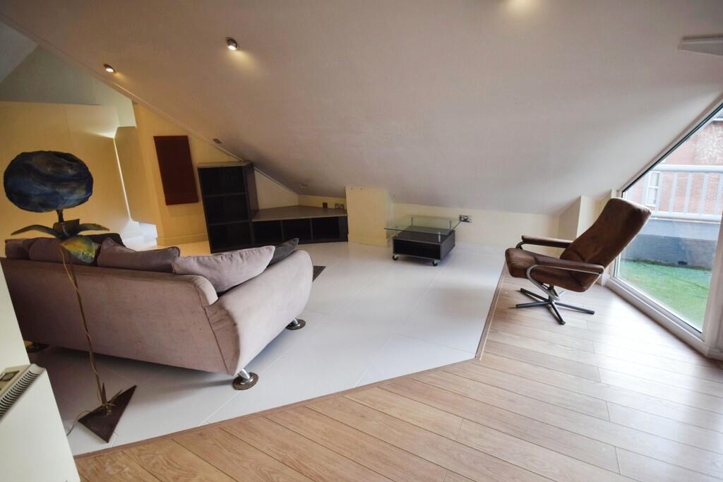
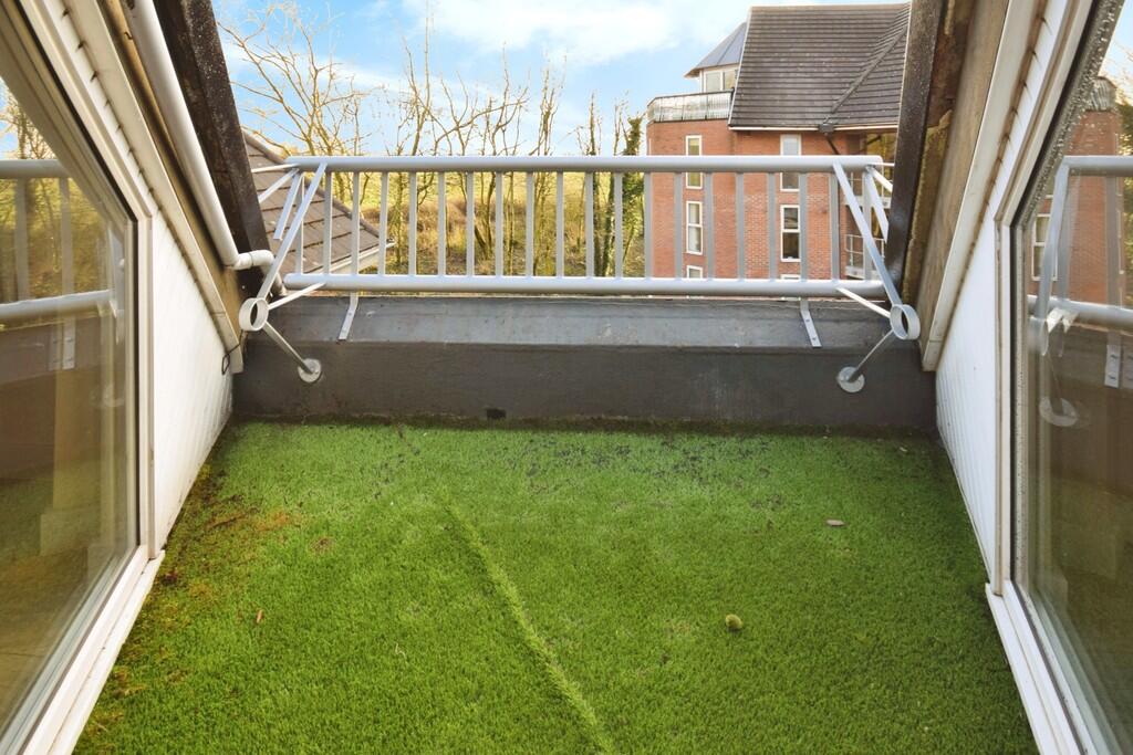
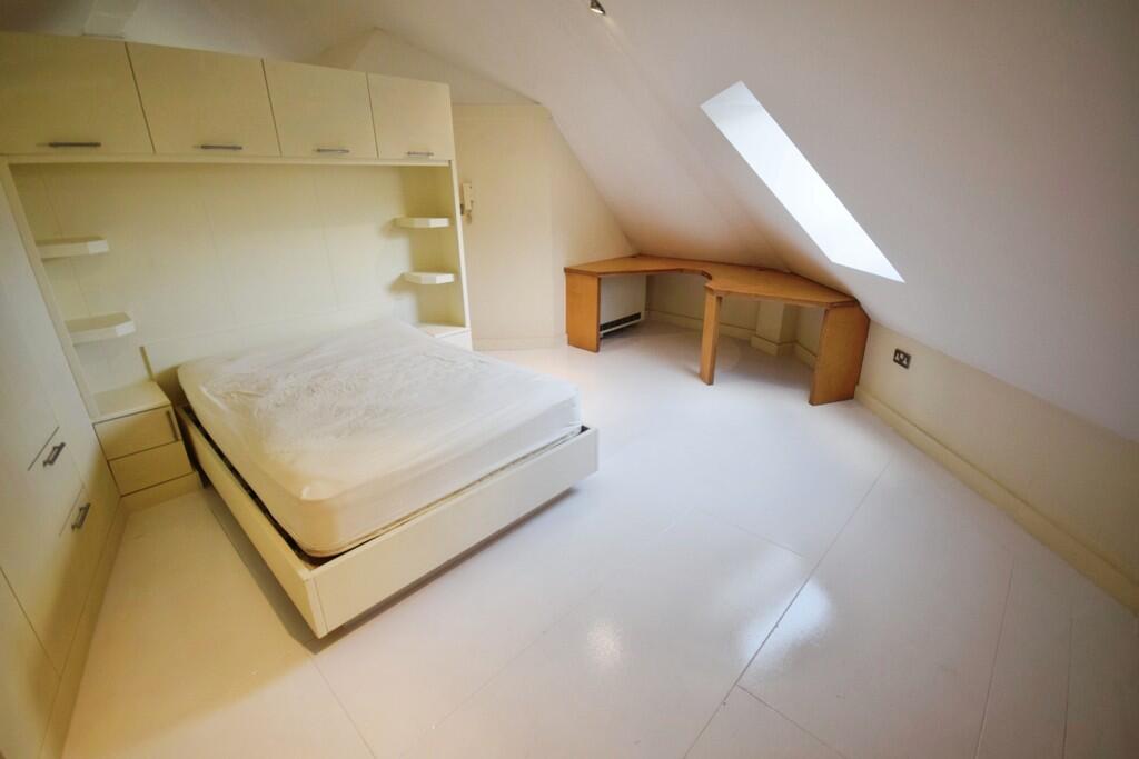
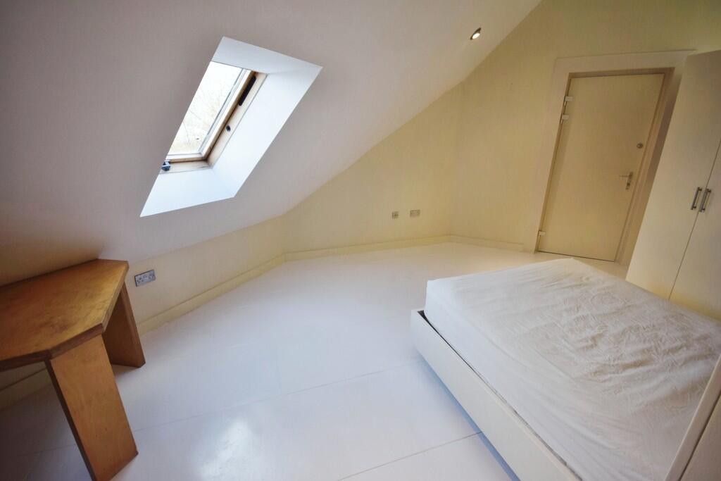
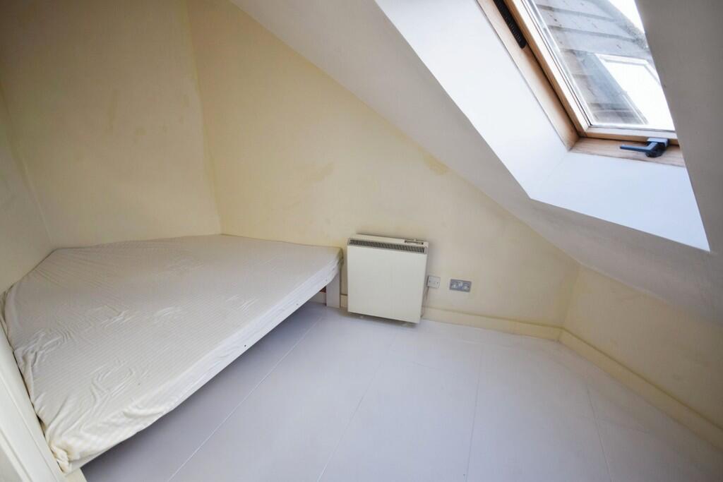
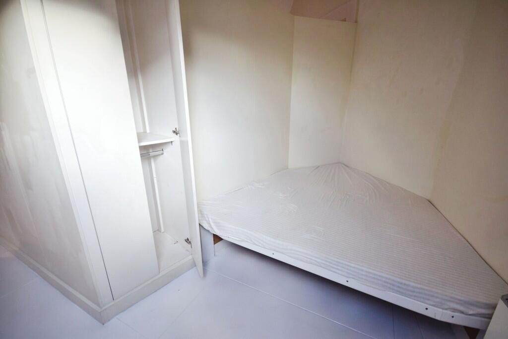
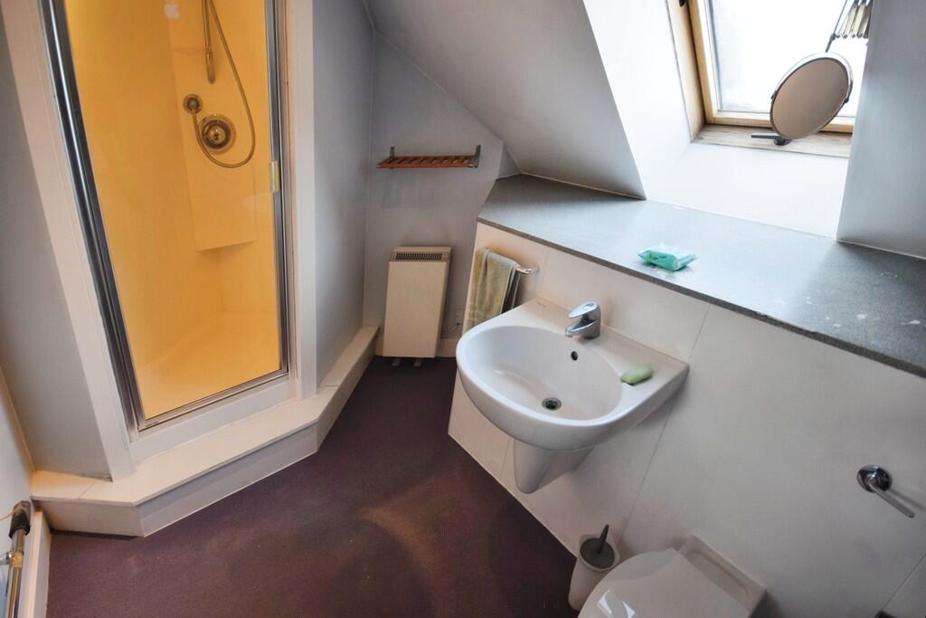
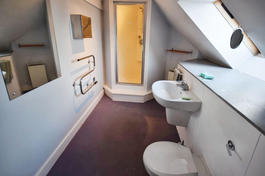
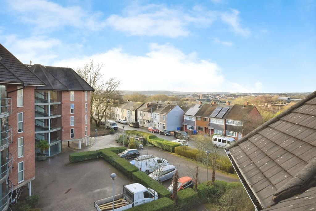
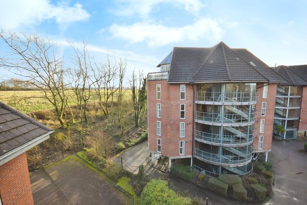
Photo 1 Photo 2 Photo 3 Photo 4 Photo 5 Photo 6 Photo 7 Photo 8 Photo 9 Photo 10 Photo 11 Photo 12 Photo 13 Photo 14 Photo 15 Photo 16 Photo 17
/ 17
Property details
Floor area
120 m²
Council tax band
B
Deprivation
Decile 1 (1,186 of 33,755)
Street crime
579 incidents within 1 mile (May 2026)
Key features
- Furnished penthouse flat
- open plan lounge dining and kitchen area
- 2 Bedrooms
- Shower room
- Balcony
- Parking
- Council tax band B
- Close to Hanley town centre
Additional details
- Parking
- Yes
Description
Listed by
Stoke On Trent
The Property Franchise Group
Reference: 88426497
EPC ratings on this postcode
We don't have a matched EPC for this property yet. Below are efficiency scores and details for other addresses on this postcode.
| Address | Current | Potential | Floor area | Age band | Type |
|---|---|---|---|---|---|
| 22 FOREST EDGE, SNEYD STREET, STOKE-ON-TRENT, STOKE-ON-TRENT | 75 | 85 | 42 m² | England and Wales: 2007-2011 | Flat |
| Apartment 1, Forest Edge, Sneyd Street, STOKE-ON-TRENT | 82 | 84 | 51 m² | England and Wales: 1991-1995 | Flat |
| Apartment 10 Forest Edge, Sneyd Street, STOKE-ON-TRENT | 69 | 75 | 48 m² | England and Wales: 1991-1995 | Flat |
| Apartment 11, Forest Edge, STOKE-ON-TRENT | 78 | 80 | 43 m² | England and Wales: 2003-2006 | Flat |
| APARTMENT 12, FOREST EDGE, SNEYD STREET, STOKE-ON-TRENT | 85 | 86 | 61 m² | England and Wales: 1996-2002 | Flat |
| Apartment 15, Forest Edge, STOKE-ON-TRENT | 78 | 79 | 32 m² | England and Wales: 2003-2006 | Flat |
| Apartment 17 Forest Edge, Sneyd Street, STOKE-ON-TRENT | 67 | 82 | 42 m² | England and Wales: 2007-2011 | Flat |
| Apartment 18, Forest Edge, STOKE-ON-TRENT | 56 | 72 | 50 m² | England and Wales: 1996-2002 | Flat |
| Apartment 19, Forest Edge, STOKE-ON-TRENT | 54 | 70 | 50 m² | England and Wales: 1996-2002 | Flat |
| Apartment 2 Forest Edge, Sneyd Street, STOKE-ON-TRENT | 77 | 82 | 48 m² | England and Wales: 1991-1995 | Flat |
| Apartment 20 Forest Edge, Sneyd Street, STOKE-ON-TRENT | 73 | 85 | 48 m² | England and Wales: 2003-2006 | Flat |
| APARTMENT 21, FOREST EDGE, SNEYD STREET, STOKE-ON-TRENT | 76 | 86 | 41 m² | England and Wales: 2007-2011 | Flat |
| Apartment 23 Forest Edge, Sneyd Street, STOKE-ON-TRENT | 67 | 82 | 59 m² | England and Wales: 1996-2002 | Flat |
| Apartment 23, Forest Edge, Sneyd Street, STOKE-ON-TRENT | 71 | 84 | 51 m² | England and Wales: 2012 onwards | Flat |
| Apartment 24 Forest Edge, Sneyd Street, STOKE-ON-TRENT | 72 | 84 | 81 m² | England and Wales: 2003-2006 | Flat |
Flood risk
Zone: 1
Risk: Low
Job (default Low)
EPC Graphs
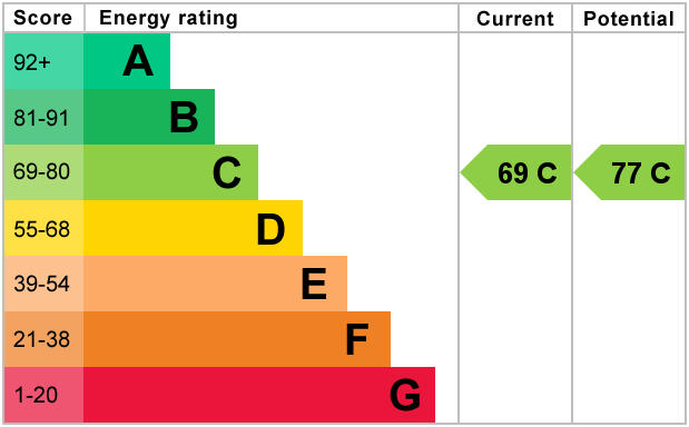
EPC 1
Rental Range
Estimated market rent for Stoke-on-Trent. Low = conservative, Realistic = average, Optimistic = best case.
Based on Local Authority from postcode lookup → Stoke-on-Trent.
LHA (30th percentile) floor for Staffordshire North: £479/mo (Apr 2025 – Mar 2026)
Location
Address
Sneyd Street
Nearby
Nearest stations, universities and amenities (distance from property).
| Type | Name | Distance |
|---|---|---|
| Shop | Beverley's News | 0.3 miles |
| Bus stop | Unknown | 0.3 miles |
| Shop | Mercedes-Benz | 0.4 miles |
| Hospital | St Augustine's Hospital | 0.4 miles |
| Hospital | Haywood Hospital Walk-in Centre | 1.4 miles |
| Train station | Longport | 1.6 miles |
| University | University of Staffordshire Stoke Campus | 1.9 miles |
| Train station | Stoke-on-Trent | 2.0 miles |
Street-level crime
| Category | Count |
|---|---|
| Violence and sexual offences | 182 |
| Anti-social behaviour | 114 |
| Public order | 60 |
| Shoplifting | 50 |
| Criminal damage and arson | 44 |
| Other theft | 37 |
| Drugs | 19 |
| Burglary | 18 |
| Vehicle crime | 16 |
| Possession of weapons | 12 |
| Robbery | 10 |
| Other crime | 9 |
| Bicycle theft | 4 |
| Theft from the person | 4 |
| Total incidents | 579 |
Within 1 mile during May 2026. Source: data.police.uk (England & Wales).
Schools nearby
Nearest open schools with Ofsted ratings (England). Closed schools are not shown. Data from Get Information about Schools and Ofsted.
| Name | Type | Distance | Ofsted |
|---|---|---|---|
| Sneyd Academy | Primary | 0.2 miles | Good — 1 Aug 2023 |
| Forest Park Primary School | Primary | 0.3 miles | Good — 4 Jul 2013 |
| North Road Academy | Other | 0.4 miles | Requires improvement — 2 Apr 2023 |
| Hamilton Academy | Primary | 0.4 miles | Good — 23 Oct 2014 |
| St Peter's Catholic Academy | Primary | 0.4 miles | — (Inspected (no overall grade)) |
Rental Comparables
Residential lets from OpenRent and Rightmove for the area (same bedroom count). Use to validate rent estimates. Student lets are excluded.
Average rent: £723/mo (33 listings)
Enter House Number
Enter the house number to help us retrieve more accurate pricing history and property data.
Please log in to submit or correct the house number for this listing.
Log in to continue