18A
INGELOW ROAD, LONDON, GREATER LONDON SW8 3QA
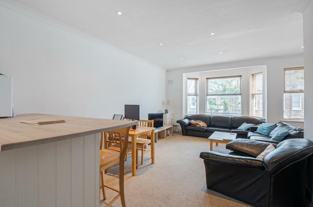
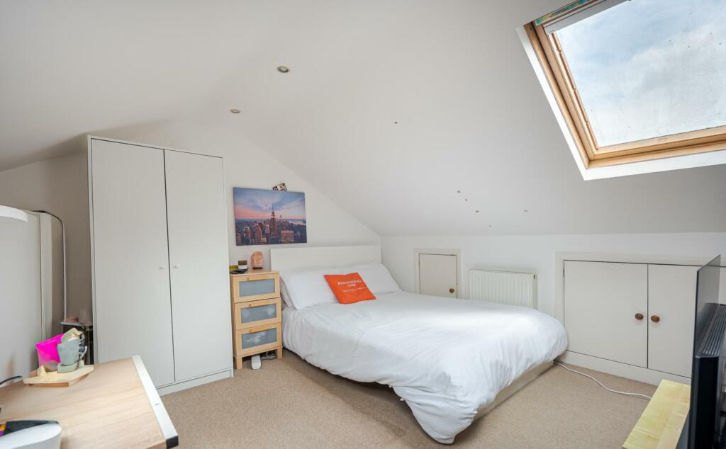
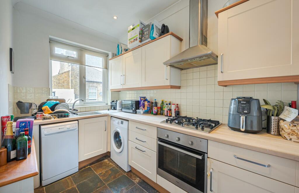
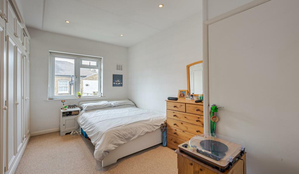
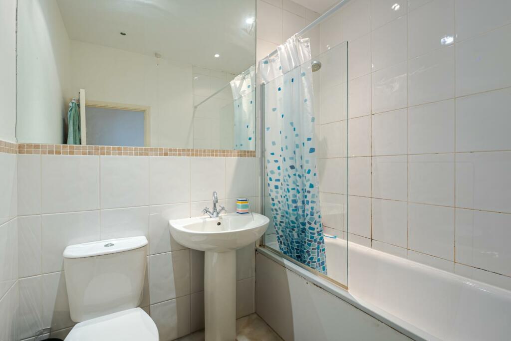
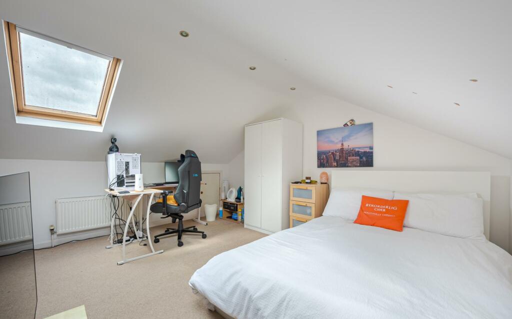
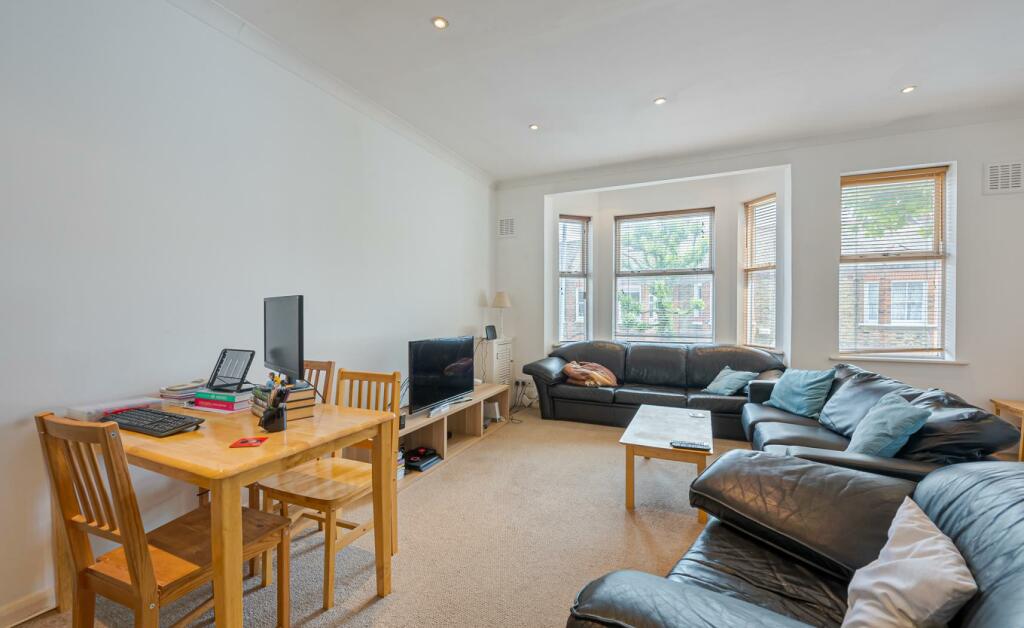
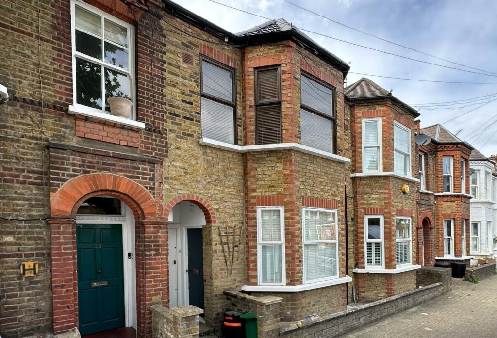
Photo 1 Photo 2 Photo 3 Photo 4 Photo 5 Photo 6 Photo 7 Photo 8
/ 8
Property details
Floor area
77 m²
Council tax band
D
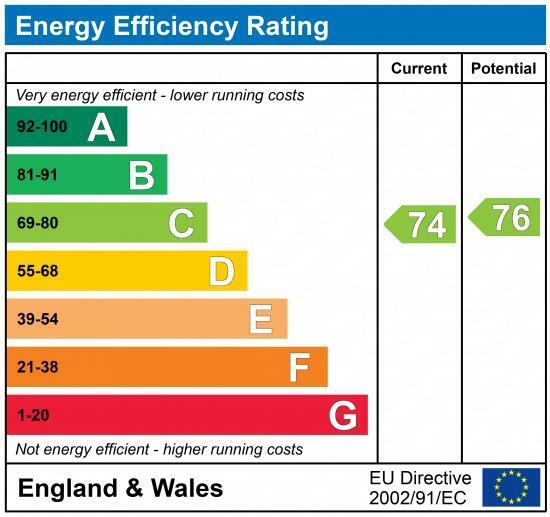
EPC rating
C
Year built
England and Wales: 1983-1990
Deprivation
Decile 5 (15,805 of 33,755)
Street crime
1081 incidents within 1 mile (Apr 2026)
Key features
- Two Double Bedrooms
- Large Reception Room
- Split-Level Flat
- Modern Kitchen
- One Bathroom
- Furnished
- Residential Road
Description
Located within easy reach of the cafes, bars and restaurants of Queenstown Road, Battersea Park Road and Lavender Hill. The beautiful green open spaces of Battersea Park are within a short walk. The property is also within walking distance of Chelsea's fashionable 'Kings Road'.
Transport is provided by Queenstown mainline station (Waterloo) and Battersea Park mainline station (Victoria).
Listed by
London
Noble Estates
Reference: 148843211
EPC Rating & Upgrade Cost
Current rating: C
Potential rating: C
Inspection date: 30/09/2019
Expiry date: 29/09/2029
Recommendations
- Low energy lighting for all fixed outlets (45)
Flood risk
Zone: 1
Risk: Low
Job (default Low)
Floorplans
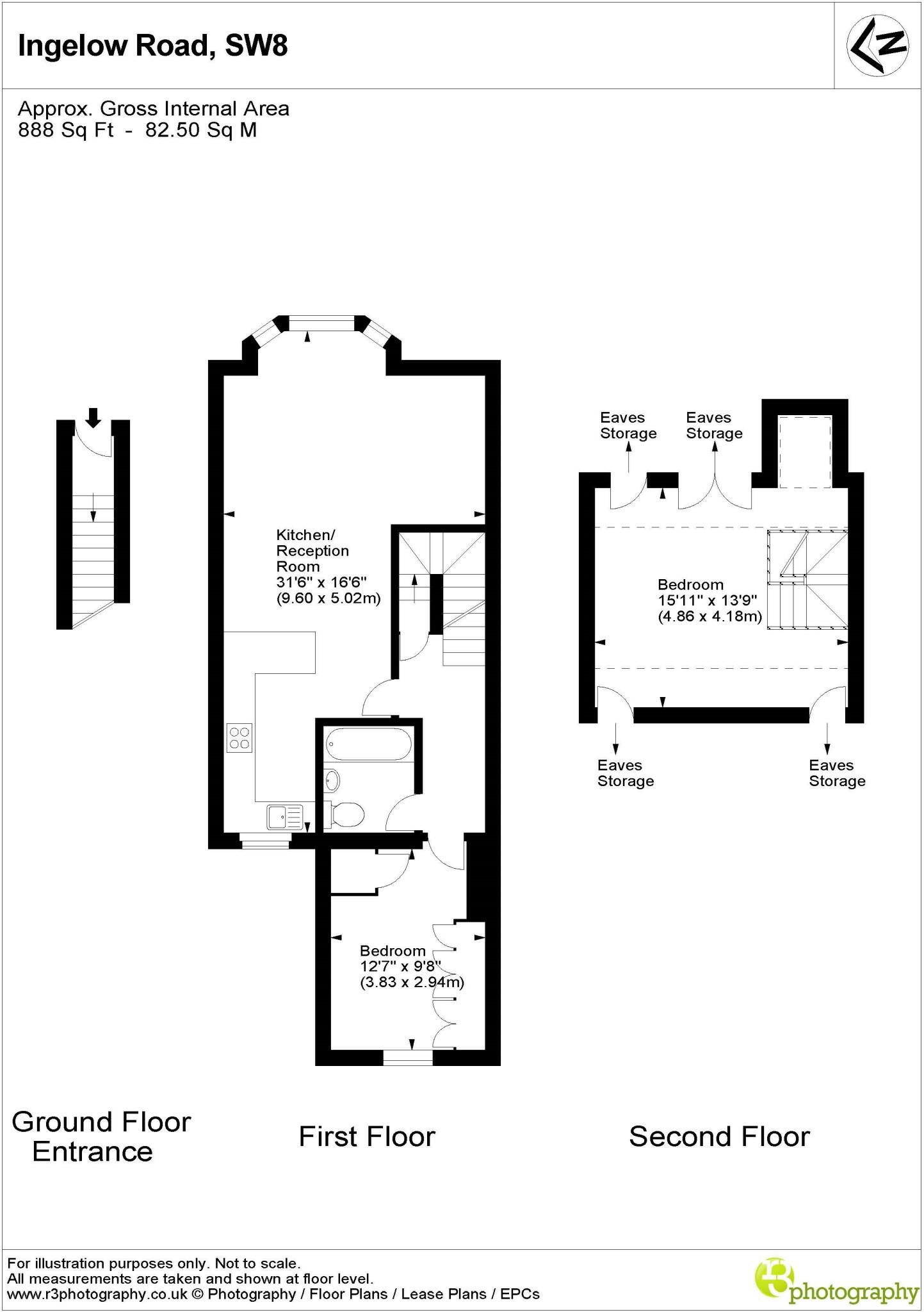
Floorplan
EPC Graphs
EPC Graph
Rental Range
Estimated market rent for Wandsworth. Low = conservative, Realistic = average, Optimistic = best case.
Based on Local Authority from postcode lookup → Wandsworth.
LHA (30th percentile) floor for Stevenage & North Herts: £972/mo (Apr 2025 – Mar 2026)
Location
Nearby
Nearest stations, universities and amenities (distance from property).
| Type | Name | Distance |
|---|---|---|
| Bus stop | Prairie Street | 0.1 miles |
| Shop | Bowloom Limited | 0.1 miles |
| Shop | Queenstown Express | 0.1 miles |
| Train station | Queenstown Road | 0.3 miles |
| Train station | Battersea Park | 0.5 miles |
| Hospital | Bridge Lane Health Centre | 0.7 miles |
| University | National Heart and Lung Institute | 1.4 miles |
| University | University of Wales Trinity Saint David London Campus | 1.9 miles |
| Hospital | King's College Hospital Emergency Department | 2.5 miles |
Street-level crime
| Category | Count |
|---|---|
| Anti-social behaviour | 255 |
| Violence and sexual offences | 200 |
| Shoplifting | 116 |
| Theft from the person | 106 |
| Other theft | 86 |
| Vehicle crime | 72 |
| Burglary | 58 |
| Robbery | 39 |
| Bicycle theft | 37 |
| Public order | 36 |
| Criminal damage and arson | 34 |
| Drugs | 29 |
| Other crime | 8 |
| Possession of weapons | 5 |
| Total incidents | 1081 |
Within 1 mile during Apr 2026. Source: data.police.uk (England & Wales).
Schools nearby
Nearest open schools with Ofsted ratings (England). Closed schools are not shown. Data from Get Information about Schools and Ofsted.
| Name | Type | Distance | Ofsted |
|---|---|---|---|
| John Burns Primary School | Primary | 0.2 miles | Good — 6 Feb 2018 |
| Heathbrook Primary School | Primary | 0.3 miles | Good — 13 Jun 2016 |
| Chesterton Primary School | Primary | 0.3 miles | Outstanding — 6 Feb 2023 |
| Shaftesbury Park Primary School | Primary | 0.3 miles | Good — 29 Nov 2013 |
| Harris Academy Battersea | Secondary | 0.4 miles | Outstanding — 12 Mar 2018 |
Rental Comparables
Rental listings exist nearby, but none matched the 2-bedroom count for this property.