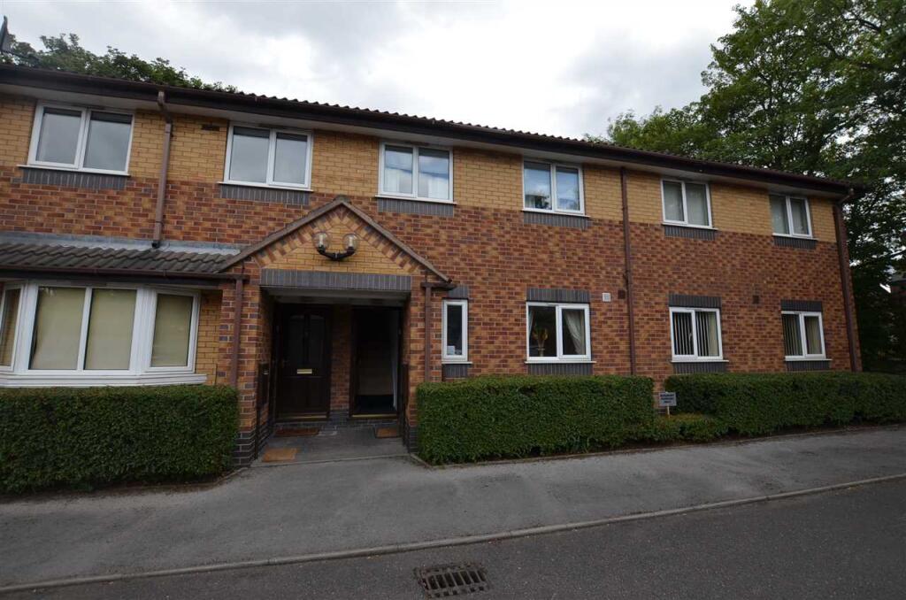
Tolkien Way
Penkhull, Stoke-On-Trent, ST4 7SJ
£750 pcm
Property details
Deprivation
Decile 5 (16,658 of 33,755)
Street crime
425 incidents within 1 mile (Apr 2026)
Key features
- Furnished two bedroom first floor flat
- Lounge/dining, kitchen, bathroom
- Two bedrooms, GCH & D/G, parking
Additional details
- Parking
- Yes
Description
AVAILABLE FROM 28th FEBRUARY
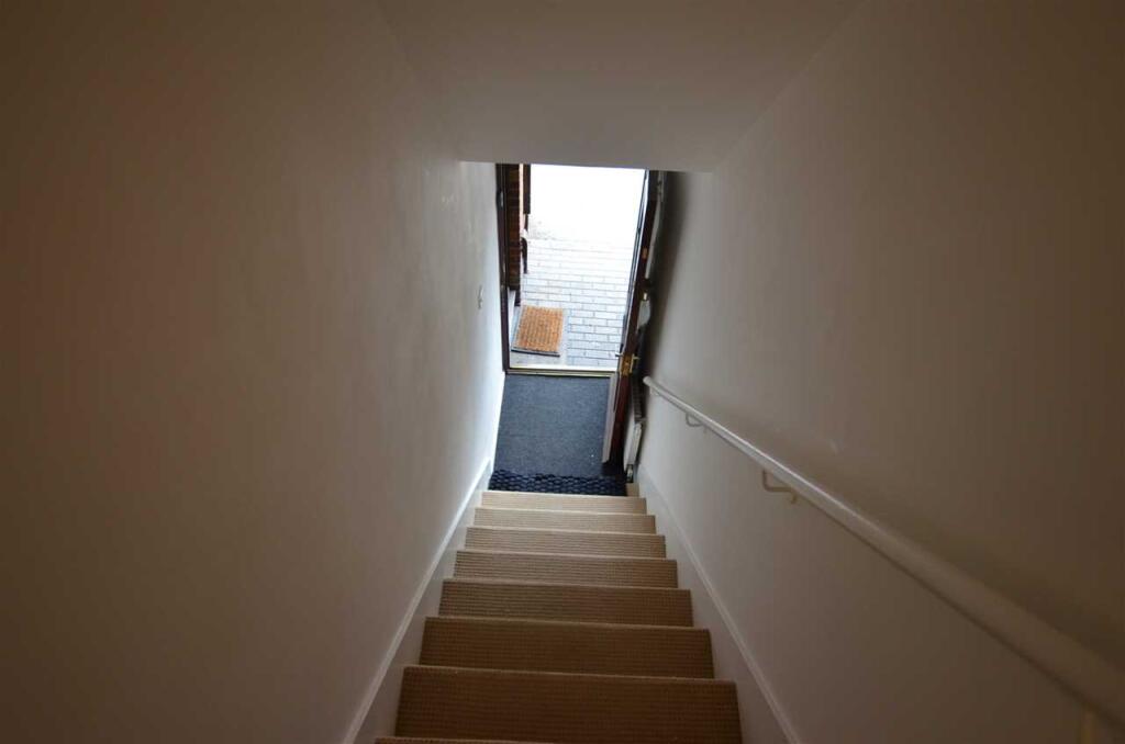
HALLWAY
Wood door. Carpeted stairs to:
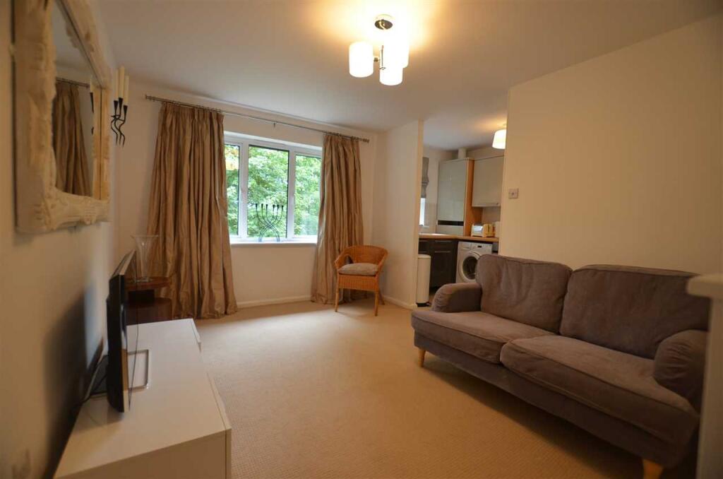
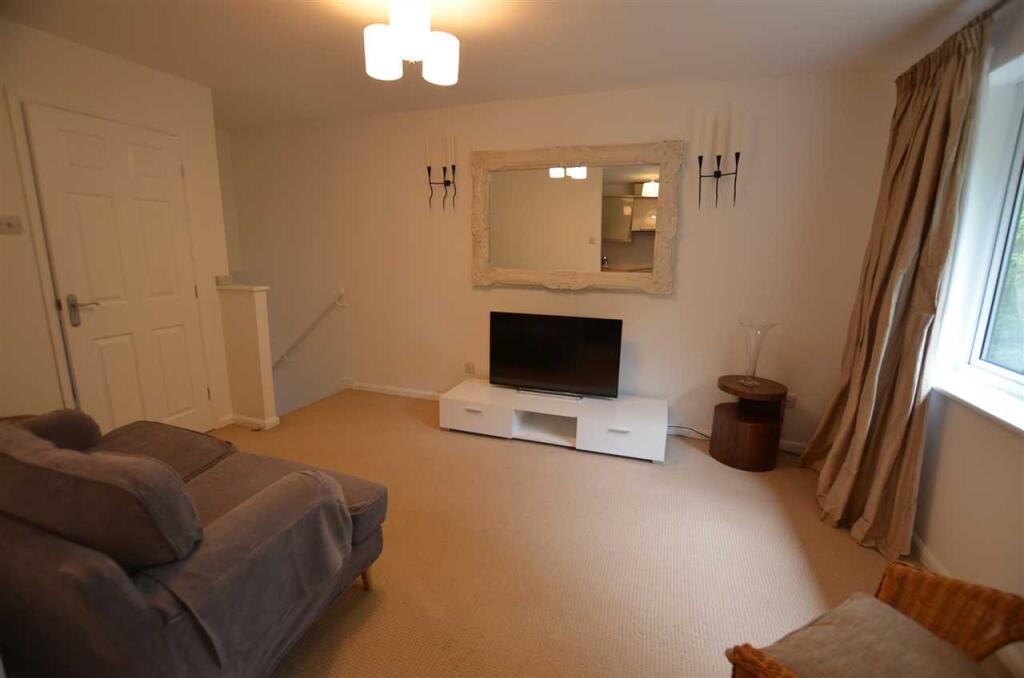
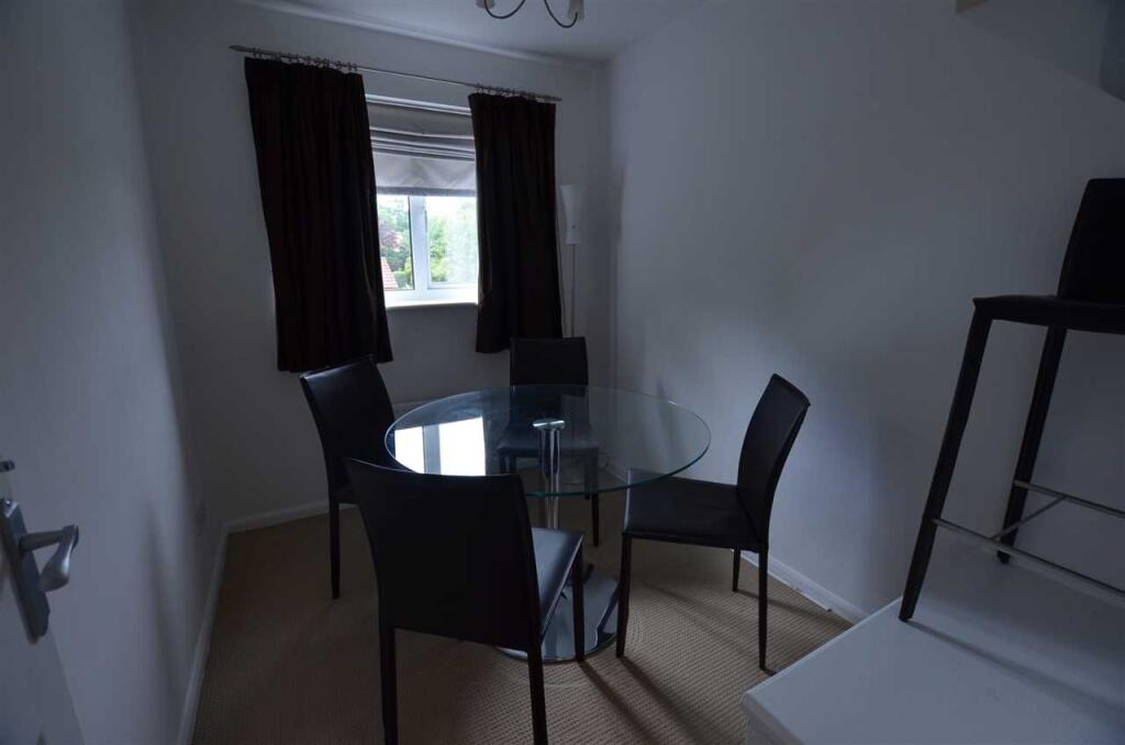
LOUNGE/DINER 4.20m (13' 9") x 3.03m (9' 11")
UPVC double-glazed window to rear elevation, carpet, radiator, ceiling light, curtains. Furnishings include a sofa, tv unit and tv, lamp, lamp stands, wicker chair.
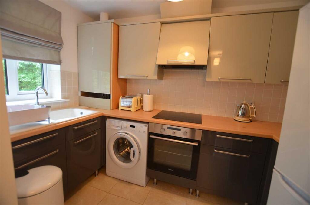
KITCHEN 3.07m (10' 1") x 1.70m (5' 7")
UPVC double-glazed window to rear elevation, wall and base units and drawers with worktops. Ceiling light, vinyl flooring, boiler. Furnishings include: fridge/freezer, washing machine, toaster, kettle, bin, oven, hob and extractor.
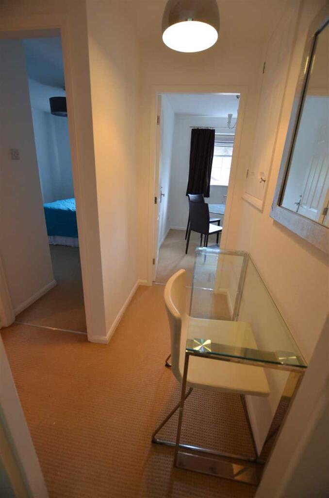
INNER HALLWAY
Light, carpet, desk and chair.
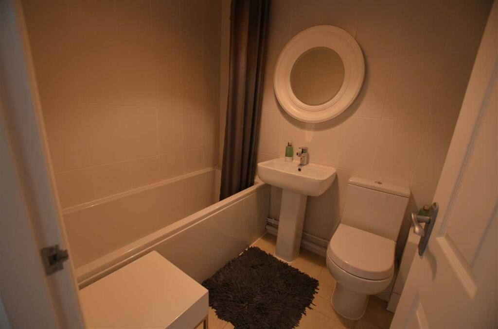
BATHROOM 1.99m (6' 6") x 1.67m (5' 6")
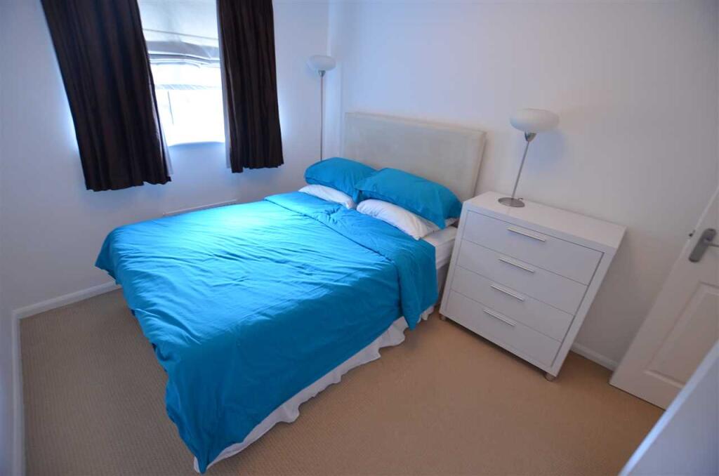
BEDROOM ONE 3.67m (12' 0") x 2.64m (8' 8")
UPVC double-glazed window to rear elevation, carpet, light and radiator. Furnishings include a double bed and mattress, chest of drawers, wardrobe and lamp.
Dining Room 2.68m (8' 10") x 2.09m (6' 10")
UPVC double-glazed window to rear elevation, carpet, radiator, light. Glass dining table and 4 chairs.
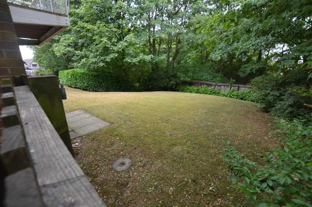
EXTERIOR**
Communal gardens for residents only. Allocated parking for two cars.
Listed by
Newcastle-under-Lyme
Bramptons
Reference: 171357725
EPC ratings on this postcode
We don't have a matched EPC for this property yet. Below are efficiency scores and details for other addresses on this postcode.
| Address | Current | Potential | Floor area | Age band | Type |
|---|---|---|---|---|---|
| 10, Tolkien Way, STOKE-ON-TRENT | 64 | 78 | 114 m² | England and Wales: 1991-1995 | Detached |
| 103 TOLKIEN WAY, HARTSHILL, STOKE-ON-TRENT, STOKE-ON-TRENT | 74 | 89 | 56 m² | England and Wales: 2003-2006 | Detached |
| 105 Tolkien Way, STOKE-ON-TRENT | 71 | 74 | 52 m² | England and Wales: 1983-1990 | Flat |
| 105, Tolkien Way, STOKE-ON-TRENT | 70 | 76 | 55 m² | England and Wales: 1996-2002 | Flat |
| 107, Tolkien Way, STOKE-ON-TRENT | 75 | 76 | 55 m² | England and Wales: 1996-2002 | Flat |
| 107, Tolkien Way, STOKE-ON-TRENT | 75 | 76 | 55 m² | England and Wales: 1996-2002 | Flat |
| 11, Tolkien Way, STOKE-ON-TRENT | 64 | 87 | 57 m² | England and Wales: 1983-1990 | Terraced |
| 111, Tolkien Way, STOKE-ON-TRENT | 78 | 78 | 44 m² | England and Wales: 1991-1995 | Flat |
| 115 Tolkien Way, STOKE-ON-TRENT | 75 | 76 | 43 m² | England and Wales: 1996-2002 | Flat |
| 117 TOLKIEN WAY, HARTSHILL, STOKE-ON-TRENT, STOKE-ON-TRENT | 72 | 74 | 47 m² | England and Wales: 1996-2002 | Flat |
| 119 Tolkien Way, STOKE-ON-TRENT | 76 | 76 | 52 m² | England and Wales: 1996-2002 | Flat |
| 119, Tolkien Way, STOKE-ON-TRENT | 72 | 78 | 51 m² | England and Wales: 1996-2002 | Flat |
| 12, Tolkien Way, STOKE-ON-TRENT | 58 | 81 | 121 m² | England and Wales: 1991-1995 | Detached |
| 121 Tolkien Way, STOKE-ON-TRENT | 77 | 77 | 38 m² | England and Wales: 1996-2002 | Flat |
| 121, Tolkien Way, STOKE-ON-TRENT | 69 | 72 | 32 m² | England and Wales: 1991-1995 | Flat |
Flood risk
Zone: 1
Risk: Low
Job (default Low)
EPC Graphs

EPC
Rental Range
Estimated market rent for Stoke-on-Trent. Low = conservative, Realistic = average, Optimistic = best case.
Based on Local Authority from postcode lookup → Stoke-on-Trent.
LHA (30th percentile) floor for Staffordshire North: £424/mo (Apr 2025 – Mar 2026)
Location
Address
Tolkien Way
Nearby
Nearest stations, universities and amenities (distance from property).
| Type | Name | Distance |
|---|---|---|
| Bus stop | Unknown | 0.0 miles |
| Bus stop | Richmond Street | 0.1 miles |
| Shop | Penkhull Food & Wine Store | 0.2 miles |
| Shop | Theresa's Hairdressing Salon | 0.3 miles |
| Hospital | North Staffordshire Hospital | 0.5 miles |
| University | University of Staffordshire Stoke Campus | 0.5 miles |
| Train station | Stoke-on-Trent | 0.5 miles |
| Hospital | Hartshill Medical Centre | 0.7 miles |
| Train station | Longport | 2.5 miles |
Street-level crime
| Category | Count |
|---|---|
| Violence and sexual offences | 138 |
| Anti-social behaviour | 59 |
| Public order | 46 |
| Criminal damage and arson | 38 |
| Shoplifting | 25 |
| Drugs | 24 |
| Other theft | 23 |
| Burglary | 19 |
| Vehicle crime | 19 |
| Other crime | 13 |
| Possession of weapons | 11 |
| Bicycle theft | 4 |
| Robbery | 4 |
| Theft from the person | 2 |
| Total incidents | 425 |
Within 1 mile during Apr 2026. Source: data.police.uk (England & Wales).
Schools nearby
Nearest open schools with Ofsted ratings (England). Closed schools are not shown. Data from Get Information about Schools and Ofsted.
| Name | Type | Distance | Ofsted |
|---|---|---|---|
| St Thomas Aquinas Catholic Primary School | Primary | 0.2 miles | Good — 15 Jan 2023 |
| The Willows Primary School | Primary | 0.4 miles | Good — 14 Dec 2010 |
| The Registry | Other | 0.5 miles | — (No rating) |
| Regent College | Other | 0.5 miles | — (No rating) |
| Staffordshire University | Other | 0.5 miles | — (No rating) |
Rental Comparables
Residential lets from OpenRent and Rightmove for the area (same bedroom count). Use to validate rent estimates. Student lets are excluded.
Average rent: £620/mo (45 listings)
Enter House Number
Enter the house number to help us retrieve more accurate pricing history and property data.
Please log in to submit or correct the house number for this listing.
Log in to continue