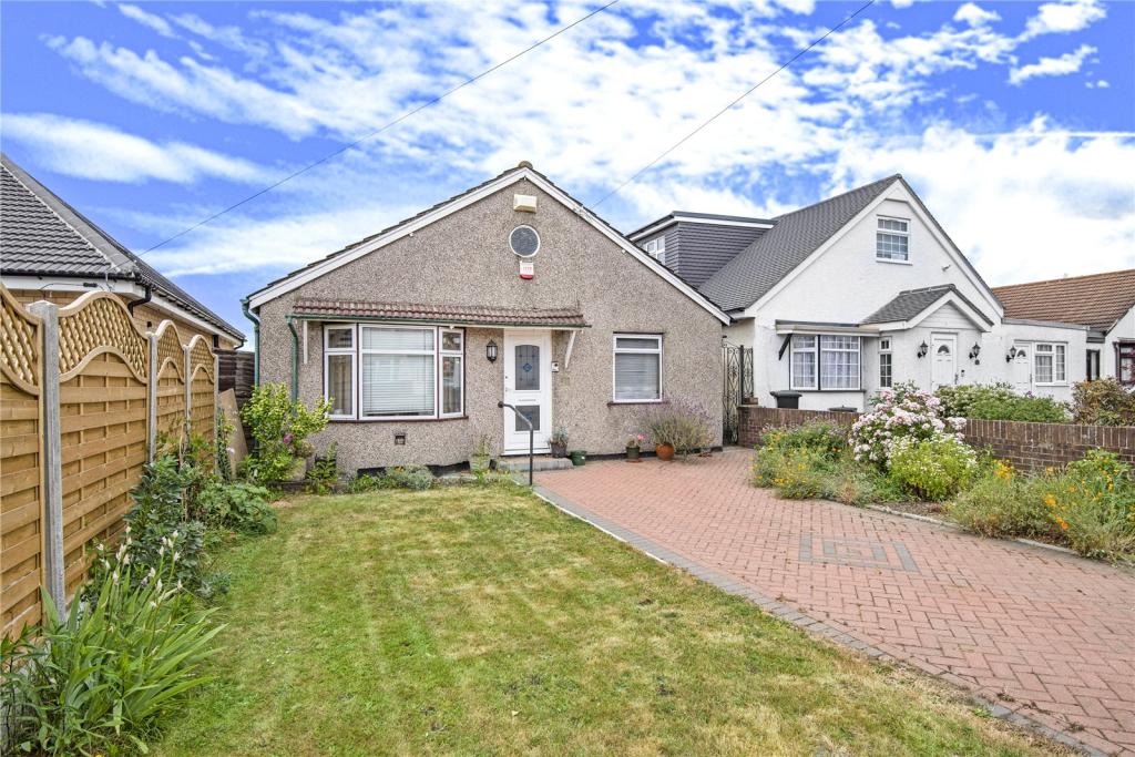
26 LEES ROAD
UXBRIDGE, GREATER LONDON UB8 3AT
Property details
Tenure
FREEHOLD
Floor area
178 m²
EPC rating
C
Year built
England and Wales: 2007-2011
Last sold
£432,500 Aug 2020
Price per m²
£2,612/m²
Local average
£716,692 (-35.1%)
Deprivation
Decile 5 (14,242 of 33,755)
Street crime
297 incidents within 1 mile (Apr 2026)
Key features
- No onward chain
- Offering huge potential to extend subject to the usual planning consents
- Detached bungalow
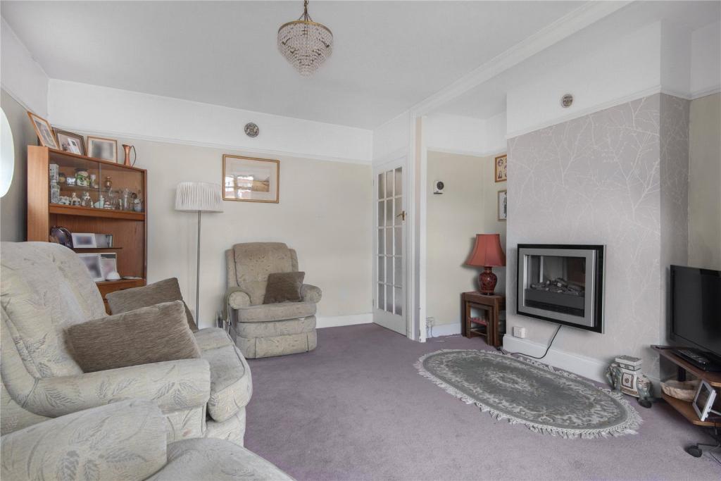
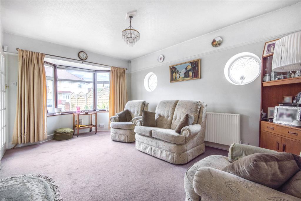
- Reception room
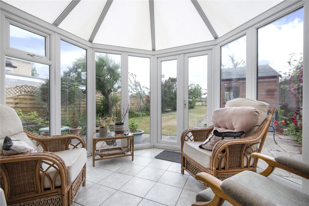
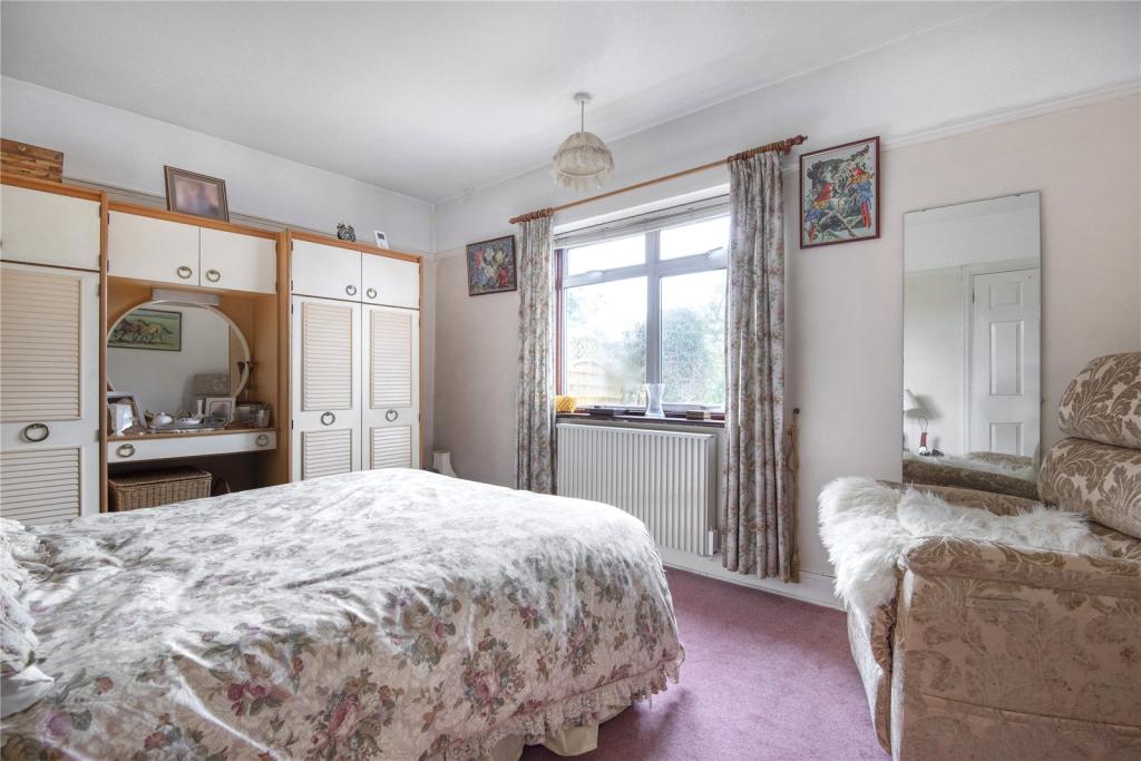
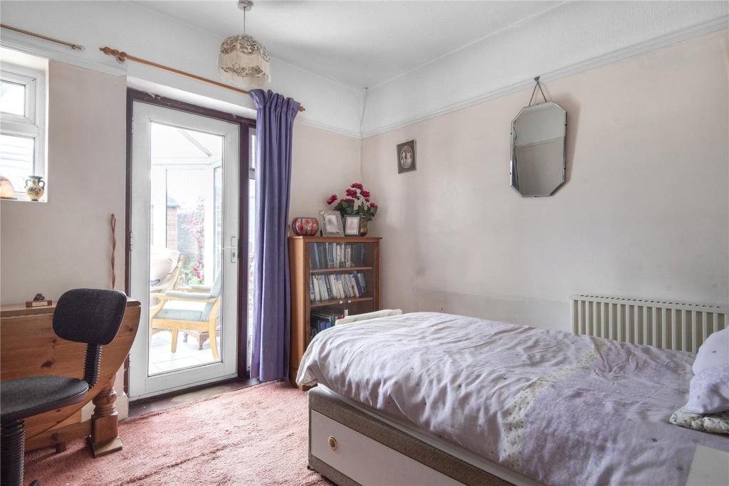
- Two double bedrooms
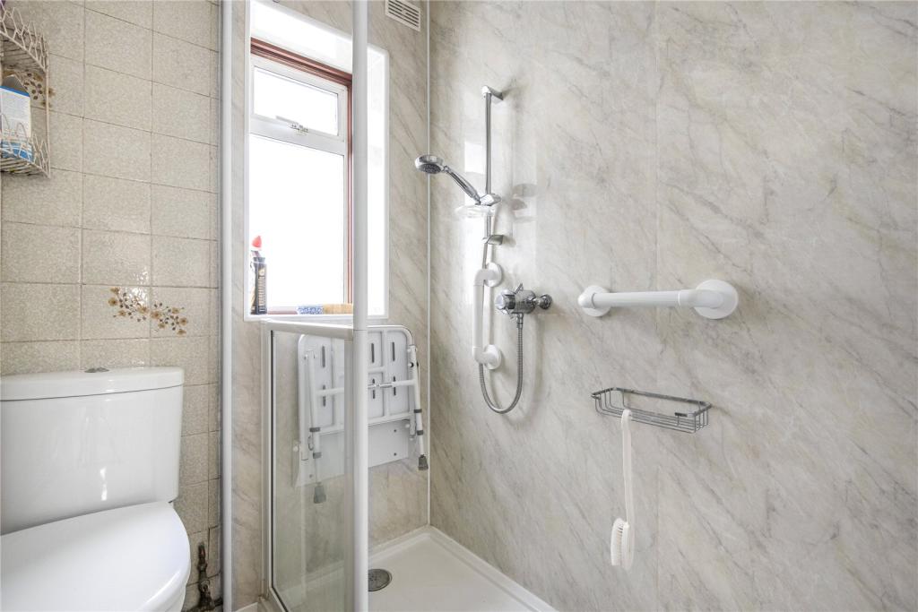
- One family bathroom
- Off street parking for multiple cars
- A sun kissed rear garden
- Walking distance to local shops
- EPC rating F
Additional details
- Parking
- Yes
- Garden
- Yes
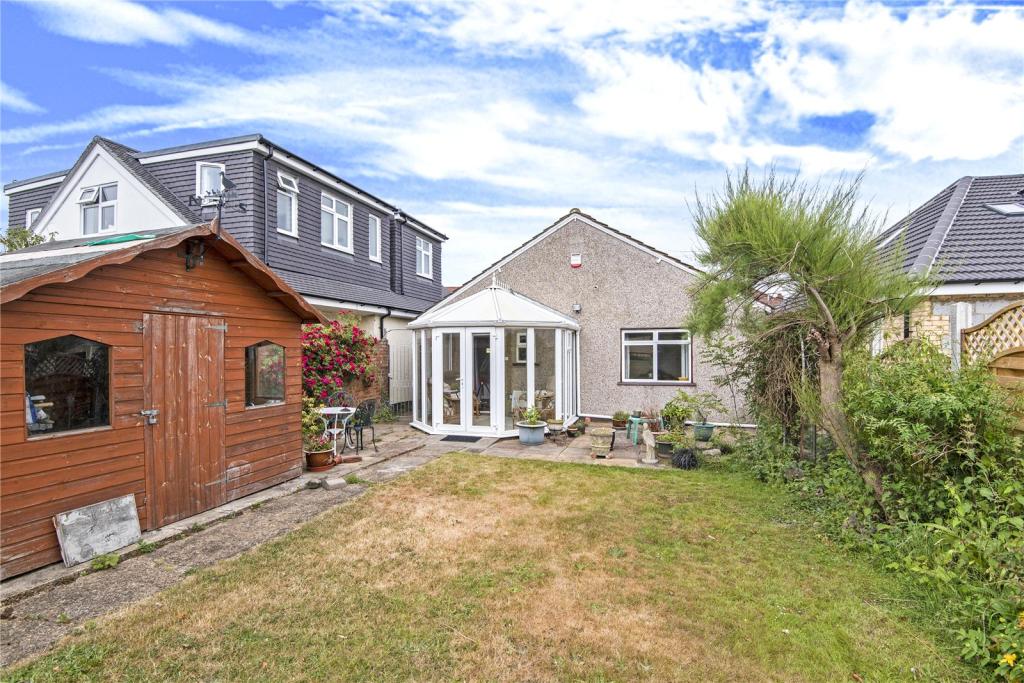
Description
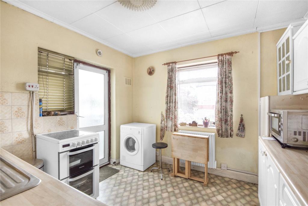
The accommodation briefly comprises of a reception room with a bay window, a kitchen with access to the rear, two double bedrooms with one enjoying a single door leading to the conservatory and one family bathroom. Externally, there is off street parking for multiple cars. To the rear aspect is a large sun kissed garden ideal for dining and entertaining during the warm summer months.
Lees Road is situated off the main Uxbridge Road, within easy reach of local shops, schools, Hillingdon Hospital, Brunel University and bus links into Uxbridge Town Centre. The town centre boasts multiple shopping facilities, restaurants, bars and the Metropolitan/Piccadilly Line Station.
Listed by
Uxbridge Sales
Leaders and Romans Group
Reference: 71163672
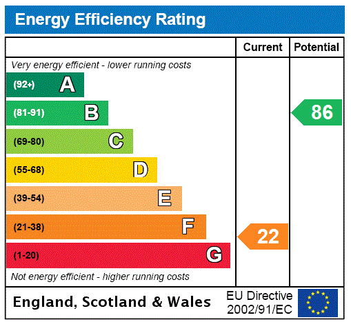
EPC Rating & Upgrade Cost
Current rating: C
Potential rating: B
Inspection date: 09/01/2025
Expiry date: 08/01/2035
Current heating cost: £782/year
Potential heating cost: £786/year
Est. upgrade cost to C: £9,500
Recommendations
- Solar water heating (£4,000 - £6,000)
- Solar photovoltaic panels, 2.5 kWp (£3,500 - £5,500)
Flood risk
Zone: 1
Risk: Low
Job (default Low)
Floorplans
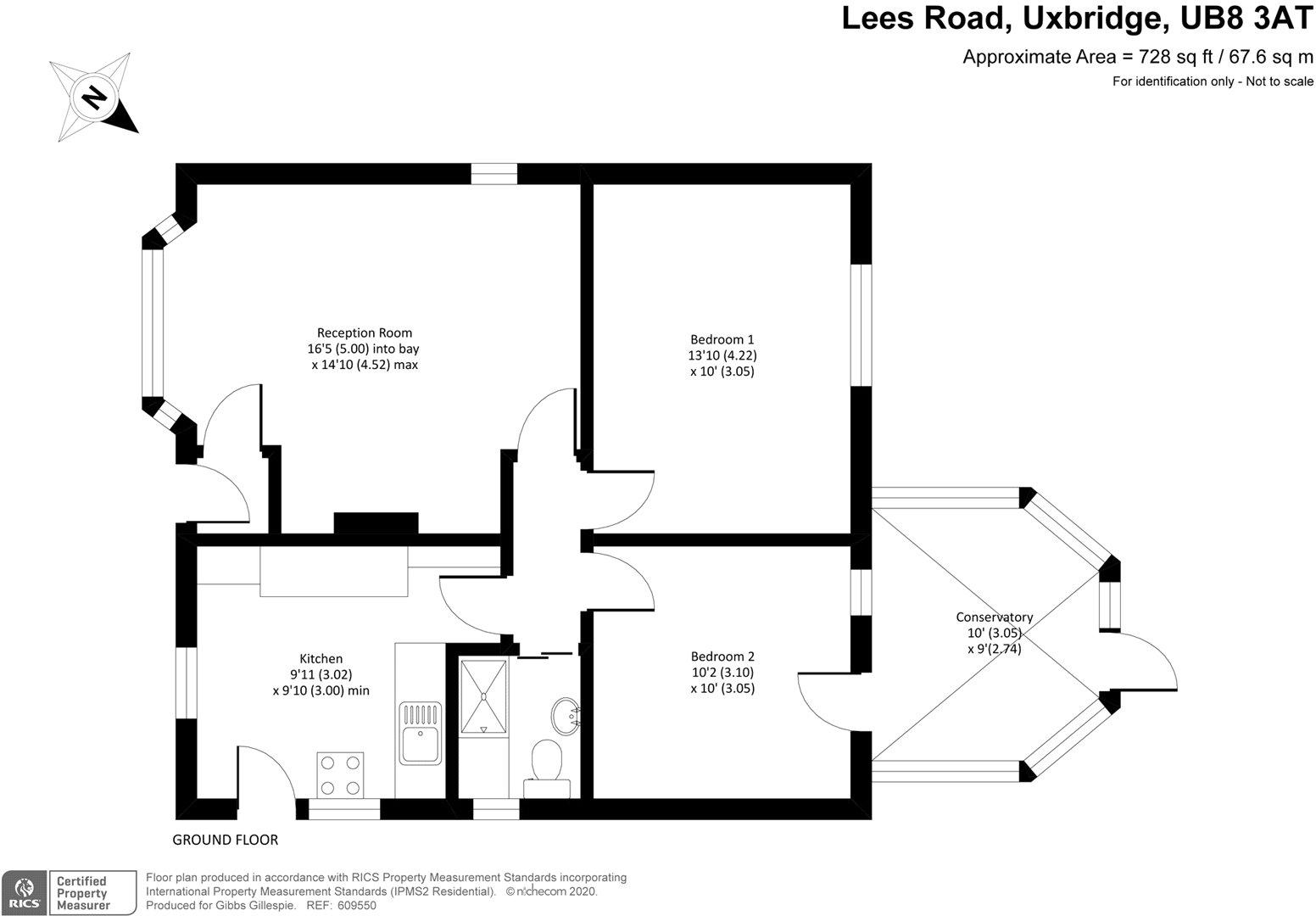
Picture No. 11
EPC Graphs
EPC Rating Graph
Price history
| Event | Date | Price | % change |
|---|---|---|---|
| Sold | 12/08/2020 (5 years ago) | £432,500 | — |
Source: HM Land Registry Price Paid Data. Crown copyright.
Sold Comparables
Same street and nearby sales within 0.25 miles (last 5 years). Data from Land Registry Price Paid.
| Address | Price | Date | Type |
|---|---|---|---|
| 21 BOURN AVENUE, UXBRIDGE, HILLINGDON, GREATER LONDON, UB8 3AR | £452,000 | 18/03/2025 | Detached |
| 129 HARLINGTON ROAD, UXBRIDGE, HILLINGDON, GREATER LONDON, UB8 3JA | £433,407 | 27/03/2023 | Detached |
| 33 BOURN AVENUE, UXBRIDGE, HILLINGDON, GREATER LONDON, UB8 3AR | £590,000 | 10/02/2023 | Detached |
| 18 NICHOLLS AVENUE, UXBRIDGE, HILLINGDON, GREATER LONDON, UB8 3JL | £625,000 | 24/11/2022 | Detached |
| 27 NICHOLLS AVENUE, UXBRIDGE, HILLINGDON, GREATER LONDON, UB8 3JL | £675,000 | 23/11/2022 | Detached |
| 16 LEES ROAD, UXBRIDGE, HILLINGDON, GREATER LONDON, UB8 3AS | £825,000 | 10/11/2022 | Detached |
| 7 BOURN AVENUE, UXBRIDGE, HILLINGDON, GREATER LONDON, UB8 3AR | £595,000 | 14/10/2022 | Detached |
| 6 NICHOLLS AVENUE, UXBRIDGE, HILLINGDON, GREATER LONDON, UB8 3JL | £635,000 | 05/08/2022 | Detached |
| 47 BOURN AVENUE, UXBRIDGE, HILLINGDON, GREATER LONDON, UB8 3AR | £465,000 | 18/02/2022 | Detached |
| 48 BOURN AVENUE, UXBRIDGE, HILLINGDON, GREATER LONDON, UB8 3AR | £500,000 | 18/02/2022 | Detached |
| 137 HARLINGTON ROAD, UXBRIDGE, HILLINGDON, GREATER LONDON, UB8 3JA | £670,000 | 25/01/2022 | Detached |
| 22 NICHOLLS AVENUE, UXBRIDGE, HILLINGDON, GREATER LONDON, UB8 3JL | £592,000 | 26/08/2021 | Detached |
Area average: £588,117 (12 sales)
Capital growth trend
Land Registry outcode average: last 12 months vs 5y and 10y ago (from sold prices).
House Price Index (HM Land Registry — official index, not sold-price averages): Hillingdon. Series: Detached. As of March 2026.
Rental Range
Estimated market rent for Hillingdon. Low = conservative, Realistic = average, Optimistic = best case.
Based on Local Authority from postcode lookup → Hillingdon.
LHA (30th percentile) floor for Outer West London: £1,296/mo (Apr 2025 – Mar 2026)
Location
Nearby
Nearest stations, universities and amenities (distance from property).
| Type | Name | Distance |
|---|---|---|
| Bus stop | Widmore Road | 0.1 miles |
| Bus stop | Aldenham Drive | 0.1 miles |
| Shop | Hillingdon Vehicle Specialists | 0.1 miles |
| Shop | New Choice Carpets | 0.1 miles |
| Hospital | Hillingdon Hospital | 0.6 miles |
| University | Faraday Complex | 0.9 miles |
| University | Clifton Halls | 1.0 miles |
| Train station | West Drayton | 1.6 miles |
| Train station | Uxbridge | 1.7 miles |
| Hospital | The Broadway Health Centre | 3.3 miles |
Street-level crime
| Category | Count |
|---|---|
| Violence and sexual offences | 99 |
| Anti-social behaviour | 63 |
| Drugs | 25 |
| Vehicle crime | 20 |
| Public order | 18 |
| Criminal damage and arson | 15 |
| Burglary | 13 |
| Other theft | 12 |
| Other crime | 8 |
| Shoplifting | 8 |
| Theft from the person | 8 |
| Robbery | 4 |
| Possession of weapons | 3 |
| Bicycle theft | 1 |
| Total incidents | 297 |
Within 1 mile during Apr 2026. Source: data.police.uk (England & Wales).
Schools nearby
Nearest open schools with Ofsted ratings (England). Closed schools are not shown. Data from Get Information about Schools and Ofsted.
| Name | Type | Distance | Ofsted |
|---|---|---|---|
| Hillingdon Primary School | Primary | 0.2 miles | Outstanding — 30 Apr 2024 |
| Hillingdon Manor School | Other | 0.3 miles | Good — 8 May 2022 |
| Hewens College | Secondary | 0.4 miles | Requires improvement — 28 Mar 2023 |
| Hewens Primary School | Primary | 0.4 miles | Good — 3 Jul 2015 |
| De Salis Studio College | Secondary | 0.4 miles | Good — 18 Jun 2019 |
Rental Comparables
Rental listings exist nearby, but none matched the 2-bedroom count for this property.
Rent-driven metrics
Based on Area rent estimate.
- Rent ratio — Monthly rent ÷ purchase price (1% rule). 1%+ = strong, 0.8–1% = okay, <0.8% = weak for cashflow.
- Max investor price — Rent ÷ 0.8%; the price at which rent would be 0.8% of price (Stoke-style target).
- Target investor price — Rent ÷ 1%; the price at which rent would be 1% of price (strong cashflow band).
- Gross yield — Annual rent as % of purchase price (no costs).