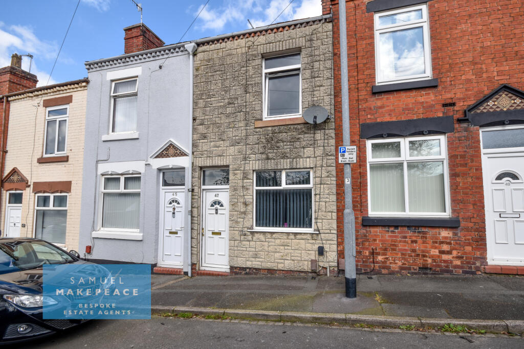
47 LINGARD STREET
STOKE-ON-TRENT, STOKE-ON-TRENT, STOKE-ON-TRENT ST6 1ED

Property details
Tenure
FREEHOLD
Floor area
73 m²
Council tax band
A
Last sold
£35,950 Jul 2003
Local average
£102,293 (+7.5%)
Deprivation
Decile 1 (1,186 of 33,755)
Street crime
431 incidents within 1 mile (May 2026)
Additional details
- Garden
- Yes
- Required access
- No
- Rights of way
- No
Description
ROOM DETAILS
INTERIOR
GROUND FLOOR
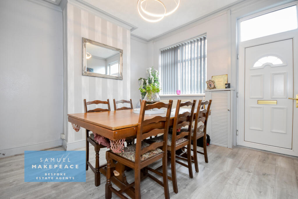
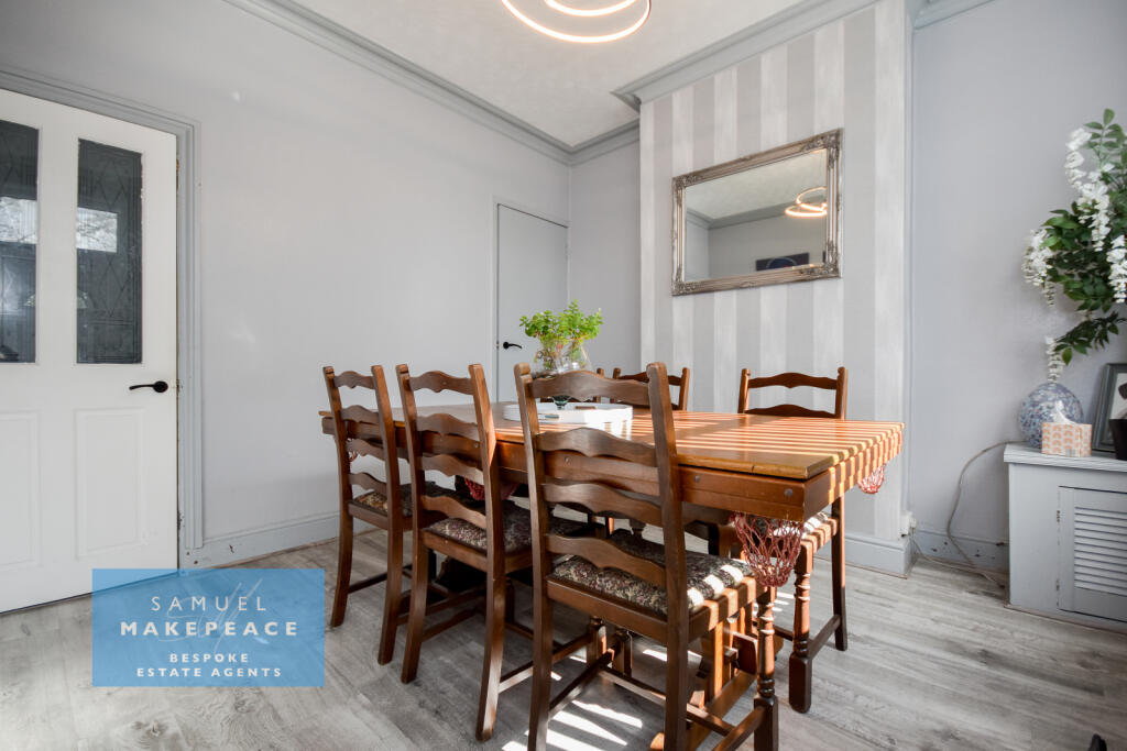
Dining Room - Double glazed window, laminate wood flooring and radiator.
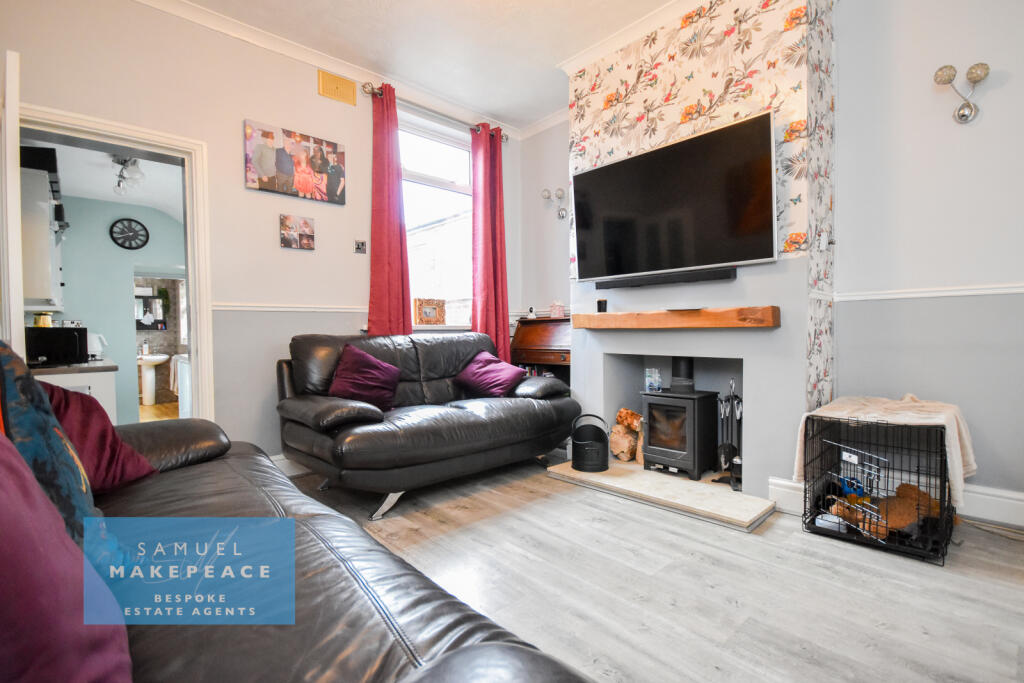
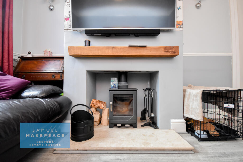
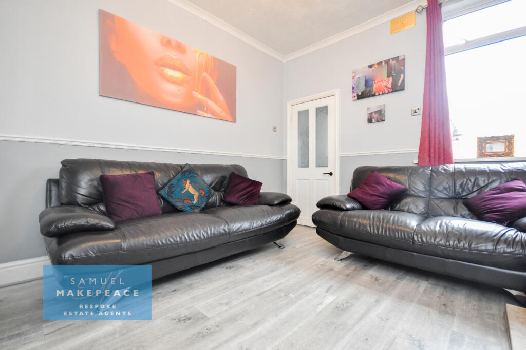
Lounge - Double glazed window, laminate wood flooring and radiator. Wood burner.
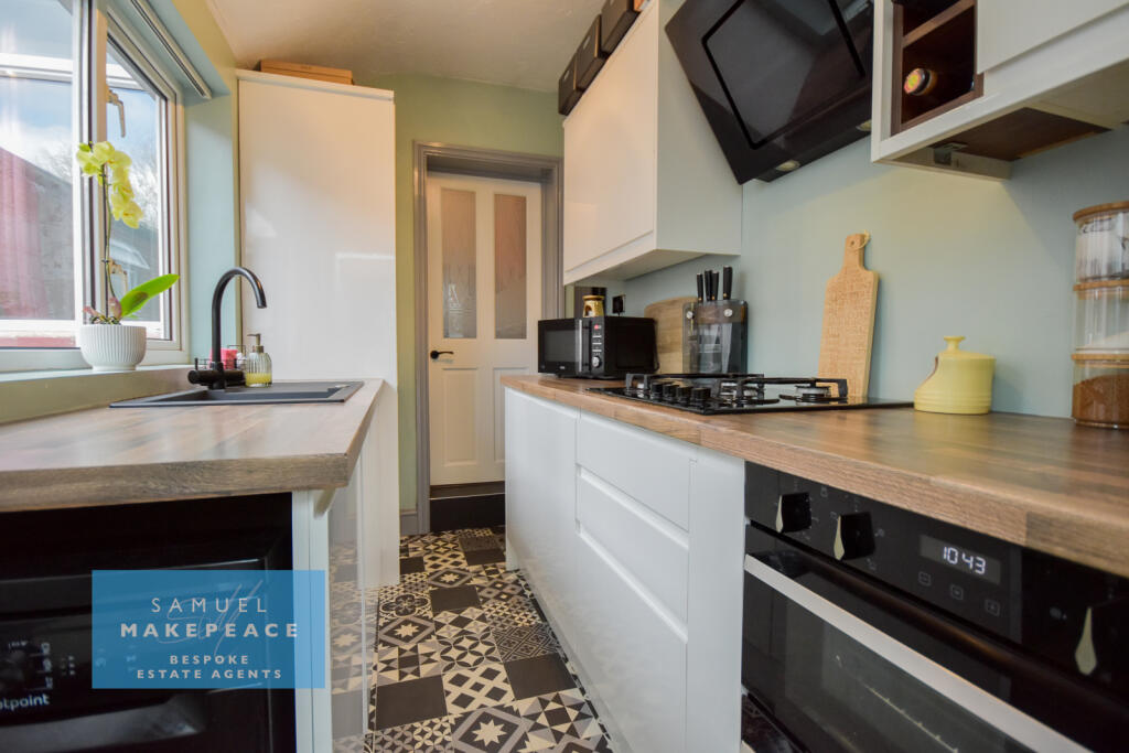
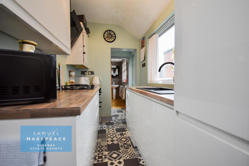
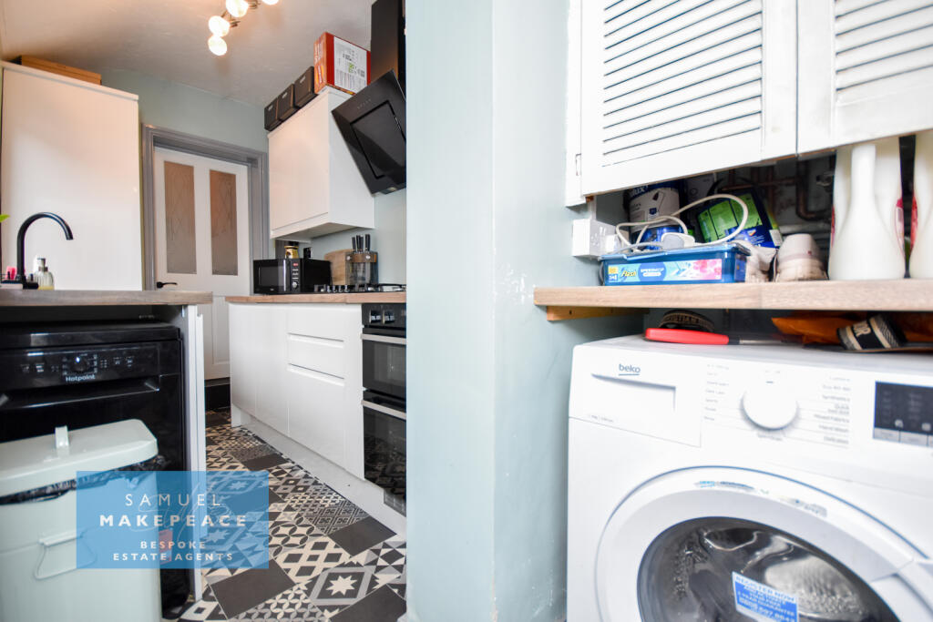
Kitchen - Double glazed window and single double glazed door. A range of fitted wall and base cupboards with work surfaces. Integrated fridge/freezer. Built under cooker with gas hob and cooker hood. Space for a washing machine and a dishwasher. Vinyl flooring and vertical panel cast iron radiator. Boiler cupboard.
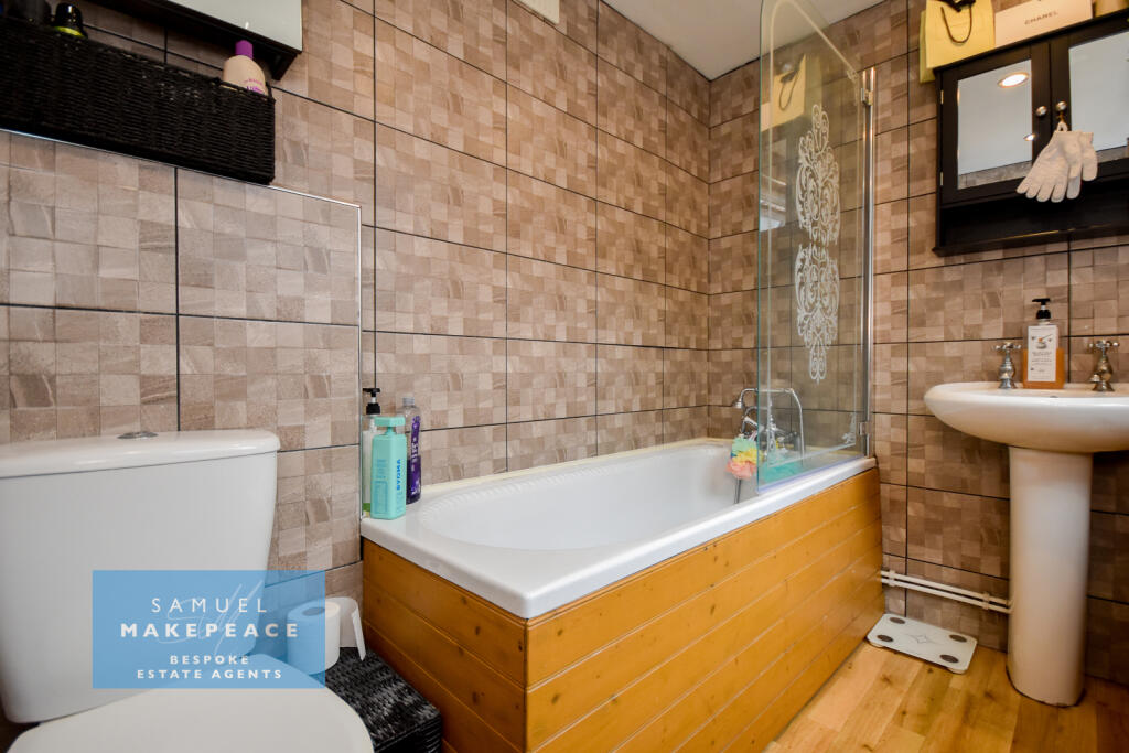
Bathroom - Double glazed window, bath with shower, LLWC, hand wash basin, vinyl flooring, tiled walls, extractor fan, radiator.
FIRST FLOOR
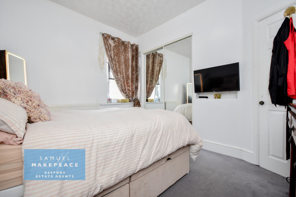
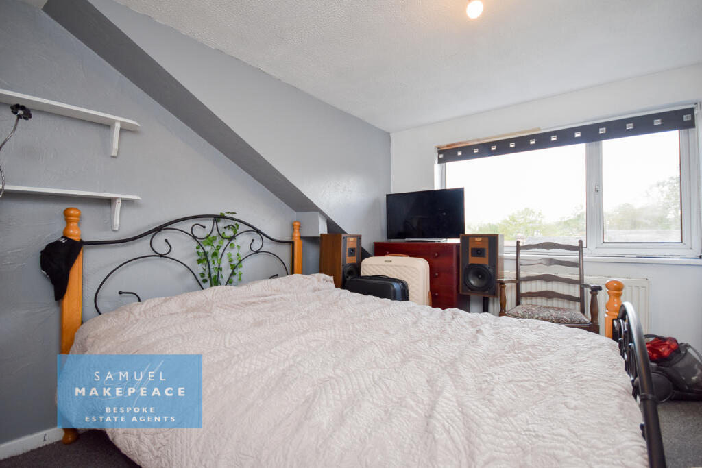
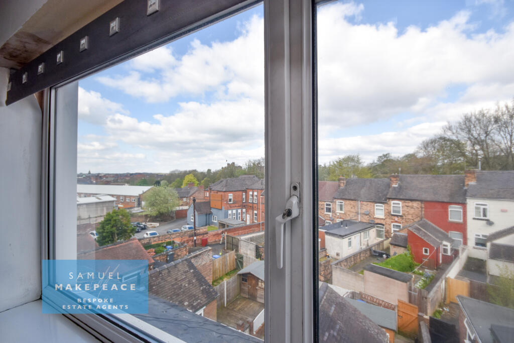
Bedroom One - Double glazed window, fitted wardrobes, built in cupboard over stairs, radiator.
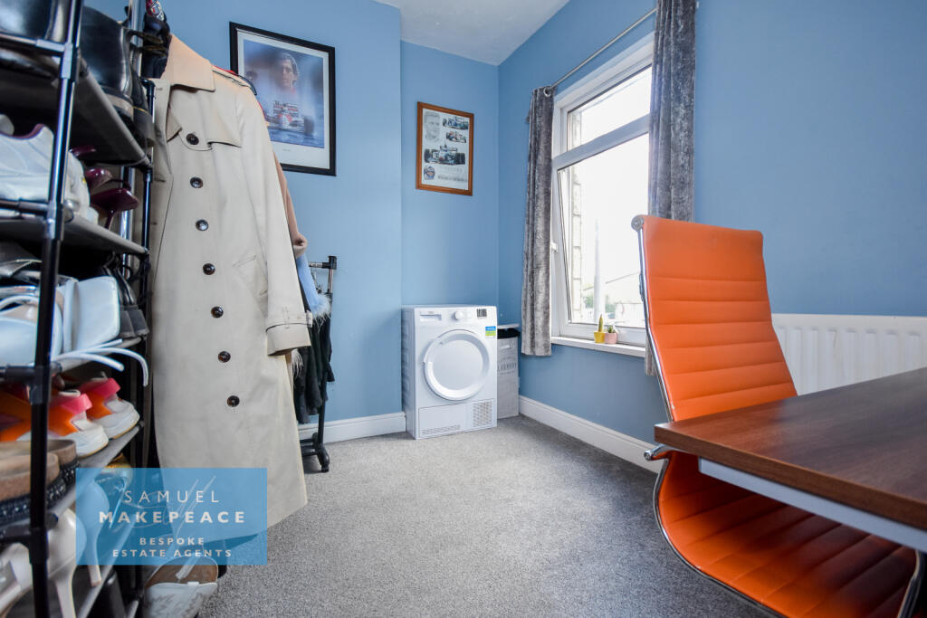
Bedroom Two - Double glazed window, radiator.
SECOND FLOOR
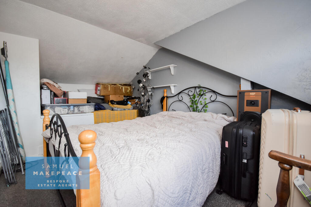
Bedroom Three - Double glazed window, radiator.
EXTERNAL
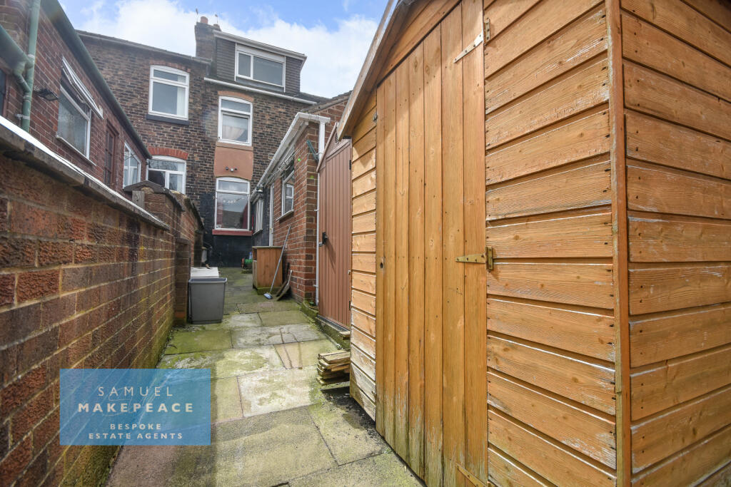
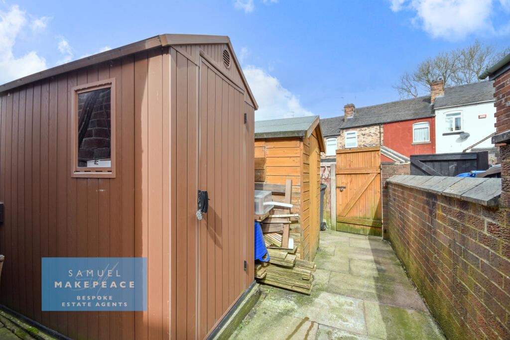
Rear Garden - Paved rear garden, two sheds.
Disclaimer:
All property particulars are provided in good faith and are believed to be accurate to the best of our knowledge at the time of publication. Samuel Makepeace (Newcastle & Stoke) Ltd t/a Samuel Makepeace Bespoke Estate Agents cannot accept any responsibility for any errors, omissions, or misstatements. Prospective purchasers are advised to verify the details independently and should not rely solely on the information provided when making decisions. These particulars remain the property of Samuel Makepeace Bespoke Estate Agents Stoke on Trent, Newcastle Under Lyme & Alsager.
Listed by
Stoke-on-Trent
Samuel Makepeace (Newcastle & Stoke) Ltd
Reference: 174799535
EPC Rating & Upgrade Cost
Fetching EPC data… Refresh this page in a moment.
Flood risk
Zone: 1
Risk: Low
Job (default Low)
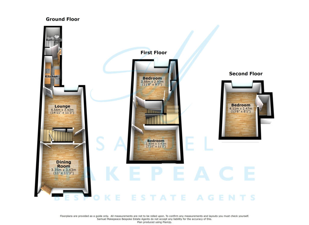
Floorplans
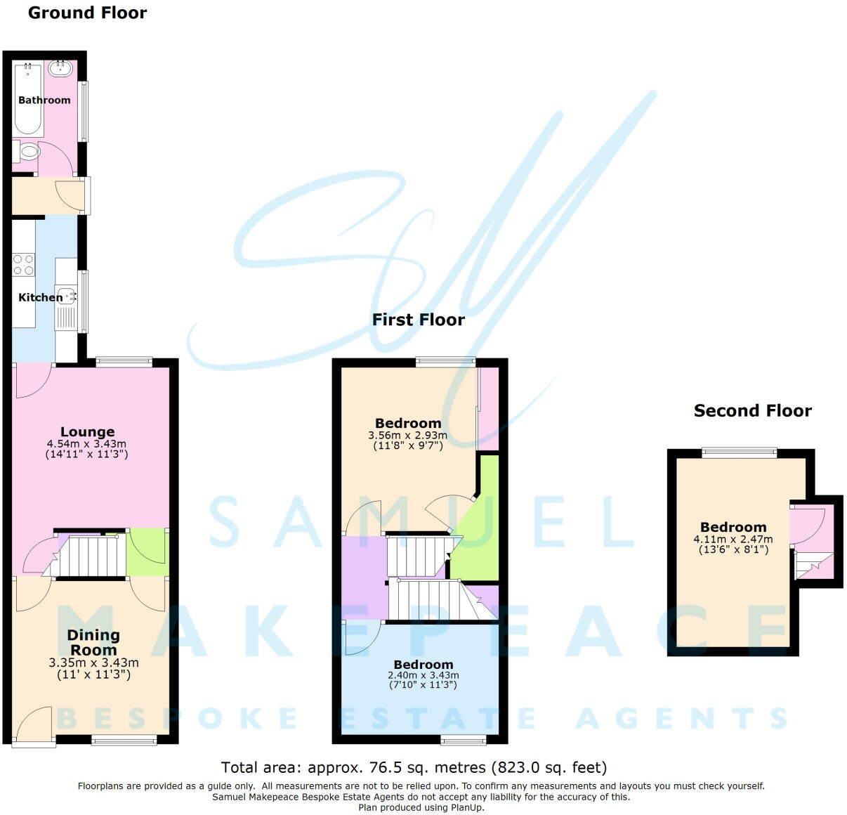
Floor Plan
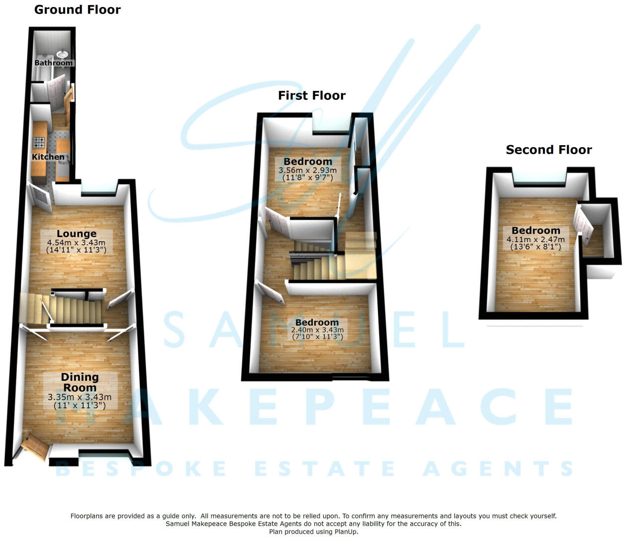
Floor Plan
Price history
| Event | Date | Price | % change |
|---|---|---|---|
| Listed for sale | — | £110,000 | +206% |
| Sold | 25/07/2003 (23 years ago) | £35,950 | — |
Source: HM Land Registry Price Paid Data. Crown copyright.
Sold Comparables
Same street and nearby sales within 0.25 miles (last 5 years). Data from Land Registry Price Paid.
| Address | Price | Date | Type |
|---|---|---|---|
| 48 BOWDEN STREET, STOKE-ON-TRENT, ST6 1JB | £112,500 | 01/04/2026 | Terraced |
| 156 MOORLAND ROAD, BURSLEM, STOKE-ON-TRENT, ST6 1EB | £61,500 | 09/01/2026 | Terraced |
| 32 BOWDEN STREET, STOKE-ON-TRENT, ST6 1JB | £105,000 | 12/12/2025 | Terraced |
| 103 MACCLESFIELD STREET, STOKE-ON-TRENT, ST6 1HX | £75,000 | 05/12/2025 | Terraced |
| 164 MOORLAND ROAD, BURSLEM, STOKE-ON-TRENT, ST6 1EB | £98,000 | 28/11/2025 | Terraced |
| 14 BOWDEN STREET, STOKE-ON-TRENT, ST6 1EZ | £108,000 | 22/05/2025 | Terraced |
| 10 BROADHURST STREET, STOKE-ON-TRENT, ST6 1EY | £85,000 | 17/07/2024 | Terraced |
| 36 BOWDEN STREET, STOKE-ON-TRENT, ST6 1JB | £95,000 | 09/07/2024 | Terraced |
| Same street 39 LINGARD STREET, STOKE-ON-TRENT, ST6 1ED | £72,500 | 21/11/2023 | Semi-detached |
| 10 BROADHURST STREET, STOKE-ON-TRENT, ST6 1EY | £90,500 | 31/10/2023 | Terraced |
| 25 BROADHURST STREET, STOKE-ON-TRENT, ST6 1EX | £55,000 | 09/10/2023 | Terraced |
| 188 MOORLAND ROAD, BURSLEM, STOKE-ON-TRENT, ST6 1EB | £90,000 | 11/08/2023 | Terraced |
| 212 MOORLAND ROAD, BURSLEM, STOKE-ON-TRENT, ST6 1EF | £81,000 | 03/07/2023 | Terraced |
| 145 MOORLAND ROAD, BURSLEM, STOKE-ON-TRENT, ST6 1JH | £83,000 | 30/06/2023 | Terraced |
| 70 PARK ROAD, STOKE-ON-TRENT, ST6 1EJ | £115,000 | 30/06/2023 | Terraced |
| 141 MOORLAND ROAD, BURSLEM, STOKE-ON-TRENT, ST6 1JH | £69,500 | 29/06/2023 | Terraced |
| 27 DARTMOUTH STREET, STOKE-ON-TRENT, ST6 1HA | £90,000 | 09/06/2023 | Terraced |
| 16 BROADHURST STREET, STOKE-ON-TRENT, ST6 1EY | £90,000 | 08/06/2023 | Terraced |
| 4 BOWDEN STREET, STOKE-ON-TRENT, ST6 1EZ | £75,000 | 02/06/2023 | Terraced |
| 15 BOWDEN STREET, STOKE-ON-TRENT, ST6 1JB | £70,500 | 05/04/2023 | Terraced |
| 193 MOORLAND ROAD, BURSLEM, STOKE-ON-TRENT, ST6 1JH | £110,000 | 22/03/2023 | Terraced |
| Same street 15 LINGARD STREET, STOKE-ON-TRENT, ST6 1ED | £184,995 | 24/06/2022 | Terraced |
| Same street 1 LINGARD STREET, STOKE-ON-TRENT, ST6 1ED | £173,995 | 27/05/2022 | Terraced |
| Same street 19 LINGARD STREET, STOKE-ON-TRENT, ST6 1ED | £204,995 | 11/02/2022 | Semi-detached |
| Same street 13 LINGARD STREET, STOKE-ON-TRENT, ST6 1ED | £174,995 | 26/11/2021 | Terraced |
| Same street 11 LINGARD STREET, STOKE-ON-TRENT, ST6 1ED | £177,995 | 29/10/2021 | Terraced |
| Same street 17 LINGARD STREET, STOKE-ON-TRENT, ST6 1ED | £200,995 | 28/09/2021 | Semi-detached |
| Same street 5 LINGARD STREET, STOKE-ON-TRENT, ST6 1ED | £149,995 | 24/09/2021 | Semi-detached |
| Same street 3 LINGARD STREET, STOKE-ON-TRENT, ST6 1ED | £147,995 | 27/08/2021 | Semi-detached |
| Same street 7 LINGARD STREET, STOKE-ON-TRENT, ST6 1ED | £199,995 | 27/08/2021 | Semi-detached |
| Same street 9 LINGARD STREET, STOKE-ON-TRENT, ST6 1ED | £204,500 | 27/08/2021 | Semi-detached |
Street average: £172,087 (11 sales)
Area average: £87,975 (20 sales)
Capital growth trend
Land Registry outcode average: last 12 months vs 5y and 10y ago (from sold prices).
House Price Index (HM Land Registry — official index, not sold-price averages): Stoke-on-Trent. Series: Terraced. As of April 2026.
Rental Range
Estimated market rent for Stoke-on-Trent. Low = conservative, Realistic = average, Optimistic = best case.
Based on Local Authority from postcode lookup → Stoke-on-Trent.
LHA (30th percentile) floor for Staffordshire North: £593/mo (Apr 2025 – Mar 2026)
Location
Nearby
Nearest stations, universities and amenities (distance from property).
| Type | Name | Distance |
|---|---|---|
| Bus stop | Moorland Road, opposite Park Road | 0.1 miles |
| Bus stop | Moorland Road, Park Road | 0.1 miles |
| Shop | Electro Appliances | 0.2 miles |
| Shop | PVFC Shop | 0.2 miles |
| Hospital | Haywood Hospital Walk-in Centre | 0.7 miles |
| Hospital | Haywood Hospital | 0.7 miles |
| Train station | Longport | 1.2 miles |
| University | University of Staffordshire Stoke Campus | 2.6 miles |
| Train station | Stoke-on-Trent | 2.7 miles |
Street-level crime
| Category | Count |
|---|---|
| Violence and sexual offences | 156 |
| Anti-social behaviour | 93 |
| Criminal damage and arson | 37 |
| Public order | 34 |
| Other theft | 29 |
| Vehicle crime | 21 |
| Burglary | 16 |
| Drugs | 12 |
| Shoplifting | 8 |
| Possession of weapons | 7 |
| Other crime | 6 |
| Robbery | 6 |
| Bicycle theft | 3 |
| Theft from the person | 3 |
| Total incidents | 431 |
Within 1 mile during May 2026. Source: data.police.uk (England & Wales).
Schools nearby
Nearest open schools with Ofsted ratings (England). Closed schools are not shown. Data from Get Information about Schools and Ofsted.
| Name | Type | Distance | Ofsted |
|---|---|---|---|
| The Valiant School | Other | 0.2 miles | — (No rating) |
| Moorpark Junior School | Primary | 0.2 miles | Good — 11 Jul 2016 |
| Jackfield Infant School | Primary | 0.3 miles | Good — 18 Jan 2023 |
| North Road Academy | Other | 0.4 miles | Requires improvement — 2 Apr 2023 |
| Haywood Academy | Secondary | 0.6 miles | Good — 14 Jun 2023 |
Rental Comparables
Residential lets from OpenRent and Rightmove for the area (same bedroom count). Use to validate rent estimates. Student lets are excluded.
| Title | Rent | Beds | Distance | As seen on |
|---|---|---|---|---|
| Lingard Street, Burslem, Stoke-on-Trent, ST6 | £750/mo | — | 0.05 miles | Rightmove |
| Bowden Street, Stoke-On-Trent, ST6 | £850/mo | 3 | 0.17 miles | Rightmove |
| Minster Street, Stoke-On-Trent | £700/mo | — | 0.25 miles | Rightmove |
| Walley Place, STOKE-ON-TRENT | £825/mo | 3 | 0.37 miles | Rightmove |
| Rent To Buy | £920/mo | 3 | 0.46 miles | Rightmove |
| Shaftesbury Avenue, Stoke-On-Trent | £975/mo | 3 | 0.52 miles | Rightmove |
| Lower Hadderidge, Stoke-On-Trent, ST6 | £925/mo | 3 | 0.57 miles | Rightmove |
| Barrett Drive, Stoke-on-trent | £925/mo | 3 | 0.83 miles | Rightmove |
| Scott Lidgett Road,Longport, Stoke-on-Trent | £825/mo | 3 | 1.09 miles | Rightmove |
| High Street, Tunstall | £550/mo | — | 1.12 miles | Rightmove |
| Furlong Road, Tunstall, Stoke-on-Trent | £950/mo | 3 | 1.42 miles | Rightmove |
| Clanway Street, Stoke-On-Trent, ST6 | £895/mo | 3 | 1.49 miles | Rightmove |
| Hoskins Road, Tunstall, ST6 | £950/mo | 3 | 1.52 miles | Rightmove |
| Jacqueline Street, Tunstall, Stoke-on-Trent, Staffordshire, ST6 | £850/mo | 3 | 1.6 miles | Rightmove |
Average rent: £849/mo (14 listings)
Rent-driven metrics
Based on OpenRent comparables.
- This street — Gross yield for this street only (Land Registry sales + rental comparables, same postcode + street).
- Rent ratio — Monthly rent ÷ purchase price (1% rule). 1%+ = strong, 0.8–1% = okay, <0.8% = weak for cashflow.
- Max investor price — Rent ÷ 0.8%; the price at which rent would be 0.8% of price (Stoke-style target).
- Target investor price — Rent ÷ 1%; the price at which rent would be 1% of price (strong cashflow band).
- Gross yield — Annual rent as % of purchase price (no costs).
- Cost-to-rent — Price ÷ annual rent (from OpenRent comparables). Under 14× = strong, 14–16× = acceptable, 17×+ = compressed.
- Cashflow — Rent minus mortgage, 10% maintenance, £25/mo compliance. Assumes 75% LTV, 3.95% APR (5yr fixed), 25yr term.
- ROI — Annual profit ÷ cash in (deposit + 4% purchase costs).