74 HAZLEWELL ROAD
LONDON, GREATER LONDON SW15 6UR
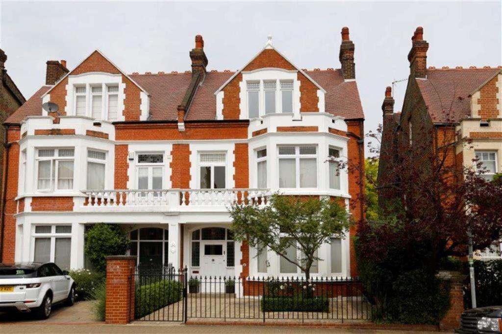
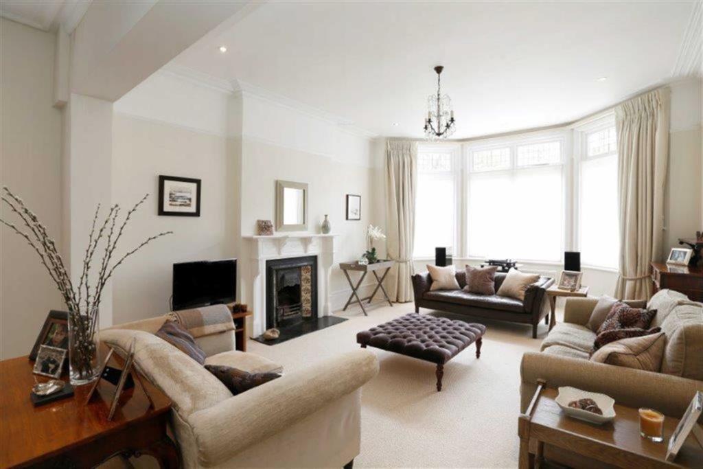
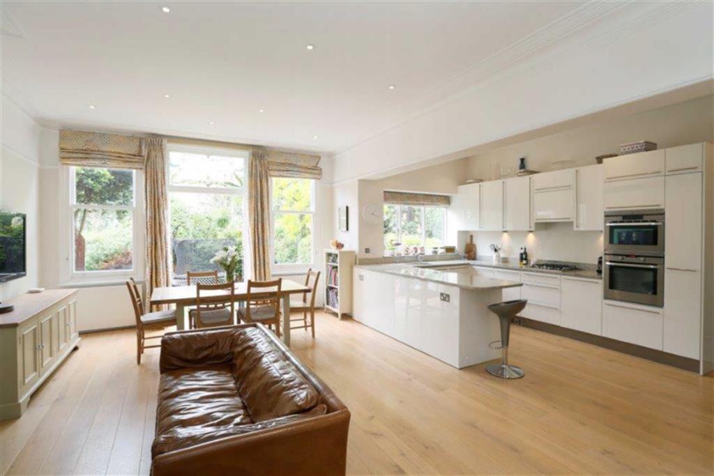
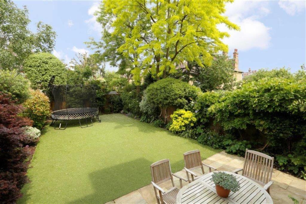
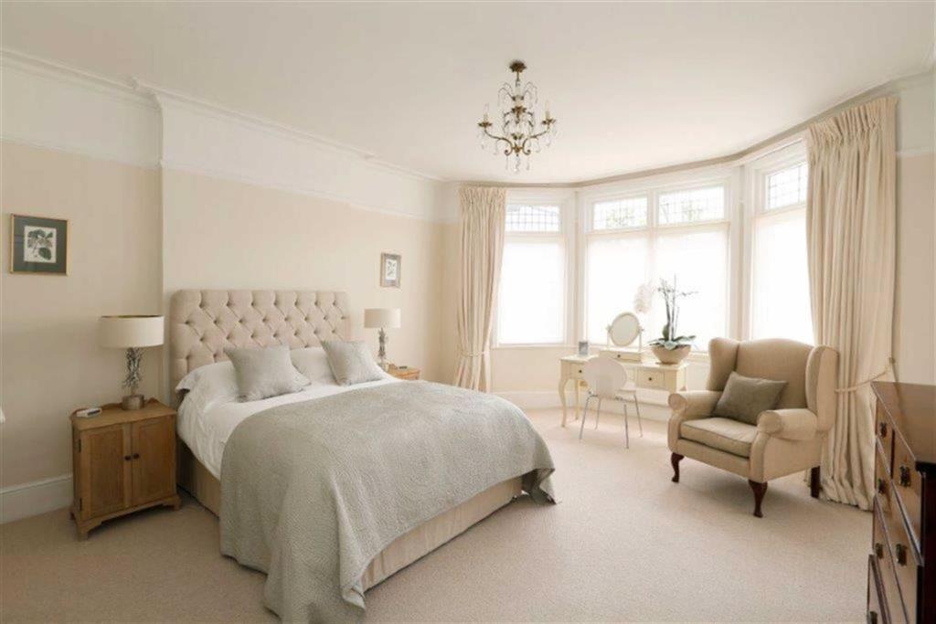
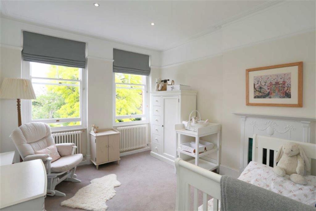
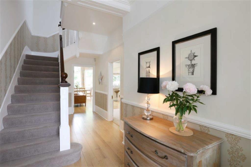
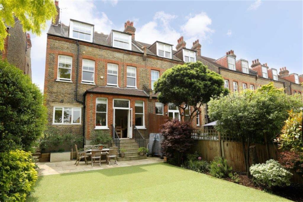
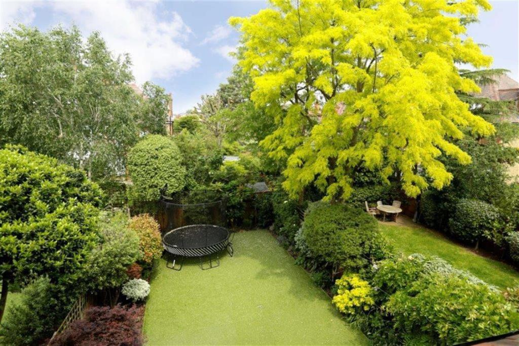
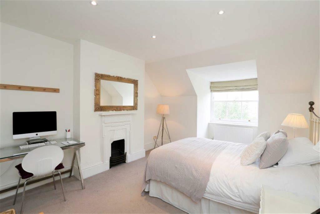
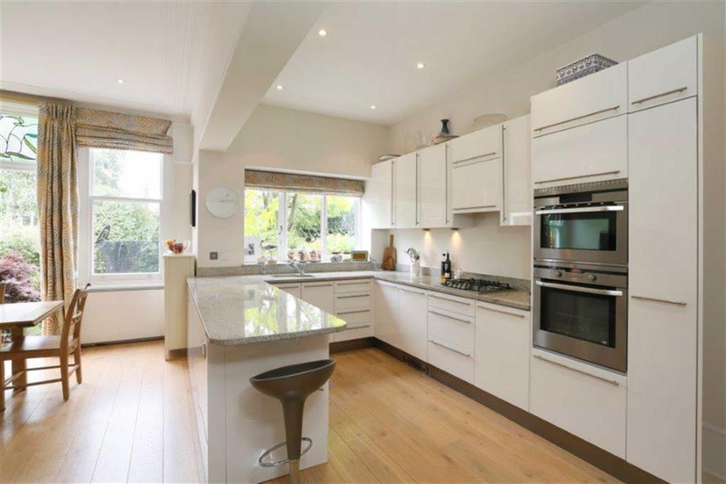
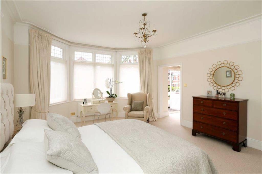
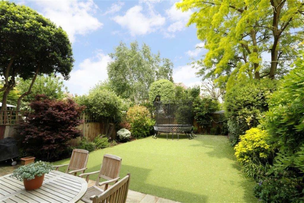
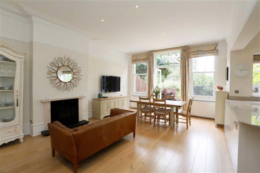
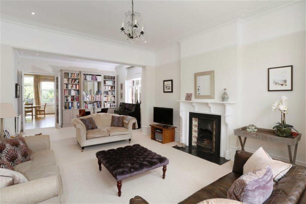
Photo 1 Photo 2 Photo 3 Photo 4 Photo 5 Photo 6 Photo 7 Photo 8 Photo 9 Photo 10 Photo 11 Photo 12 Photo 13 Photo 14 Photo 15 Photo 16 Photo 17 Photo 18 Photo 19
/ 19
Property details
Floor area
273 m²
Last sold
£2,300,000 Oct 2016
Local average
£1,425,614 (+75.4%)
Deprivation
Decile 9 (29,021 of 33,755)
Street crime
414 incidents within 1 mile (Apr 2026)
Key features
- 3,833 SQUARE FEET (INCLUDING STORAGE AND LOFT AREA)
- ENTRANCE HALLWAY
- DOUBLE RECEPTION ROOM
- KITCHEN/DINING/FAMILY ROOM
- DOWNSTAIRS CLOAKROOM
- MASTER BEDROOM SUITE
- FIVE FURTHER DOUBLE BEDROOMS
- TWO FAMILY BATHROOMS
- CLOAKROOM
- LOFT AREA
Additional details
- Parking
- Yes
- Garden
- Yes
Description
DISCLAIMERThese particulars are intended to give a fair and substantially correct overall description for the guidance of intending purchasers and do not constitute an offer or part of a contract. Prospective purchasers and/or lessees ought to seek their own professional advice.
All descriptions, dimensions, areas, references to condition and necessary permissions for use and occupation and other details are given in good faith and are believed to be correct, but any intending purchasers should not rely on them as statements or representations of fact, but must satisfy themselves by inspection or otherwise as to the correctness of each of them.
All measurements are approximate.
Listed by
Putney
Warren Residential Sales & Lettings
Reference: 54555550
EPC Rating & Upgrade Cost
Fetching EPC data… Refresh this page in a moment.
Flood risk
Zone: 1
Risk: Low
Job (default Low)
Floorplans
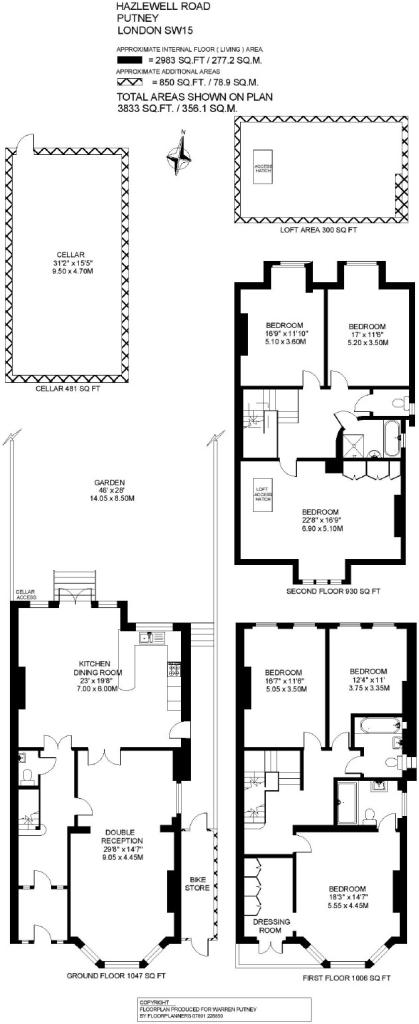
Floorplan 1
FENSA Certificates
This property has 2 FENSA certificate(s) on record, indicating window/door installations by FENSA-approved installers.
FENSA Certificate #12398284
Property Details
Street: 74 Hazlewell Road
Town: LONDON
Postcode: SW15 6UR
Installation Details
Items: 13 windows and 2 doors
Certificate Issued: 19/06/2017
Work Completed: 28/03/2017
This certificate data was retrieved from FENSA's database
FENSA Certificate #16066060 Recent
Property Details
Street: 74 Hazlewell Road
Town: LONDON
Postcode: SW15 6UR
Installation Details
Items: 3 windows
Certificate Issued: 26/11/2023
Work Completed: 31/10/2023
This certificate data was retrieved from FENSA's database
What is FENSA? FENSA (Fenestration Self-Assessment Scheme) is a government-authorised scheme that monitors building regulation compliance for replacement windows and doors. Certificates indicate that work was completed by FENSA-approved installers.
Price history
| Event | Date | Price | % change |
|---|---|---|---|
| Sold | 14/10/2016 (9 years ago) | £2,300,000 | — |
Source: HM Land Registry Price Paid Data. Crown copyright.
Sold Comparables
Same street and nearby sales within 0.25 miles (last 5 years). Data from Land Registry Price Paid.
| Address | Price | Date | Type |
|---|---|---|---|
| 22 CAMPION ROAD, LONDON, WANDSWORTH, GREATER LONDON, SW15 6NW | £3,076,750 | 04/09/2025 | Semi-detached |
| 29 COALECROFT ROAD, LONDON, WANDSWORTH, GREATER LONDON, SW15 6LW | £2,260,000 | 07/08/2023 | Semi-detached |
| Same street 76 HAZLEWELL ROAD, LONDON, WANDSWORTH, GREATER LONDON, SW15 6UR | £2,700,000 | 28/06/2023 | Semi-detached |
| 18 COALECROFT ROAD, LONDON, WANDSWORTH, GREATER LONDON, SW15 6LP | £915,000 | 08/06/2023 | Semi-detached |
| 46 HAZLEWELL ROAD, LONDON, WANDSWORTH, GREATER LONDON, SW15 6LR | £3,325,000 | 14/10/2022 | Semi-detached |
| 111 HOWARDS LANE, LONDON, WANDSWORTH, GREATER LONDON, SW15 6NZ | £2,850,000 | 04/11/2021 | Semi-detached |
| 5 CAMPION ROAD, LONDON, WANDSWORTH, GREATER LONDON, SW15 6NN | £2,370,000 | 31/08/2021 | Semi-detached |
| 11 LUTTRELL AVENUE, LONDON, WANDSWORTH, GREATER LONDON, SW15 6PA | £2,400,000 | 16/06/2021 | Semi-detached |
Street average: £2,700,000 (1 sale)
Area average: £2,456,679 (7 sales)
Capital growth trend
Land Registry outcode average: last 12 months vs 5y and 10y ago (from sold prices).
House Price Index (HM Land Registry — official index, not sold-price averages): Wandsworth. Series: Semi-detached. As of March 2026.
Rental Range
Estimated market rent for Wandsworth. Low = conservative, Realistic = average, Optimistic = best case.
Based on Local Authority from postcode lookup → Wandsworth.
LHA (30th percentile) floor for Stevenage & North Herts: Apr 2025 – Mar 2026
Location
Nearby
Nearest stations, universities and amenities (distance from property).
| Type | Name | Distance |
|---|---|---|
| Bus stop | Hail & Ride Genoa Avenue | 0.2 miles |
| Bus stop | Hail & Ride Whitnell Way | 0.2 miles |
| Shop | Al Laundrette & Dry Clean | 0.3 miles |
| Shop | Harding's Newsagent | 0.3 miles |
| Train station | Putney | 0.7 miles |
| Train station | Barnes | 0.7 miles |
| University | BIMM Institute London | 2.1 miles |
| University | Horton Halls Reception | 2.8 miles |
| Hospital | Bridge Lane Health Centre | 2.9 miles |
| Hospital | Chapel Orchard Day Surgery | 4.7 miles |
Street-level crime
| Category | Count |
|---|---|
| Violence and sexual offences | 99 |
| Anti-social behaviour | 92 |
| Shoplifting | 37 |
| Other theft | 36 |
| Vehicle crime | 27 |
| Public order | 26 |
| Criminal damage and arson | 24 |
| Drugs | 21 |
| Burglary | 20 |
| Bicycle theft | 15 |
| Theft from the person | 11 |
| Robbery | 4 |
| Possession of weapons | 2 |
| Total incidents | 414 |
Within 1 mile during Apr 2026. Source: data.police.uk (England & Wales).
Schools nearby
Nearest open schools with Ofsted ratings (England). Closed schools are not shown. Data from Get Information about Schools and Ofsted.
| Name | Type | Distance | Ofsted |
|---|---|---|---|
| Granard Primary School | Primary | 0.2 miles | Good — 6 Jul 2023 |
| Falcons School | Other | 0.3 miles | — (No rating) |
| Ark Putney Academy | Secondary | 0.4 miles | Good — 12 Jan 2023 |
| Sacred Heart Catholic Primary School, Roehampton | Primary | 0.5 miles | Good — 10 Jul 2023 |
| Our Lady of Victories Catholic Primary School | Primary | 0.5 miles | Good — 10 May 2022 |
Rental Comparables
Residential lets from OpenRent and Rightmove for the area. Bedroom counts vary — use the Beds column to compare like-for-like lets. Student lets are excluded.
| Title | Rent | Beds | Distance | As seen on |
|---|---|---|---|---|
| 2 Bed Flat, Hazlewell Road, SW15 | £2,500/mo | 2 | 0.1 miles | OpenRent |
| 2 Bed Flat, Dealtry Road, SW15 | £2,400/mo | 2 | 0.18 miles | OpenRent |
| 2 Bed Flat, Chartfield Avenue, SW15 | £2,450/mo | 2 | 0.31 miles | OpenRent |
| 2 Bed Flat, Belvedere Court, SW15 | £2,450/mo | 2 | 0.34 miles | OpenRent |
| 2 Bed Flat, Halford House, SW15 | £1,995/mo | 2 | 0.35 miles | OpenRent |
| 2 Bed Flat, Westleigh Avenue, SW15 | £2,300/mo | 2 | 0.39 miles | OpenRent |
Average rent: £2,349/mo (6 listings)
Rent-driven metrics
Based on OpenRent comparables.
- This street — Gross yield for this street only (Land Registry sales + rental comparables, same postcode + street).
- Rent ratio — Monthly rent ÷ purchase price (1% rule). 1%+ = strong, 0.8–1% = okay, <0.8% = weak for cashflow.
- Max investor price — Rent ÷ 0.8%; the price at which rent would be 0.8% of price (Stoke-style target).
- Target investor price — Rent ÷ 1%; the price at which rent would be 1% of price (strong cashflow band).
- Gross yield — Annual rent as % of purchase price (no costs).
- Cost-to-rent — Price ÷ annual rent (from OpenRent comparables). Under 14× = strong, 14–16× = acceptable, 17×+ = compressed.
- Cashflow — Rent minus mortgage, 10% maintenance, £25/mo compliance. Assumes 75% LTV, 3.95% APR (5yr fixed), 25yr term.
- ROI — Annual profit ÷ cash in (deposit + 4% purchase costs).