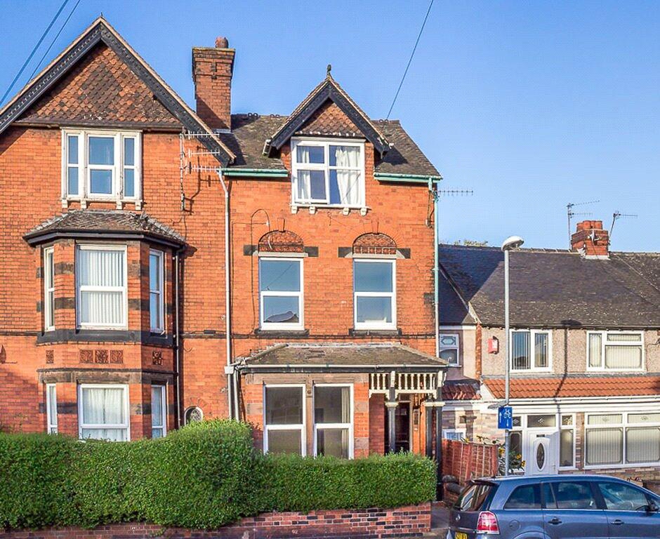
Cauldon Road
Stoke-on-Trent, Staffordshire, ST4, ST4 2DX
£425 pcm
Property details
Council tax band
A
Deprivation
Decile 3 (9,441 of 33,755)
Street crime
648 incidents within 1 mile (Mar 2026)
Key features
- Close To Local Shops And Amenities
- A Short Walk From Stoke Train Station
- Moments From Staffordshire Universtity
- Well-Maintained Green Spaces On Your Doorstep
- Good Commuter And Transport Links
Additional details
- Electricity
- Mains supply
- Water
- Mains supply
- Sewerage
- Mains supply
- Heating
- Electric
- Accessibility
- No wheelchair access
- Parking
- On street, Permit
- Listed property
- No
- Restrictions
- No
- Required access
- No
- Flooded in last 5 years
- No
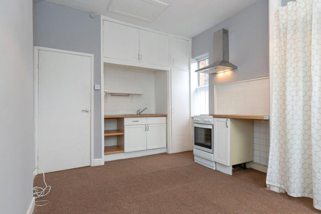
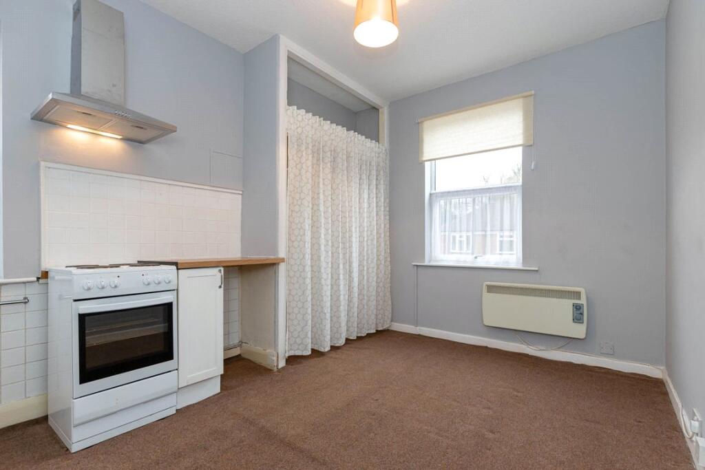
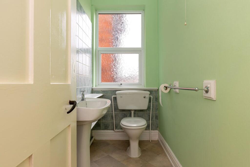
Description
Located in the thriving, hustle and bustle of Shelton, this studio apartment is ideally placed for access to good local schools, such as Staffordshire University, and shops and amenities. Stoke-on-Trent Train Station is a couple of minutes walk away and the property is next to a useful bus route.
The surrounding area is alive with a strong sense of community and has excellent access to the local motorway network, as well as having the Stoke-On-Trent train station within walking distance.
Do not hesitate to get in touch to discuss a viewing if you feel this is an opportunity that might interest you.
Important bits: NO pets under any circumstances. A guarantor is preferred but not essential. NO smokers please. This property is let unfurnished are we are looking for a long term let ideally.
Listed by
Macclesfield
The Property Franchise Group
Reference: 88052103
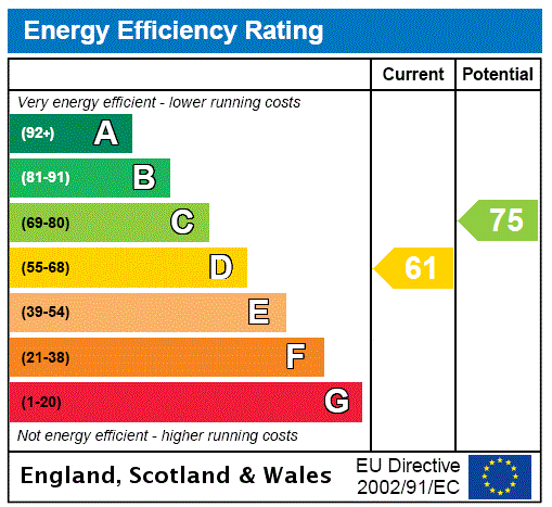
EPC ratings on this postcode
We don't have a matched EPC for this property yet. Below are efficiency scores and details for other addresses on this postcode.
| Address | Current | Potential | Floor area | Age band | Type |
|---|---|---|---|---|---|
| 105 Cauldon Road, STOKE-ON-TRENT | 69 | 80 | 138 m² | England and Wales: 1930-1949 | Terraced |
| 105 Cauldon Road, STOKE-ON-TRENT | 62 | 80 | 149 m² | England and Wales: 1930-1949 | Terraced |
| 107 Cauldon Road, STOKE-ON-TRENT | 73 | 81 | 121 m² | England and Wales: 1930-1949 | Terraced |
| 107, Cauldon Road, STOKE-ON-TRENT | 62 | 77 | 121 m² | England and Wales: 1930-1949 | Detached |
| 109 Cauldon Road, STOKE-ON-TRENT | 77 | 84 | 181 m² | England and Wales: 1930-1949 | Terraced |
| 109 Cauldon Road, STOKE-ON-TRENT | 66 | 82 | 196 m² | England and Wales: 1930-1949 | Detached |
| 111, Cauldon Road, STOKE-ON-TRENT | 59 | 82 | 91 m² | England and Wales: 1930-1949 | Detached |
| 111, Cauldon Road, STOKE-ON-TRENT | 59 | 82 | 91 m² | England and Wales: 1930-1949 | Detached |
| 111, Cauldon Road, STOKE-ON-TRENT | 60 | 85 | 56 m² | England and Wales: 1930-1949 | Detached |
| 113 Cauldon Road, STOKE-ON-TRENT | 76 | 82 | 180 m² | England and Wales: 1930-1949 | Detached |
| 117, Cauldon Road, STOKE-ON-TRENT | 51 | 78 | 116 m² | England and Wales: 1930-1949 | Detached |
| 119 Cauldon Road, STOKE-ON-TRENT | 79 | 87 | 181 m² | England and Wales: 1930-1949 | Terraced |
| 119 Cauldon Road, STOKE-ON-TRENT | 65 | 80 | 196 m² | England and Wales: 1930-1949 | Terraced |
| 121 Cauldon Road, STOKE-ON-TRENT | 82 | 84 | 123 m² | England and Wales: 1950-1966 | Terraced |
| 121, Cauldon Road, STOKE-ON-TRENT | 67 | 79 | 128 m² | England and Wales: 1930-1949 | Terraced |
Flood risk
Zone: 1
Risk: Low
Job (default Low)
Floorplans
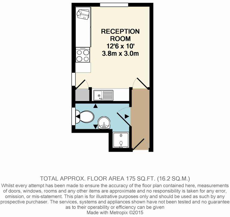
2d Floorplan
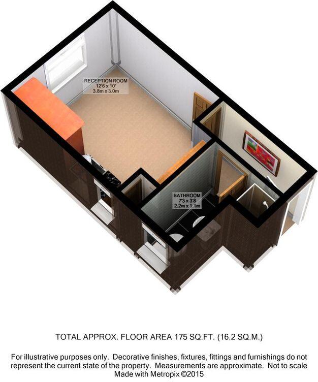
3d Floorplan
EPC Graphs
EPC Rating Graph
Rental Range
Estimated market rent for Stoke-on-Trent. Low = conservative, Realistic = average, Optimistic = best case.
Based on Local Authority from postcode lookup → Stoke-on-Trent.
LHA (30th percentile) floor for Staffordshire North: £424/mo (Apr 2025 – Mar 2026)
Location
Address
Cauldon Road
Nearby
Nearest stations, universities and amenities (distance from property).
| Type | Name | Distance |
|---|---|---|
| Bus stop | Seaford Street | 0.0 miles |
| Shop | Zagros Store | 0.1 miles |
| Shop | Azin Gents Hairdressers | 0.1 miles |
| Bus stop | Stoke-on-Trent College | 0.1 miles |
| University | University of Staffordshire Stoke Campus | 0.2 miles |
| Train station | Stoke-on-Trent | 0.3 miles |
| Hospital | North Staffordshire Hospital | 1.1 miles |
| Hospital | Hartshill Medical Centre | 1.3 miles |
| Train station | Longton | 2.4 miles |
Street-level crime
| Category | Count |
|---|---|
| Violence and sexual offences | 196 |
| Anti-social behaviour | 119 |
| Public order | 67 |
| Criminal damage and arson | 50 |
| Shoplifting | 43 |
| Other theft | 41 |
| Drugs | 32 |
| Burglary | 28 |
| Vehicle crime | 23 |
| Robbery | 14 |
| Other crime | 12 |
| Bicycle theft | 10 |
| Possession of weapons | 10 |
| Theft from the person | 3 |
| Total incidents | 648 |
Within 1 mile during Mar 2026. Source: data.police.uk (England & Wales).
Schools nearby
Nearest open schools with Ofsted ratings (England). Closed schools are not shown. Data from Get Information about Schools and Ofsted.
| Name | Type | Distance | Ofsted |
|---|---|---|---|
| Excellence Girls Academy | Other | 0.1 miles | Good — 16 Jun 2024 |
| Staffordshire University | Other | 0.2 miles | — (No rating) |
| Stoke-on-Trent College | Other | 0.2 miles | — (No rating) |
| The Registry | Other | 0.2 miles | — (No rating) |
| Edison Pace School | Other | 0.3 miles | Good — 14 Dec 2022 |
Rental Comparables
Residential lets from OpenRent and Rightmove for the area (same bedroom count). Use to validate rent estimates. Student lets are excluded.
Average rent: £610/mo (45 listings)
Enter House Number
Enter the house number to help us retrieve more accurate pricing history and property data.
Please log in to submit or correct the house number for this listing.
Log in to continue