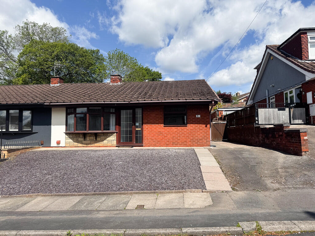
Coleridge Road
Blurton, Stoke-on-Trent, ST3 2ER
£1,195 pcm
Property details
Council tax band
C
Deprivation
Decile 6 (19,786 of 33,755)
Street crime
335 incidents within 1 mile (May 2026)
Key features
- Refurbished Bungalow
- Three Bedrooms
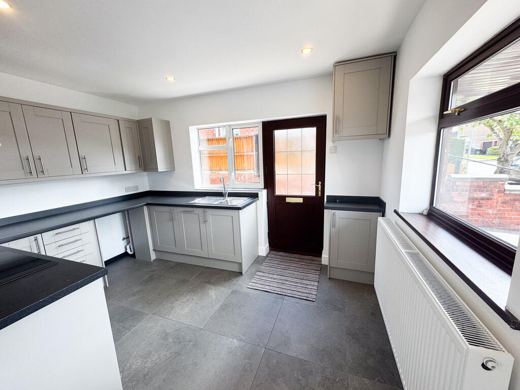
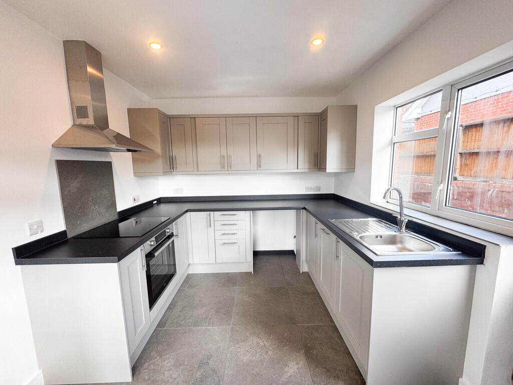
- New Kitchen
- New Bathroom
- Large Private Garden
- Available Now
- Air Source Heat Pump
- Council Tax Band C
- Close to Longton and The A50
- Viewing Advised
Additional details
- Electricity
- Mains supply
- Water
- Mains supply
- Heating
- Air source heat pump
- Parking
- Off street
- Garden
- Yes
Description
DINING KITCHEN 12' 2" x 8' 9" (3.71m x 2.67m) Stunning newly fitted kitchen with integrated dishwasher, oven and induction hob. UPVC double glazed door to the side.
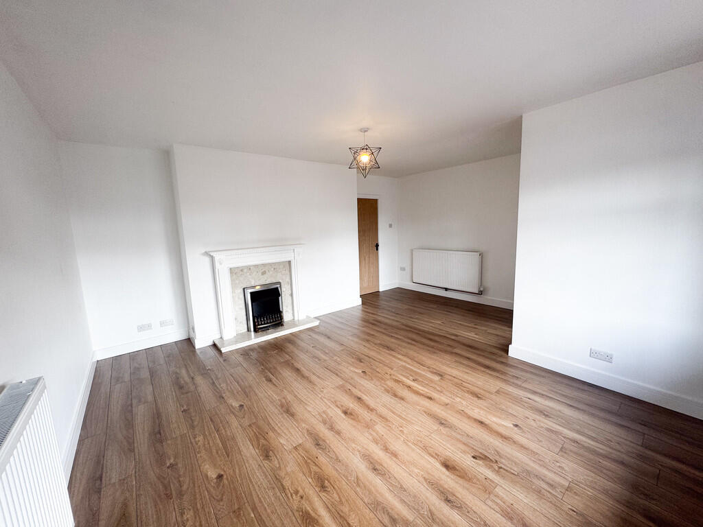
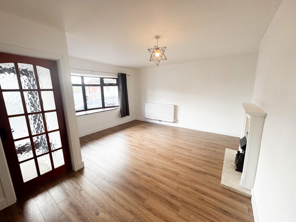
LOUNGE/DINING ROOM 17' 1" x 15' 7" (5.21m x 4.75m) Feature fireplace with electric living flame effect fire.
INNER HALL Access to the loft, doors leading into:
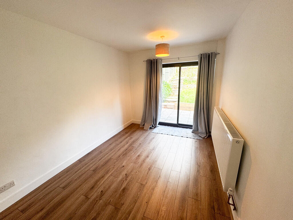
BEDROOM 13' 3" x 8' 9" (4.04m x 2.67m) Double glazed patio door leading to the garden.
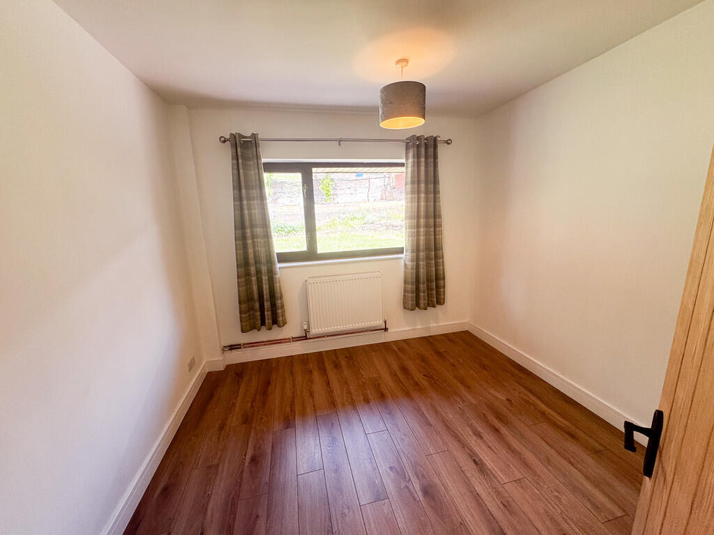
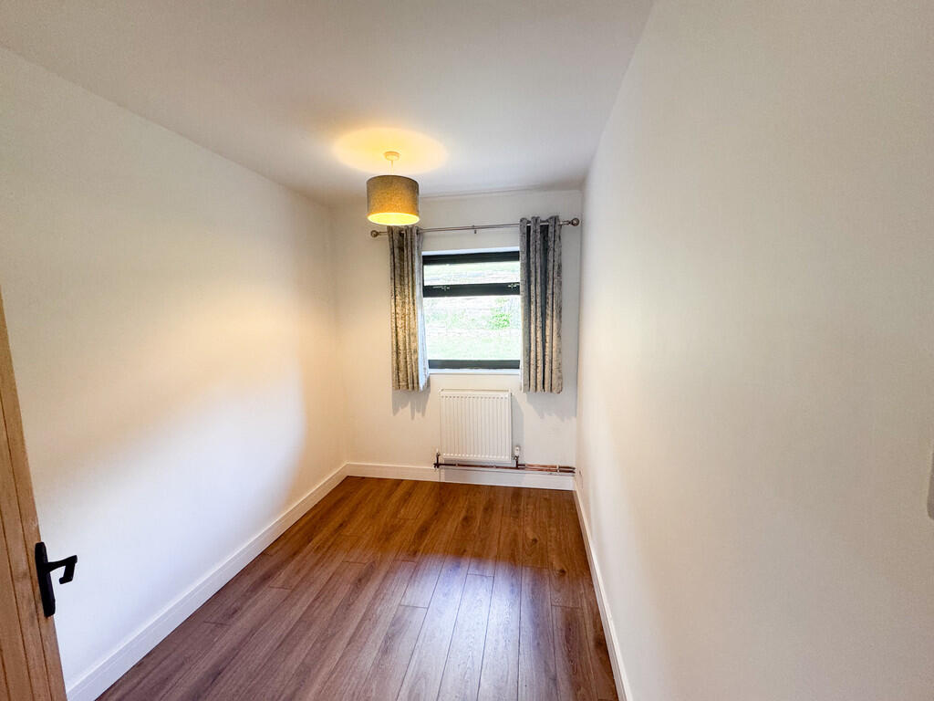
BEDROOM 10' 0" x 9' 9" (3.05m x 2.97m)
BEDROOM 9' 10" x 6' 10" (3m x 2.08m)
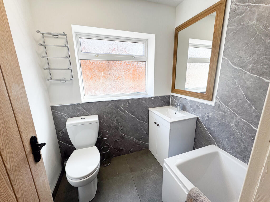
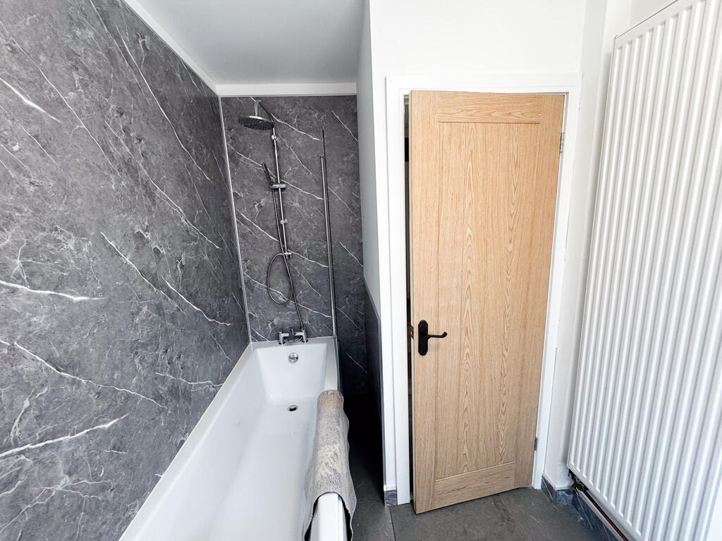
BATHROOM/WC 8' 4" x 6' 3" (2.54m x 1.91m) Newly fitted bathroom comprising of: Bath with shower over, vanity sink unit, WC.
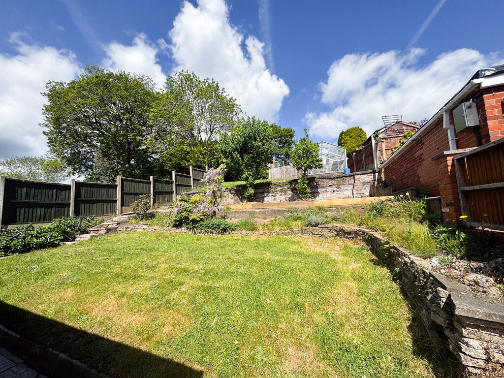
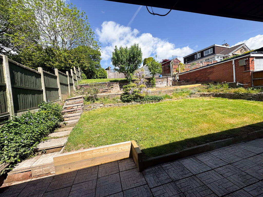
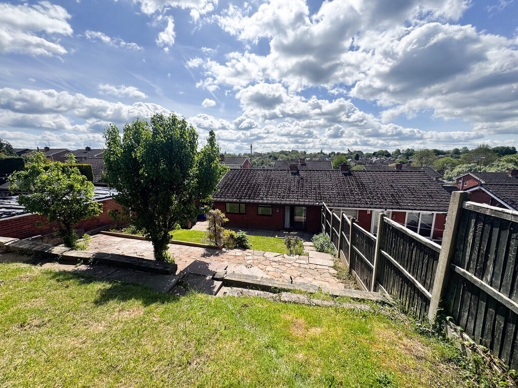
EXTERIOR ** To the front there is a low maintenance garden and a driveway. Double gates lead to the rear garden.
The garden is of an excellent size, it has a patio area and lawn.
Listed by
Stoke-on-Trent
Findahome Online
Reference: 88227585
EPC ratings on this postcode
We don't have a matched EPC for this property yet. Below are efficiency scores and details for other addresses on this postcode.
| Address | Current | Potential | Floor area | Age band | Type |
|---|---|---|---|---|---|
| 10, Coleridge Road, STOKE-ON-TRENT | 63 | 83 | 56 m² | England and Wales: 1967-1975 | Detached |
| 11 Coleridge Road, STOKE-ON-TRENT | 51 | 76 | 85 m² | England and Wales: 1950-1966 | Detached |
| 12, Coleridge Road, STOKE-ON-TRENT | 61 | 86 | 71 m² | England and Wales: 1967-1975 | Detached |
| 13 Coleridge Road, STOKE-ON-TRENT | 73 | 86 | 86 m² | England and Wales: 1967-1975 | Detached |
| 14 Coleridge Road, STOKE-ON-TRENT | 65 | 88 | 74 m² | England and Wales: 1976-1982 | Detached |
| 18, Coleridge Road, STOKE-ON-TRENT | 64 | 83 | 73 m² | England and Wales: 1950-1966 | Detached |
| 21, Coleridge Road, STOKE-ON-TRENT | 70 | 86 | 92 m² | England and Wales: 1950-1966 | Detached |
| 27 Coleridge Road, STOKE-ON-TRENT | 72 | 79 | 50 m² | England and Wales: 1967-1975 | Detached |
| 27, Coleridge Road, STOKE-ON-TRENT | 70 | 91 | 54 m² | England and Wales: 1967-1975 | Detached |
| 29 Coleridge Road, STOKE-ON-TRENT | 70 | 85 | 75 m² | England and Wales: 1967-1975 | Detached |
| 31 Coleridge Road, STOKE-ON-TRENT | 65 | 80 | 72 m² | England and Wales: 1967-1975 | Detached |
| 5, Coleridge Road, STOKE-ON-TRENT | 60 | 69 | 107 m² | England and Wales: 1976-1982 | Detached |
| 6 Coleridge Road, STOKE-ON-TRENT | 62 | 87 | 75 m² | England and Wales: 1976-1982 | Detached |
| 6, Coleridge Road, STOKE-ON-TRENT | 57 | 84 | 75 m² | England and Wales: 1967-1975 | Detached |
| 8, Coleridge Road, STOKE-ON-TRENT | 63 | 86 | 72 m² | England and Wales: 1967-1975 | Detached |
Flood risk
Zone: 1
Risk: Low
Job (default Low)
EPC Graphs

EPC Front Page
Rental Range
Estimated market rent for Stoke-on-Trent. Low = conservative, Realistic = average, Optimistic = best case.
Based on Local Authority from postcode lookup → Stoke-on-Trent.
LHA (30th percentile) floor for Staffordshire North: £593/mo (Apr 2025 – Mar 2026)
Location
Address
Coleridge Road
Nearby
Nearest stations, universities and amenities (distance from property).
| Type | Name | Distance |
|---|---|---|
| Shop | Coral | 0.2 miles |
| Bus stop | Poplar Drive | 0.2 miles |
| Shop | Select and Save | 0.2 miles |
| Train station | Longton | 0.8 miles |
| Train station | Stoke-on-Trent | 2.2 miles |
| Hospital | Royal Stoke University Hospital | 2.9 miles |
| Hospital | North Staffordshire Nuffield Hospital | 3.0 miles |
| University | Keele University | 5.1 miles |
| University | Buxton & Leek College | 10.2 miles |
Street-level crime
| Category | Count |
|---|---|
| Violence and sexual offences | 127 |
| Anti-social behaviour | 73 |
| Public order | 36 |
| Other theft | 20 |
| Criminal damage and arson | 17 |
| Shoplifting | 17 |
| Burglary | 12 |
| Drugs | 9 |
| Robbery | 6 |
| Possession of weapons | 5 |
| Bicycle theft | 4 |
| Vehicle crime | 4 |
| Other crime | 3 |
| Theft from the person | 2 |
| Total incidents | 335 |
Within 1 mile during May 2026. Source: data.police.uk (England & Wales).
Schools nearby
Nearest open schools with Ofsted ratings (England). Closed schools are not shown. Data from Get Information about Schools and Ofsted.
| Name | Type | Distance | Ofsted |
|---|---|---|---|
| The Meadows Primary Academy | Primary | 0.3 miles | Good — 3 Mar 2014 |
| St Paul's CofE (C) Primary School | Primary | 0.3 miles | — (Inspected (no overall grade)) |
| Sutherland Primary Academy | Primary | 0.4 miles | Good — 13 Jun 2017 |
| St Thomas More Catholic Academy | Secondary | 0.5 miles | Good — 8 Jun 2017 |
| St Gregory's Catholic Academy | Primary | 0.6 miles | Outstanding — 12 Jan 2017 |
Rental Comparables
Residential lets from OpenRent and Rightmove for the area (same bedroom count). Use to validate rent estimates. Student lets are excluded.
| Title | Rent | Beds | Distance | As seen on |
|---|---|---|---|---|
| Coleridge Road, Blurton, Stoke-on-Trent | £1,195/mo | 3 | 0 miles | Rightmove |
| Critchlow Grove, Blurton, Stoke-On-Trent | £850/mo | 3 | 0.3 miles | Rightmove |
| 3 Bed Semi-Detached House, Cedar Grove, ST3 | £995/mo | 3 | 0.45 miles | OpenRent |
| Beaconsfield Drive, Stoke-On-Trent | £895/mo | 3 | 0.45 miles | Rightmove |
| 3 Bed Terraced House, Dennington Crescent, ST3 | £800/mo | 3 | 0.52 miles | OpenRent |
| Roundway, Blurton | £1,135/mo | 3 | 0.55 miles | Rightmove |
| The Strand, Stoke-On-Trent, Staffordshire, ST3 | £550/mo | — | 0.74 miles | Rightmove |
| Jesmond Grove, Stoke-On-Trent | £895/mo | 3 | 0.77 miles | Rightmove |
| 3 Bed Terraced House, Grove Rd, ST4 | £895/mo | 3 | 0.79 miles | OpenRent |
| 3 Bed Terraced House, Grove Road, ST4 | £895/mo | 3 | 0.79 miles | OpenRent |
| 3 Bed Terraced House, Grove Rd, ST4 | £895/mo | 3 | 0.79 miles | OpenRent |
| Pembridge Road, Blurton | £975/mo | 3 | 0.82 miles | Rightmove |
| Blandford Close, Longton, Stoke-on-Trent, Staffordshire, ST3 | £950/mo | 3 | 1.04 miles | Rightmove |
| Eversley Road, Stoke-on-Trent, Staffordshire, ST3 | £900/mo | 3 | 1.35 miles | Rightmove |
| Albert Avenue, Stoke-On-Trent, ST3 | £1,400/mo | 3 | 1.4 miles | Rightmove |
| Westsprink Crescent, Stoke-on-Trent, Staffordshire, ST3 | £995/mo | 3 | 1.58 miles | Rightmove |
Average rent: £951/mo (16 listings)
Enter House Number
Enter the house number to help us retrieve more accurate pricing history and property data.
Please log in to submit or correct the house number for this listing.
Log in to continue